Antique Maps of the Far East
Showing 1–30 of 182 products
Sort by:

Add to Wishlist
Add to Wishlist
The first printed map recording Tasman's second visit to Australia, 1644
DONCKER, Hendrik. Date: 1659 Stock #: 24893 £15,000.00
Add to Wishlist
Add to Wishlist

The Far East, with an elaborate title cartouche
SEUTTER, Matthaus. Date: 1741 Stock #: 18156 £1,400.00
Add to Wishlist
Add to Wishlist

A 24-sheet map of Hong Kong at the end of the Second World War
WAR OFFICE. Date: 1945 Stock #: 25699 £15,000.00
Add to Wishlist
Add to Wishlist

Sea chart of the Malacca Strait
DE LORENZO, J. Date: 1867 Stock #: 12463 £480.00
Add to Wishlist
Add to Wishlist

18th century English map of Tartary
MOLL, Herman. Date: 1732 Stock #: 25671 £200.00
Add to Wishlist
Add to Wishlist

An 17th century Italian map of Japan
CORONELLI, Vincenzo Maria. Date: 1696 Stock #: 25407 £2,200.00
Add to Wishlist
Add to Wishlist
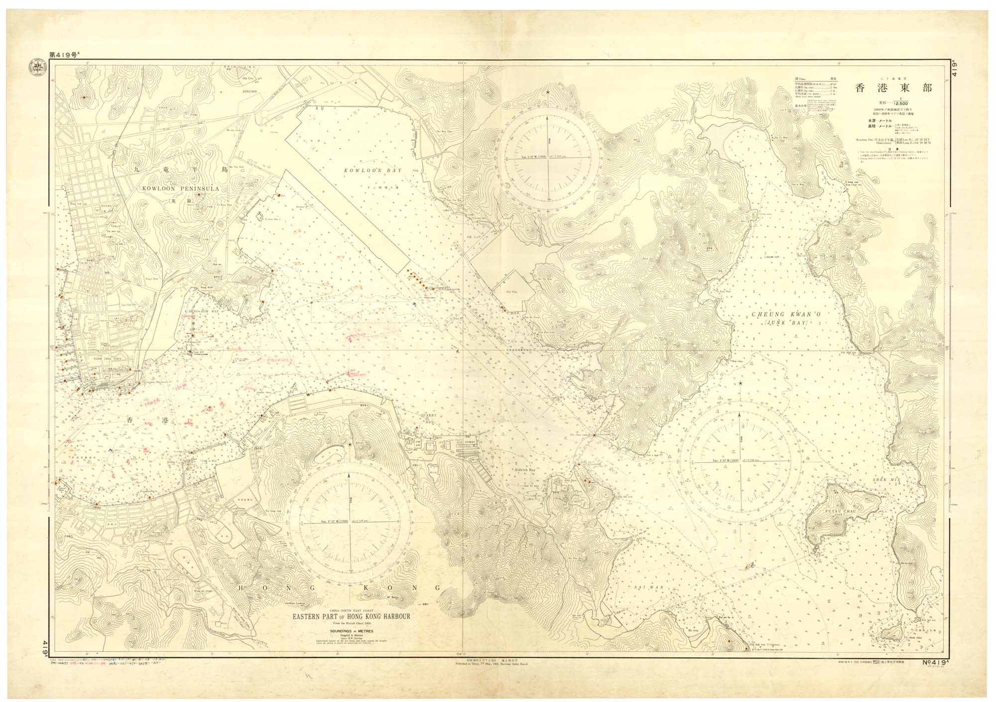
A rare Japanese chart of Hong Kong harbour
MARITIME SAFETY BOARD. Date: 1963 Stock #: 25057 £1,750.00
Add to Wishlist
Add to Wishlist
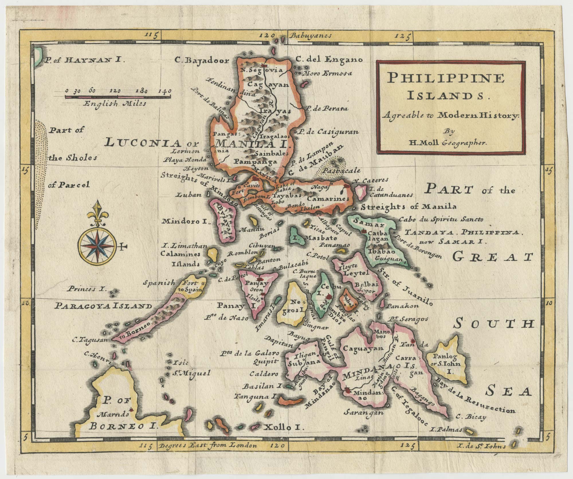
An early 18th century map of the Philippines
MOLL, Herman. Date: 1727 Stock #: 24754 £1,250.00
Add to Wishlist
Add to Wishlist
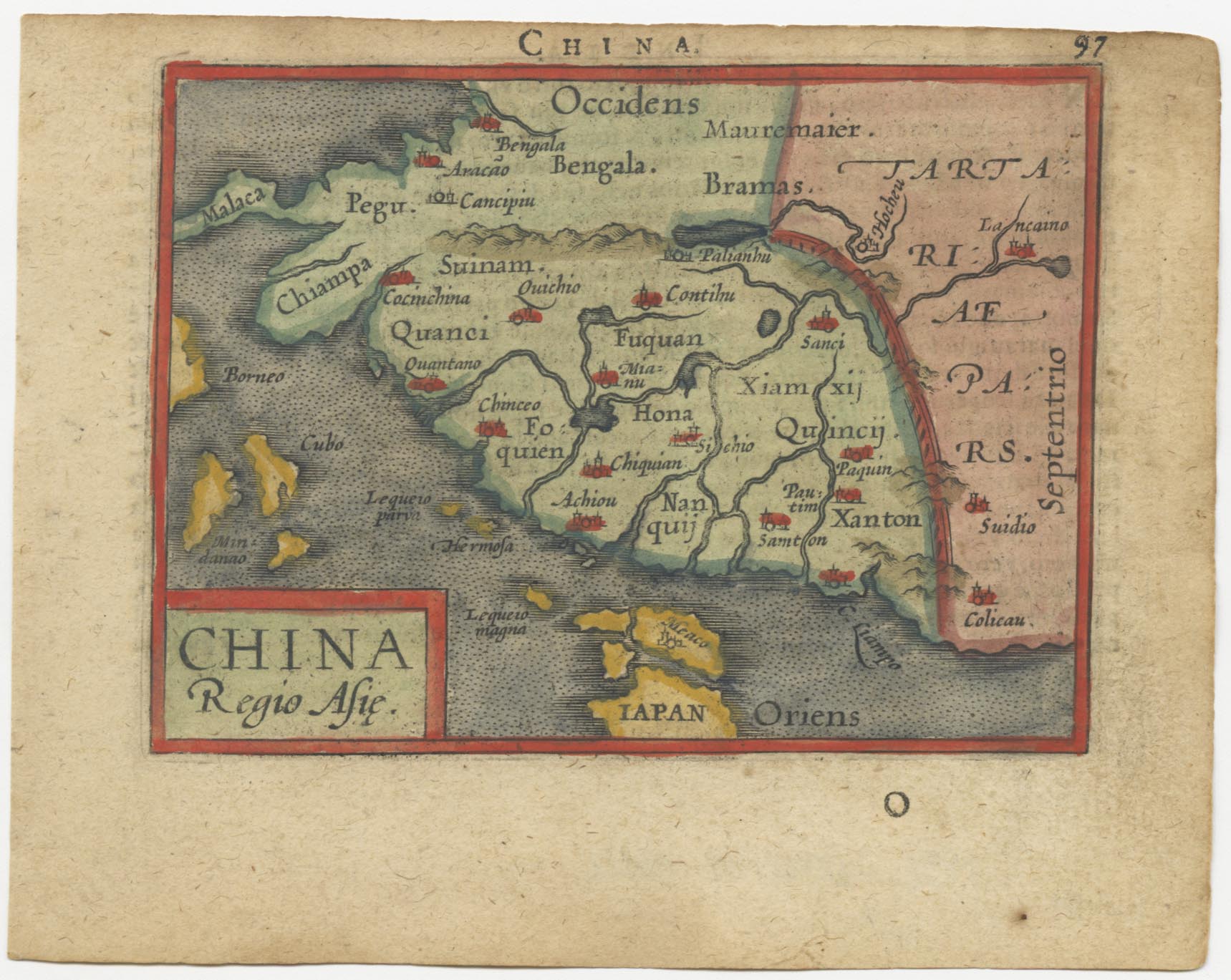
A 16th century miniature map of China
ORTELIUS, Abraham. Date: 1593 Stock #: 24459 £280.00
Add to Wishlist
Add to Wishlist
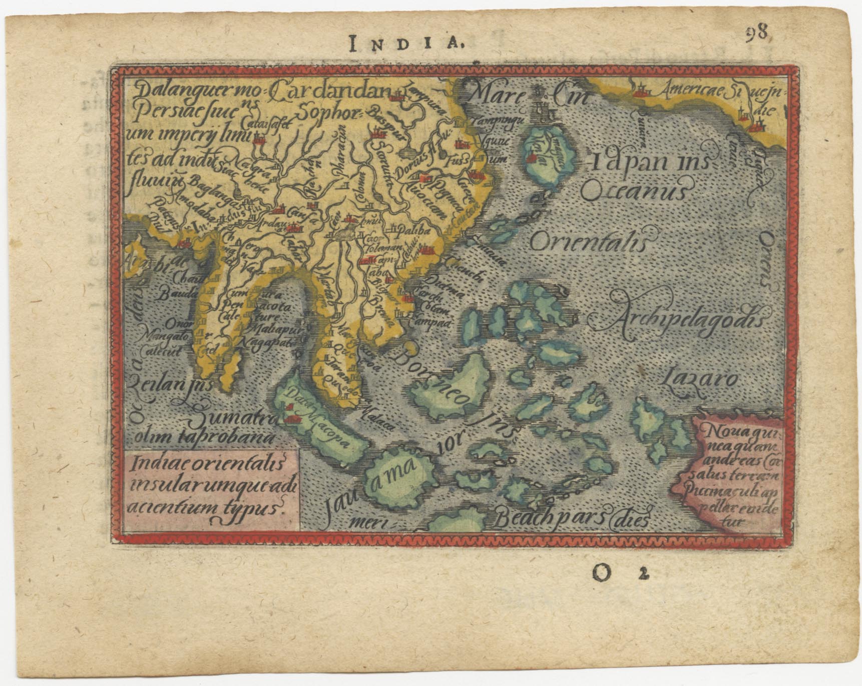
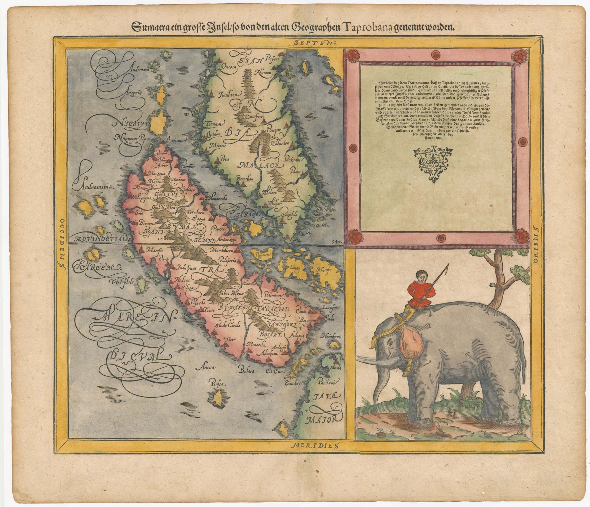
A 16th century miniature map of South East Asia
ORTELIUS, Abraham. Date: 1593 Stock #: 24460 £350.00
Add to Wishlist
Add to Wishlist
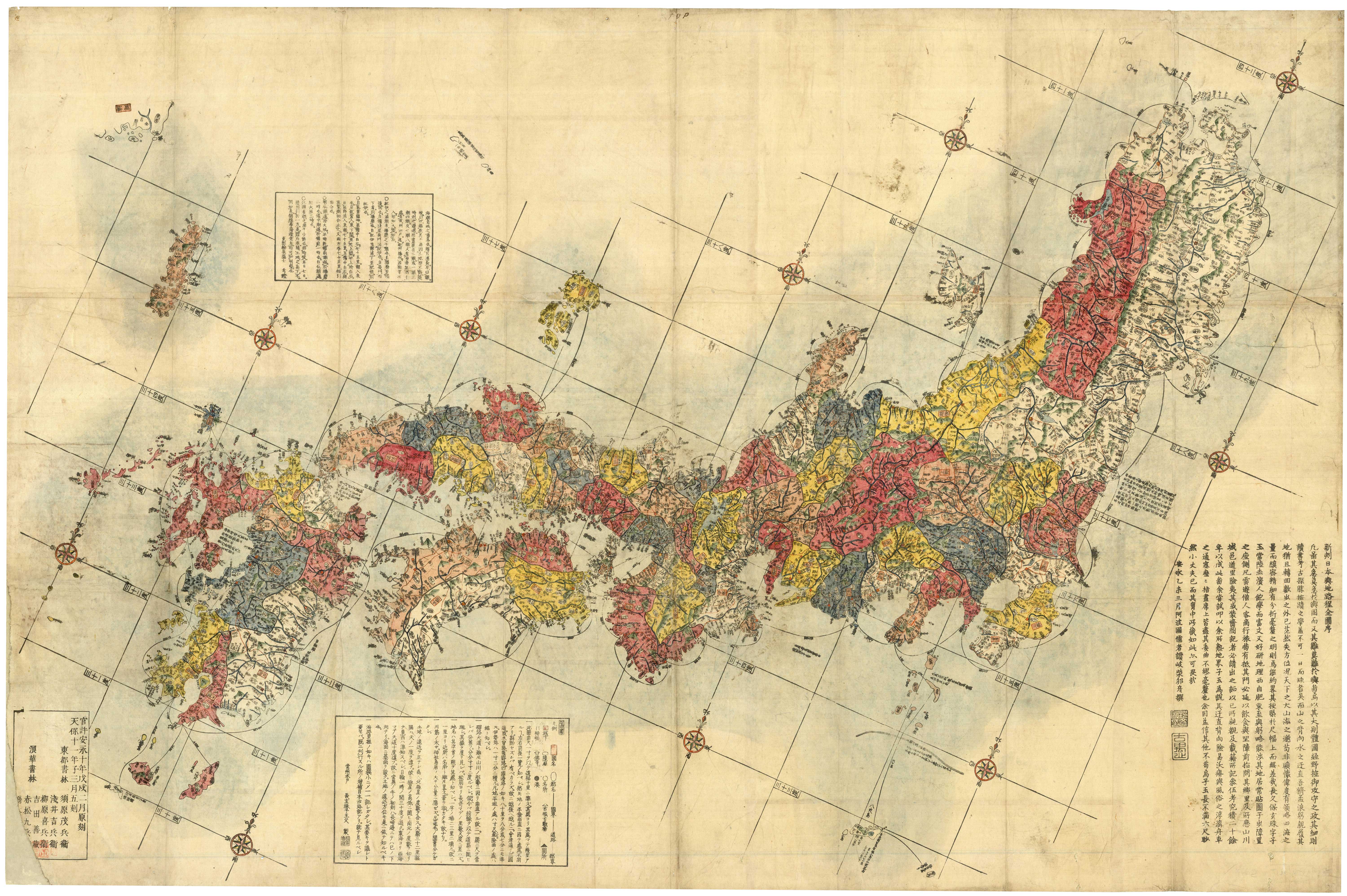
'Revised Map of All Japan and its Main Routes'
NAGAKUBO Selisui. Date: 1811 Stock #: 23070 £1,700.00
Add to Wishlist
Add to Wishlist
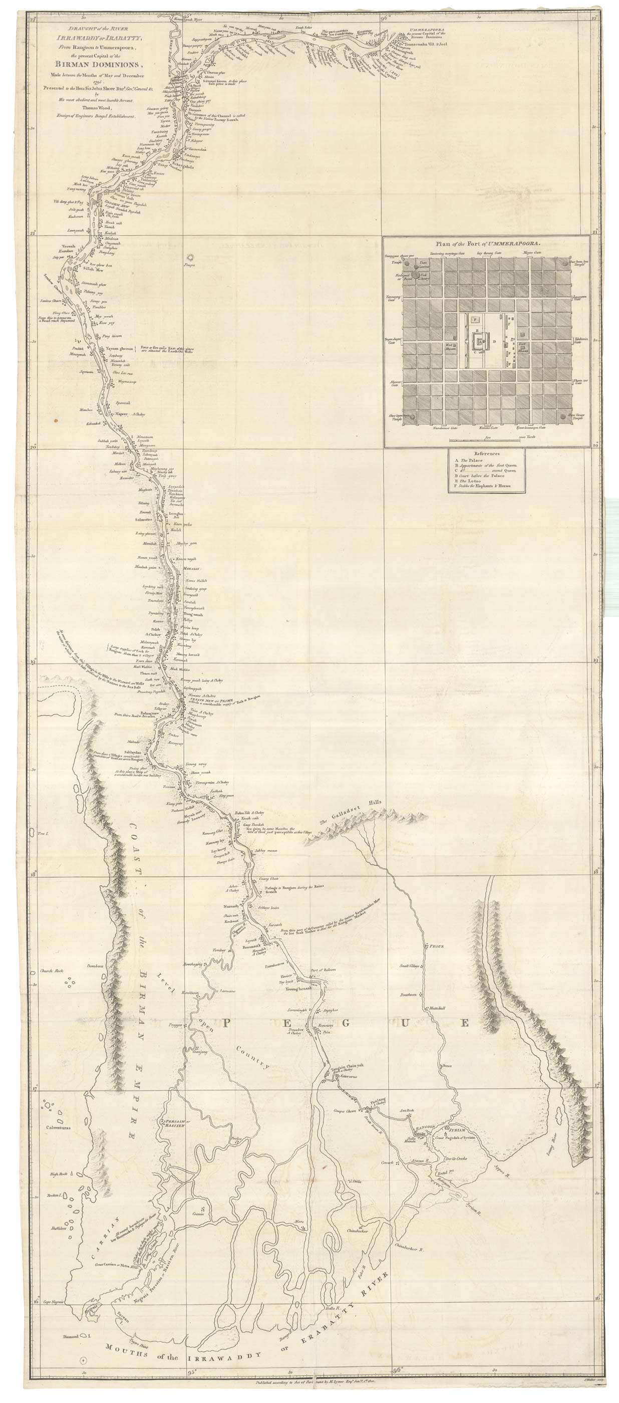
The first accurate map of the Irrawaday River
WOOD, Thomas. Date: 1800 Stock #: 25086 £900.00
Add to Wishlist
Add to Wishlist

The East Indies with early evidence of the Dutch discovery of Australia
JANSSON, Jan. Date: 1807 Stock #: 25082 £1,700.00
Add to Wishlist
Add to Wishlist
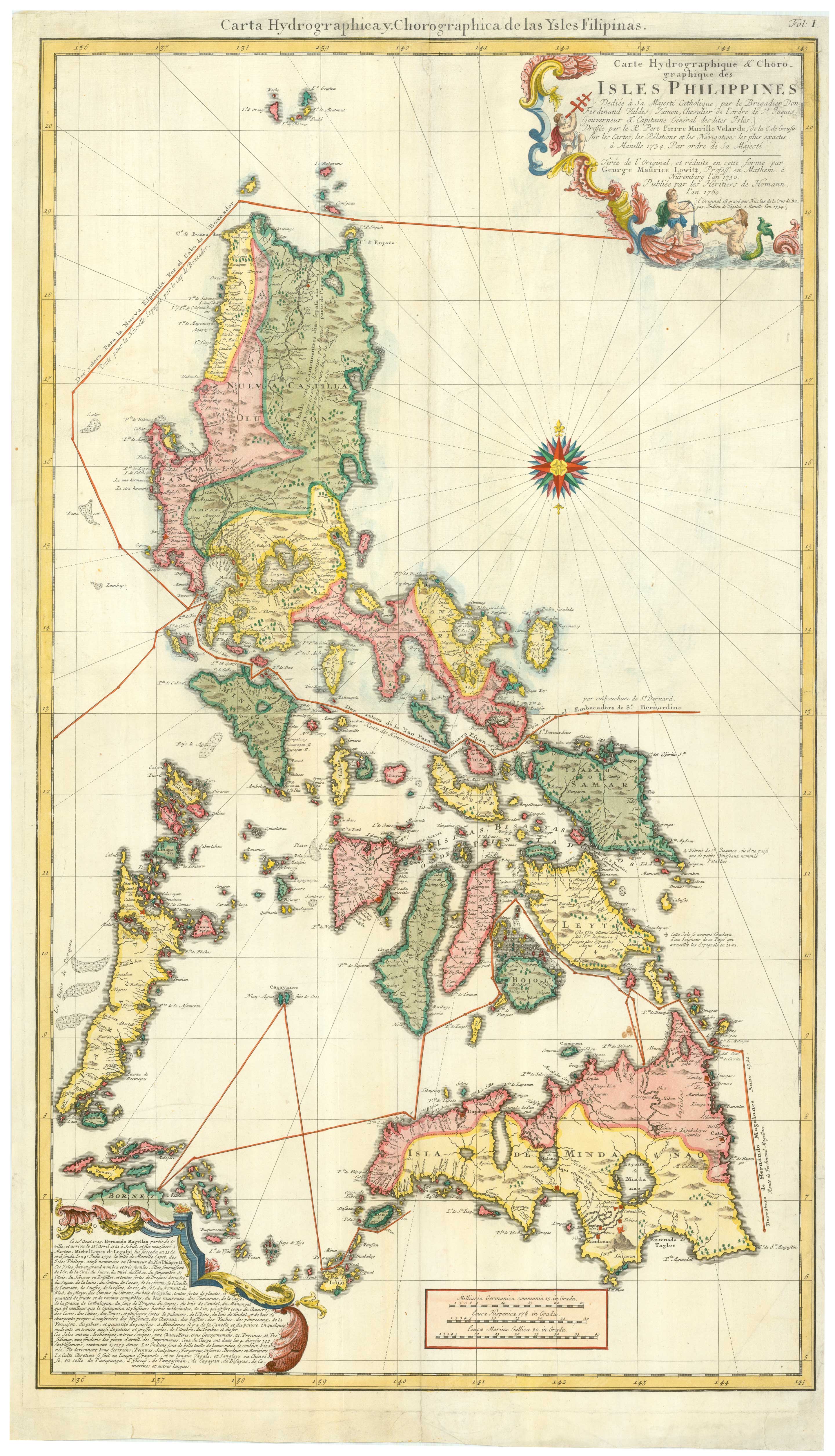
An 18th century map of the Philippines on two sheets
LOWITZ, Georg Moritz. Date: 1760 Stock #: 25153 £5,500.00
Add to Wishlist
Add to Wishlist
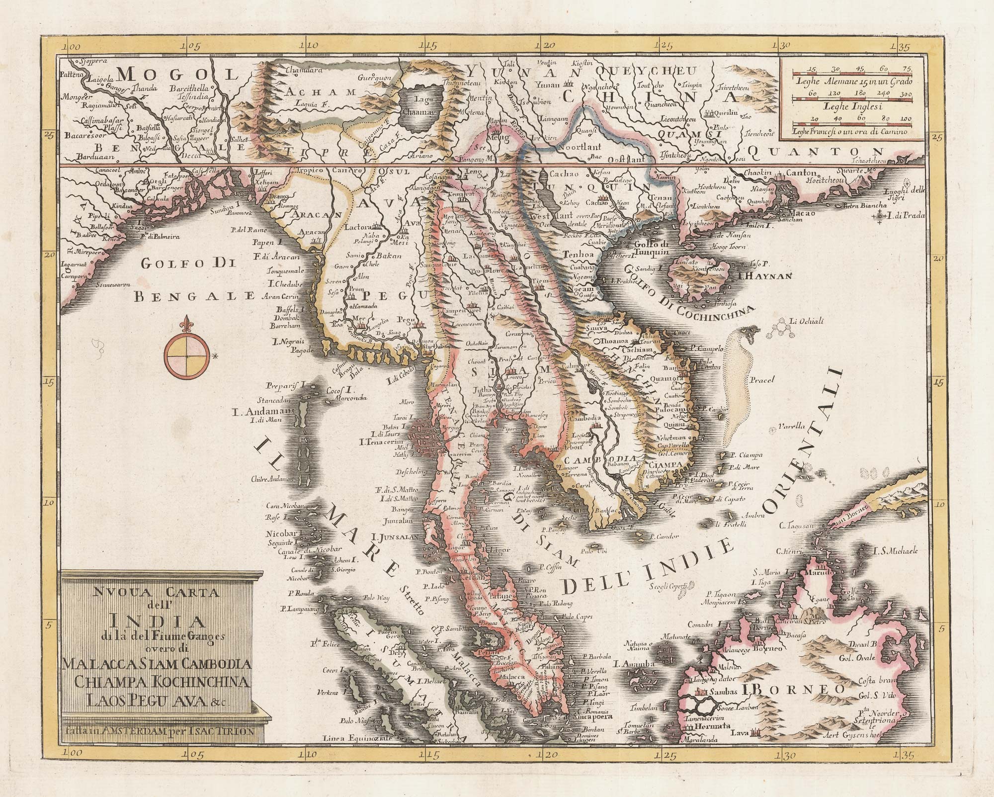
18th century map of Indochina
TIRION, Isaak. Date: 1734 Stock #: 23412 £450.00
Add to Wishlist
Add to Wishlist
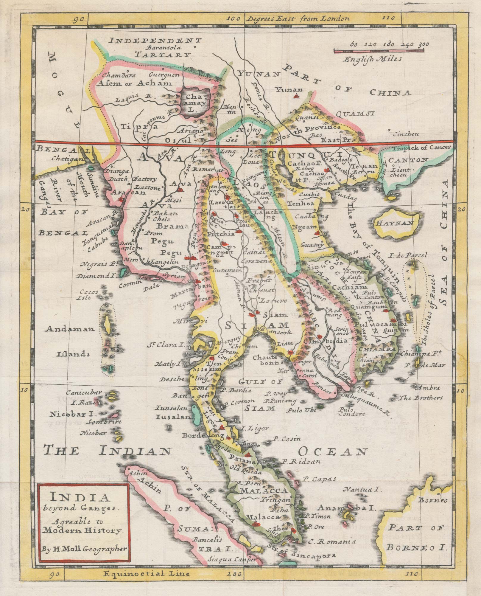
An 18th century map of Indochina
MOLL, Herman. Date: 1727 Stock #: 22426 £400.00
Add to Wishlist
Add to Wishlist
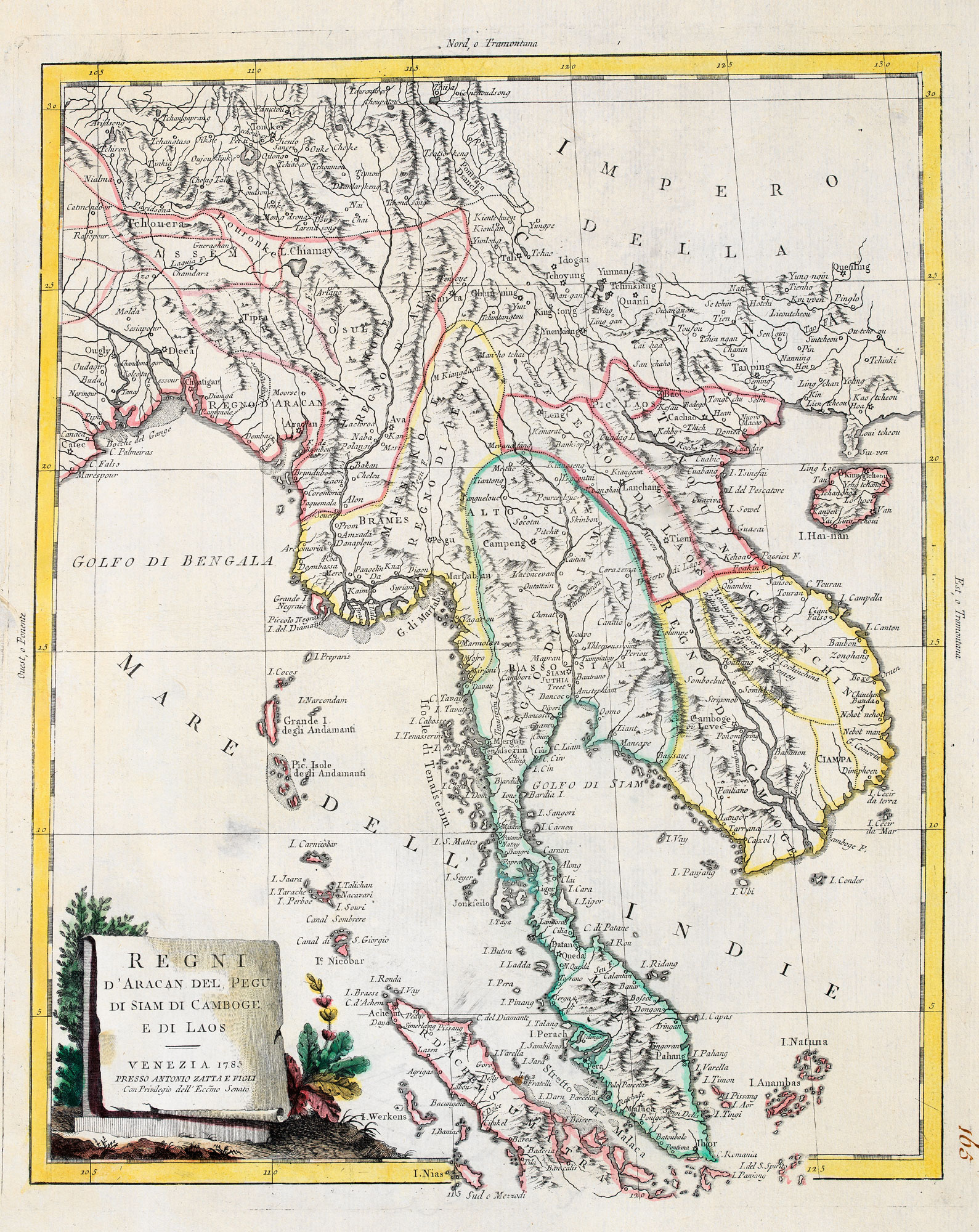
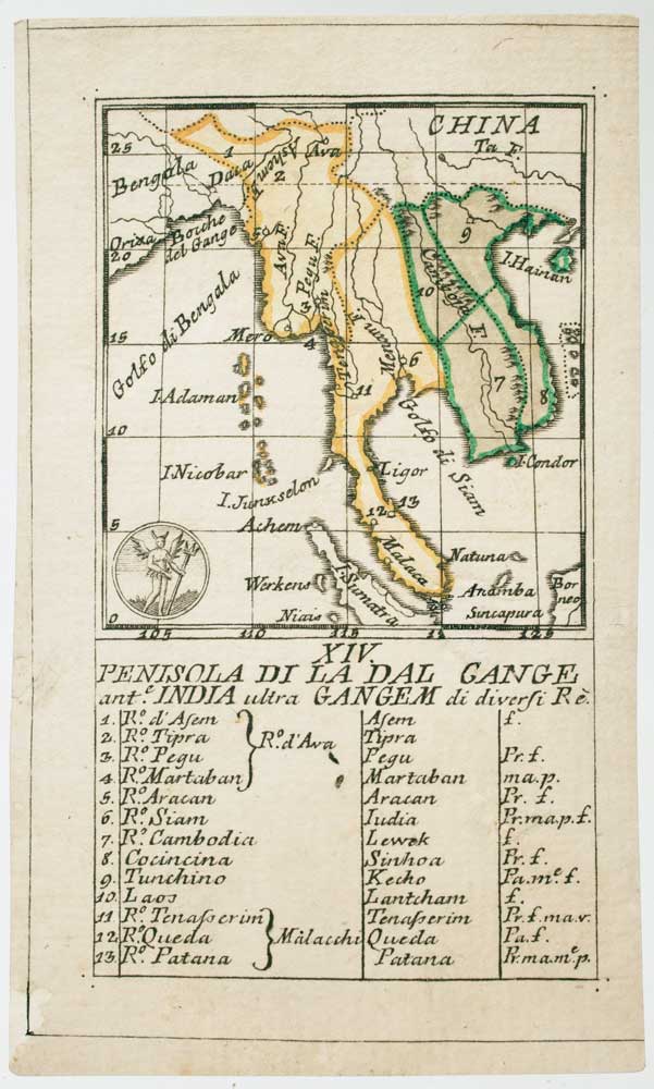
18th century map of Indo-China
ZATTA, Antonio. Date: 1785 Stock #: 20722 £420.00
Add to Wishlist
Add to Wishlist
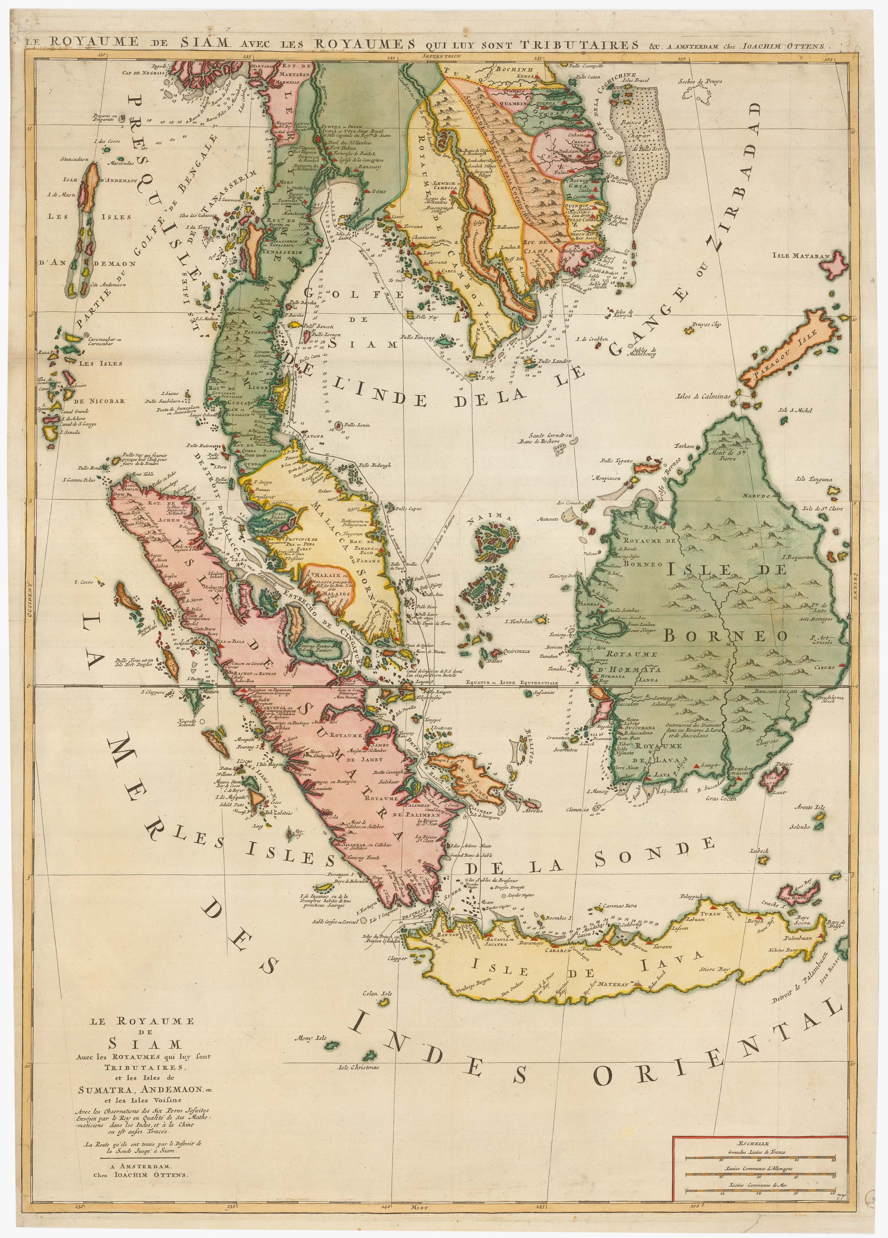
Two-sheet sea chart of the Malay Peninsula
MORTIER, Pierre. Date: 1705 Stock #: 22900 £2,000.00
Add to Wishlist
Add to Wishlist
An 18th century playing-card map of the Malay Peninsula
RABATTA, Augusto & BAILOU, Jean Baptist de. Date: 1779 Stock #: 12985 £350.00
Add to Wishlist
Add to Wishlist
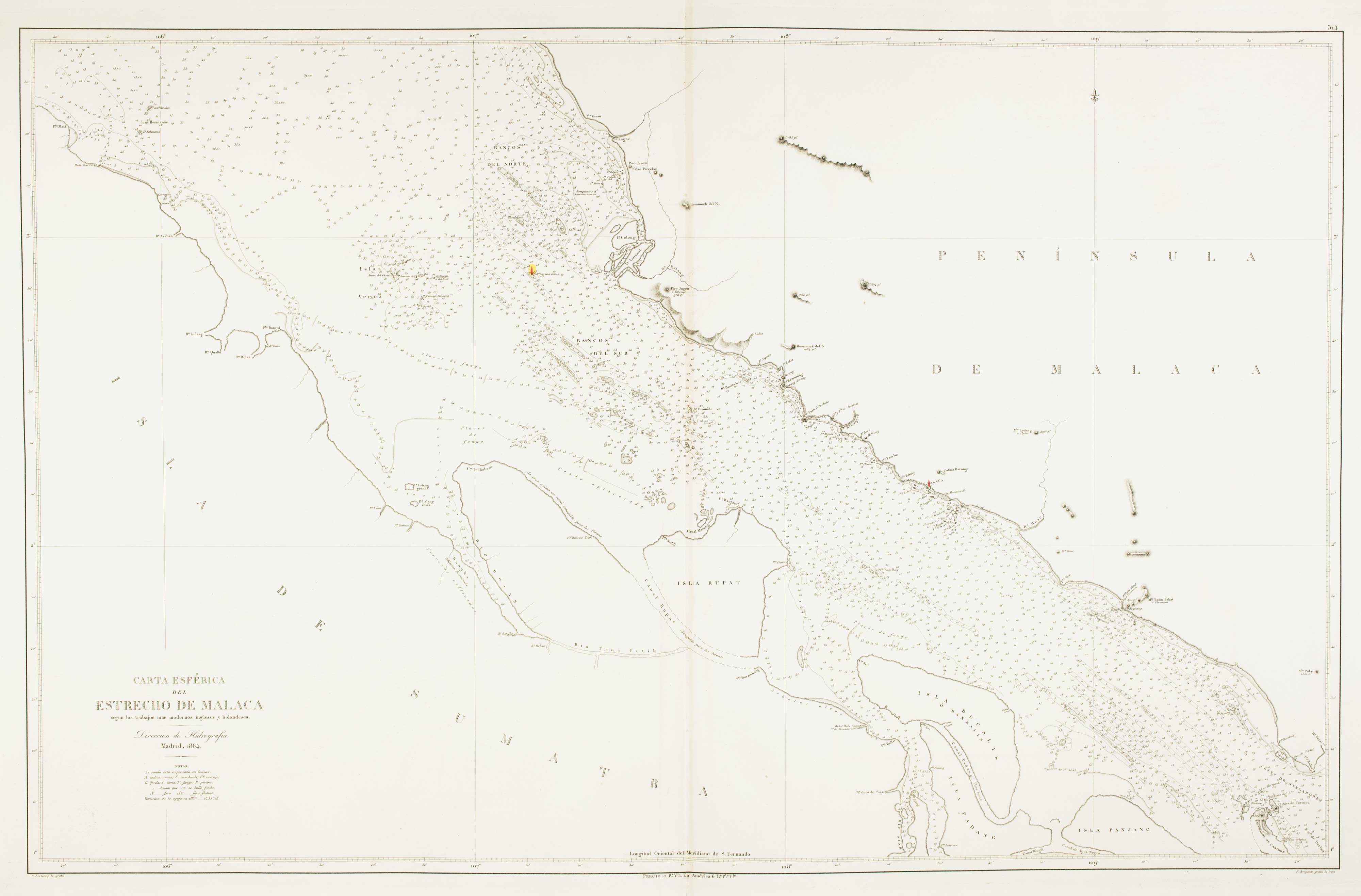
Sea chart of the Malacca Strait
LECLERCQ, C. Date: 1864 Stock #: 12461 £400.00
Add to Wishlist
Add to Wishlist
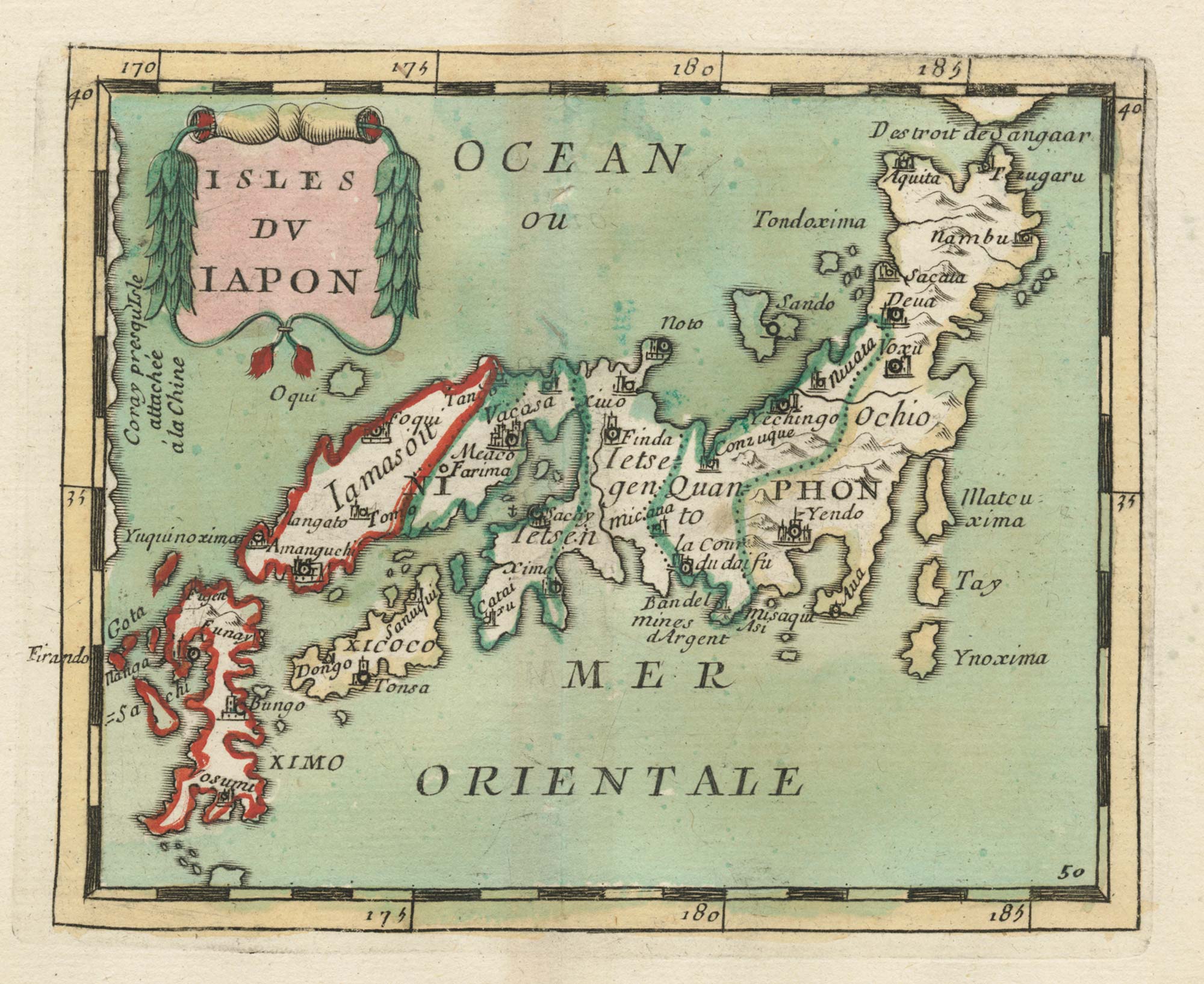
17th century miniature map of Japan
DU VAL, Pierre. Date: 1690 Stock #: 24849 £380.00
Add to Wishlist
Add to Wishlist
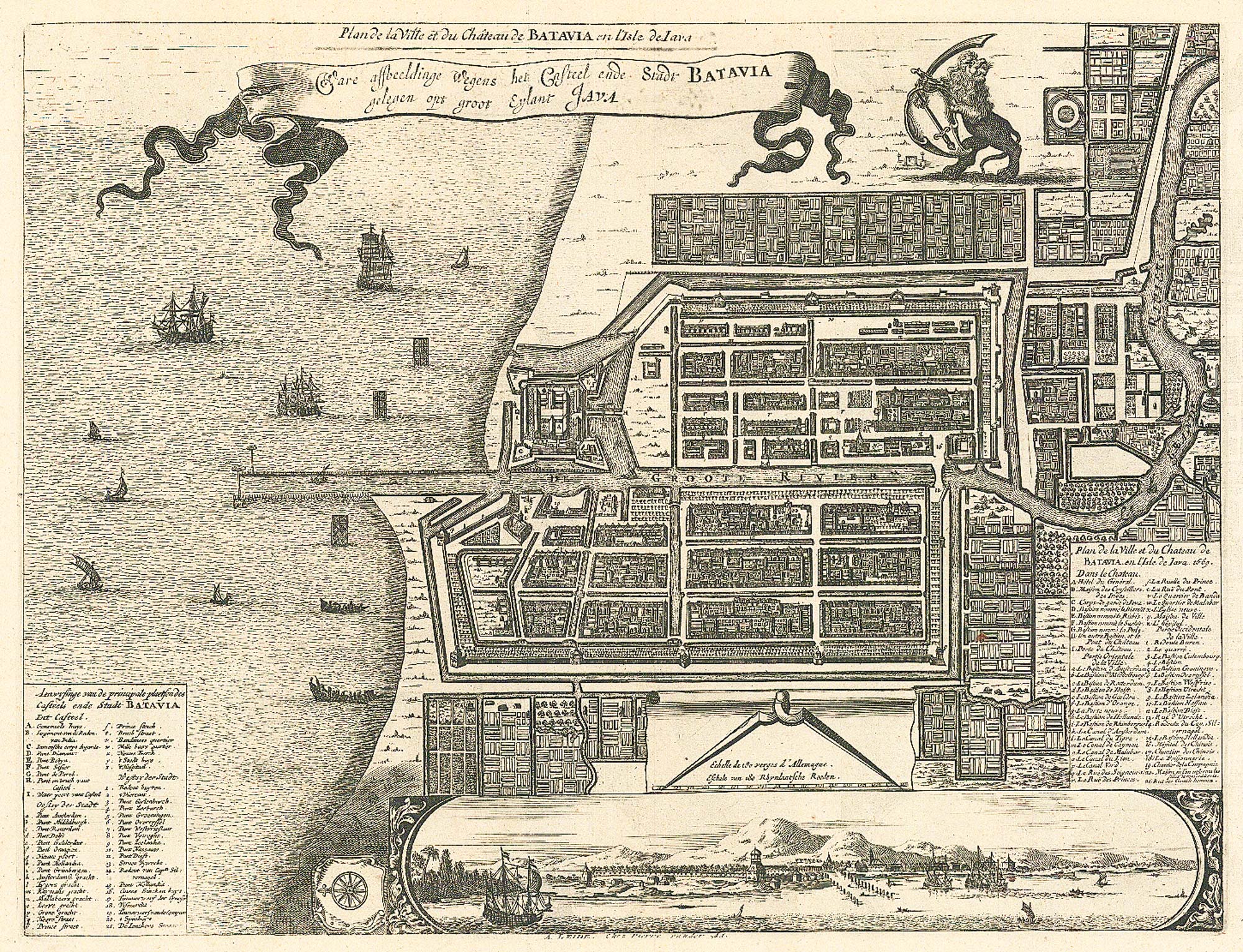
17th century plan of Batavia
MONTANUS, Arnoldus. Date: 1728 Stock #: 24796 £400.00
Add to Wishlist
Add to Wishlist

Miniature plan of Singapore
BROCKHAUS, F. A.. Date: 1663 Stock #: 24697 £240.00
Add to Wishlist
Add to Wishlist
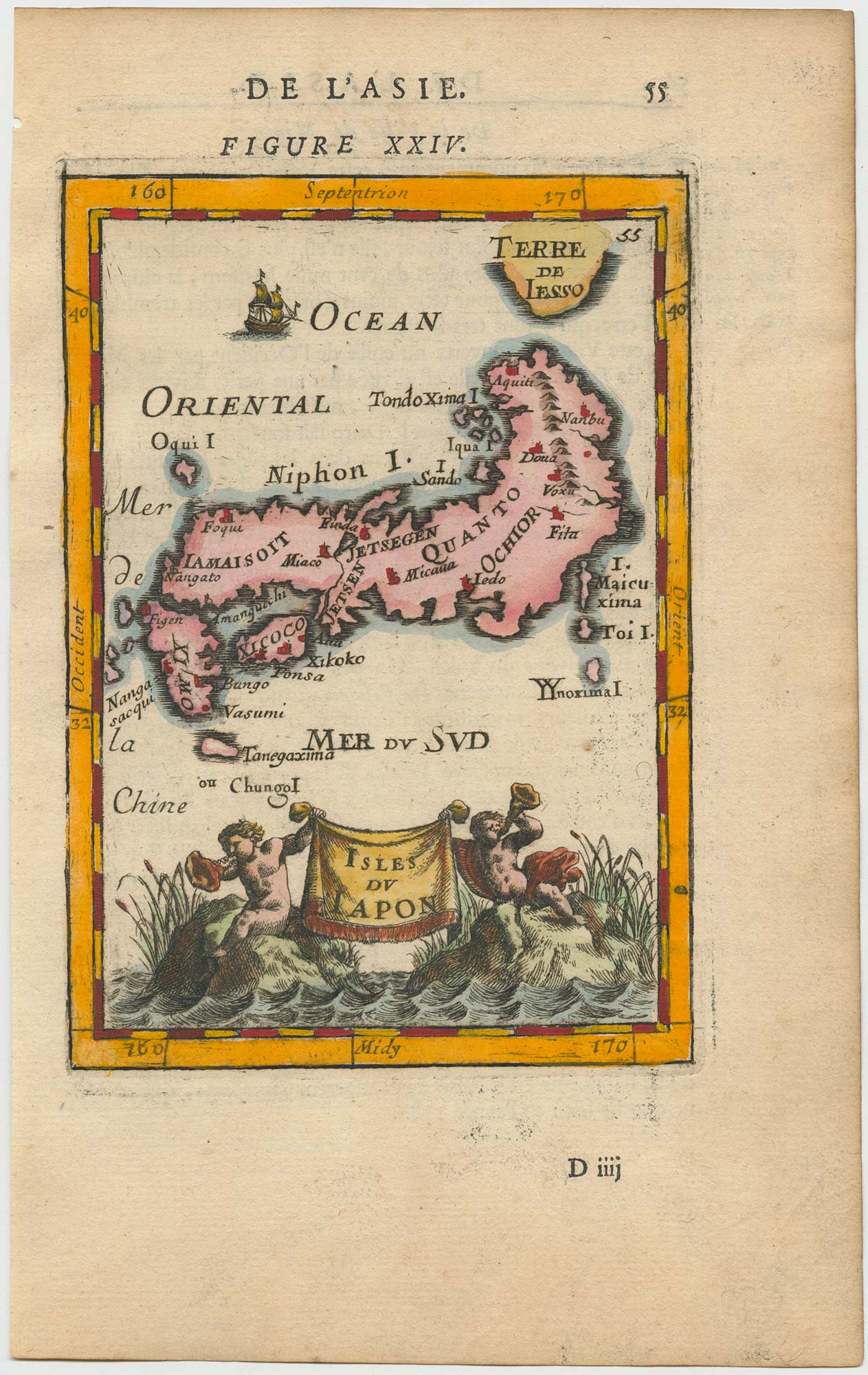
17th century miniature map of Japan
MALLET, Alain Manesson. Date: 1683 Stock #: 24704 £275.00
Add to Wishlist
Add to Wishlist
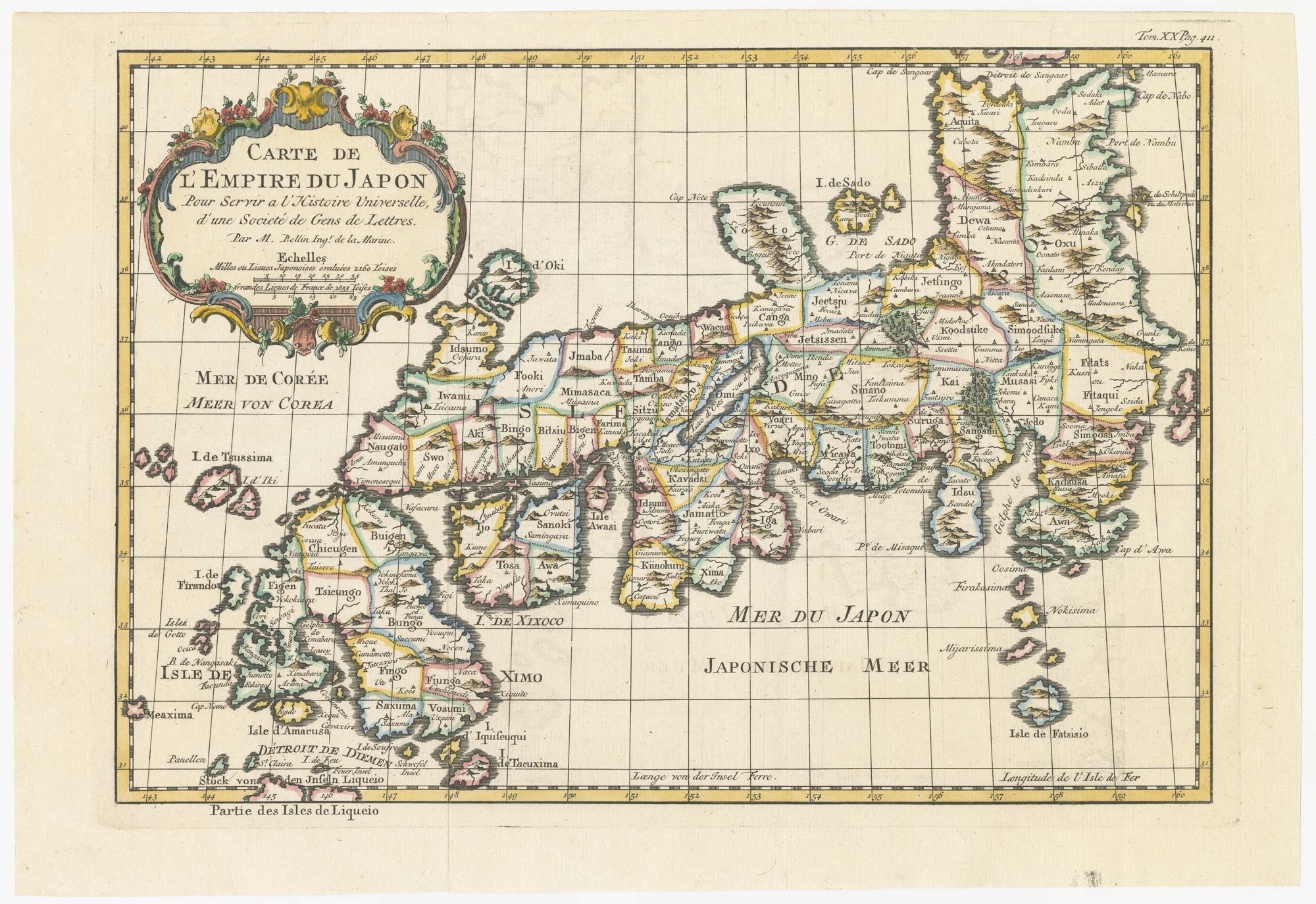
18th century map of Japan
BELLIN, Jacques-Nicolas. Date: 1752 Stock #: 24729 £320.00
Add to Wishlist
Add to Wishlist
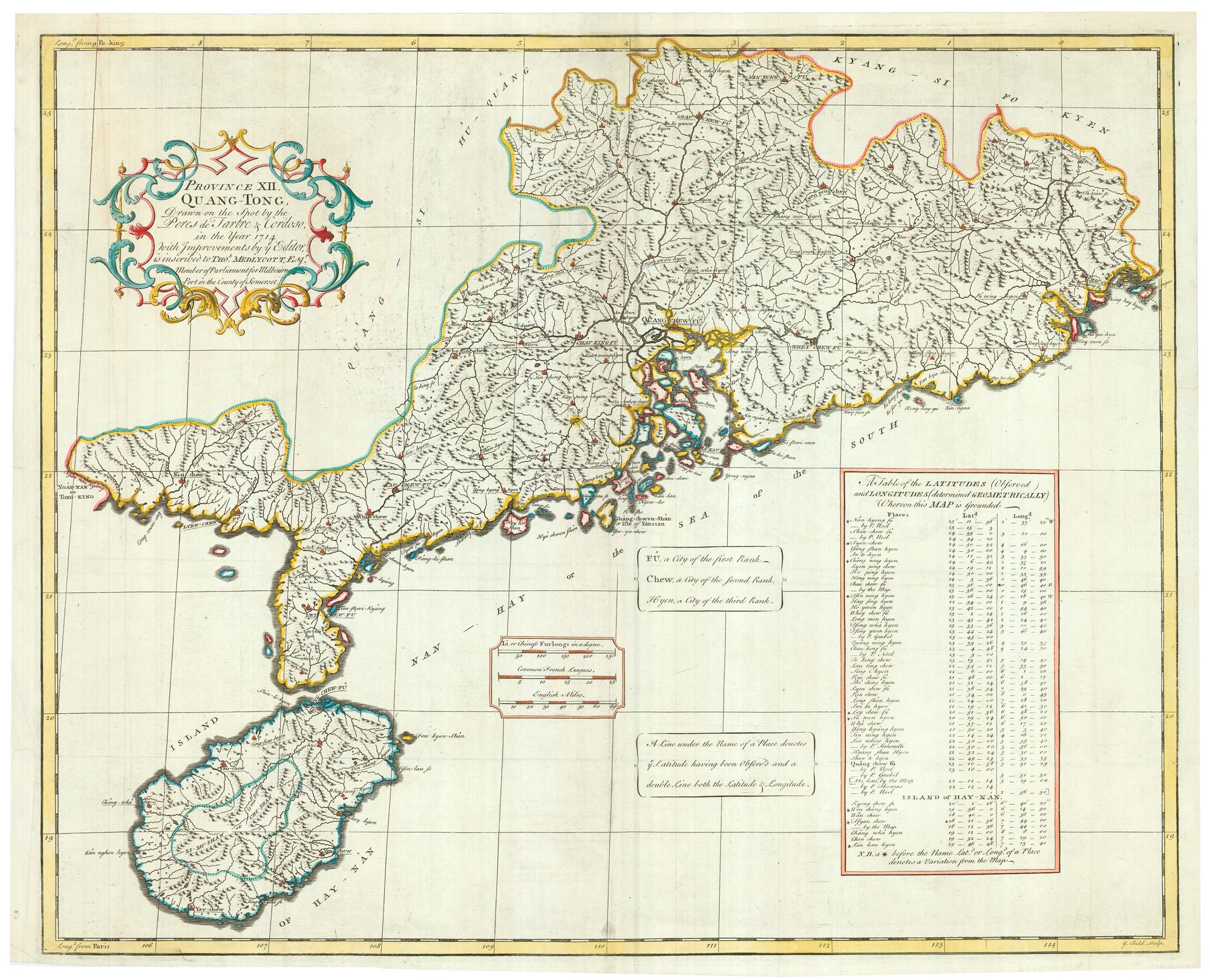
The English edition of Du Halde's map of Guangdong
DU HALDE, Johann Baptiste. Date: 1738 Stock #: 24558 £1,600.00
Add to Wishlist
Add to Wishlist
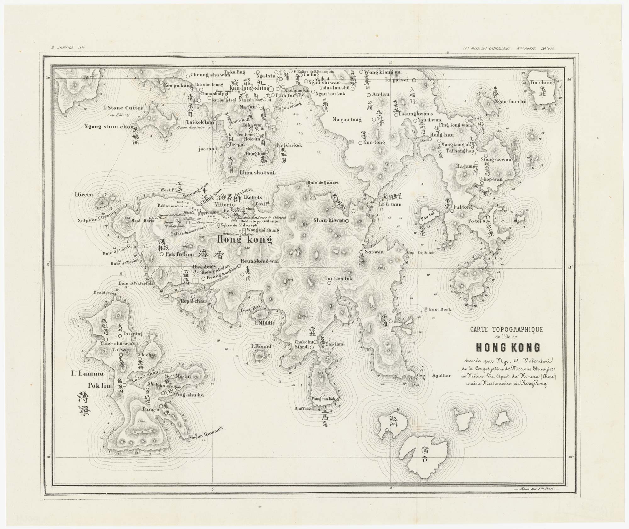
A rare missionary's map of Hong Kong
VOLONTERI, Simeone. Date: 1874 Stock #: 24927 £4,450.00
Add to Wishlist
Add to Wishlist
A map of European trade in China in the 1850s
Society for the Diffusion of Useful Knowledge. Date: 1857 Stock #: 24870 £400.00
Add to Wishlist
Add to Wishlist