Antique Maps of Canada
Showing 1–18 of 18 products
Sort by:
[ti_wishlists_addtowishlist]
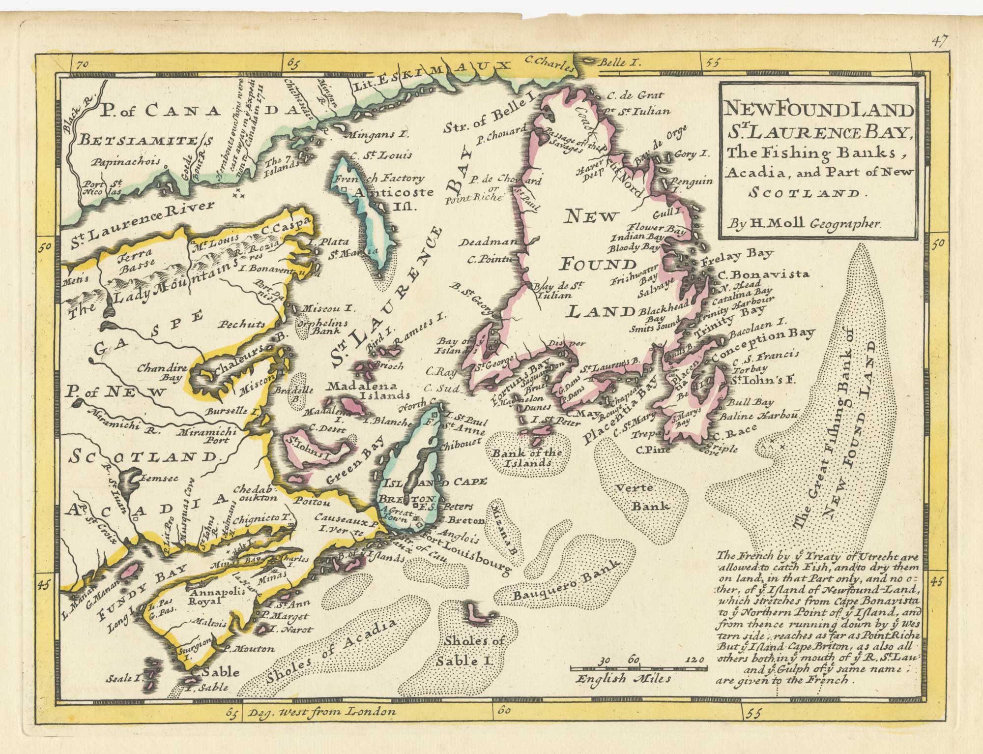
A map of Newfoundland according to the Treaty of Utrecht
MOLL, Herman. Date: 1732 Stock #: 25654 £400.00
[ti_wishlists_addtowishlist]
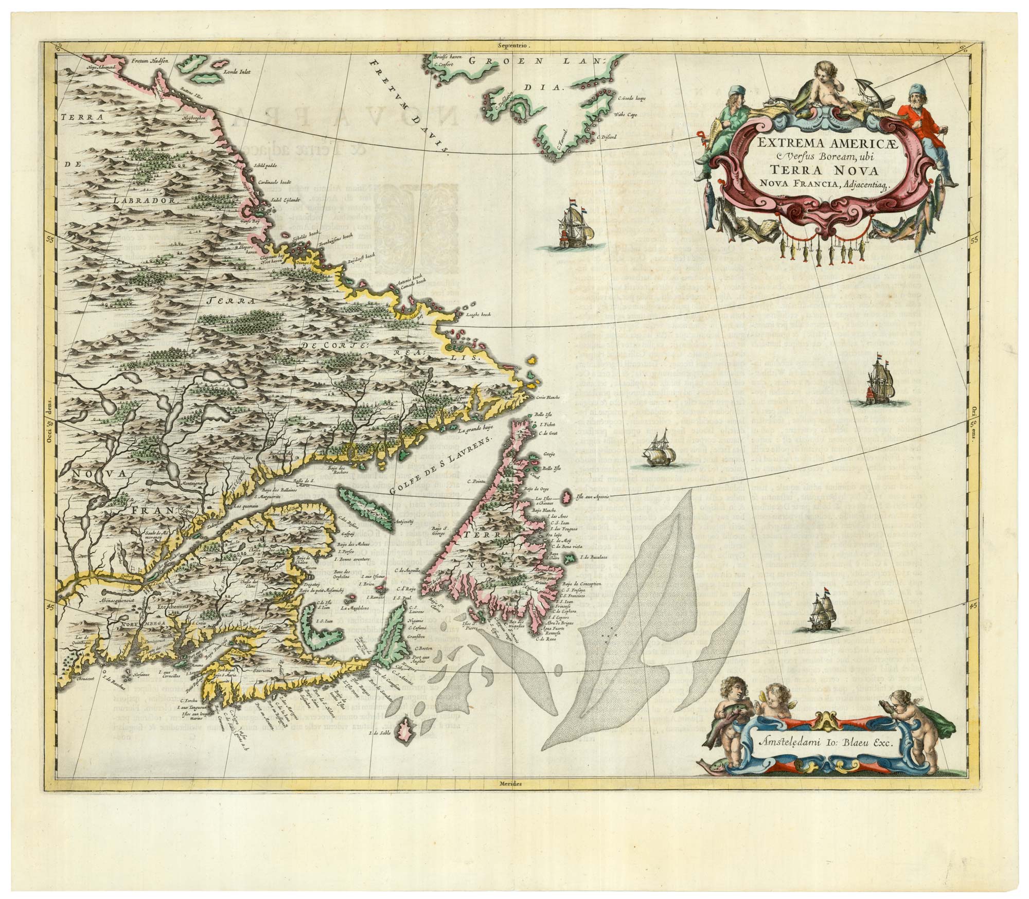
A scarce 17th century map of Newfoundland and Nova Scotia
BLAEU, Johannes. Date: 1662 Stock #: 22716 £1,500.00
[ti_wishlists_addtowishlist]
[ti_wishlists_addtowishlist]
[ti_wishlists_addtowishlist]
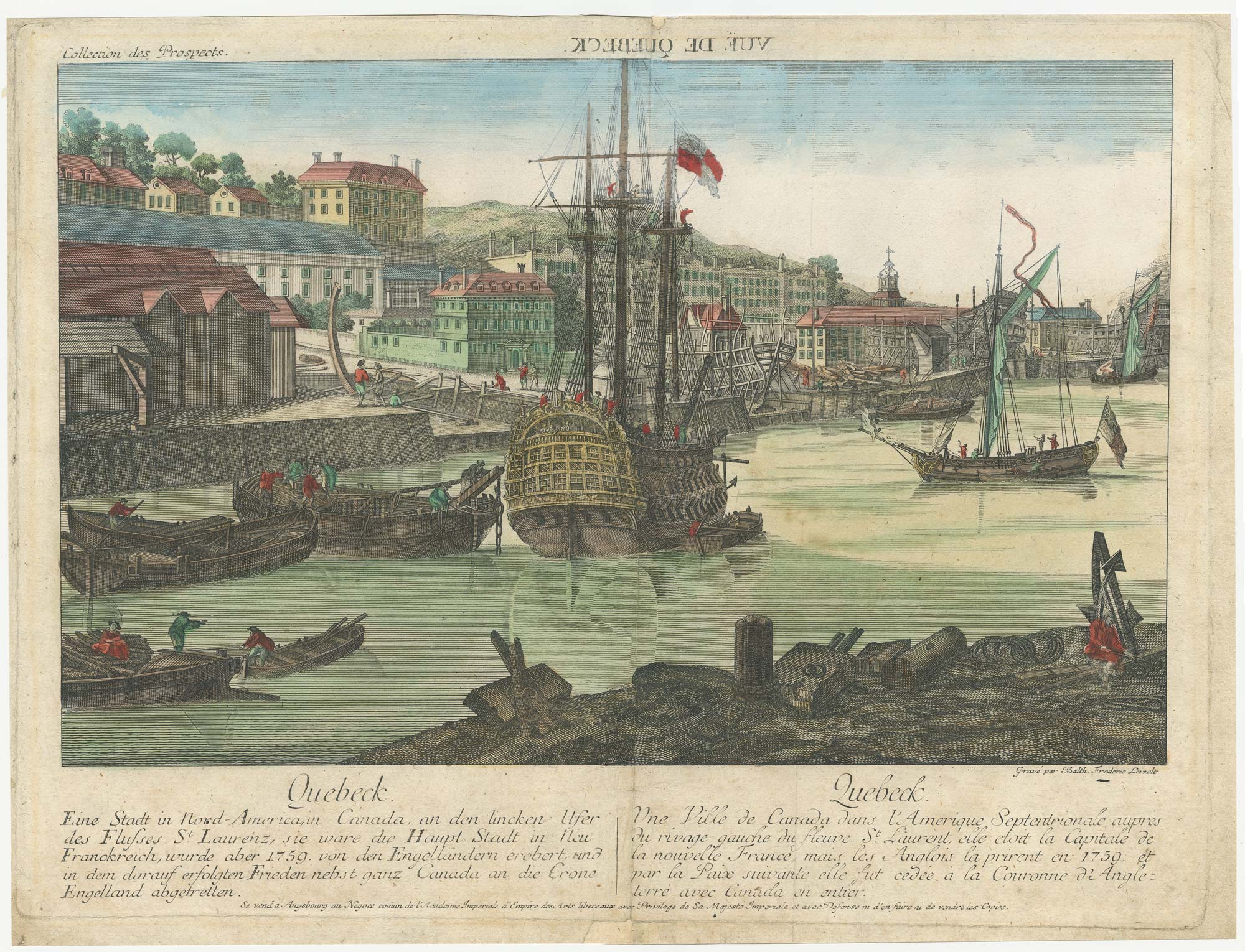
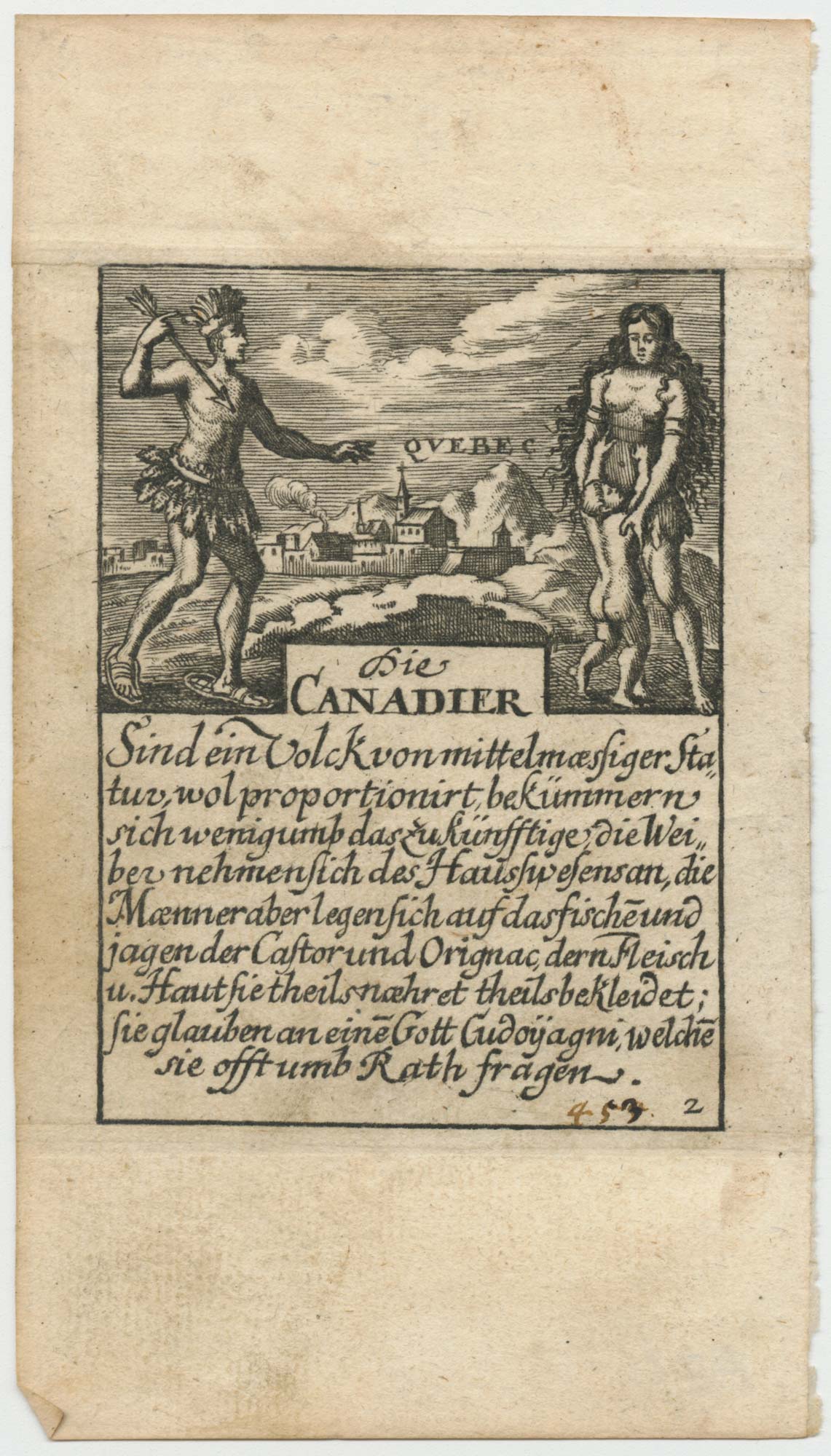
An 18th century 'vue d'optique' of Quebec
LEIZELT, Balthasar Frederick. Date: 1775 Stock #: 24523 £750.00
[ti_wishlists_addtowishlist]
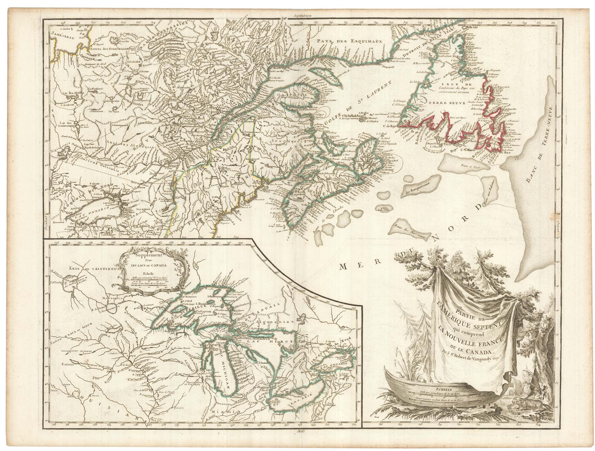
A late 18th century map of Canada and the Great Lakes
ROBERT DE VAUGONDY, Didier. Date: 1793 Stock #: 23279 £550.00
[ti_wishlists_addtowishlist]
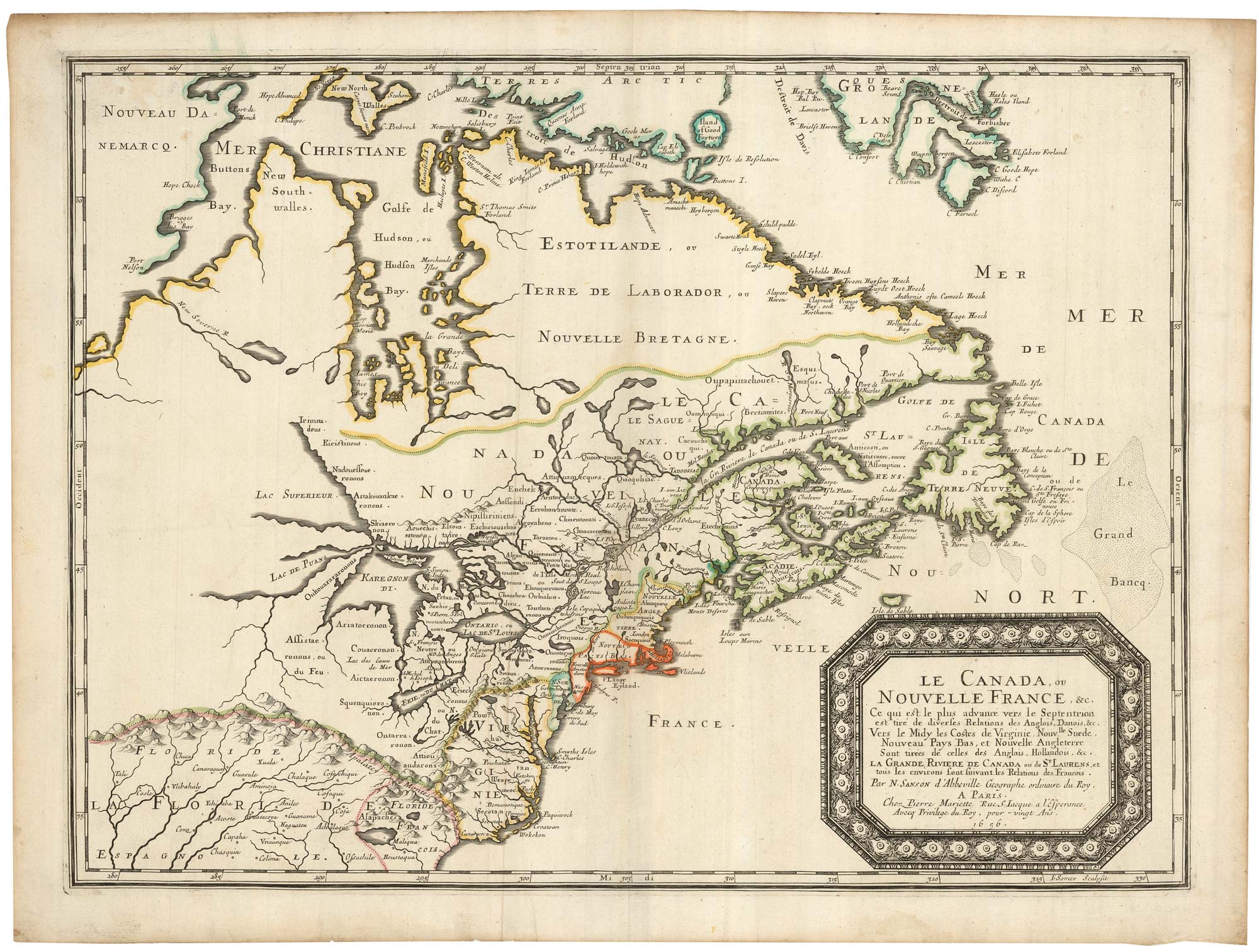
Sanson's map of Canada with an early depiction of the Great Lakes
SANSON, Nicolas. Date: 1662 Stock #: 23067 £4,750.00
[ti_wishlists_addtowishlist]
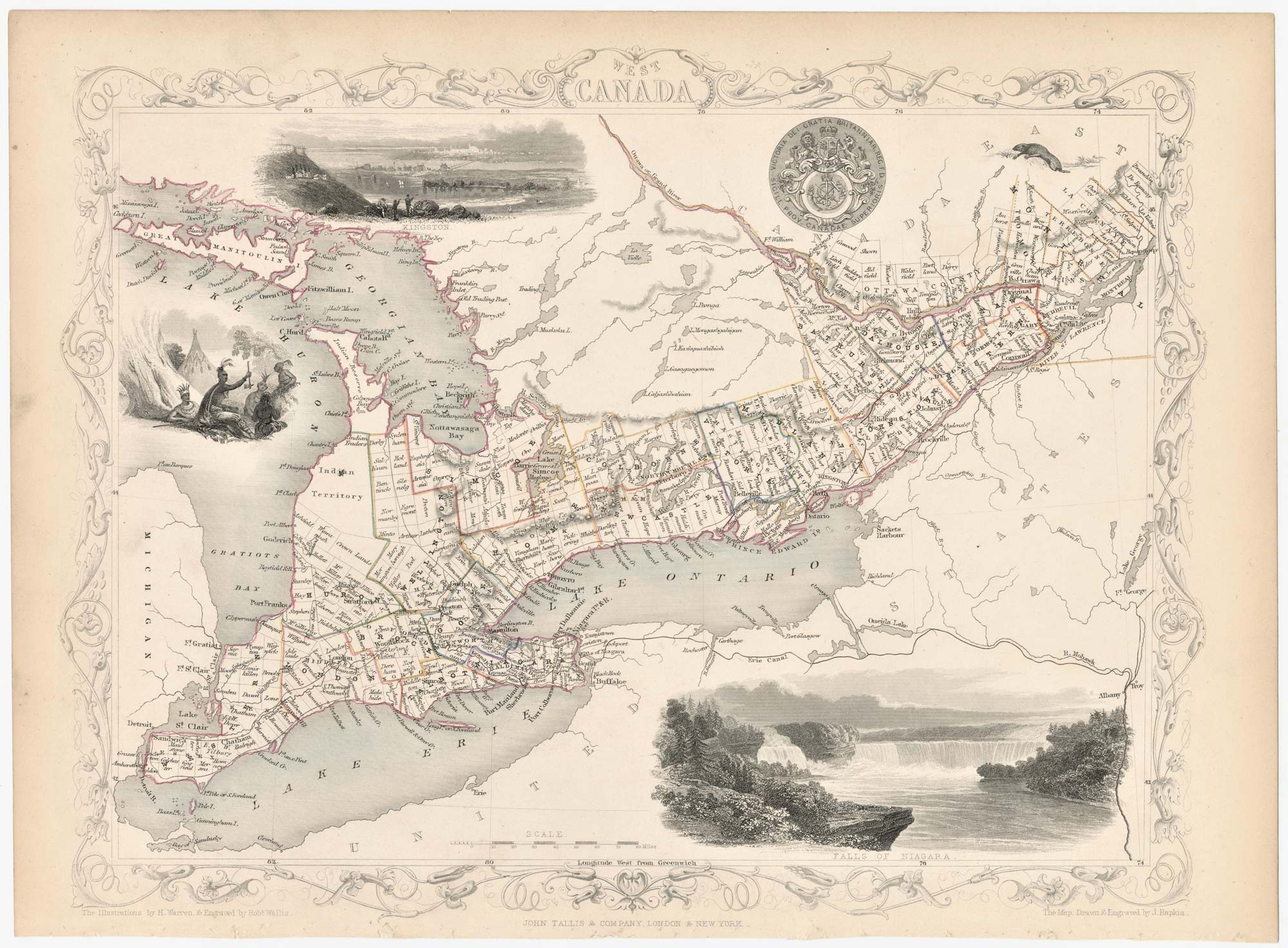
A mid 19th century map of West Canada with vignettes
TALLIS, John. Date: 1851 Stock #: 23498 £160.00
[ti_wishlists_addtowishlist]
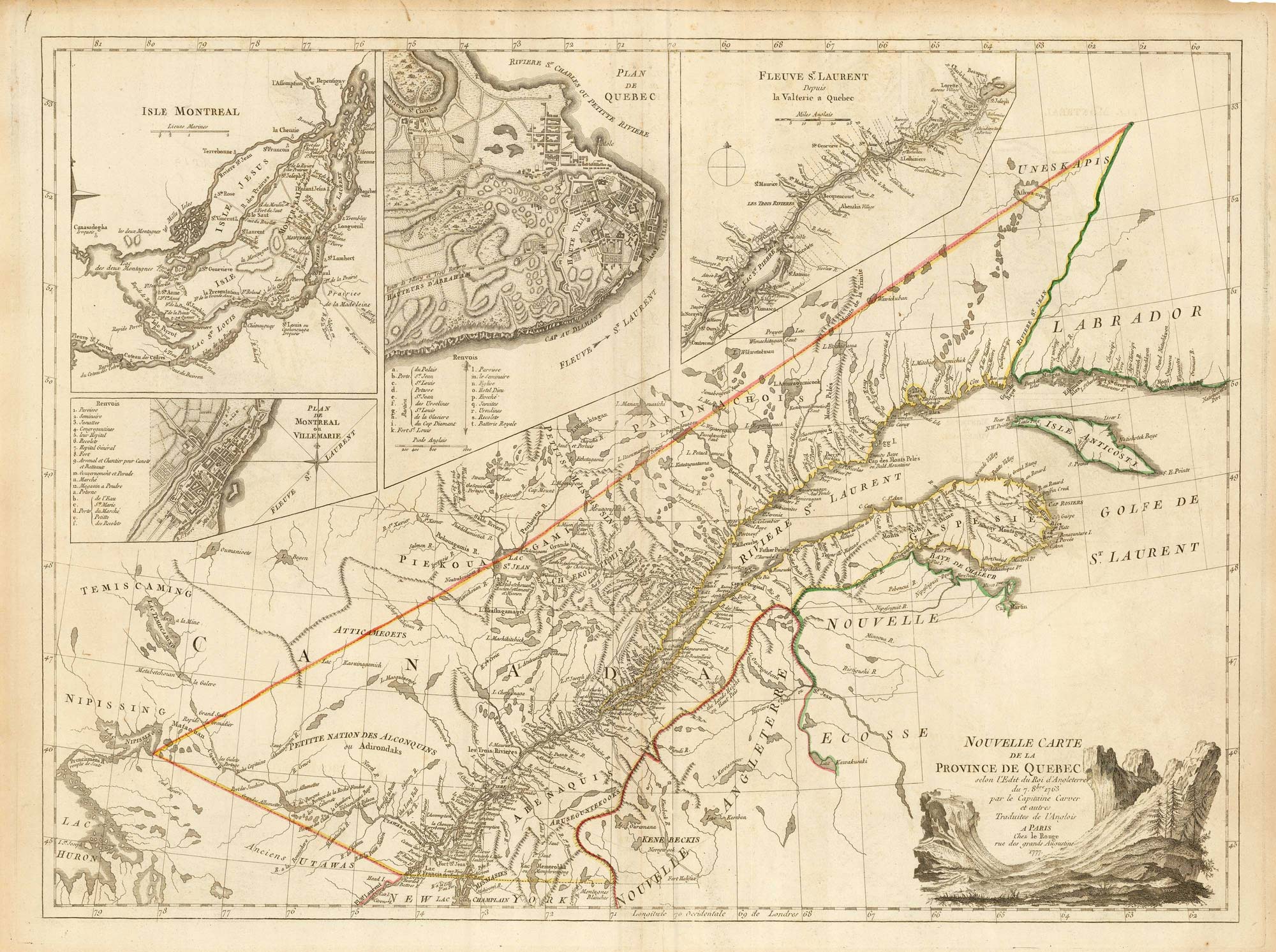
A French edition of an important map of the St Lawrence valley
CARVER, Jonathan. Date: 1777 Stock #: 23477 £1,600.00
[ti_wishlists_addtowishlist]
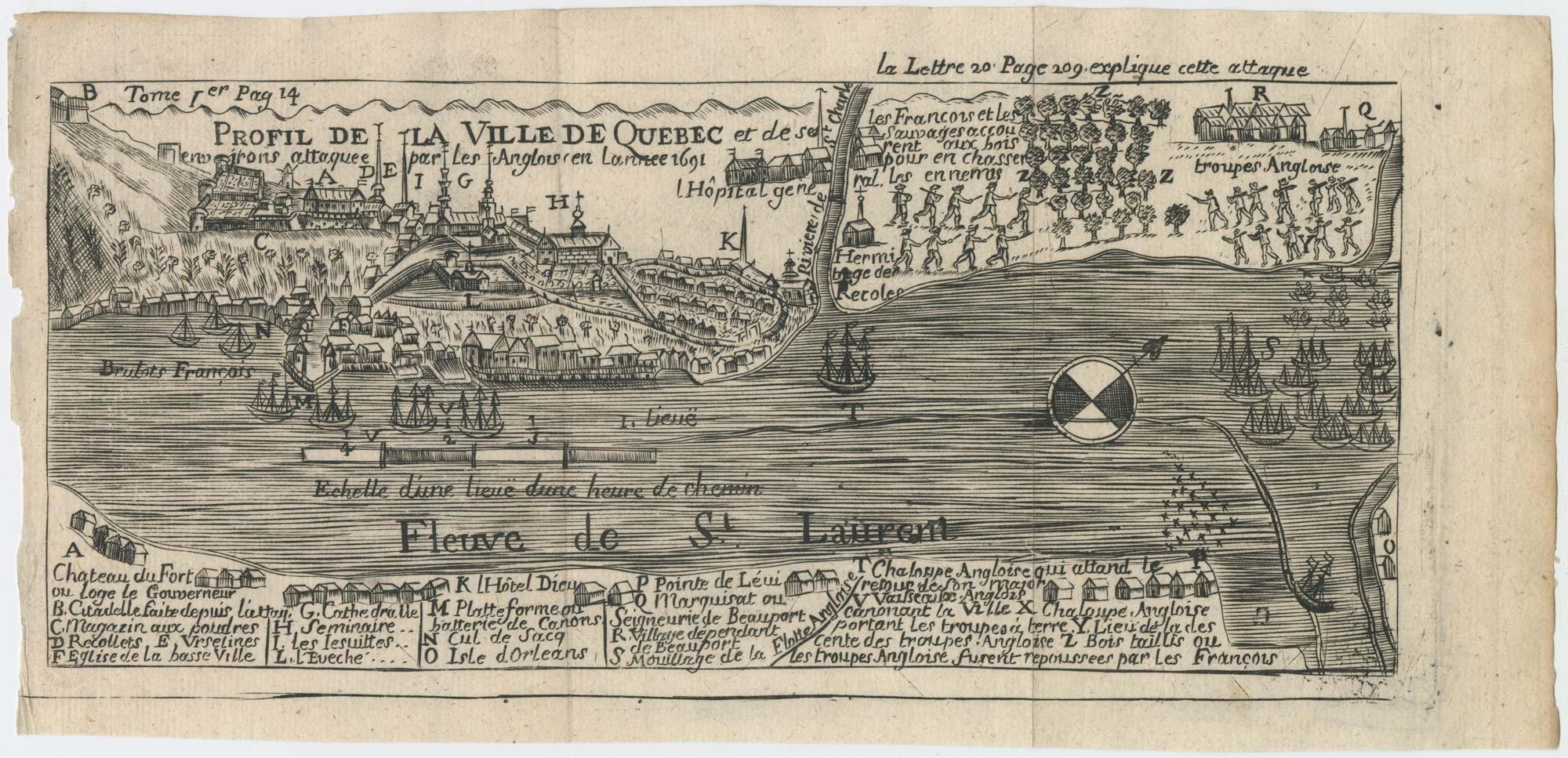
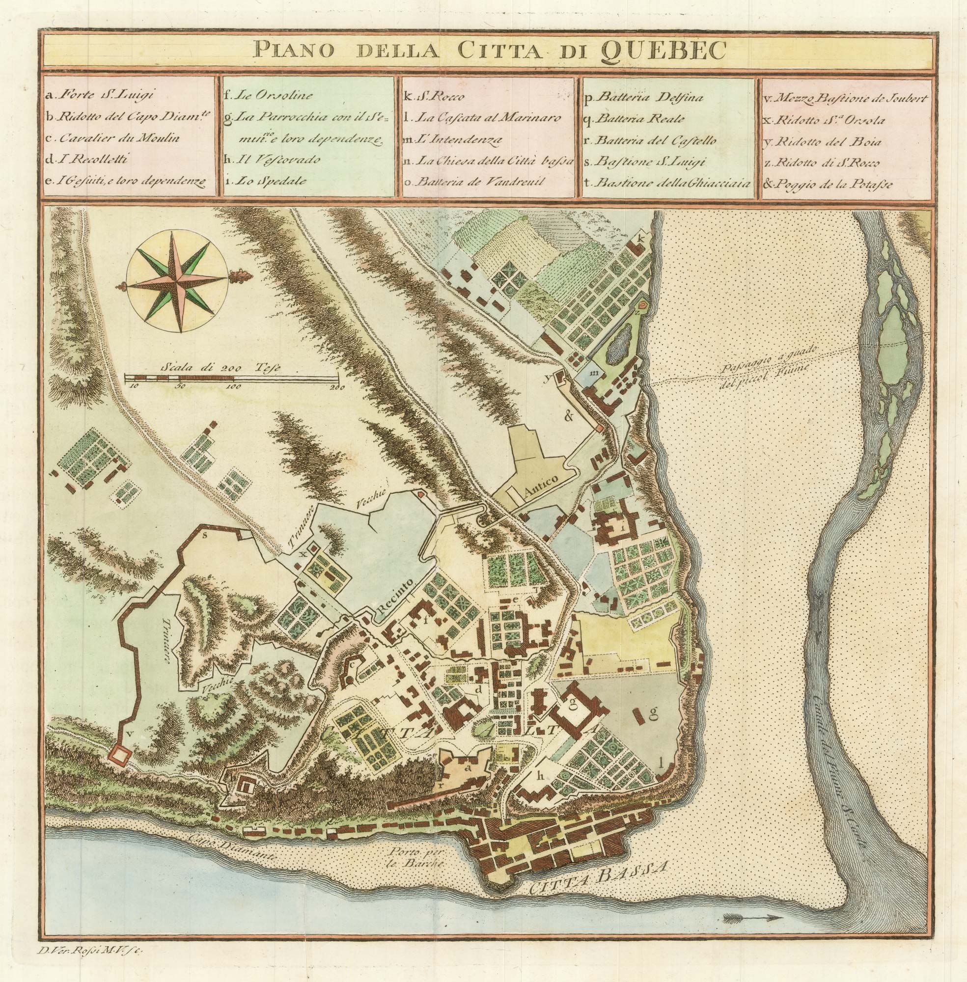
A plan of the British attack on Quebec in October 1690 by a defender
LAHONTAN, Louis-Armande de. Date: 1741 Stock #: 22562 £550.00
[ti_wishlists_addtowishlist]
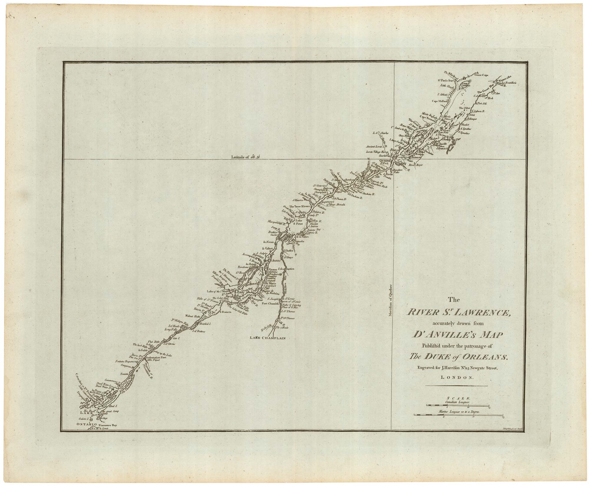
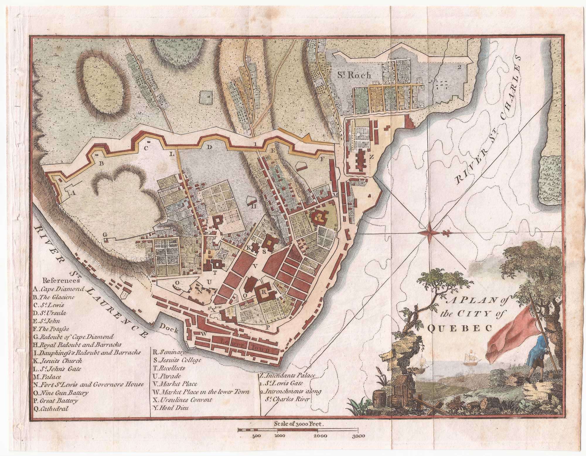
A detailed 18th century plan of the St Lawrence River
HARRISON, John. Date: 1784 Stock #: 22812 £420.00
[ti_wishlists_addtowishlist]
[ti_wishlists_addtowishlist]
[ti_wishlists_addtowishlist]
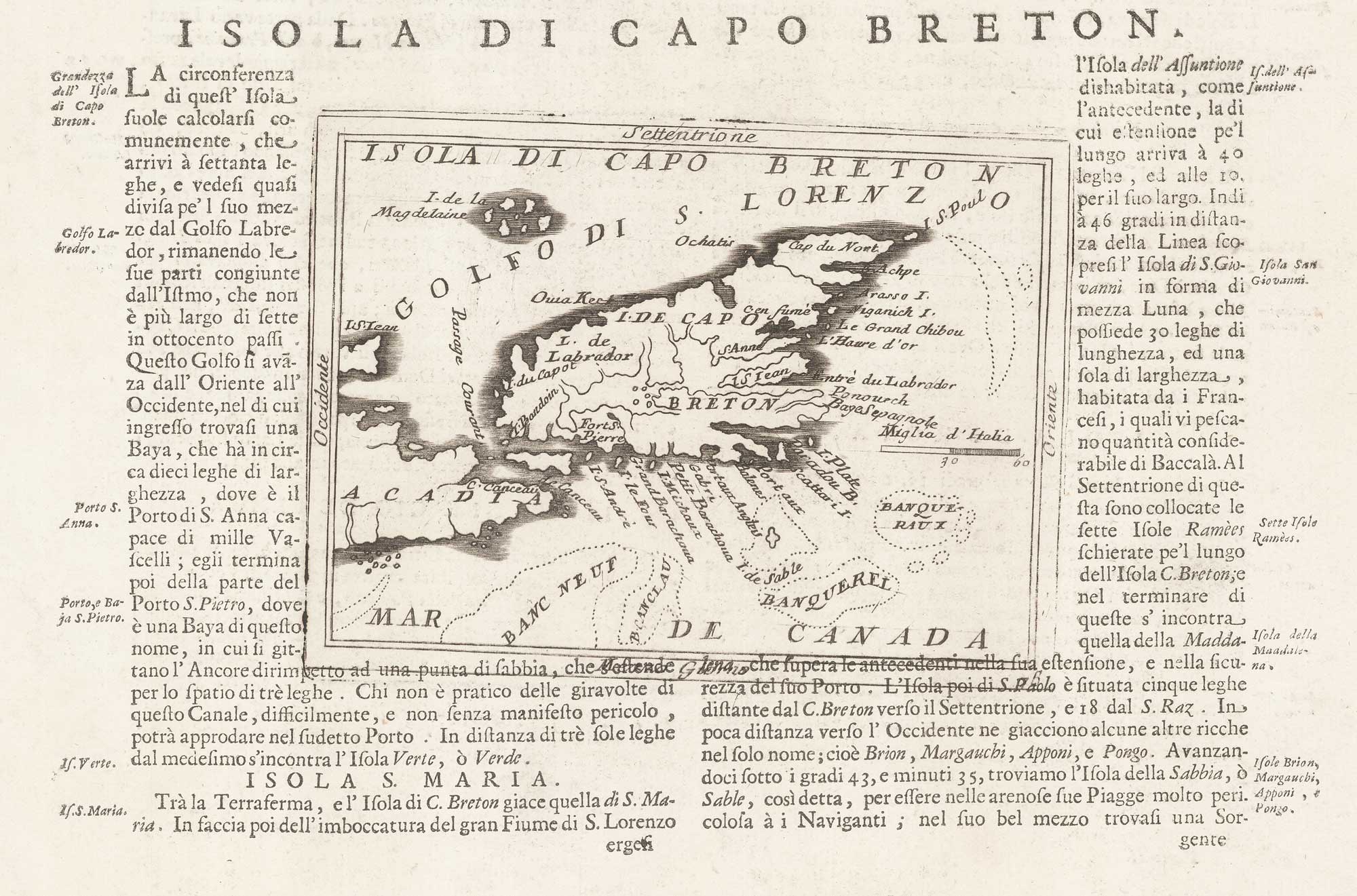
A 17th century map of Cape Breton Island
CORONELLI, Vincenzo Maria. Date: 1696 Stock #: 21640 £160.00
[ti_wishlists_addtowishlist]
[ti_wishlists_addtowishlist]
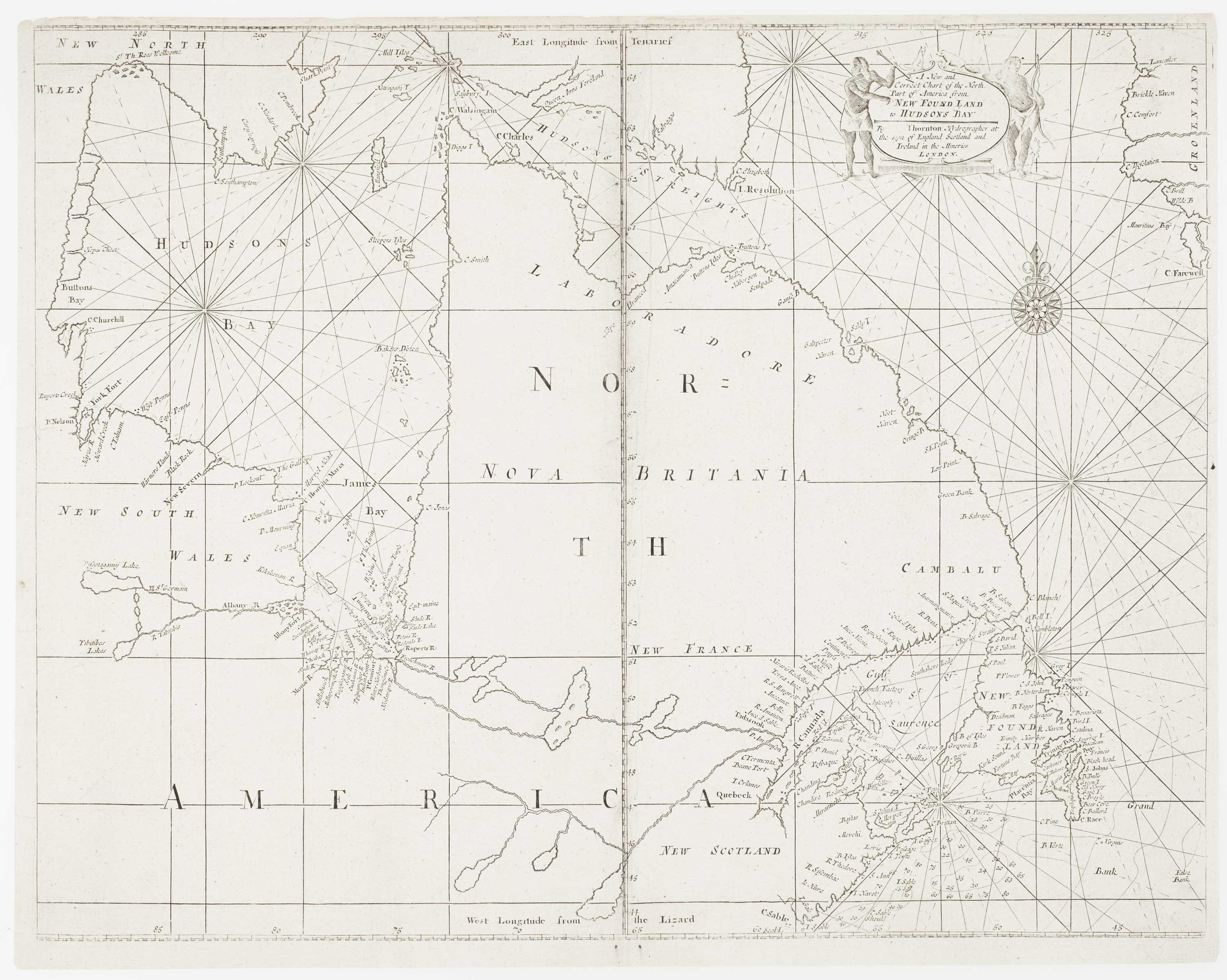
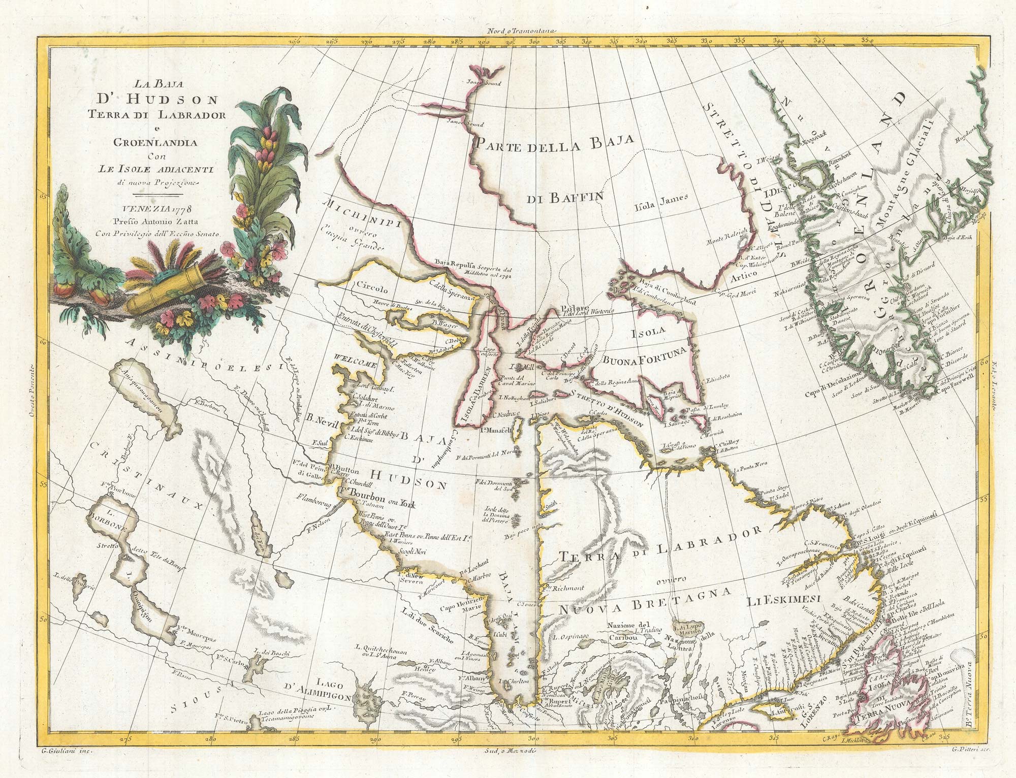
An early English chart of northern Canada with Hudson Bay
THORNTON, John. Date: 1748 Stock #: 15550 £300.00
[ti_wishlists_addtowishlist]
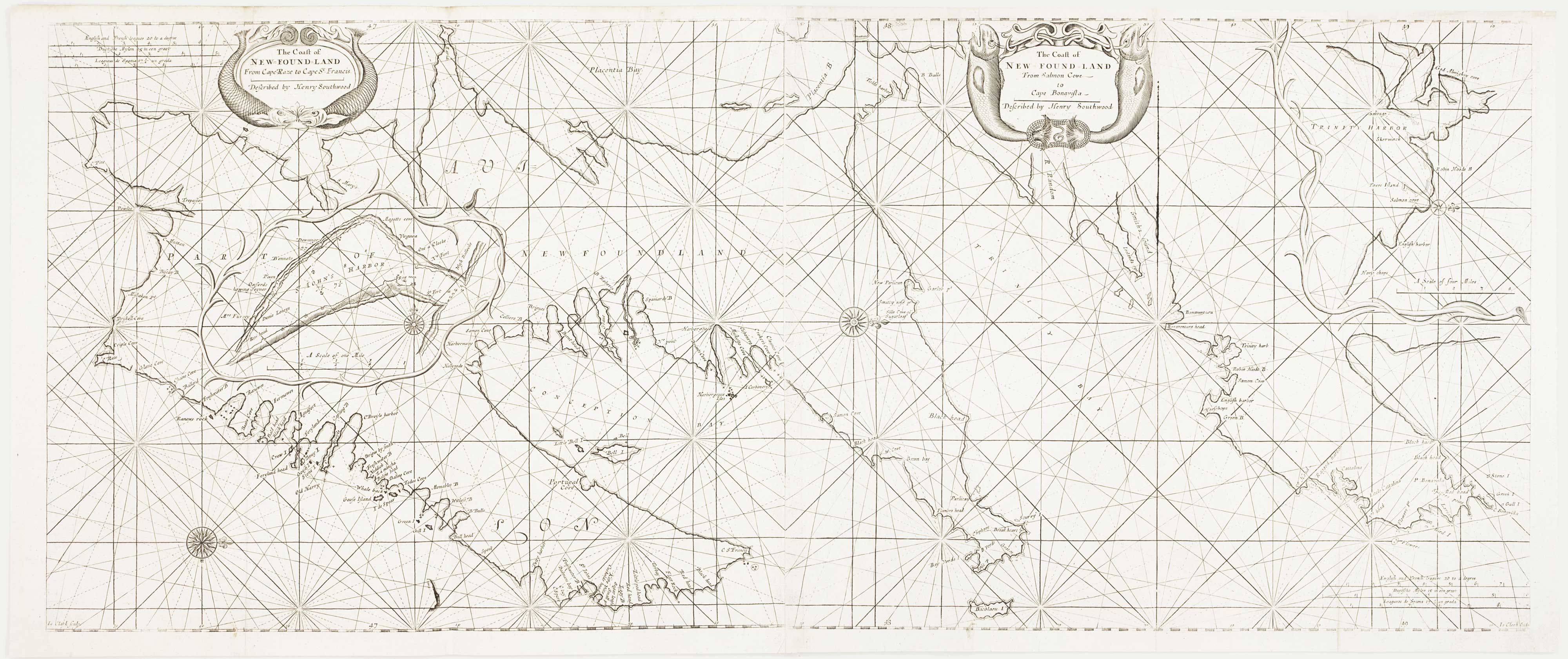
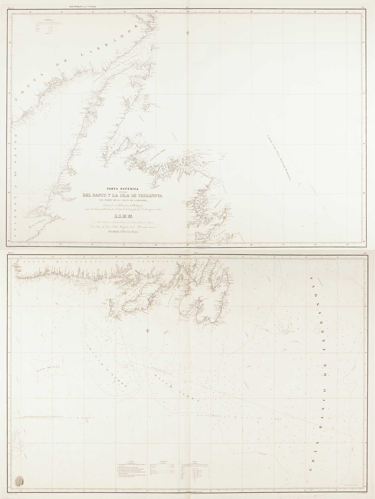
An early English chart of the east coast of Newfoundland on two sheets
SOUTHWOOD, Henry. Date: 1748 Stock #: 15528 £900.00
[ti_wishlists_addtowishlist]