Antique Maps of England and Wales
Showing 1–30 of 39 products
Sort by:
[ti_wishlists_addtowishlist]

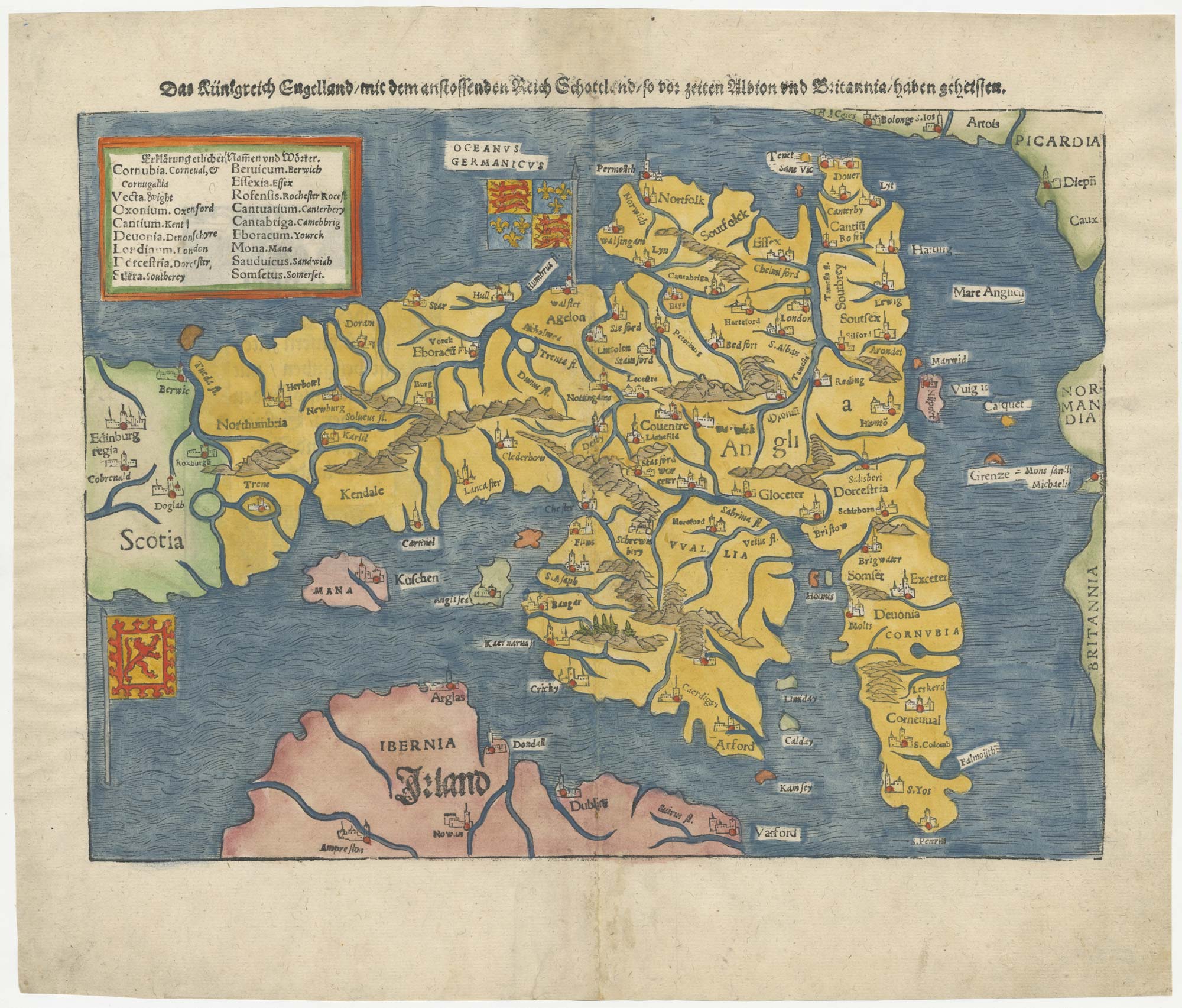
The rarest Ortelius atlas map of England and Wales
ORTELIUS, Abraham. Date: 1603 Stock #: 25643 £2,000.00
[ti_wishlists_addtowishlist]
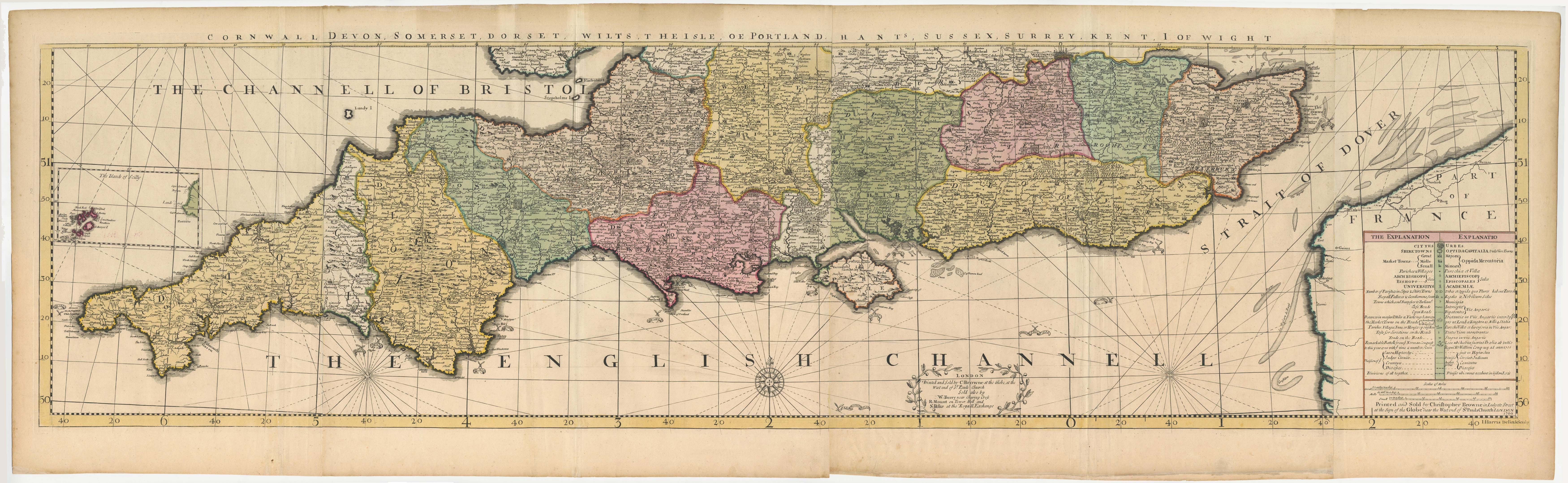
The southern counties of England from a 1700 wall map of England
HARRIS, John. Date: 1700 Stock #: 25108 £3,000.00
[ti_wishlists_addtowishlist]

[ti_wishlists_addtowishlist]
[ti_wishlists_addtowishlist]

[ti_wishlists_addtowishlist]
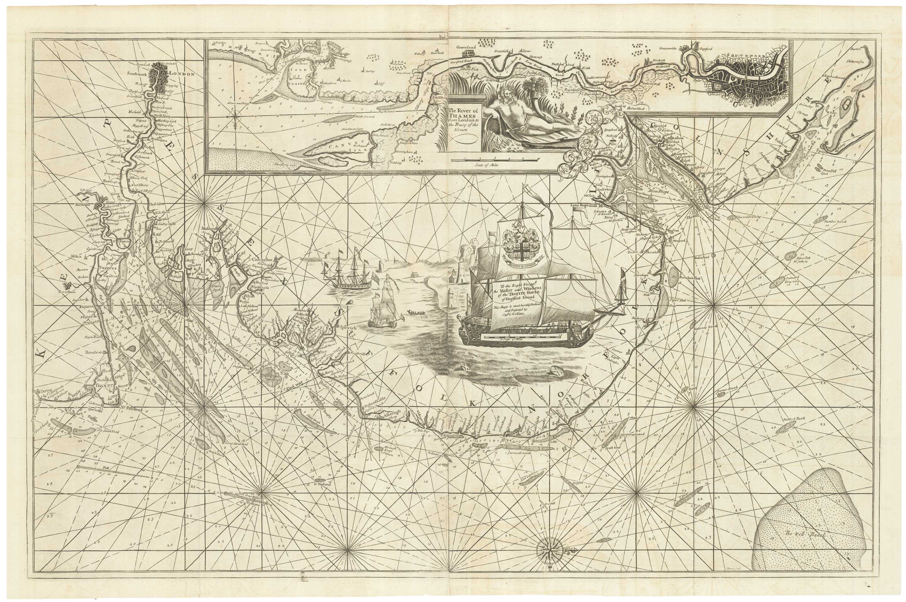
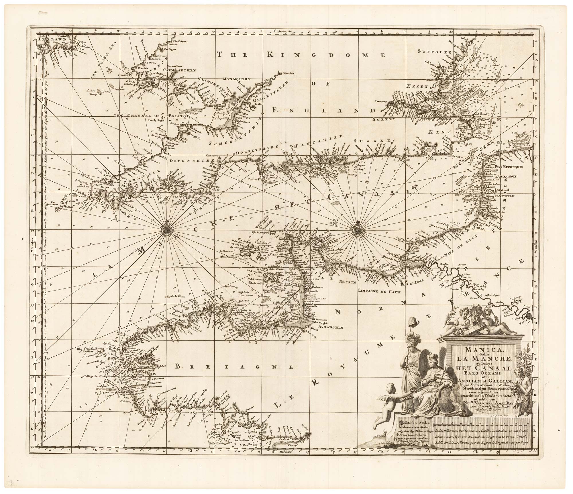
An English 17th century sea-chart of Dover to Spurn Head with the River Thames
COLLINS, Greenvile. Date: 1740 Stock #: 25078 £1,500.00
[ti_wishlists_addtowishlist]
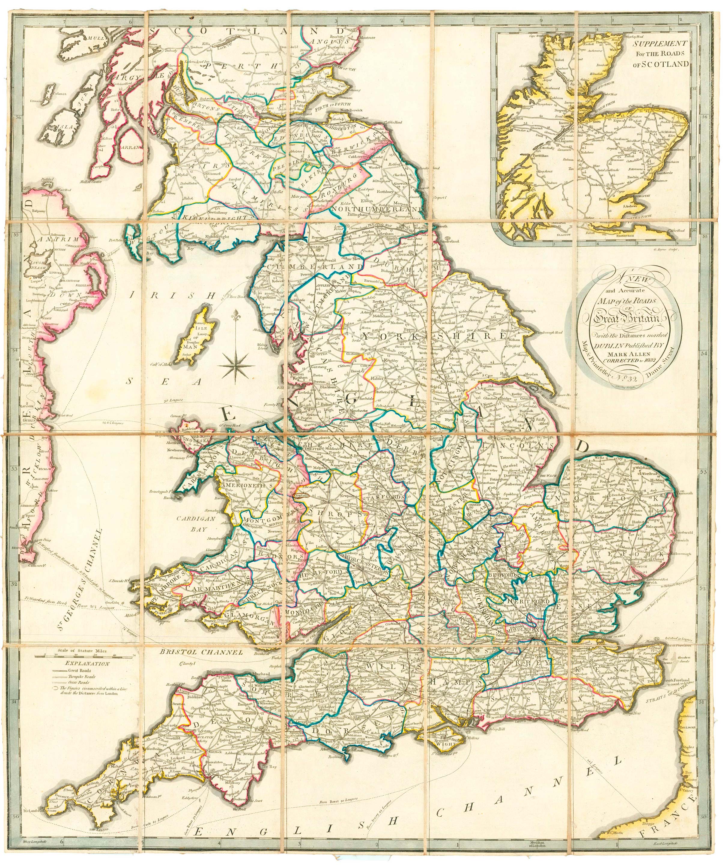
A scarce road map of England and Wales published in Dublin
ALLEN, Mark. Date: 1832 Stock #: 24777 £450.00
[ti_wishlists_addtowishlist]
[ti_wishlists_addtowishlist]
[ti_wishlists_addtowishlist]
A leaf of Saxton's 'Traveller's Guide' of England and Wales
SAXTON, Christopher. Date: 1700 Stock #: 24050 £900.00
[ti_wishlists_addtowishlist]
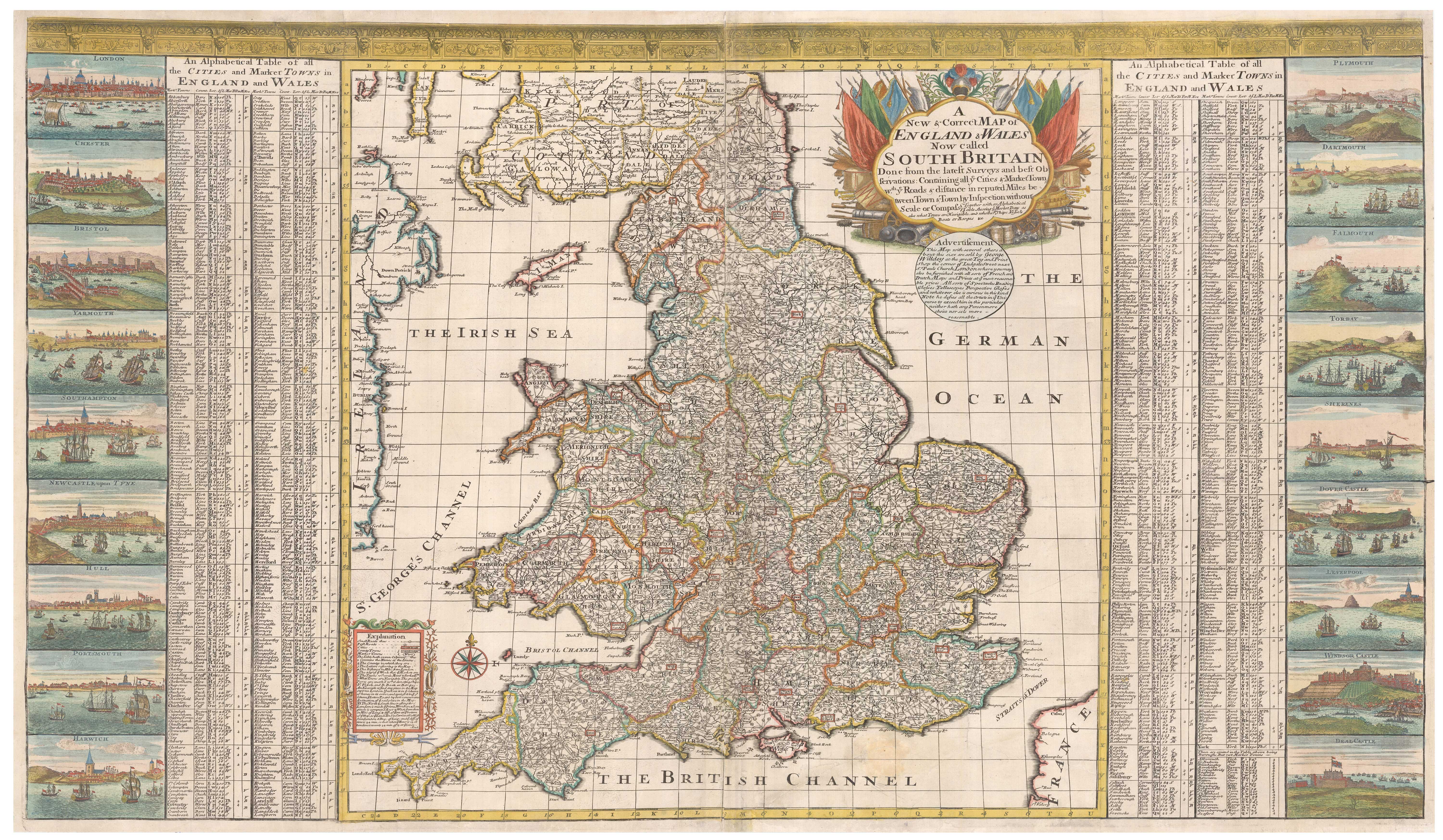
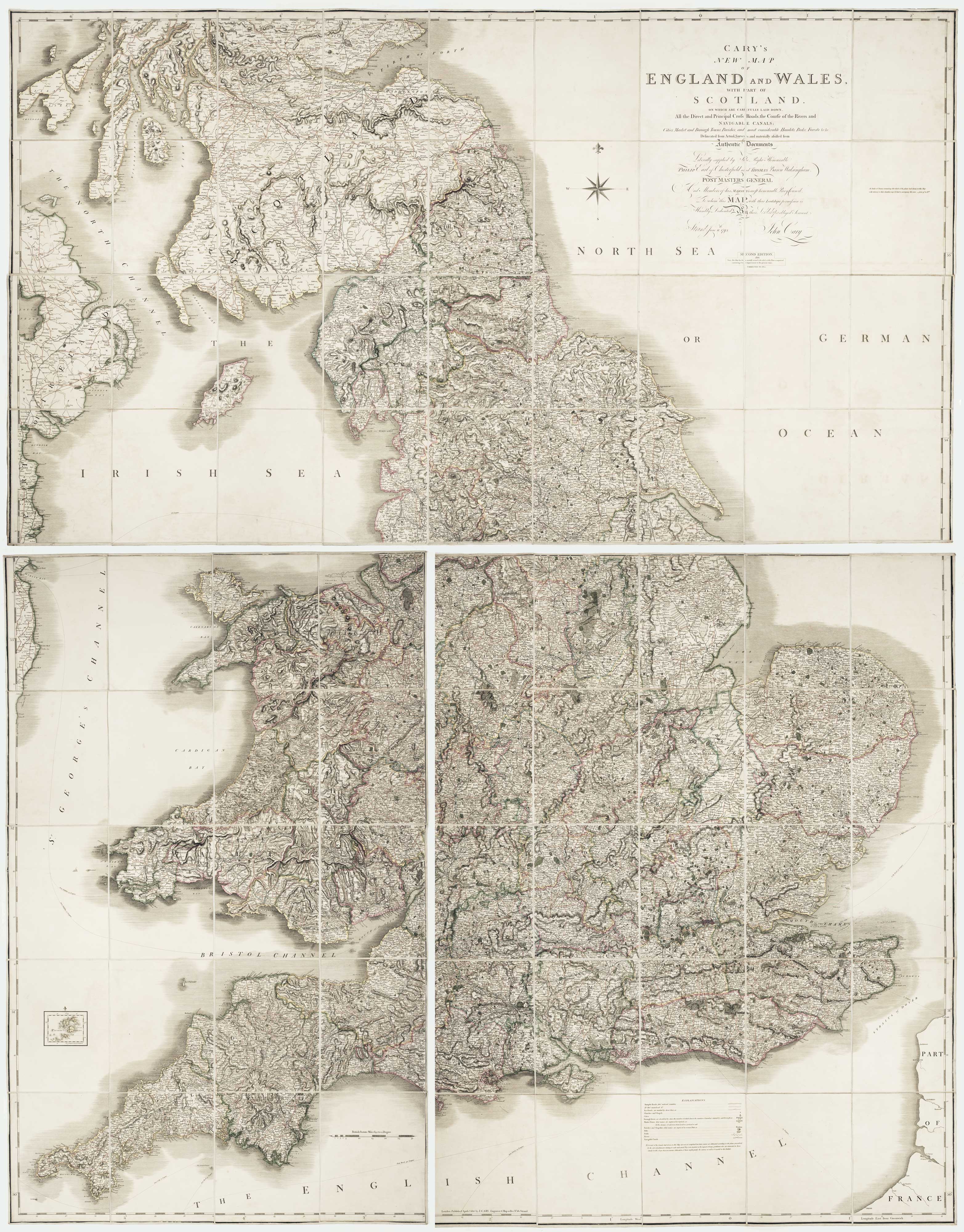
A scarce two-sheet map of England and Wales with side panels
WILLDEY, George. Date: 1715 Stock #: 24165 £3,000.00
[ti_wishlists_addtowishlist]
[ti_wishlists_addtowishlist]
[ti_wishlists_addtowishlist]
[ti_wishlists_addtowishlist]

[ti_wishlists_addtowishlist]
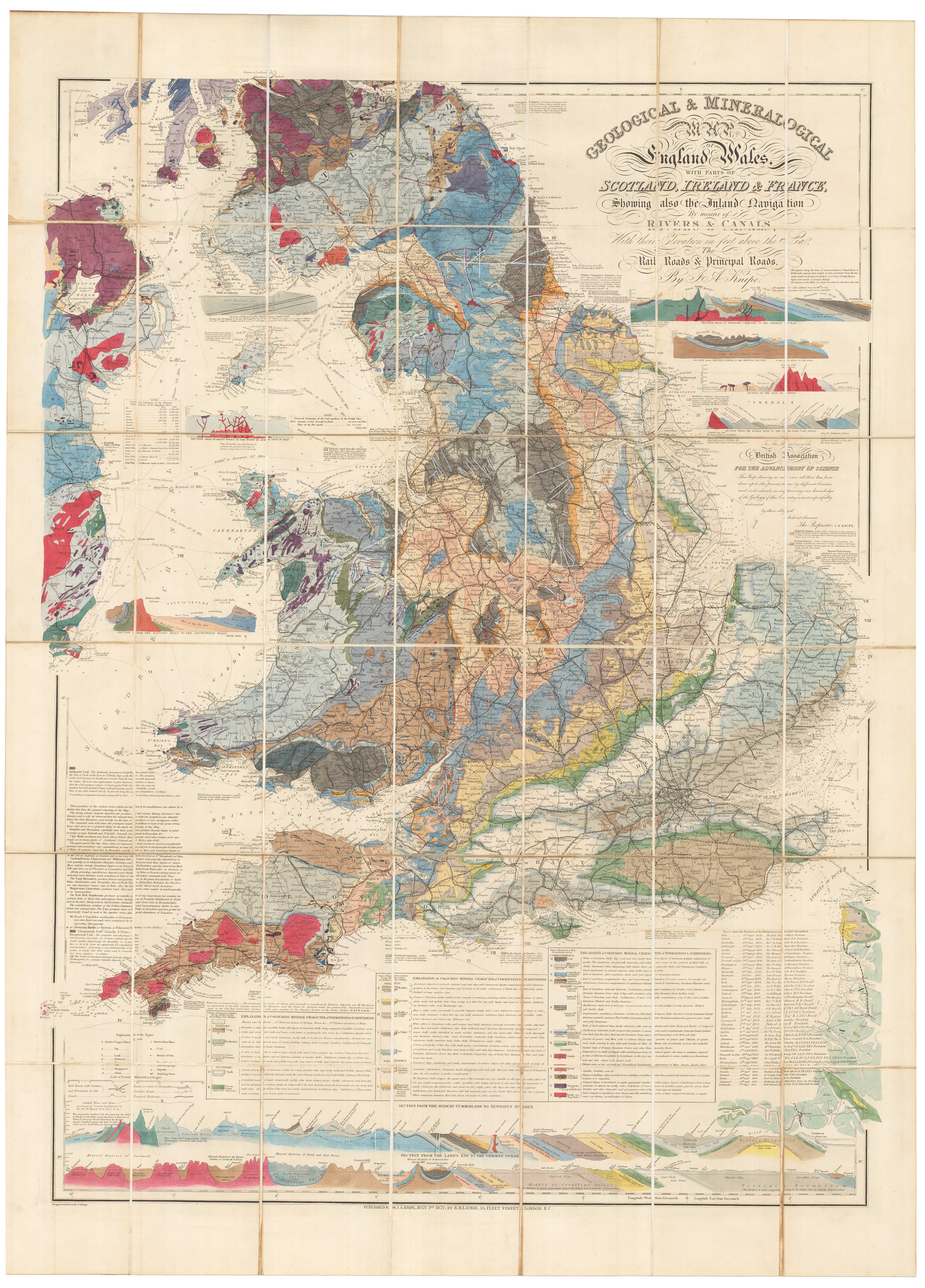
A detailed geological map of England and Wales
KNIPE, James Alexander. Date: 1870 Stock #: 23418 £1,500.00
[ti_wishlists_addtowishlist]
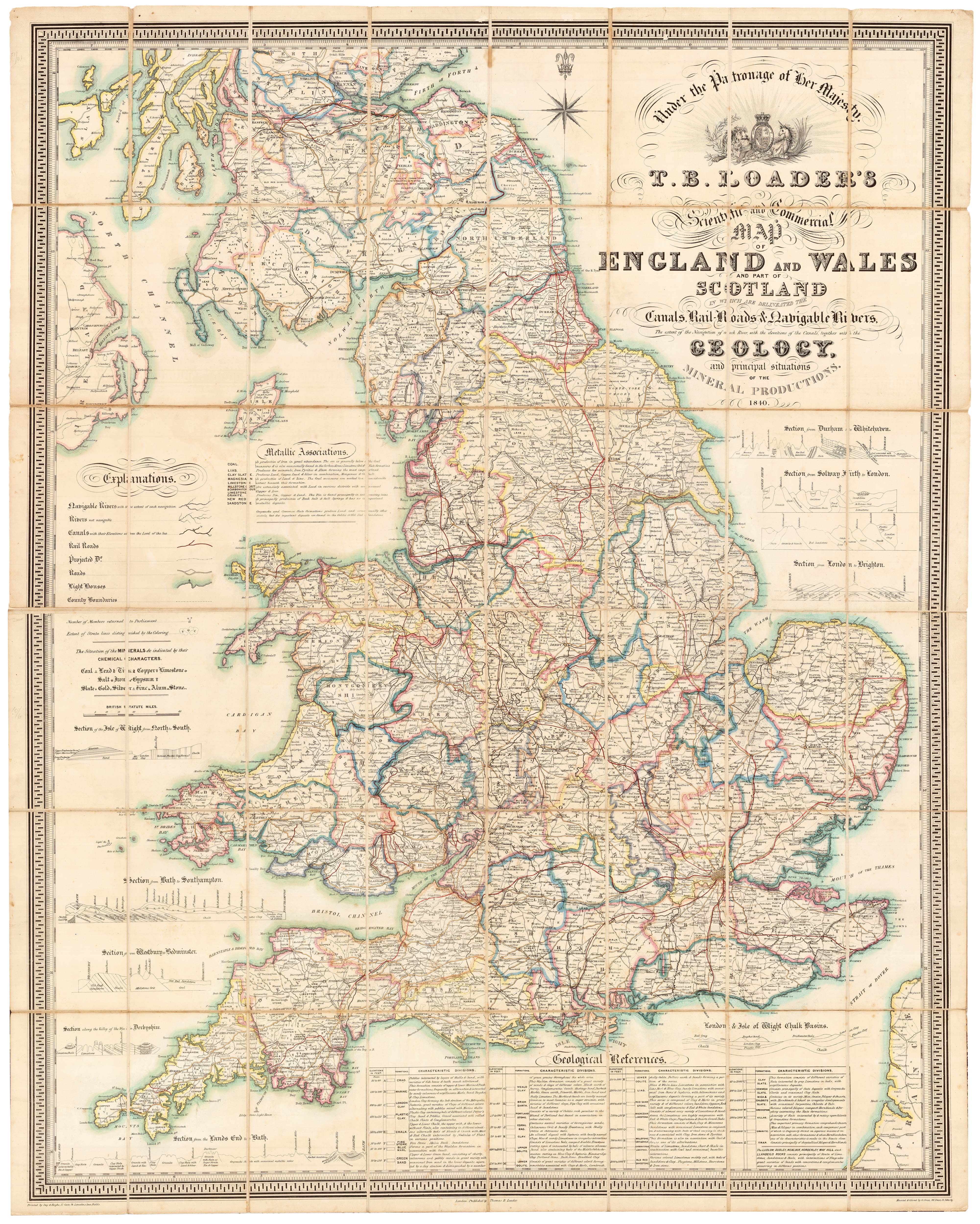
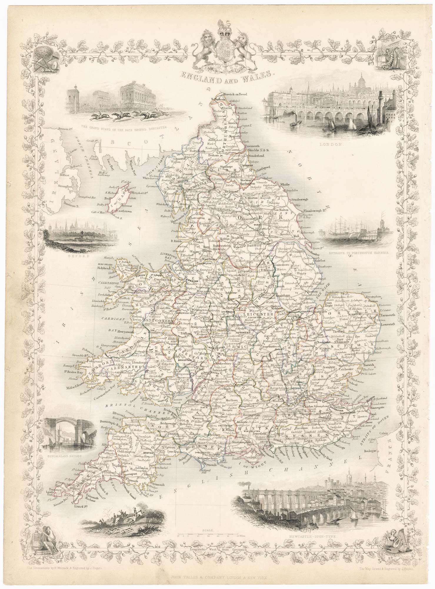
A large and detailed Victorian map of England & Wales
LOADER, T.B. Date: 1840 Stock #: 22981 £1,850.00
[ti_wishlists_addtowishlist]
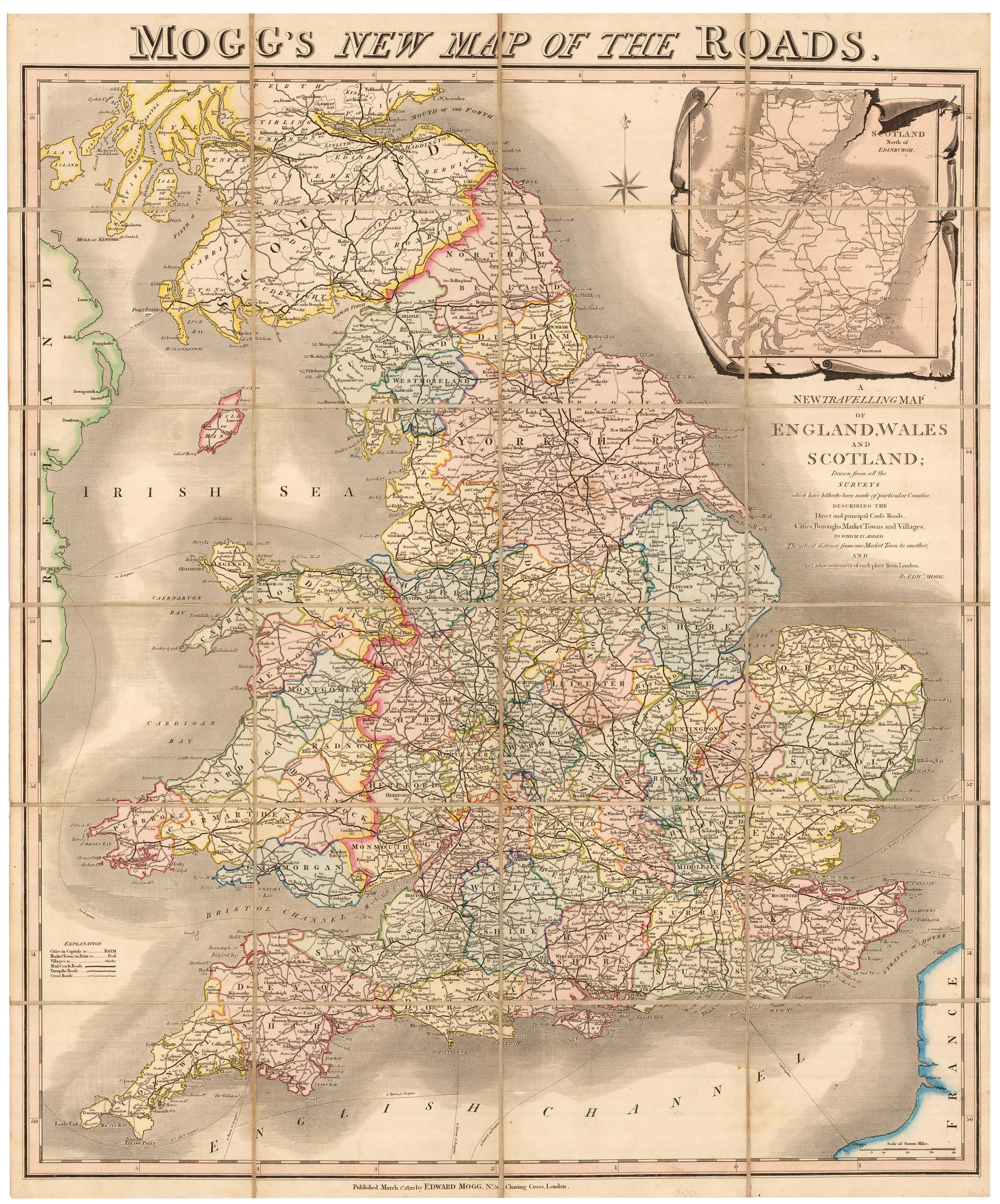
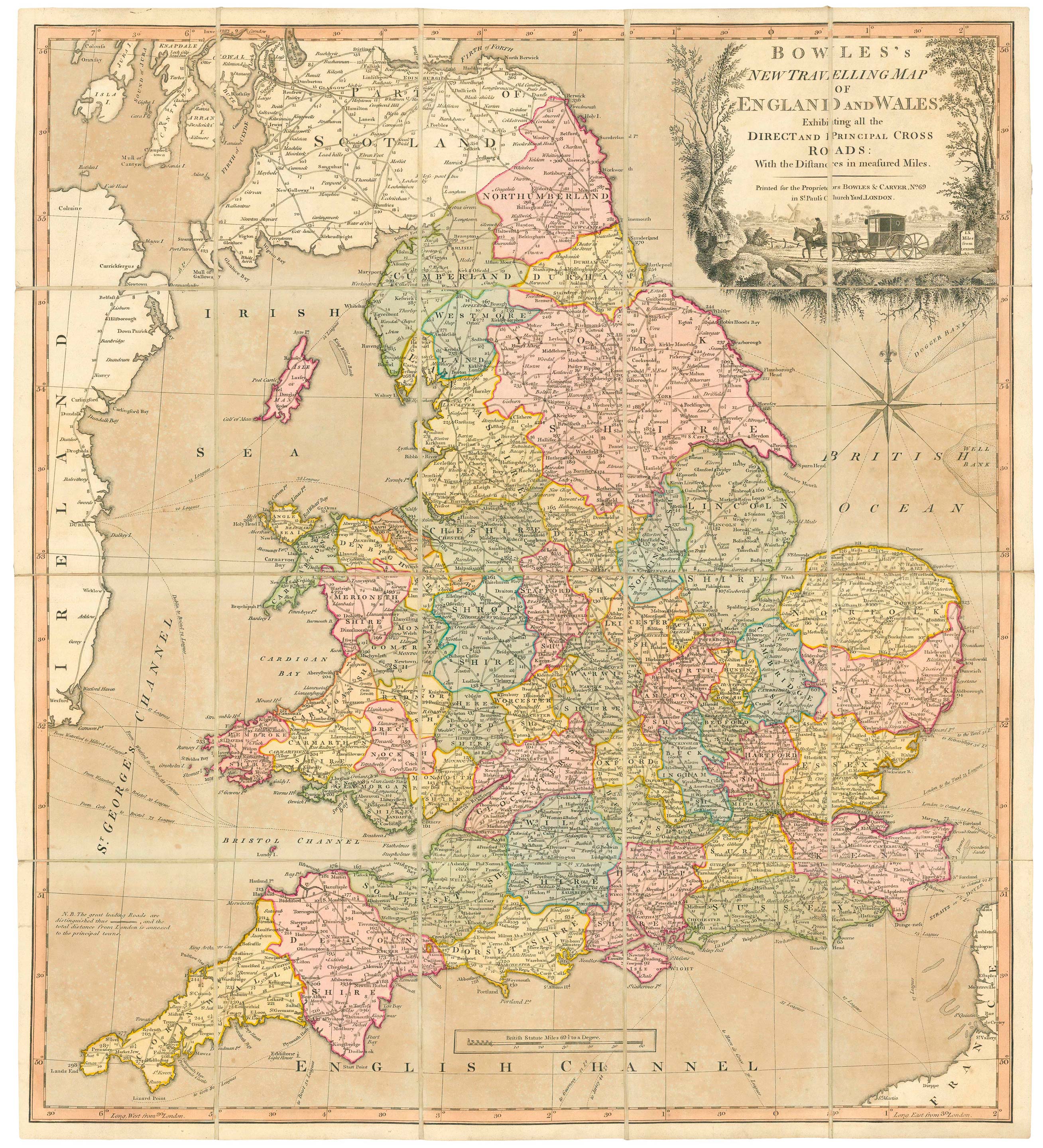
A colourful Georgian map of the roads of England & Wales
MOGG, Edward Slatford. Date: 1838 Stock #: 22986 £250.00
[ti_wishlists_addtowishlist]
[ti_wishlists_addtowishlist]
[ti_wishlists_addtowishlist]
[ti_wishlists_addtowishlist]
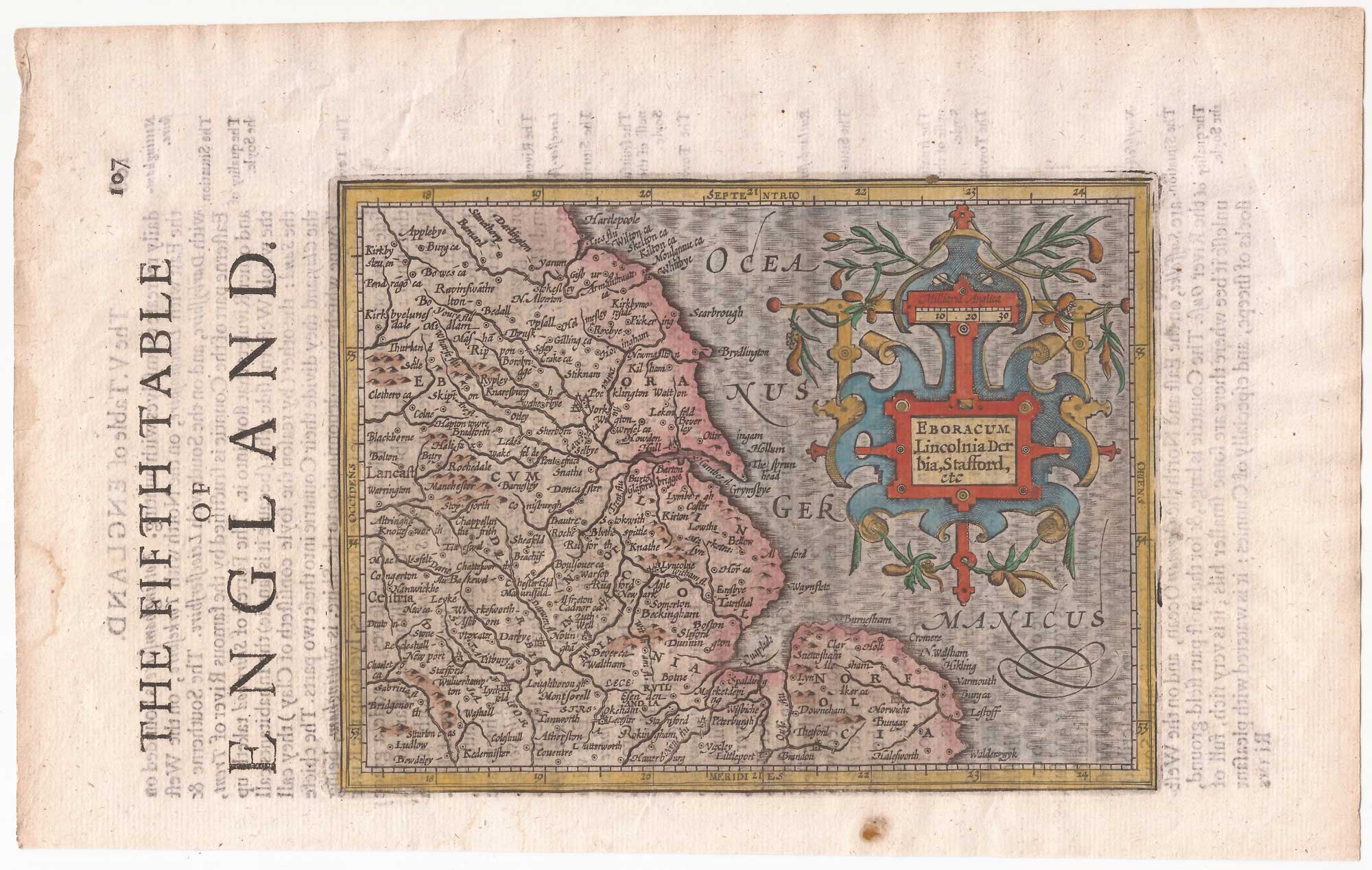
North East England from the first English Edition of the 'Atlas Minor'
HONDIUS, Jodocus. Date: 1635 Stock #: 22447 £110.00
[ti_wishlists_addtowishlist]
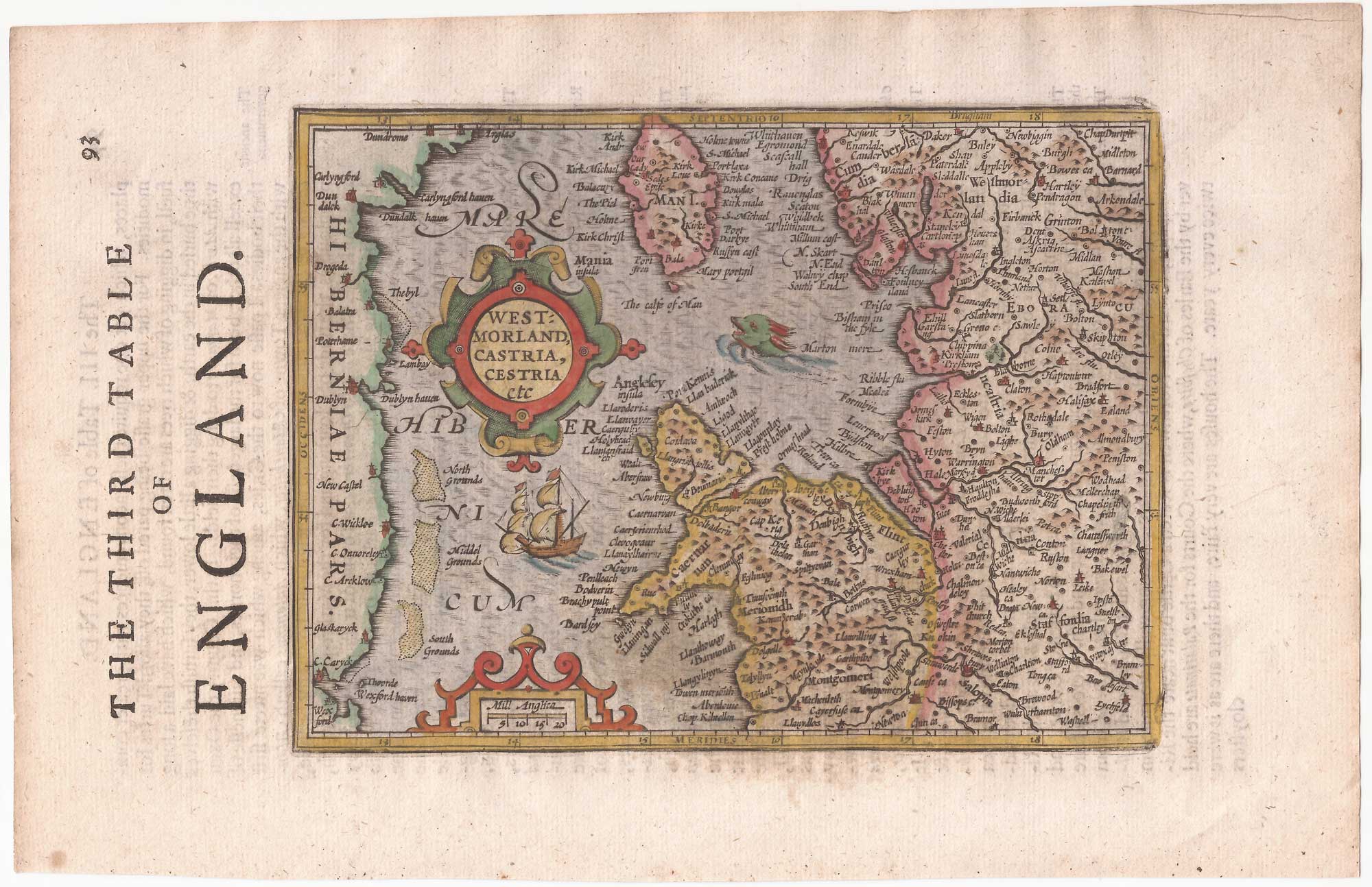
North West England from the first English Edition of the 'Atlas Minor'
HONDIUS, Jodocus. Date: 1635 Stock #: 22445 £150.00
[ti_wishlists_addtowishlist]
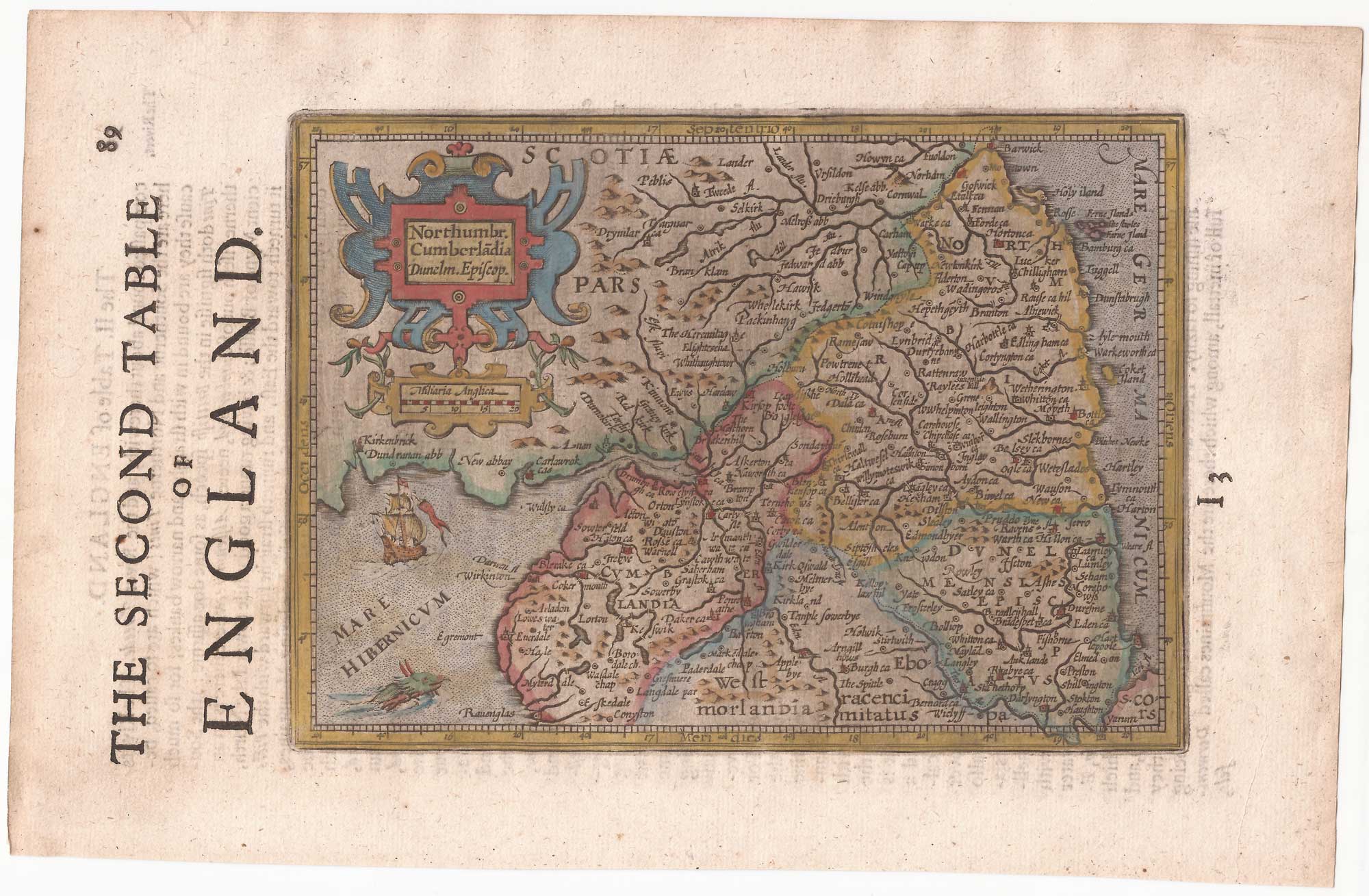
Northern England from the first English Edition of the 'Atlas Minor'
HONDIUS, Jodocus. Date: 1635 Stock #: 22444 £100.00
[ti_wishlists_addtowishlist]

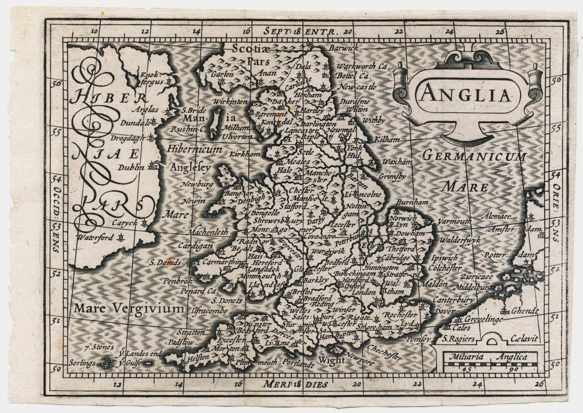
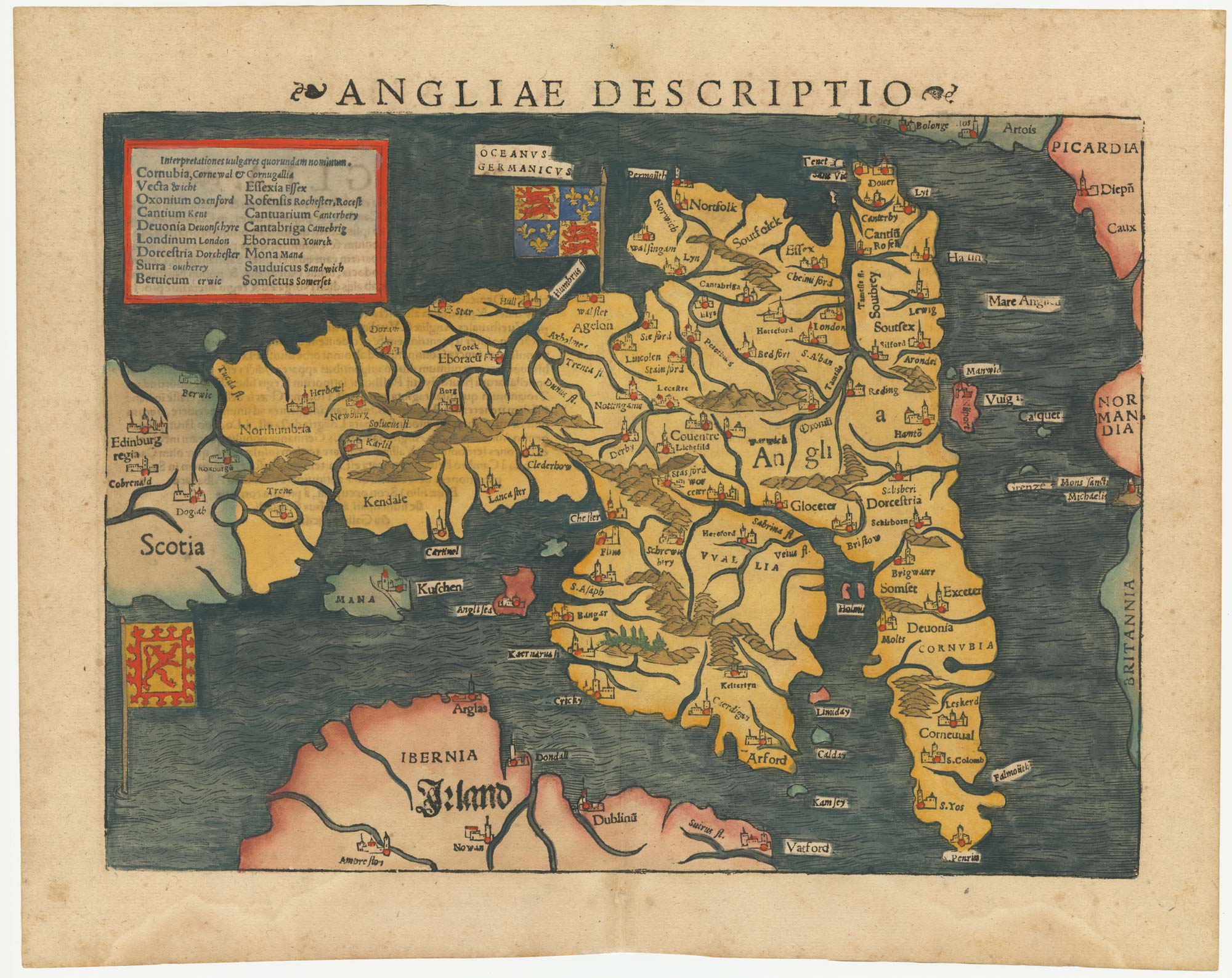
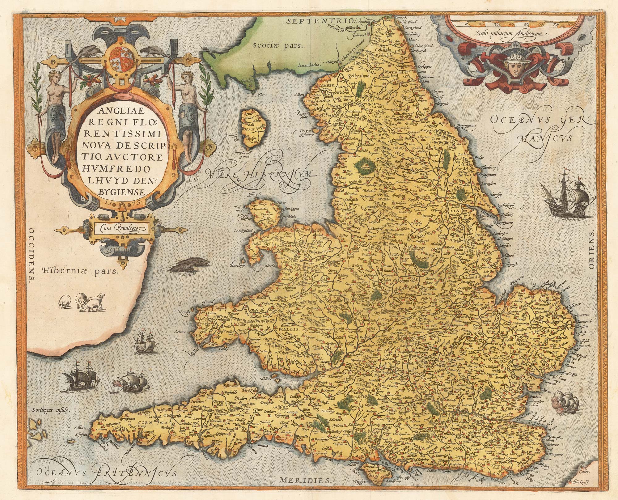
England and Wales from the first English Edition of the 'Atlas Minor'
HONDIUS, Jodocus. Date: 1635 Stock #: 22399 £220.00
[ti_wishlists_addtowishlist]

An unrecorded state of Saxton's map of South East England
SAXTON, Christopher. Date: 1690 Stock #: 22260 £3,000.00
[ti_wishlists_addtowishlist]
[ti_wishlists_addtowishlist]
[ti_wishlists_addtowishlist]

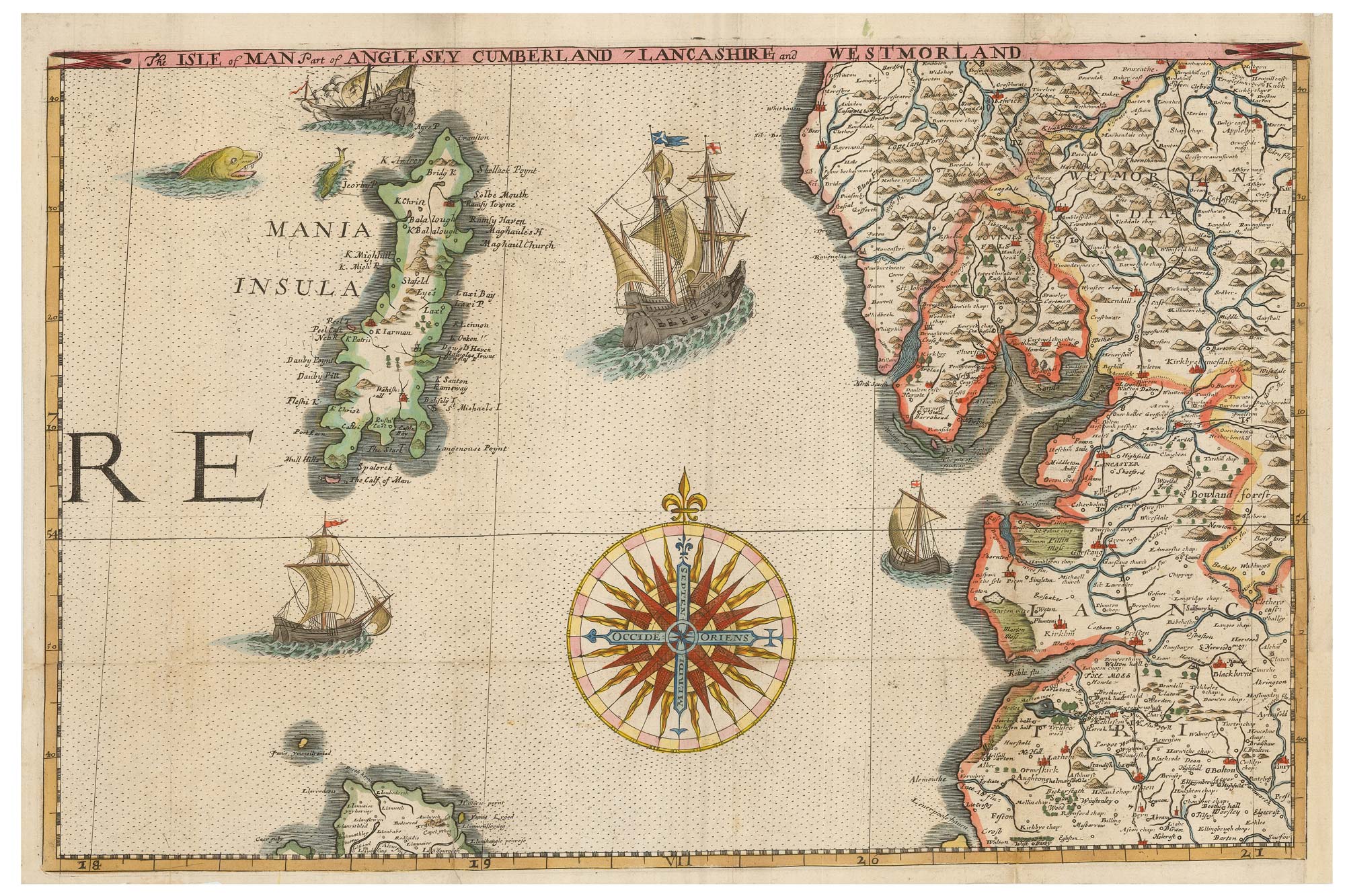
A miniature map of North West England and Wales
HONDIUS, Jodocus II. Date: 1807 Stock #: 22148 £80.00
[ti_wishlists_addtowishlist]