Antique Maps of North America
Showing 1–17 of 17 products
Sort by:
[ti_wishlists_addtowishlist]
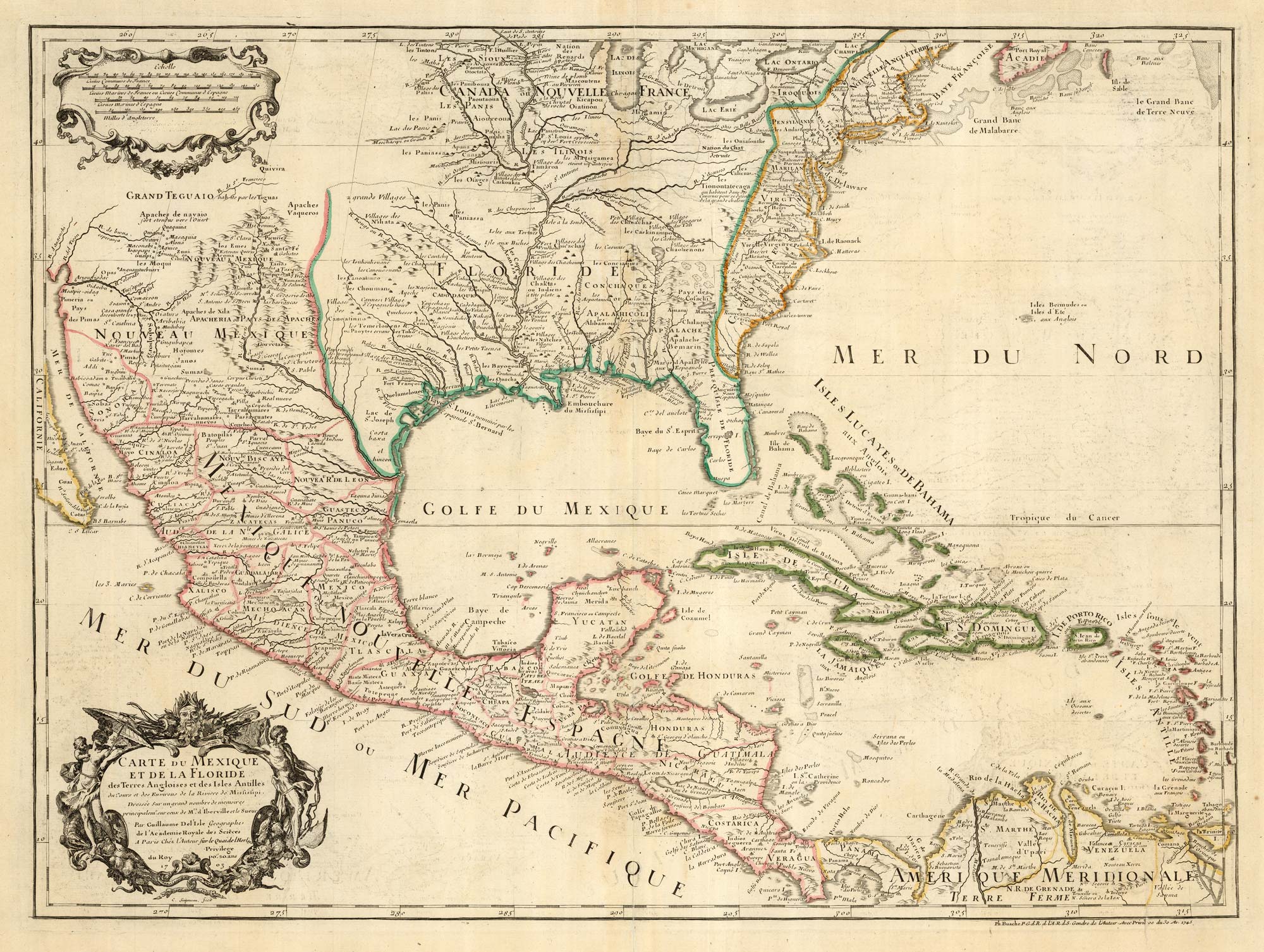
The first printed map to accurately map the Mississippi River
DELISLE, Guillaume. Date: 1745 Stock #: 25238 £850.00
[ti_wishlists_addtowishlist]
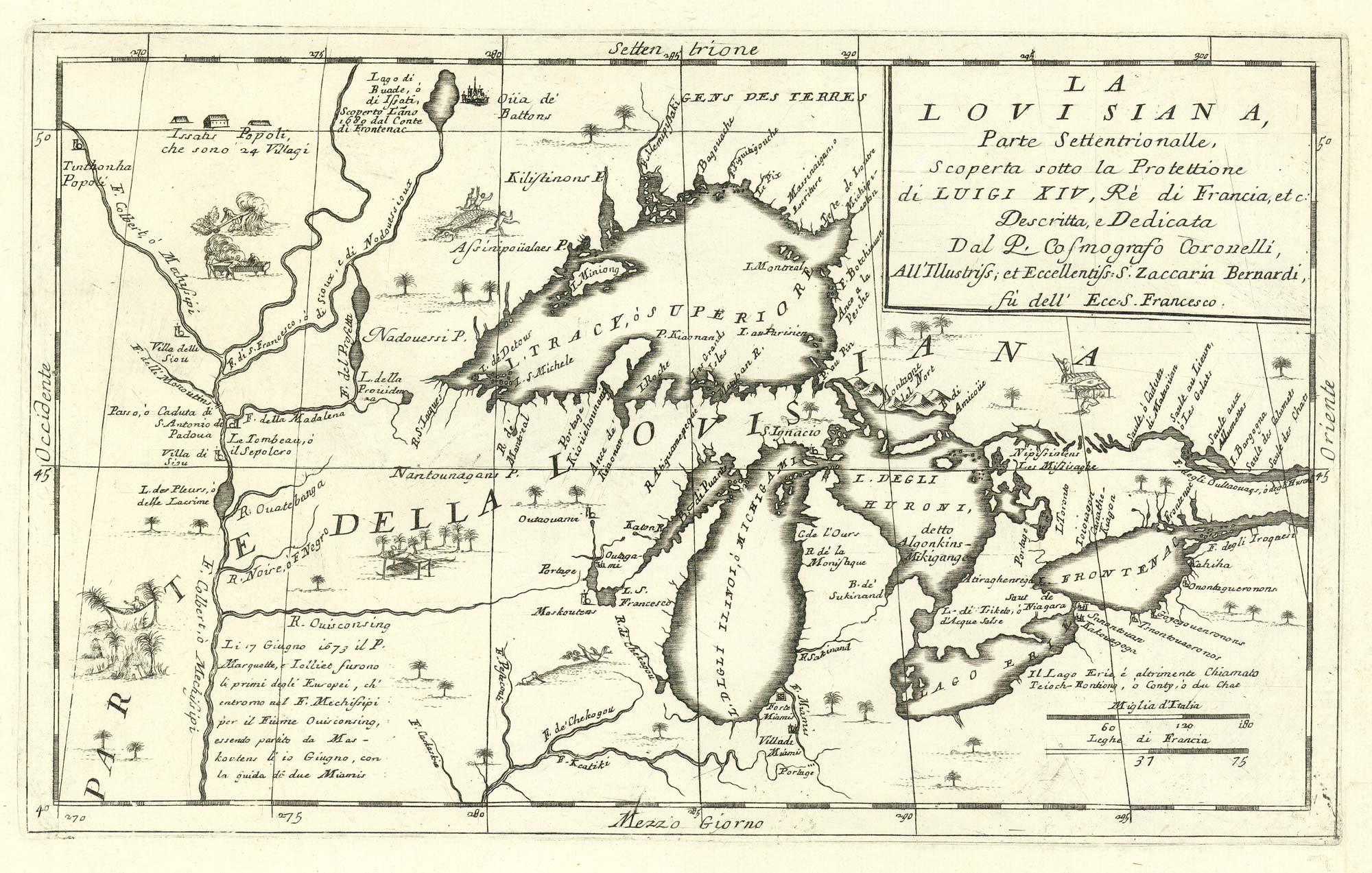
The first map to show the five Great Lakes
CORONELLI, Vincenzo Maria. Date: 1695 Stock #: 24767 £4,400.00
[ti_wishlists_addtowishlist]
[ti_wishlists_addtowishlist]
[ti_wishlists_addtowishlist]
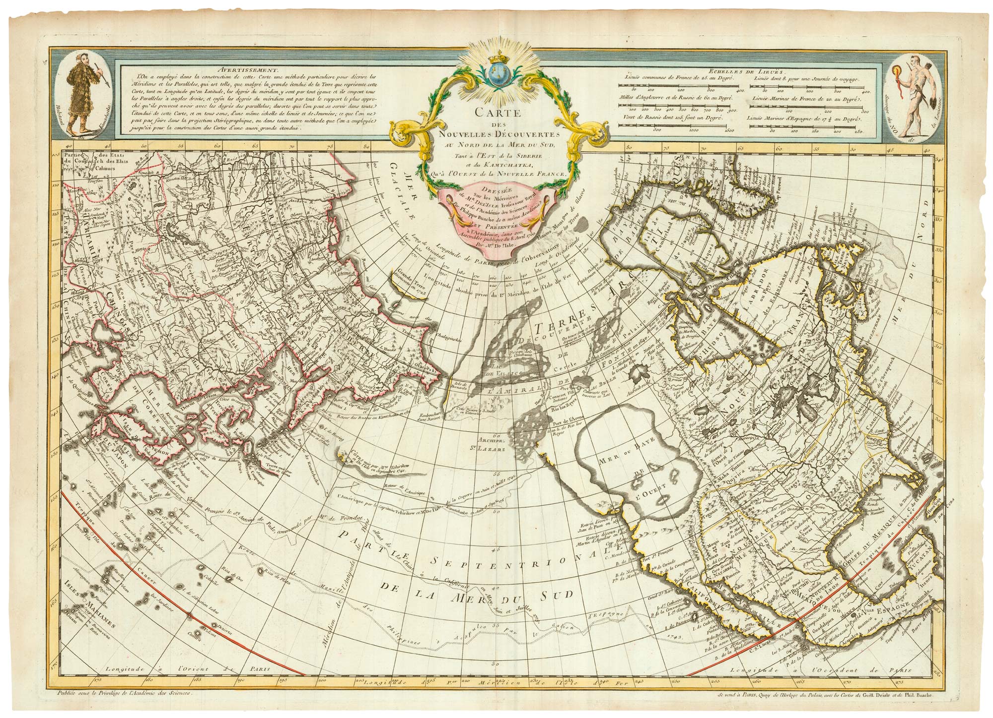
The first issue of an influential map, the first to show the 'Mer de l'Ouest'
BUACHE, Philippe. Date: 1752 Stock #: 24615 £4,500.00
[ti_wishlists_addtowishlist]
[ti_wishlists_addtowishlist]
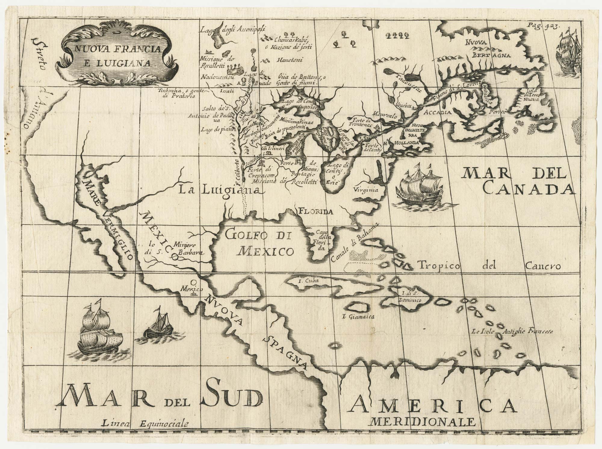
A rare Italian edition of Hennepin's landmark map of Louisiana
HENNEPIN, Louis. Date: 1691 Stock #: 24027 £2,800.00
[ti_wishlists_addtowishlist]
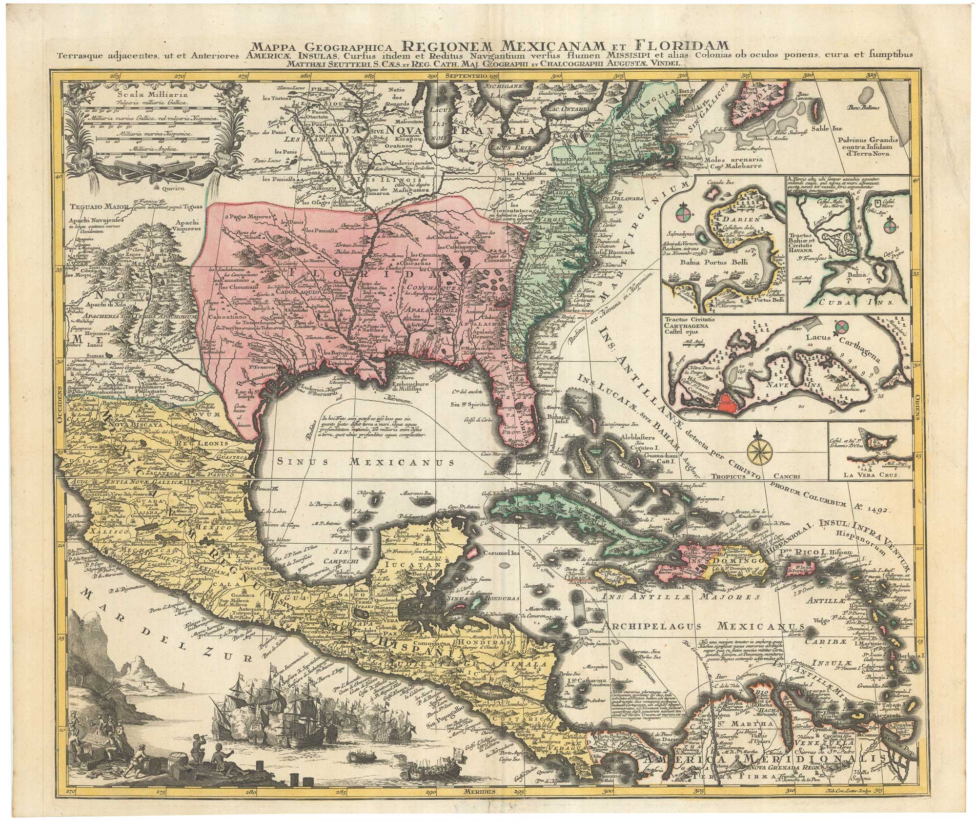
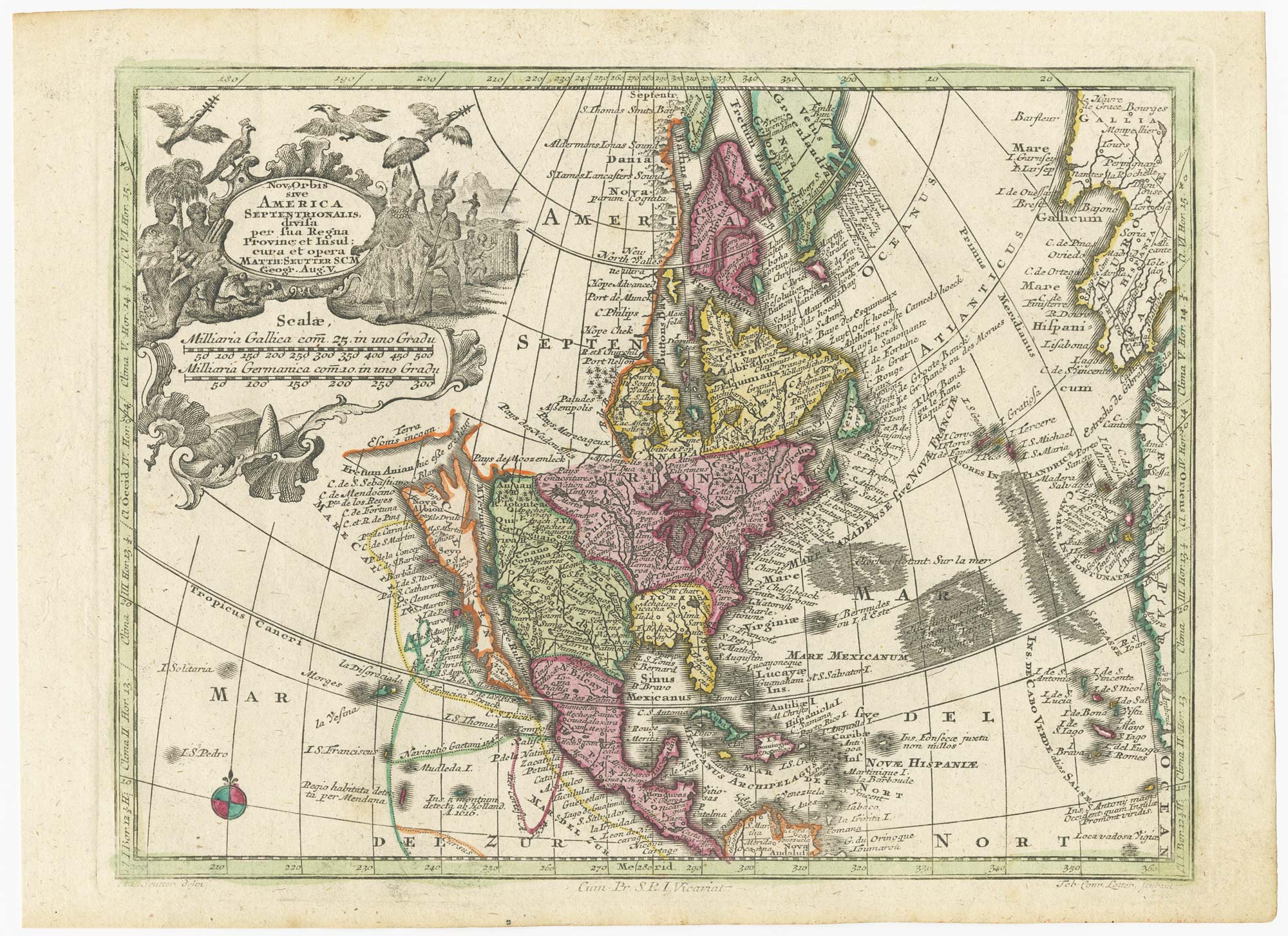
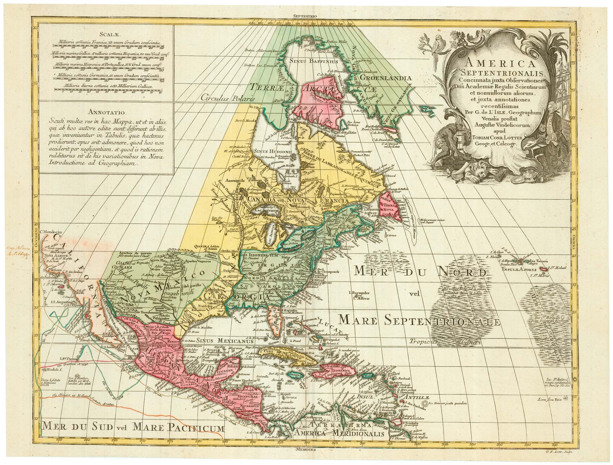
The European colonies in North America in the 18th century
SEUTTER, Matthaus. Date: 1735 Stock #: 24089 £1,400.00
[ti_wishlists_addtowishlist]
[ti_wishlists_addtowishlist]
[ti_wishlists_addtowishlist]
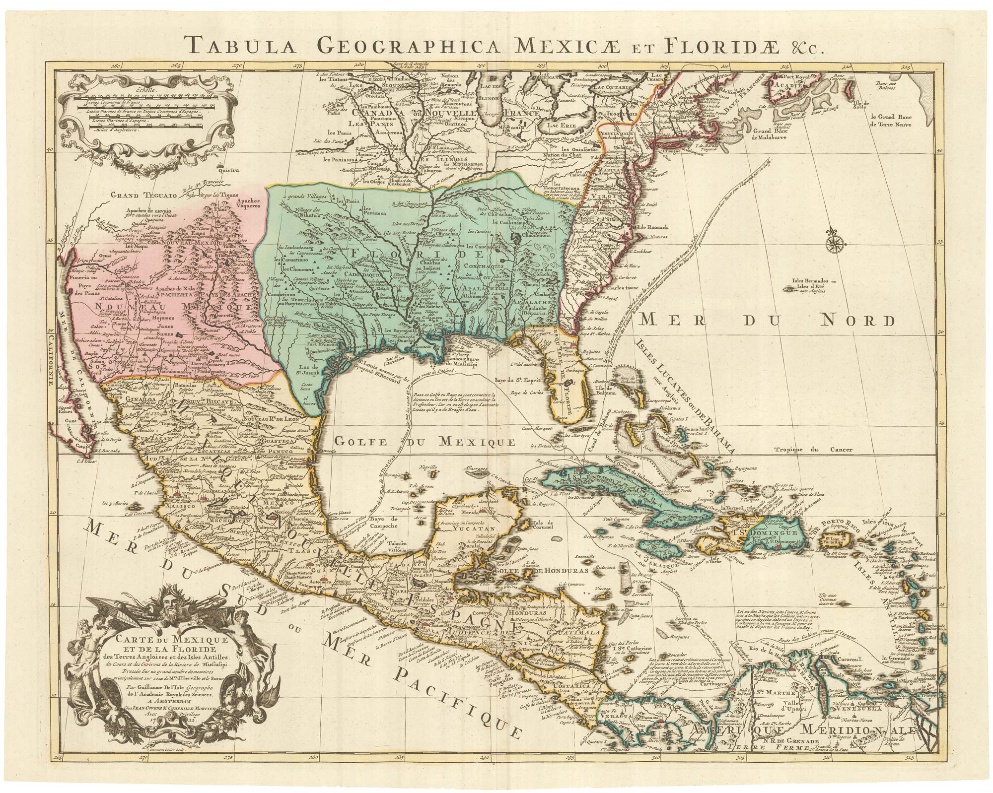
A Dutch edition of the first printed map to accurately plot the Mississippi River
DELISLE, Guillaume. Date: 1722 Stock #: 23463 £1,700.00
[ti_wishlists_addtowishlist]
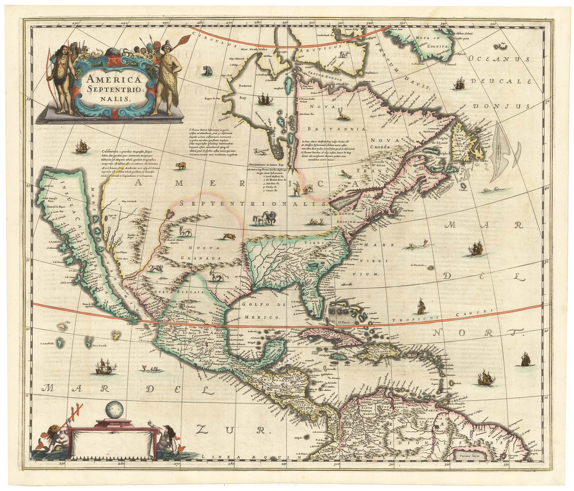
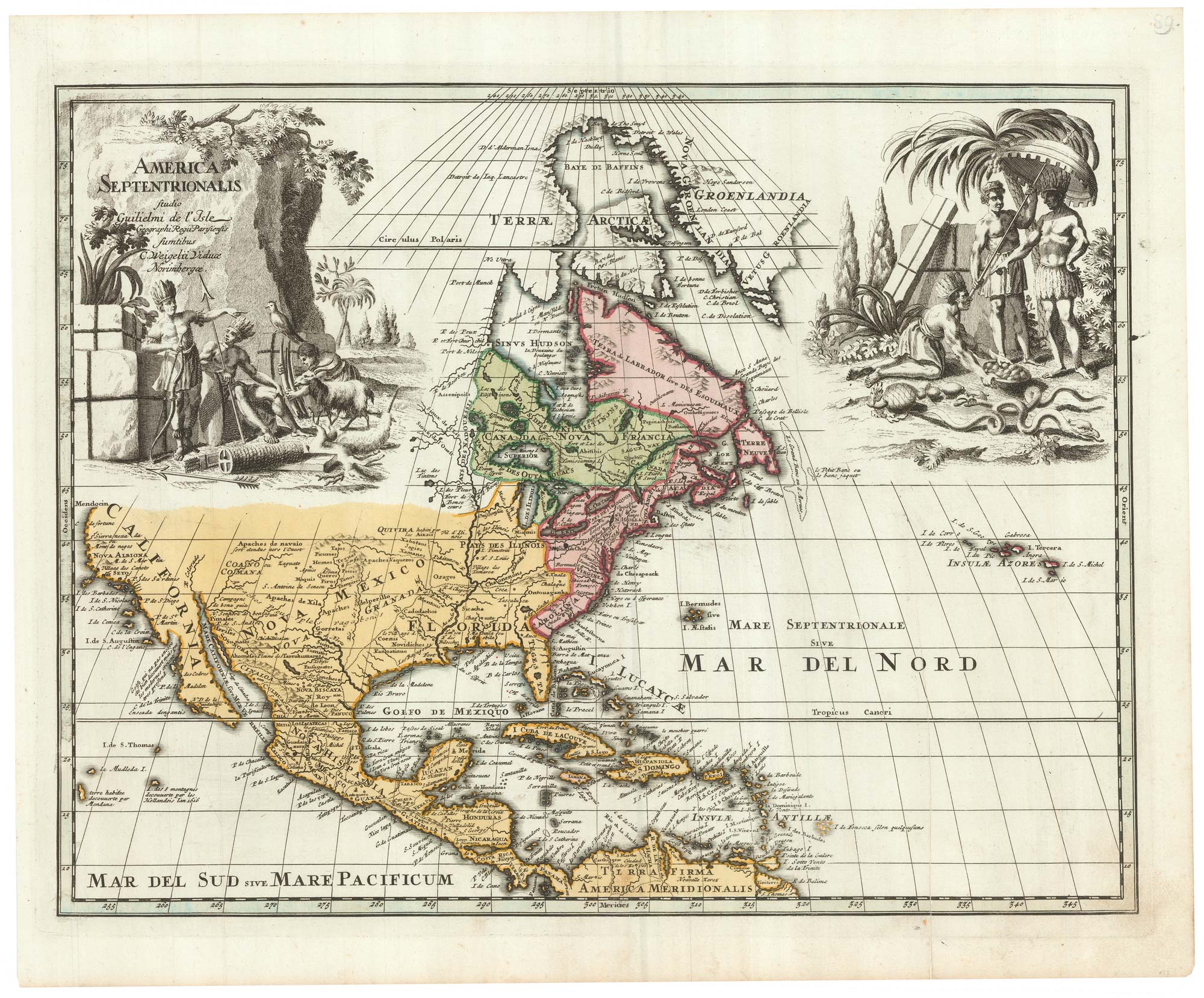
The first issue of an important map of North America
HONDIUS, Henricus. Date: 1636 Stock #: 22862 £6,500.00
[ti_wishlists_addtowishlist]
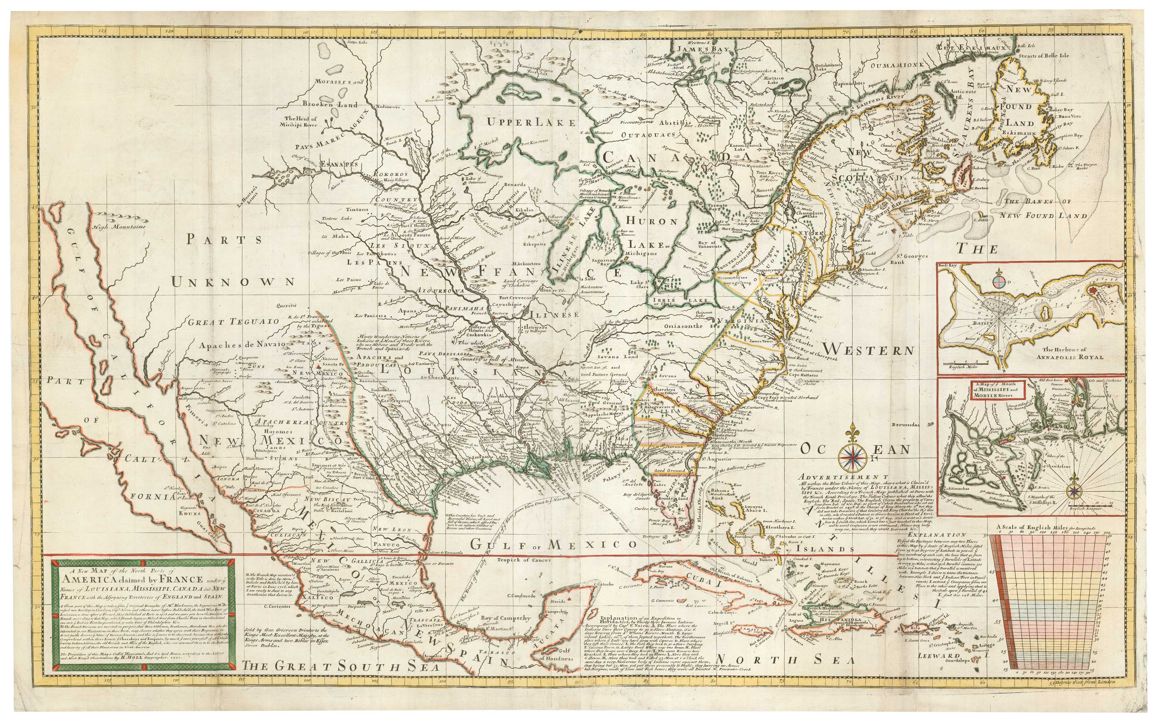
Grierson's version of Moll's two-sheet map of the French claims in North America
MOLL, Herman. Date: 1735 Stock #: 22697 £8,000.00
[ti_wishlists_addtowishlist]

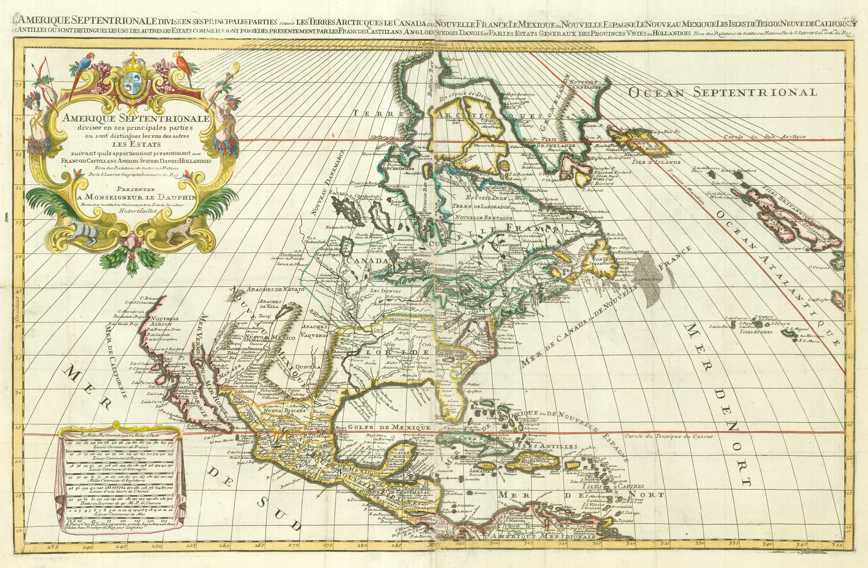
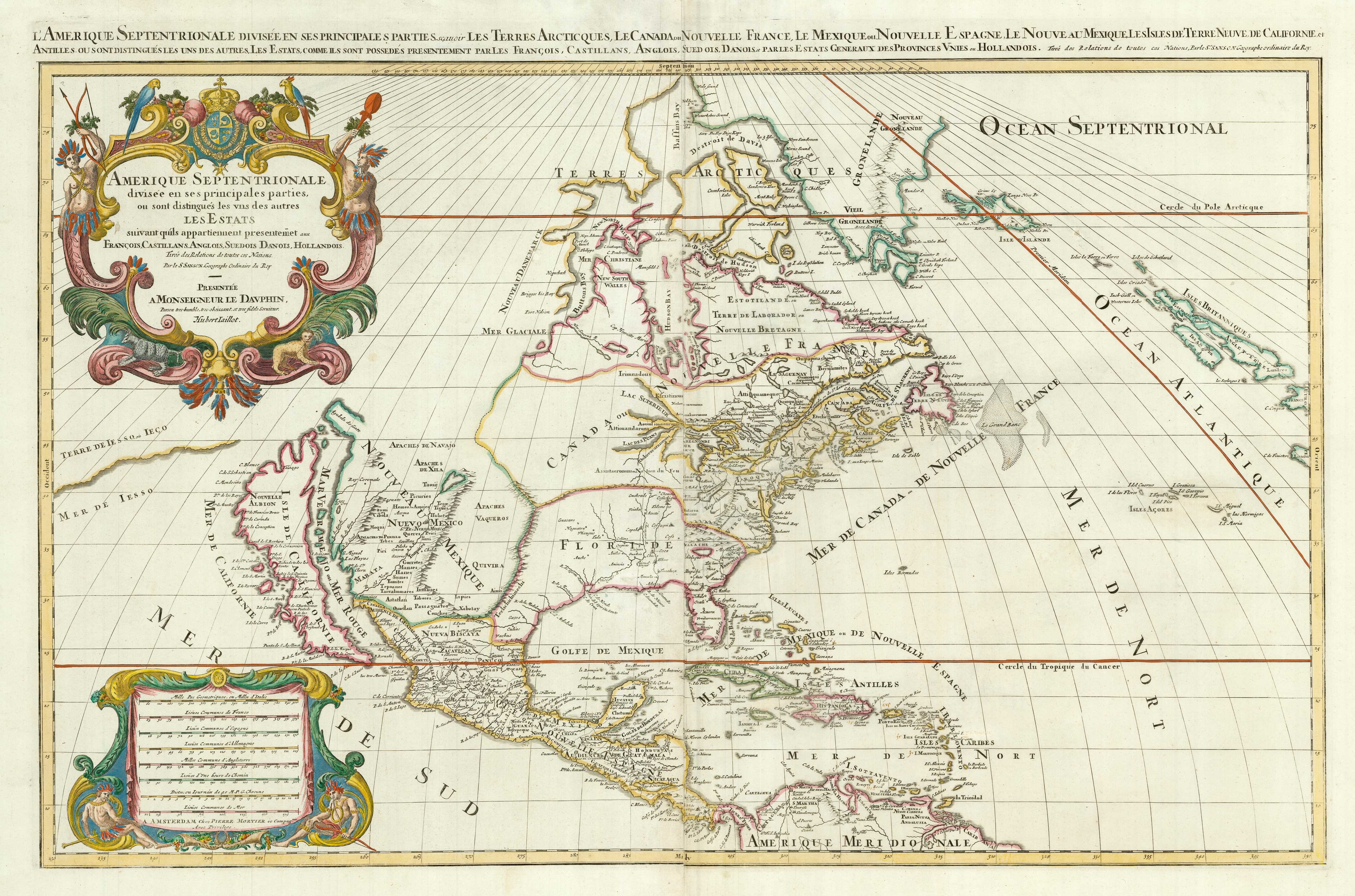
A map of North America during the Mississippi Bubble
CHATELAIN, Henri Abraham. Date: 1747 Stock #: 22751 £2,400.00
[ti_wishlists_addtowishlist]
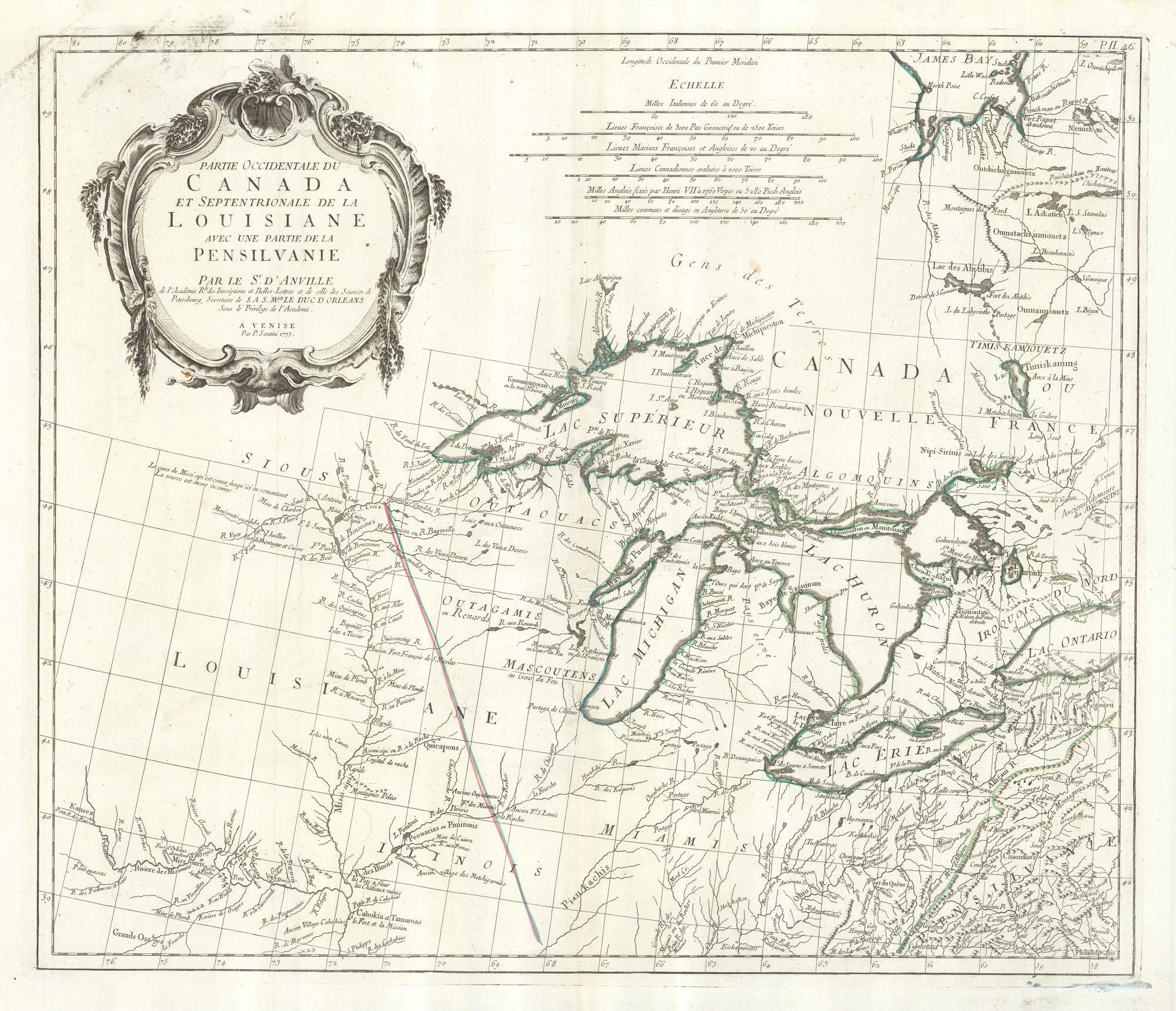
An 18th century map of the Great Lakes
SANTINI, Francesco & Paolo. Date: 1776 Stock #: 22627 £600.00
[ti_wishlists_addtowishlist]
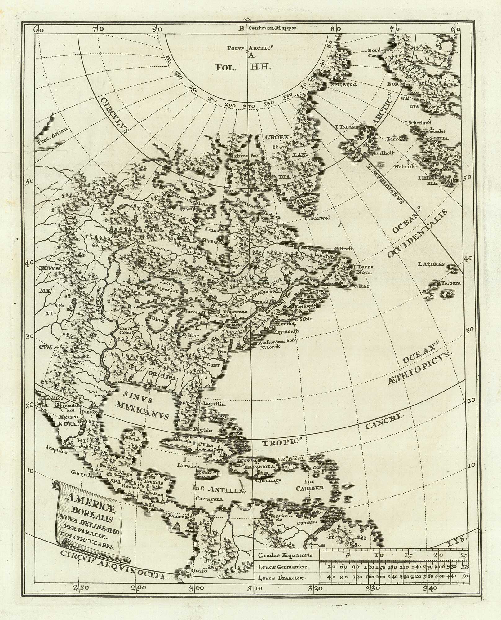
An early 18th century map of eastern North America
SCHERER, Heinrich. Date: 1700 Stock #: 21193 £360.00
[ti_wishlists_addtowishlist]