Antique Maps by DELISLE, Guillaume.
Showing 1–9 of 9 products
Sort by:
[ti_wishlists_addtowishlist]

Map of the Holy Land and Cyprus for a history of the Crusades
DELISLE, Guillaume. Date: 1780 Stock #: 20578 £750.00
[ti_wishlists_addtowishlist]
[ti_wishlists_addtowishlist]
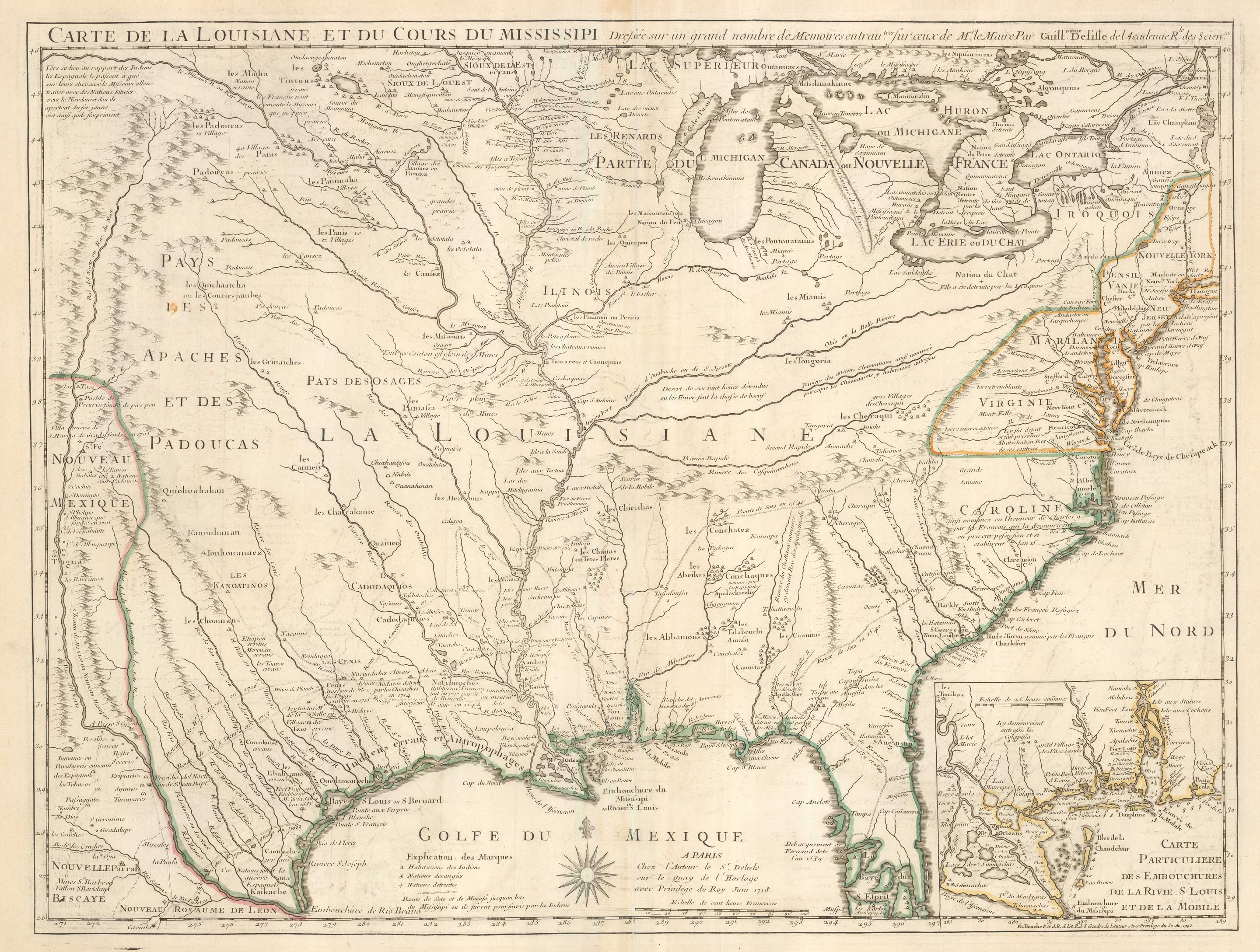
The first printed map to accurately map the Mississippi River
DELISLE, Guillaume. Date: 1745 Stock #: 25238 £850.00
[ti_wishlists_addtowishlist]
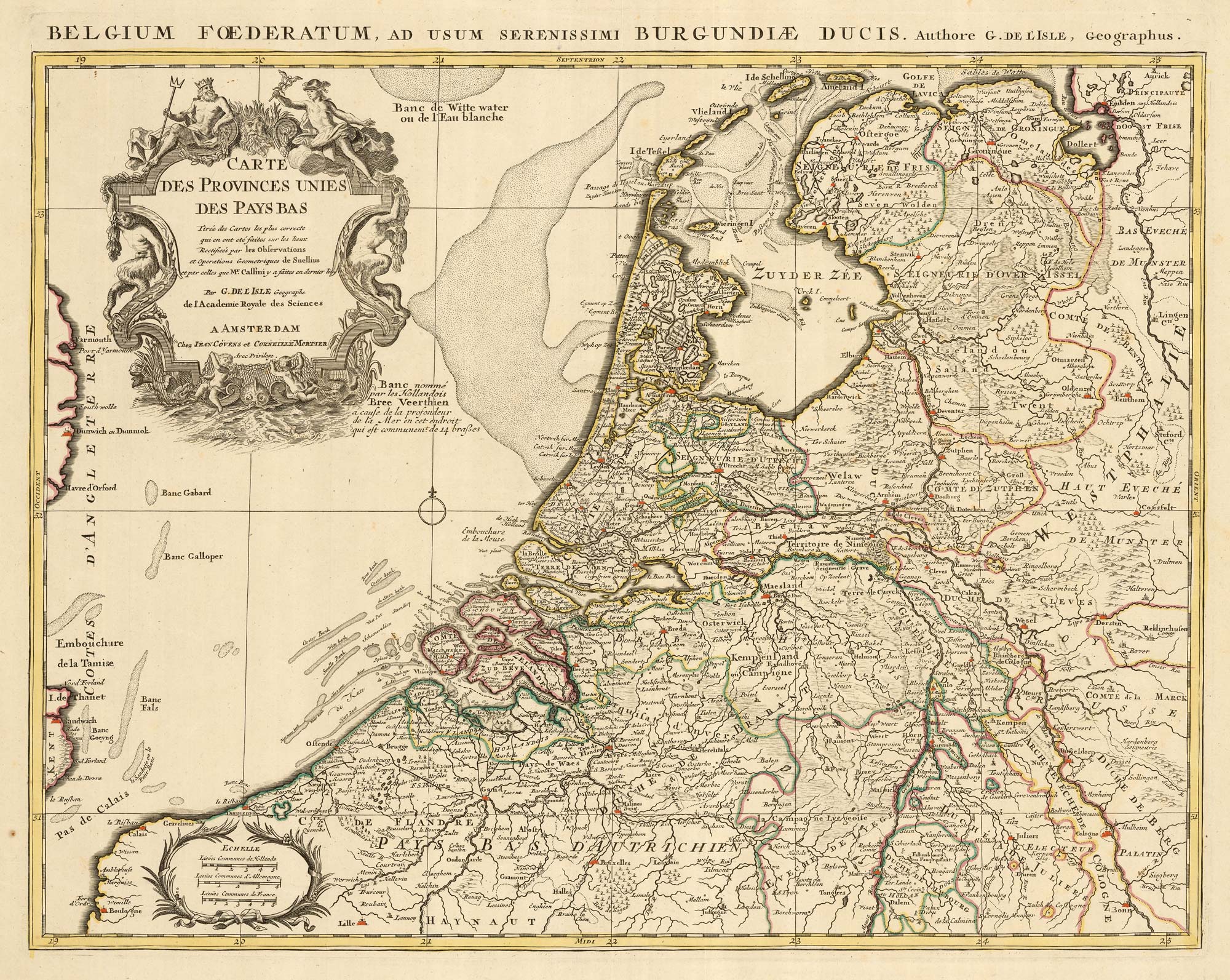
A detailed 18th century map of the Netherlands
DELISLE, Guillaume. Date: 1730 Stock #: 24456 £300.00
[ti_wishlists_addtowishlist]
[ti_wishlists_addtowishlist]
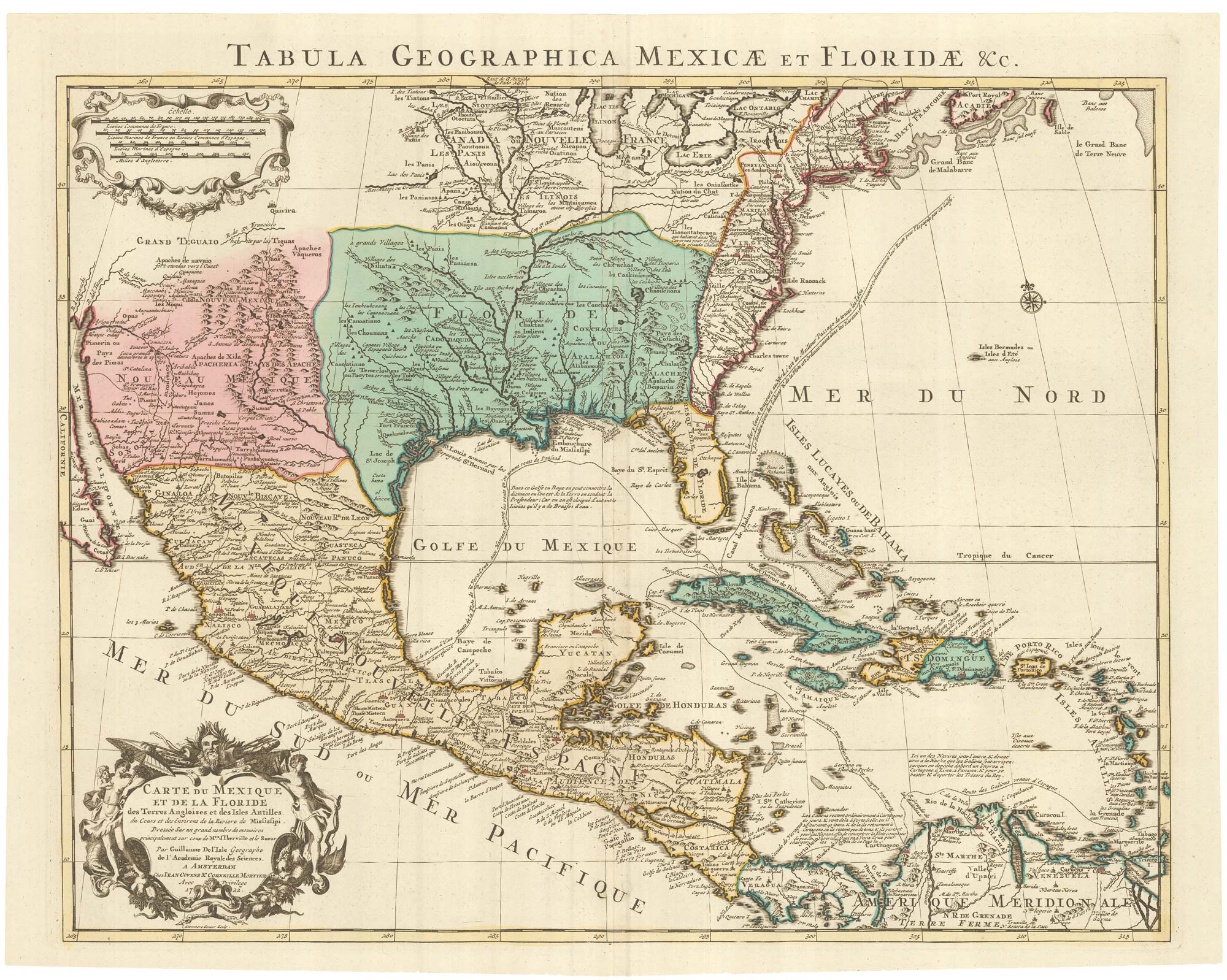
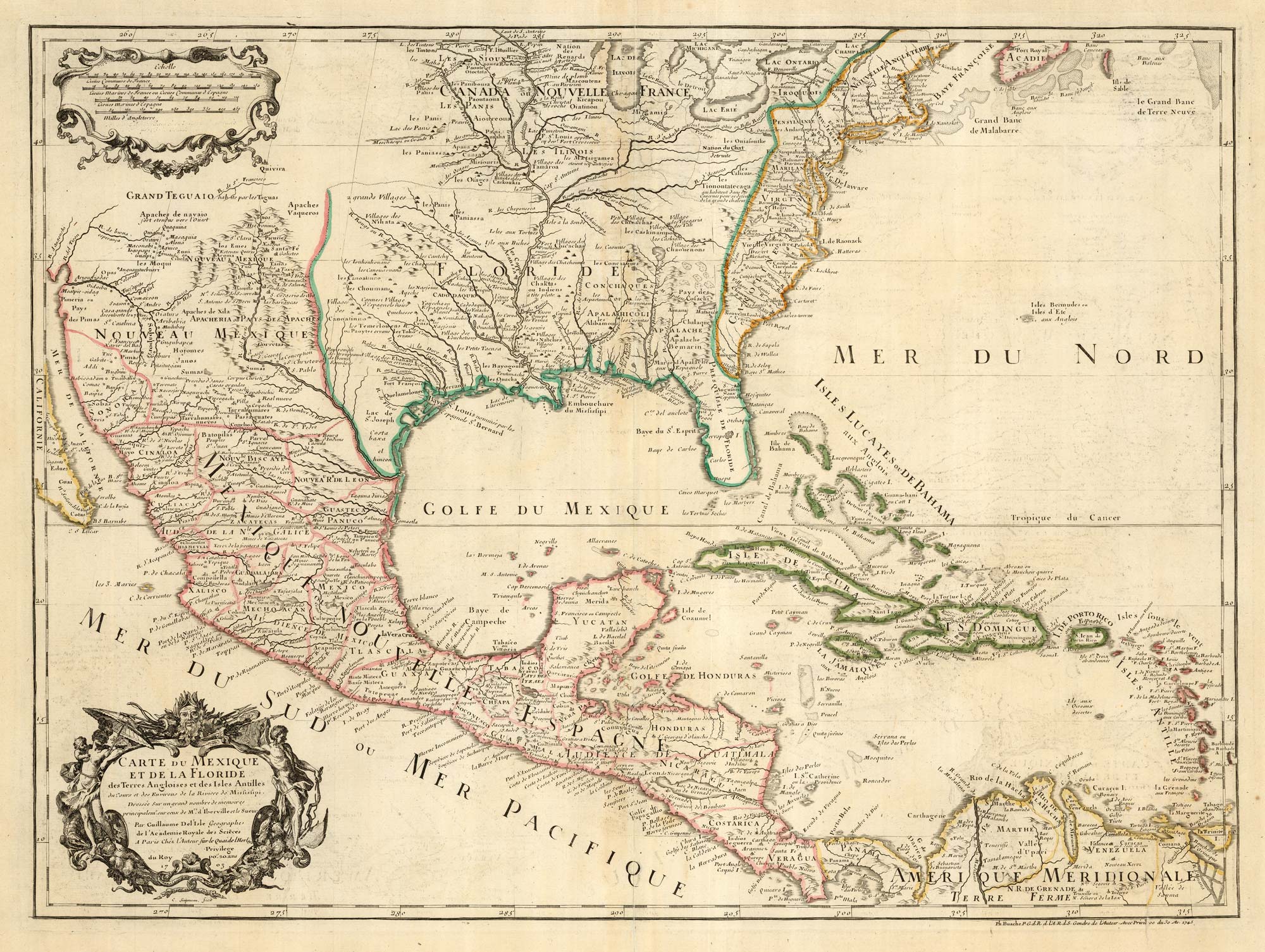
A Dutch edition of the first printed map to accurately plot the Mississippi River
DELISLE, Guillaume. Date: 1722 Stock #: 23463 £1,700.00
[ti_wishlists_addtowishlist]

[ti_wishlists_addtowishlist]
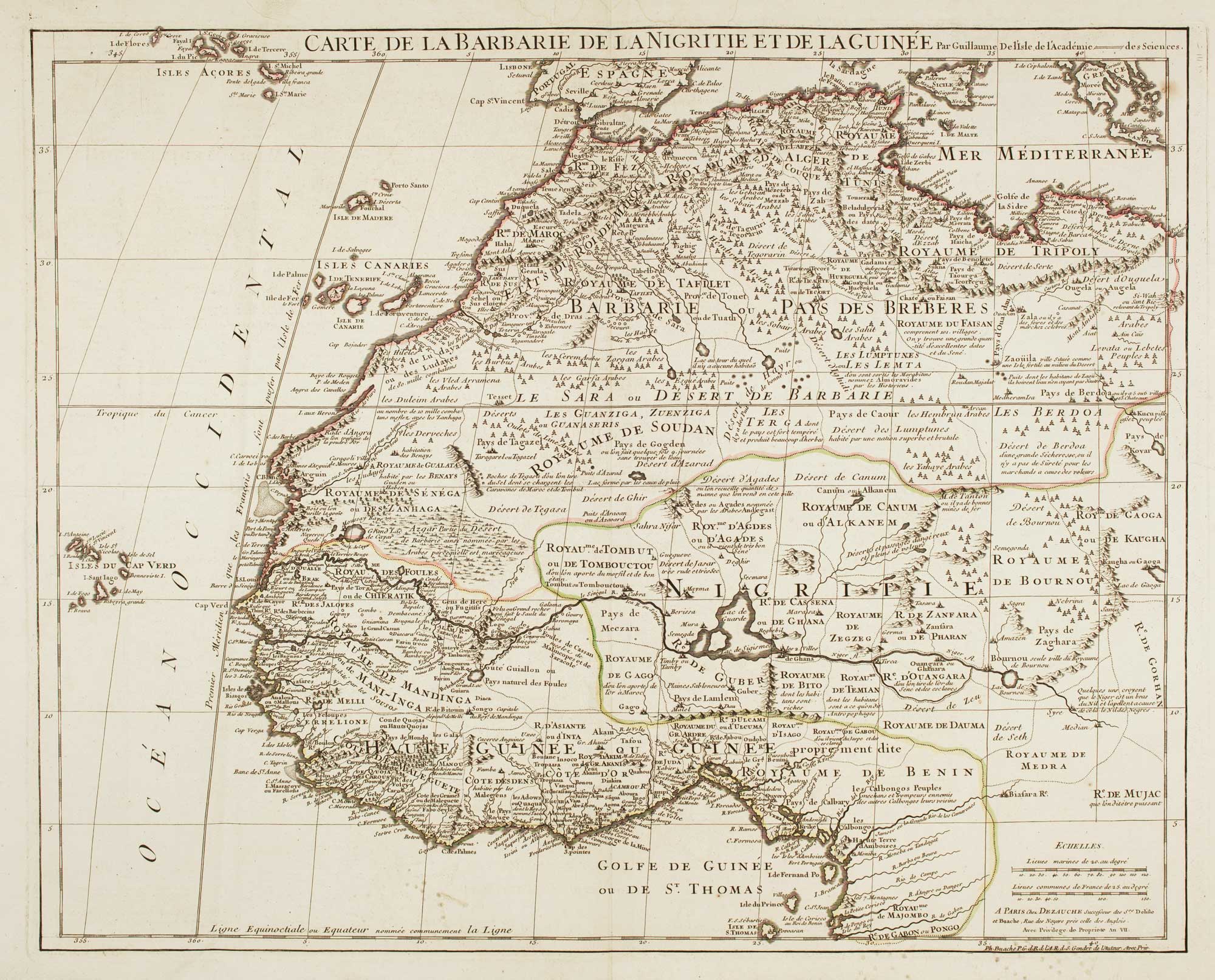
Large map of West Africa published at the end of the 18th century
DELISLE, Guillaume. Date: 1798 Stock #: 14029 £300.00
[ti_wishlists_addtowishlist]
