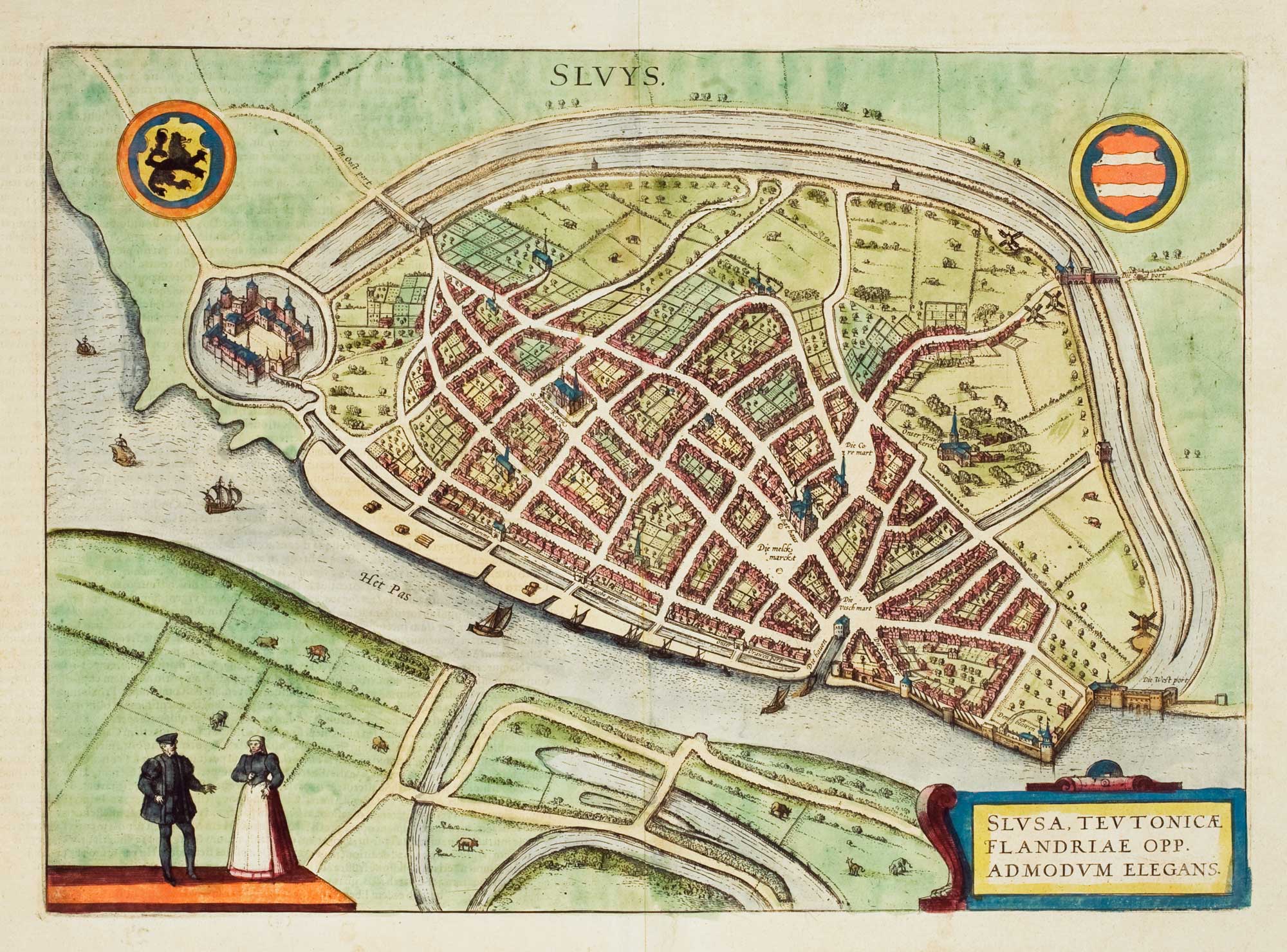
Antique Maps of Belgium
Showing 1–17 of 17 products
Sort by:
[ti_wishlists_addtowishlist]
[ti_wishlists_addtowishlist]
[ti_wishlists_addtowishlist]
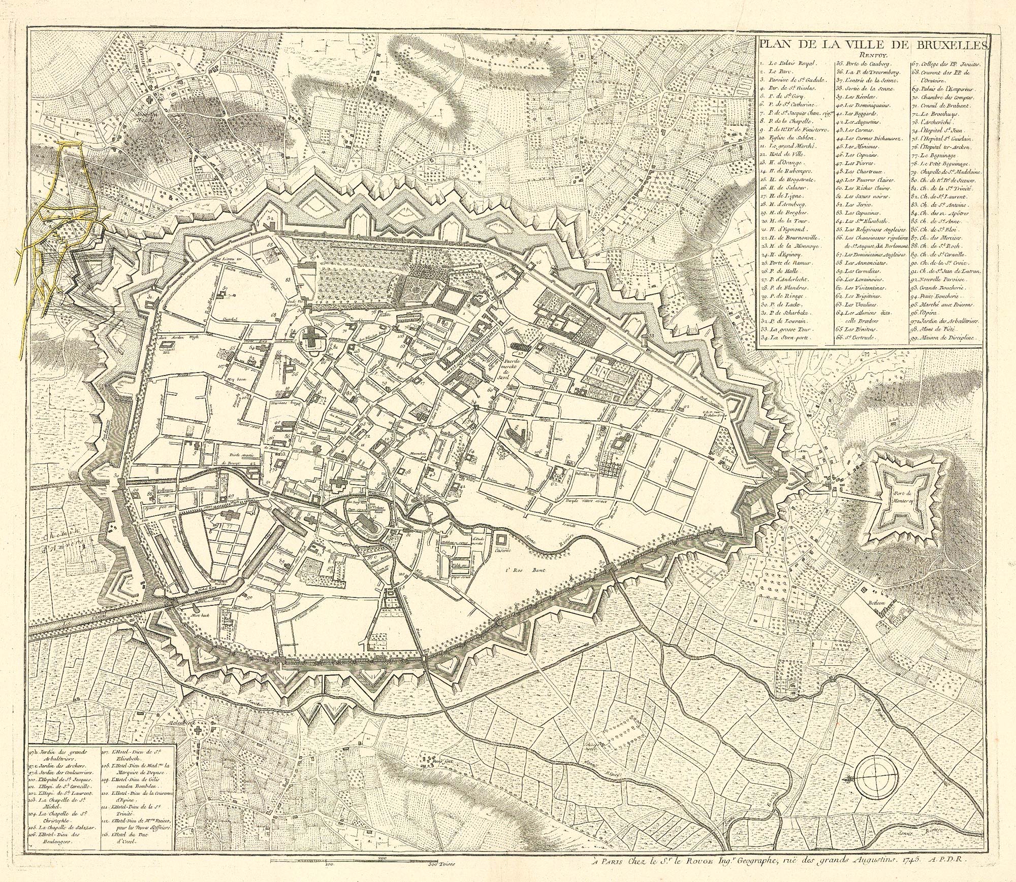
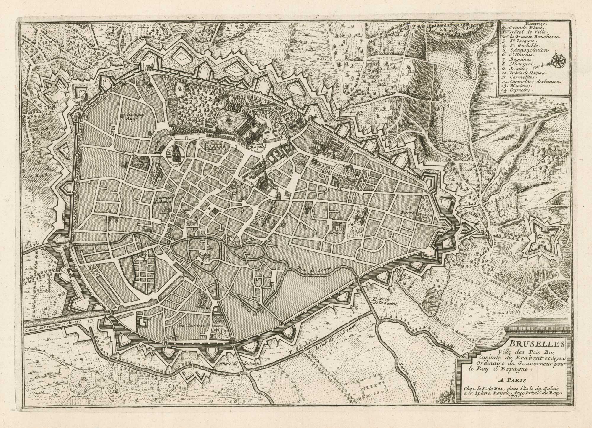
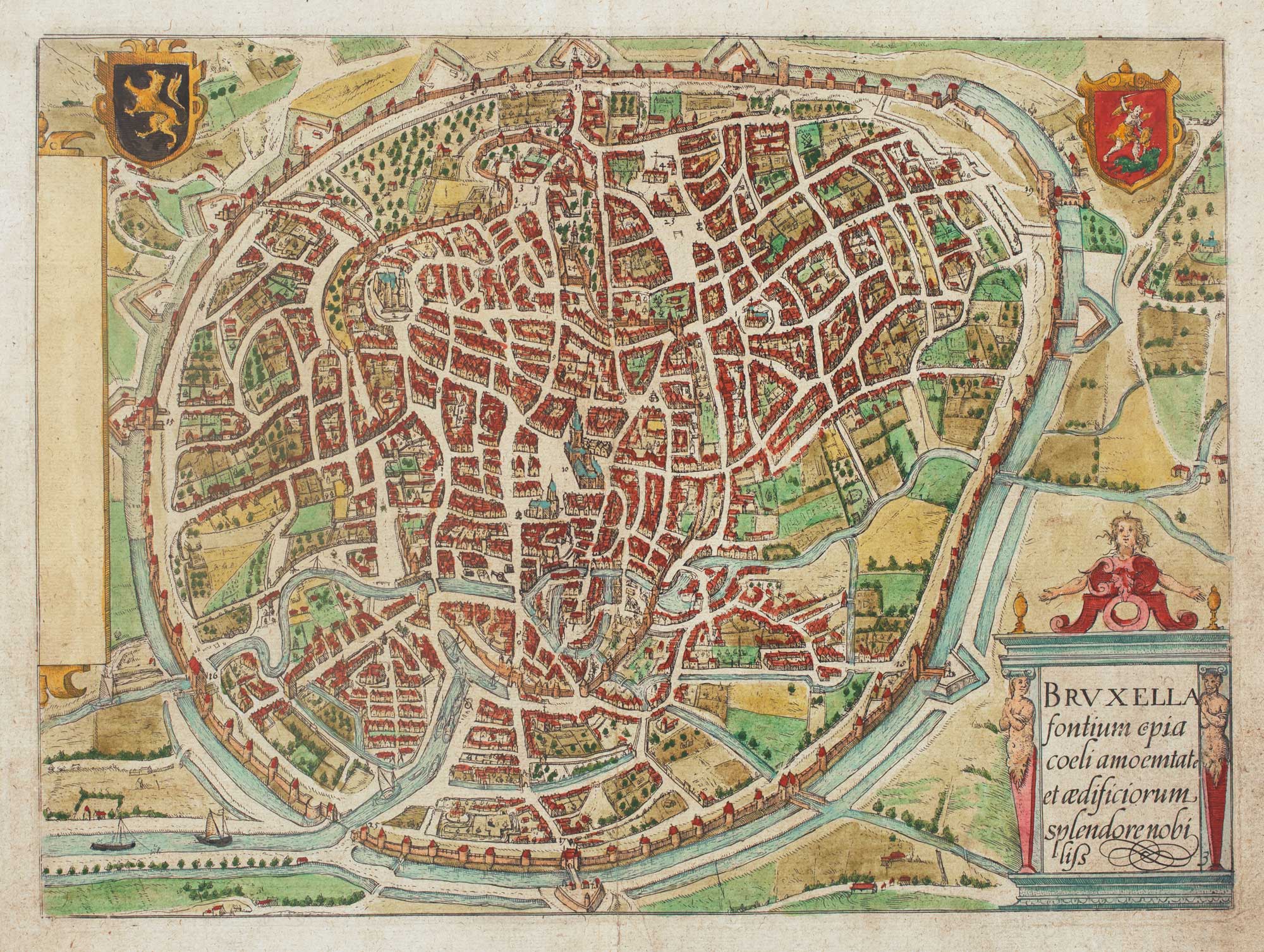
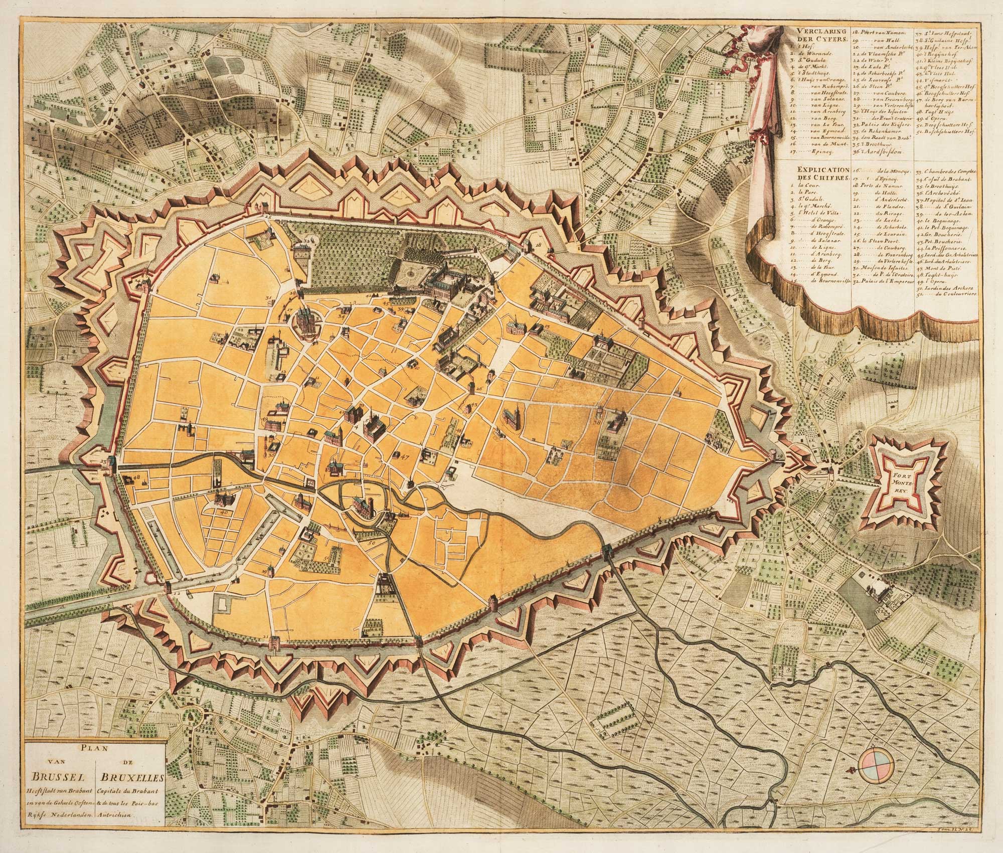
A town plan of Brussels just prior its capture by the French
LE ROUGE, Georges-Louis. Date: 1745 Stock #: 24832 £450.00
[ti_wishlists_addtowishlist]
[ti_wishlists_addtowishlist]
[ti_wishlists_addtowishlist]
[ti_wishlists_addtowishlist]
[ti_wishlists_addtowishlist]
[ti_wishlists_addtowishlist]
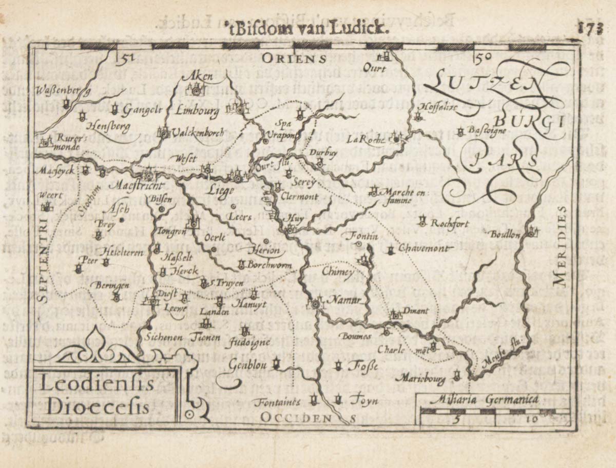
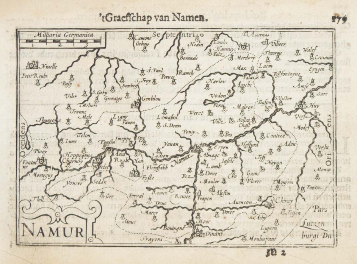
A 16th century miniature map of the Diocese of Liège
LANGENES, Barent. Date: 1599 Stock #: 21152 £55.00
[ti_wishlists_addtowishlist]
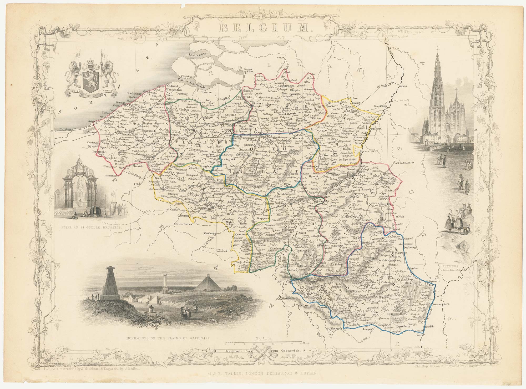
Mid 19th century map of Belgium with decorative vignettes
TALLIS, John. Date: 1851 Stock #: 21637 £120.00
[ti_wishlists_addtowishlist]
[ti_wishlists_addtowishlist]
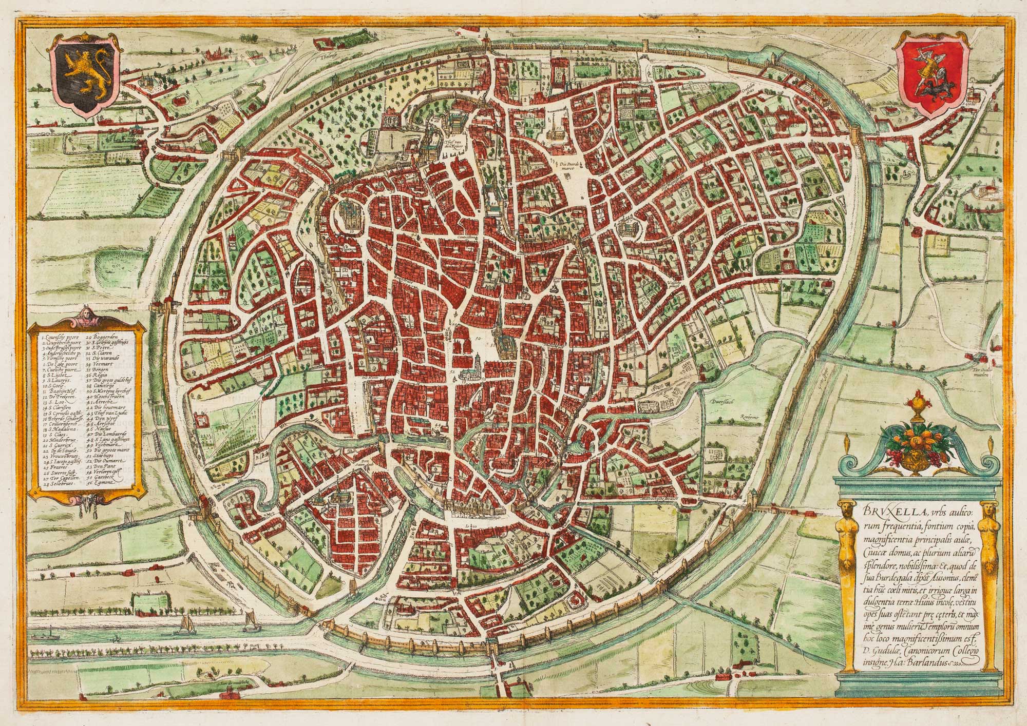
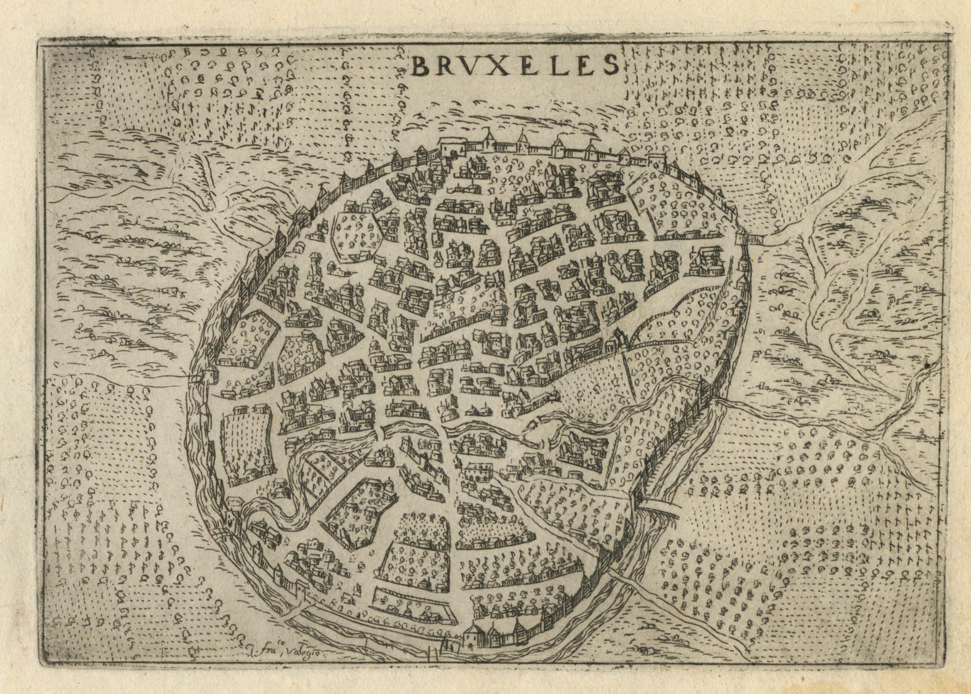
16th century town plan of Brussels
BRAUN, Georg & HOGENBERG, Frans. Date: 1572 Stock #: 14660 £900.00
[ti_wishlists_addtowishlist]
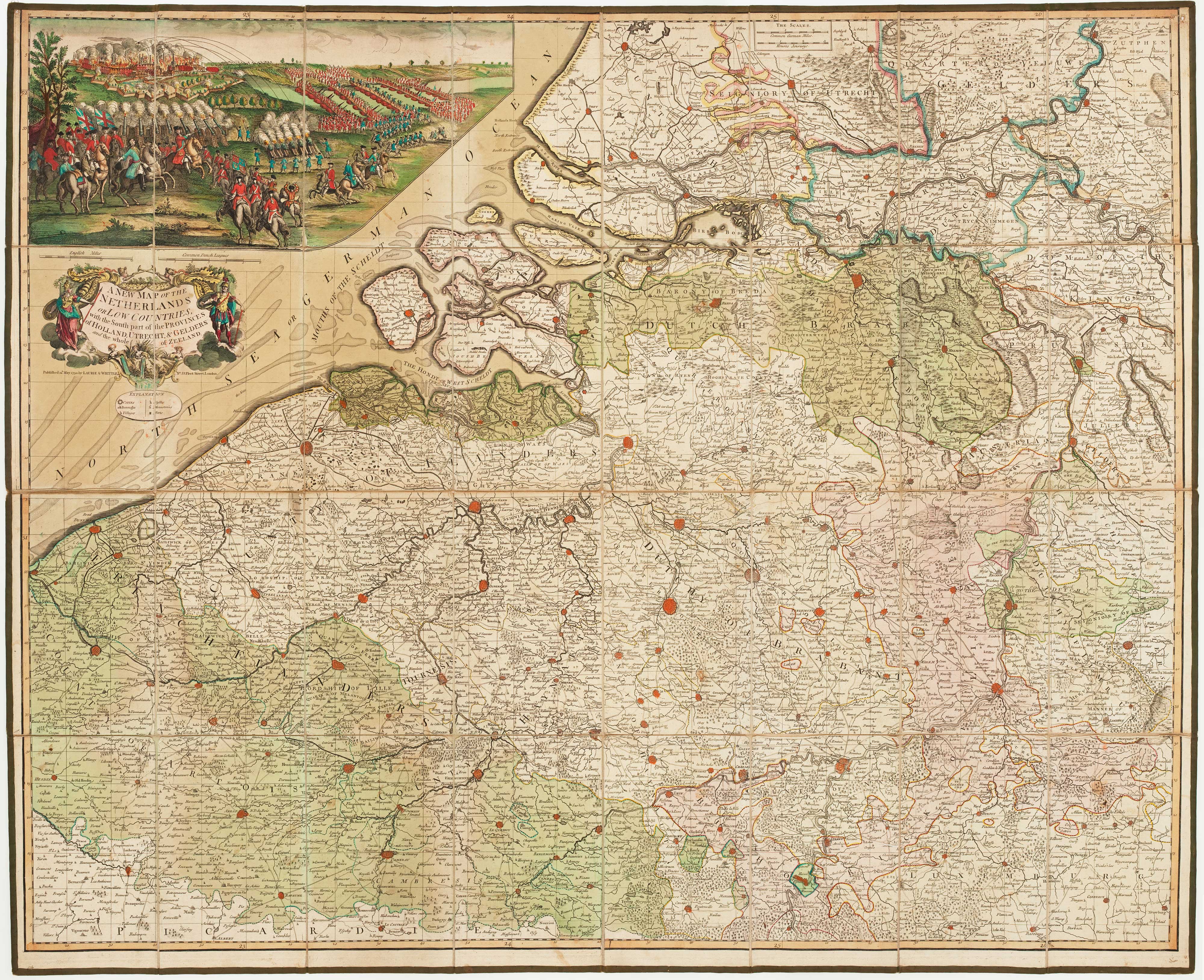
The British Flanders Campaign of the French Revolutionary War
KITCHIN, Thomas. Date: 1794 Stock #: 15434 £1,250.00
[ti_wishlists_addtowishlist]
[ti_wishlists_addtowishlist]
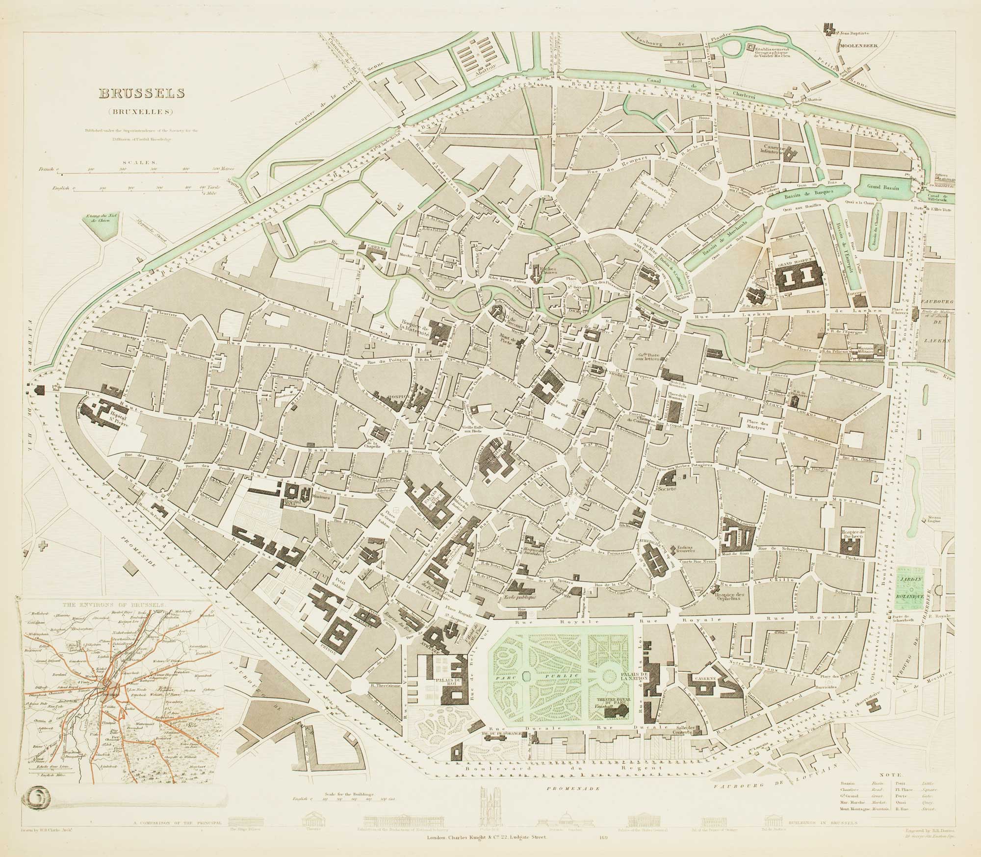
19th century plan of Brussels
Society for the Diffusion of Useful Knowledge. Date: 1837 Stock #: 13838 £60.00
[ti_wishlists_addtowishlist]
[ti_wishlists_addtowishlist]