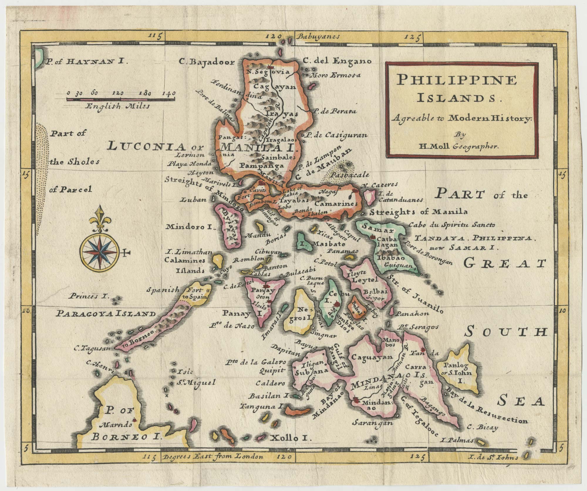


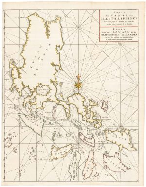
An early 18th century map of the Philippines
Philippine Islands. Agreable to Modern History.
London, c.1727. Coloured. 200 x 255mm.
£1,250.00
1 in stock
x
Question About This Item?
An early 18th century map of the Philippines & MOLL, Herman.Stock #: 24754Similar to Sell?
Description
One of the first English maps to focus on the Philippines, published in Moll's 'Atlas minor or a new and curious set of sixty-two maps, in which are shewn all the empires, kingdoms, countries, states, in all the known parts of the earth'.
Condition:
Binding folds flattened.Related products
-
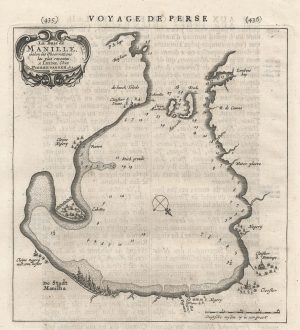
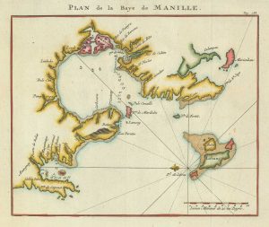
An early chart of Manila Bay
AA, Pieter van der. Date: 1729Stock #: 22822 £350.00 -
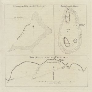
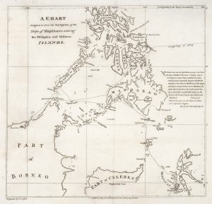
Three charts showing ‘a dangerous shoal’ off the Philippines
CARTERET, Philip. Date: 1773Stock #: 20892 £160.00 -
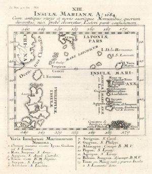
A scarce map of the Philippines
STOCKLEIN, Joseph. Date: 1740Stock #: 18773 £625.00 -
Admiral Anson’s plan of the Bay of Manila
ANSON, George. Date: 1750Stock #: 21190 £260.00 -
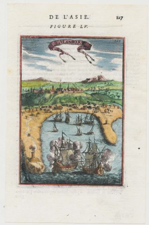
A 17th century miniature prospect of Manila
MALLET, Alain Manesson. Date: 1683Stock #: 22333 £380.00 -
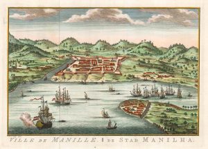
Dutch edition of Bellin’s view of Manila
BELLIN, Jacques-Nicolas. Date: 1756Stock #: 20177 £450.00 -
An unusual variant of Anson’s chart of the Philippines
ANSON, George. Date: 1750Stock #: 22306 £750.00 -
Magellan’s route through the Philippines
BURNEY, James. Date: 1803Stock #: 20895 £1,750.00 -
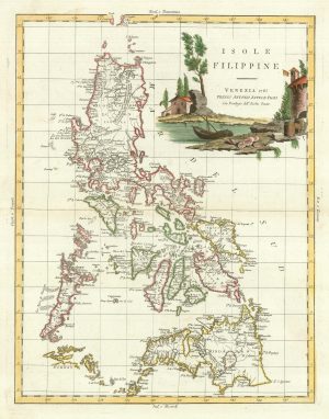
18th century Italian map of the Philippines
ZATTA, Antonio. Date: 1785Stock #: 21225 £1,650.00
Items by the same author
[ti_wishlists_addtowishlist]
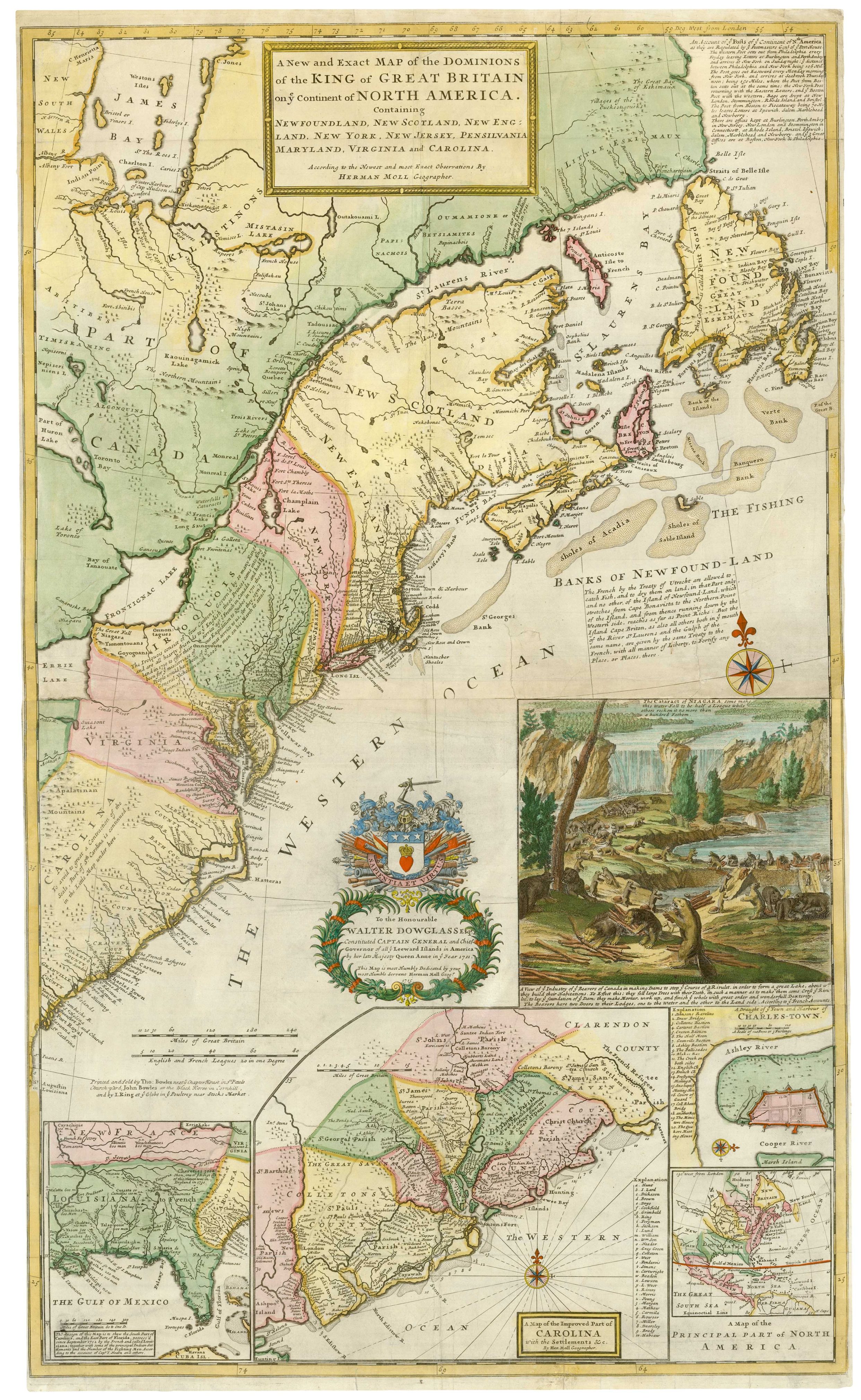
The famous 'Beaver Map' of the British Colonies in America
MOLL, Herman. Date: 1731 Stock #: 25405 £8,500.00
[ti_wishlists_addtowishlist]
[ti_wishlists_addtowishlist]

[ti_wishlists_addtowishlist]
