Antique Maps of Indonesia
Showing 1–30 of 30 products
Sort by:
Add to Wishlist
Add to Wishlist
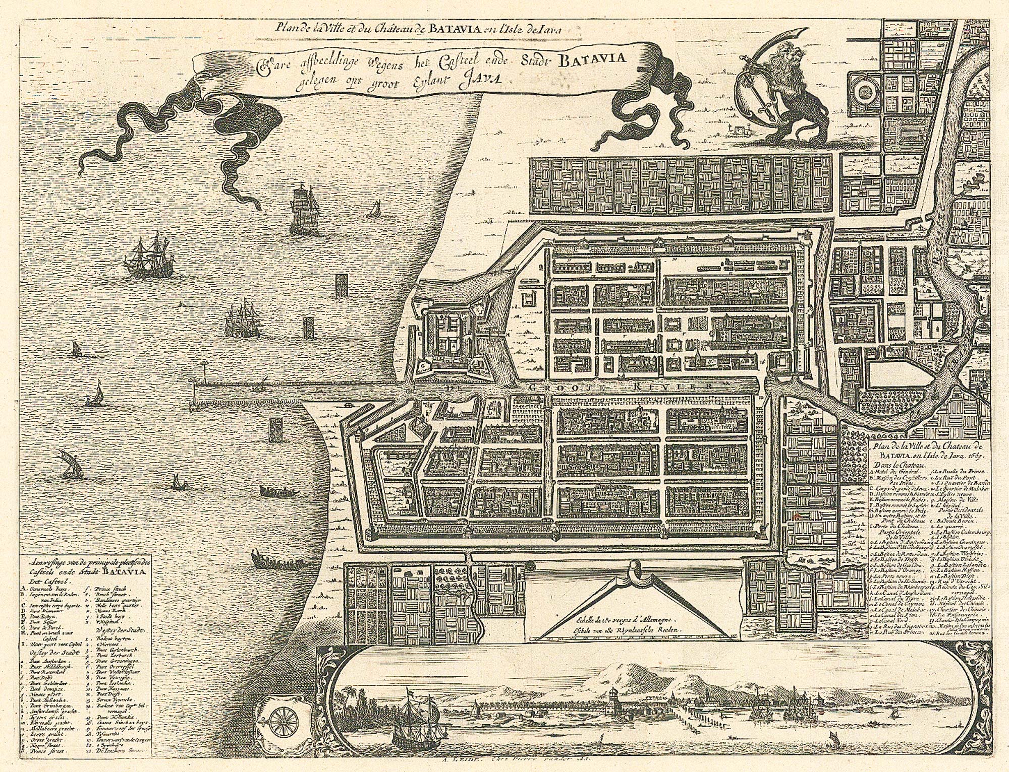
17th century plan of Batavia
MONTANUS, Arnoldus. Date: 1728 Stock #: 24796 £400.00
Add to Wishlist
Add to Wishlist
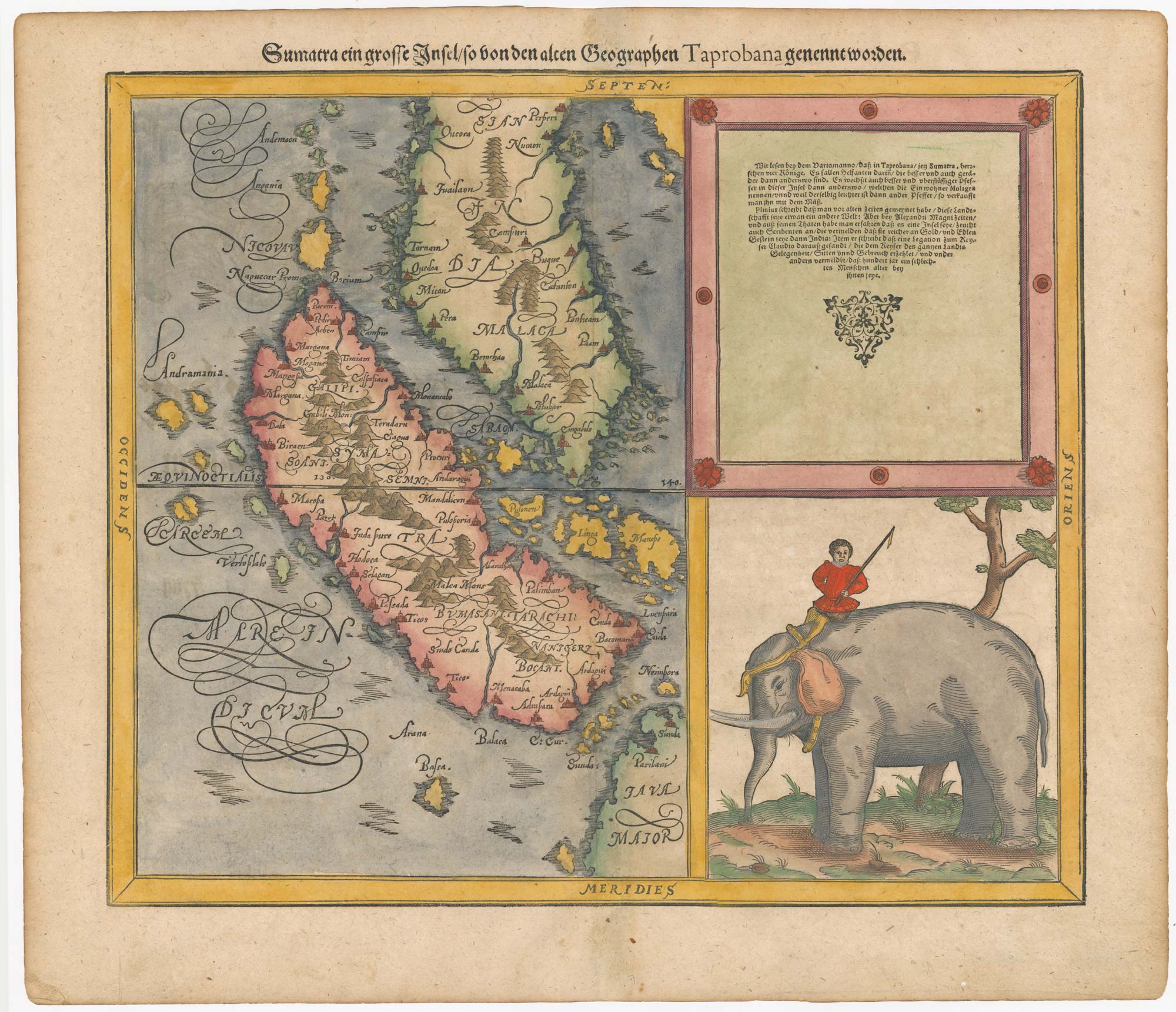
Woodblock map of Sumatra and the Malay Peninsula
MUNSTER, Sebastian. Date: 1588 Stock #: 24584 £495.00
Add to Wishlist
Add to Wishlist
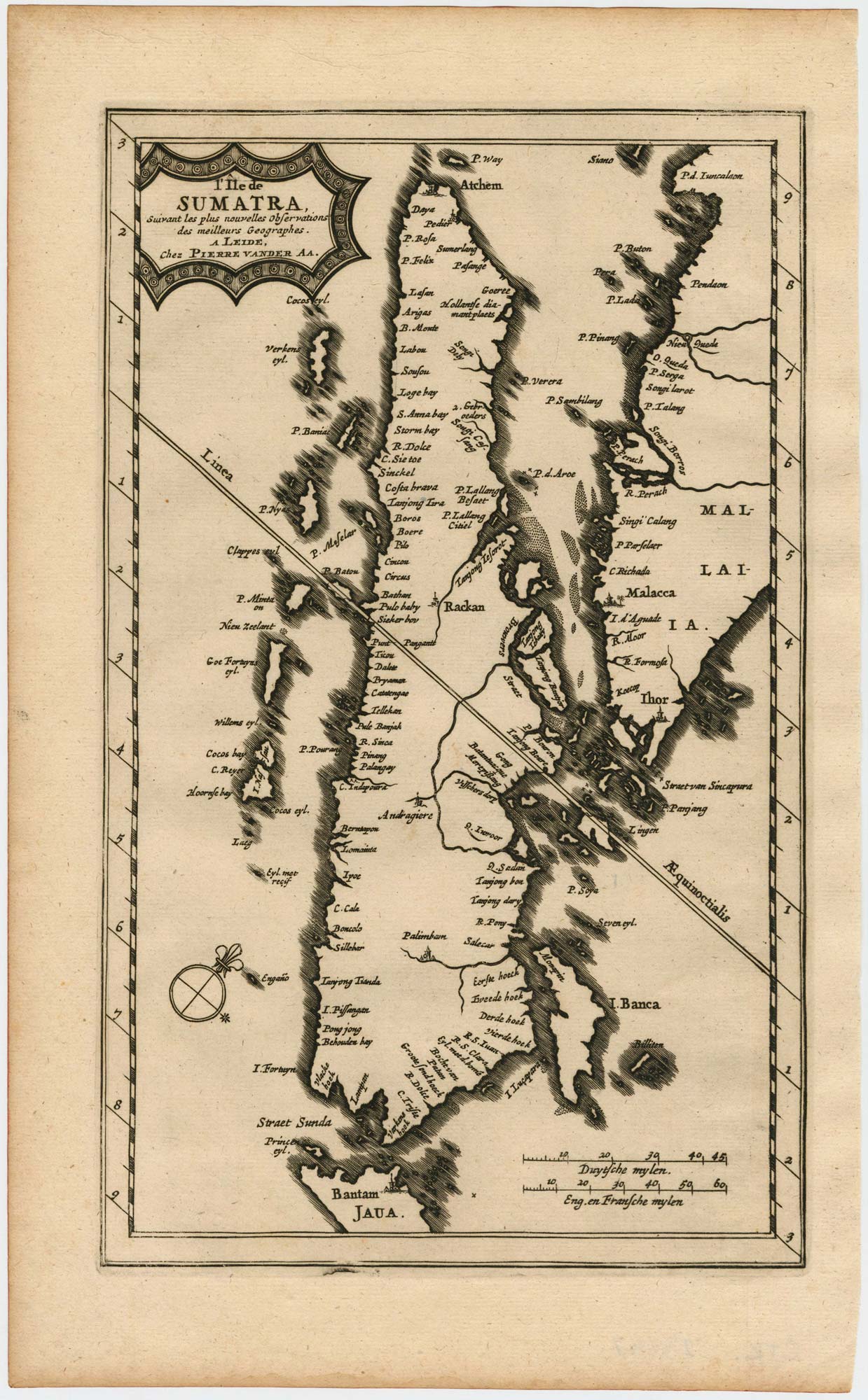
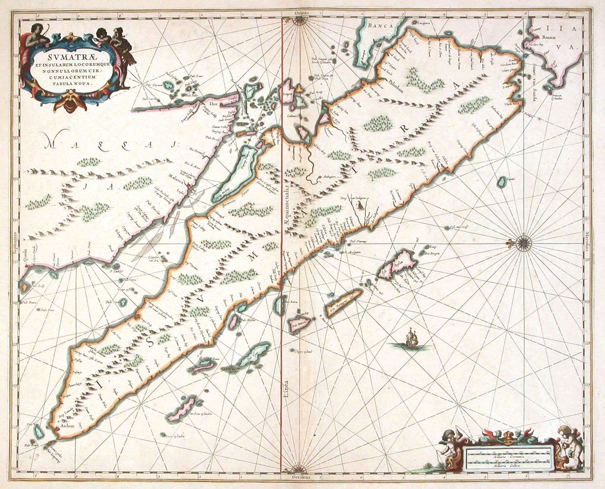
Map of Sumatra and the Malay Peninsula
AA, Pieter van der. Date: 1714 Stock #: 23647 £425.00
Add to Wishlist
Add to Wishlist

The Strait of Malacca & Singapore
AA, Pieter van der. Date: 1714 Stock #: 23646 £475.00
Add to Wishlist
Add to Wishlist
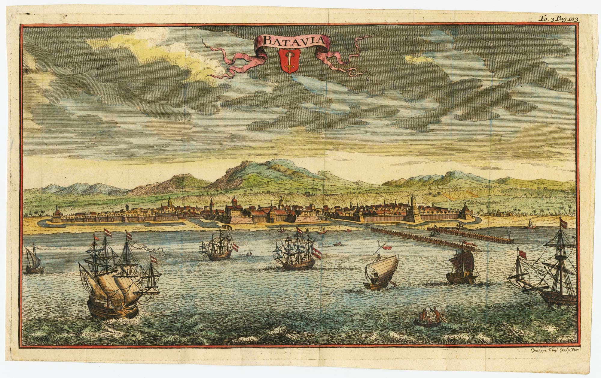
18th century view of the Dutch city of Batavia
SALMON, Thomas. Date: 1753 Stock #: 23642 £160.00
Add to Wishlist
Add to Wishlist
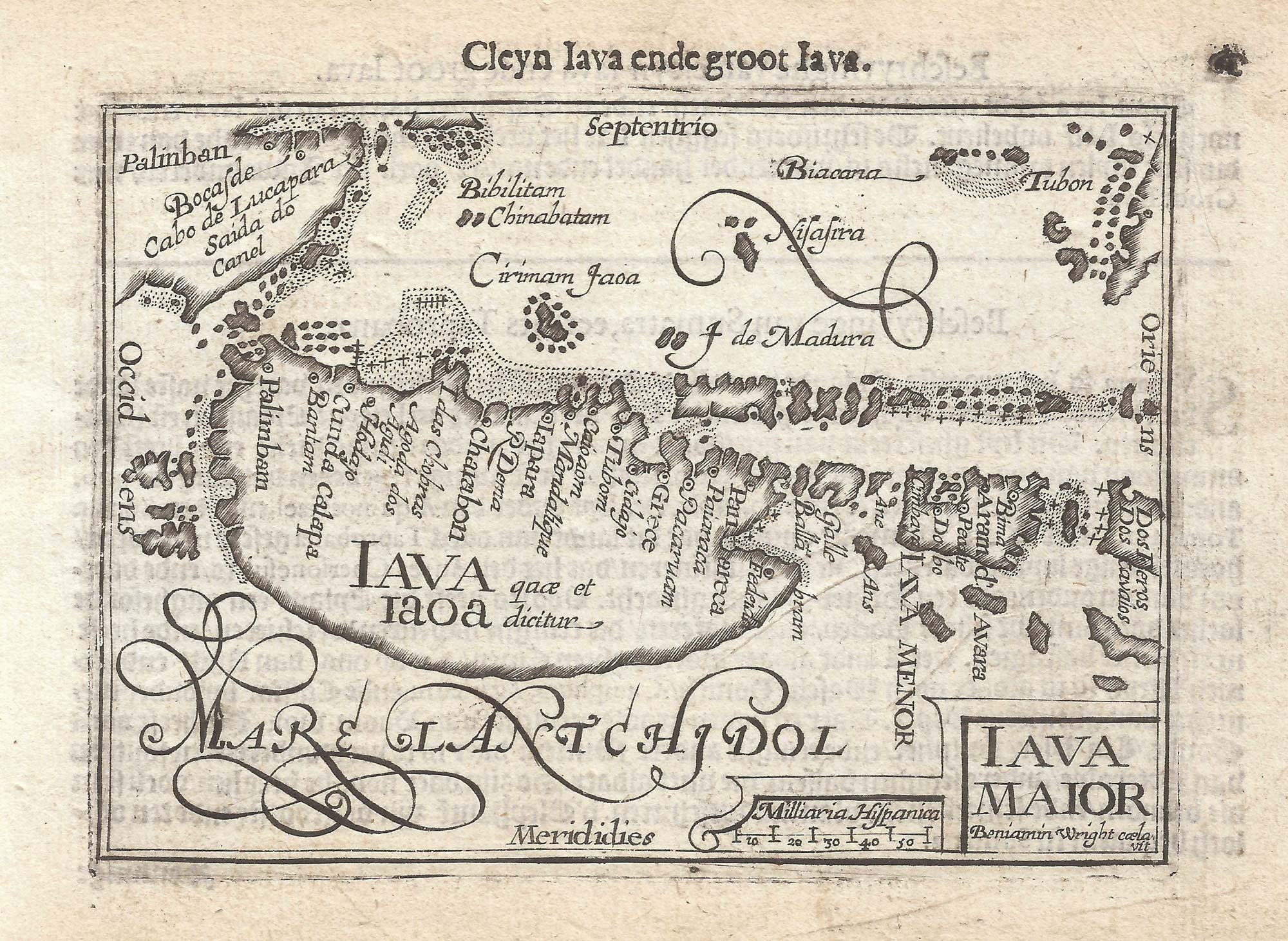
The first issue of this 16th century miniature map of Java
WRIGHT, Benjamin. Date: 1599 Stock #: 21280 £260.00
Add to Wishlist
Add to Wishlist
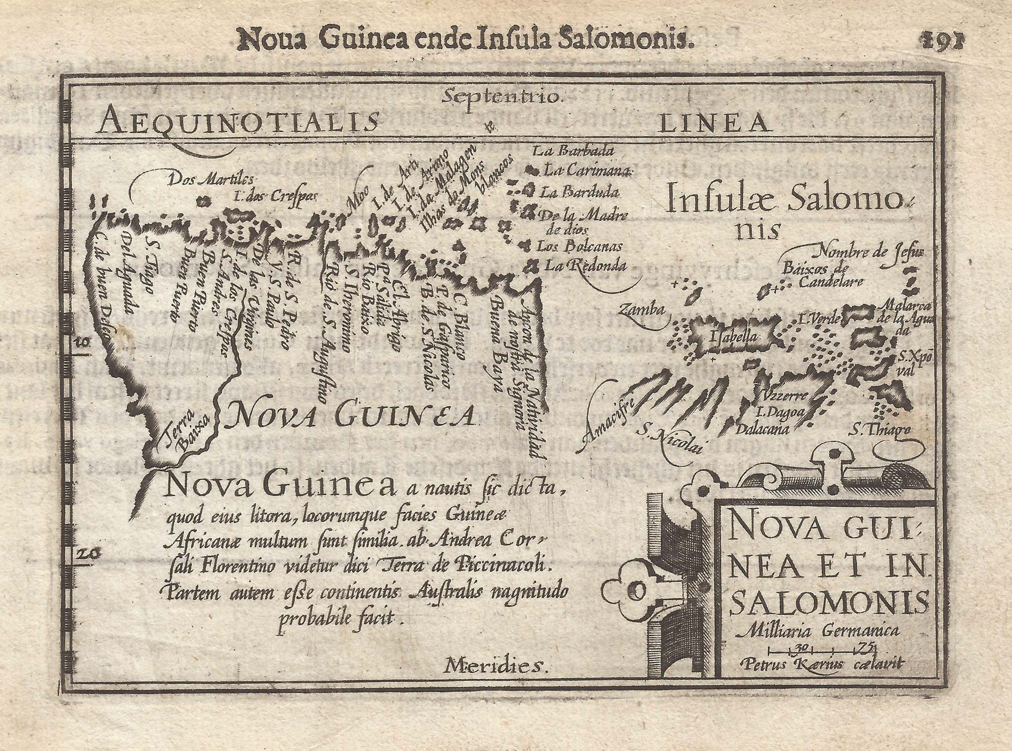
A 16th century miniature map of New Guinea
LANGENES, Barent. Date: 1599 Stock #: 21278 £400.00
Add to Wishlist
Add to Wishlist
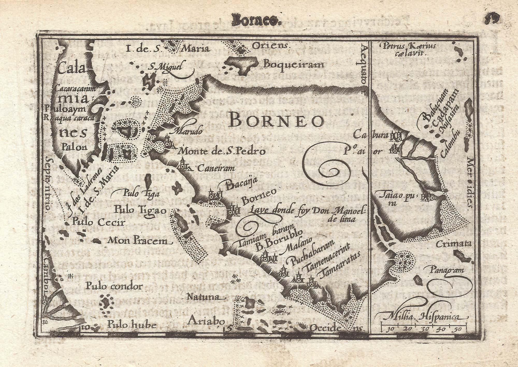
The first printed map of Borneo
LANGENES, Barent. Date: 1599 Stock #: 21269 £320.00
Add to Wishlist
Add to Wishlist
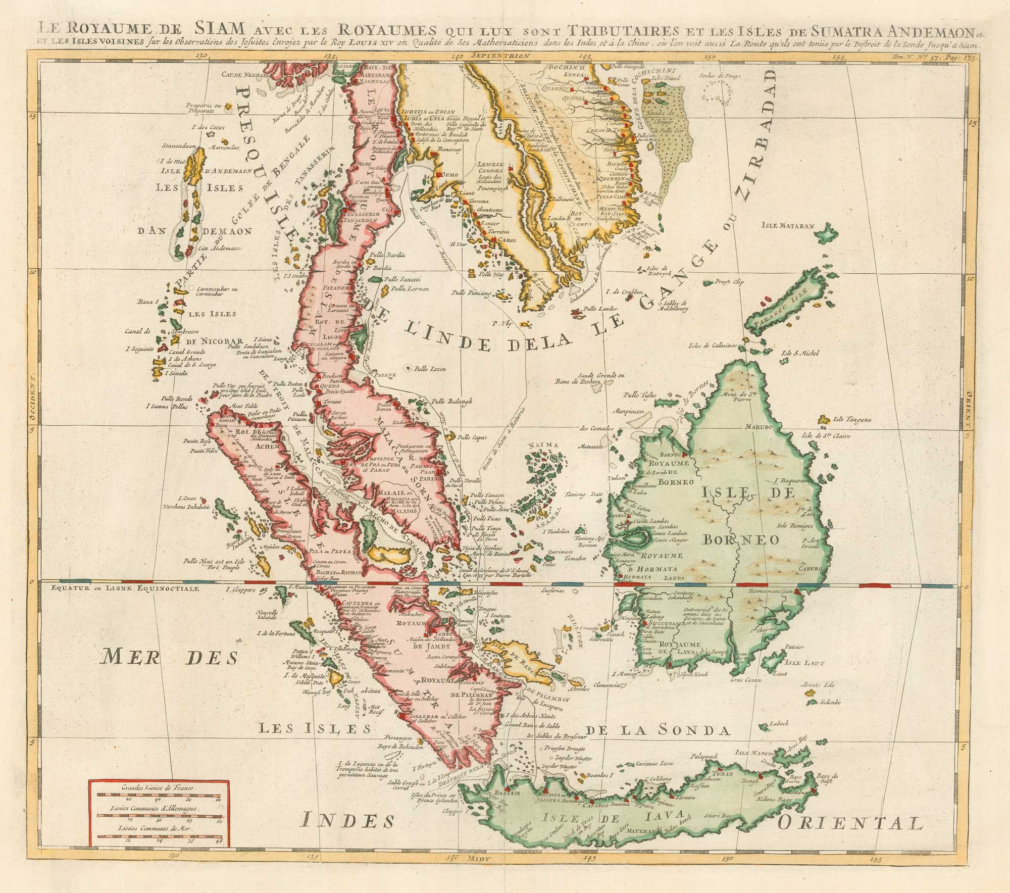
18th century map of the Malay Peninsula and Indonesia
CHATELAIN, Henri Abraham. Date: 1719 Stock #: 19983 £600.00
Add to Wishlist
Add to Wishlist
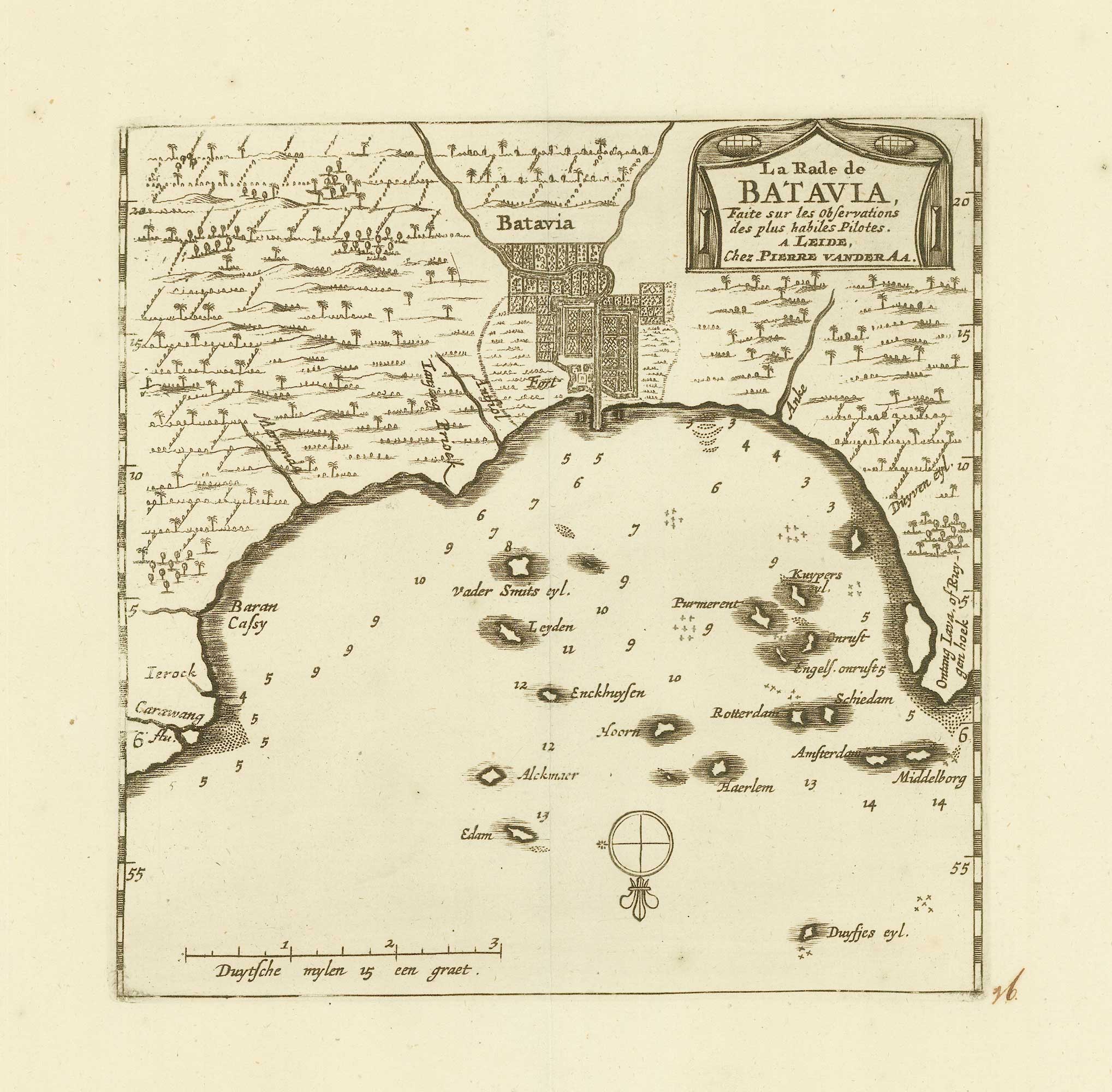
Early 18th century map of Batavia
AA, Pieter van der. Date: 1725 Stock #: 20079 £200.00
Add to Wishlist
Add to Wishlist
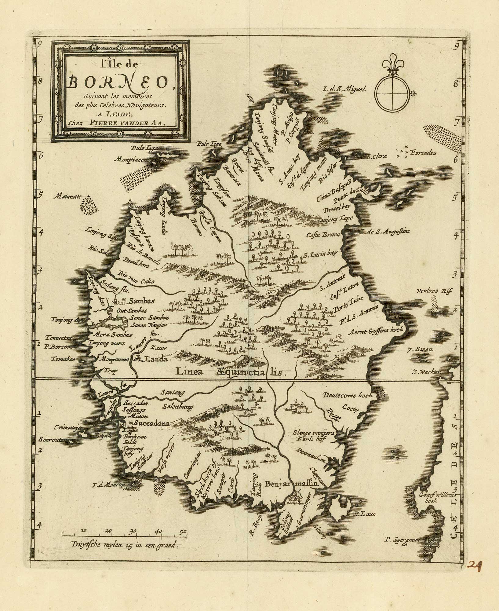
18th century map of Borneo
AA, Pieter van der. Date: 1725 Stock #: 20069 £325.00
Add to Wishlist
Add to Wishlist
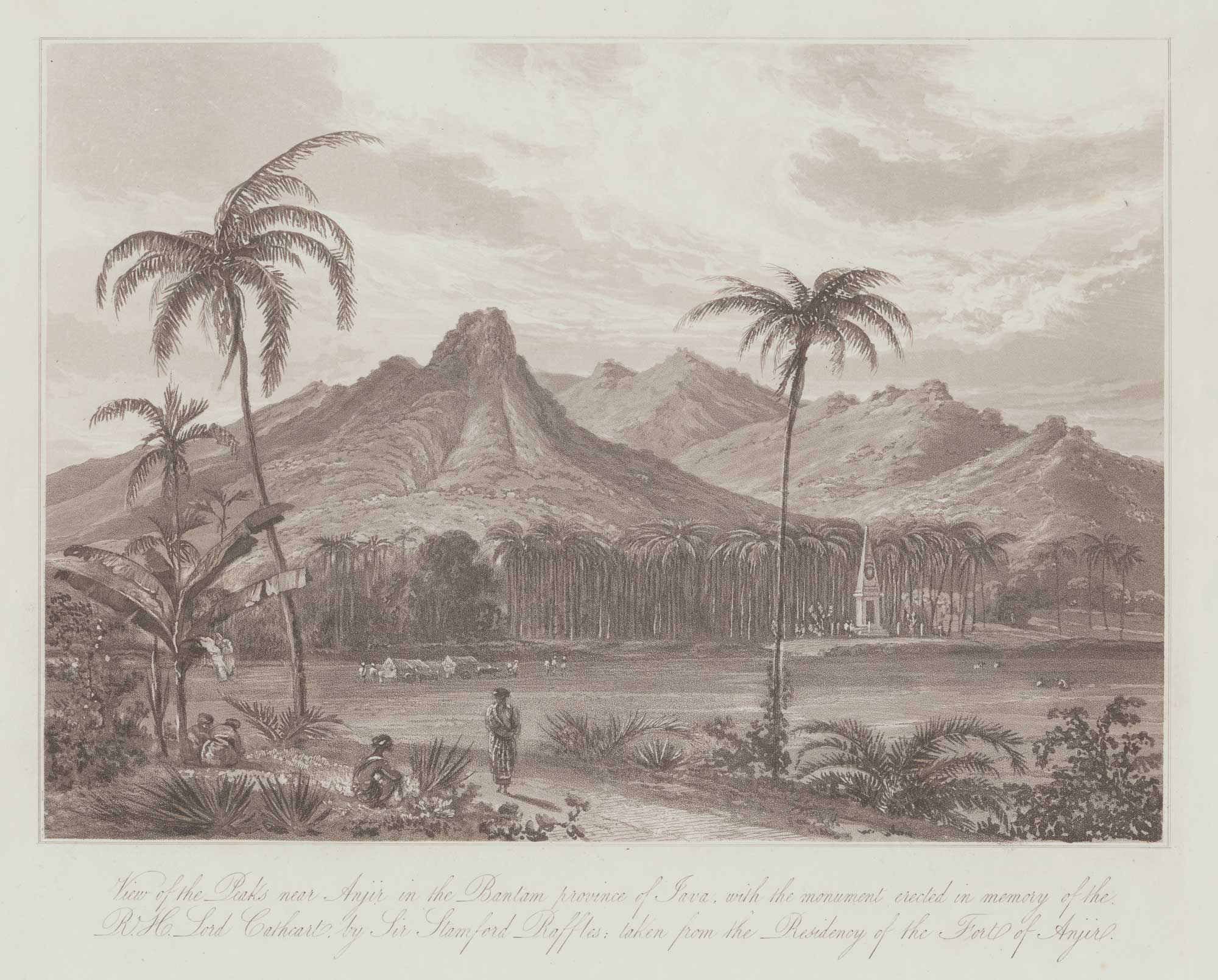
A view of Anjer-Lor, western Java
DANIELL, William. Date: 1830 Stock #: 20078 £150.00
Add to Wishlist
Add to Wishlist
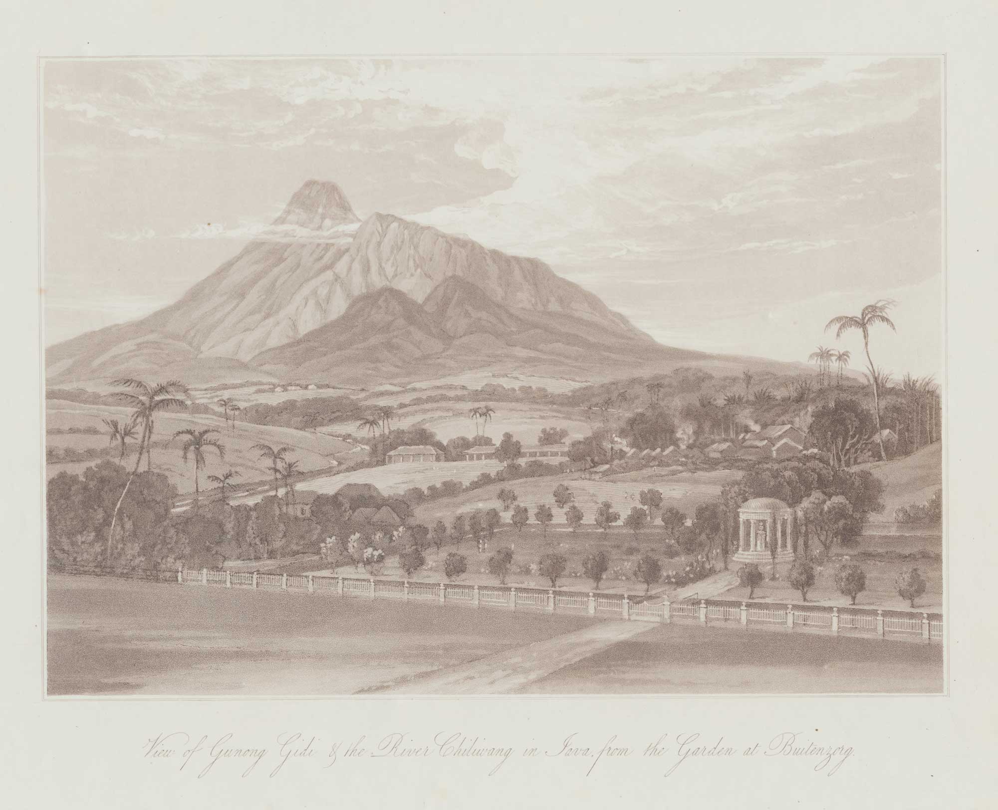
A view from Buitenzorg in Bogor, Java
DANIELL, William. Date: 1830 Stock #: 20076 £150.00
Add to Wishlist
Add to Wishlist

A view of Buitenzorg in Bogor, Java
DANIELL, William. Date: 1830 Stock #: 20077 £150.00
Add to Wishlist
Add to Wishlist
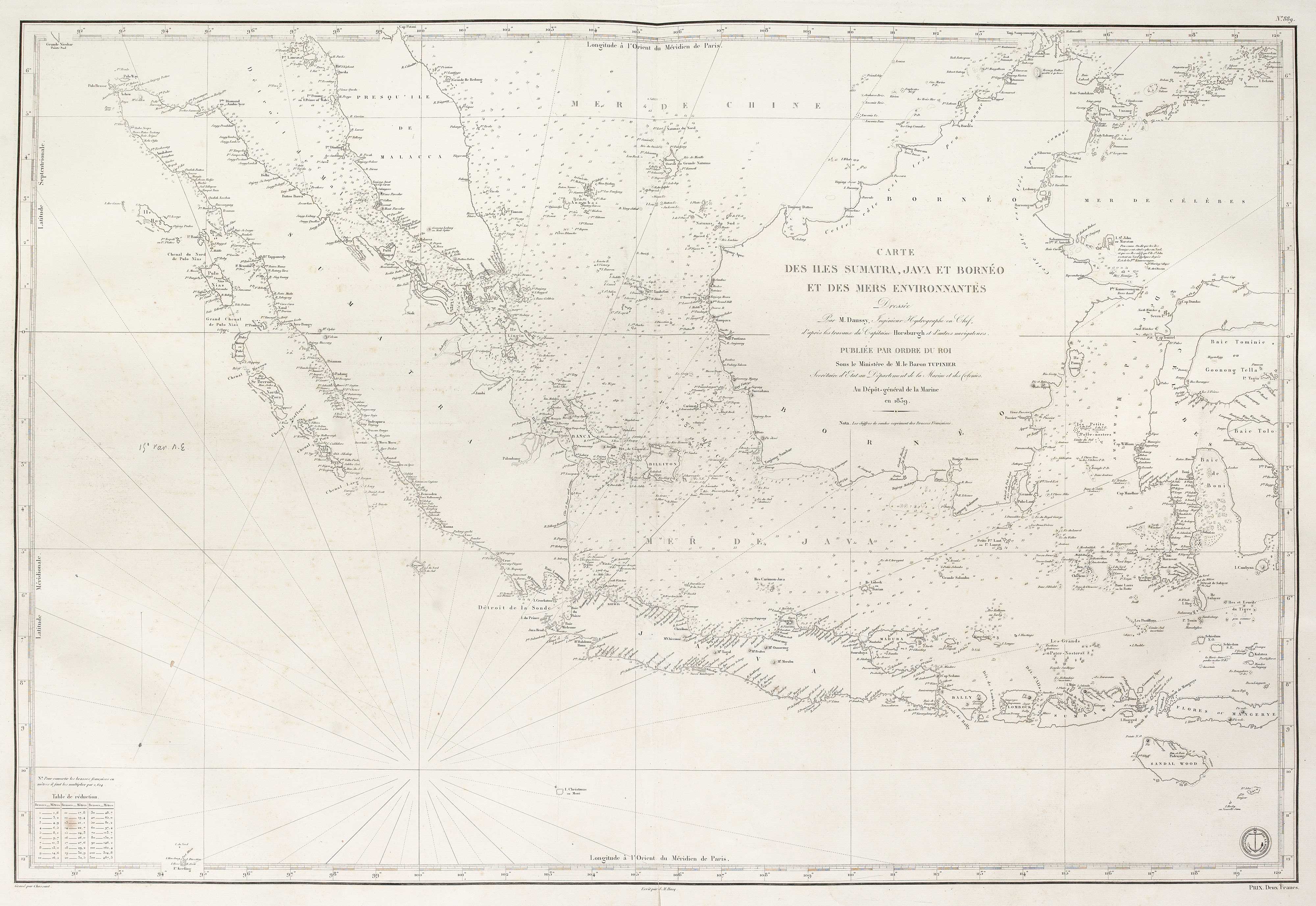
A French early 19th century sea chart of Indonesia & Singapore
DAUSSY, Pierre. Date: 1839 Stock #: 18868 £1,250.00
Add to Wishlist
Add to Wishlist

Map of Bantam on Java from Varthema's Travels
VARTHEMA, Ludovico di. Date: 1610 Stock #: 13210 £250.00
Add to Wishlist
Add to Wishlist
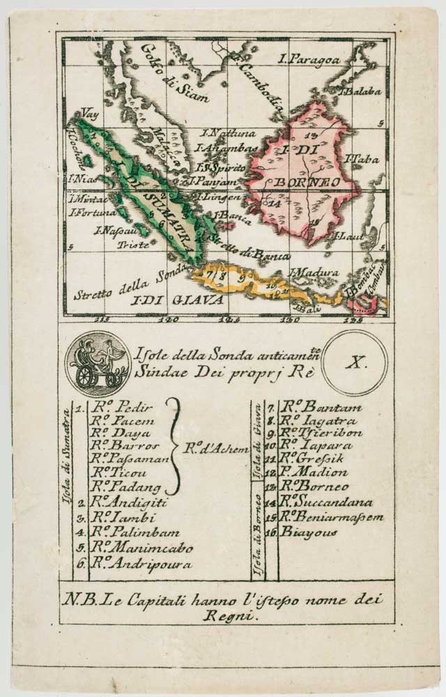
An 18th century playing-card map of Borneo & Sumatra
RABATTA, Augusto & BAILOU, Jean Baptist de. Date: 1779 Stock #: 13010 £250.00
Add to Wishlist
Add to Wishlist
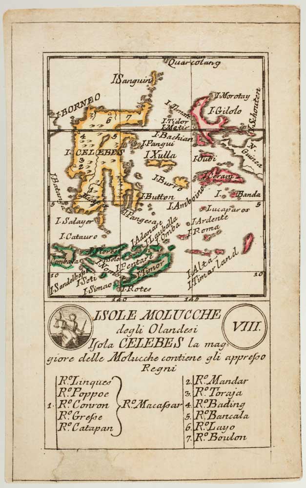
An 18th century playing-card map of Indonesia
RABATTA, Augusto & BAILOU, Jean Baptist de. Date: 1779 Stock #: 13008 £180.00
Add to Wishlist
Add to Wishlist
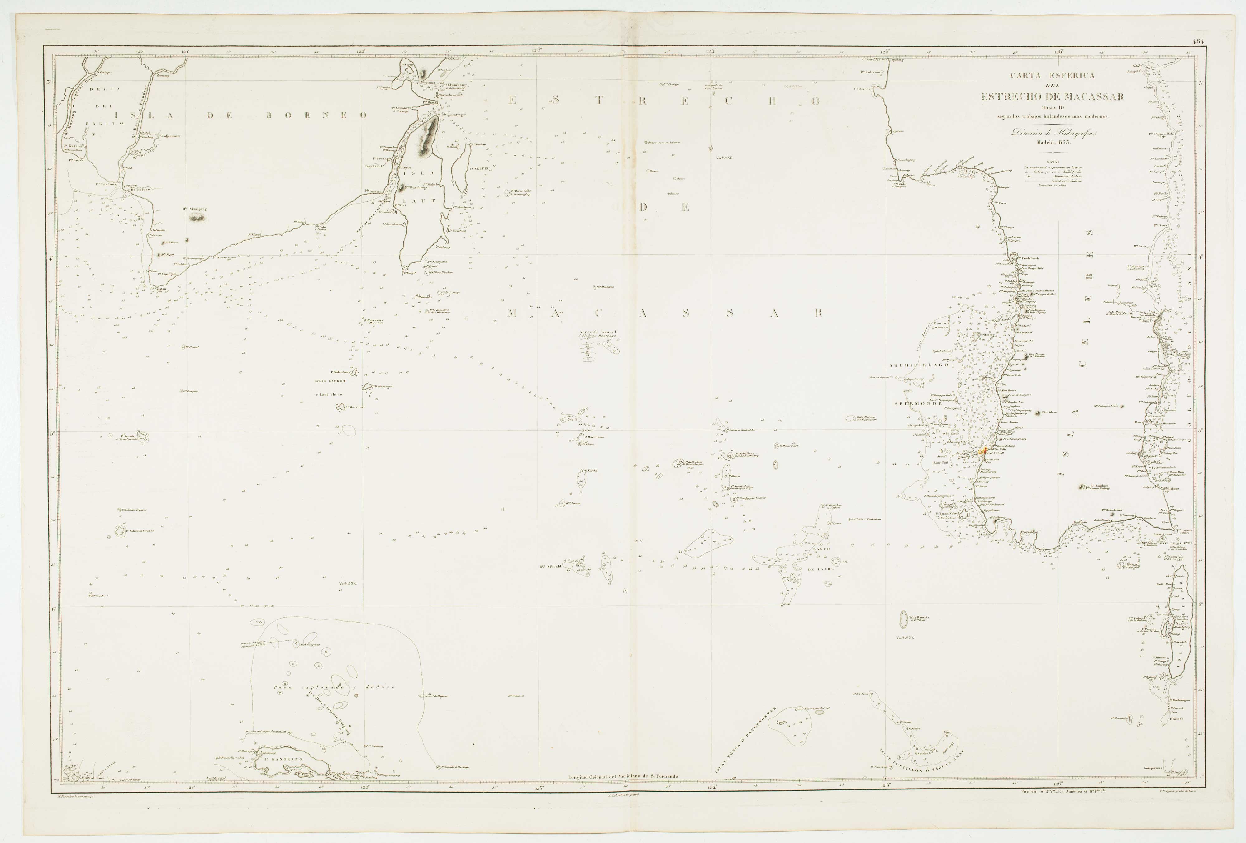
Pair of sea charts of the Makassar Strait
BRYANT, Tomas. Date: 1863 Stock #: 12474 £650.00
Add to Wishlist
Add to Wishlist
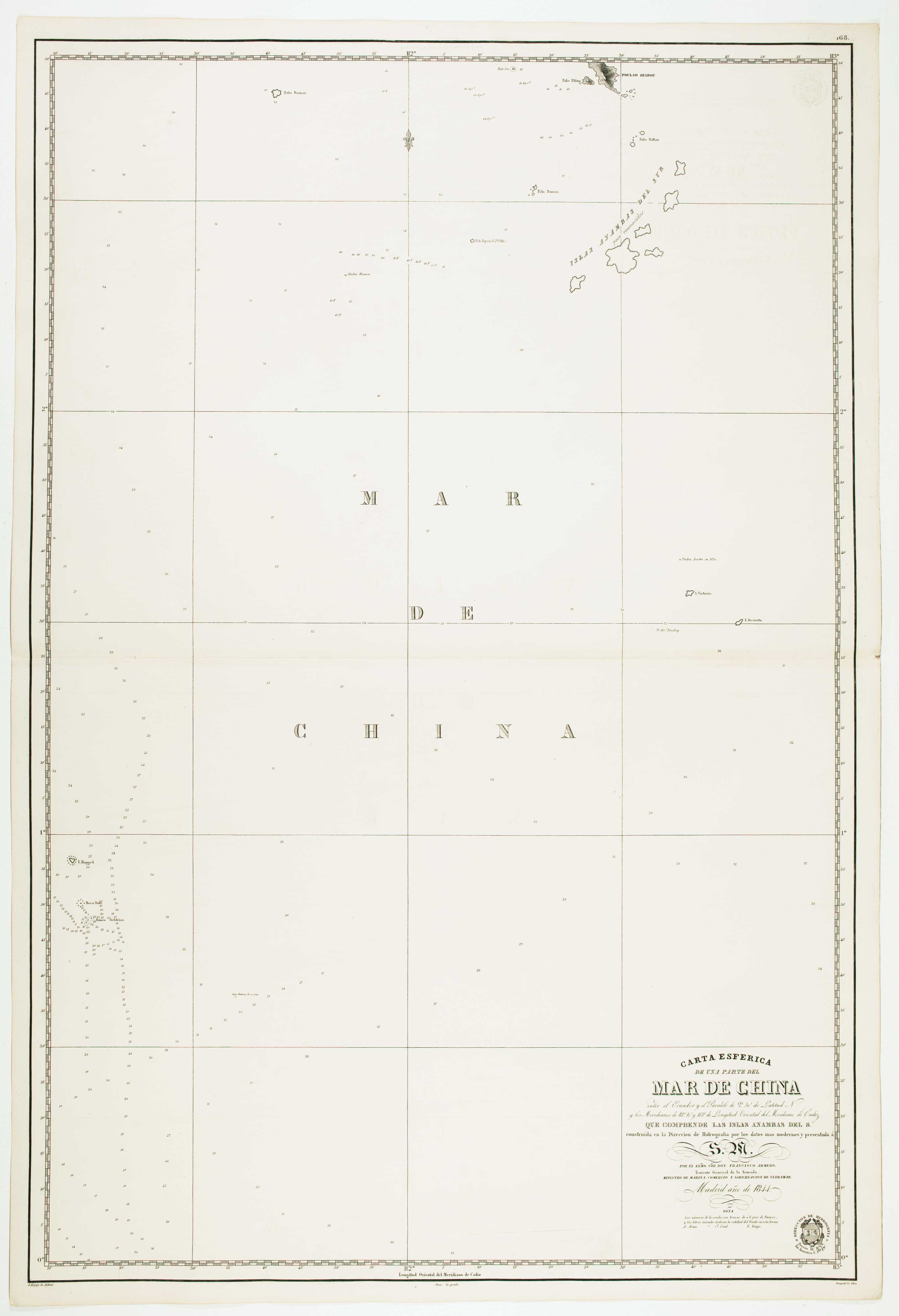
Pair of sea charts of the Anambas Islands
HORTIGOSA, P. Date: 1844 Stock #: 12472 £600.00
Add to Wishlist
Add to Wishlist
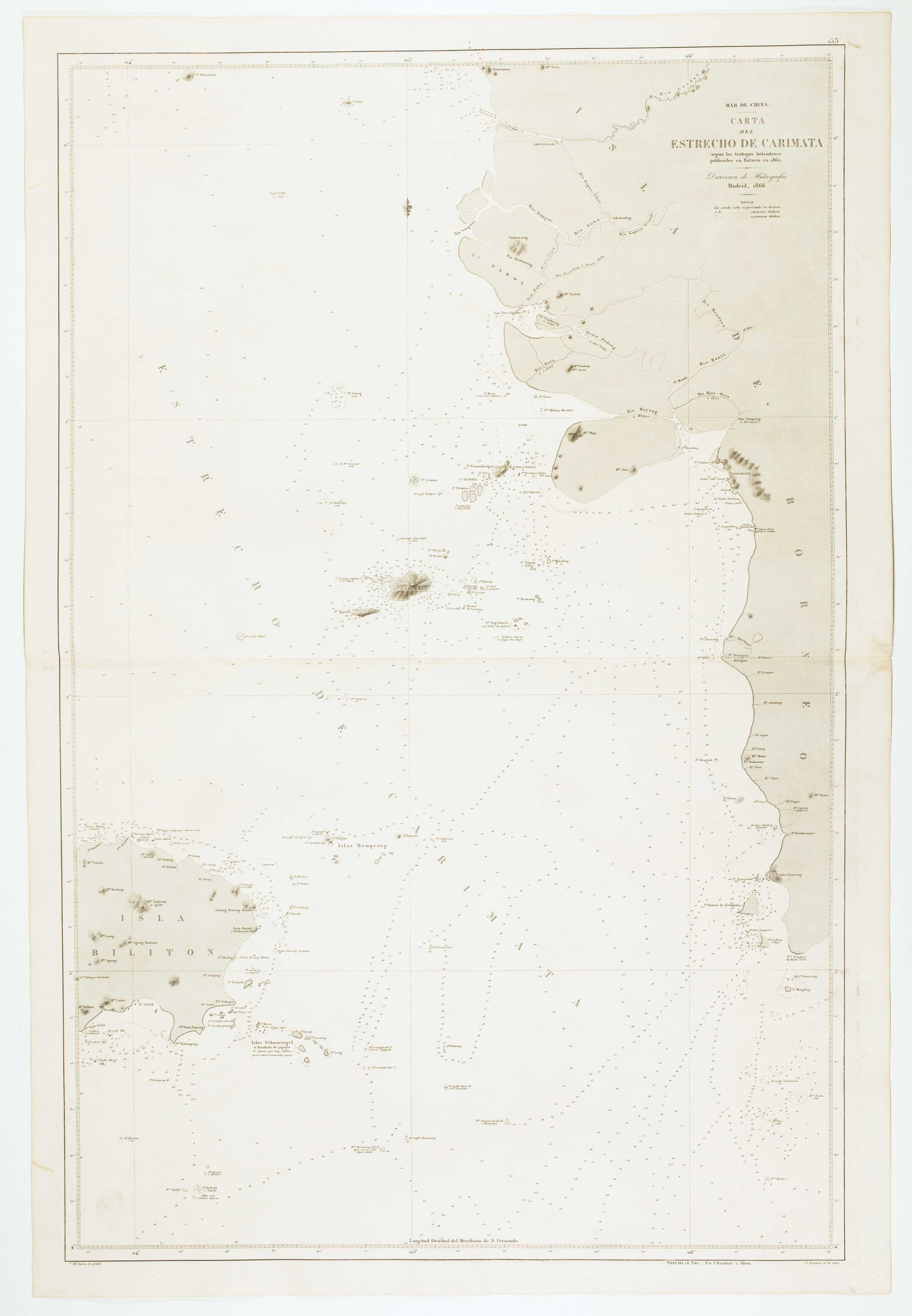
Sea chart of the Karimata Strait
HORTIGOSA, P. Date: 1866 Stock #: 12471 £350.00
Add to Wishlist
Add to Wishlist
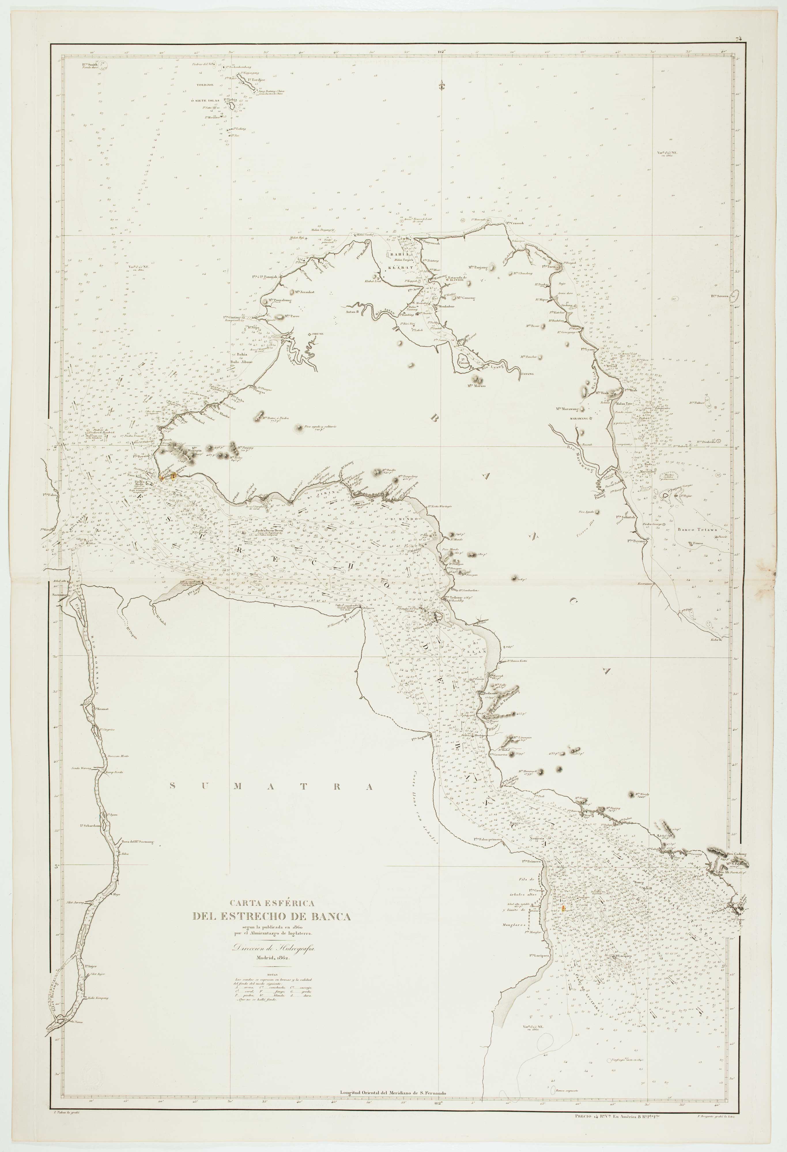
Sea chart of the Bangka Strait
TUBAU, I. Date: 1866 Stock #: 12470 £450.00
Add to Wishlist
Add to Wishlist
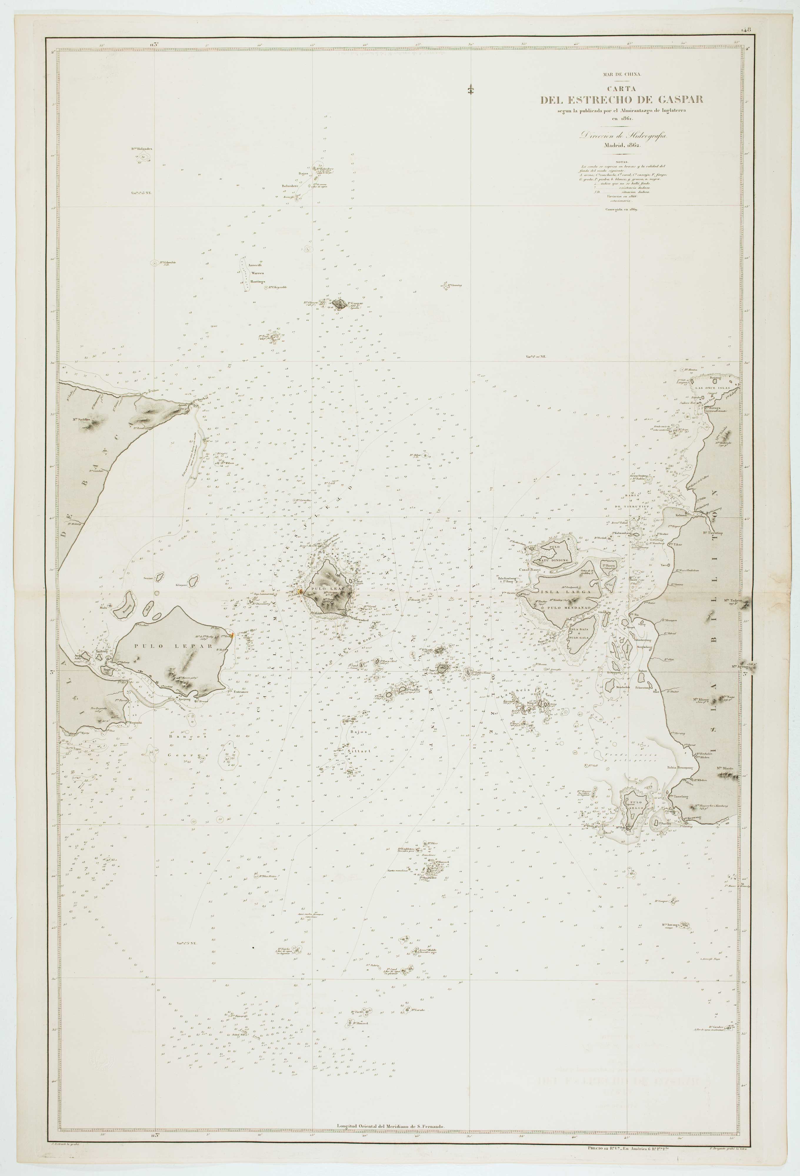
Spanish Sea chart of the Gaspar Strait
ESTRUCHE, J. Date: 1862 Stock #: 12469 £450.00
Add to Wishlist
Add to Wishlist

Sea chart of the western Java Sea
DE LORENZO, J. Date: 1863 Stock #: 12468 £350.00
Add to Wishlist
Add to Wishlist

Sea chart of the Bay of Jakarta
RIUDAVETS, José Maria. Date: 1862 Stock #: 12466 £450.00
Add to Wishlist
Add to Wishlist
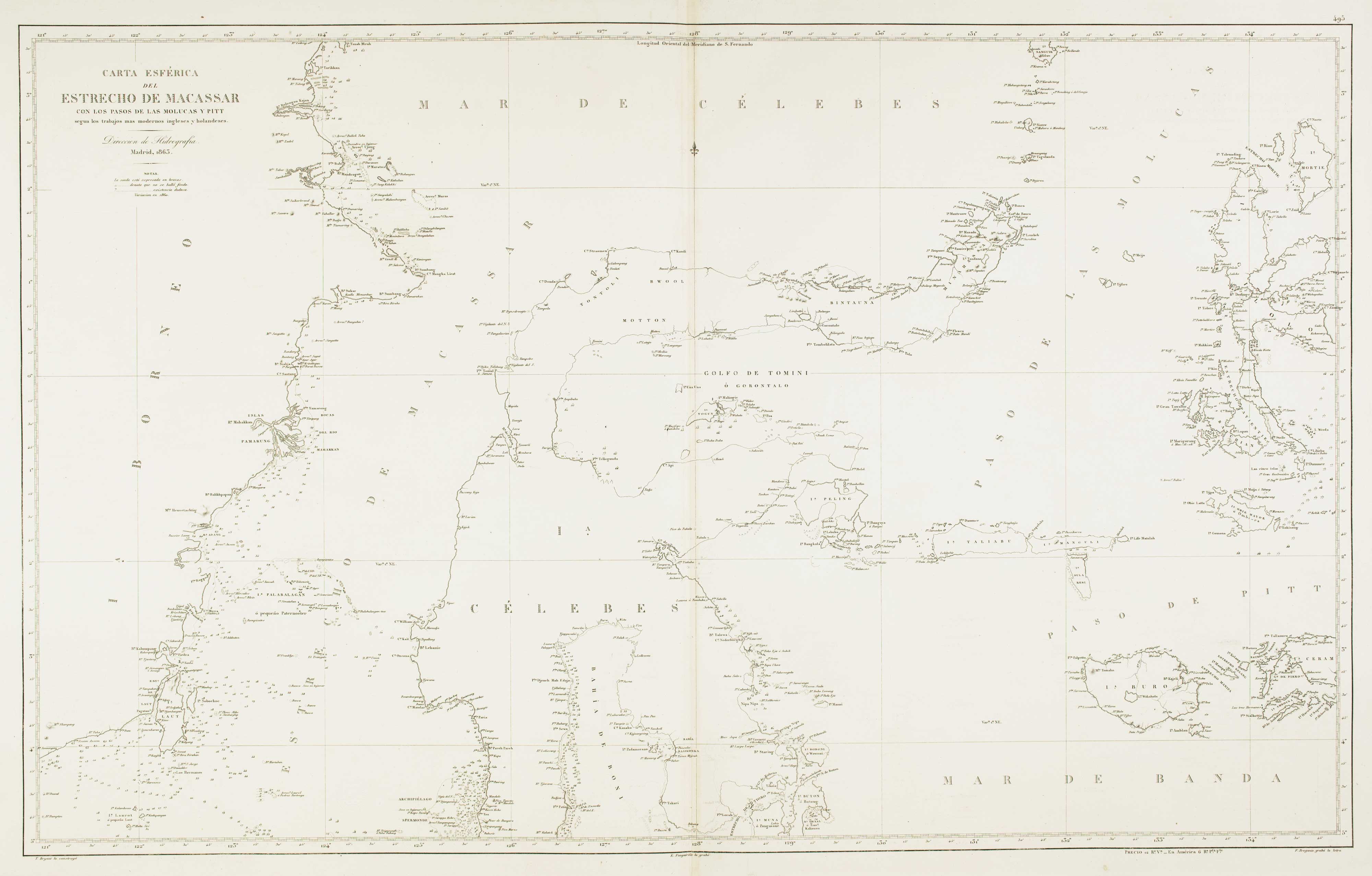
Sea chart of the Makassar Strait
BRYANT, Tomas. Date: 1863 Stock #: 12464 £650.00
Add to Wishlist
Add to Wishlist
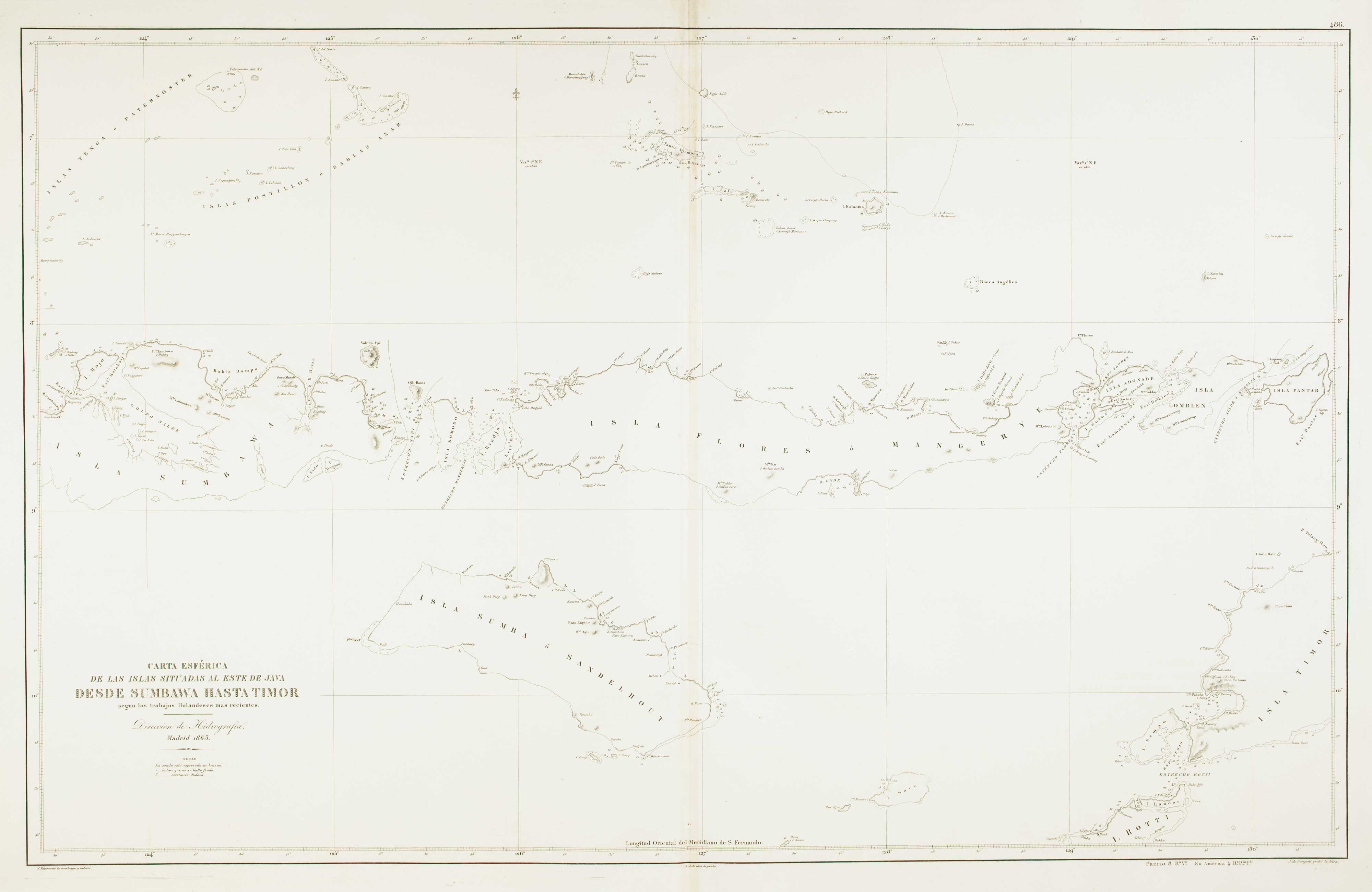
Sea chart of the Lesser Sunda Islands
RIUDAVETS, José Maria. Date: 1863 Stock #: 12460 £500.00
Add to Wishlist
Add to Wishlist

Sea chart of the Halmahera Sea, Indonesia
ESPEJO, José. Date: 1843 Stock #: 12459 £700.00
Add to Wishlist
Add to Wishlist
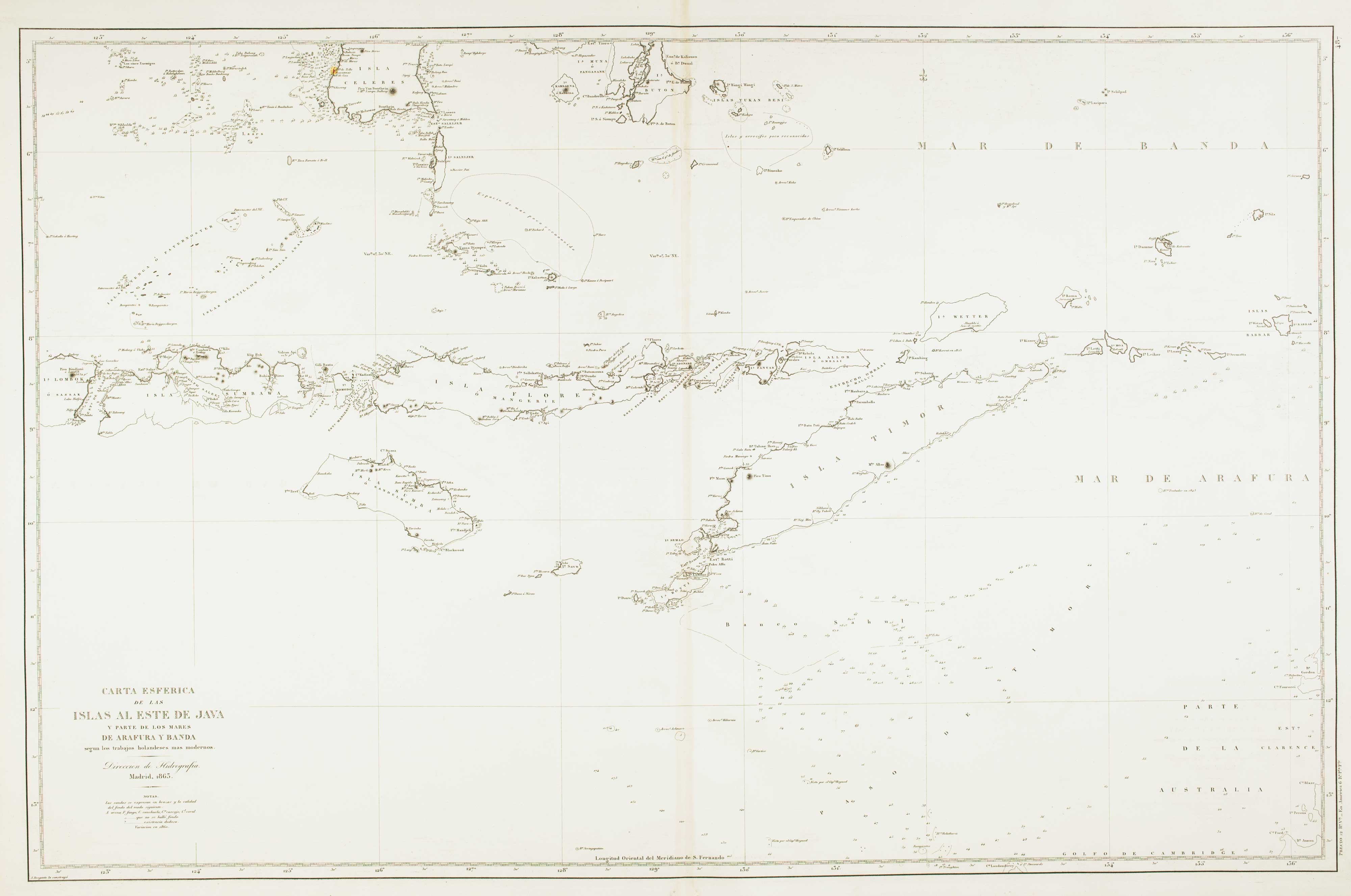
Sea chart of the Indonesian provinces of West & East Nusa Tenggara, with East Timor
BREGANTE, S. Date: 1863 Stock #: 12458 £500.00
Add to Wishlist
Add to Wishlist