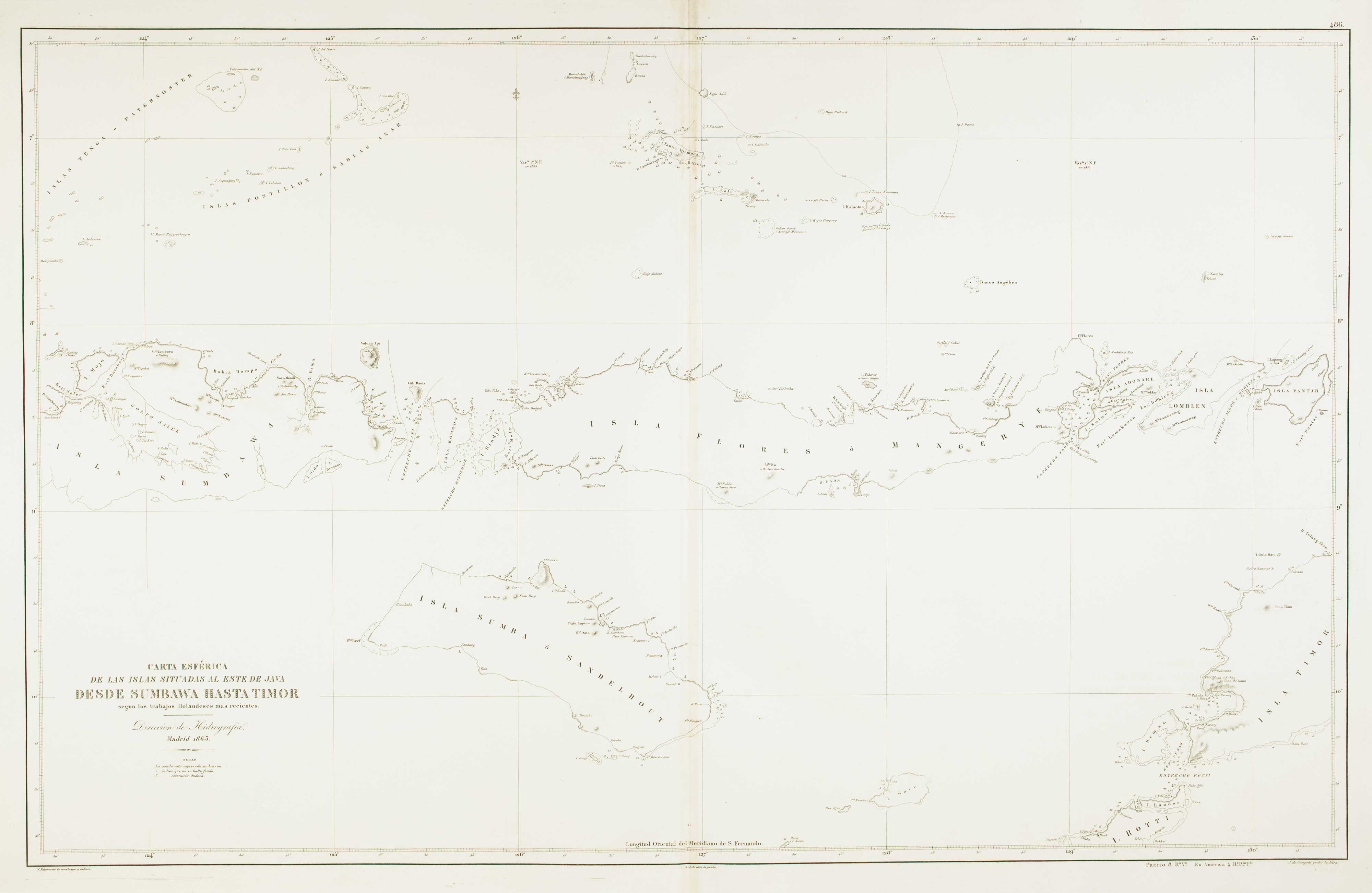


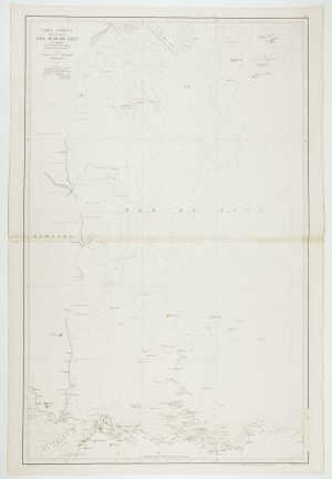
Sea chart of the Lesser Sunda Islands
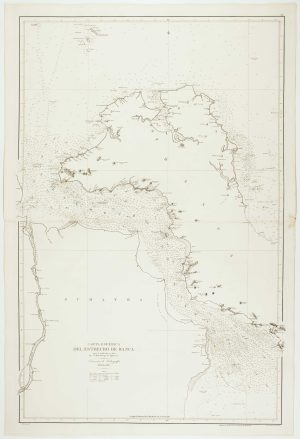
Carta Esferica de las Islas al Este de Java y parte de los Mares de Aruafura y Banda segun los trabajos holandeses mas modernos.
Madrid: Direccion de Hidrografia, 1863. 640 x 980mm. Blind stamp of the Direccion de Hidrografia.
£500.00
1 in stock
x
Question About This Item?
Sea chart of the Lesser Sunda Islands & RIUDAVETS, José Maria.Stock #: 12460Similar to Sell?
Description
Sea chart of part of the Indonesian island chain of the Lesser Sunda Islands, including Sumbawa, Flores and Sumba, with the western tip of Timor.
Condition:
A good example.Related products
-
Sea chart of the Halmahera Sea, Indonesia
ESPEJO, José. Date: 1843Stock #: 12459 £700.00 -
A French early 19th century sea chart of Indonesia & Singapore
DAUSSY, Pierre. Date: 1839Stock #: 18868 £1,250.00 -
The first printed map of Borneo
LANGENES, Barent. Date: 1599Stock #: 21269 £320.00 -
Sea chart of the western Java Sea
DE LORENZO, J. Date: 1863Stock #: 12468 £350.00 -
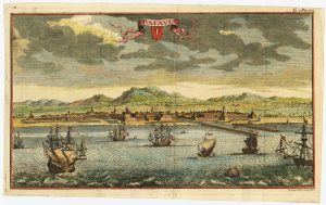
18th century view of the Dutch city of Batavia
SALMON, Thomas. Date: 1753Stock #: 23642 £160.00 -
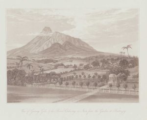
A view from Buitenzorg in Bogor, Java
DANIELL, William. Date: 1830Stock #: 20076 £150.00 -
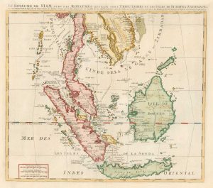
18th century map of the Malay Peninsula and Indonesia
CHATELAIN, Henri Abraham. Date: 1719Stock #: 19983 £600.00 -
Sea chart of the Bangka Strait
TUBAU, I. Date: 1866Stock #: 12470 £450.00 -
An 18th century playing-card map of Borneo & Sumatra
RABATTA, Augusto & BAILOU, Jean Baptist de. Date: 1779Stock #: 13010 £250.00
Items by the same author
[ti_wishlists_addtowishlist]
An uncommon Spanish sea chart of Angola, Namibia and South Africa
RIUDAVETS, José Maria. Date: 1870 Stock #: 18239 £700.00
[ti_wishlists_addtowishlist]
