Antique Maps
Showing 1–30 of 2574 products
Sort by:

Add to Wishlist
Add to Wishlist
A full-size facsimile of 'Carta Marina'
WALDSEEMULLER, Martin. Date: 1959 Stock #: 25455 £2,750.00
Add to Wishlist
Add to Wishlist
A map of London during the Interregum
NEWCOURT, Richard. Date: 1878 Stock #: 25458 £6,850.00
Add to Wishlist
Add to Wishlist
A rare two-sheet plan of classical Rome
SANDRART, Jacob von. Date: 1677 Stock #: 25322 £3,500.00
Add to Wishlist
Add to Wishlist
Ptolemy's model of the Solar System
CELLARIUS, Andreas. Date: 1708 Stock #: 25347 £2,900.00
Add to Wishlist
Add to Wishlist

The southern celestial hemisphere
CELLARIUS, Andreas. Date: 1708 Stock #: 25348 £4,000.00
Add to Wishlist
Add to Wishlist
A very detailed map of the Moon
CHEMLA-LAMECH, Felix. Date: 1946 Stock #: 25406 £3,000.00
Add to Wishlist
Add to Wishlist
The earliest depiction of post roads in America
MOLL, Herman. Date: 1732 Stock #: 25480 £1,100.00
Add to Wishlist
Add to Wishlist
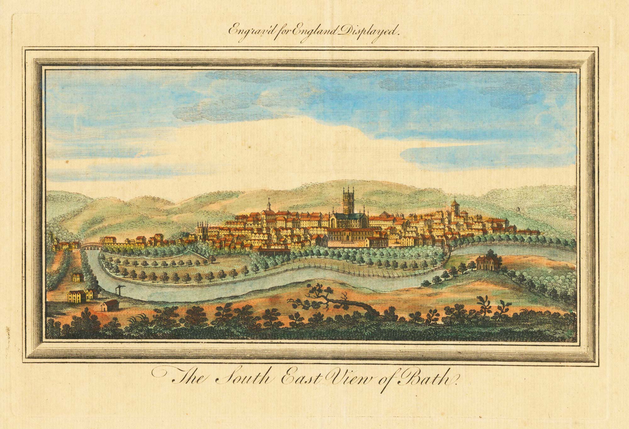
An 18th century prospect of Bath
BUCK, Samuel & Nathaniel. Date: 1769 Stock #: 23697 £200.00
Add to Wishlist
Add to Wishlist
The Holy Land and Egypt in fine colour
SEATON, Robert. Date: 1731 Stock #: 24596 £2,400.00
Add to Wishlist
Add to Wishlist
De Fer's large-format map of the island of California
FER, Nicolas de. Date: 1720 Stock #: 25088 £6,000.00
Add to Wishlist
Add to Wishlist
The first map of the continent of America
MUNSTER, Sebastian. Date: 1568 Stock #: 25503 £6,000.00
Add to Wishlist
Add to Wishlist
17th century miniature map of Virginia
DU VAL, Pierre. Date: 1672 Stock #: 25366 £500.00
Add to Wishlist
Add to Wishlist
An 18th century English map of India
MOLL, Herman. Date: 1732 Stock #: 25481 £500.00
Add to Wishlist
Add to Wishlist
A 16th century woodcut map of the Holy Land & Cyprus
MUNSTER, Sebastian. Date: 1550 Stock #: 25482 £220.00
Add to Wishlist
Add to Wishlist
An 18th century pocket atlas of England, Wales & Scotland
OSBORNE, Thomas. Date: 1756 Stock #: 25500 £980.00
Add to Wishlist
Add to Wishlist
A folding map of London in 1817
DARTON, William. Date: 1817 Stock #: 25501 £1,600.00
Add to Wishlist
Add to Wishlist
An 18th century world map with 'Terrestrial' and 'Maritime' hemispheres
SANTINI, Francesco & SANTINI, Paolo. Date: 1784 Stock #: 25417 £1,600.00
Add to Wishlist
Add to Wishlist
A late 18th century pocket globe
ADAMS, Dudley Date: 1795 Stock #: 24635 £17,500.00
Add to Wishlist
Add to Wishlist
A 16th century map of the colony of New Spain
ORTELIUS, Abraham. Date: 1592 Stock #: 25516 £800.00
Add to Wishlist
Add to Wishlist
The British Empire in 1886 by Walter Crane
CRANE Walter. Date: 1886 Stock #: 24938 £5,500.00
Add to Wishlist
Add to Wishlist
The first detailed map of Uruguay
ROGER. Aimé. Date: 1817 Stock #: 25275 £6,000.00
Add to Wishlist
Add to Wishlist
The first railway-themed board game
WALLIS, Edward. Date: 1840 Stock #: 25499 £1,400.00
Add to Wishlist
Add to Wishlist
The first printed map recording Tasman's second visit to Australia, 1644
DONCKER, Hendrik. Date: 1659 Stock #: 24893 £15,000.00
Add to Wishlist
Add to Wishlist

A magnificent example of the first folio sea atlas of the World
JANSSON, Jan. Date: 1650 Stock #: 23074 £47,500.00
Add to Wishlist
Add to Wishlist
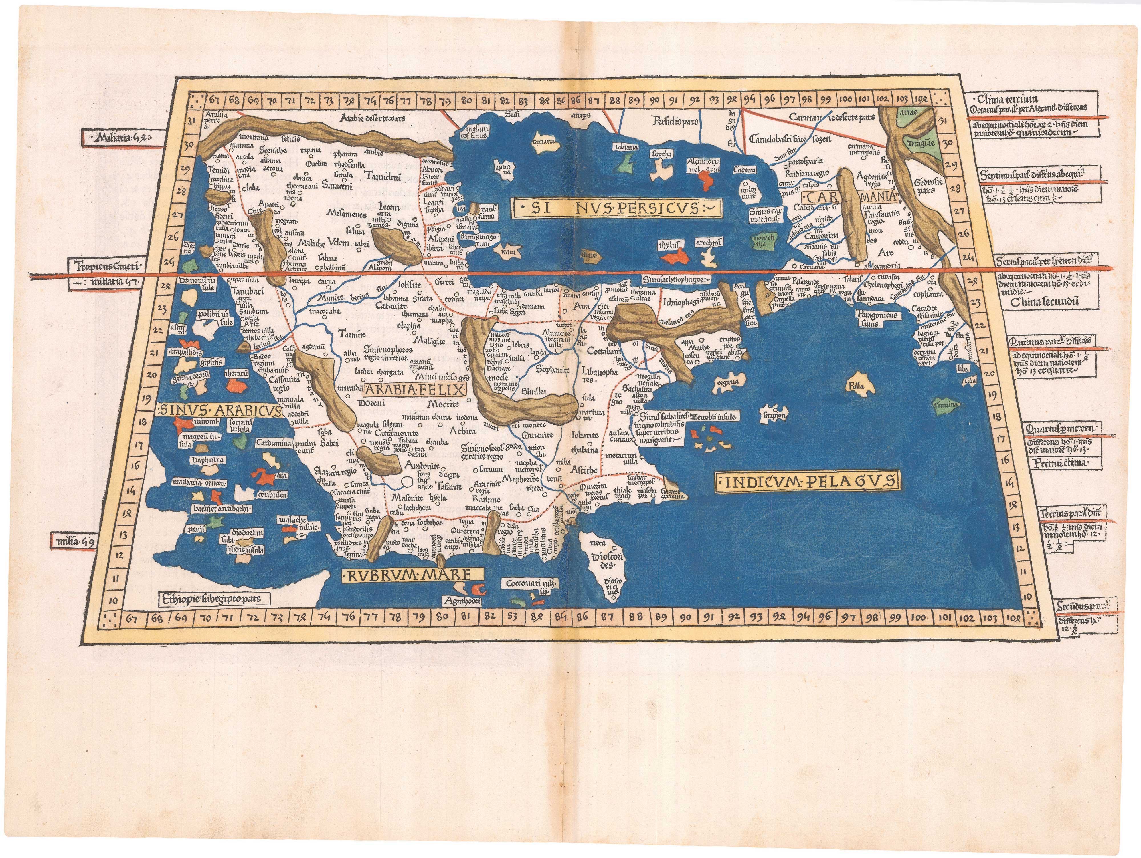
An incunable map of Arabia with lapis lazuli blue
PTOLEMY, Claudius. Date: 1482 Stock #: 23380 Price on Application
Add to Wishlist
Add to Wishlist
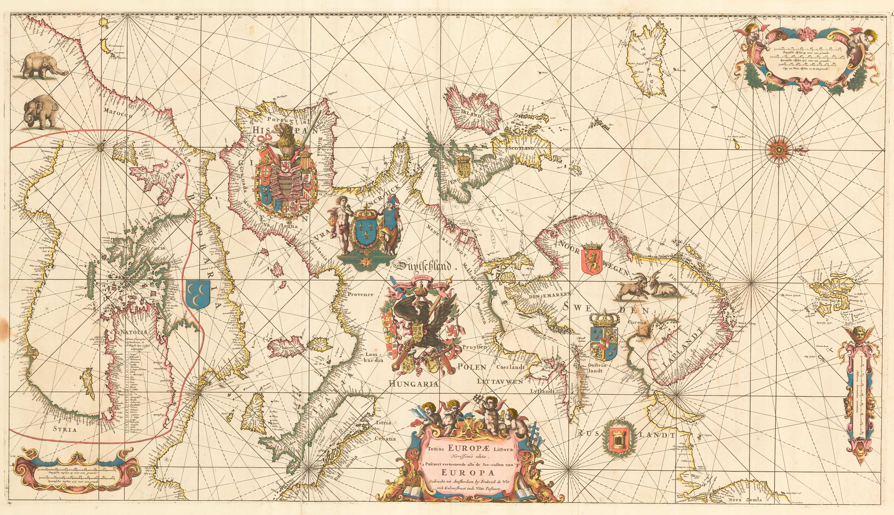
An exceptional 17th century sea chart of Europe
DE WIT, Frederick. Date: 1675 Stock #: 23450 £7,500.00
Add to Wishlist
Add to Wishlist
