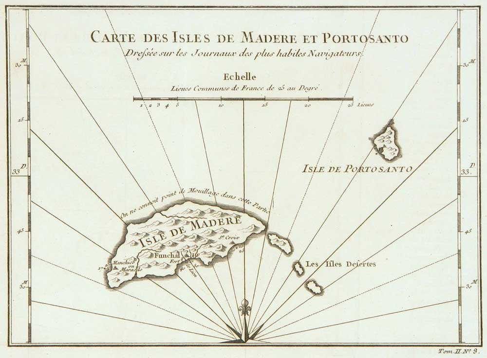


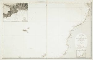
Madeira
Carte des Isles de Madere et Portosanto Dressée sur les Journaux des plus habiles Navigateurs.
Paris, c.1746. 175 x 235mm.
£150.00
Description
- Detailed map of Madeira and Portosanto islands
- Created by skilled navigators
- Rich history and culture
- Stunning locations
Condition:
A good example.Related products
-
A Spanish sea chart of Madagascar and the Seychelles
OWEN, William Fitzwilliam. Date: 1845Stock #: 18237 £1,600.00 -
The Cape Verde Islands
CASSINI, Giovanni Maria. Date: 1798Stock #: 7825 £320.00 -
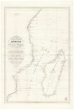
A Spanish sea chart of Madagascar and Mozambique
OWEN, William Fitzwilliam. Date: 1845Stock #: 18236 £1,300.00 -
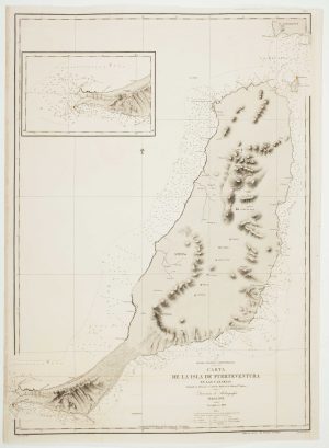
An uncommon 19th century Spanish sea chart of Fuerteventura
ARLETT, William. Date: 1868Stock #: 12576 £1,500.00 -
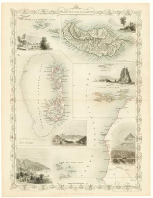
Maps of Bermuda and other islands in the Atlantic
TALLIS, John. Date: 1851Stock #: 17752 £100.00 -
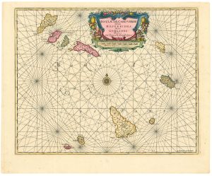
Dutch sea chart of the Cape Verde Islands
JANSSON, Jan. Date: 1730Stock #: 24813 £500.00 -
Sea chart of the African coast with Madeira
VIDAL, Alexander & ARLETT, William. Date: 1867Stock #: 12593 £400.00 -
17th century map of Madagascar
CORONELLI, Vincenzo Maria. Date: 1690Stock #: 22294 £550.00 -
Mortier’s sea chart of Madagascar in full original colour
MORTIER, Pierre. Date: 1700Stock #: 14518 £1,100.00
Items by the same author
[ti_wishlists_addtowishlist]
[ti_wishlists_addtowishlist]
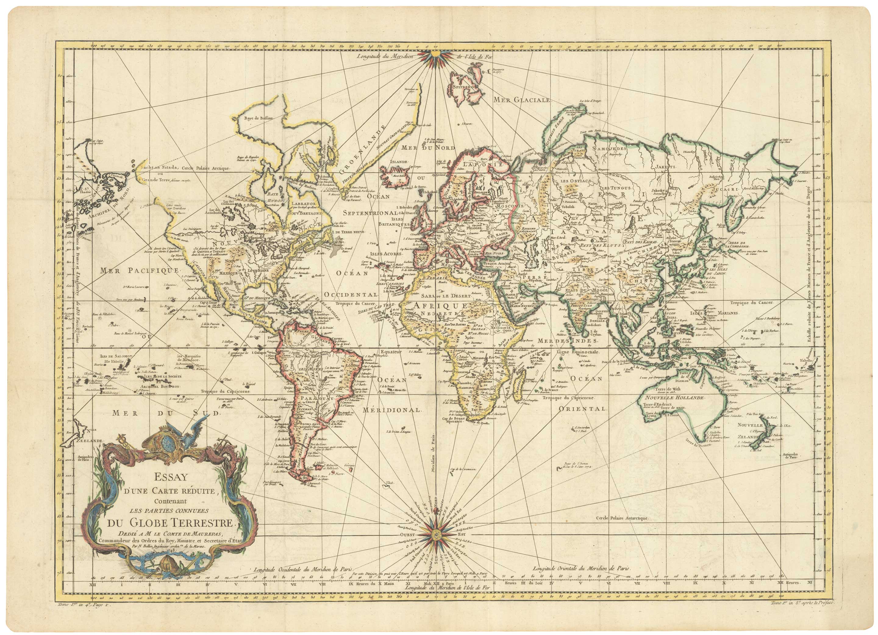
A large sea chart of the World on Mercator's Projection
BELLIN, Jacques-Nicolas. Date: 1775 Stock #: 25116 £1,600.00
[ti_wishlists_addtowishlist]
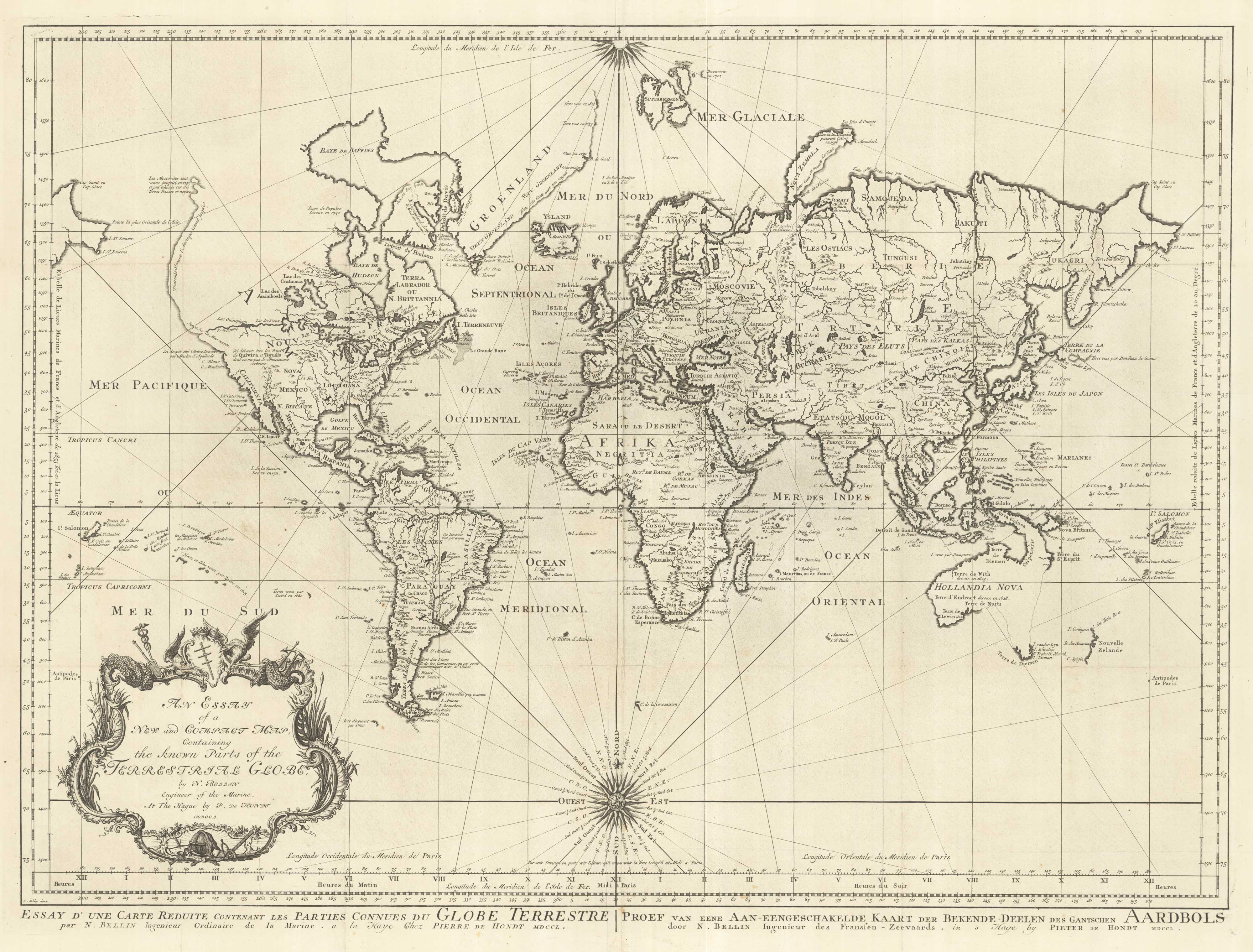
18th century nautical chart on Mercator's Projection
BELLIN, Jacques-Nicolas. Date: 1750 Stock #: 25151 £1,600.00
[ti_wishlists_addtowishlist]
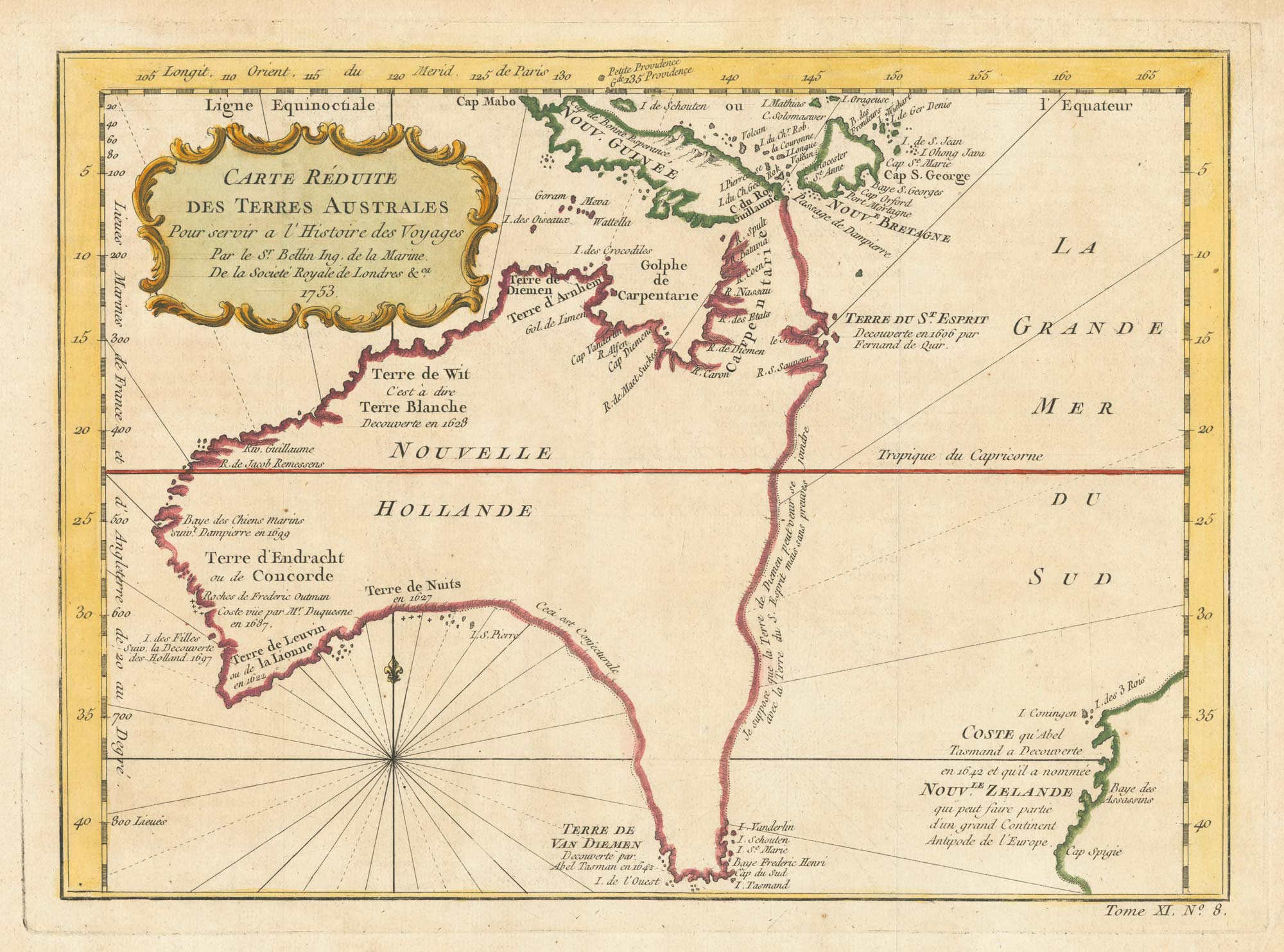
A pre-Cook discoveries map of Australia
BELLIN, Jacques-Nicolas. Date: 1753 Stock #: 25052 £1,000.00
[ti_wishlists_addtowishlist]
[ti_wishlists_addtowishlist]