Antique Maps of the British Isles
Lorem ipsum dolor sit amet, consectetur adipiscing elit. Sed sed aliquet mi. Nulla euismod tincidunt odio, ornare semper justo tristique at. Fusce vitae nunc elit. Vivamus ullamcorper arcu sed sem maximus, sit amet dictum ligula aliquam. Donec quis ligula a erat tristique bibendum. In porttitor quam sit amet ante volutpat egestas. Nunc aliquet at quam ut ullamcorper. Duis et tincidunt risus, sit amet egestas justo.
Mauris vehicula augue non mi feugiat scelerisque. Duis non bibendum nibh. Aliquam erat volutpat. Nam aliquet efficitur diam, at gravida quam lobortis eget. Donec lacus est, mollis id feugiat sed, euismod a odio. Aliquam elementum lorem vitae aliquam blandit. Nulla et quam ac ante aliquet lobortis. Nunc consequat efficitur cursus. Lorem ipsum dolor sit amet, consectetur adipiscing elit. Donec elementum finibus malesuada. Nullam vel nibh varius, ullamcorper neque ac, eleifend sem. Maecenas ac lacinia arcu, quis molestie ante.
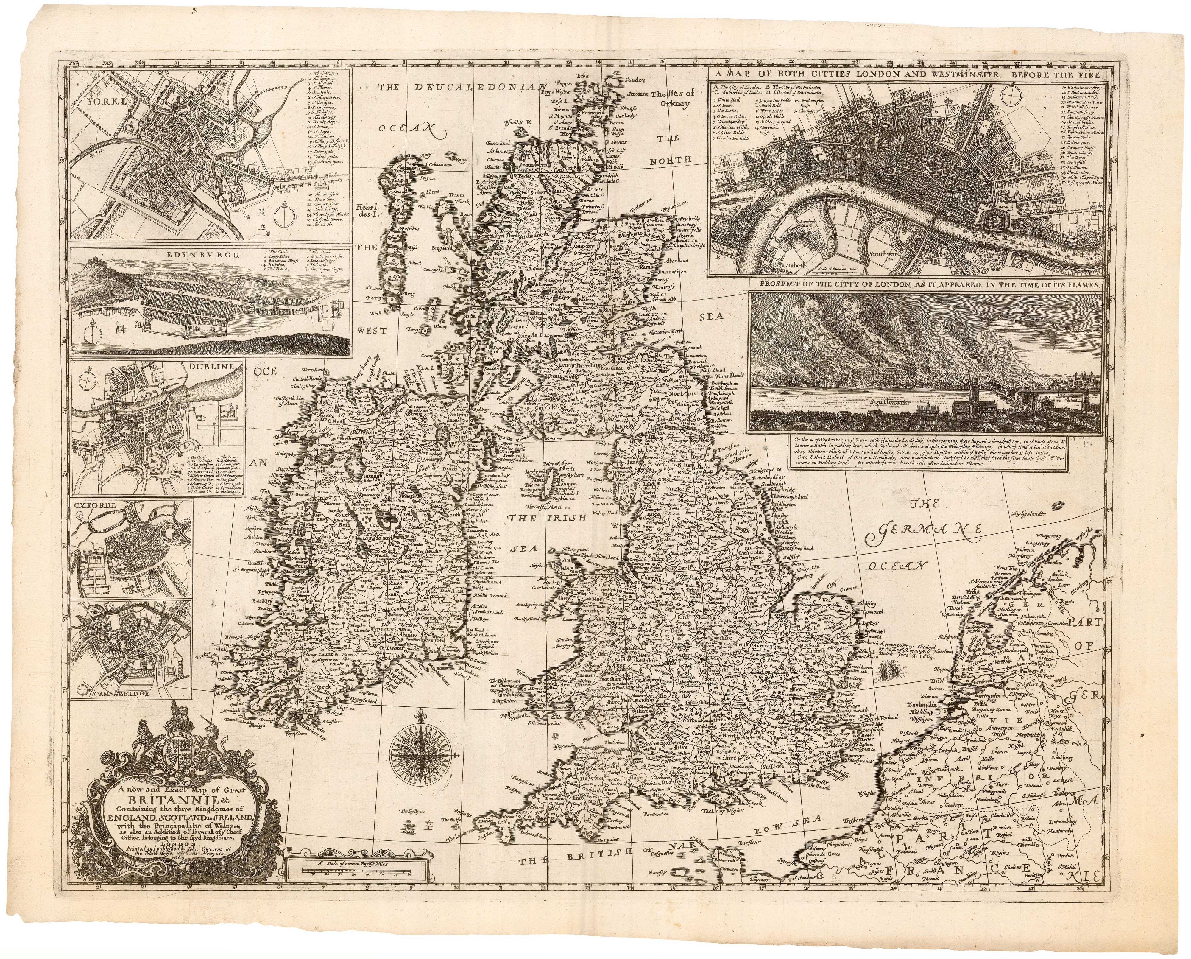
A rare map of the British Isles with a prospect of the Great Fire of...
HOLLAR, Wenceslaus. Date: 1667 Stock #: 24086 £12,000.00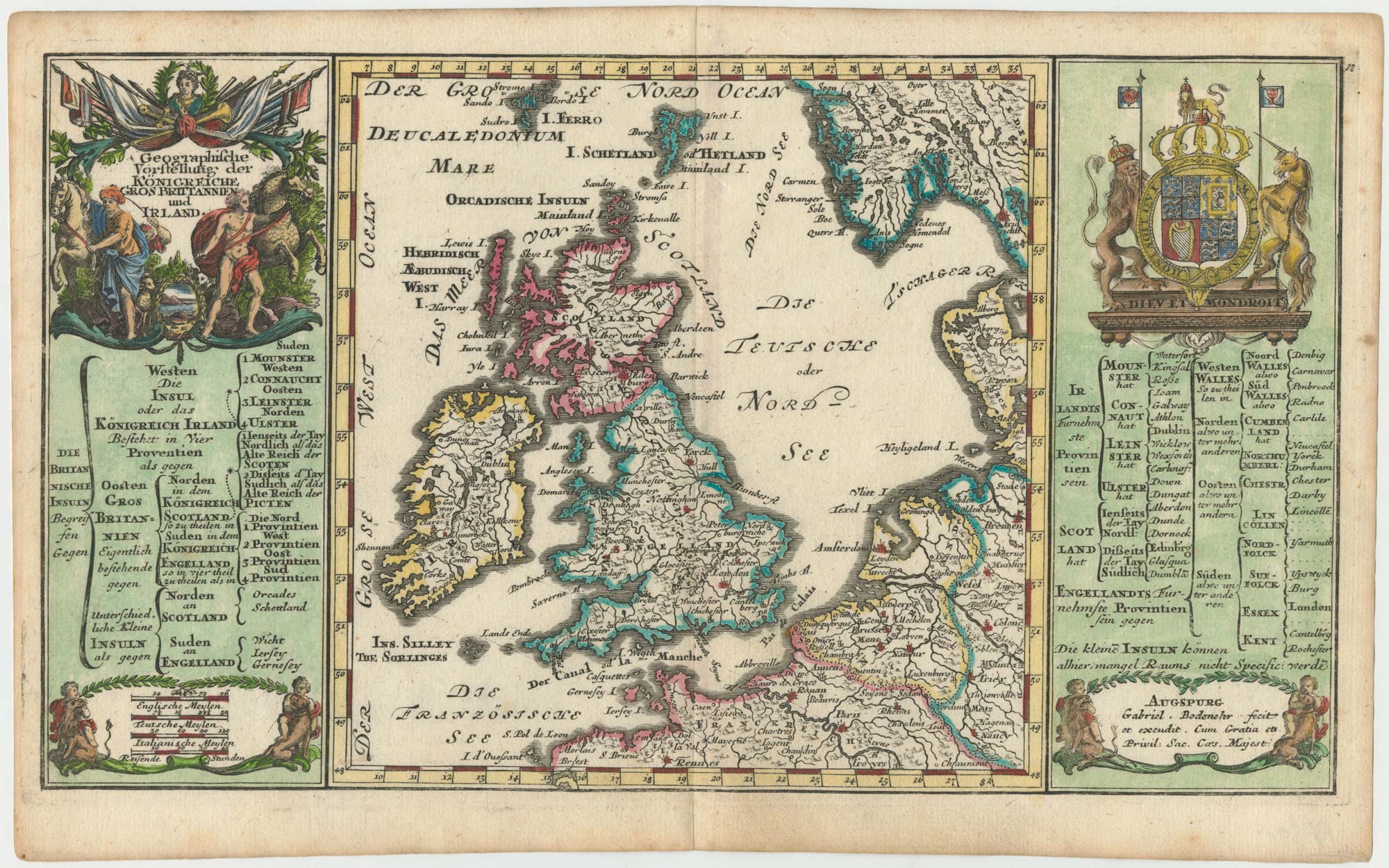
Early 18th century map of the British Isles
BODENEHR, Gabriel. Date: 1704 Stock #: 25105 £350.00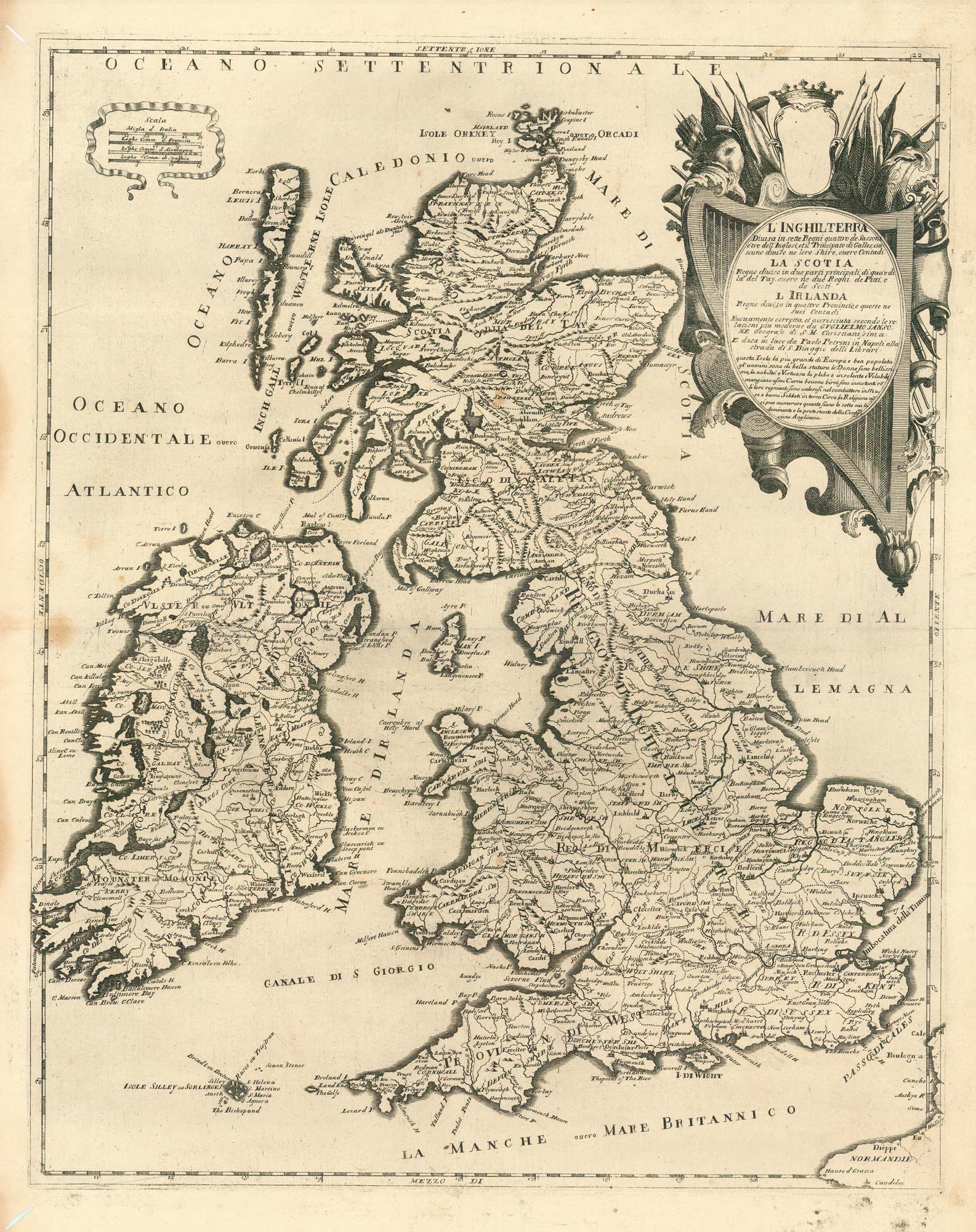
A scarce Italian map of the British Isles
PETRINI, Paolo. Date: 1717 Stock #: 24923 £750.00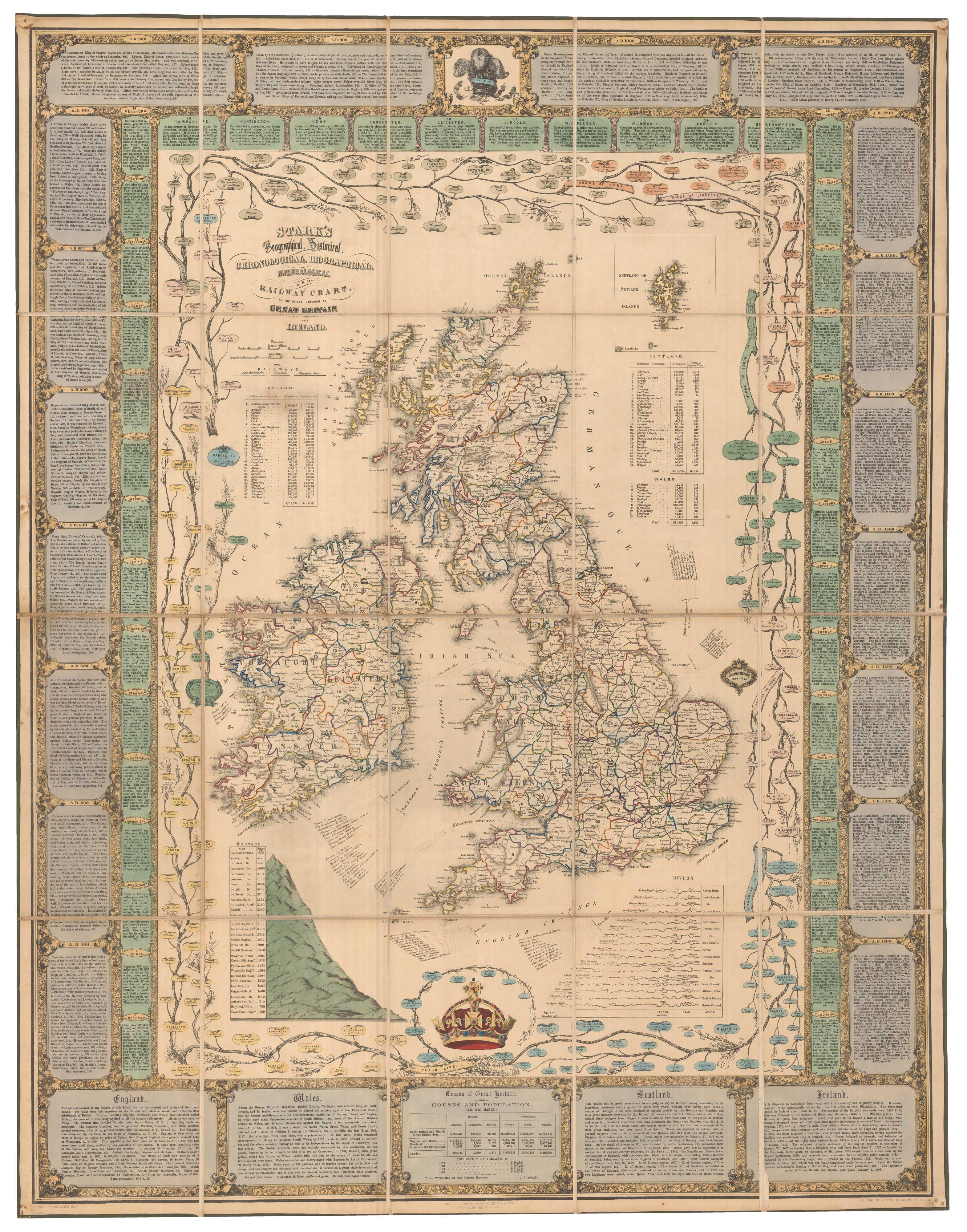
A Victorian educational map of the British Isles
STARK, J. Date: 1851 Stock #: 24080 £1,700.00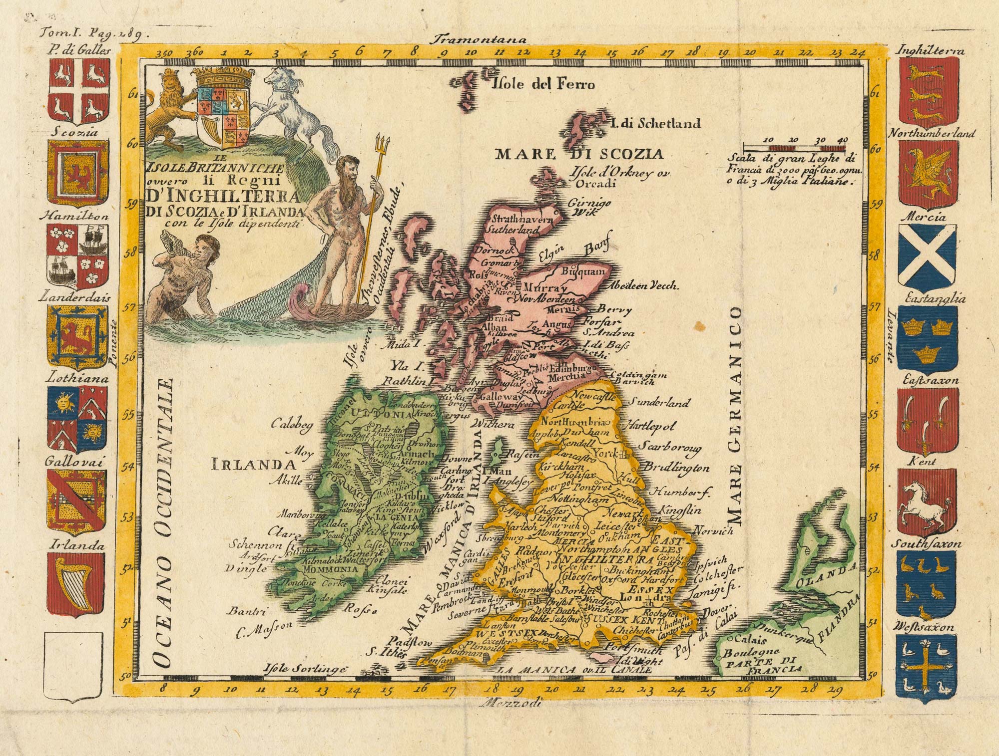
An 18th century Italian map of the British Isles with roll of arms
LA FEUILLE, Daniel de. Date: 1770 Stock #: 23694 £300.00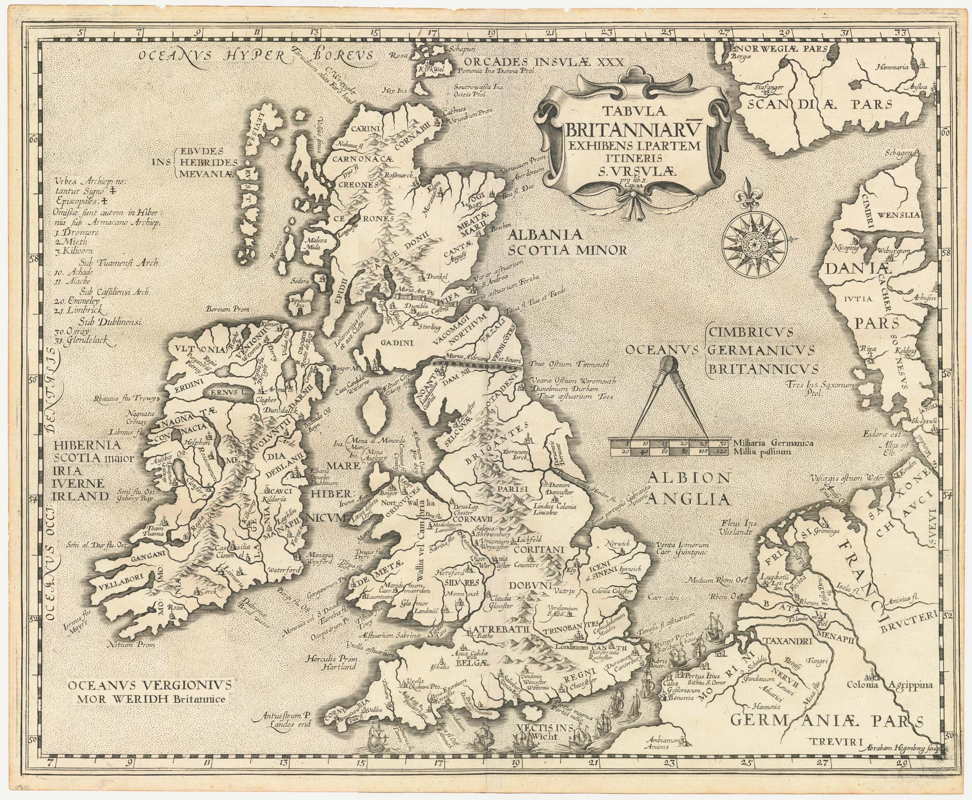
The route of Saint Ursula and the 11,000 virgin martyrs
HOGENBERG, Abraham. Date: 1647 Stock #: 23910 £800.00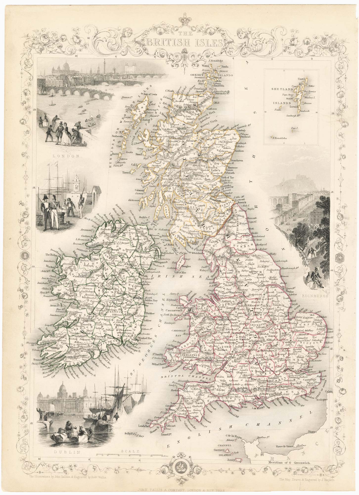
19th century decorative map of the British Isles
TALLIS, John. Date: 1851 Stock #: 23507 £260.00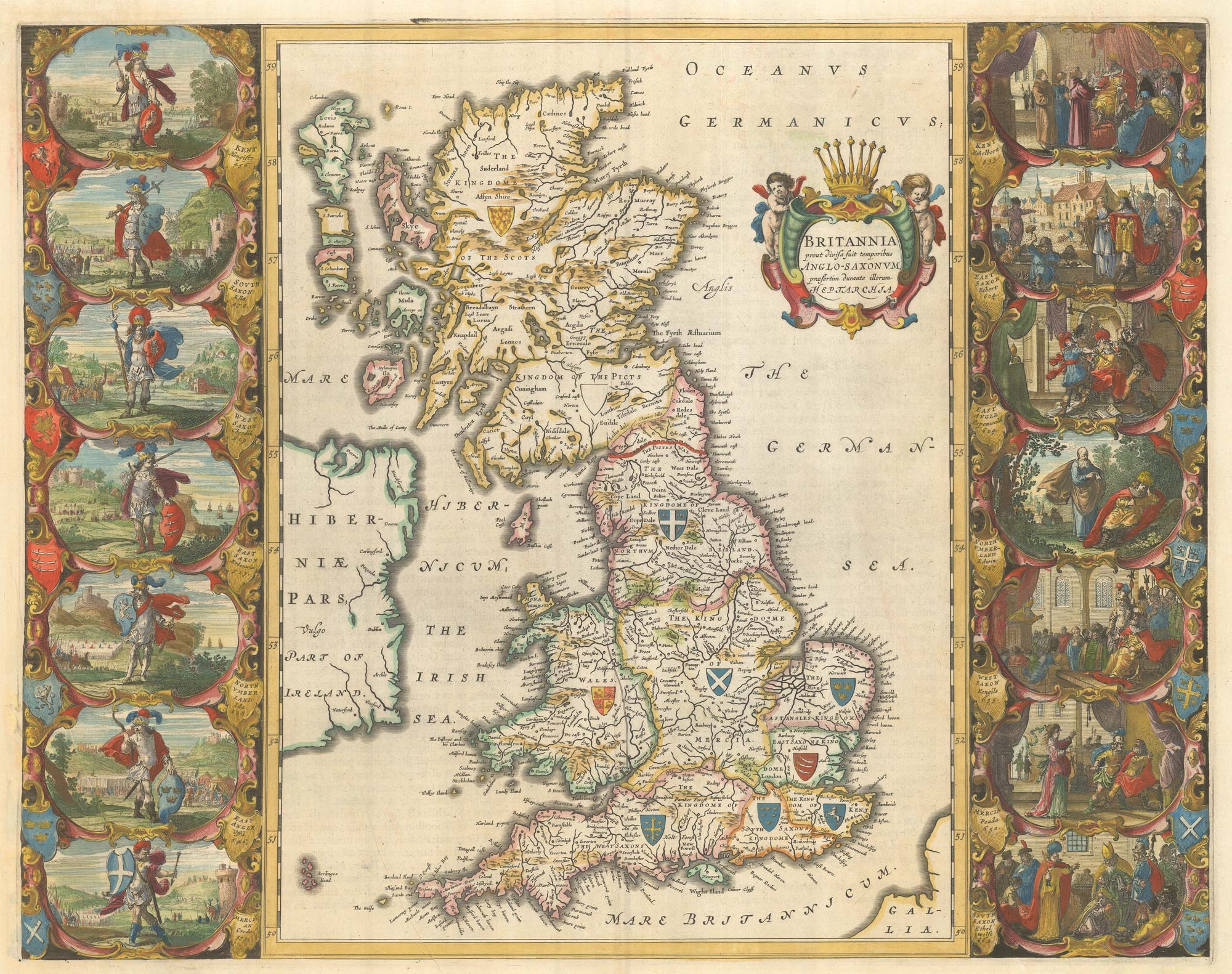
The famous map depicting Anglo-Saxon Britain
BLAEU, Johannes. Date: 1646 Stock #: 23593 £2,500.00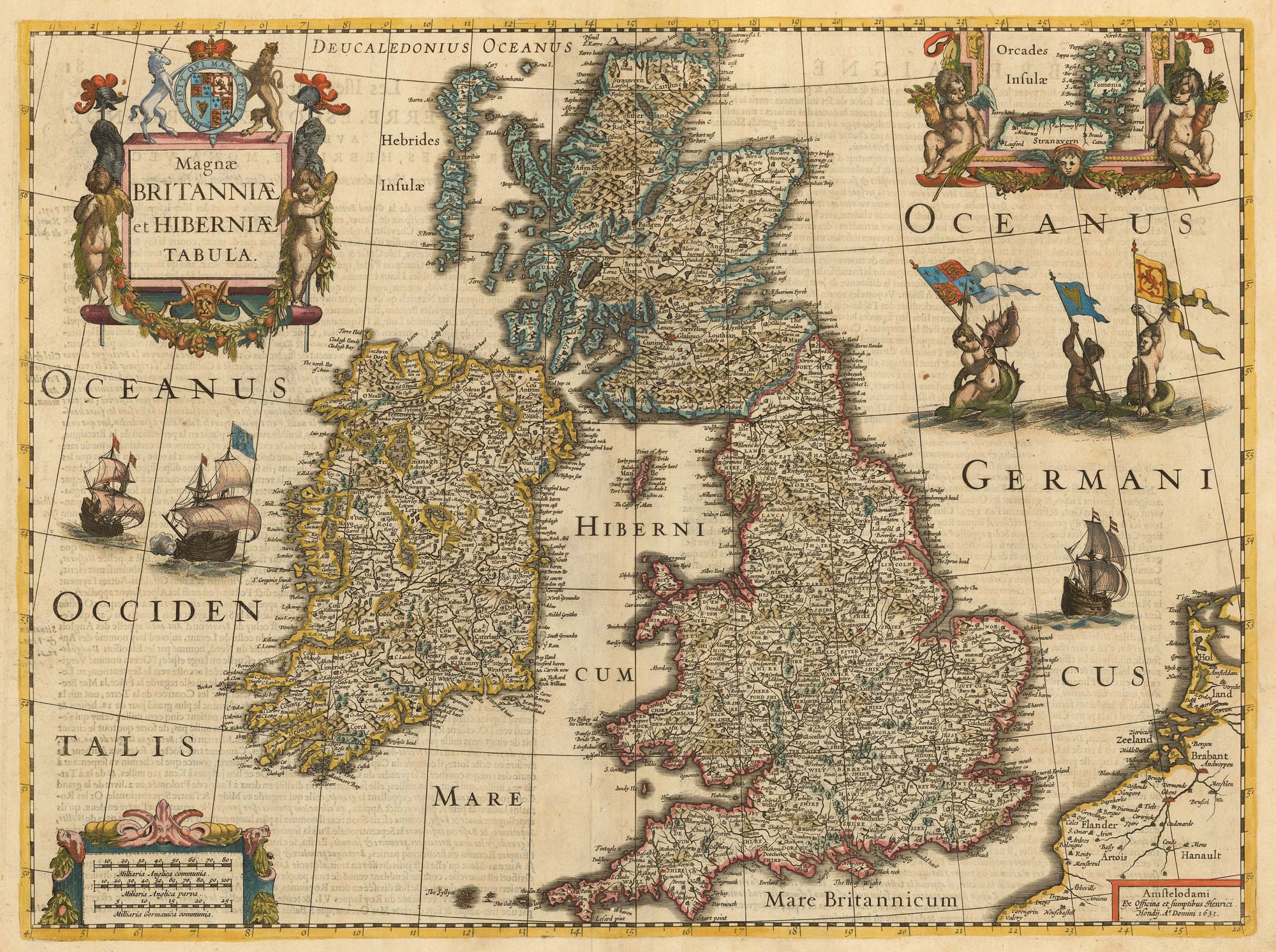
The first atlas issue of the Jodocus Hondius map of the British Isles
HONDIUS, Jodocus II. Date: 1633 Stock #: 23008 £1,100.00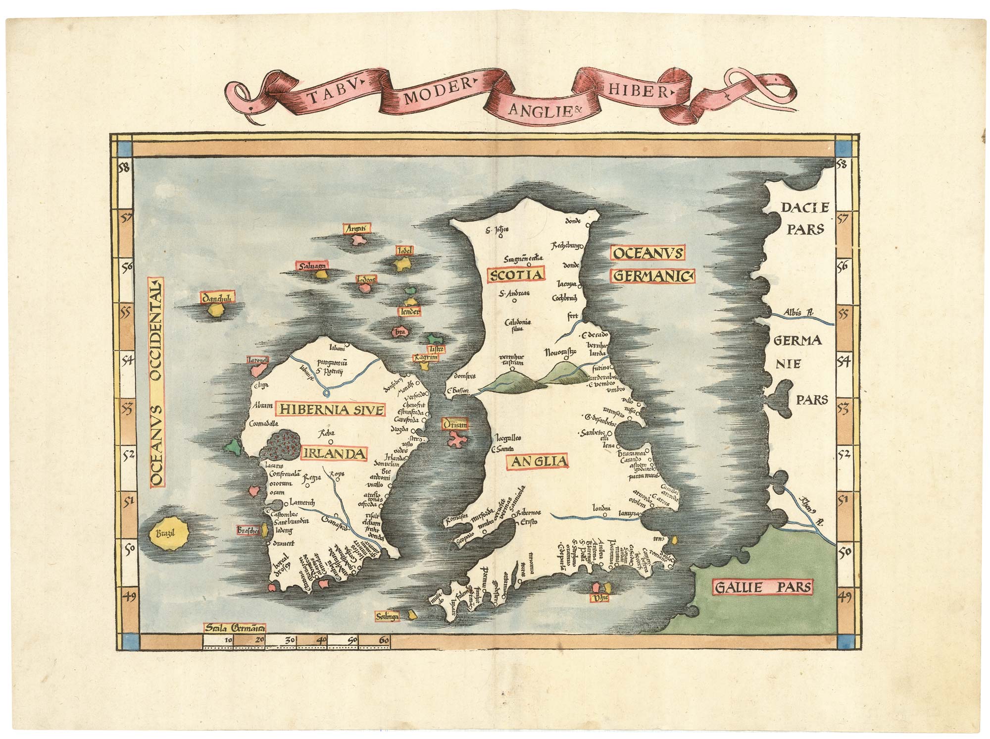
Waldseemuller's 'modern' map of the British Isles
WALDSEEMULLER, Martin. Date: 1535 Stock #: 22846 £2,250.00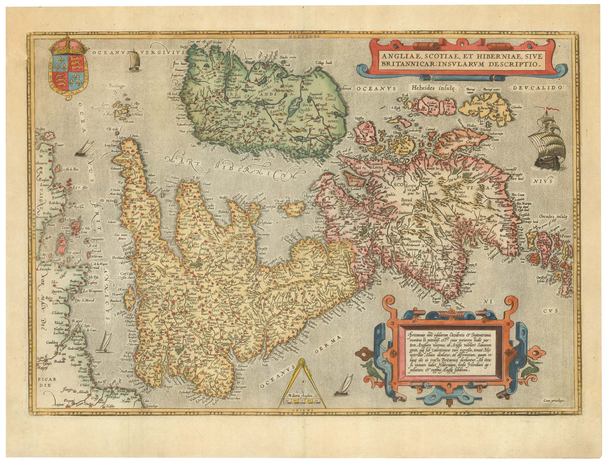
16th century Dutch map of the British Isles
ORTELIUS, Abraham. Date: 1585 Stock #: 22753 £1,600.00
A Dutch map of the British Isles, celebrating the Glorious Revolution
ALLARD, Carel. Date: 1690 Stock #: 22276 £2,000.00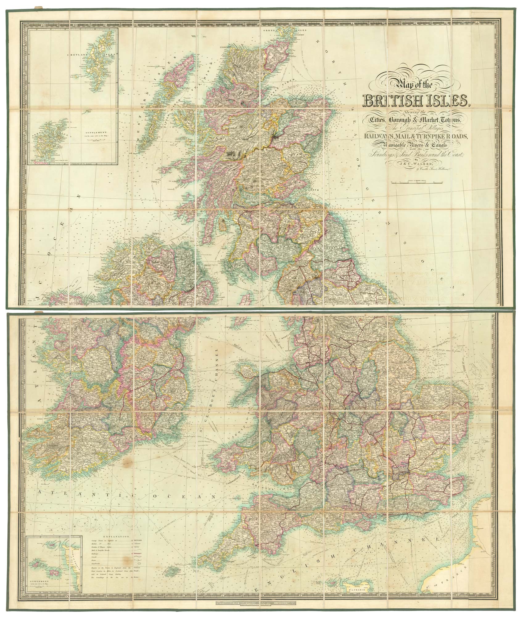
A folding map of the British Isles with fine hand colour
WALKER, J. & C. Date: 1840 Stock #: 21202 £750.00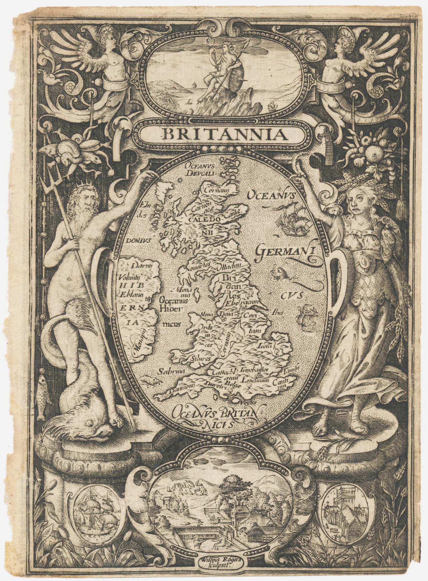
The frontispiece from an Elizabethan edition of Camden's 'Britannia'
ROGERS, William. Date: 1600 Stock #: 21909 £450.00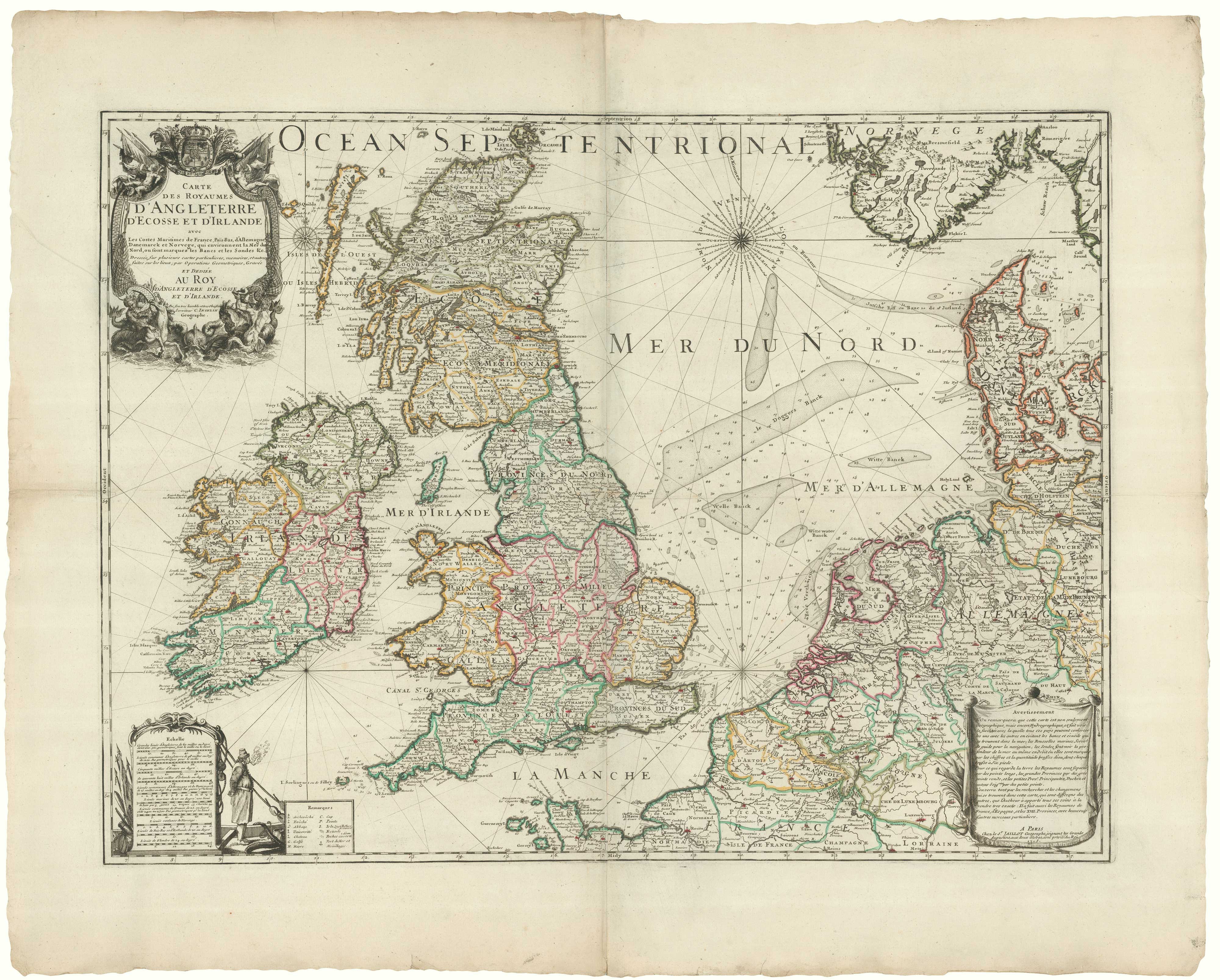
Inselin's Jacobite map of the British Isles
INSELIN, Charles. Date: 1715 Stock #: 20556 £2,200.00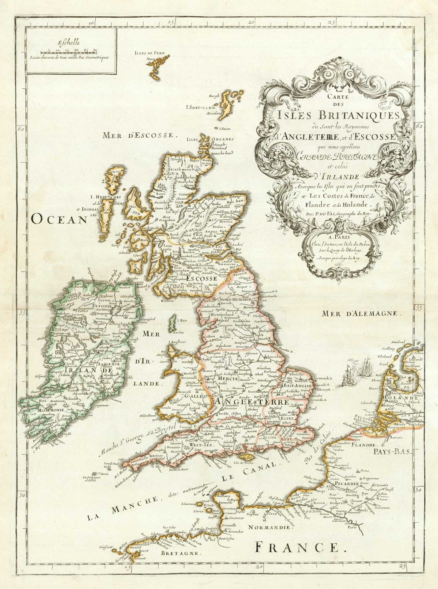
First edition of Du Val's folio map of the British Isles
DU VAL, Pierre. Date: 1665 Stock #: 19059 £800.00
The Saxon Heptarchy
JANSSON, Jan. Date: 1700 Stock #: 18100 £1,800.00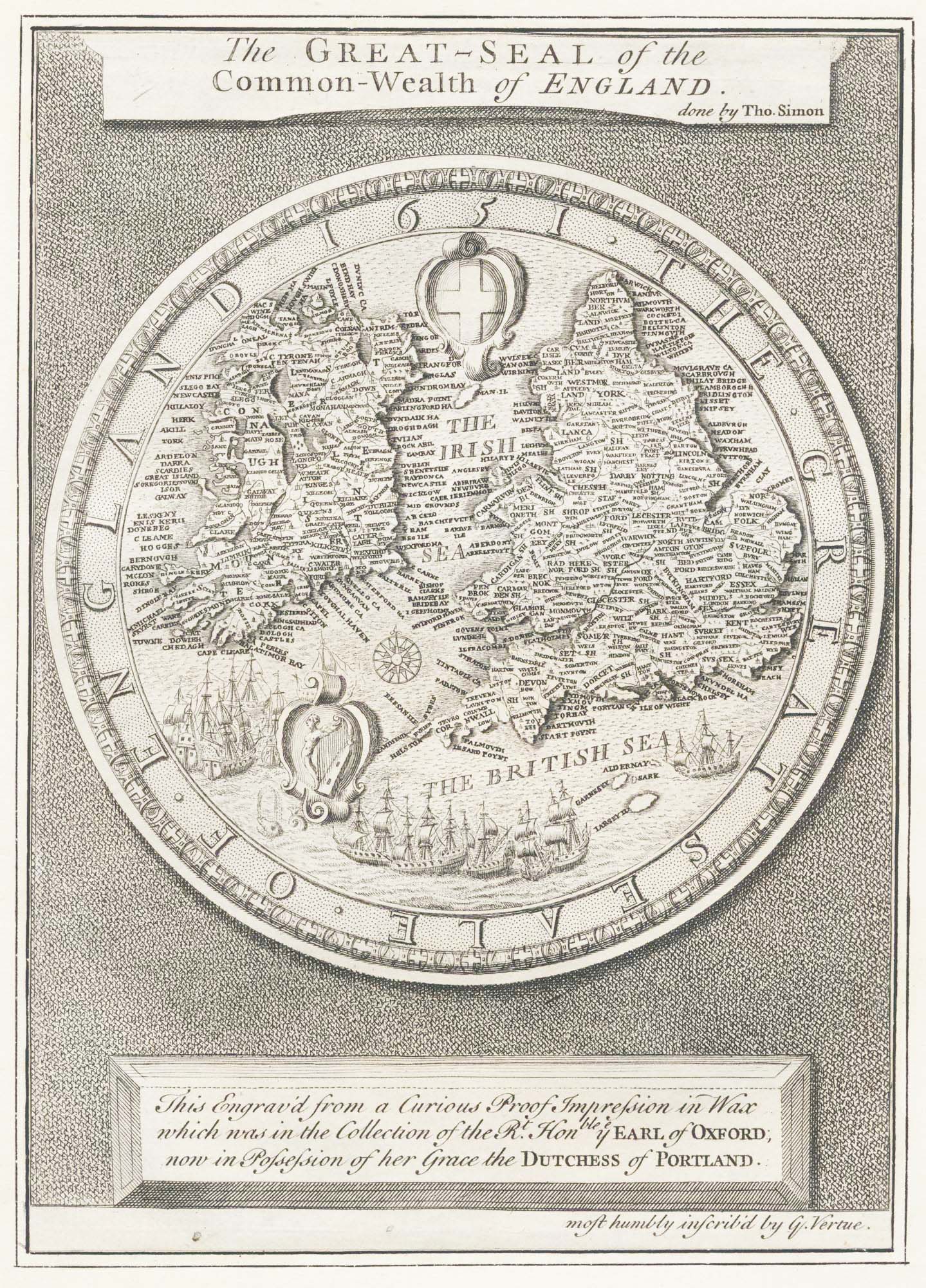
The Great Seal of the Commonwealth, 1651
SIMON, Thomas. Date: 1753 Stock #: 17363 £650.00
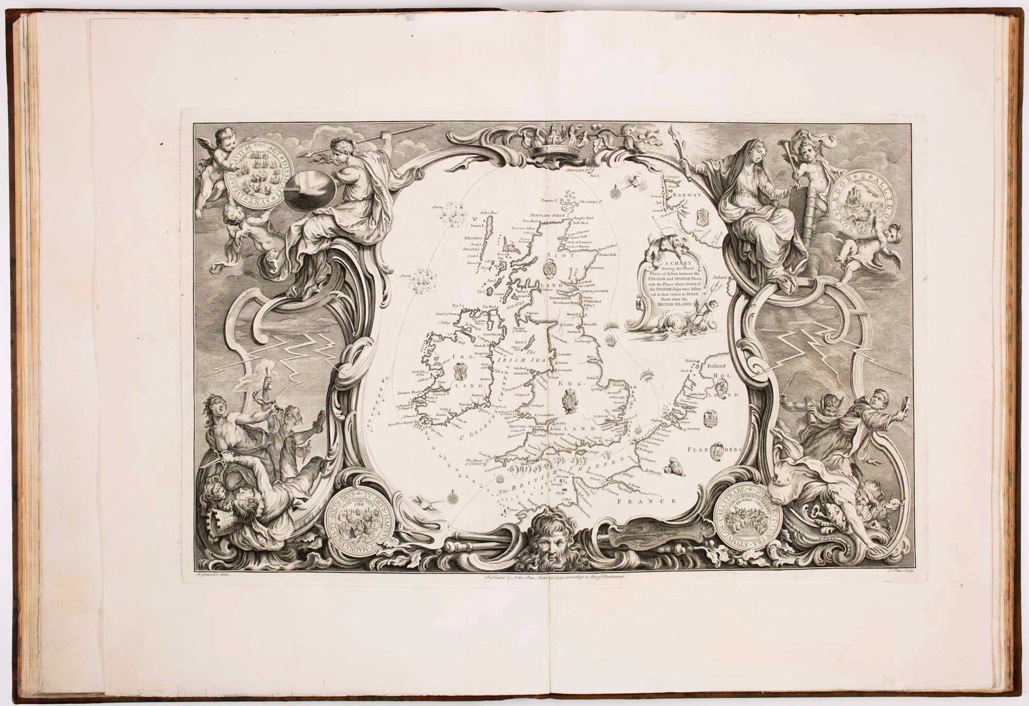
Mid-18th century wall map of the British Isles
DESNOS, Louis Charles. Date: 1766 Stock #: 16860 £2,500.00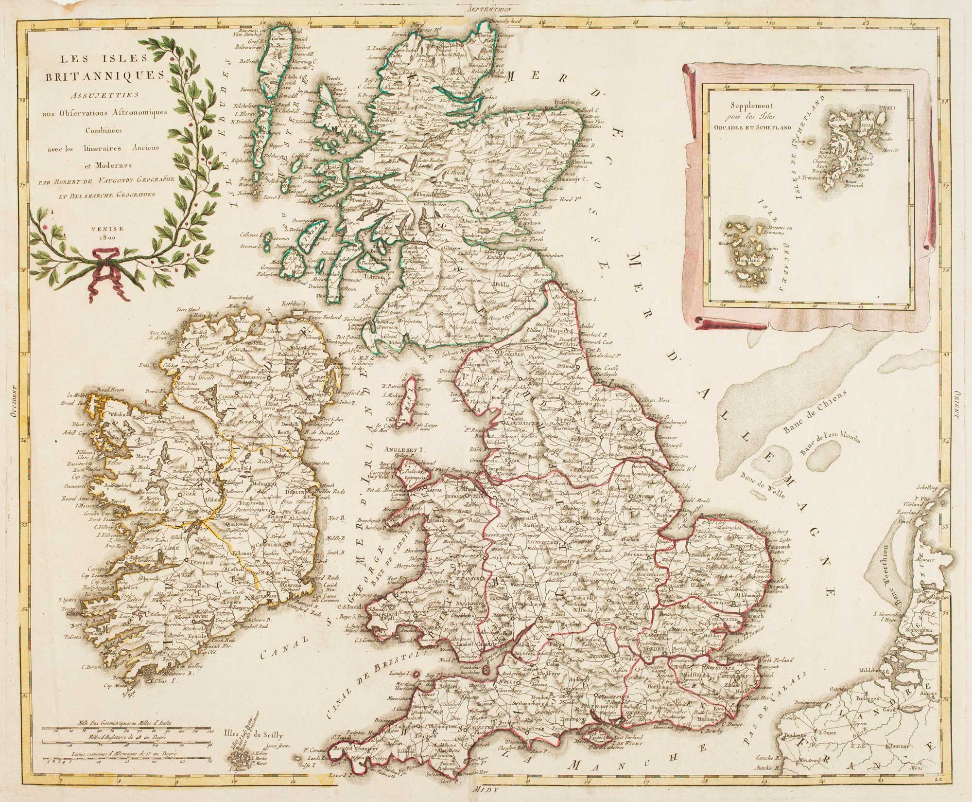
Uncommon Italian map of the British Isles
SOCIETA CALCOGRAFICA. Date: 1800 Stock #: 16616 £900.00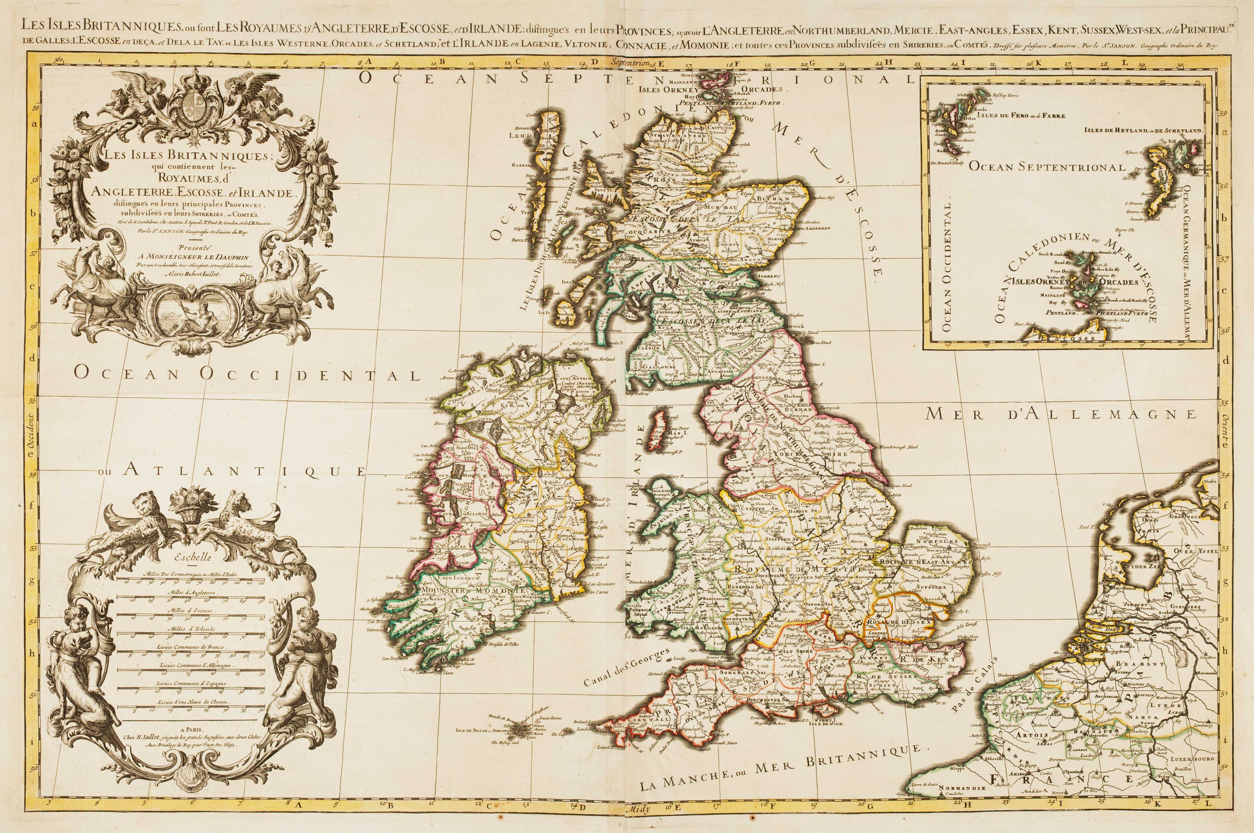
17th century map of the British Isles on two sheets
JAILLOT, Alexis-Hubert. Date: 1696 Stock #: 14463 £1,200.00