Antique Maps of America
Showing 91–120 of 243 products
Sort by:
[ti_wishlists_addtowishlist]
The scarce second Galle plate for America used in the 'Epitome'
ORTELIUS, Abraham. Date: 1598 Stock #: 23190 £470.00
[ti_wishlists_addtowishlist]
[ti_wishlists_addtowishlist]
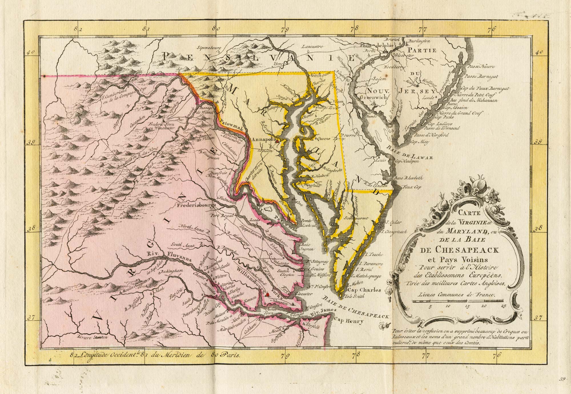
18th century map of Virginia & Maryland in original colours.
BELLIN, Jacques-Nicolas. Date: 1773 Stock #: 23224 £380.00
[ti_wishlists_addtowishlist]
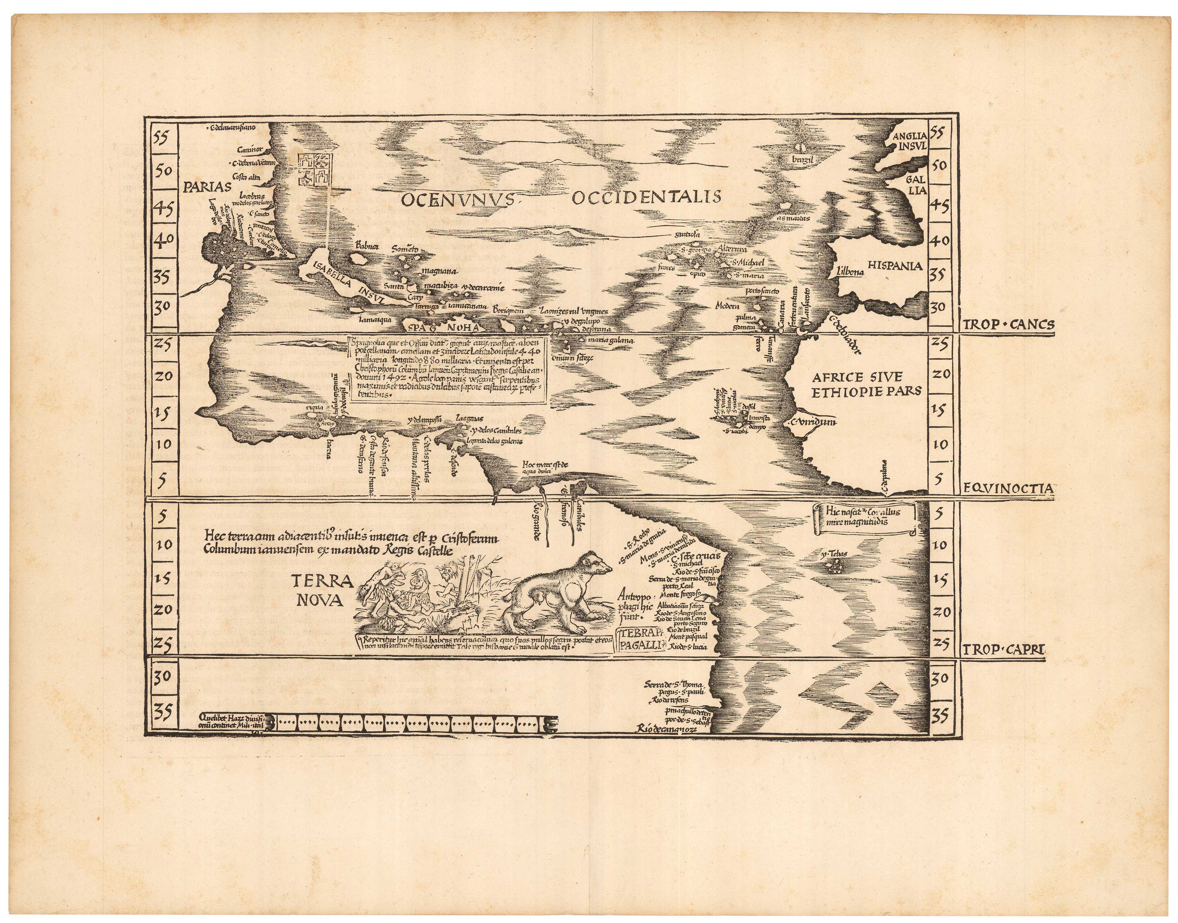
The Fries edition of Wäldseemüller's map of the Americas
WALDSEEMULLER, Martin. Date: 1541 Stock #: 23045 £8,500.00
[ti_wishlists_addtowishlist]
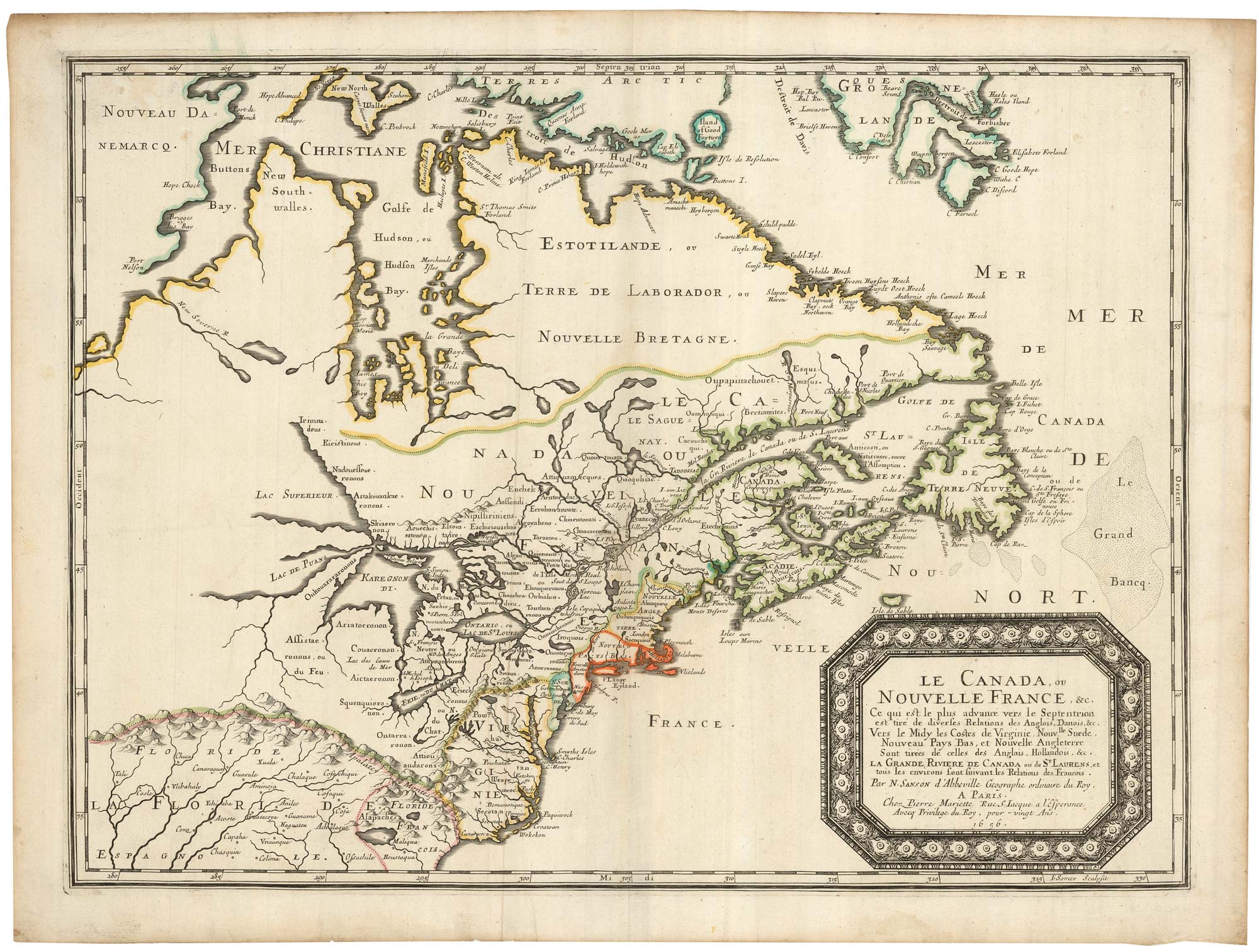
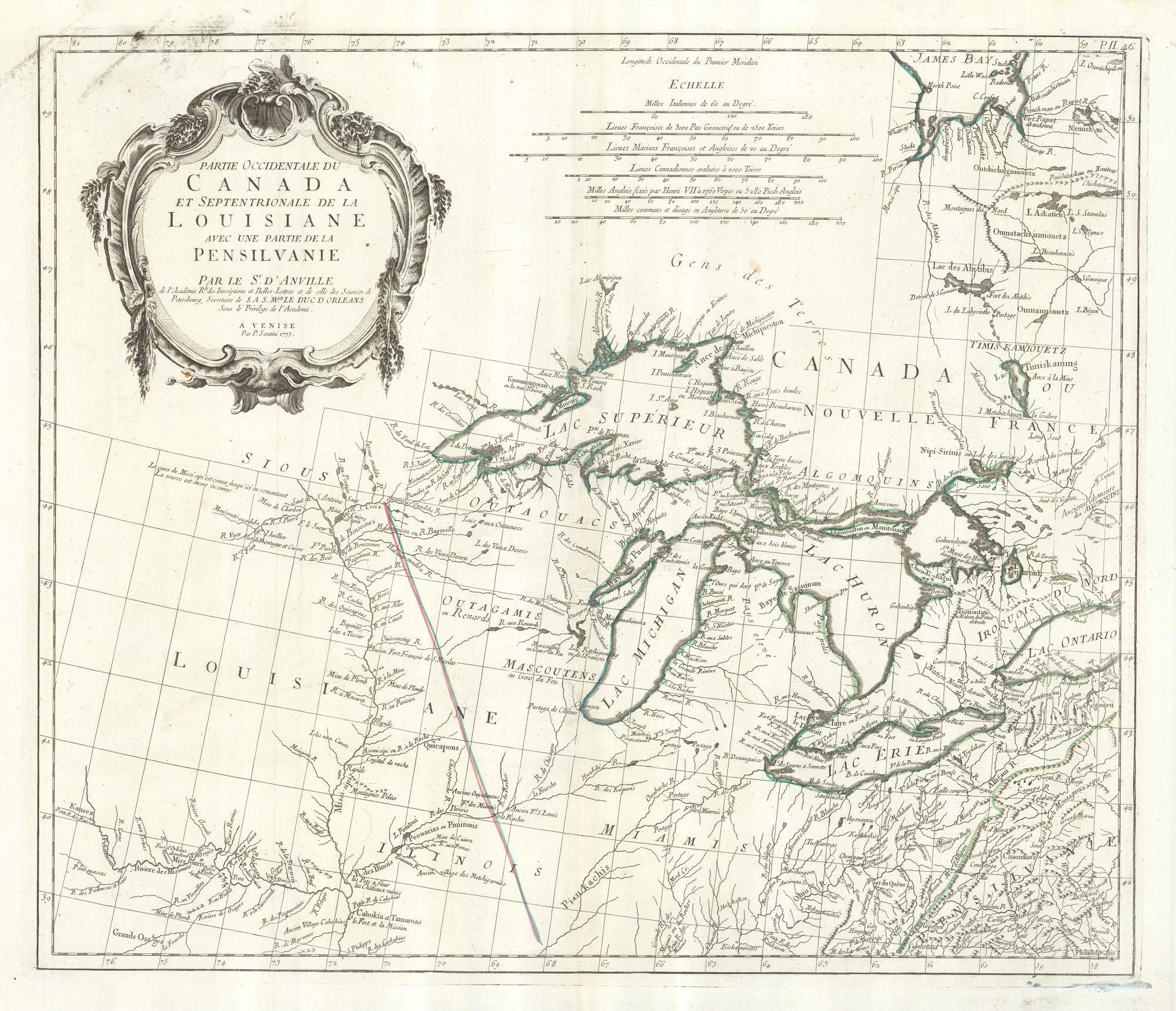
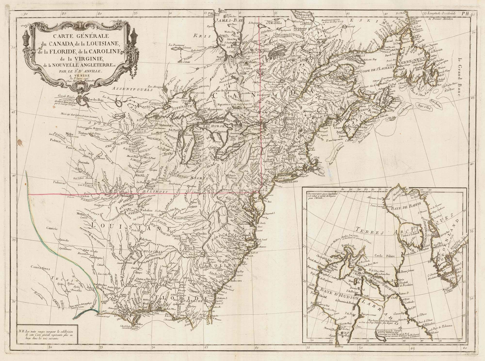
Sanson's map of Canada with an early depiction of the Great Lakes
SANSON, Nicolas. Date: 1662 Stock #: 23067 £4,750.00
[ti_wishlists_addtowishlist]
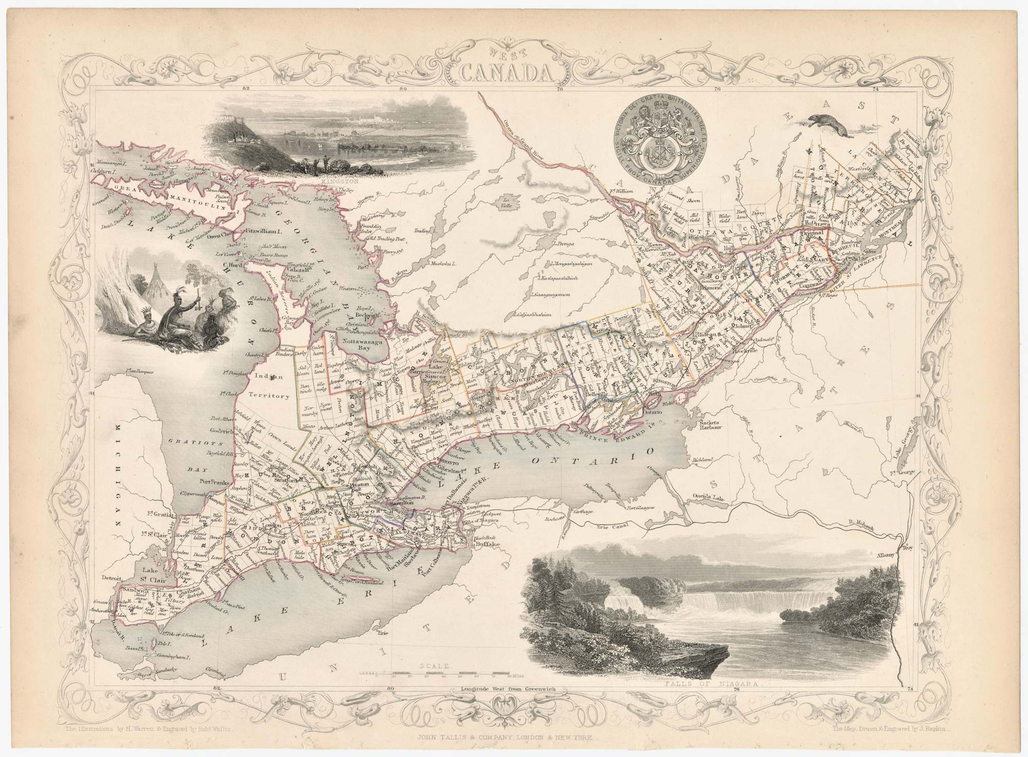
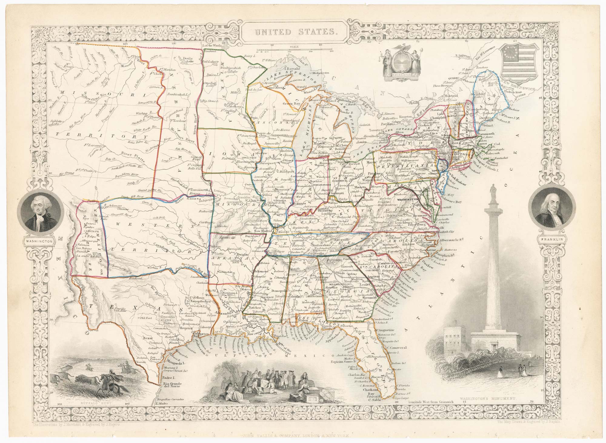
A mid 19th century map of West Canada with vignettes
TALLIS, John. Date: 1851 Stock #: 23498 £160.00
[ti_wishlists_addtowishlist]
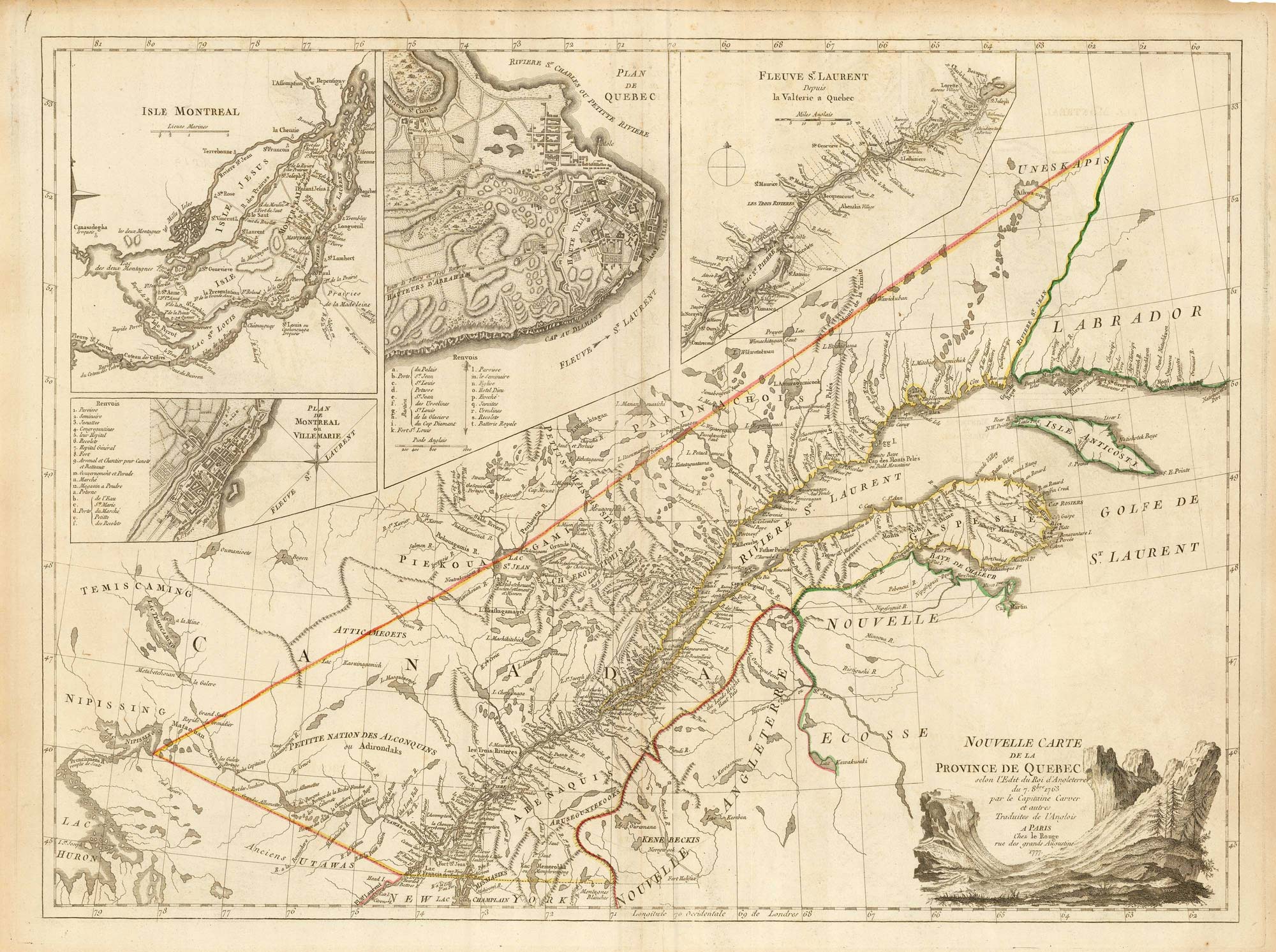
A French edition of an important map of the St Lawrence valley
CARVER, Jonathan. Date: 1777 Stock #: 23477 £1,600.00
[ti_wishlists_addtowishlist]
[ti_wishlists_addtowishlist]
[ti_wishlists_addtowishlist]
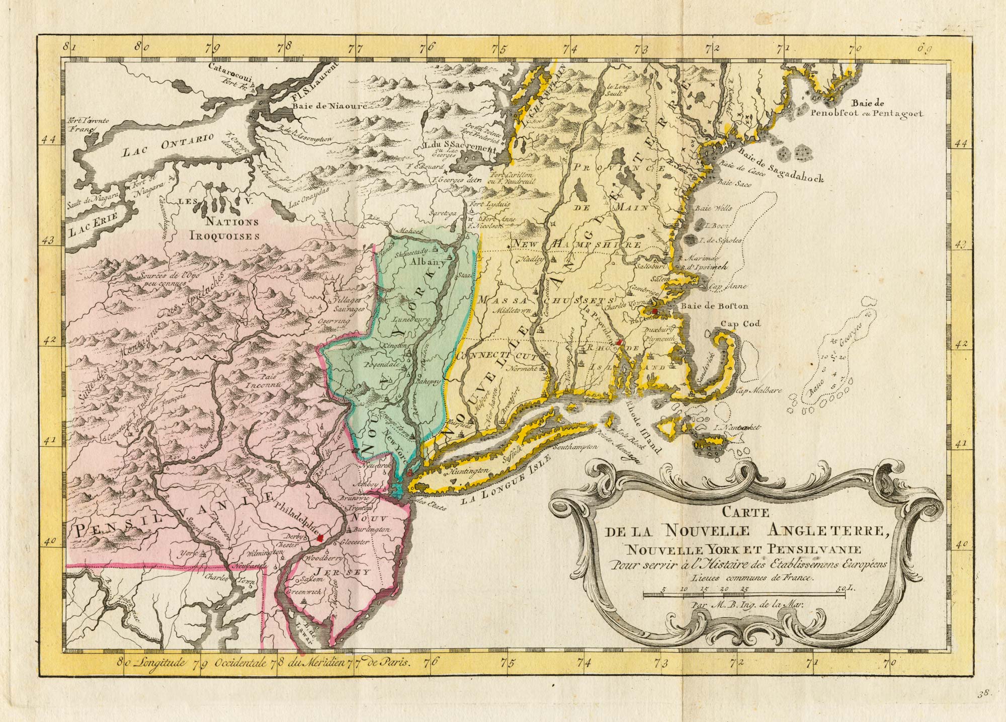
18th century map of New England and New York in original colours
BELLIN, Jacques-Nicolas. Date: 1773 Stock #: 23227 £380.00
[ti_wishlists_addtowishlist]
[ti_wishlists_addtowishlist]
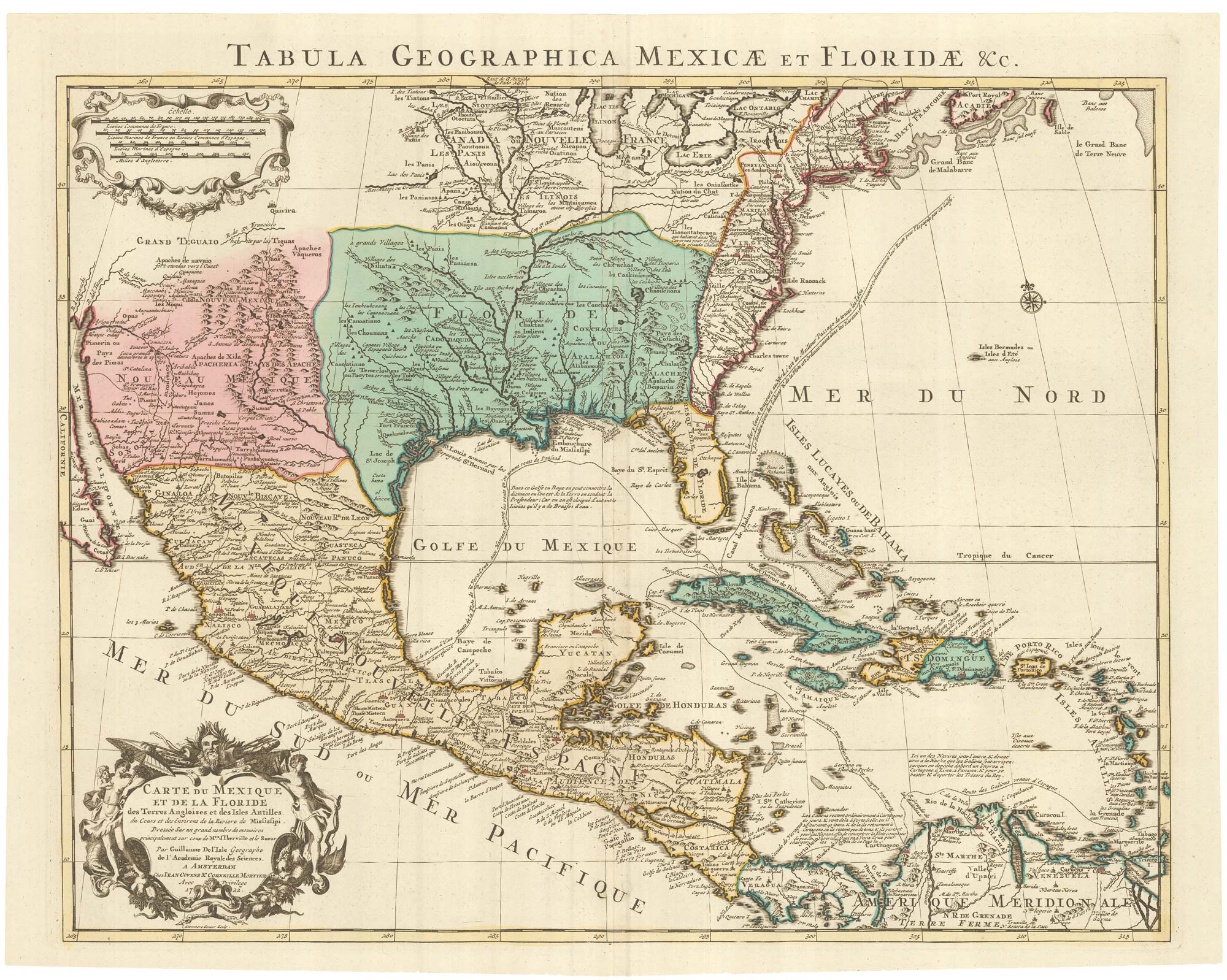
A Dutch edition of the first printed map to accurately plot the Mississippi River
DELISLE, Guillaume. Date: 1722 Stock #: 23463 £1,700.00
[ti_wishlists_addtowishlist]
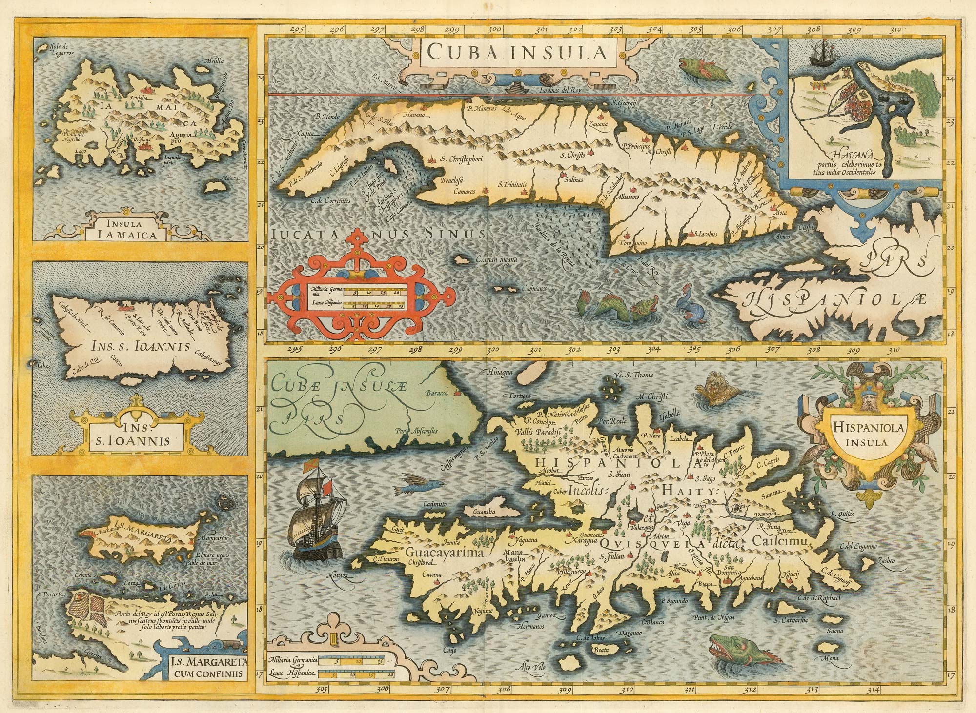
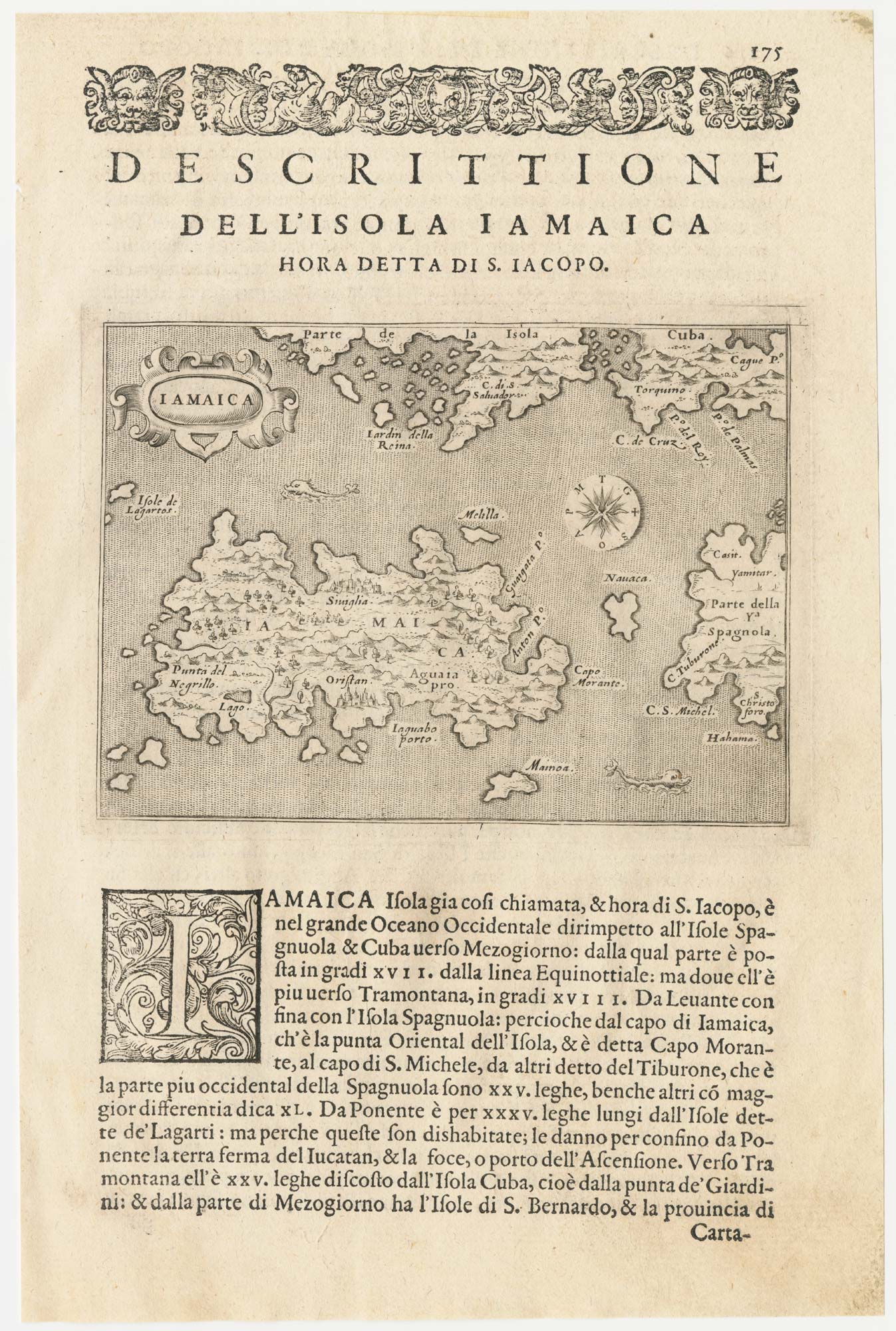
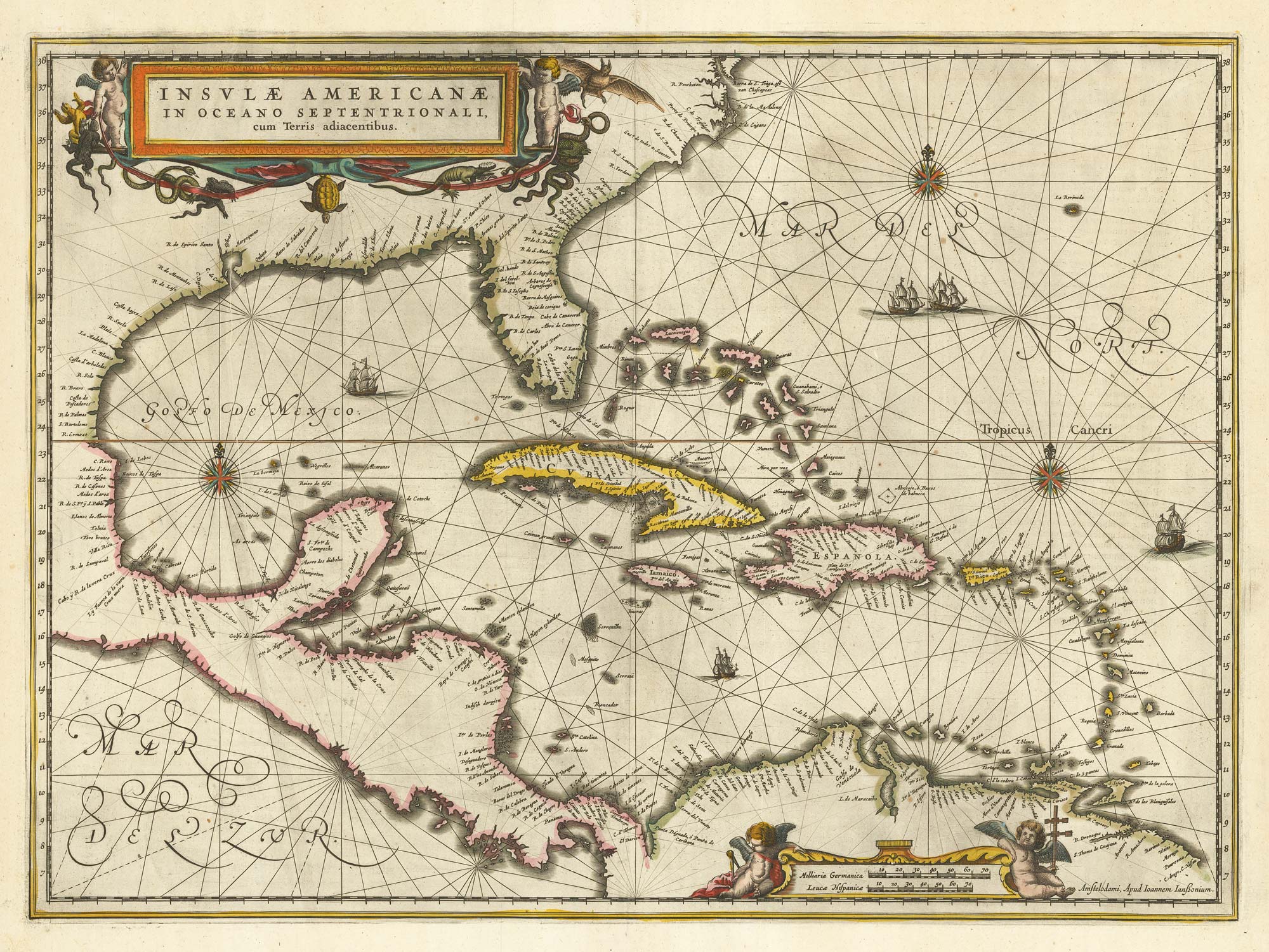
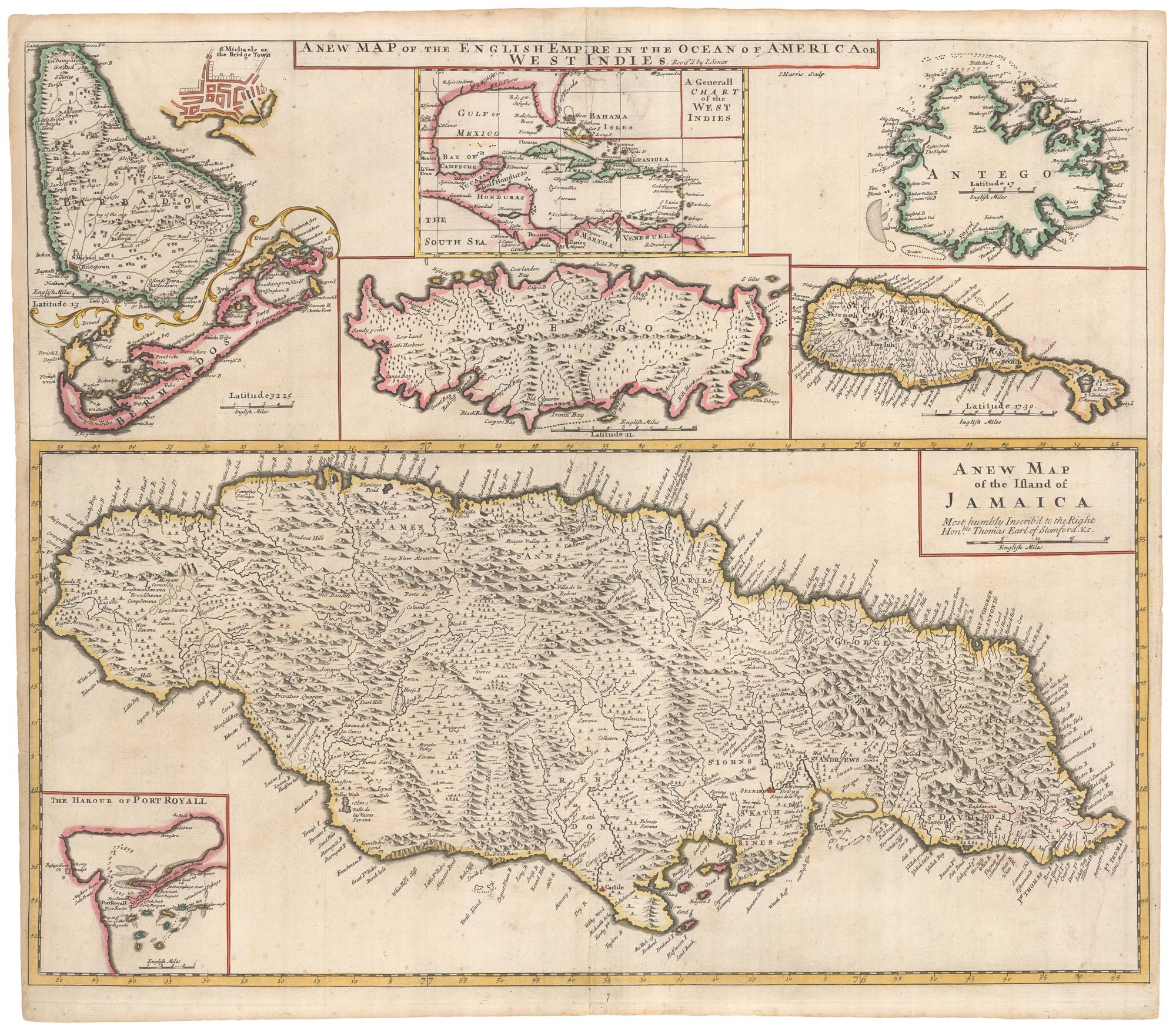
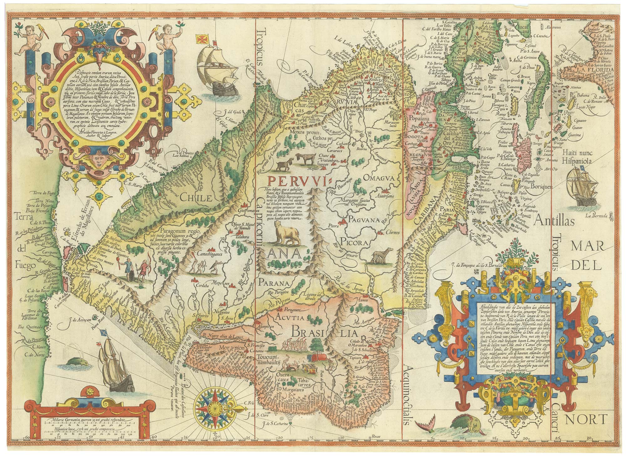
17th century old maps of the West Indian Islands
HONDIUS, Jodocus. Date: 1623 Stock #: 23456 £1,200.00
[ti_wishlists_addtowishlist]
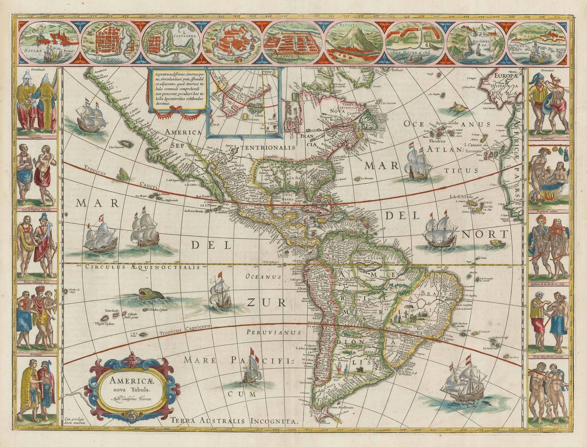
Blaeu's famous carte à figure map of America
BLAEU, Willem Janszoon. Date: 1650 Stock #: 22579 £5,000.00
[ti_wishlists_addtowishlist]
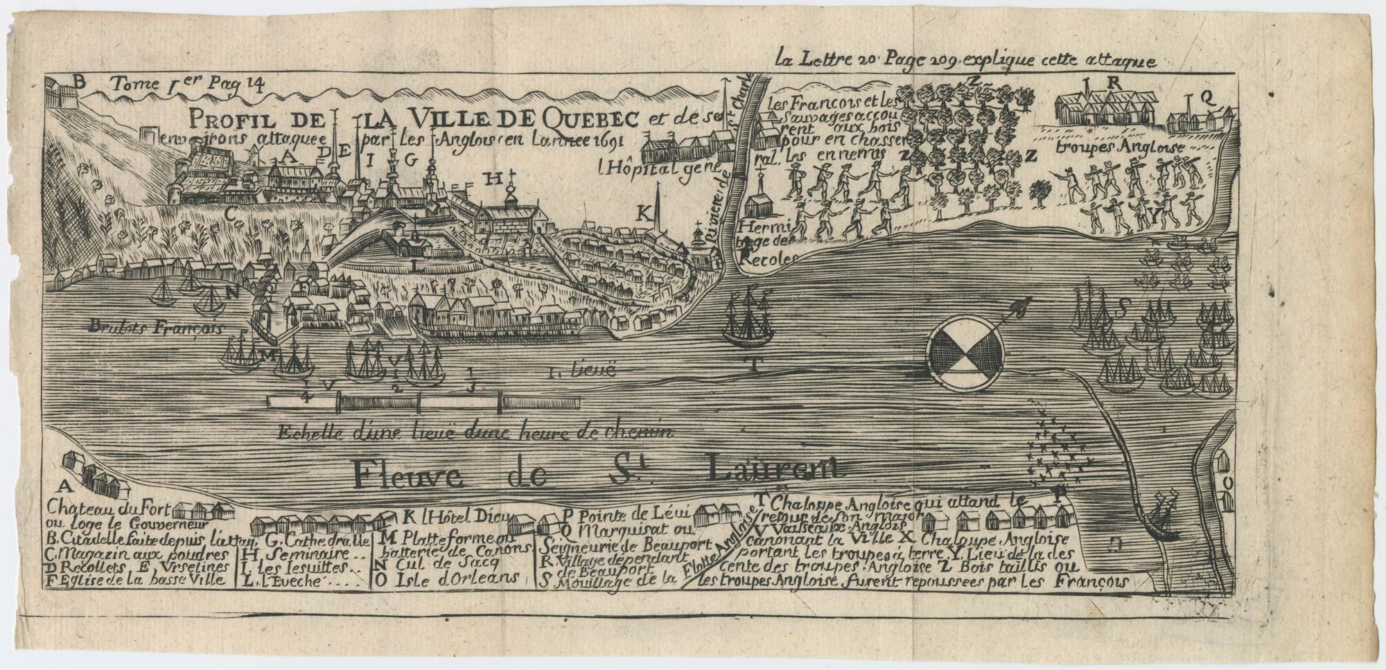
A plan of the British attack on Quebec in October 1690 by a defender
LAHONTAN, Louis-Armande de. Date: 1741 Stock #: 22562 £550.00
[ti_wishlists_addtowishlist]
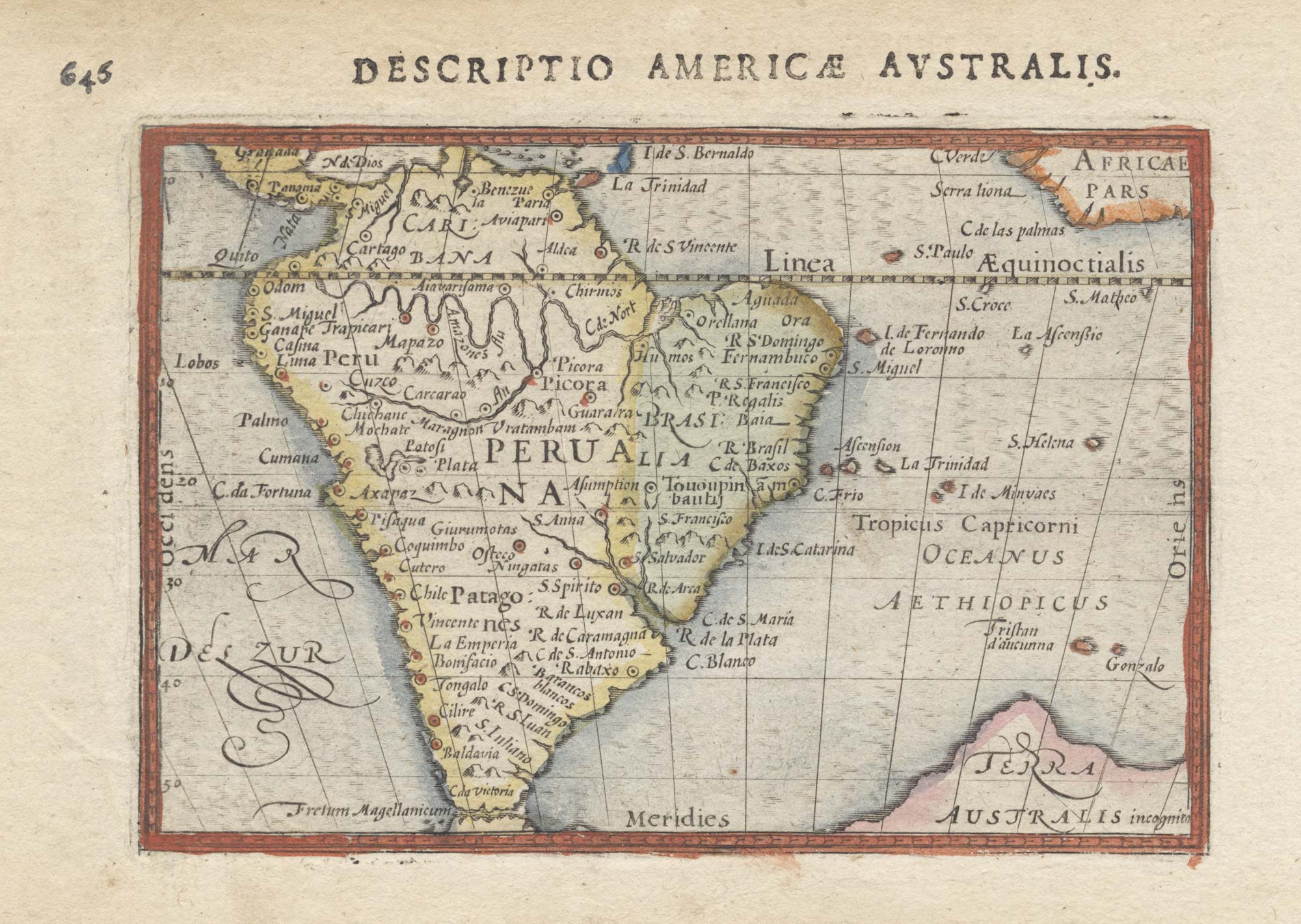
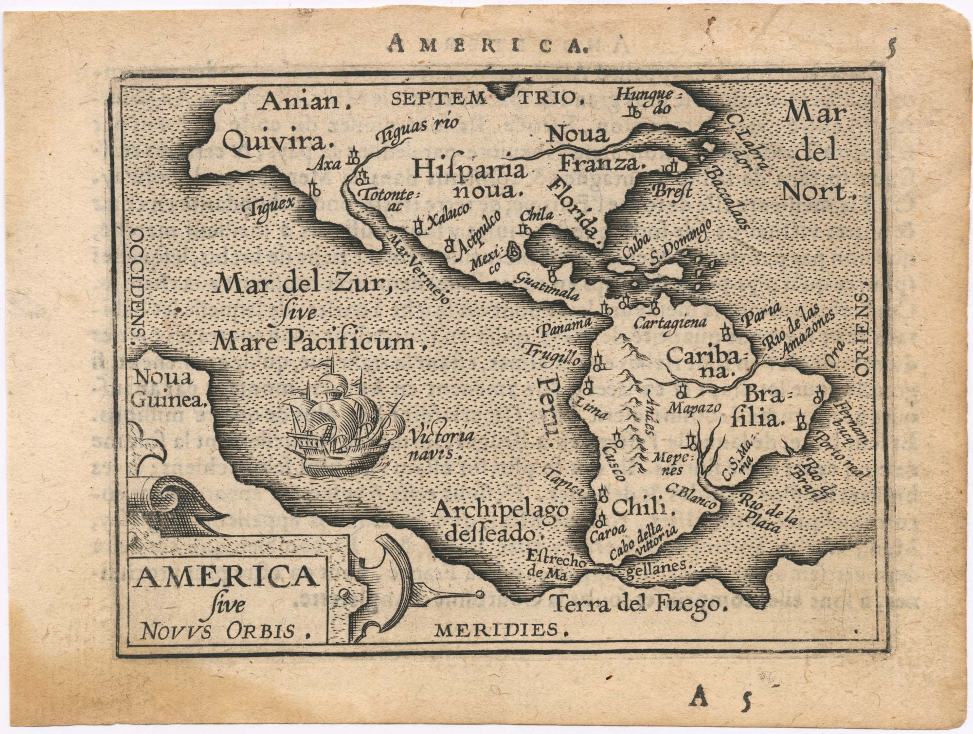
A 16th century miniature map of South America in original colour.
LANGENES, Barent. Date: 1603 Stock #: 22563 £450.00
[ti_wishlists_addtowishlist]
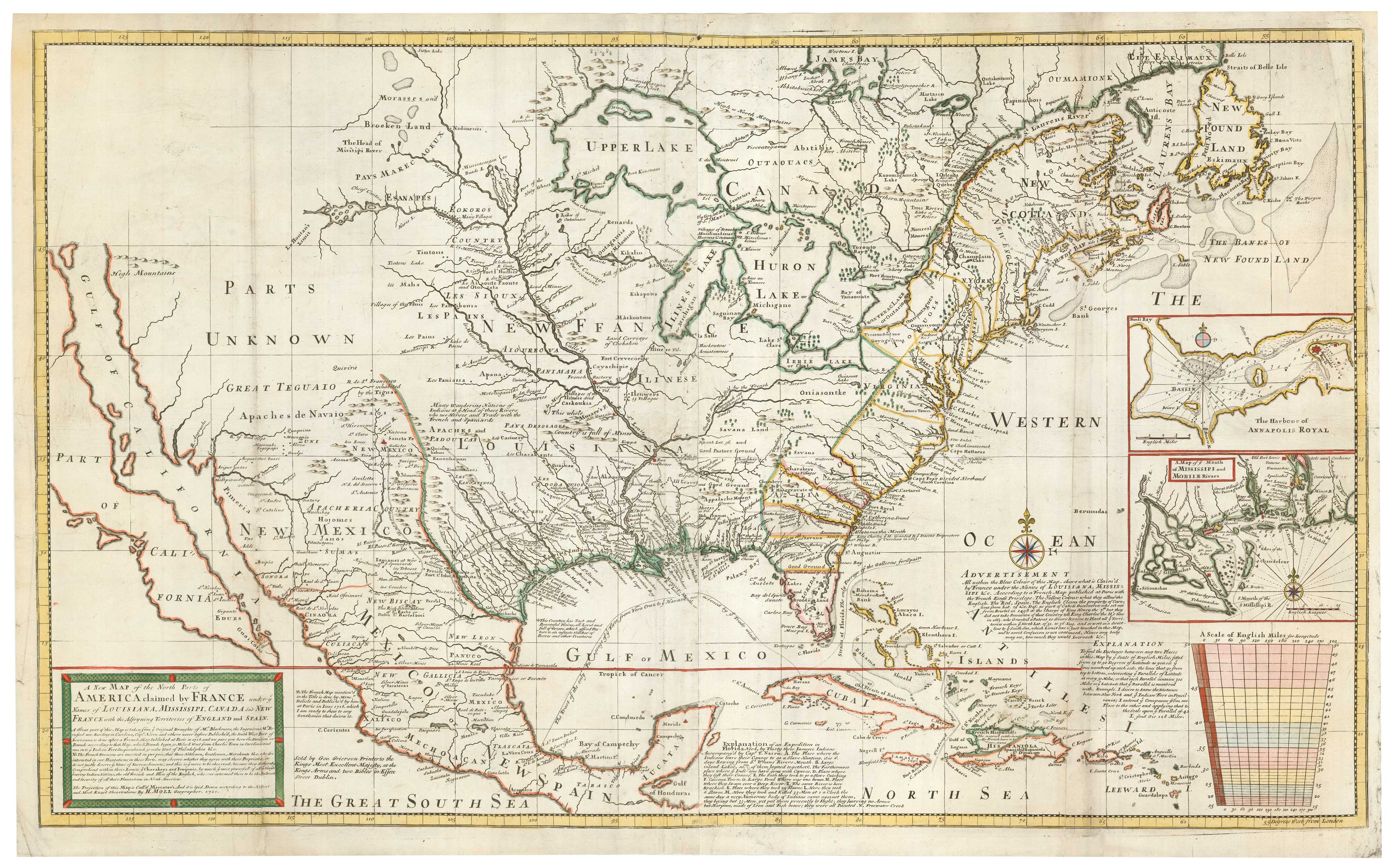
Grierson's version of Moll's two-sheet map of the French claims in North America
MOLL, Herman. Date: 1735 Stock #: 22697 £8,000.00
[ti_wishlists_addtowishlist]
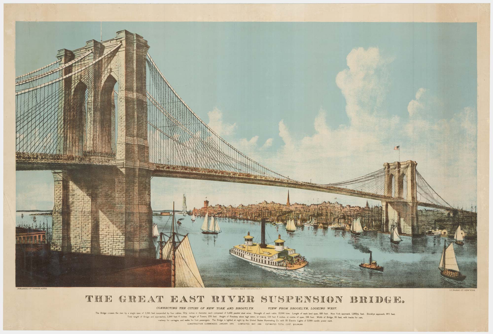
A large view of the newly-completed Brooklyn Bridge
CURRIER & IVES. Date: 1886 Stock #: 22791 £5,000.00
[ti_wishlists_addtowishlist]
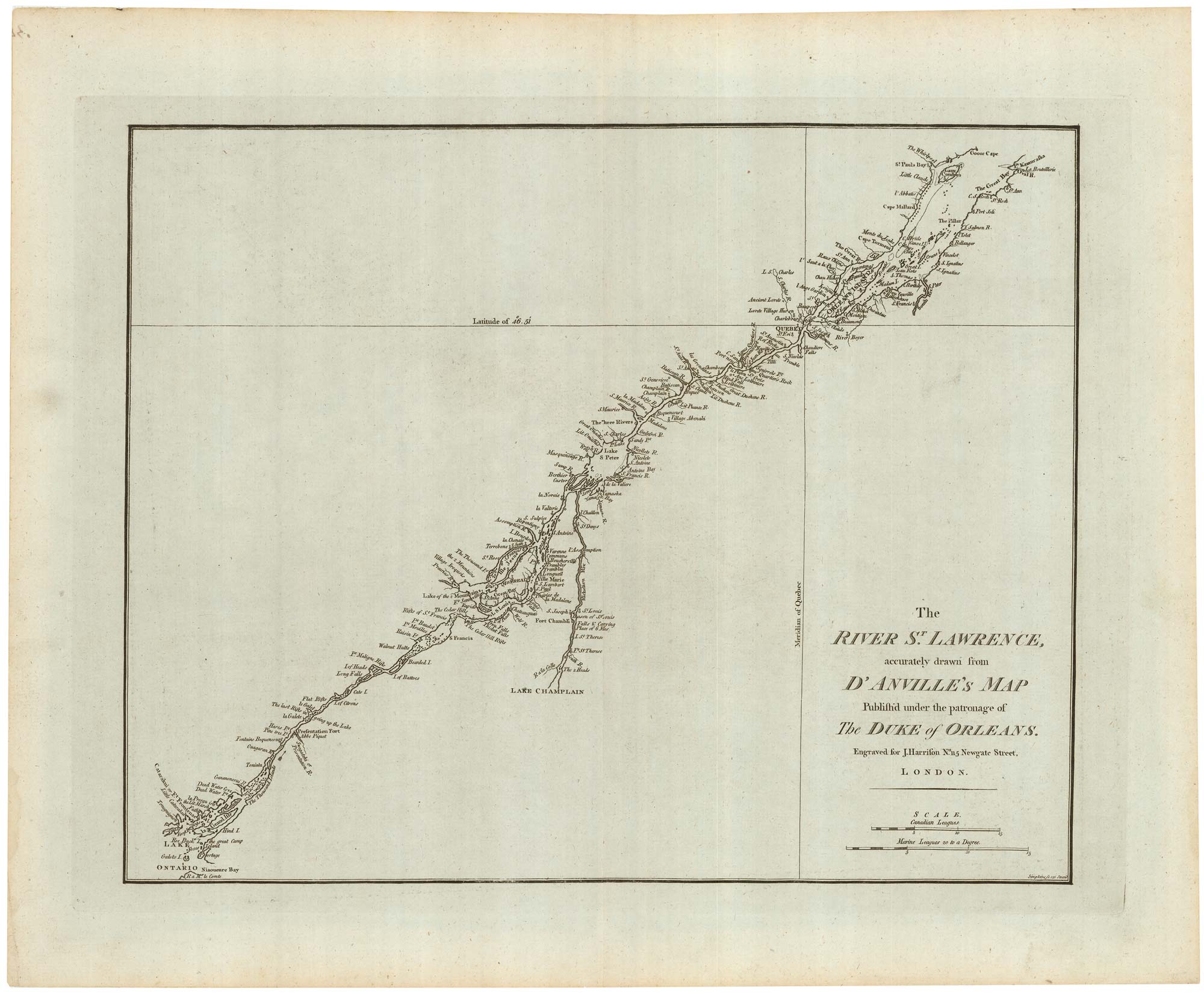
A detailed 18th century plan of the St Lawrence River
HARRISON, John. Date: 1784 Stock #: 22812 £420.00
[ti_wishlists_addtowishlist]
[ti_wishlists_addtowishlist]
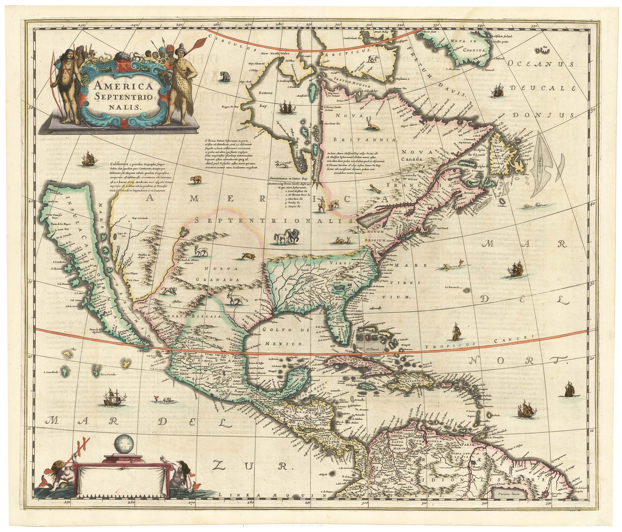
The first issue of an important map of North America
HONDIUS, Henricus. Date: 1636 Stock #: 22862 £6,500.00
[ti_wishlists_addtowishlist]
Classic early 17th century Dutch map of South America in fine colour
HONDIUS, Jodocus. Date: 1633 Stock #: 22863 £1,400.00
[ti_wishlists_addtowishlist]

[ti_wishlists_addtowishlist]
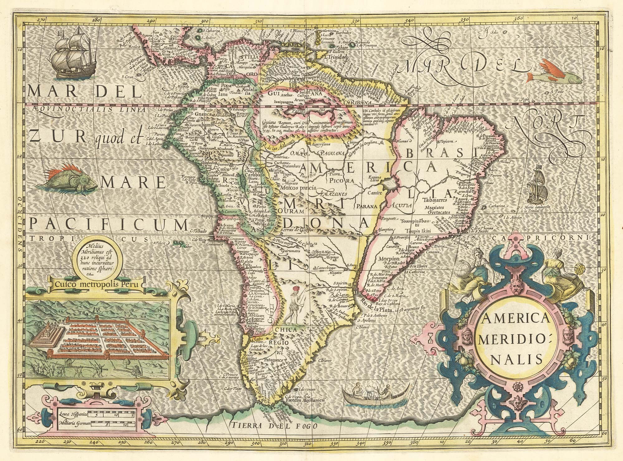
A classic 16th century map of South America
LINSCHOTEN, Jan Huygen van. Date: 1596 Stock #: 22752 £8,000.00
[ti_wishlists_addtowishlist]
[ti_wishlists_addtowishlist]
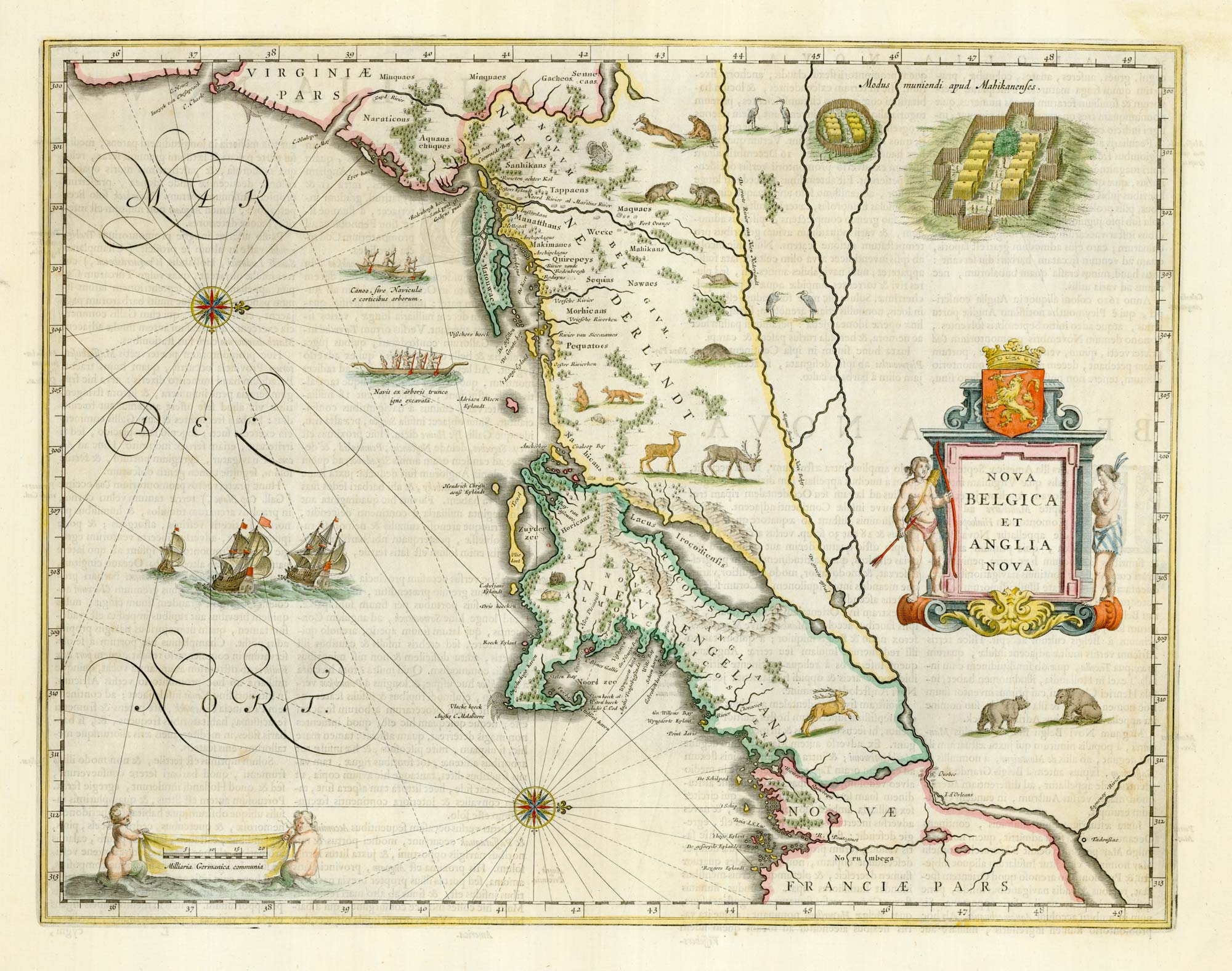
Classic C17th map of New England and New Netherlands
BLAEU, Willem Janszoon. Date: 1662 Stock #: 22719 £4,250.00
[ti_wishlists_addtowishlist]
[ti_wishlists_addtowishlist]
[ti_wishlists_addtowishlist]

A map of North America during the Mississippi Bubble
CHATELAIN, Henri Abraham. Date: 1747 Stock #: 22751 £2,400.00
[ti_wishlists_addtowishlist]