Antique Maps by WALDSEEMULLER, Martin.
Showing 1–8 of 8 products
Sort by:
[ti_wishlists_addtowishlist]
[ti_wishlists_addtowishlist]
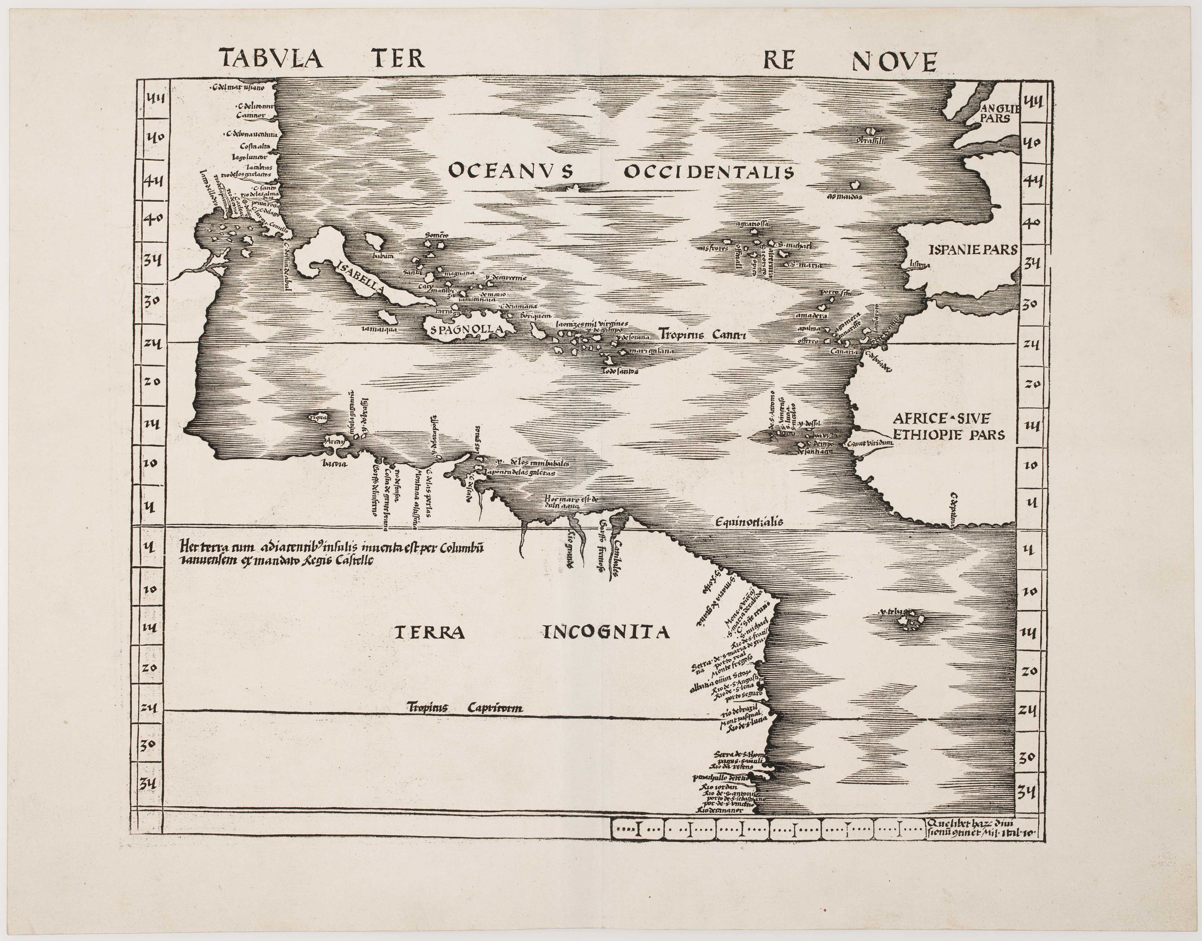
One of the earliest maps to depict America
WALDSEEMULLER, Martin. Date: 1513 Stock #: 24130 £42,500.00
[ti_wishlists_addtowishlist]

A 16th century 'modern' map of the Holy Land.
WALDSEEMULLER, Martin. Date: 1541 Stock #: 25261 £1,400.00
[ti_wishlists_addtowishlist]
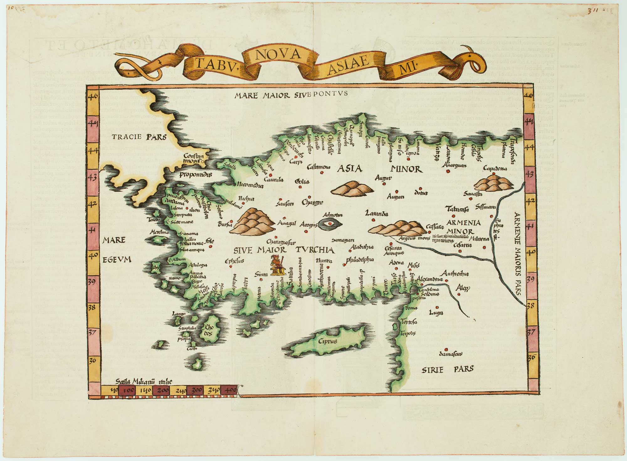
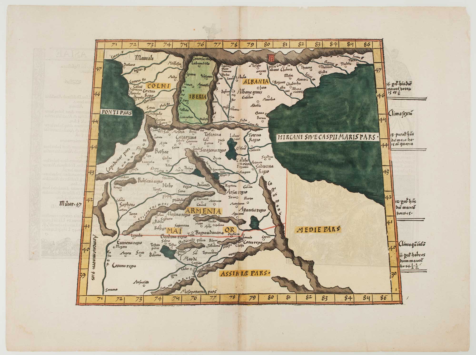
The 16th century Wäldseemüller/Fries map of 'Modern' Turkey
WALDSEEMULLER, Martin. Date: 1535 Stock #: 16996 £950.00
[ti_wishlists_addtowishlist]
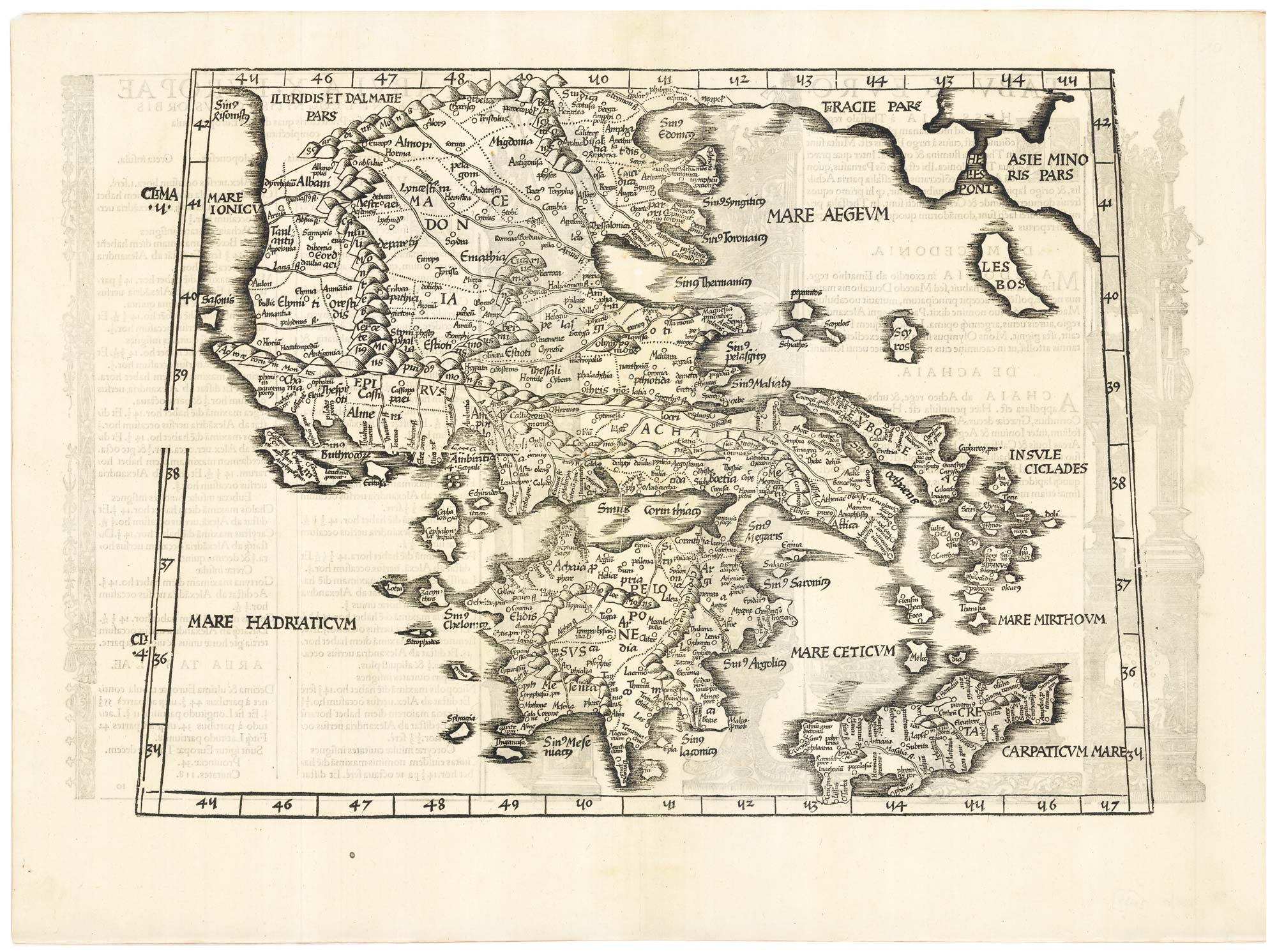
The Wäldseemüller/Fries Ptolemaic map of Greece
WALDSEEMULLER, Martin. Date: 1535 Stock #: 21935 £850.00
[ti_wishlists_addtowishlist]
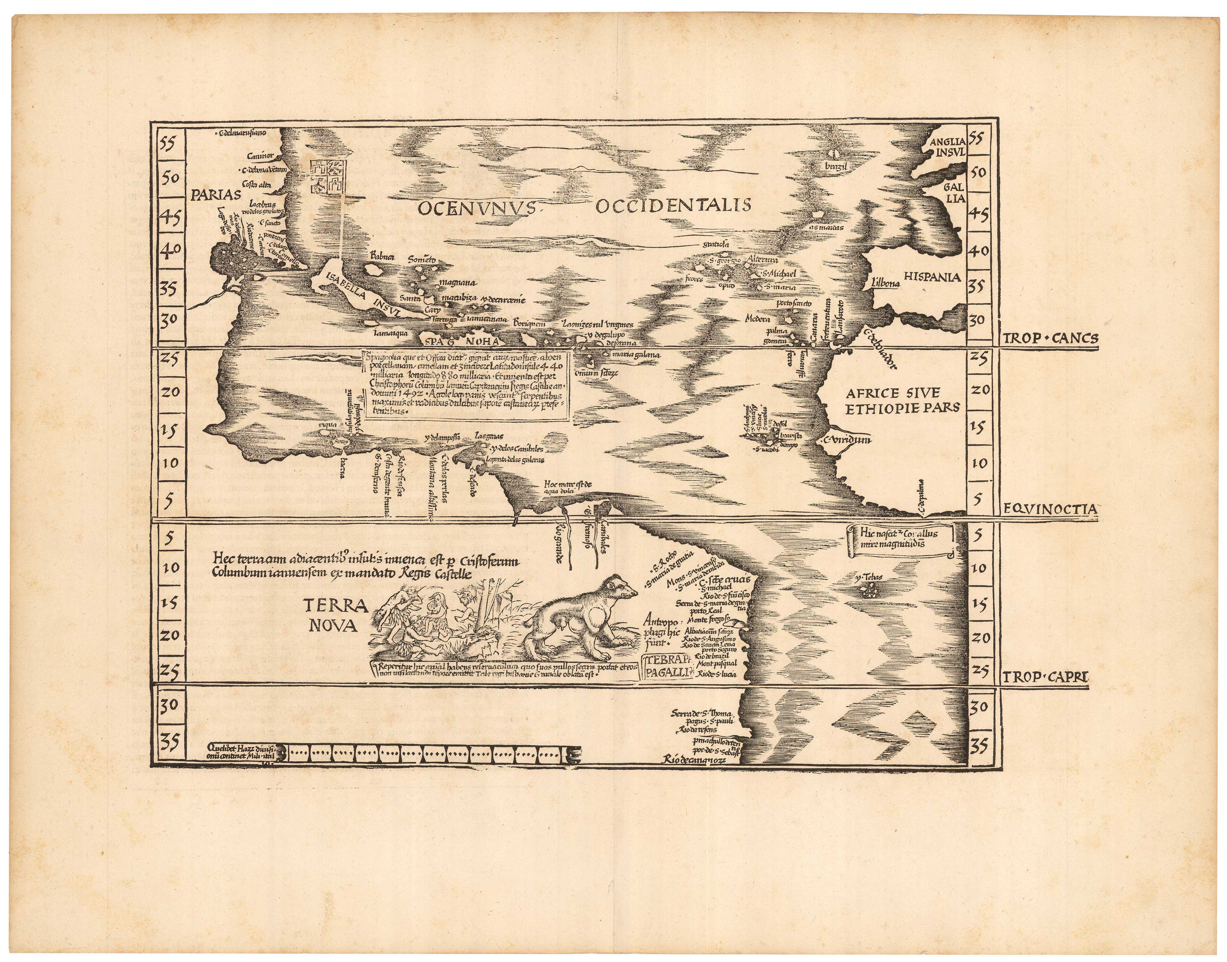
The Fries edition of Wäldseemüller's map of the Americas
WALDSEEMULLER, Martin. Date: 1541 Stock #: 23045 £8,500.00
[ti_wishlists_addtowishlist]
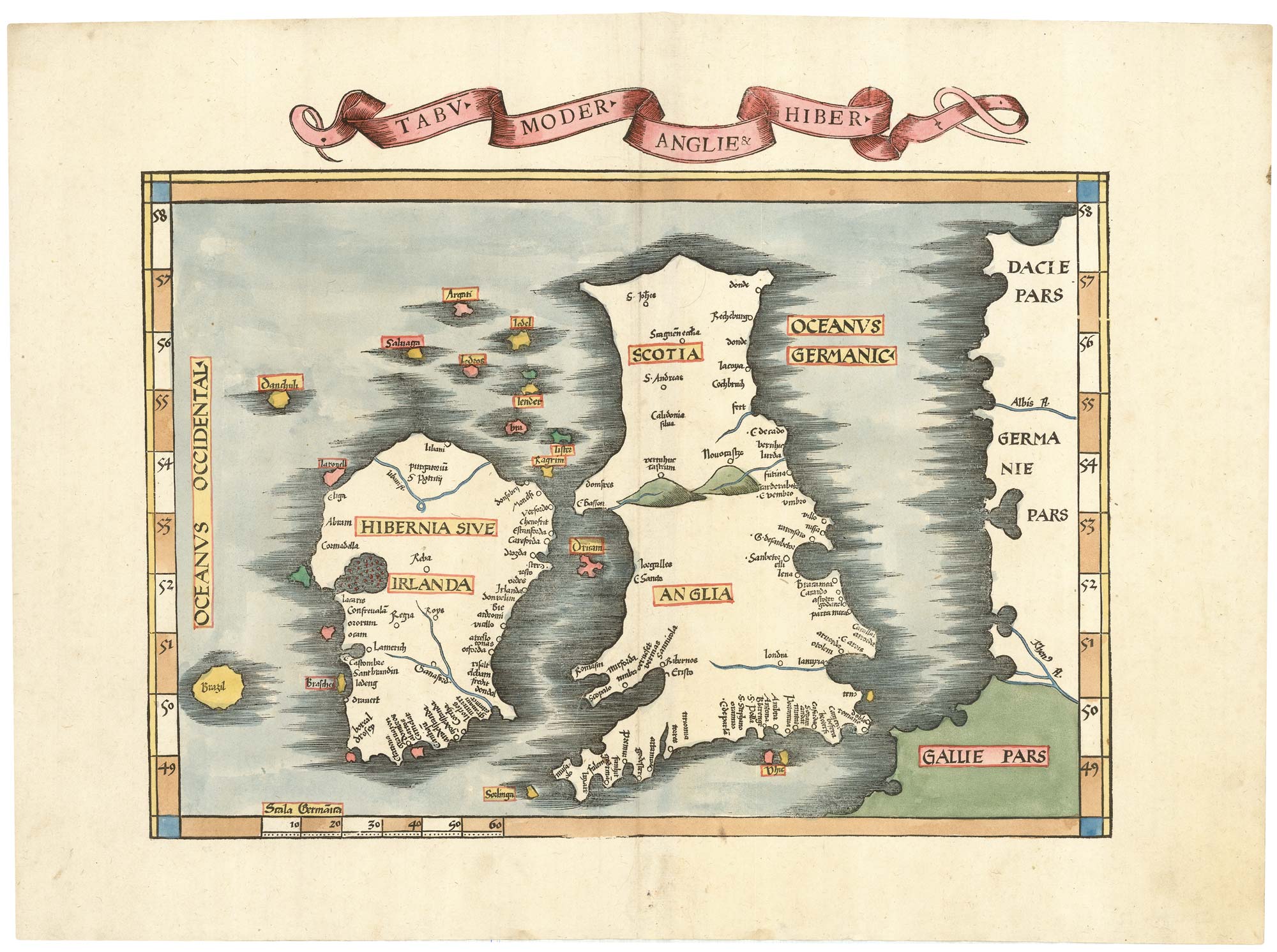
Waldseemuller's 'modern' map of the British Isles
WALDSEEMULLER, Martin. Date: 1535 Stock #: 22846 £2,250.00
[ti_wishlists_addtowishlist]