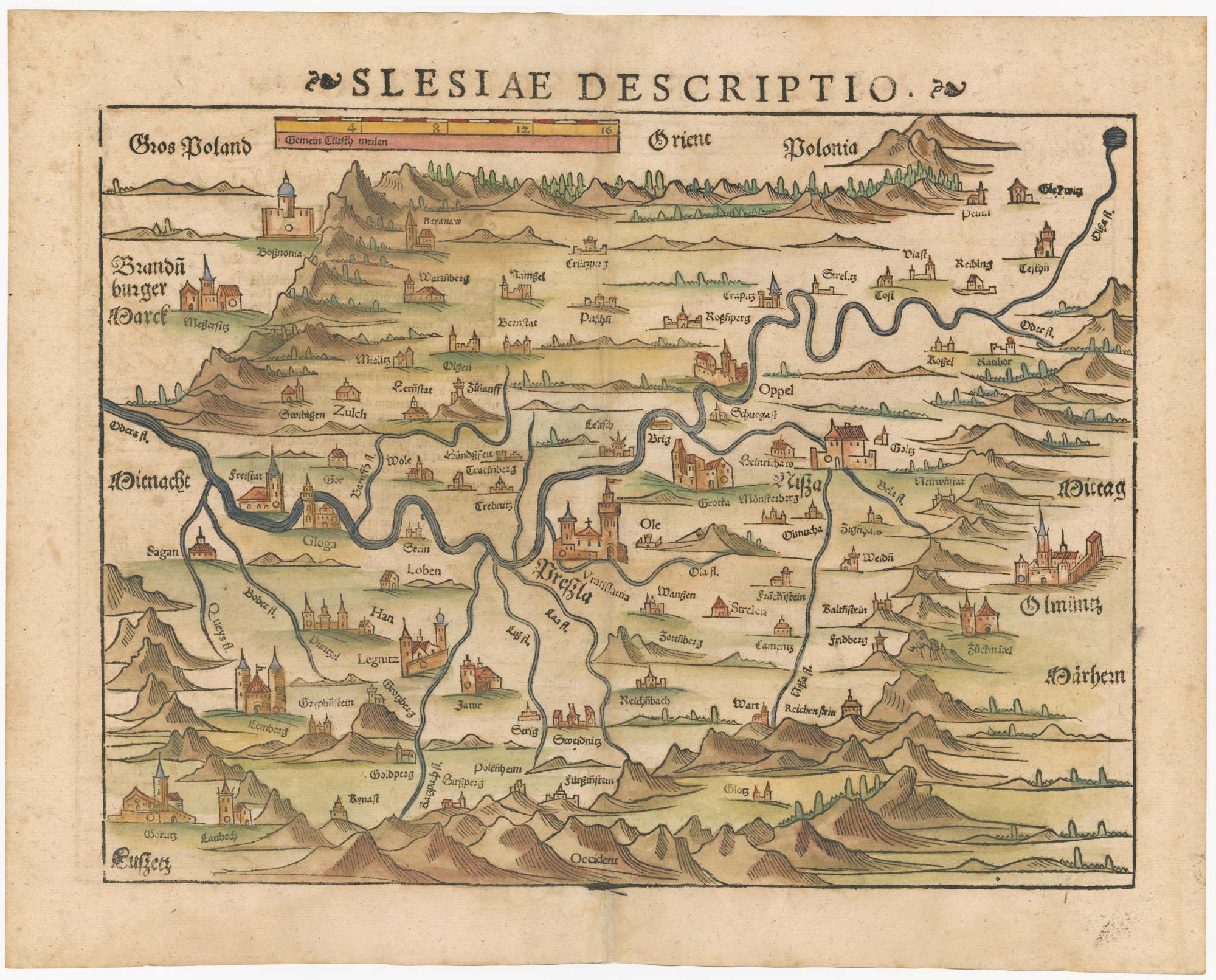


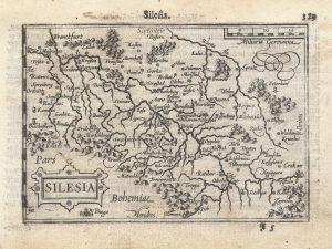
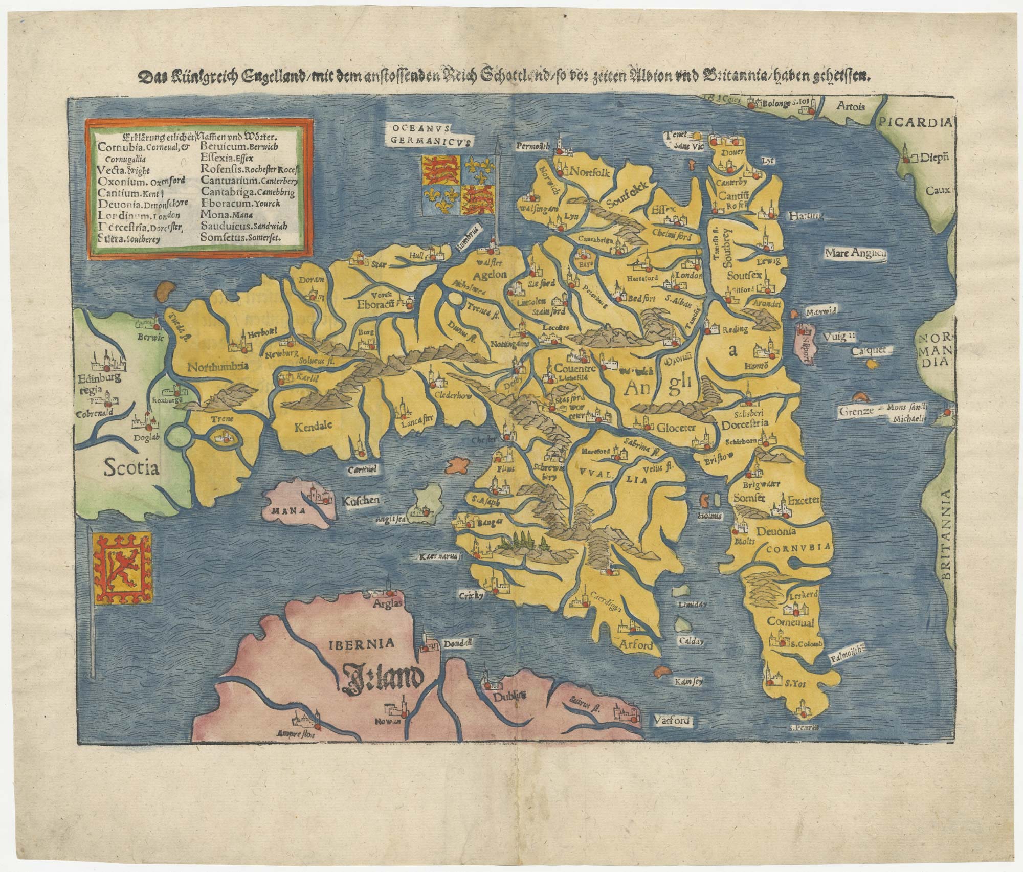
16th century woodblock map of Silesia
Slesiae Descriptio.
Basle, 1572, Latin text edition. Coloured woodcut, printed area 270 x 345mm.
£300.00
Description
Munster's early map of Silesia, centred on Wroclaw but orientated with north to the left, published in his 'Cosmographia'.
Condition:
A good example.Related products
-
A map of the Partition of Poland
VALLARDI, Antonio. Date: 1863Stock #: 20570 £700.00 -
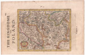
A 16th century miniature map of Oswiecim & Zator
LANGENES, Barent. Date: 1599Stock #: 21317 £110.00 -

A pirated edition of the Ortelius Epitome map of Poland
ORTELIUS, Abraham. Date: 1655Stock #: 21727 £180.00 -
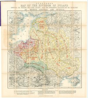
A map showing territorial losses suffered by Poland
STANFORD, Edward. Date: 1863Stock #: 18823 £675.00 -
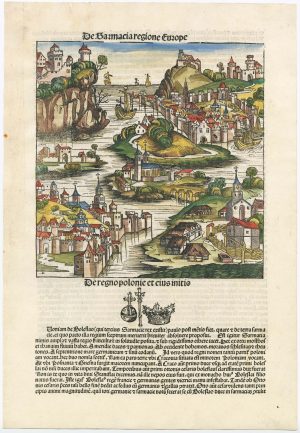
An incunable ‘view’ of Poland
SCHEDEL, D. Hartmann. Date: 1493Stock #: 23232 £650.00 -
18th century map of Poland & Lithuania
SEUTTER, Matthaus. Date: 1740Stock #: 24690 £250.00 -
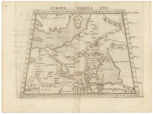
A 16th century map of eastern Europe according to Ptolemy
RUSCELLI, Girolamo. Date: 1599Stock #: 22245 £220.00 -
A 16th century miniature map of Silesia
LANGENES, Barent. Date: 1599Stock #: 21325 £160.00 -
Poland from the first English Edition of the ‘Atlas Minor’
HONDIUS, Jodocus. Date: 1635Stock #: 22441 £180.00
Items by the same author
[ti_wishlists_addtowishlist]
[ti_wishlists_addtowishlist]
[ti_wishlists_addtowishlist]
[ti_wishlists_addtowishlist]