Antique Maps of Western Europe
Showing 121–150 of 210 products
Sort by:
[ti_wishlists_addtowishlist]
[ti_wishlists_addtowishlist]
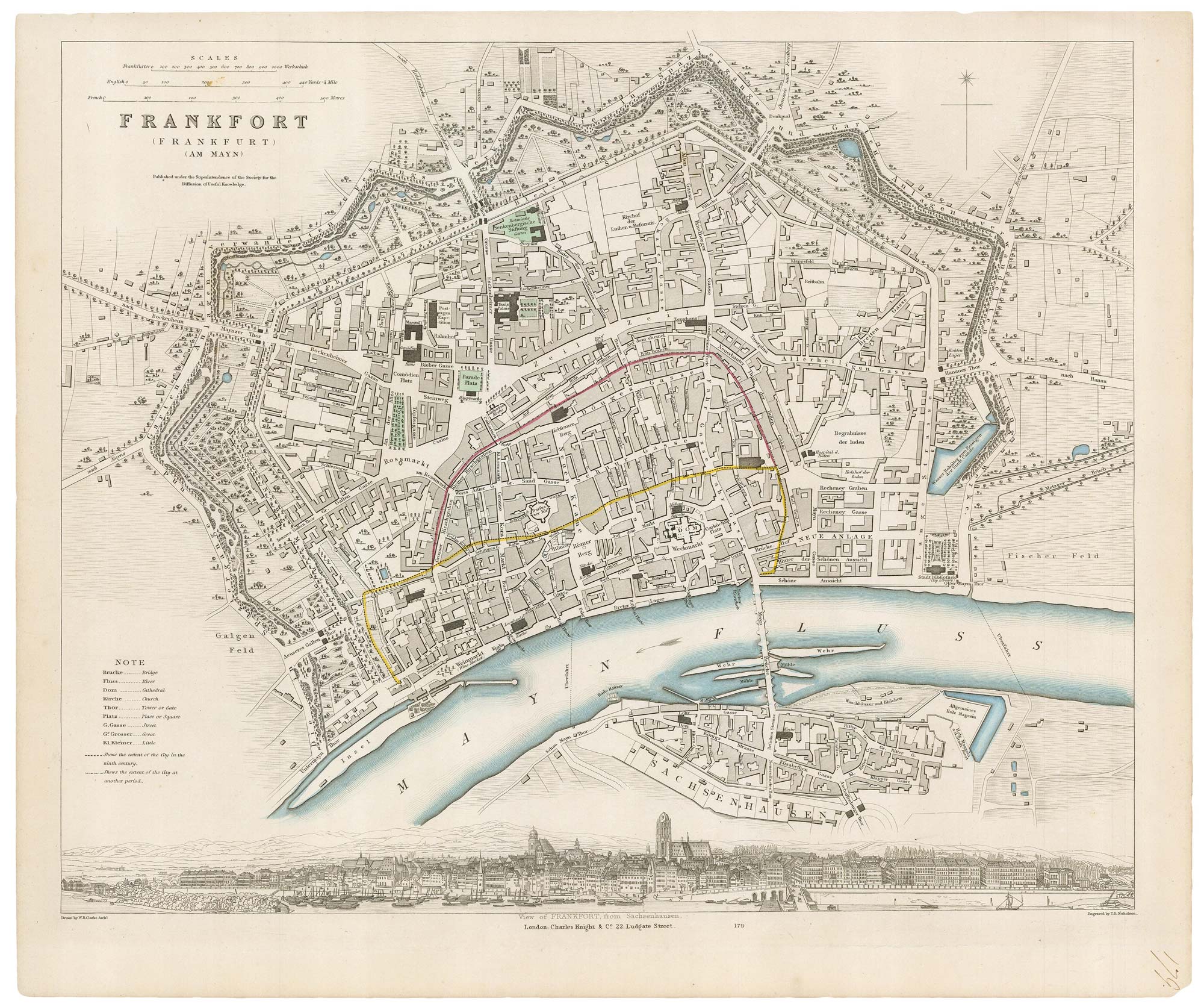
19th century plan of Frankfurt
Society for the Diffusion of Useful Knowledge. Date: 1835 Stock #: 20916 £100.00
[ti_wishlists_addtowishlist]
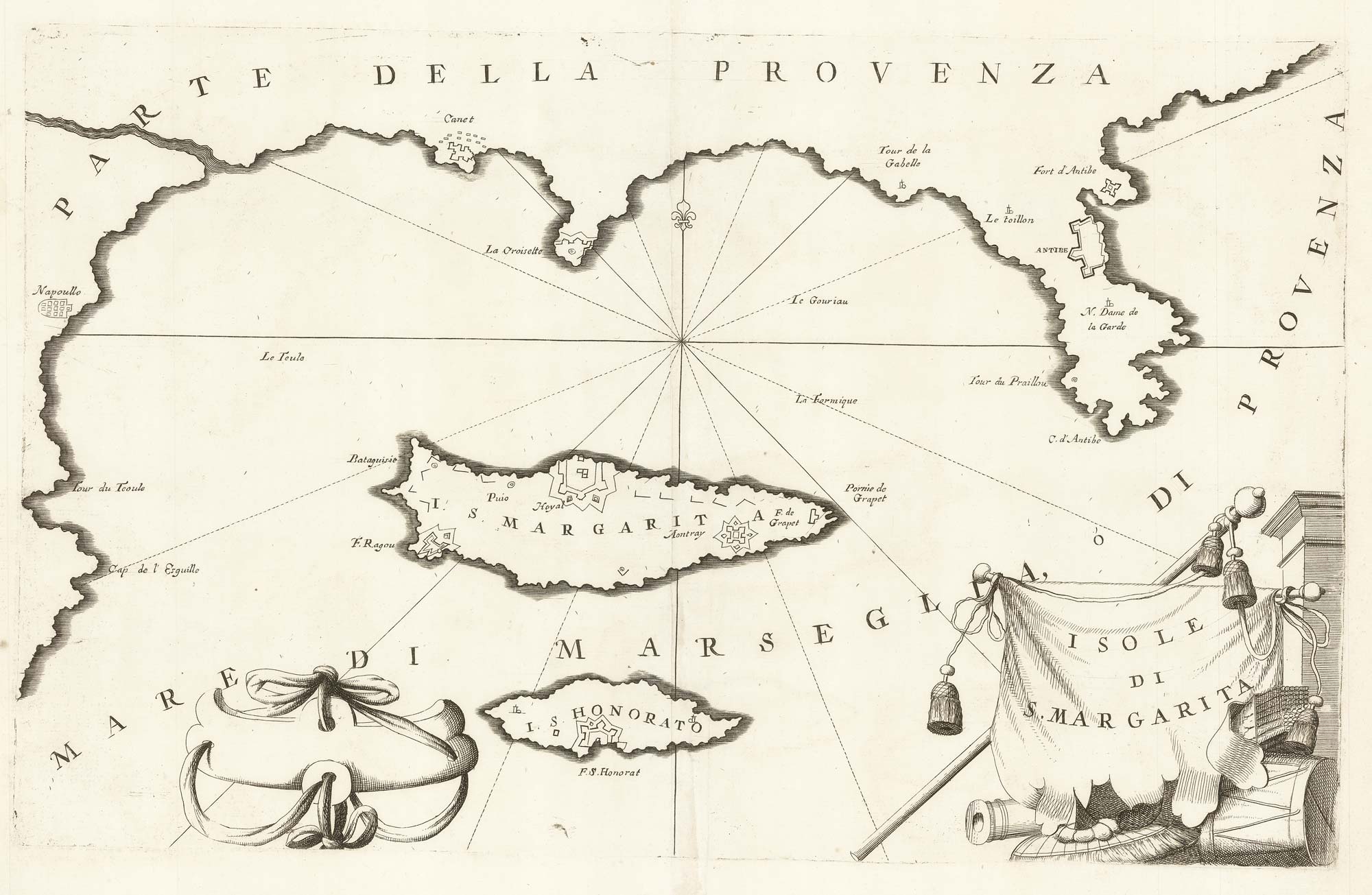
A map of Saint Marguerite with Cannes and Antibes
CORONELLI, Vincenzo Maria. Date: 1690 Stock #: 20625 £280.00
[ti_wishlists_addtowishlist]
[ti_wishlists_addtowishlist]
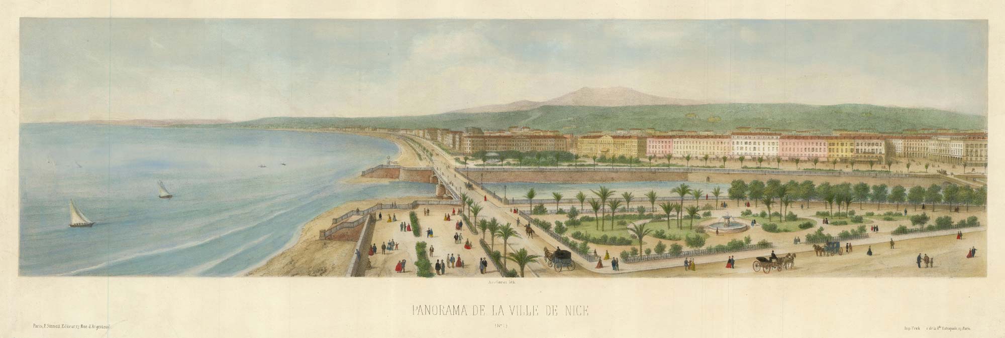
An elevated prospect of Nice, looking west
ASSELINEAU, Leon-Auguste. Date: 1860 Stock #: 21894 £450.00
[ti_wishlists_addtowishlist]
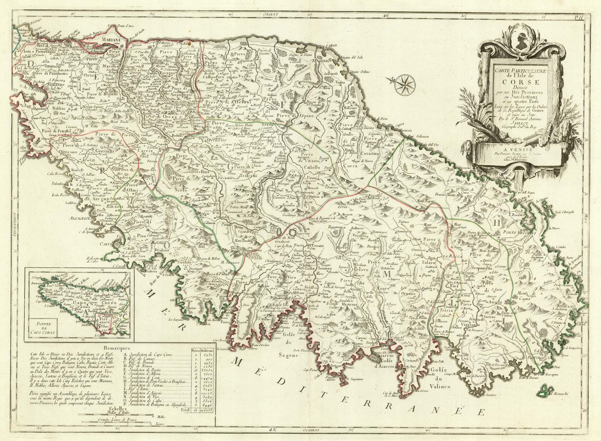
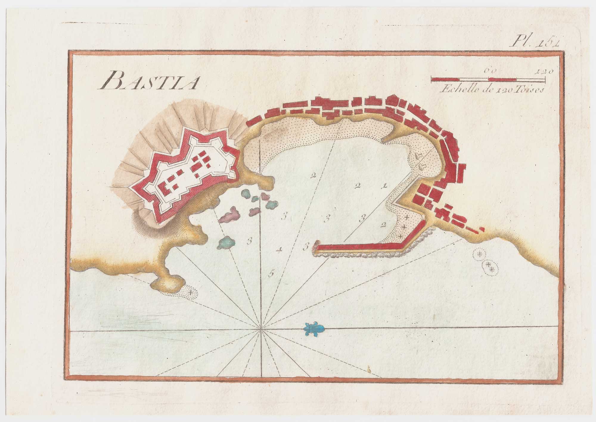
A detailed 18th century map of Corsica after Jaillot
SANTINI, Francesco & SANTINI, Paolo. Date: 1784 Stock #: 21914 £650.00
[ti_wishlists_addtowishlist]

A 17th century map of the environs of Nuremberg
BLAEU, Willem Janszoon. Date: 1667 Stock #: 22585 £300.00
[ti_wishlists_addtowishlist]
[ti_wishlists_addtowishlist]
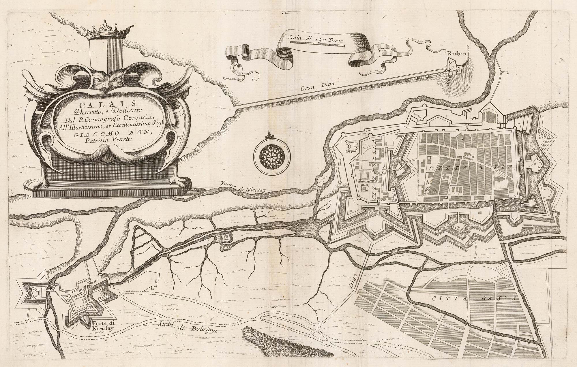
A 17th century plan of the defences of Calais
CORONELLI, Vincenzo Maria. Date: 1689 Stock #: 21662 £280.00
[ti_wishlists_addtowishlist]
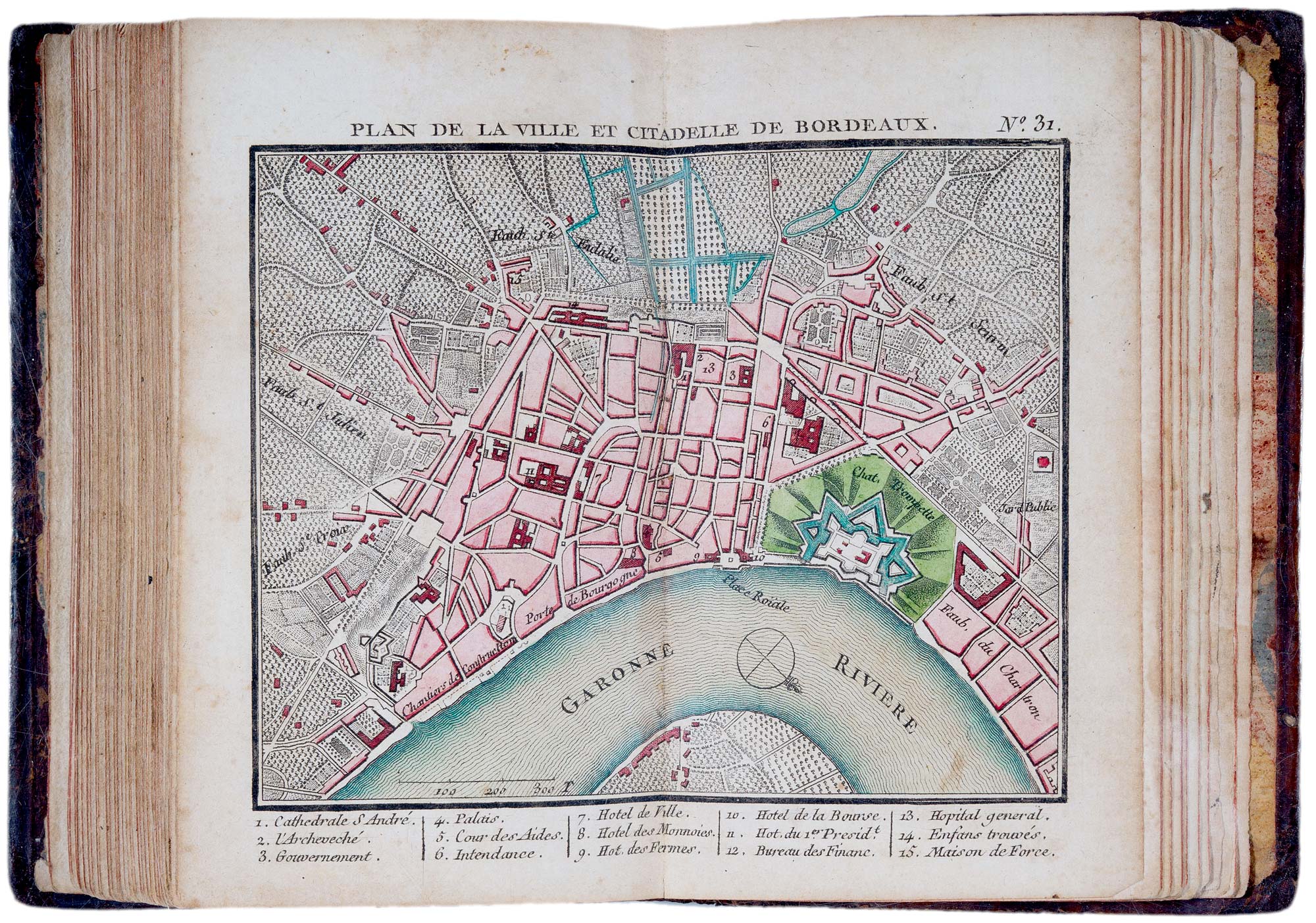
A fine 18th century miniature atlas of the coasts of France
BONNE, Rigobert. Date: 1778 Stock #: 21944 £2,700.00
[ti_wishlists_addtowishlist]
[ti_wishlists_addtowishlist]
[ti_wishlists_addtowishlist]
[ti_wishlists_addtowishlist]

[ti_wishlists_addtowishlist]
[ti_wishlists_addtowishlist]
[ti_wishlists_addtowishlist]
[ti_wishlists_addtowishlist]
[ti_wishlists_addtowishlist]
[ti_wishlists_addtowishlist]
[ti_wishlists_addtowishlist]
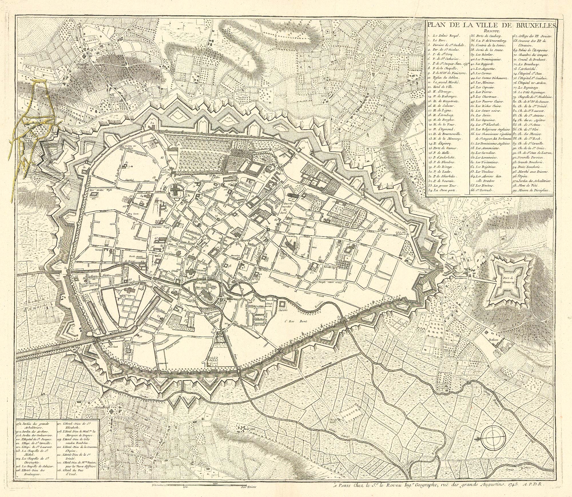
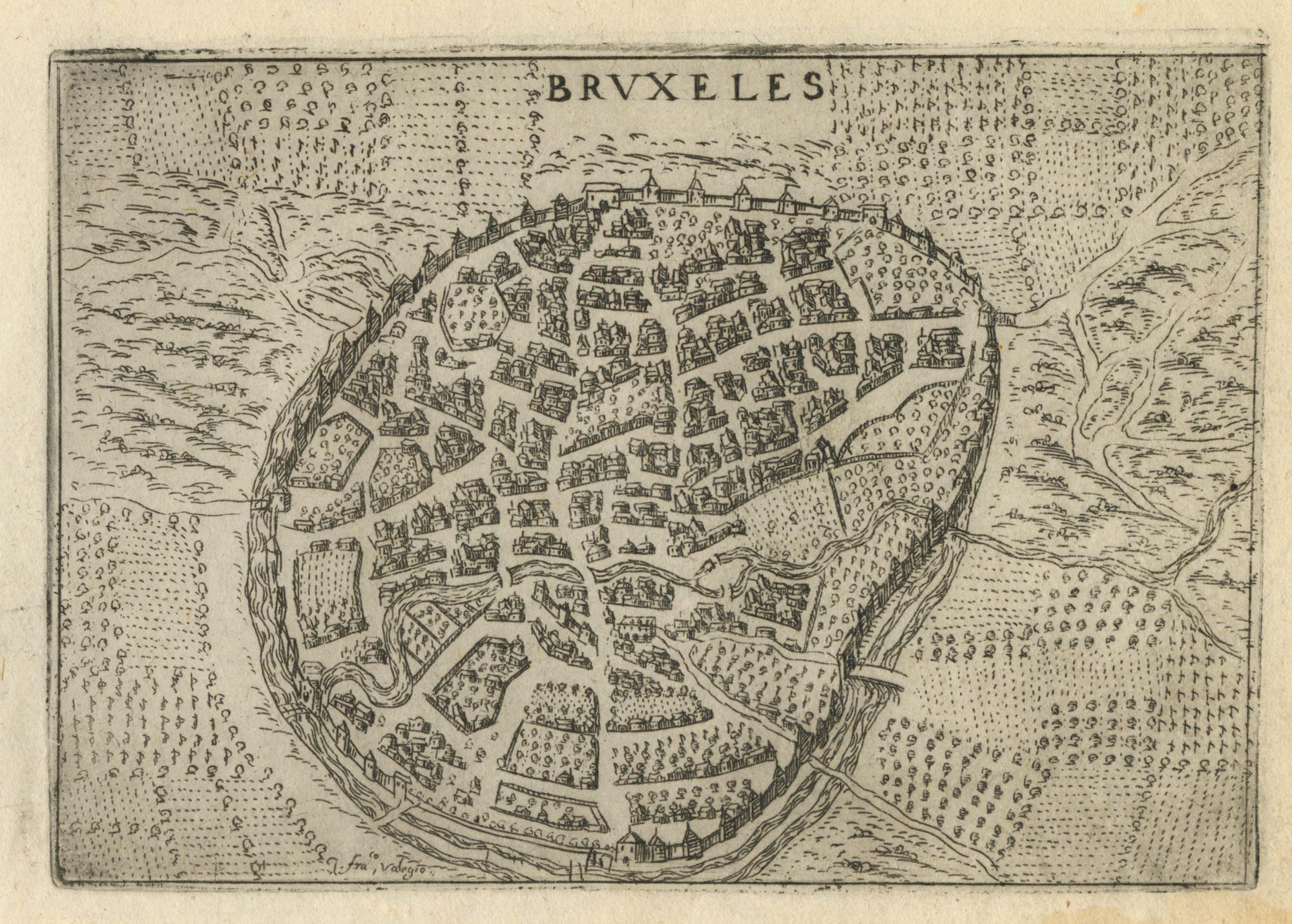
A town plan of Brussels just prior its capture by the French
LE ROUGE, Georges-Louis. Date: 1745 Stock #: 24832 £450.00
[ti_wishlists_addtowishlist]
[ti_wishlists_addtowishlist]
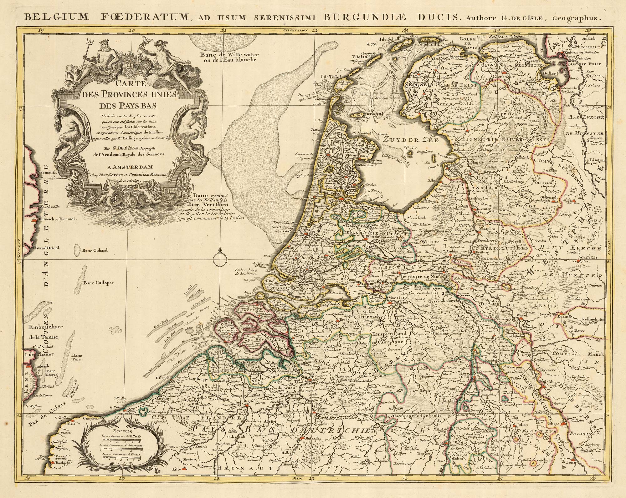
A detailed 18th century map of the Netherlands
DELISLE, Guillaume. Date: 1730 Stock #: 24456 £300.00
[ti_wishlists_addtowishlist]
[ti_wishlists_addtowishlist]

[ti_wishlists_addtowishlist]
[ti_wishlists_addtowishlist]
[ti_wishlists_addtowishlist]
[ti_wishlists_addtowishlist]
[ti_wishlists_addtowishlist]