Antique Maps of the West Indies
Showing 31–60 of 66 products
Sort by:
[ti_wishlists_addtowishlist]
[ti_wishlists_addtowishlist]
[ti_wishlists_addtowishlist]
[ti_wishlists_addtowishlist]
[ti_wishlists_addtowishlist]
[ti_wishlists_addtowishlist]

[ti_wishlists_addtowishlist]
[ti_wishlists_addtowishlist]
[ti_wishlists_addtowishlist]
[ti_wishlists_addtowishlist]
[ti_wishlists_addtowishlist]
[ti_wishlists_addtowishlist]
[ti_wishlists_addtowishlist]
[ti_wishlists_addtowishlist]
[ti_wishlists_addtowishlist]
[ti_wishlists_addtowishlist]
[ti_wishlists_addtowishlist]
[ti_wishlists_addtowishlist]
[ti_wishlists_addtowishlist]
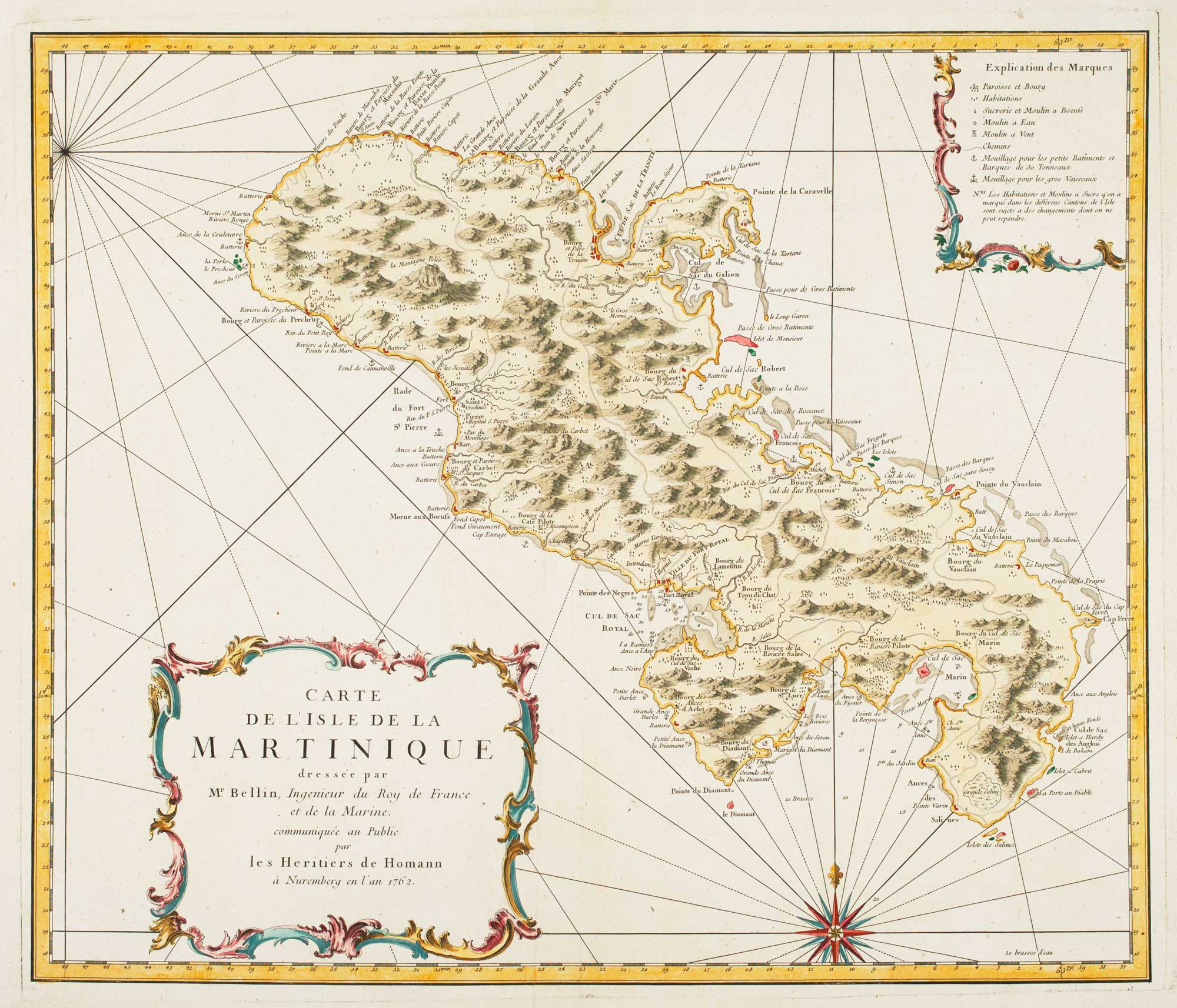
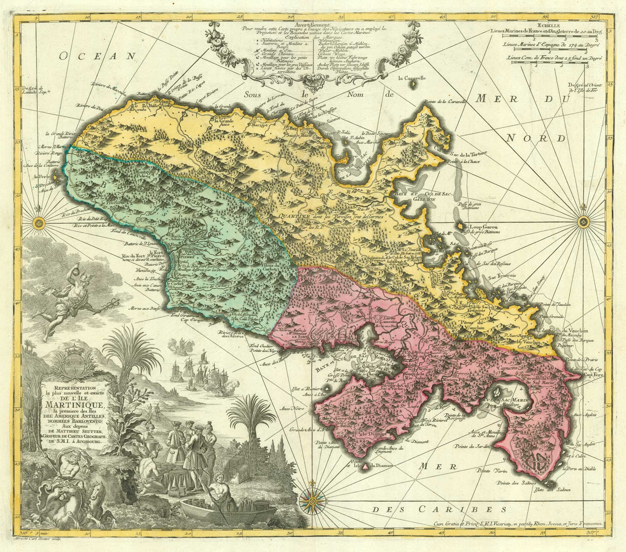
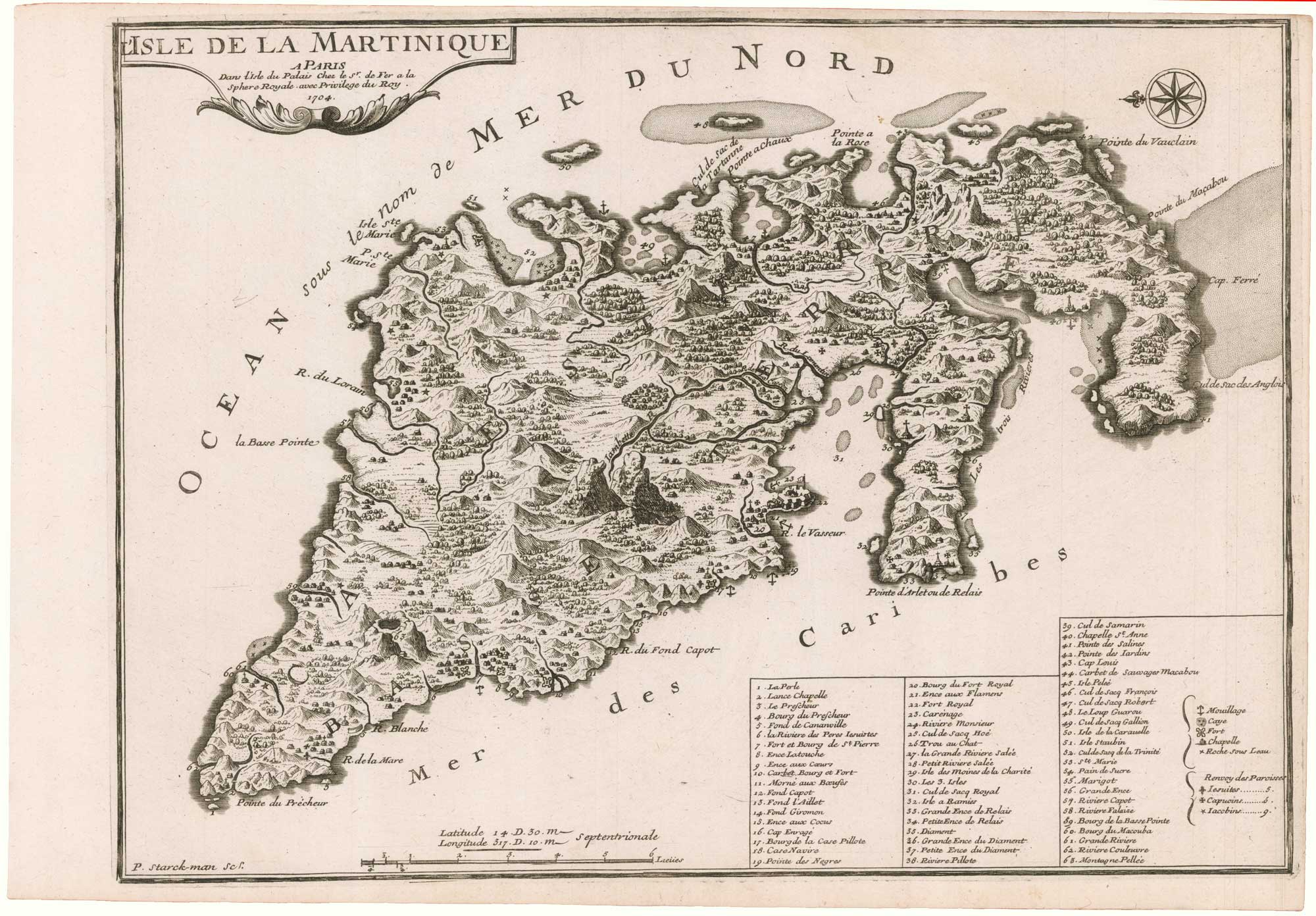
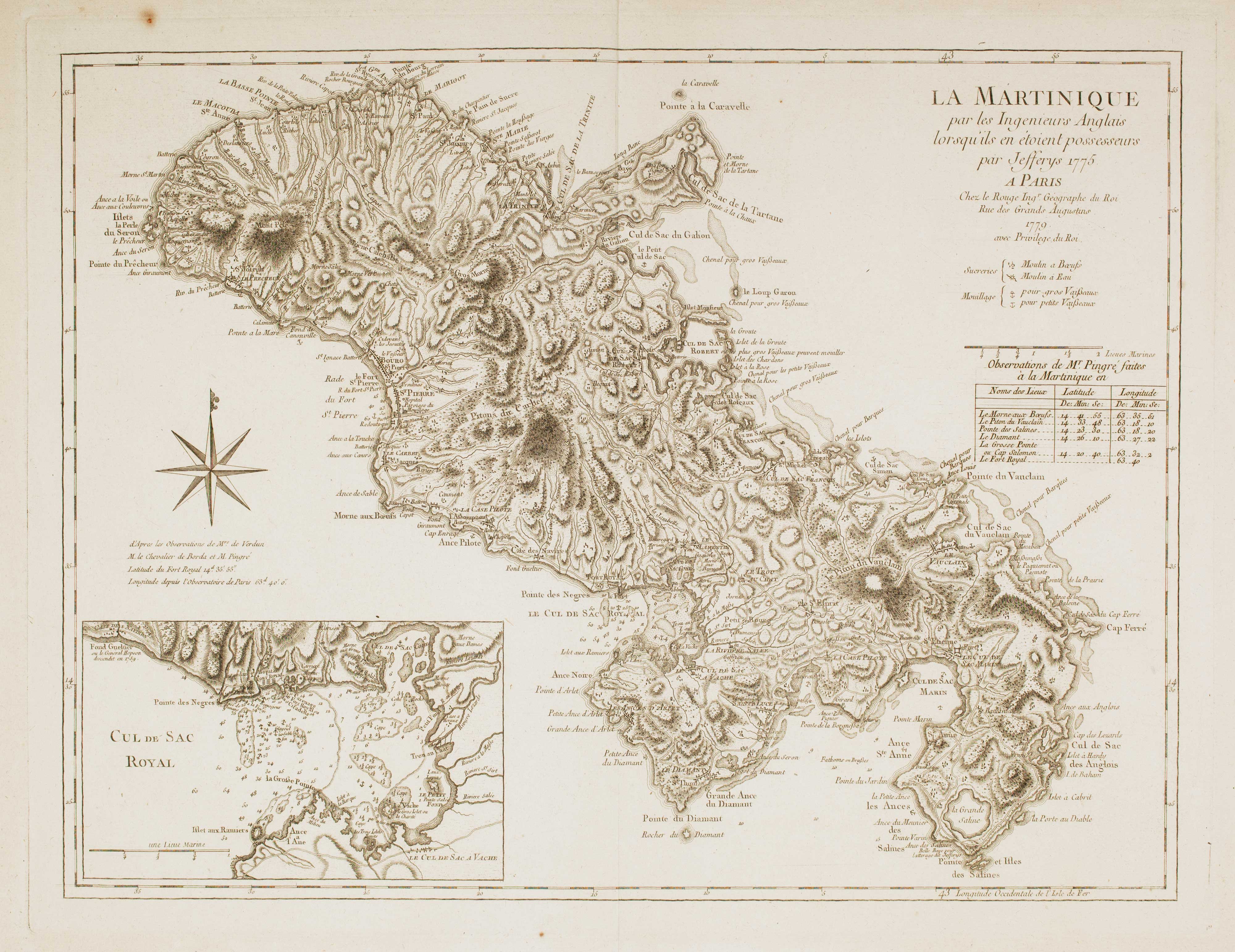
Detailed map of Martinique published during the Seven Years' War
BELLIN, Jacques-Nicolas. Date: 1762 Stock #: 14635 £600.00
[ti_wishlists_addtowishlist]
[ti_wishlists_addtowishlist]
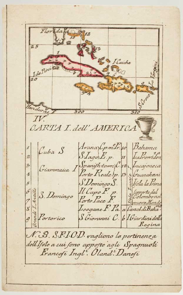
An 18th century playing-card map of northern islands of the West Indies
RABATTA, Augusto & BAILOU, Jean Baptist de. Date: 1779 Stock #: 13032 £280.00
[ti_wishlists_addtowishlist]
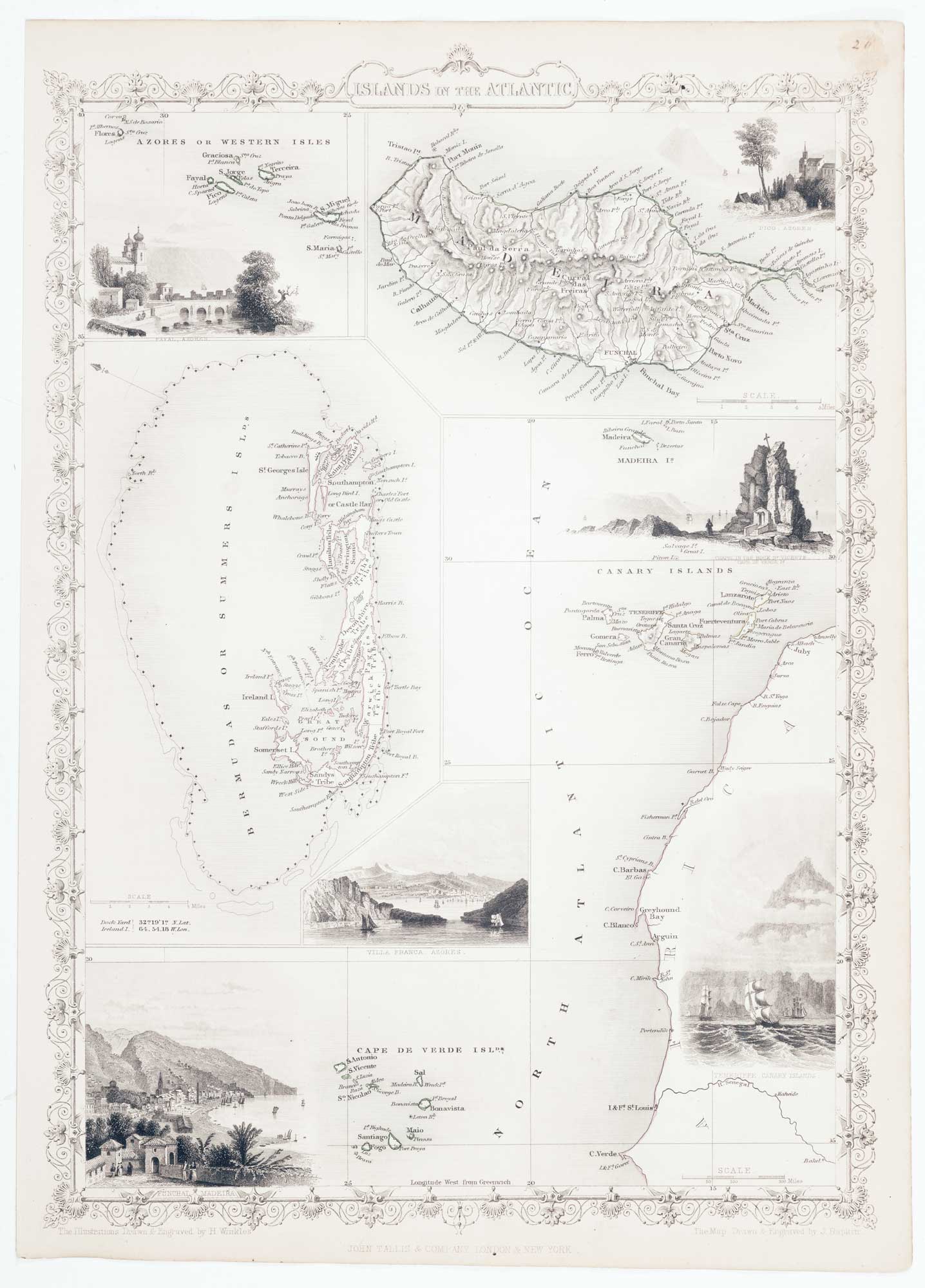
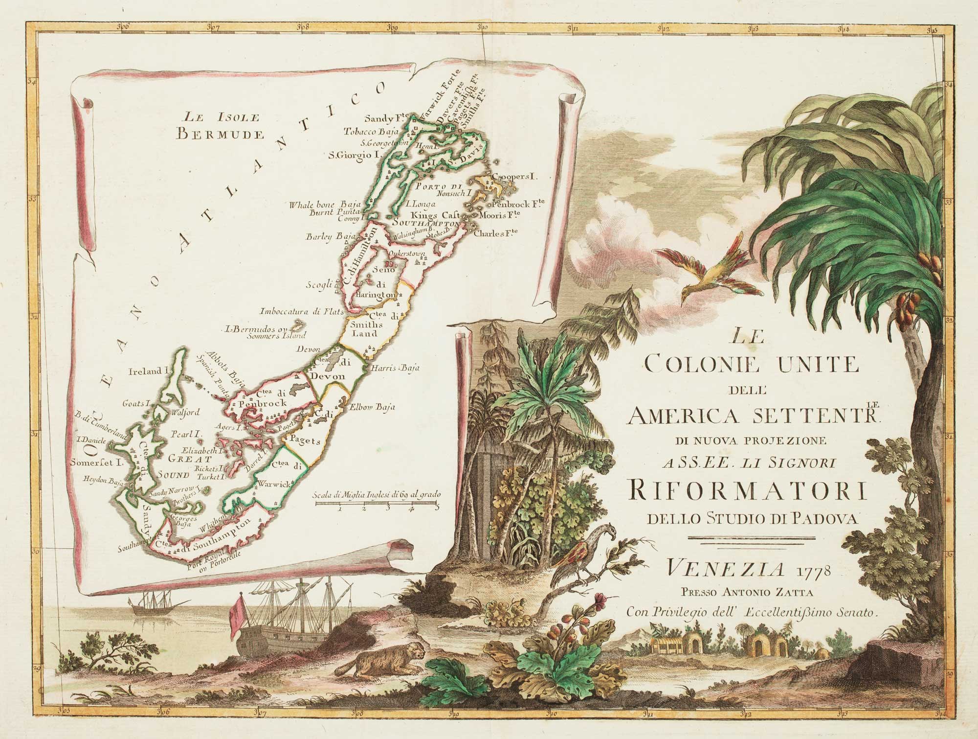
Map of Bermuda and other islands in the Atlantic, with vignettes
TALLIS, John. Date: 1851 Stock #: 12631 £100.00
[ti_wishlists_addtowishlist]
[ti_wishlists_addtowishlist]
[ti_wishlists_addtowishlist]
[ti_wishlists_addtowishlist]
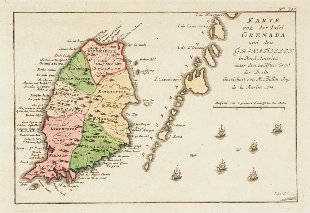
Map of Grenada during the Seven Years' War
RASPE, Gabriel Nikolaus. Date: 1762 Stock #: 12916 £160.00
[ti_wishlists_addtowishlist]
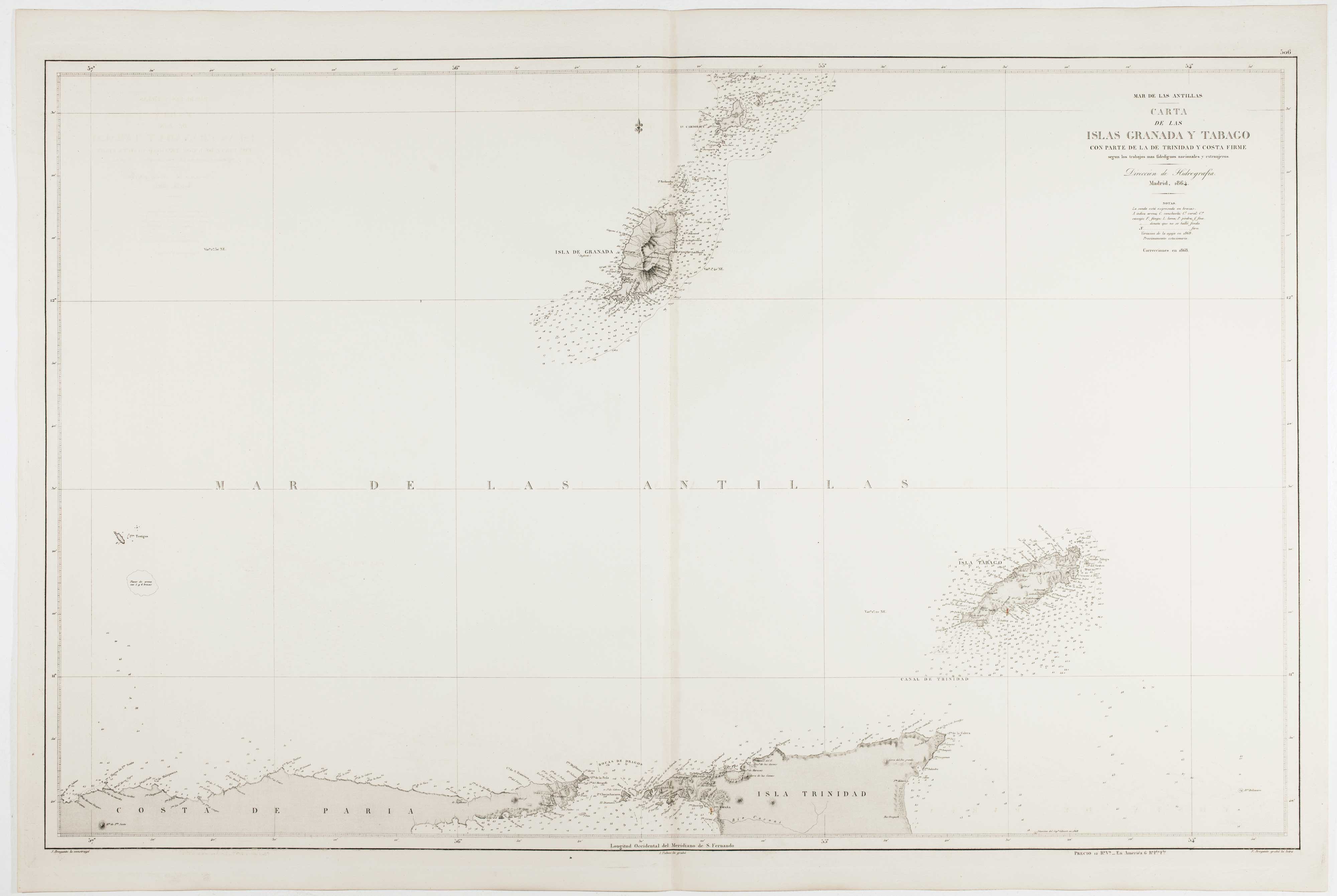
An uncommon 19th century Spanish sea chart of Grenada and Tobago
BREGANTE, S. Date: 1868 Stock #: 11824 £800.00
[ti_wishlists_addtowishlist]
[ti_wishlists_addtowishlist]

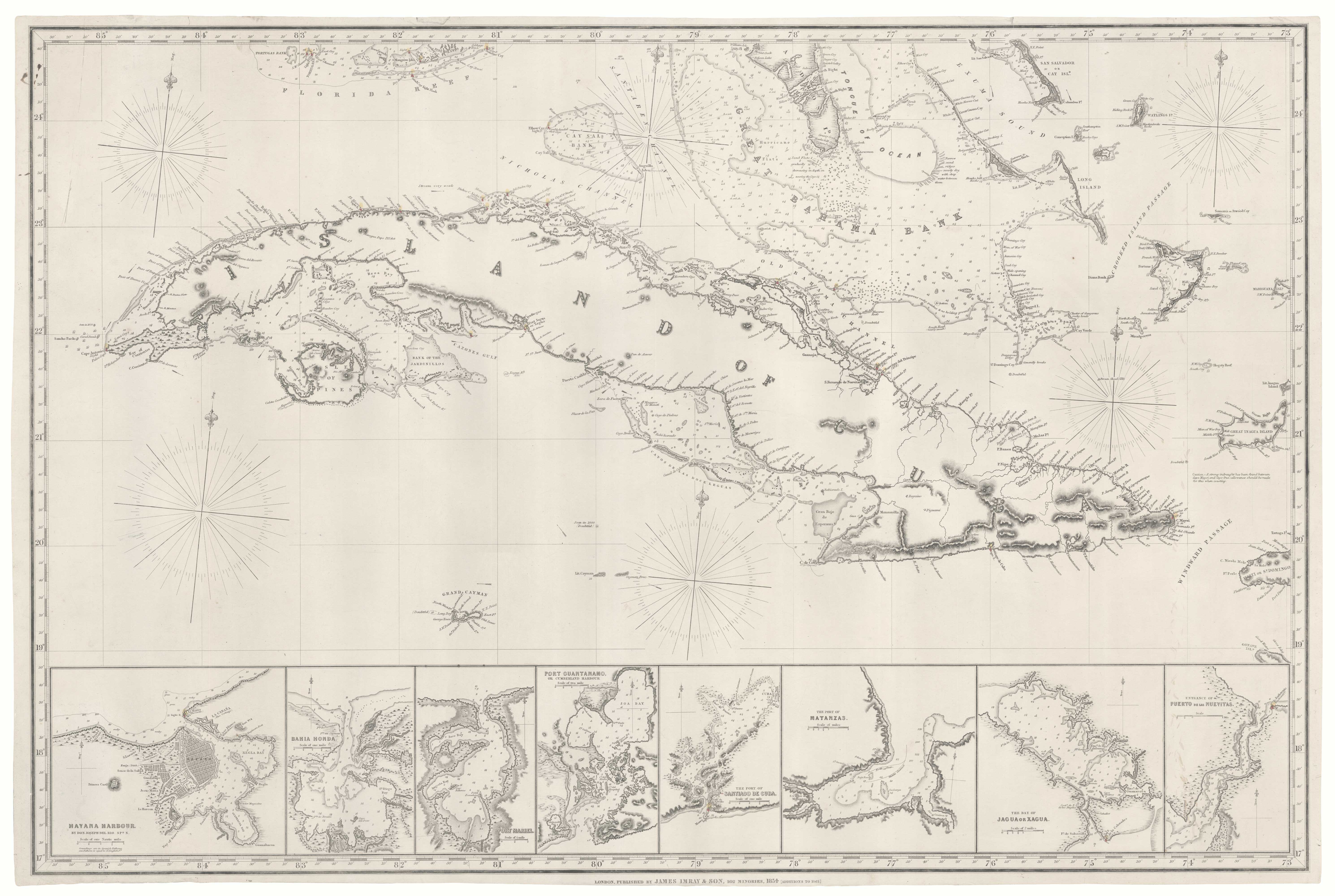
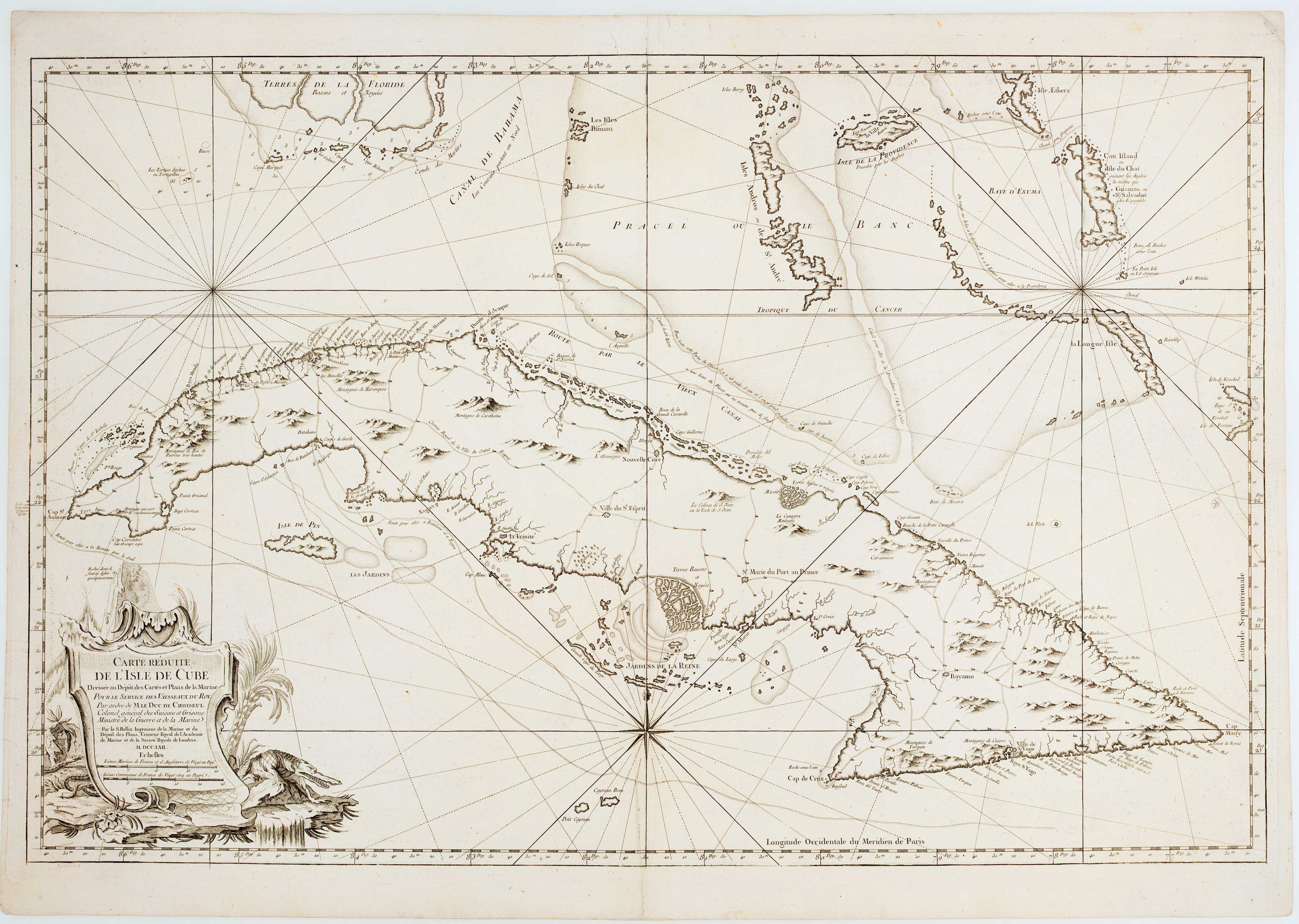
A large and detailed chart of the Bahamas
BELLIN, Jacques-Nicolas. Date: 1768 Stock #: 10641 £650.00
[ti_wishlists_addtowishlist]