

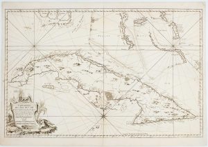
Cuba & Jamaica
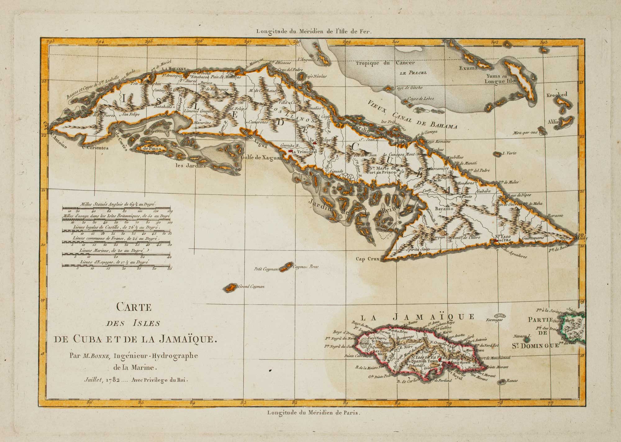
Carte Des Isles de Cuba et de la Jamaïque...
Paris, c.1782. Coloured. 250 x 360mm.
£240.00
Description
Cuba, Jamica and the surrounding islands.
Condition:
A very good example printed on heavy paper with large margins.Related products
-
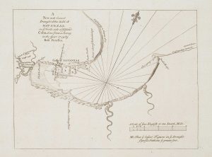
Havana during the Seven Years’ War
GENTLEMAN'S MAGAZINE. Date: 1762Stock #: 17218 £220.00 -
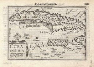
A 16th century miniature map of Cuba
LANGENES, Barent. Date: 1599Stock #: 21259 £280.00 -
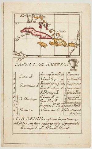
An 18th century playing-card map of northern islands of the West Indies
RABATTA, Augusto & BAILOU, Jean Baptist de. Date: 1779Stock #: 13032 £280.00 -
18th century sea chart of Cuba
BELLIN, Jacques-Nicolas. Date: 1762Stock #: 17427 £1,400.00 -
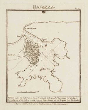
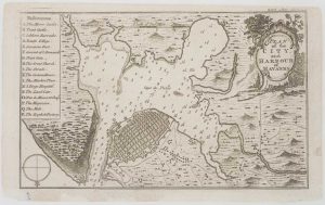
Chart of Havana Harbour
LUFFMAN, John. Date: 1802Stock #: 12805 £150.00 -
An 18th century chart of Matanzas Bay
PEARSON, Robert. Date: 1748Stock #: 16952 £160.00 -
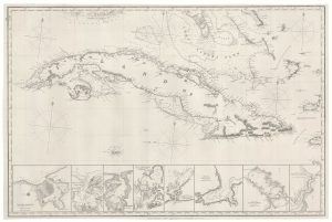
A 19th century blue-back sea chart of Cuba
IMRAY, James. Date: 1873Stock #: 19010 £2,000.00 -
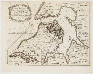
Havana during the Seven Years’ War
HINTON, John. Date: 1762Stock #: 17097 £500.00 -
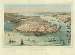
An early bird’s-eye view of Havana
BACHMANN, John. Date: 1851Stock #: 19264 £3,250.00
Items by the same author
[ti_wishlists_addtowishlist]
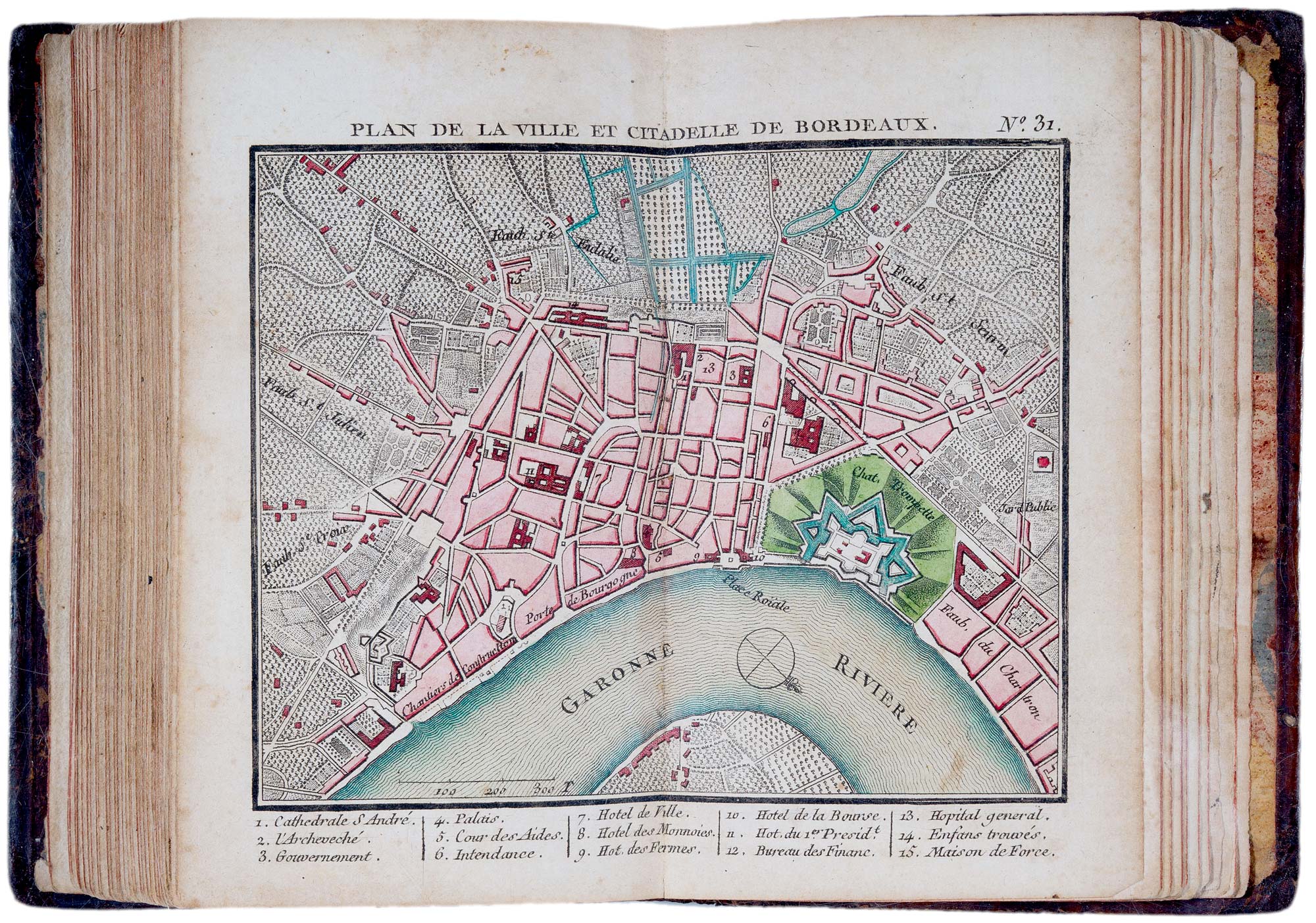
A fine 18th century miniature atlas of the coasts of France
BONNE, Rigobert. Date: 1778 Stock #: 21944 £2,700.00
[ti_wishlists_addtowishlist]
[ti_wishlists_addtowishlist]
[ti_wishlists_addtowishlist]

Extremely rare Russian edition of Bonne's map of Europe
BONNE, Rigobert. Date: 1793 Stock #: 20509 £500.00
[ti_wishlists_addtowishlist]

Extremely rare Russian edition of Bonne's map of South America
BONNE, Rigobert. Date: 1793 Stock #: 20510 £650.00
[ti_wishlists_addtowishlist]
