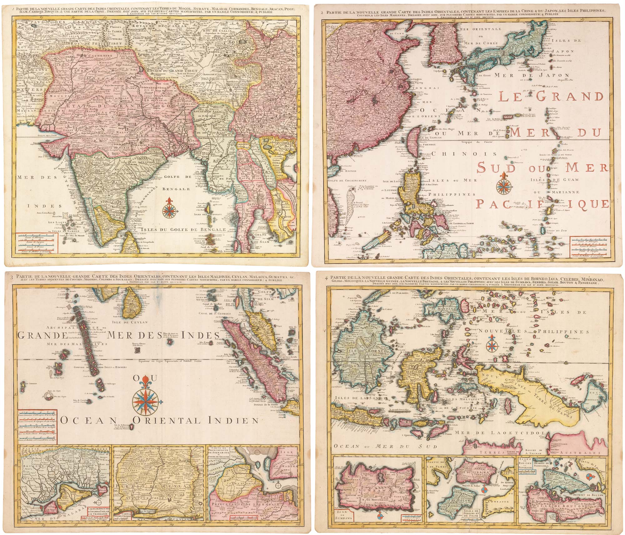


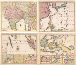
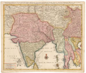
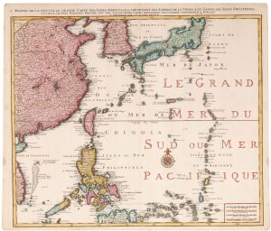
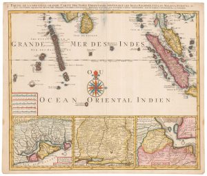
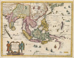
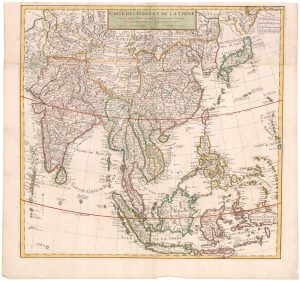
A striking four-sheet wall map of the Far East
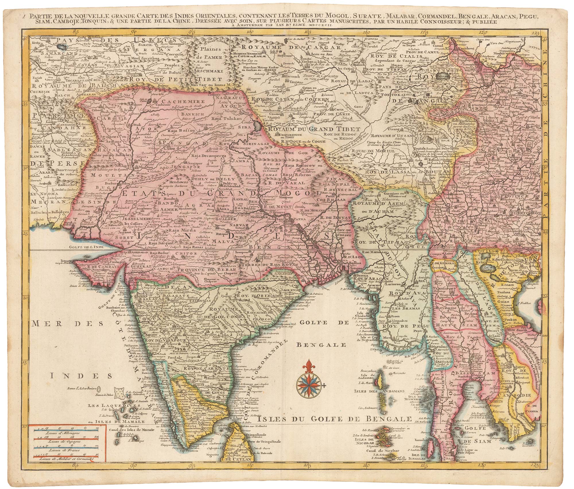
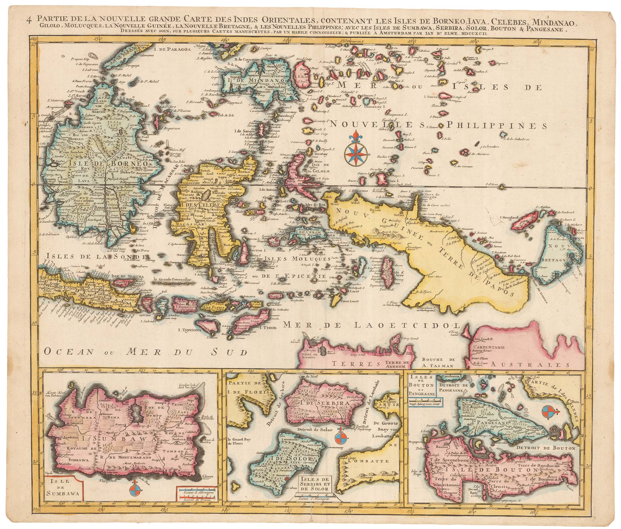
1 Partie de la nouvelle grande carte des Indes Orientales... [& 2-4 Partie]
Amsterdam: J.B. Elwe, 1792. Fine original colour. Four sheets, each plate 525 x 610mm.
£4,500.00
1 in stock
x
Question About This Item?
A striking four-sheet wall map of the Far East & OTTENS, Joachim.Stock #: 23571Similar to Sell?
Description
A large and detailed four-sheet map the Far East, with India and Sri Lanka, Indochina, Indonesia, the Philippines, China, Korea, Singapore and Japan. Along the bottom of the map are six inset details of the important ports used by the European traders.
The map was based on the work of Guillaume DelIsle and first published by Joachim Ottens c.1720.
Condition:
A good example.Related products
-
The scarce second Galle plate for the Far East used in the ‘Epitome’
ORTELIUS, Abraham. Date: 1598Stock #: 23197 £450.00 -
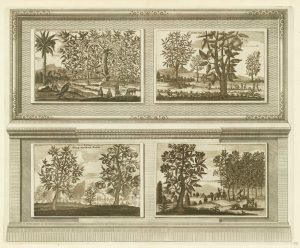
Illustrations of the flora and fauna of the East-Indies
AA, Pieter van der. Date: 1725Stock #: 20088 £200.00 -
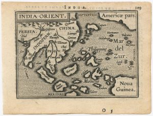
A mid-17th century map of the Far East
MERIAN, Matthaus. Date: 1650Stock #: 22920 £700.00 -
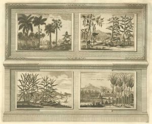
Illustrations of the flora and fauna of the East-Indies
AA, Pieter van der. Date: 1725Stock #: 20089 £200.00 -
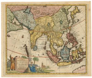
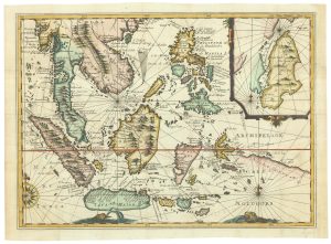
Early 18th century map of the East Indies
DELISLE, Guillaume. Date: 1705Stock #: 23907 £980.00 -
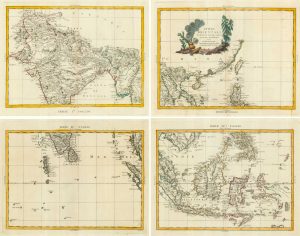
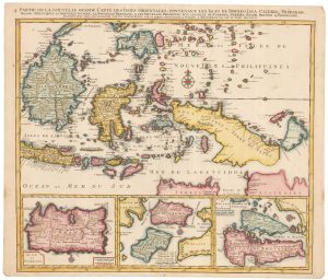
18th century four-sheet map of the East Indies
ZATTA, Antonio. Date: 1784Stock #: 9423 £725.00 -
Early 18th century map of South East Asia
AA, Pieter van der. Date: 1719Stock #: 21650 £400.00 -
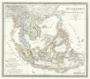
A mid-19th century map of the East Indies
WEILAND, Carl Ferdinand. Date: 1847Stock #: 21922 £240.00 -
Rare map of the interests of the V.O.C. in the East Indies
RENNEVILLE, René Auguste Constantin. Date: 1725Stock #: 22933 £1,650.00
Items by the same author
[ti_wishlists_addtowishlist]

[ti_wishlists_addtowishlist]