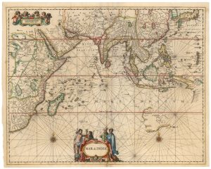
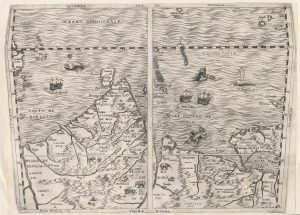
The Indian Ocean from Ortelius’s ”Parergon”
Erythraei sive Rubri Maris Periplus, olim ab Arriano descripus, nunc vero ab Abrah. Ortelio ex eodem delineatus.
Antwerp: Jan Baptist Vrients, 1608, Italian edition. Original colour. 360 x 460mm.
£950.00
1 in stock
x
Question About This Item?
The Indian Ocean from Ortelius’s ”Parergon” & ORTELIUS, Abraham.Stock #: 23719
Add to Wishlist
Export as PDFEnquireSimilar to Sell?Add to Wishlist
Description
A map of southern Asia as known to the Ancients, especially Appian and Diodorus. It shows from Alexandria and the Red Sea in the upper left, the African coast south to Madagascar, Arabia and the Persian Gulf, India and Sri Lanka ('Tabrobana'), the Malay Peninsula and Sumatra ('Iamboli'). A large inset maps the Odyssey, the route of Odysseus across the Eastern Mediterranean. Two roundels depict the cities founded by the mythical Carthaginian explorer Hanno of the Atlantic coast of Africa, and 'Hyperborea', the North Pole.
Condition:
A good example.References:
VAN DEN BROECKE: 224.Related products
-
A French 19th century sea chart of the Indian Ocean
DAUSSY, Pierre. Date: 1837Stock #: 21222 £550.00 -
A Dutch chart of the Indian Ocean with Australia
JANSSON, Jan. Date: 1650Stock #: 23581 £2,000.00 -
The Southern Indian Ocean with early Antarctic discoveries
DAUSSY, Pierre. Date: 1873Stock #: 21223 £400.00 -
Important 16th century ‘upside-down’ map of the Indian Ocean
GASTALDI, Giacomo. Date: 1565Stock #: 22851 £9,500.00
Items by the same author
Add to Wishlist
Add to Wishlist

The rarest Ortelius atlas map of England and Wales
ORTELIUS, Abraham. Date: 1603 Stock #: 25643 £2,000.00
Add to Wishlist
Add to Wishlist

A 16th century miniature map of Turkey
ORTELIUS, Abraham. Date: 1593 Stock #: 24465 £140.00
Add to Wishlist
Add to Wishlist

A 16th century miniature map of the Turkish Empire
ORTELIUS, Abraham. Date: 1593 Stock #: 24464 £280.00
Add to Wishlist
Add to Wishlist
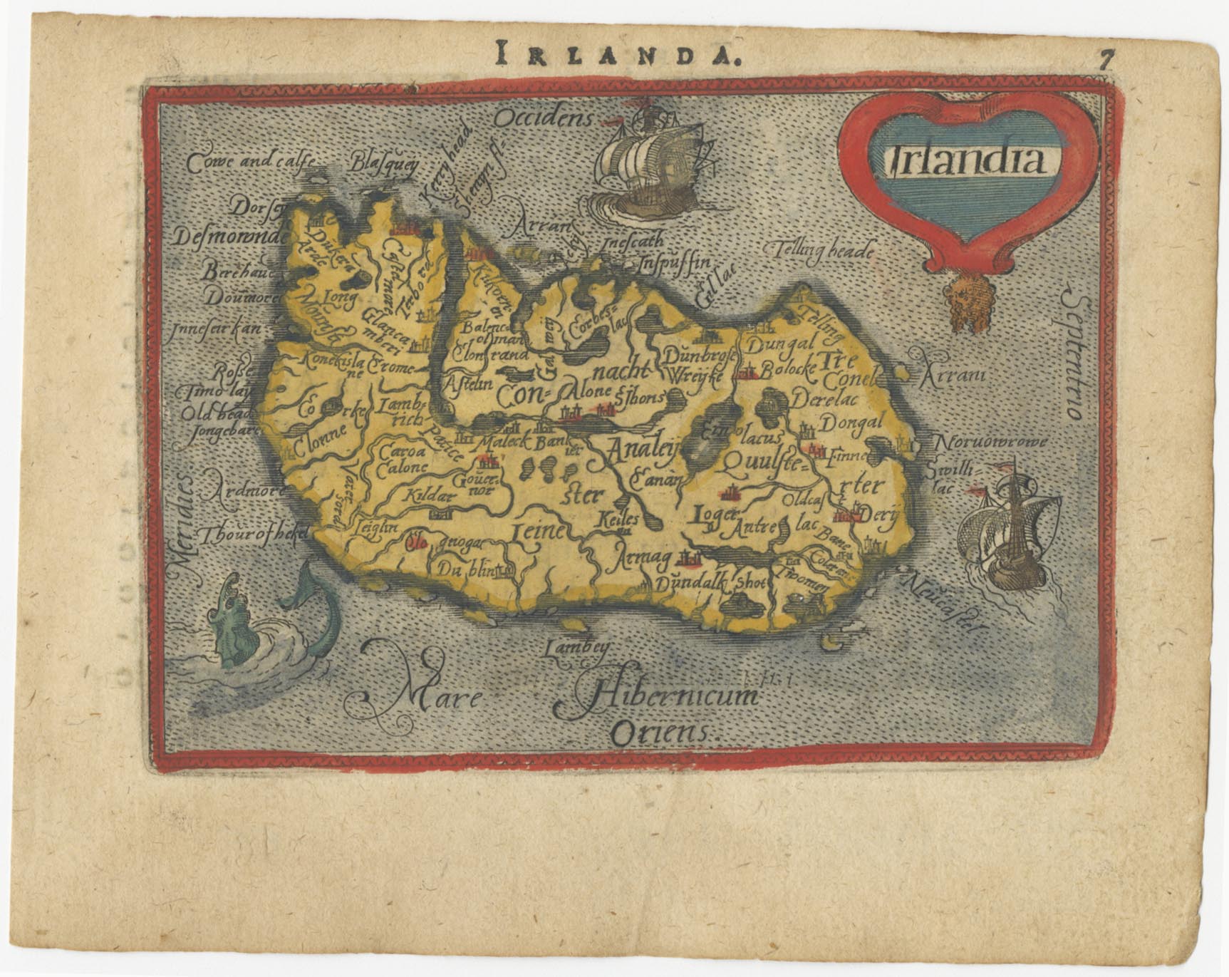
A 16th century miniature map of Ireland
ORTELIUS, Abraham. Date: 1593 Stock #: 24458 £270.00
Add to Wishlist
Add to Wishlist