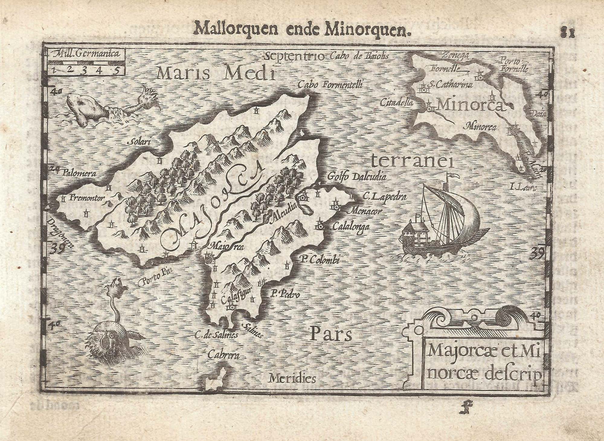


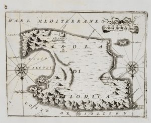
A 16th century miniature map of Majorca and Minorca
Majorcae et Minorcae descrip.
Amsterdam, Cornelis Claez, 1599, Dutch text edition. 85 x 125mm, with letterpress surtitle and pagination.
£350.00
1 in stock
x
Question About This Item?
A 16th century miniature map of Majorca and Minorca & LANGENES, Barent.Stock #: 21341Similar to Sell?
Description
A scarce map of Majorca and Minorca, engraved by either Jodocus Hondius or Pieter van der Keere for the 'Caert-Thresoor', with a text by an unknown author. Despite being published only a year after the first edition, this is a second state: the lateral borders have been re-engraved with latitude graduations.
By 1600 this map was being published in the 'Tabularum Geographicarum Contractarum' with a text by Petrus Bertius, and in 1616 a new plate was engraved by Jodocus Hondius II, slightly larger and with wider borders with scales of longitude and latitude.
Condition:
A good example.Related products
-
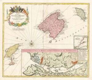
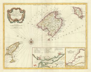
The Balearics with an inset chart of Mahon Harbour
LOTTER, Tobias Conrad. Date: 1760Stock #: 22199 £950.00 -
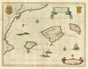
17th century Dutch map of the Balearics
BLAEU, Willem Janszoon. Date: 1645Stock #: 25334 £650.00 -
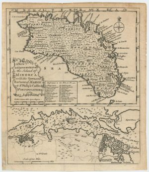
Maps of Minorca and Mahon at the end of the Seven Years’ War
Anonymous. Date: 1763Stock #: 24052 £450.00 -
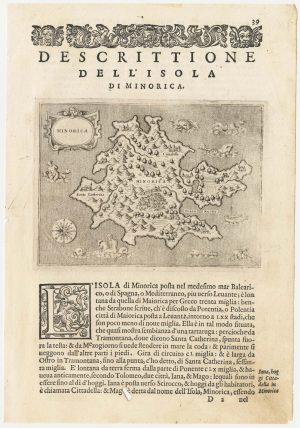
A 16th century map of Minorca
PORCACCHI, Tomaso. Date: 1590Stock #: 23211 £180.00 -
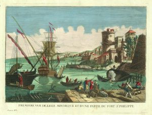
A view of Mahon Harbour with St Philip’s Castle
FONTAINE. Date: 1780Stock #: 20597 £425.00 -
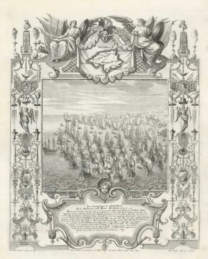
The British attack on Majorca in 1706
DECKER, Paul. Date: 1720Stock #: 18683 £1,250.00 -
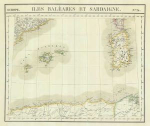
Uncommon map of the Balearics and Sardinia
VANDERMAELEN, Philippe. Date: 1827Stock #: 21116 £220.00 -
An uncommon 17th century map of Majorca
CORONELLI, Vincenzo Maria. Date: 1690Stock #: 20699 £450.00 -
Detailed 18th century map of the Balearics
SANTINI, Francesco & SANTINI, Paolo. Date: 1784Stock #: 20247 £650.00
Items by the same author
[ti_wishlists_addtowishlist]

[ti_wishlists_addtowishlist]

A 16th century miniature map of Saxony, Thuringia & Meissen
LANGENES, Barent. Date: 1599 Stock #: 21173 £50.00
[ti_wishlists_addtowishlist]

[ti_wishlists_addtowishlist]

[ti_wishlists_addtowishlist]

A 16th century miniature map of the Comtat Venaissin
LANGENES, Barent. Date: 1599 Stock #: 21137 £55.00
[ti_wishlists_addtowishlist]
