


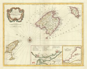
17th century Dutch map of the Balearics
Insulae Balearides et Pytivsae.
Amsterdam, 1645-1655, Latin text edition. Original colour. 380 x 500mm.
£650.00
1 in stock
x
Question About This Item?
17th century Dutch map of the Balearics & BLAEU, Willem Janszoon.Stock #: 25334Similar to Sell?
Description
A decorative map of the Balearic Islands, also showing the Spanish coastline from Barcelona south to Cap de la Nau, decorated with cartouches for the title and scale, two armorials, compass roses and vignette galleon and galleys.From a three-volume edition of the 'Terraum Orbis Terrarum', published 1645-55.
Condition:
A good example.Related products
-
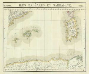
Uncommon map of the Balearics and Sardinia
VANDERMAELEN, Philippe. Date: 1827Stock #: 21116 £220.00 -
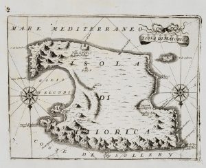
An uncommon 17th century map of Majorca
CORONELLI, Vincenzo Maria. Date: 1690Stock #: 20699 £450.00 -
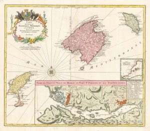
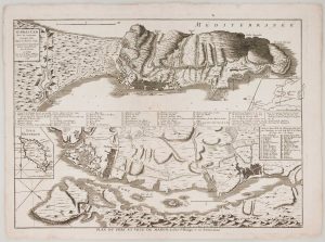
The Balearics with an inset chart of Mahon Harbour
LOTTER, Tobias Conrad. Date: 1760Stock #: 22199 £950.00 -
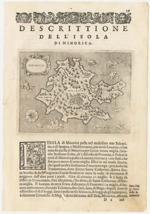
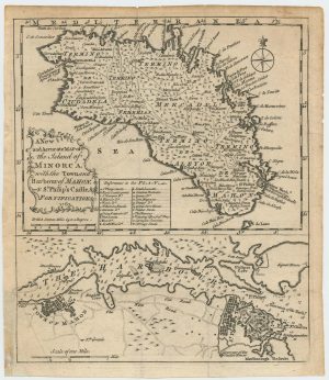
A 16th century map of Minorca
PORCACCHI, Tomaso. Date: 1590Stock #: 23211 £180.00 -
Mahon & Gibraltar besieged during the Seven Years’ War
LE ROUGE, Georges-Louis. Date: 1756Stock #: 16377 £850.00 -
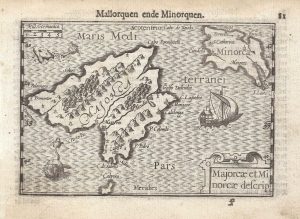
A 16th century miniature map of Majorca and Minorca
LANGENES, Barent. Date: 1599Stock #: 21341 £350.00 -
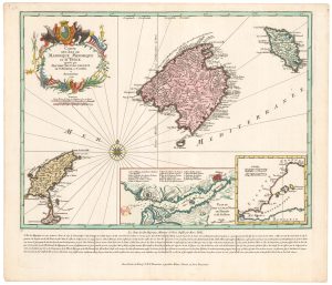
Detailed 18th century map of the Balearics
SANTINI, Francesco & SANTINI, Paolo. Date: 1784Stock #: 20247 £650.00 -
An early example of Seutter’s map of the Balearics
SEUTTER, Matthaus. Date: 1741Stock #: 23095 £980.00 -
Maps of Minorca and Mahon at the end of the Seven Years’ War
Anonymous. Date: 1763Stock #: 24052 £450.00
Items by the same author

[ti_wishlists_addtowishlist]
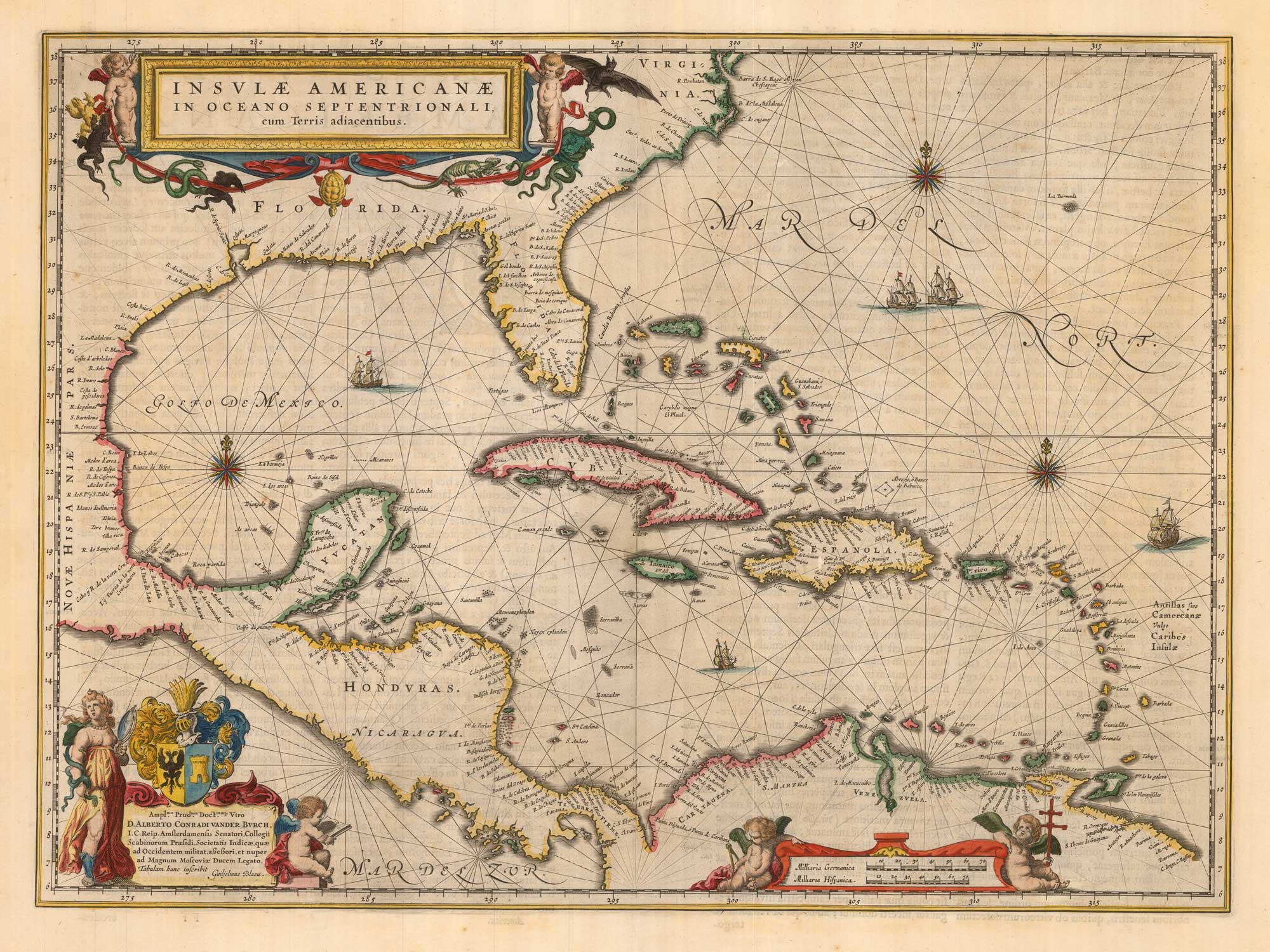
Classic 17th century map of the West Indies
BLAEU, Willem Janszoon. Date: 1662 Stock #: 22717 £1,800.00
[ti_wishlists_addtowishlist]
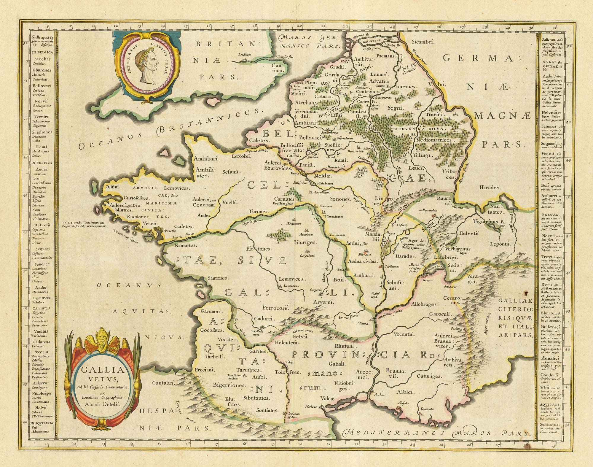
17th century Dutch map of Gaul after Ortelius
BLAEU, Willem Janszoon. Date: 1645 Stock #: 25335 £250.00
[ti_wishlists_addtowishlist]
[ti_wishlists_addtowishlist]

A 17th century map of the environs of Nuremberg
BLAEU, Willem Janszoon. Date: 1667 Stock #: 22585 £300.00
[ti_wishlists_addtowishlist]
