Antique Maps of Germany
Showing 31–46 of 46 products
Sort by:
[ti_wishlists_addtowishlist]
[ti_wishlists_addtowishlist]
[ti_wishlists_addtowishlist]
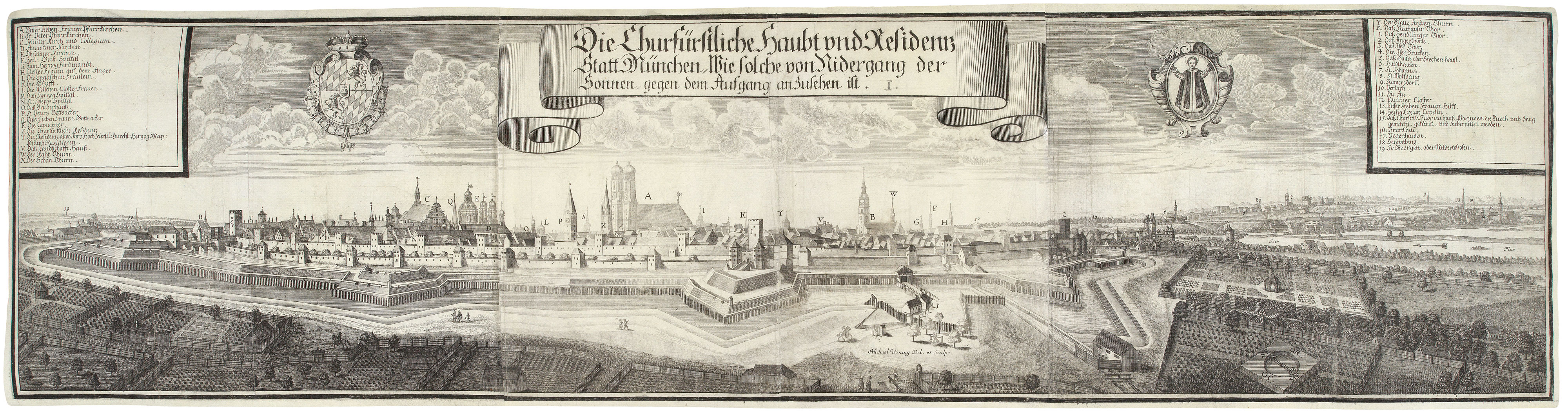
A prospect of Munich at the start of the 18th century
WENING, Michael. Date: 1701 Stock #: 20688 £650.00
[ti_wishlists_addtowishlist]
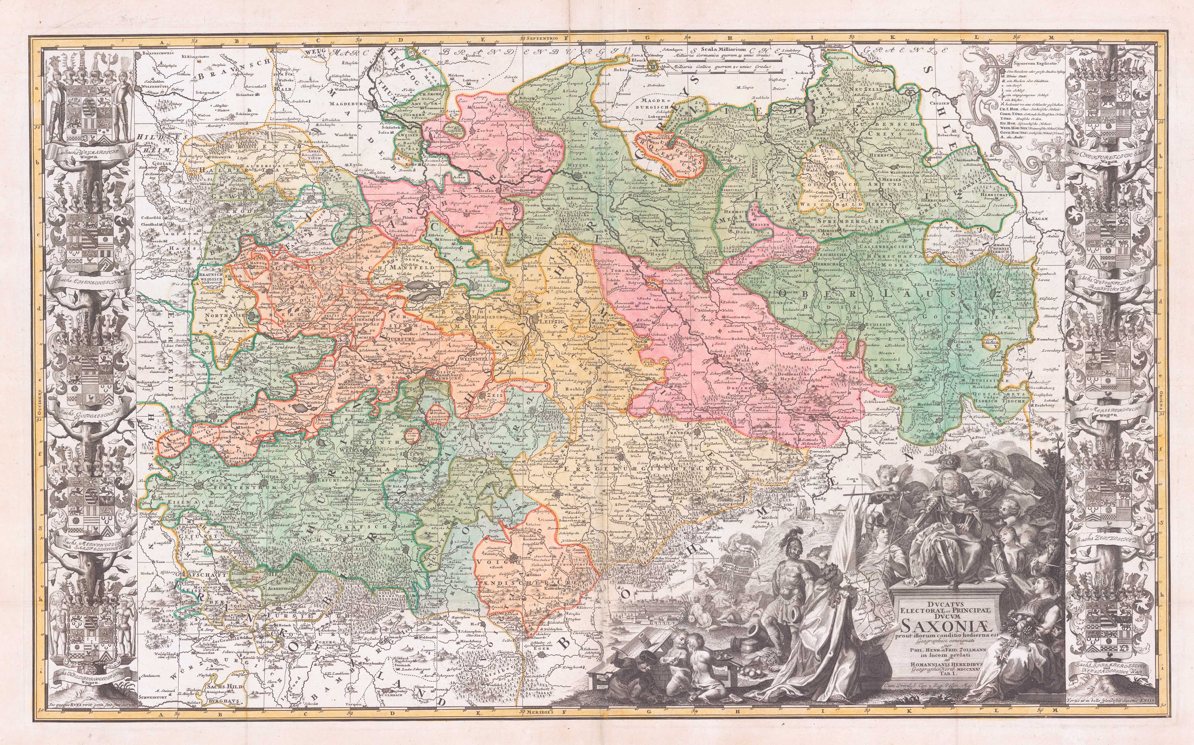
A scarce large-format map of Saxony in the 18th century
ZOLLMAN, Friedrich. Date: 1731 Stock #: 17714 £1,800.00
[ti_wishlists_addtowishlist]

[ti_wishlists_addtowishlist]
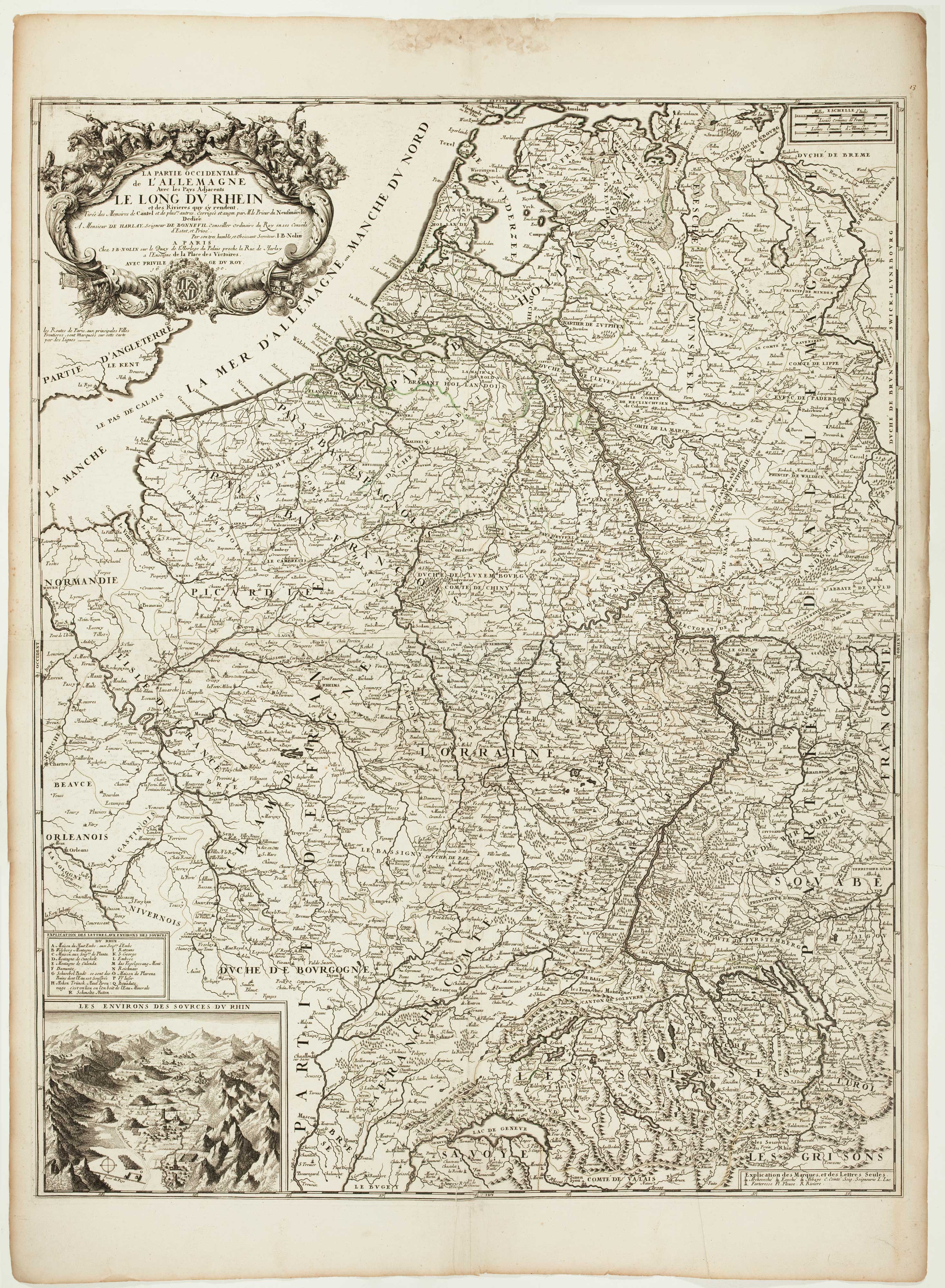
A scarce two-sheet map of the Rhine Region during the Nine Years' War
NOLIN, Jean Baptiste. Date: 1690 Stock #: 11393 £650.00
[ti_wishlists_addtowishlist]
[ti_wishlists_addtowishlist]
[ti_wishlists_addtowishlist]
[ti_wishlists_addtowishlist]
[ti_wishlists_addtowishlist]
[ti_wishlists_addtowishlist]
[ti_wishlists_addtowishlist]
[ti_wishlists_addtowishlist]

A 17th century map of the environs of Nuremberg
BLAEU, Willem Janszoon. Date: 1667 Stock #: 22585 £300.00
[ti_wishlists_addtowishlist]
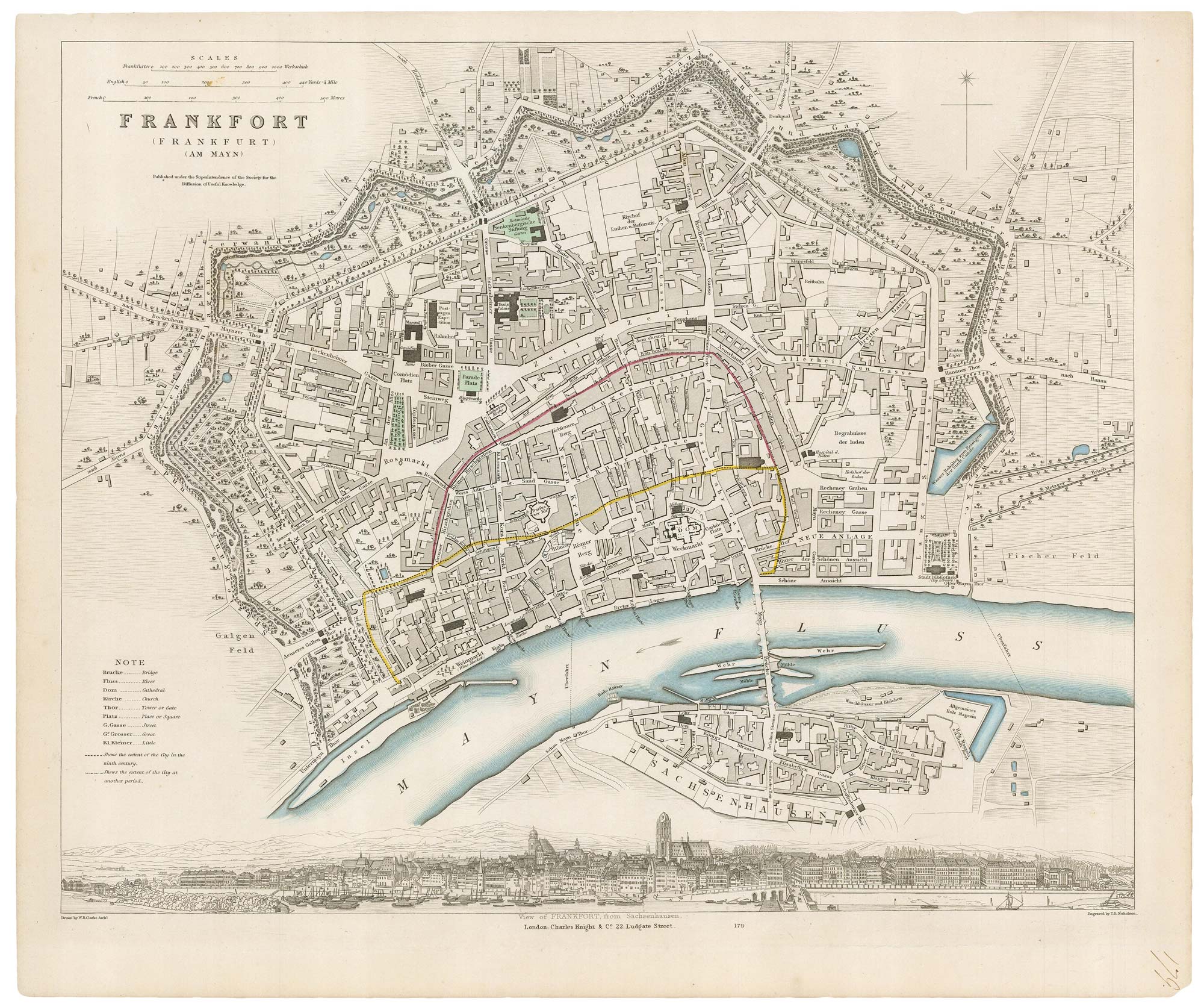
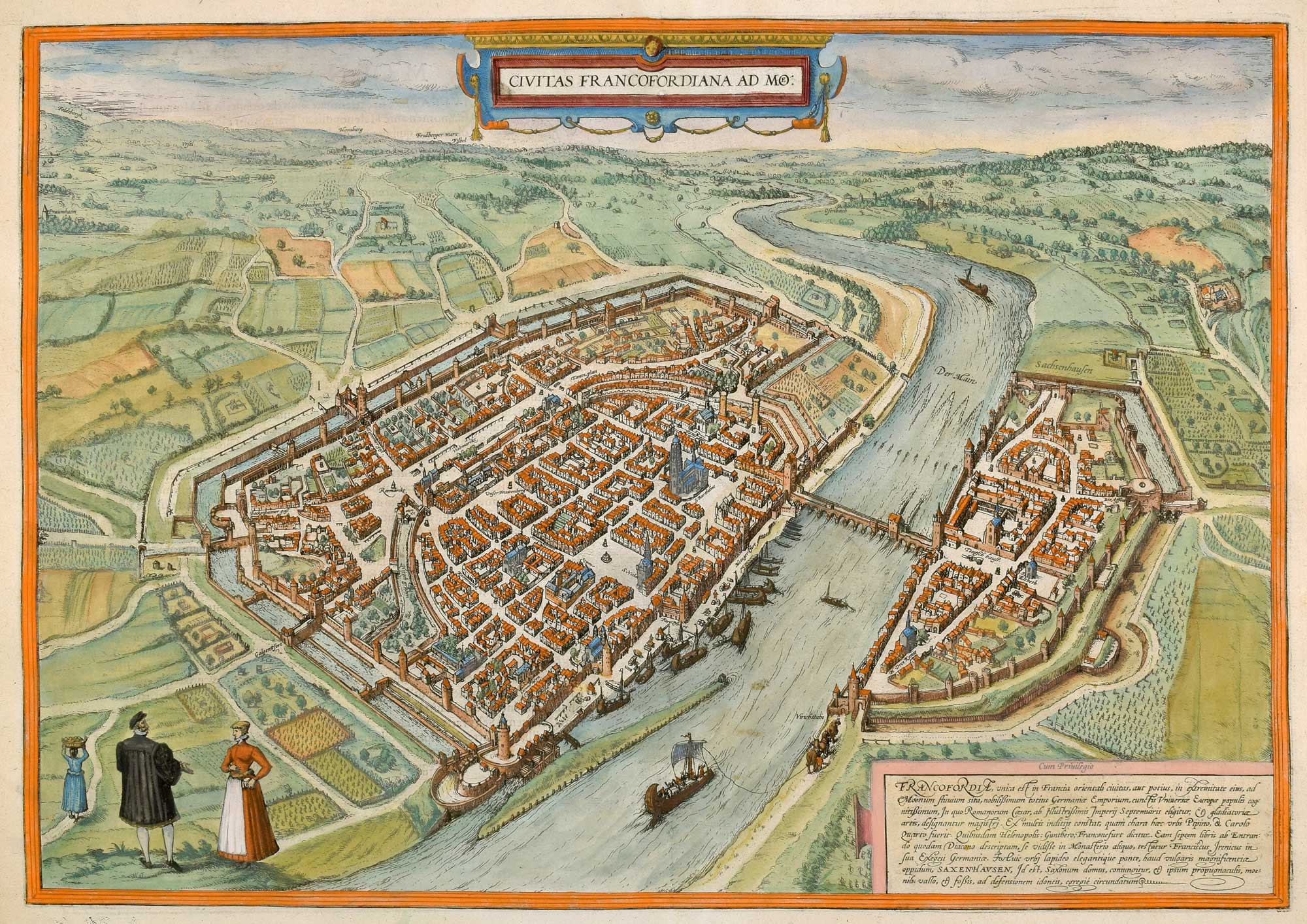
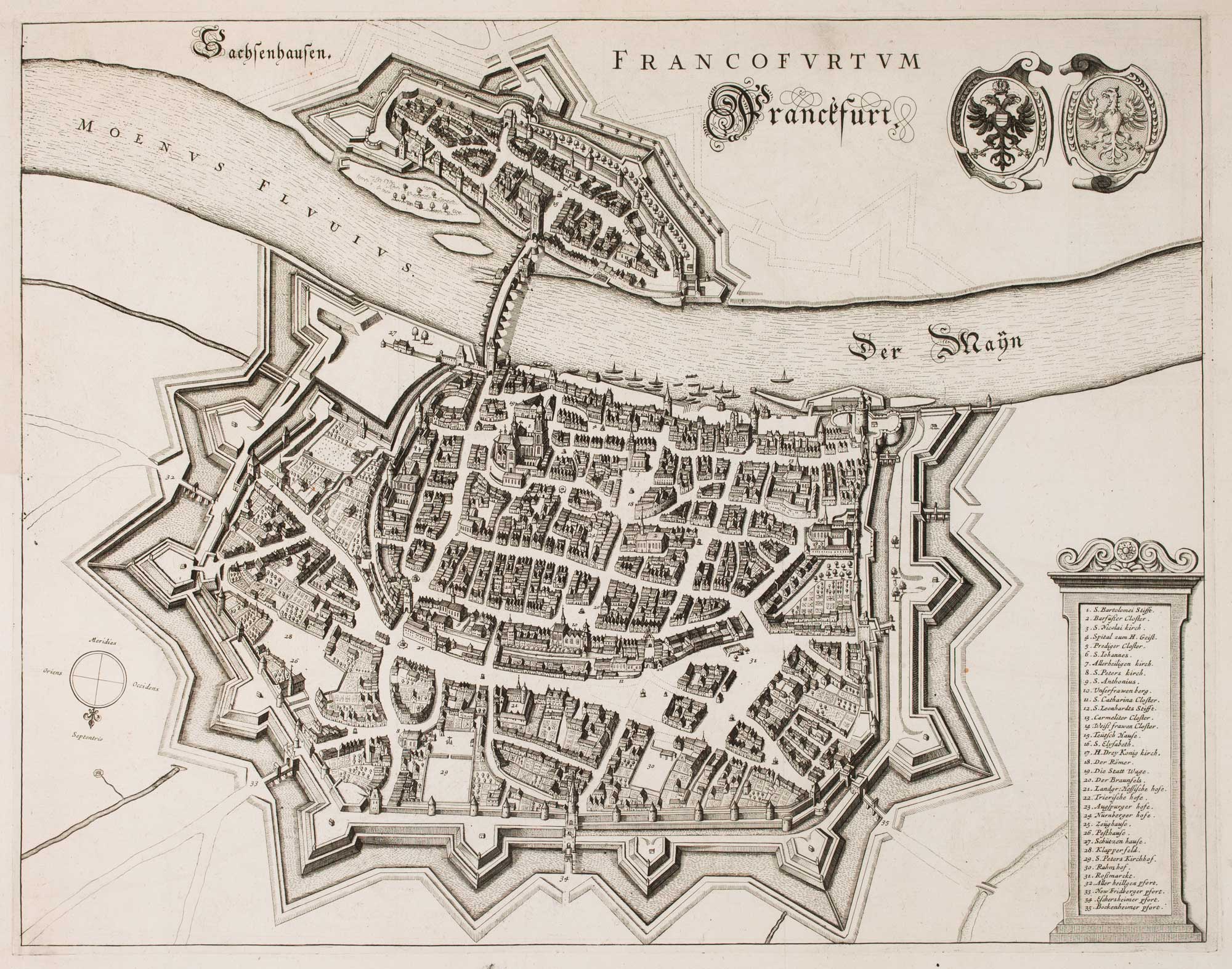
19th century plan of Frankfurt
Society for the Diffusion of Useful Knowledge. Date: 1835 Stock #: 20916 £100.00
[ti_wishlists_addtowishlist]