Antique Maps of Northern Europe
Showing 31–60 of 94 products
Sort by:
[ti_wishlists_addtowishlist]
[ti_wishlists_addtowishlist]
[ti_wishlists_addtowishlist]
The scarce second Galle plate for Iceland used in the 'Epitome'
ORTELIUS, Abraham. Date: 1598 Stock #: 23194 £600.00
[ti_wishlists_addtowishlist]
[ti_wishlists_addtowishlist]

[ti_wishlists_addtowishlist]
A separately-issued map of Denmark, the earliest dated map by de Wit
DE WIT, Frederick. Date: 1659 Stock #: 23255 £750.00
[ti_wishlists_addtowishlist]
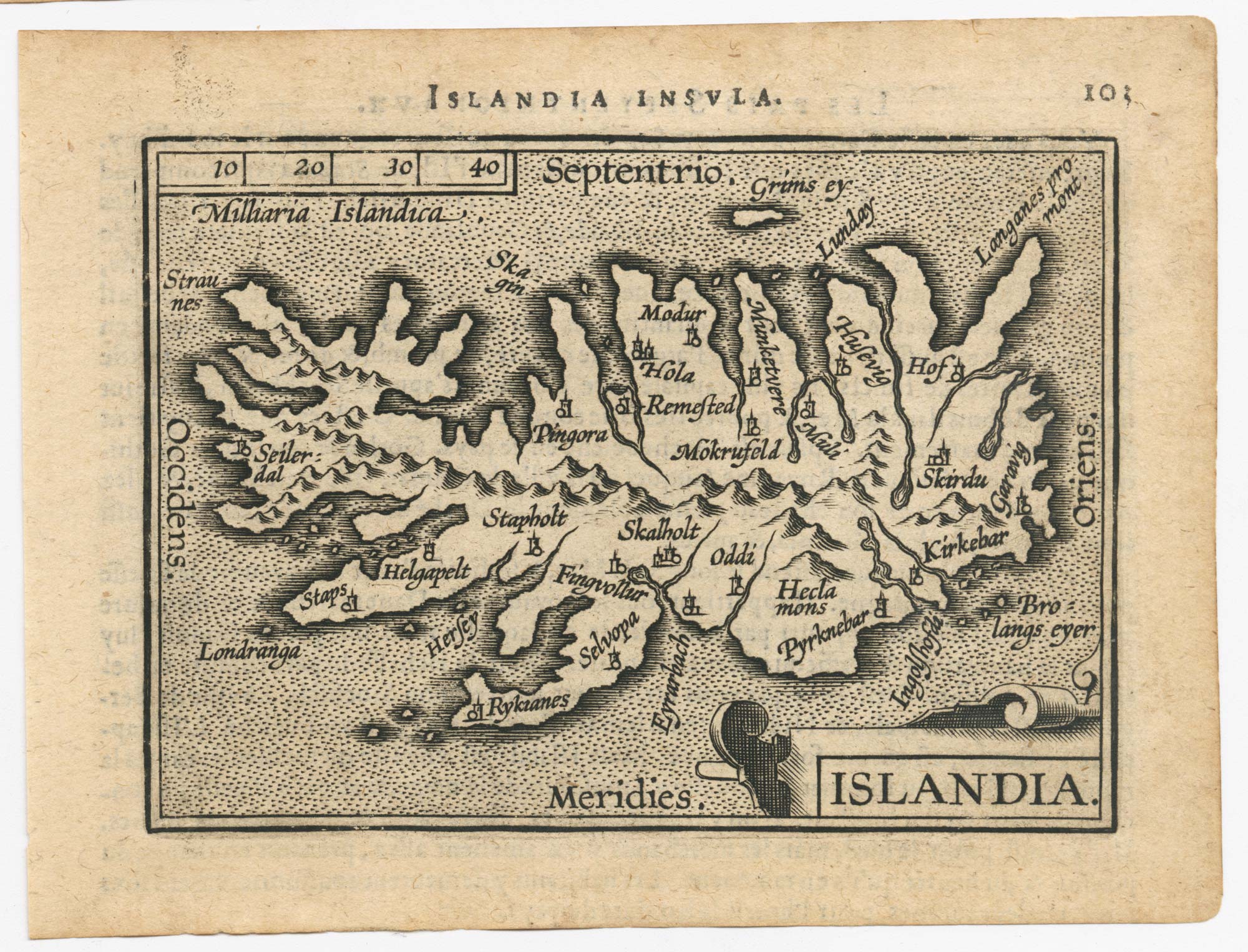
Early 17th century map of Iceland in fabulous early colour
MERCATOR, Gerard. Date: 1608 Stock #: 23475 £1,800.00
[ti_wishlists_addtowishlist]
[ti_wishlists_addtowishlist]
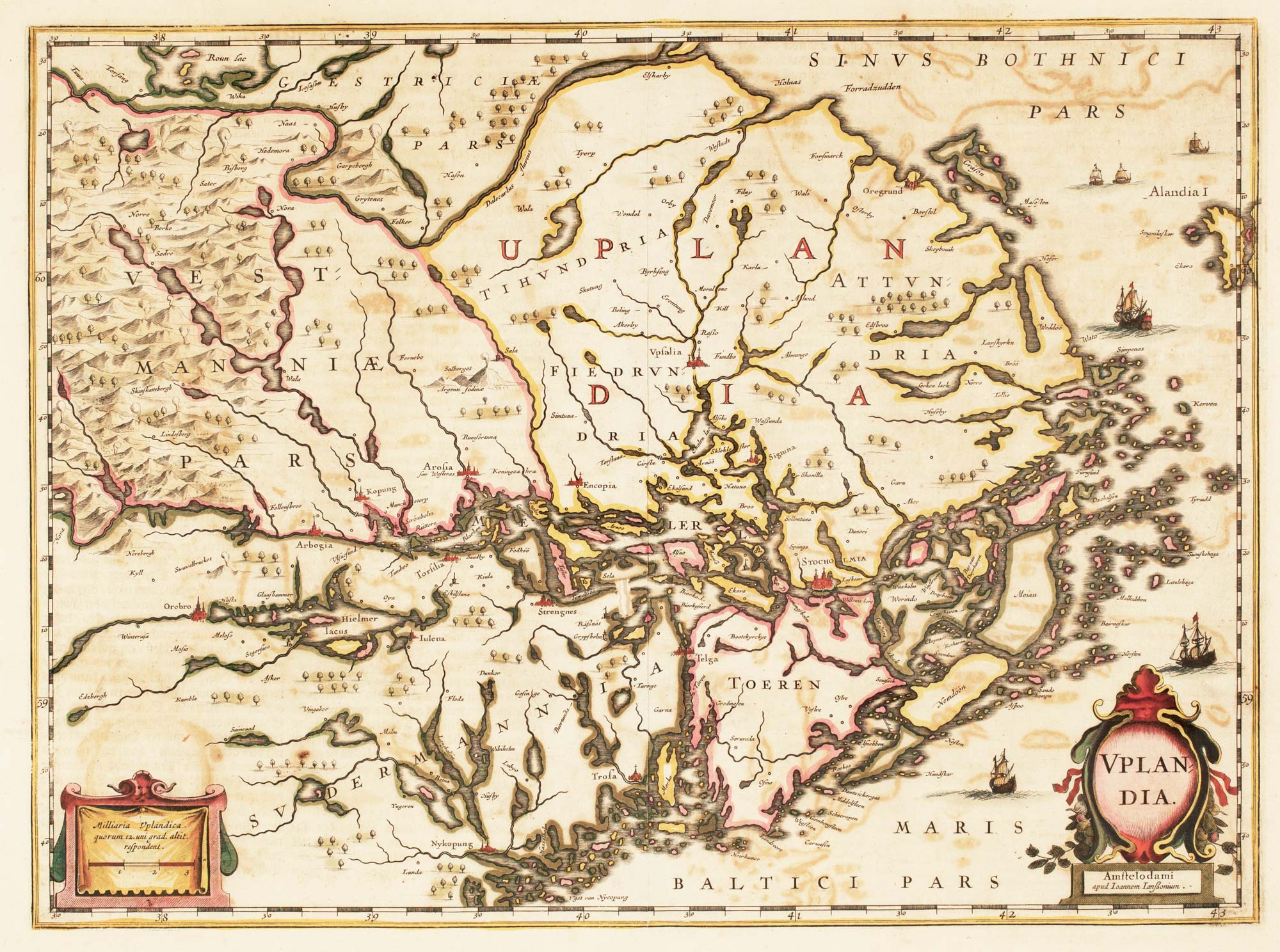
17th century Dutch map of Upland, marking Stockholm
HONDIUS, Henricus. Date: 1647 Stock #: 22704 £450.00
[ti_wishlists_addtowishlist]
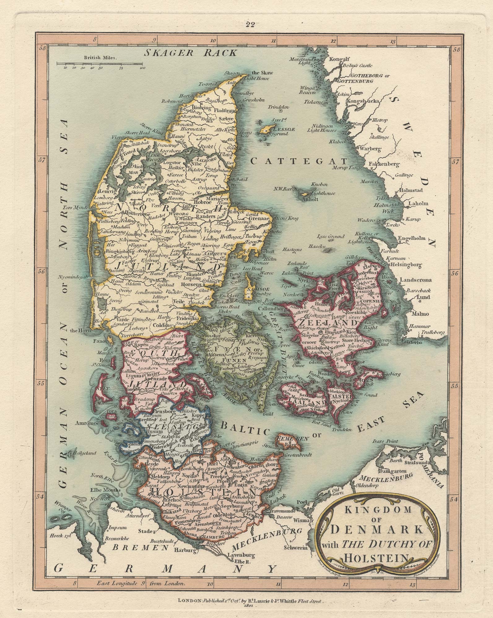
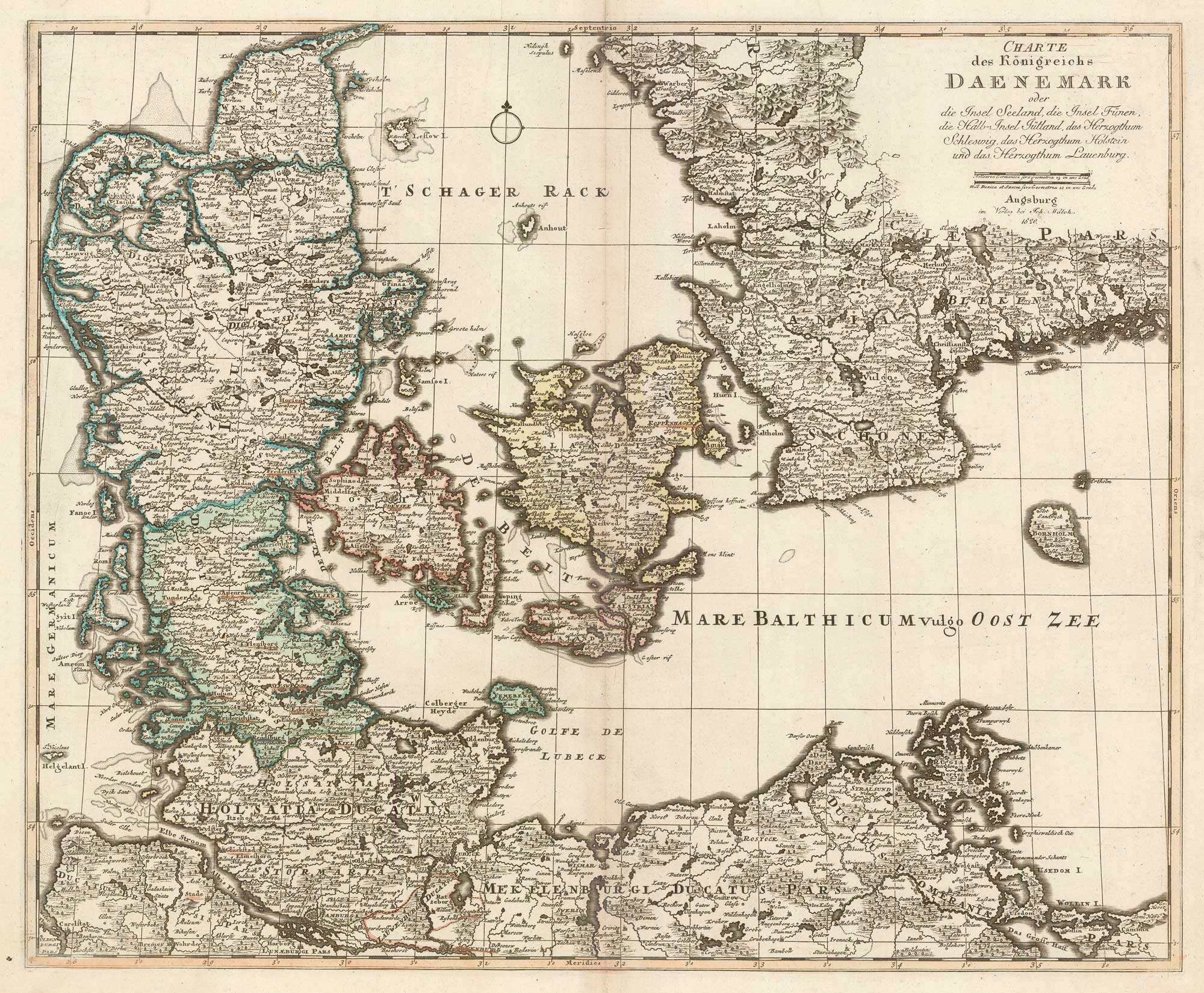
An early 19th century map of Denmark in fine colour
LAURIE & WHITTLE. Date: 1801 Stock #: 22819 £160.00
[ti_wishlists_addtowishlist]
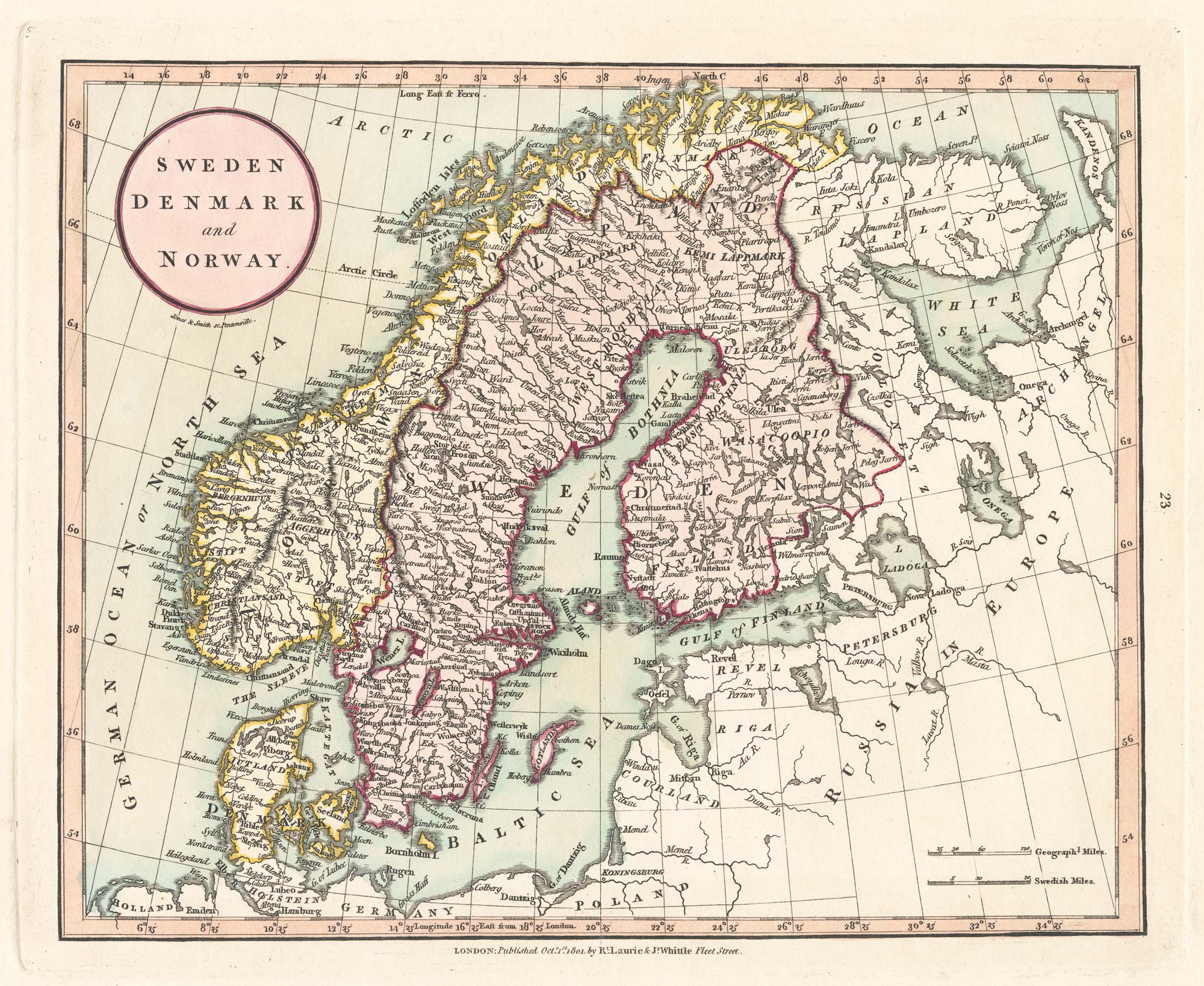
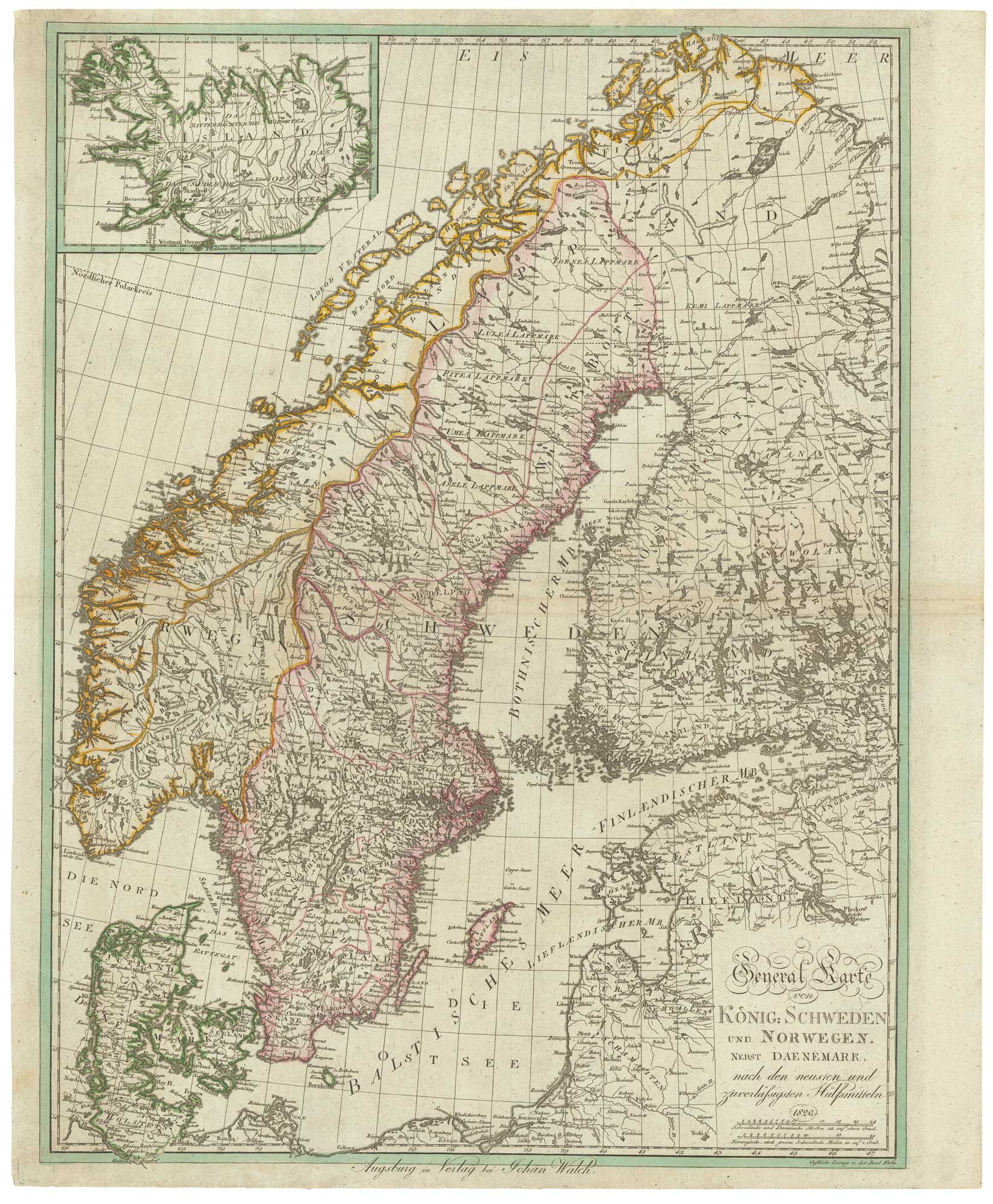
An early 19th century map of Scandinavia in fine colour
LAURIE & WHITTLE. Date: 1801 Stock #: 22823 £150.00
[ti_wishlists_addtowishlist]
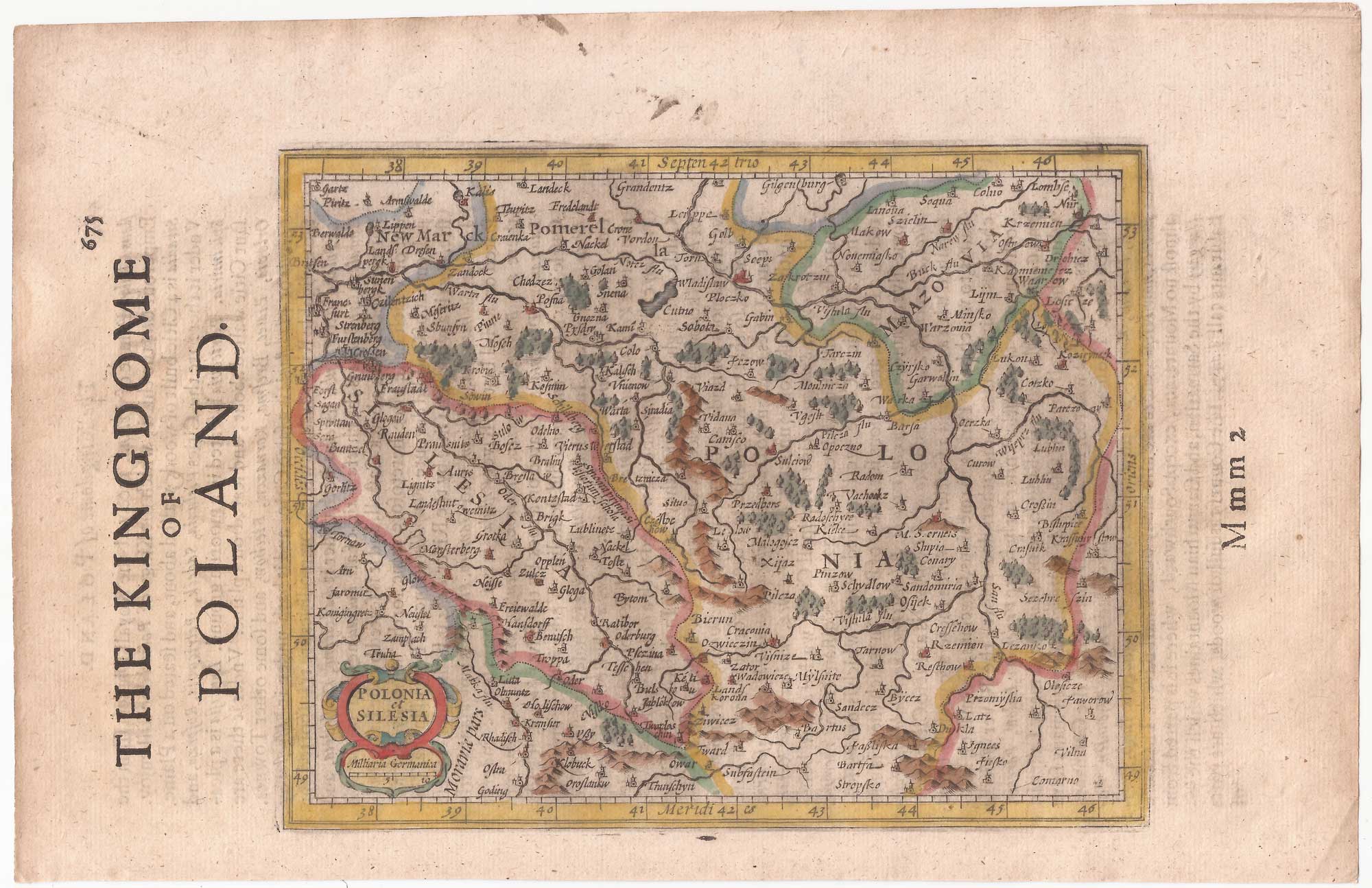
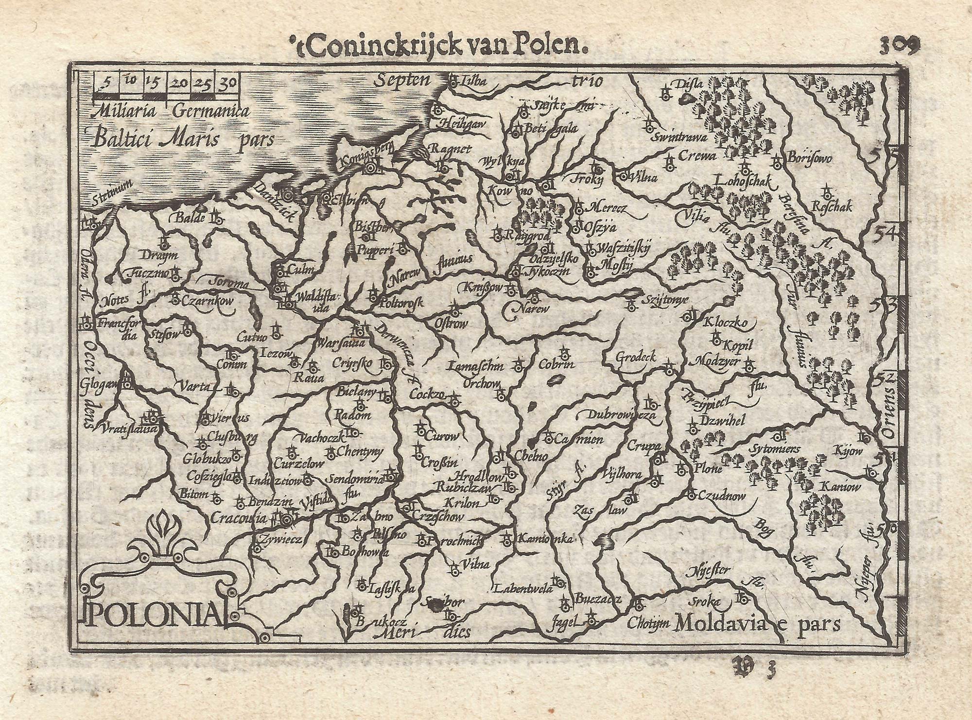
Poland from the first English Edition of the 'Atlas Minor'
HONDIUS, Jodocus. Date: 1635 Stock #: 22441 £180.00
[ti_wishlists_addtowishlist]
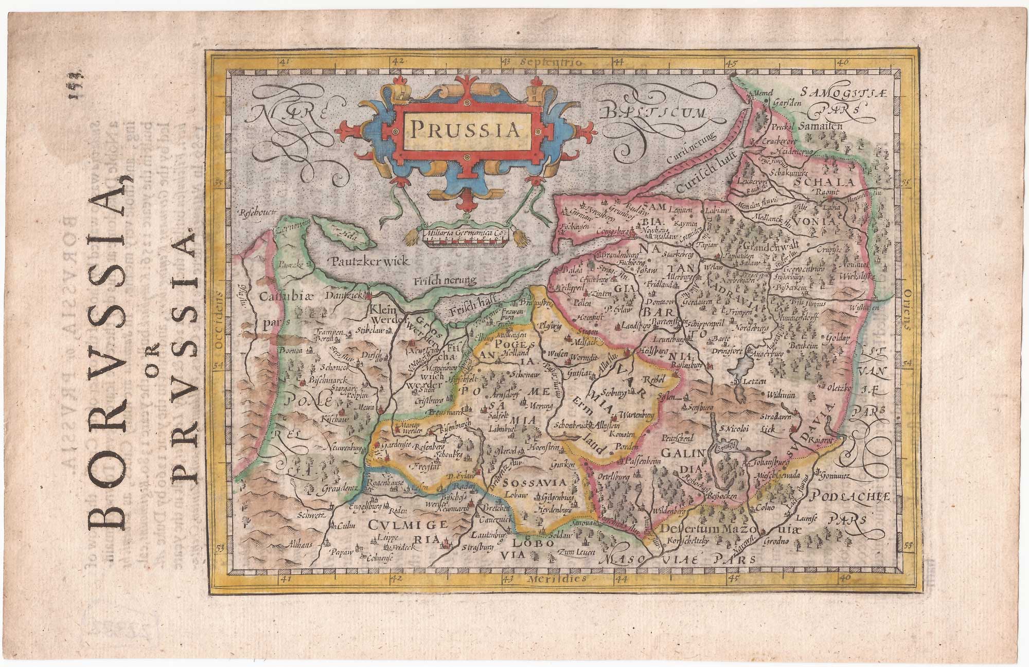
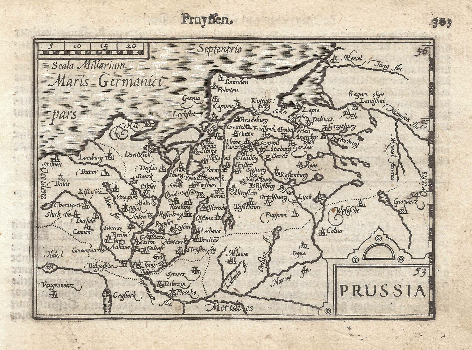
Prussia from the first English Edition of the 'Atlas Minor'
HONDIUS, Jodocus. Date: 1635 Stock #: 22382 £220.00
[ti_wishlists_addtowishlist]
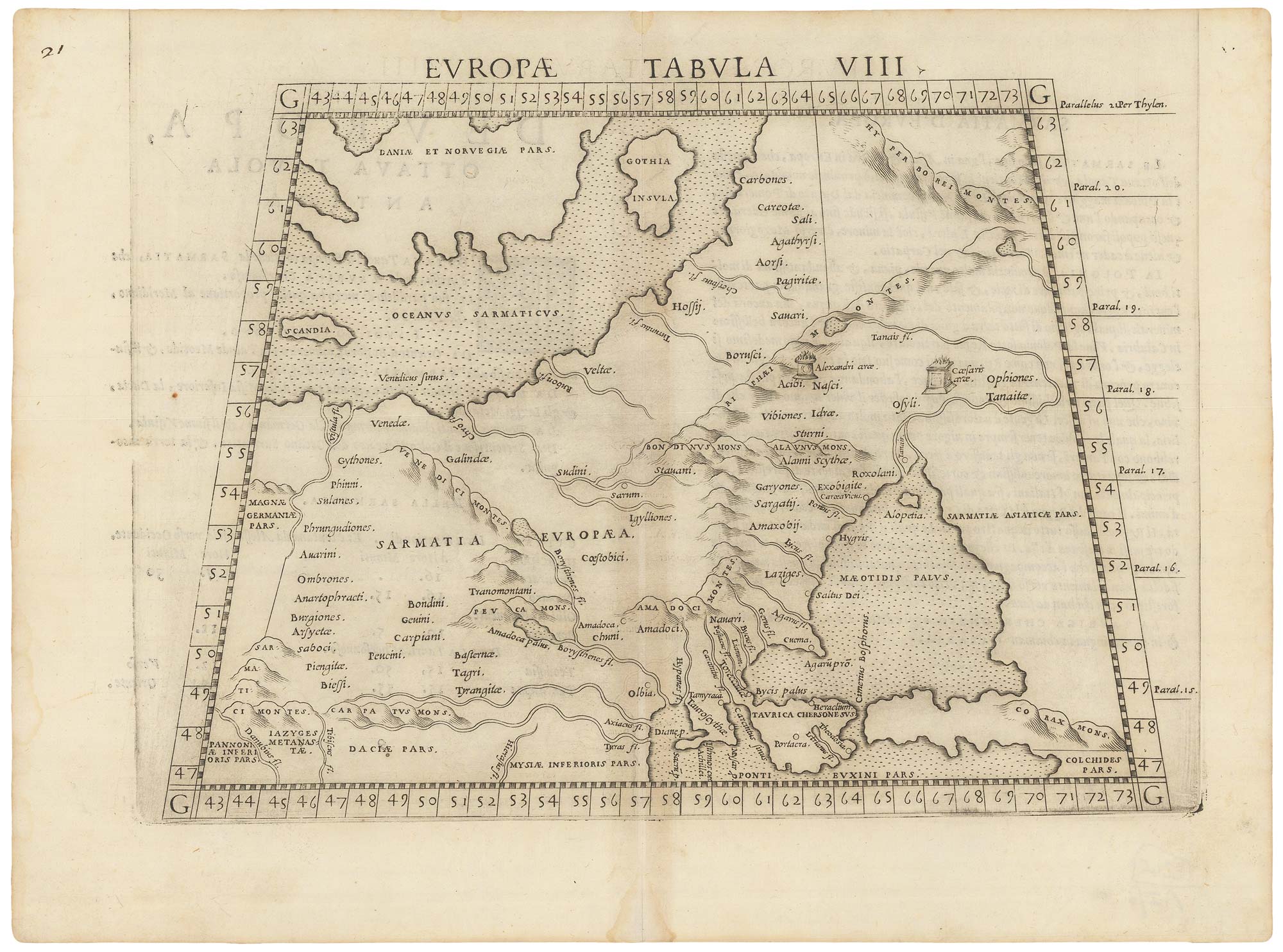
A 16th century map of eastern Europe according to Ptolemy
RUSCELLI, Girolamo. Date: 1599 Stock #: 22245 £220.00
[ti_wishlists_addtowishlist]

[ti_wishlists_addtowishlist]
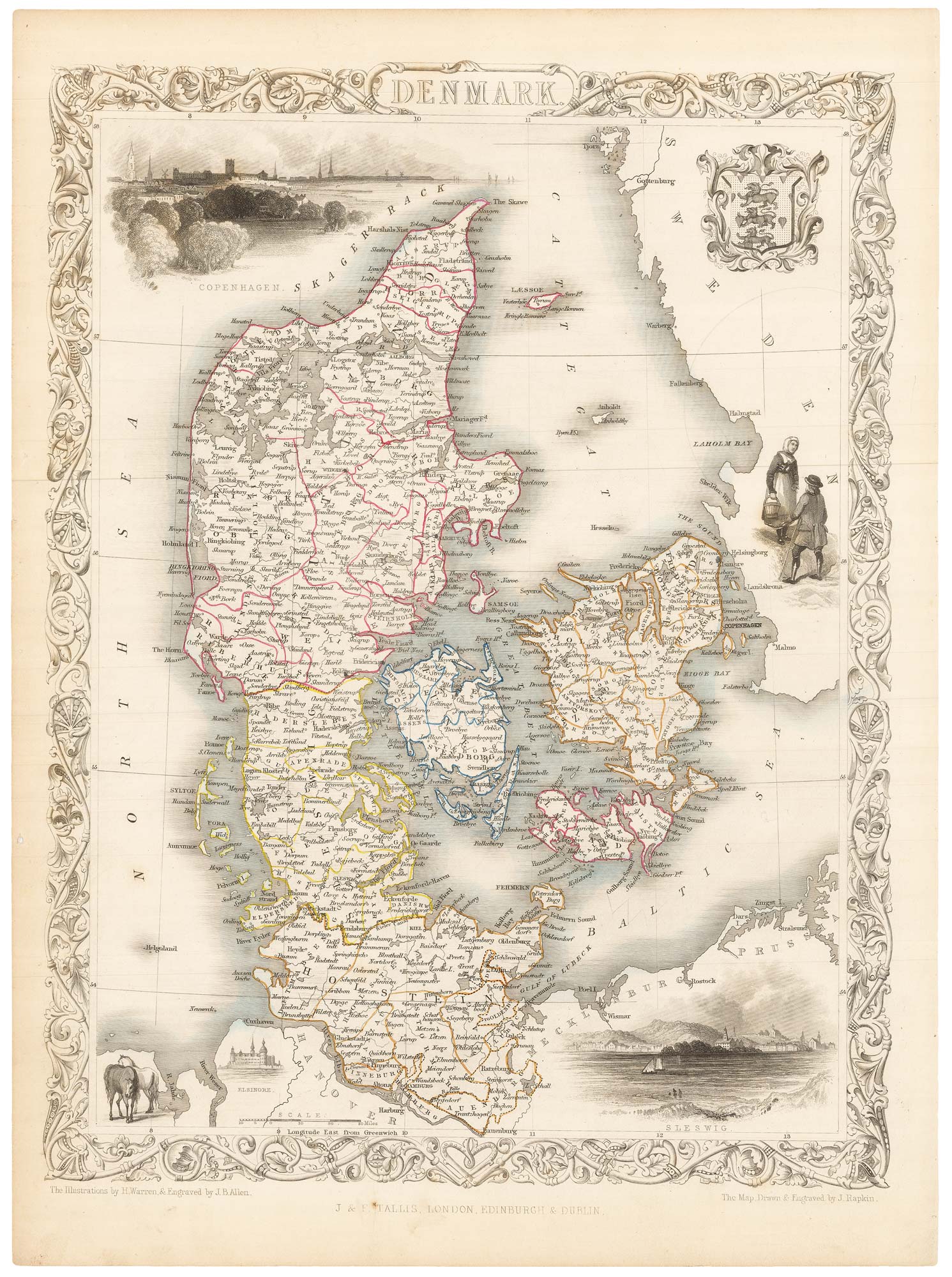
A mid 19th century map of Denmark with decorative vignettes
TALLIS, John. Date: 1851 Stock #: 21622 £125.00
[ti_wishlists_addtowishlist]
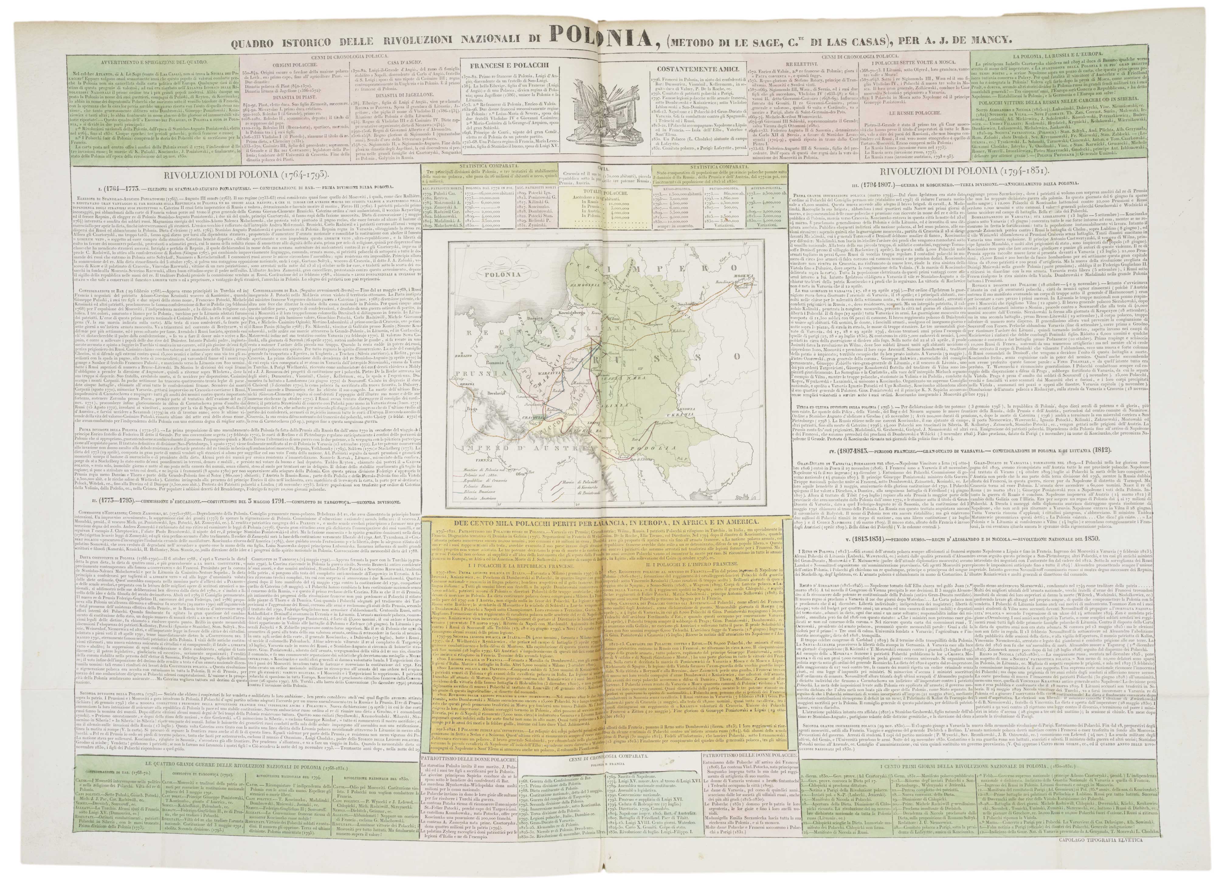
An atlas of the Partitioning of Poland
CHODZKO, Leonard & DUFOUR, Auguste-Henri. Date: 1832 Stock #: 21937 £1,800.00
[ti_wishlists_addtowishlist]
[ti_wishlists_addtowishlist]
[ti_wishlists_addtowishlist]
[ti_wishlists_addtowishlist]
[ti_wishlists_addtowishlist]
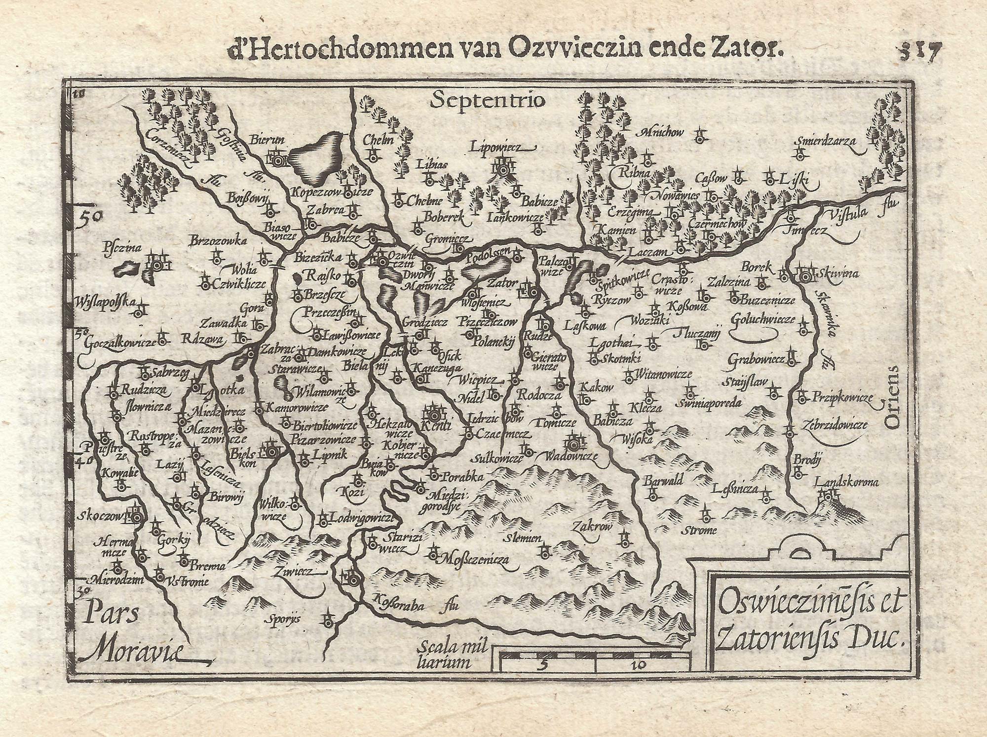
A 16th century miniature map of Oswiecim & Zator
LANGENES, Barent. Date: 1599 Stock #: 21317 £110.00
[ti_wishlists_addtowishlist]
[ti_wishlists_addtowishlist]
[ti_wishlists_addtowishlist]

A pirated edition of the Ortelius Epitome map of eastern Pomerania
ORTELIUS, Abraham. Date: 1655 Stock #: 21723 £160.00
[ti_wishlists_addtowishlist]
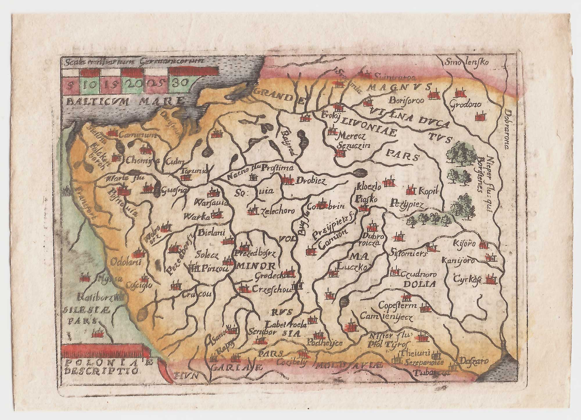
A pirated edition of the Ortelius Epitome map of Poland
ORTELIUS, Abraham. Date: 1655 Stock #: 21727 £180.00
[ti_wishlists_addtowishlist]
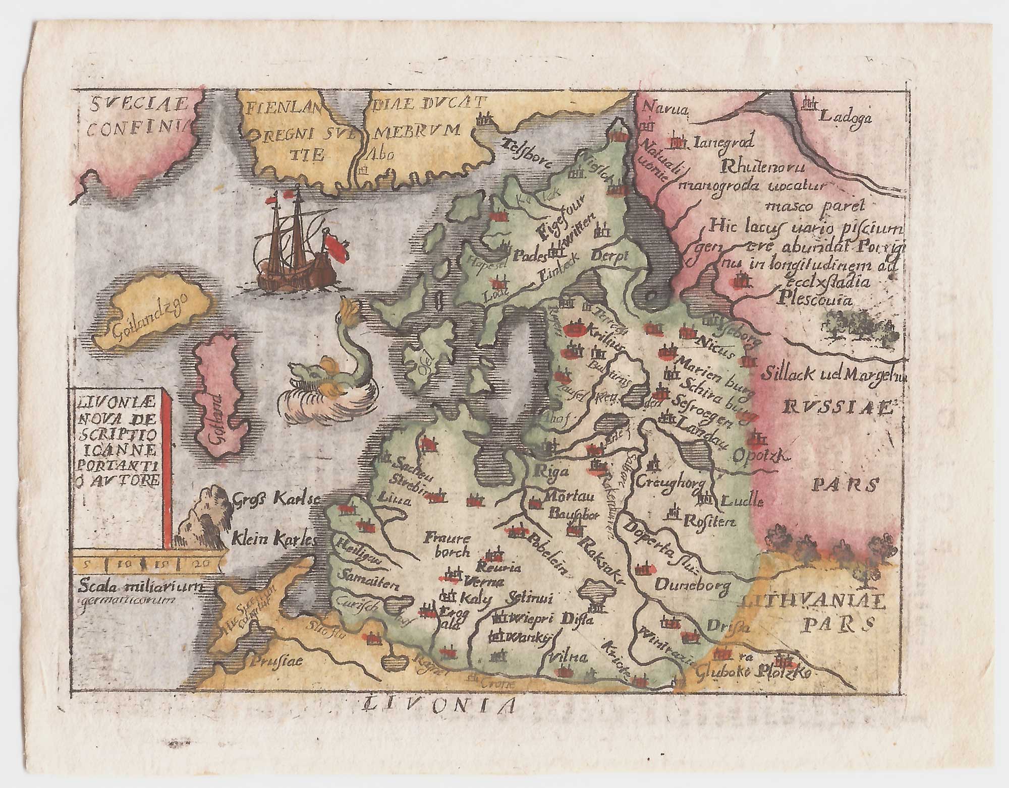
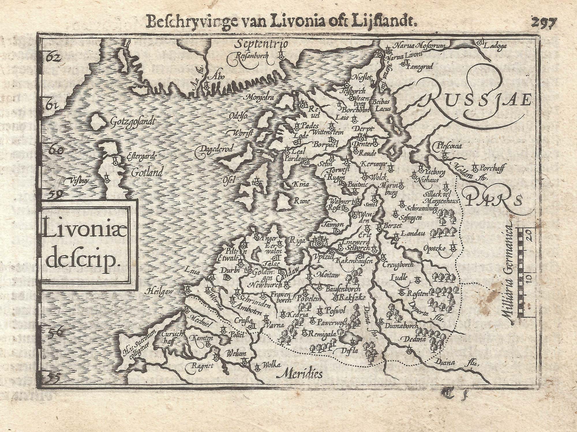
Pirated edition of the Epitome map of Latvia & Estonia
ORTELIUS, Abraham. Date: 1655 Stock #: 21728 £95.00
[ti_wishlists_addtowishlist]
[ti_wishlists_addtowishlist]
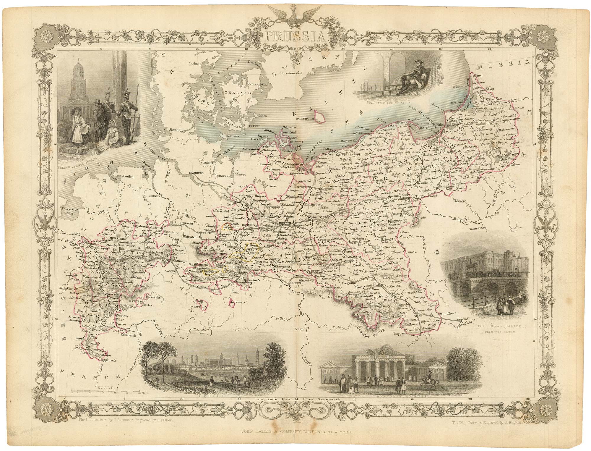
Mid-19th century map of Prussia with decorative vignettes
TALLIS, John. Date: 1851 Stock #: 19450 £120.00
[ti_wishlists_addtowishlist]