Antique Maps by DE WIT, Frederick.
Showing 1–19 of 19 products
Sort by:
[ti_wishlists_addtowishlist]
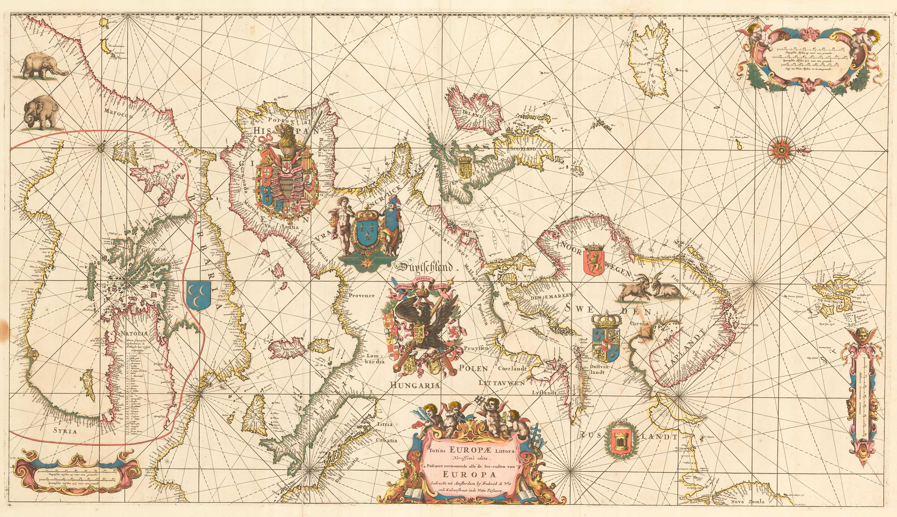
An exceptional 17th century sea chart of Europe
DE WIT, Frederick. Date: 1675 Stock #: 23450 £7,500.00
[ti_wishlists_addtowishlist]

[ti_wishlists_addtowishlist]

[ti_wishlists_addtowishlist]
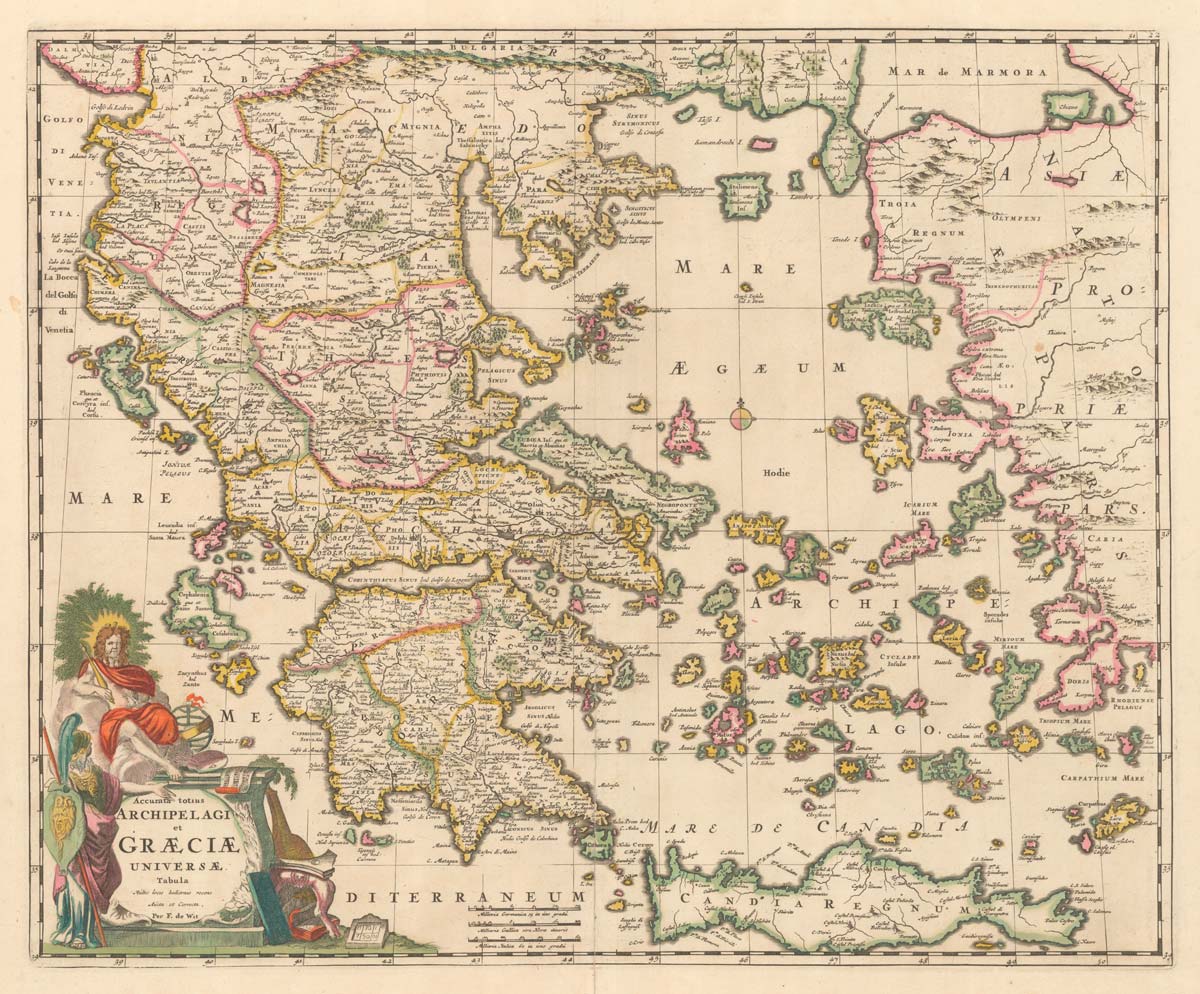
A late 17th century map of Greece in fine colour
DE WIT, Frederick. Date: 1680 Stock #: 20417 £750.00
[ti_wishlists_addtowishlist]
[ti_wishlists_addtowishlist]
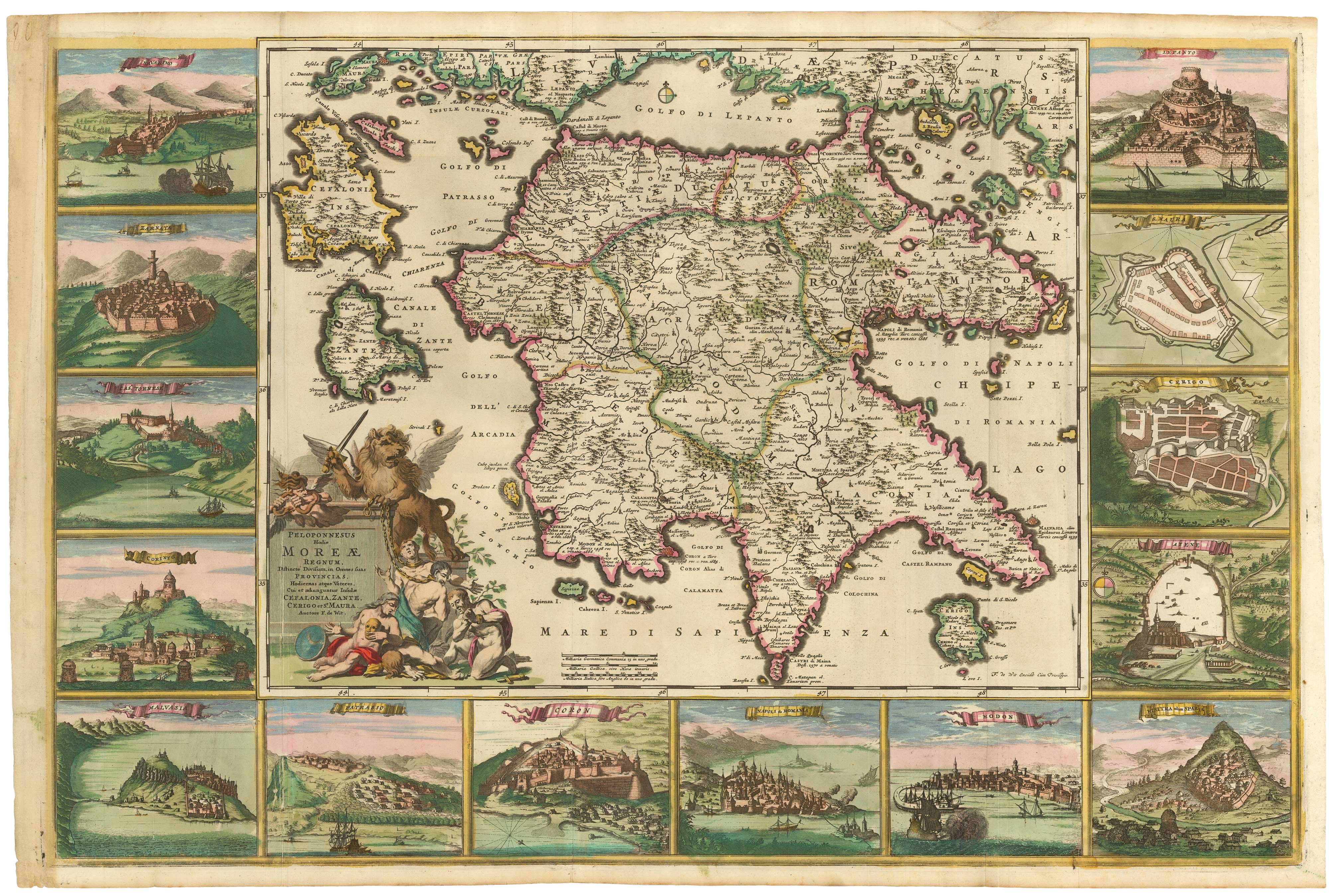
The Morea in fine original colour, surrounded by prospects of towns
DE WIT, Frederick. Date: 1685 Stock #: 21953 £4,500.00
[ti_wishlists_addtowishlist]
[ti_wishlists_addtowishlist]
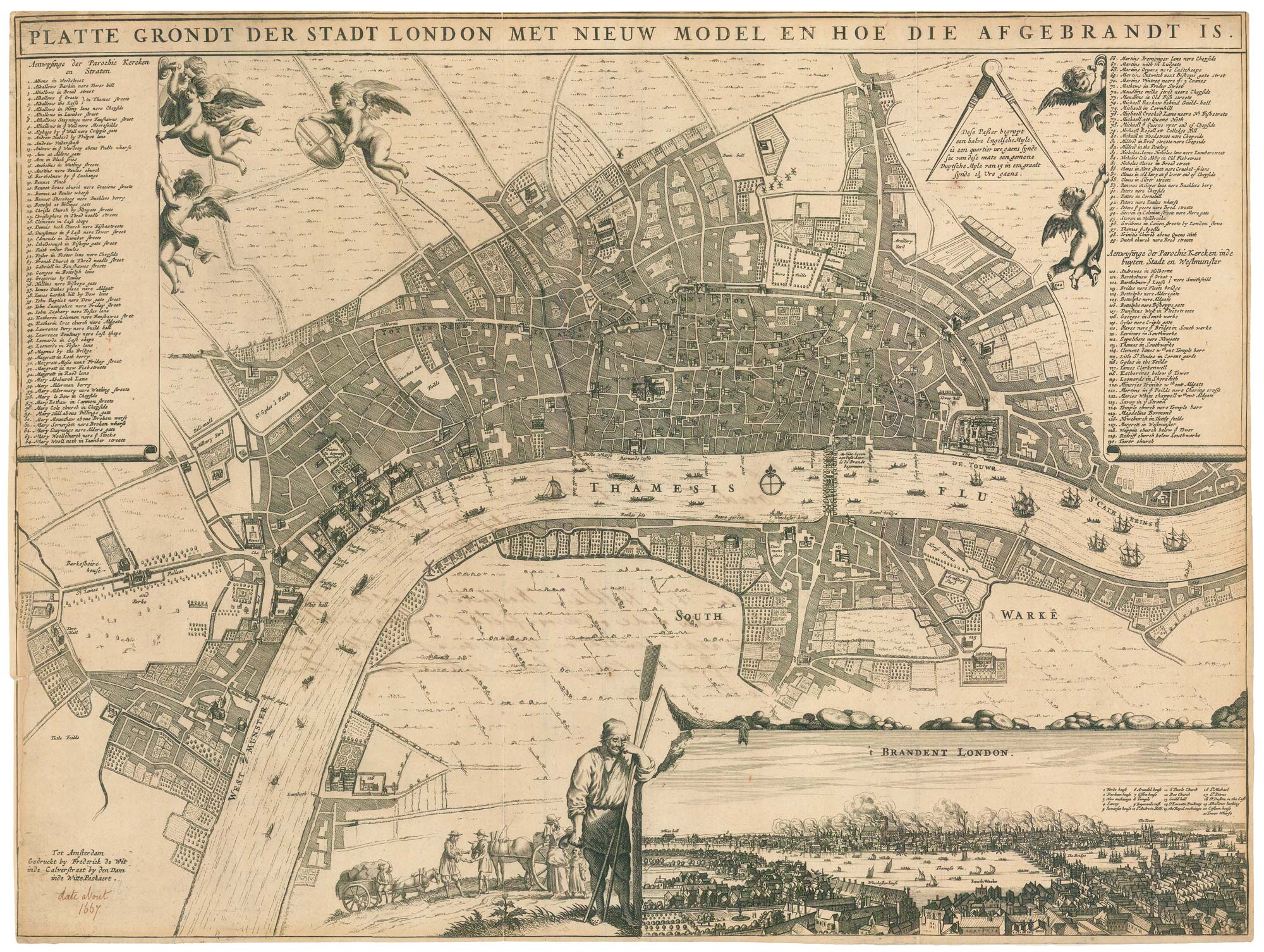
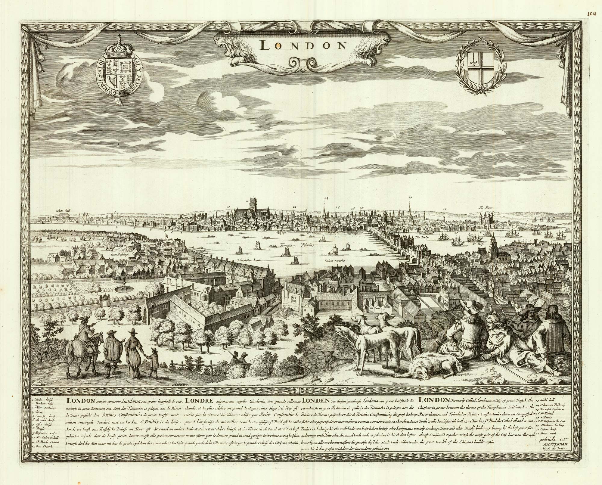
A rare broadsheet map of the Great Fire of London of 1666
DE WIT, Frederick. Date: 1666 Stock #: 24892 £7,500.00
[ti_wishlists_addtowishlist]
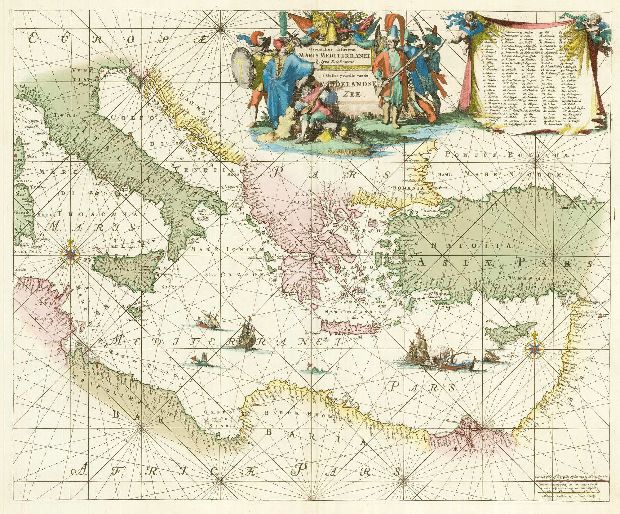
A 17th century chart of the eastern Mediterranean in fine colour.
DE WIT, Frederick. Date: 1745 Stock #: 24490 £1,600.00
[ti_wishlists_addtowishlist]
[ti_wishlists_addtowishlist]
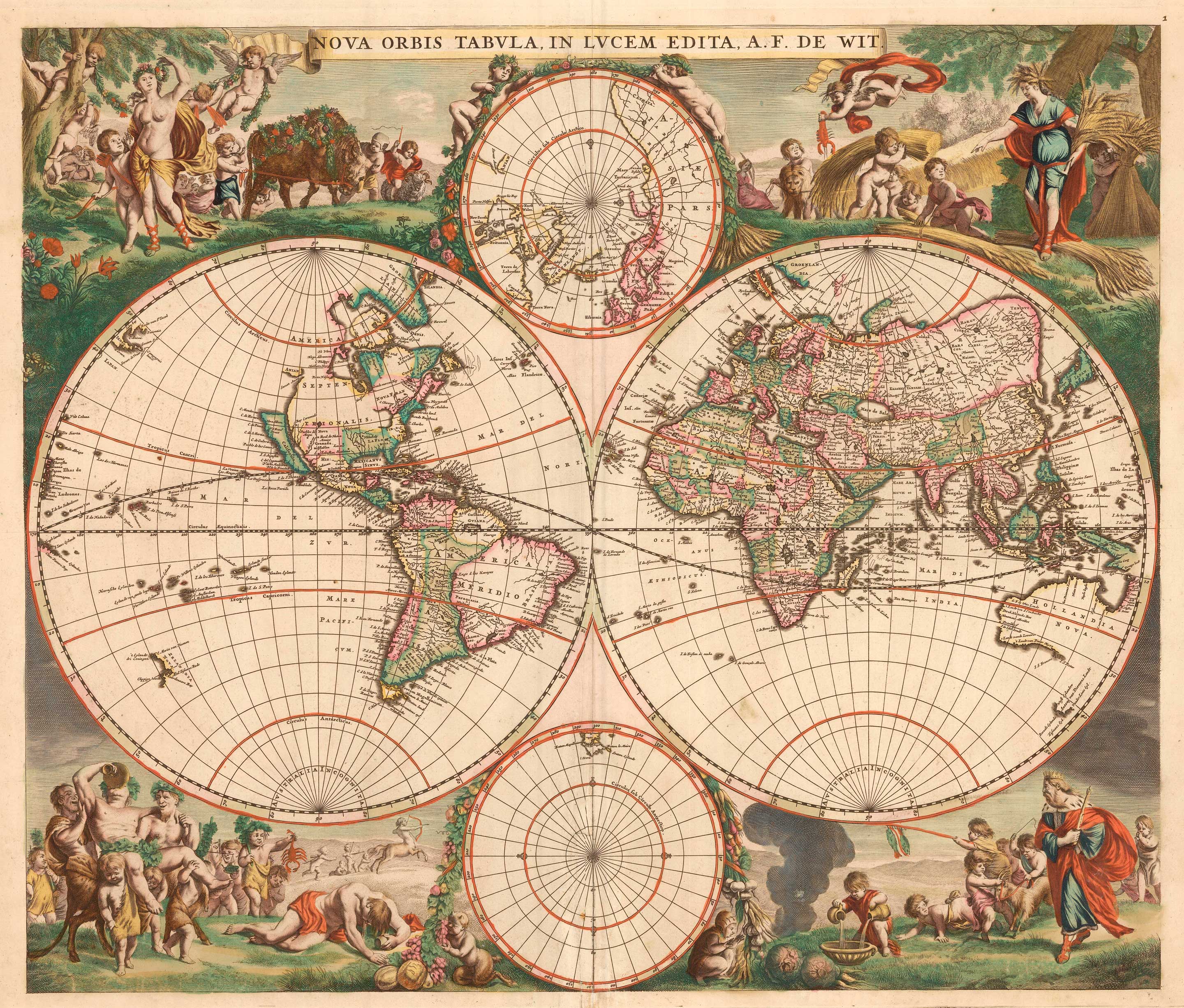
A 17th century Dutch World map with superb decorative borders
DE WIT, Frederick. Date: 1670 Stock #: 23590 £5,500.00
[ti_wishlists_addtowishlist]

[ti_wishlists_addtowishlist]
[ti_wishlists_addtowishlist]

[ti_wishlists_addtowishlist]
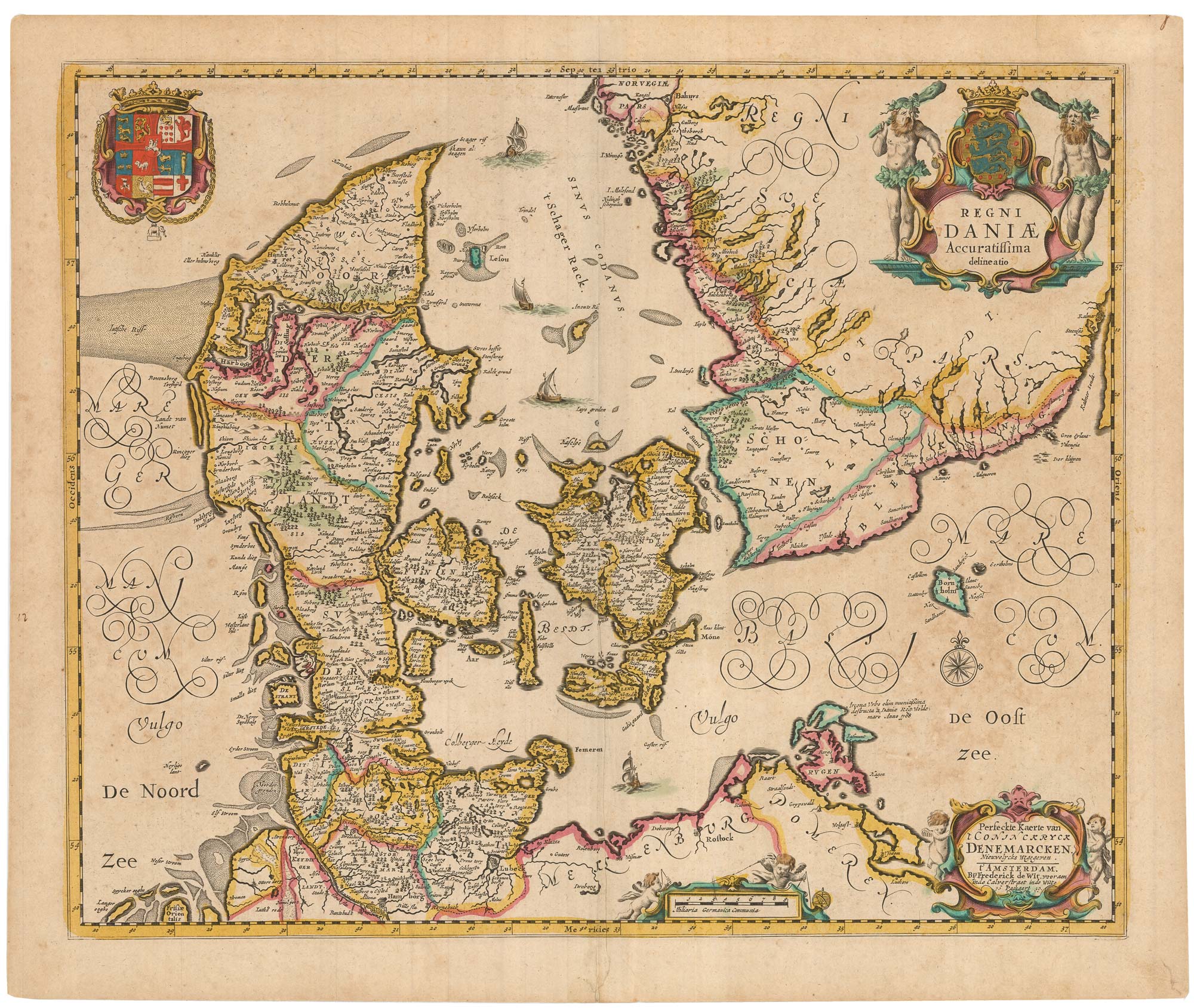
A separately-issued map of Denmark, the earliest dated map by de Wit
DE WIT, Frederick. Date: 1659 Stock #: 23255 £750.00
[ti_wishlists_addtowishlist]
[ti_wishlists_addtowishlist]

[ti_wishlists_addtowishlist]
[ti_wishlists_addtowishlist]