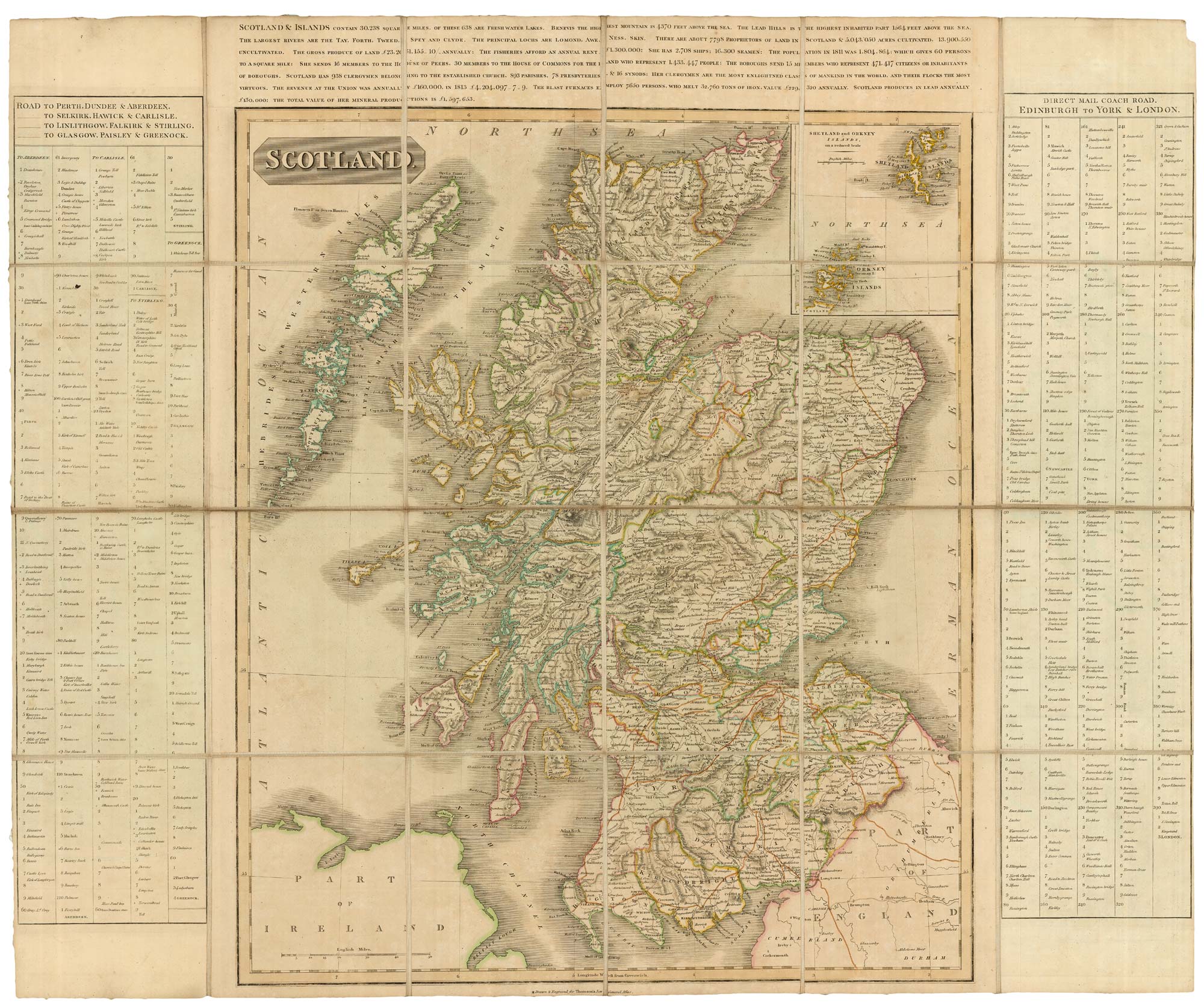


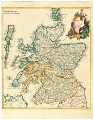
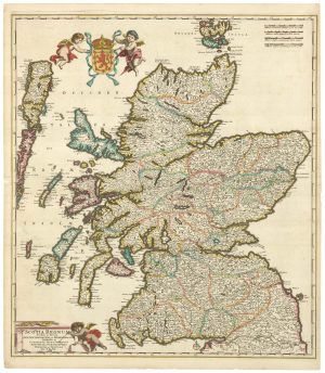
An unusual variant of Thomson’s map of Scotland
Scotland.
Edinburgh, John Thomson & Co, c.1825. Original colour. Map 600 x 540mm, with extra printed table borders, total 675 x 810mm, dissected and laid on linen with bookseller's label, folded into a slipcase with title label.
£420.00
1 in stock
x
Question About This Item?
An unusual variant of Thomson’s map of Scotland & THOMSON, John.Stock #: 18578
Add to Wishlist
Export as PDFEnquireSimilar to Sell?Add to Wishlist
Description
Although the imprint states that this map was 'Drawn and Engraved for Thomson's New General Atlas', this example has been issued folded with an engraved text description of Scotland, a table of roads of Scotland, and a table of the places on the Mail Coach Road between Edinburgh and London via York. The slipcase label reads 'A New Travelling Map of Scotland... Constructed from Mr Arrowsmith's Celebrated map... Published by John Thomson & Co.'.
Curiously, the map appears to be printed on the verso of sheets of other Thomson maps; this is only obvious when held up to the light.
The bookseller's label reads 'Thomson Brothers, Booksellers & Stationers, No 2 Princes Street Edinburgh'; The National Library of Scotland's 'Scottish Book Trade Index' names one as John (not the mapmaker!) and dates them to 1821-5.
Condition:
Slipcase worn.Related products
-
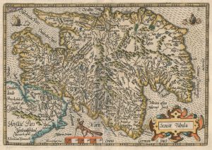
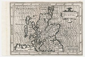
An early 17th century map of Scotland
QUAD, Matthias. Date: 1608Stock #: 22372 £450.00 -
A scarce road map of Scotland
AINSLIE, John. Date: 1790Stock #: 18581 £725.00 -
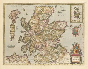
A Dutch map of Scotland in fine original colour
JANSSON, Jan. Date: 1638Stock #: 23840 £725.00 -
An 18th century map of Scotland
LE ROUGE, Georges-Louis. Date: 1746Stock #: 24901 £650.00 -
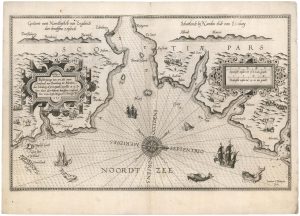
The First State of Waghenaer’s sea chart of south east Scotland
WAGHENAER, Lucas Janzoon. Date: 1585Stock #: 21772 £3,500.00 -
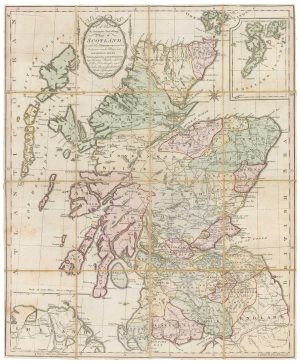
A scarce miniature map of Scotland
ROGIERS, Salomon. Date: 1807Stock #: 22089 £160.00 -
A 17th century old map of Scotland
DE WIT, Frederick. Date: 1680Stock #: 23591 £750.00 -
An extremely rare anti-smuggling chart of Scotland’s east coast
AINSLIE, John. Date: 1785Stock #: 24752 £2,500.00 -
18th century map of Scotland
SEUTTER, Matthaus. Date: 1742Stock #: 19492 £750.00
Items by the same author
Add to Wishlist
Add to Wishlist
British possessions at the end of the Napoleonic War
THOMSON, John. Date: 1816 Stock #: 24863 £200.00
Add to Wishlist
Add to Wishlist