A scarce two-sheet map of Alsace
Alsatiae Superioris et Inferioris accuratissima Geographica Descriptio. Correcta et aucta Basileae anno MDCCII. Recusa Norimbergae eodem anno.
Nuremberg, c.1702. Two sheets conjoined, total 415 x 1215mm.
£1,300.00
Description
A map of Alsace, orientated with north to the right, showing the Rhine from Speyer south past Strasbourg to Basel and Rheinfelden. Top right is a Latin-text description within an elaborate martial cartouche. The map was compiled five years after the Treaty of Ryswick (1697) confirmed Strasbourg as a French possession.
Condition:
A fine example.Related products
-
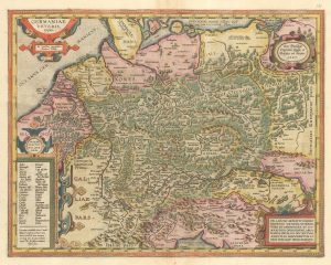
Ortelius’s map of Ancient Germany in fine colour
ORTELIUS, Abraham. Date: 1603Stock #: 23810 £600.00 -
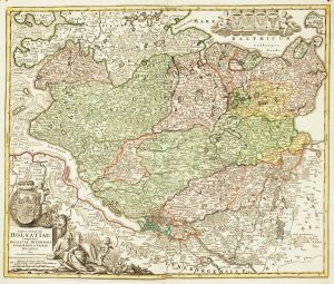
18th century map of Holstein
HOMANN, Johann Baptist. Date: 1720Stock #: 11370 £200.00 -
18th century map of Brunswick and its environs
SEUTTER, Matthaus. Date: 1735Stock #: 9404 £260.00 -
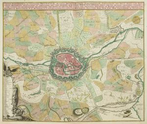
A 18th century plan of Kiel
HOMANN HEIRS. Date: 1735Stock #: 25100 £600.00 -
A 16th century miniature map of Dithmarschen
LANGENES, Barent. Date: 1599Stock #: 21169 £55.00 -
The German possessions of the Georgian monarchs
JEFFERYS, Thomas. Date: 1789Stock #: 7964 £280.00 -
A 17th century map of the Duchy of Holstein
HONDIUS, Henricus. Date: 1632Stock #: 25099 £450.00 -
A map of Germany compiled by Frans Hogenberg in fine colour
ORTELIUS, Abraham. Date: 1603Stock #: 23805 £650.00 -
Germany from the first English atlas of the World
SPEED, John. Date: 1665Stock #: 23993 £1,400.00
Items by the same author
[ti_wishlists_addtowishlist]