


Map of Reunion
Ile Bourbon.
Paris, c.1820. Original colour. 110 x 120mm.
£130.00
Description
A charming map of La Réunion, an island located in the Indian Ocean, east of Madagascar, about 200 kilometres (120 mi) south west of Mauritius
Condition:
A good example.Related products
-
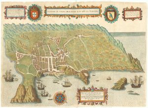
Early map of Tercera
LINSCHOTEN, Jan Huygen van. Date: 1601Stock #: 19798 £900.00 -
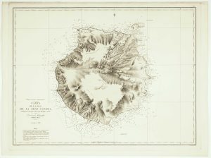
An uncommon Spanish sea chart of Gran Canaria
ARLETT, William. Date: 1868Stock #: 12572 £1,400.00 -
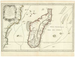
First state of Du Val’s folio map of Madagascar
DU VAL, Pierre. Date: 1666Stock #: 19085 £400.00 -
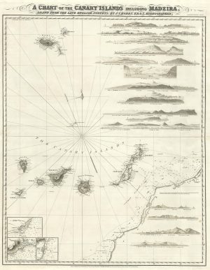
A detailed chart of the Canary Islands and Madeira
HOBBS, John Stratton. Date: 1852Stock #: 19402 £1,650.00 -
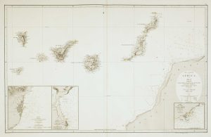
Sea chart of the African coast with Madeira
VIDAL, Alexander & ARLETT, William. Date: 1867Stock #: 12593 £400.00 -
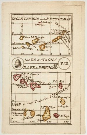
An 18th century playing-card map of the Canaries and Cape Verde Islands
RABATTA, Augusto & BAILOU, Jean Baptist de. Date: 1779Stock #: 13004 £350.00 -
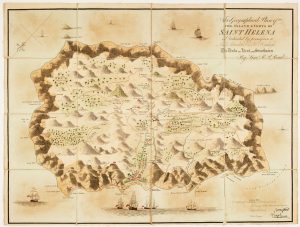
Napoleon in exile on St Helena
READ, R.P. Date: 1815Stock #: 22661 £1,400.00 -
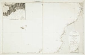
An uncommon 19th century Spanish sea chart of the Canary Islands
VIDAL, Alexander & ARLETT, William. Date: 1855Stock #: 12566 £1,450.00 -
17th century map of Madagascar
CORONELLI, Vincenzo Maria. Date: 1690Stock #: 22294 £550.00
Items by the same author
[ti_wishlists_addtowishlist]
[ti_wishlists_addtowishlist]
[ti_wishlists_addtowishlist]
[ti_wishlists_addtowishlist]
[ti_wishlists_addtowishlist]
[ti_wishlists_addtowishlist]
