


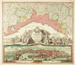
An 18th century playing-card map of Genoa
Governo Aristocratico della Republica di Genova anticamente Liguria.
Florence: Aniello Lamberti, 1779. Original colour. Sheet size 115 x 73mm.
£250.00
1 in stock
x
Question About This Item?
An 18th century playing-card map of Genoa & RABATTA, Augusto & BAILOU, Jean Baptist de.Stock #: 12971Similar to Sell?
Description
A rare miniature map of Genoa engraved by Lamberti for the 'Minchiate', the Florentine version of the Tarot, which had each card marked with an arcane symbol. The full set was published in Augusto Da Rabatta and Jean Baptiste De Baillou's pocket atlas 'Nuovo Atlante Generale'.
Condition:
A good example.Related products
-
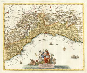
An 18th century map of Liguria with a prospect of Genoa
HOMANN, Johann Baptist. Date: 1730Stock #: 17199 £1,100.00 -
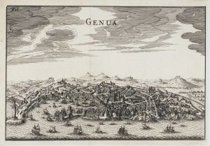
Miniature 17th century bird’s-eye view of Genoa
FURTTENBACH, Joseph. Date: 1627Stock #: 12590 £250.00 -
An 18th century map of the Republic of Genoa
OTTENS, Reinier & Joshua. Date: 1730Stock #: 24821 £600.00 -
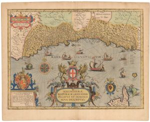
A magnificent map of Liguria in superb original colour
VRIENTS, Jan Baptist. Date: 1608Stock #: 24382 £6,000.00 -
A mid-18th century Italian map of Liguria
ALBRIZZI, Giovanni Battista. Date: 1750Stock #: 23610 £400.00 -
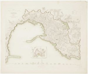
Detailed townplan of Genoa
Society for the Diffusion of Useful Knowledge. Date: 1852Stock #: 14404 £120.00 -
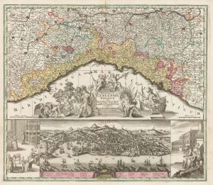
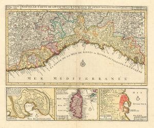
18th century map of Liguria with a prospect of the city of Genoa
SEUTTER, Matthaus. Date: 1730Stock #: 22561 £1,100.00 -
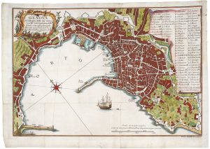
Mid-18th century plan of Genoa
BRUSCO, Giacomo Agostino. Date: 1766Stock #: 20705 £450.00 -
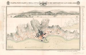
A rare large format plan and prospect of San Remo
CANTU, Alessandro. Date: 1628Stock #: 18376 £2,200.00
Items by the same author
[ti_wishlists_addtowishlist]
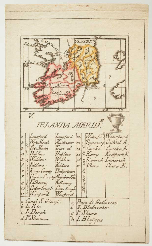
An 18th century playing-card map of southern Ireland
RABATTA, Augusto & BAILOU, Jean Baptist de. Date: 1779 Stock #: 12959 £180.00
[ti_wishlists_addtowishlist]
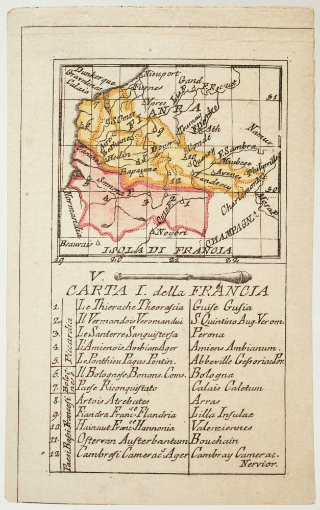
An 18th century playing-card map of France and Flanders
RABATTA, Augusto & BAILOU, Jean Baptist de. Date: 1779 Stock #: 12963 £150.00
[ti_wishlists_addtowishlist]
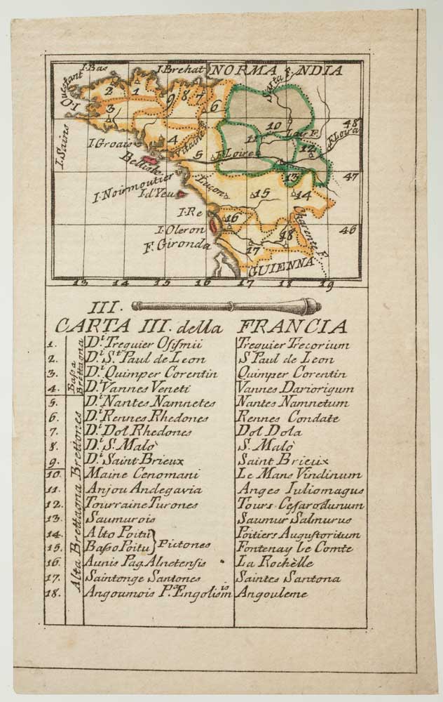
An 18th century playing-card map of Normandy and surrounds
RABATTA, Augusto & BAILOU, Jean Baptist de. Date: 1779 Stock #: 12975 £200.00
[ti_wishlists_addtowishlist]
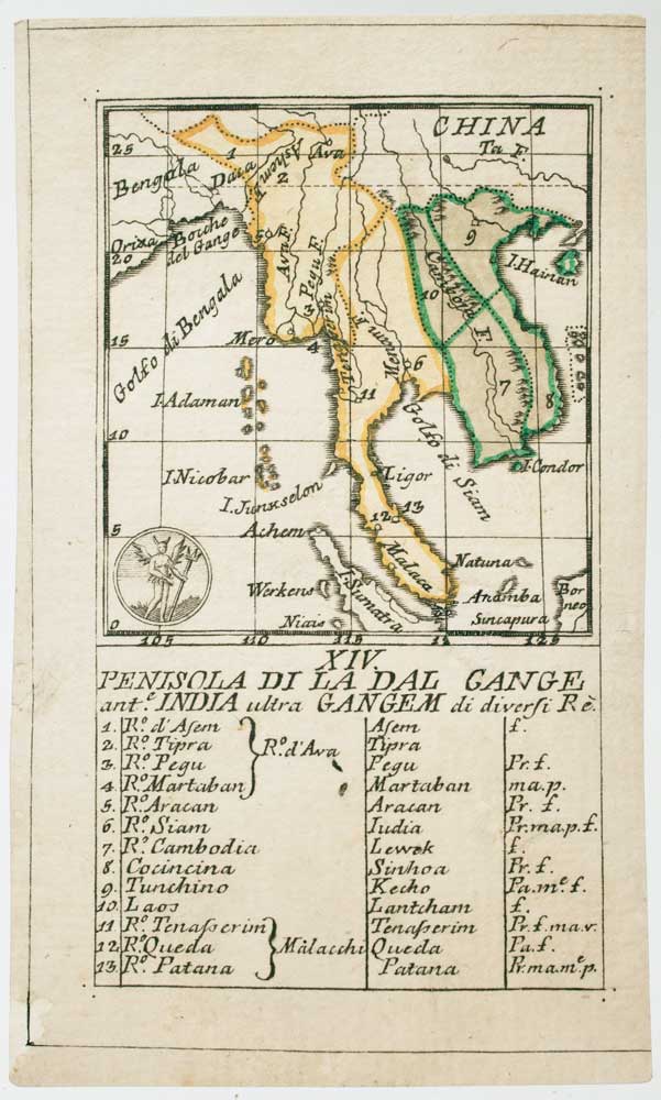
An 18th century playing-card map of the Malay Peninsula
RABATTA, Augusto & BAILOU, Jean Baptist de. Date: 1779 Stock #: 12985 £350.00
[ti_wishlists_addtowishlist]
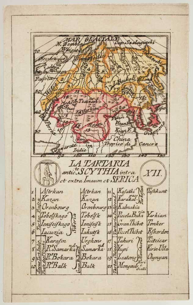
An 18th century playing-card map of Tartary
RABATTA, Augusto & BAILOU, Jean Baptist de. Date: 1779 Stock #: 13000 £250.00
[ti_wishlists_addtowishlist]
