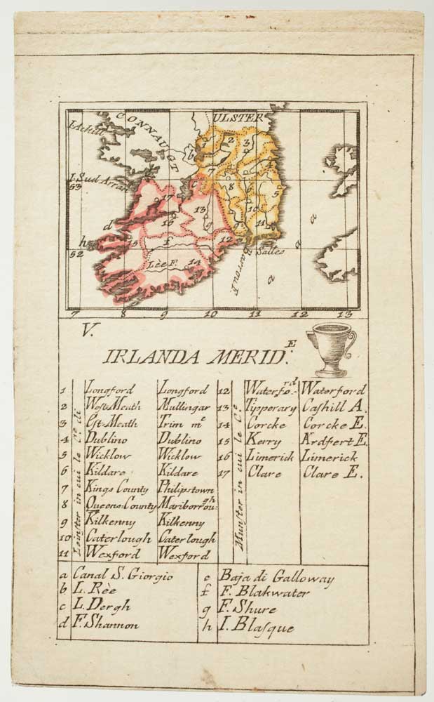


An 18th century playing-card map of southern Ireland
Irlanda Merid.
Florence: Aniello Lamberti, 1779. Original colour. Sheet size 110 x 65mm.
£180.00
1 in stock
x
Question About This Item?
An 18th century playing-card map of southern Ireland & RABATTA, Augusto & BAILOU, Jean Baptist de.Stock #: 12959Similar to Sell?
Description
A rare miniature map of southern Ireland engraved by Lamberti for the 'Minchiate', the Florentine version of the Tarot, which had each card marked with an arcane symbol. The full set was published in Augusto Da Rabatta and Jean Baptiste De Baillou's pocket atlas 'Nuovo Atlante Generale'. Information on the map is minimal, but an extensive key gives the names of the various regions and waterways.
Condition:
A good example.Related products
-
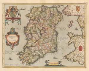
An uncommon state of Mercator’s pair of maps of Ireland
MERCATOR, Gerard. Date: 1638Stock #: 23864 £1,250.00 -
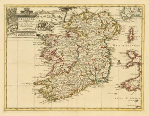
A two-sheet map of Ireland
JAILLOT, Alexis-Hubert. Date: 1700Stock #: 8318 £1,300.00 -
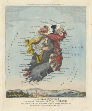
The famous caricature map of Ireland
DIGHTON, Robert. Date: 1793Stock #: 25512 £725.00 -
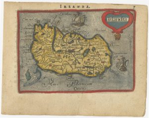
Early 17th century miniature map of Ireland
BERTIUS, Petrus. Date: 1609Stock #: 24845 £240.00 -
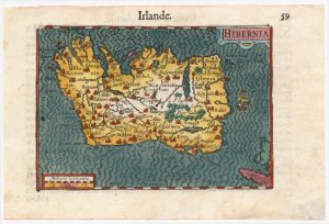
A 16th century miniature map of Ireland
ORTELIUS, Abraham. Date: 1593Stock #: 24458 £270.00 -
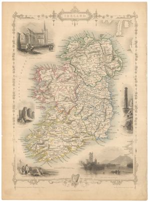
Mid 19th century map of Ireland with decorative vignettes
TALLIS, John. Date: 1851Stock #: 21568 £240.00 -
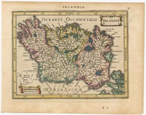
An early issue of Jansson’s map of Ireland
JANSSON, Jan. Date: 1638Stock #: 23865 £950.00 -
A 17th century map of Ireland from a pocket atlas
JANSSON, Jan. Date: 1631Stock #: 25065 £325.00 -
18th century map of Ireland
SANSON, Nicolas. Date: 1729Stock #: 20047 £220.00
Items by the same author
[ti_wishlists_addtowishlist]
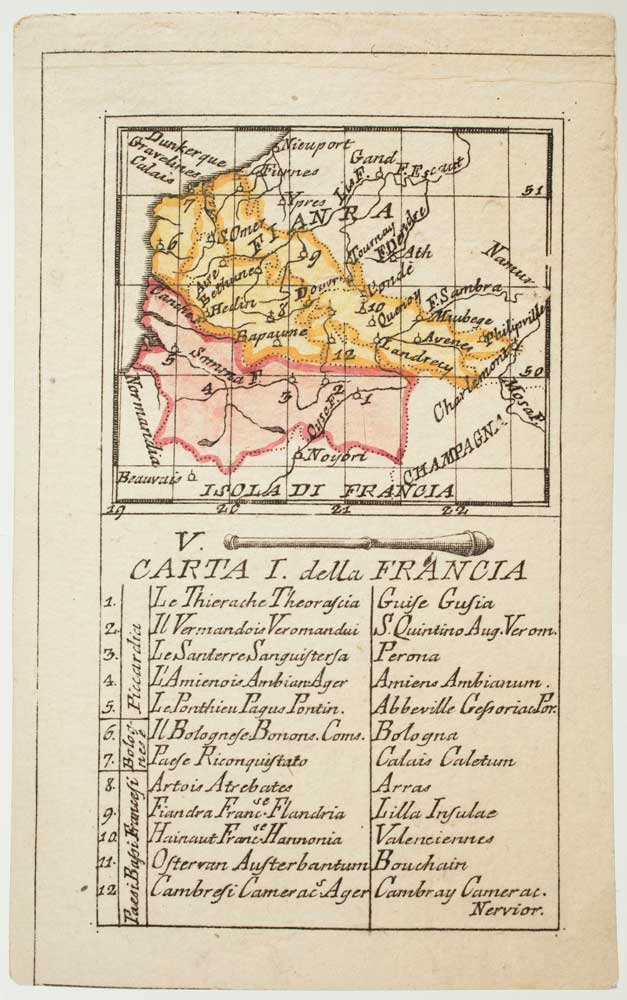
An 18th century playing-card map of France and Flanders
RABATTA, Augusto & BAILOU, Jean Baptist de. Date: 1779 Stock #: 12963 £150.00
[ti_wishlists_addtowishlist]
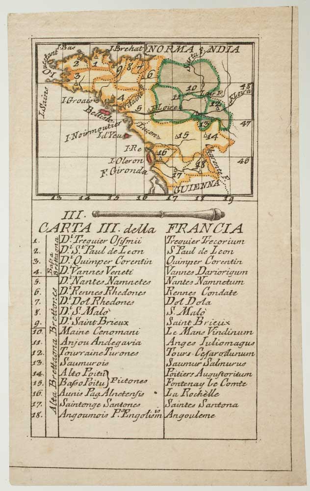
An 18th century playing-card map of Normandy and surrounds
RABATTA, Augusto & BAILOU, Jean Baptist de. Date: 1779 Stock #: 12975 £200.00
[ti_wishlists_addtowishlist]
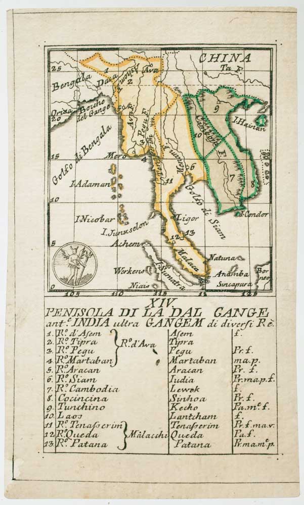
An 18th century playing-card map of the Malay Peninsula
RABATTA, Augusto & BAILOU, Jean Baptist de. Date: 1779 Stock #: 12985 £350.00
[ti_wishlists_addtowishlist]
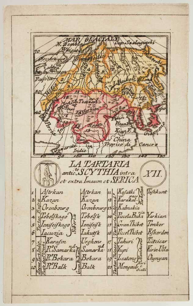
An 18th century playing-card map of Tartary
RABATTA, Augusto & BAILOU, Jean Baptist de. Date: 1779 Stock #: 13000 £250.00
[ti_wishlists_addtowishlist]

An 18th century playing-card map of Hungary
RABATTA, Augusto & BAILOU, Jean Baptist de. Date: 1779 Stock #: 13003 £380.00
[ti_wishlists_addtowishlist]