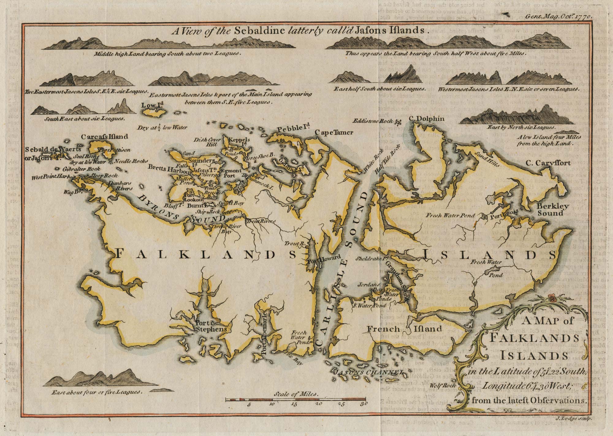


18th century map of the Falkland Islands
A map of Falklands Islands.
London; Gentlemen's Magazine; 1770. Coloured. 180 x 250mm.
£100.00
Description
Extra title at the top 'A view of the Sebaldine latterley call'd Jasons Islands'. 'Until at least 1781, the Falklands as a whole were known as the Sebald or Sebaldine Island after Sebald de Weert, who sighted them and tried to make landfall on the Jason Islands in January 1600'.
Condition:
A good example.Related products
Items by the same author
[ti_wishlists_addtowishlist]