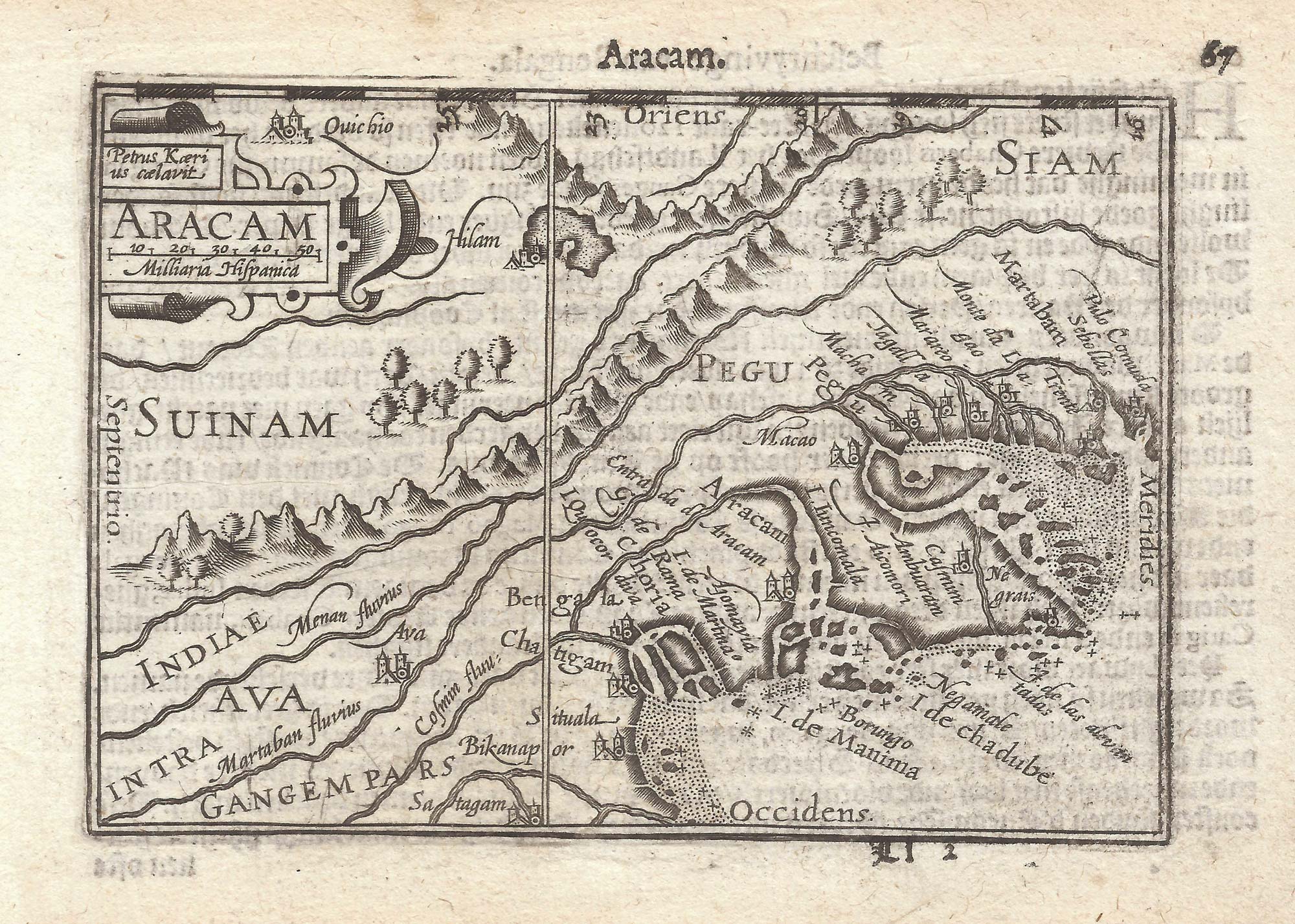


A 16th century miniature map of Burma
Aracam.
Amsterdam, Cornelis Claez, 1599, Dutch text edition. 85 x 125mm, with letterpress surtitle and pagination.
£220.00
Description
A scarce map of Burma, orientated with north to the left, engraved by Pieter van den Keere for the 1598 'Caert-Thresoor', with a text by an unknown author. Despite being published only a year after the first edition, this is a second state: the top border has been re-engraved with latitude graduations.
By 1600 this map was being published in the 'Tabularum Geographicarum Contractarum' with a text by Petrus Bertius, and in 1616 a new plate was engraved by Jodocus Hondius II, slightly larger and with wider borders with scales of longitude and latitude.
Condition:
A good example.Related products
-
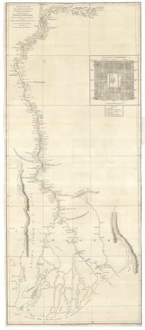
The first accurate map of the Irrawaday River
WOOD, Thomas. Date: 1800Stock #: 25086 £900.00 -
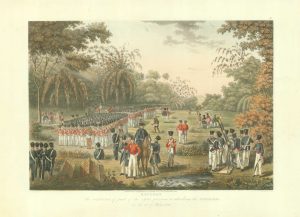
British troops preparing to attack the stockades of Rangoon
MOORE, Joseph. Date: 1825Stock #: 18627 £750.00 -
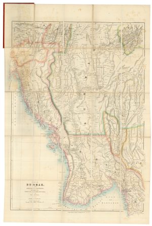
A detailed Victorian map of Burma
ARROWSMITH, John. Date: 1875Stock #: 23852 £425.00 -
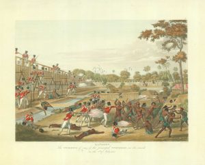
Storming the stockades, Rangoon
MOORE, Joseph. Date: 1825Stock #: 18622 £650.00 -
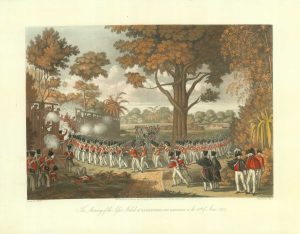
Attacking the stockade, Rangoon
MOORE, Joseph. Date: 1825Stock #: 18623 £650.00 -
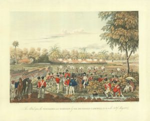
Storming the stockade at Kemmendine
MOORE, Joseph. Date: 1825Stock #: 18626 £750.00
Items by the same author
[ti_wishlists_addtowishlist]

[ti_wishlists_addtowishlist]

A 16th century miniature map of Saxony, Thuringia & Meissen
LANGENES, Barent. Date: 1599 Stock #: 21173 £50.00
[ti_wishlists_addtowishlist]

[ti_wishlists_addtowishlist]

[ti_wishlists_addtowishlist]

A 16th century miniature map of the Comtat Venaissin
LANGENES, Barent. Date: 1599 Stock #: 21137 £55.00
[ti_wishlists_addtowishlist]
