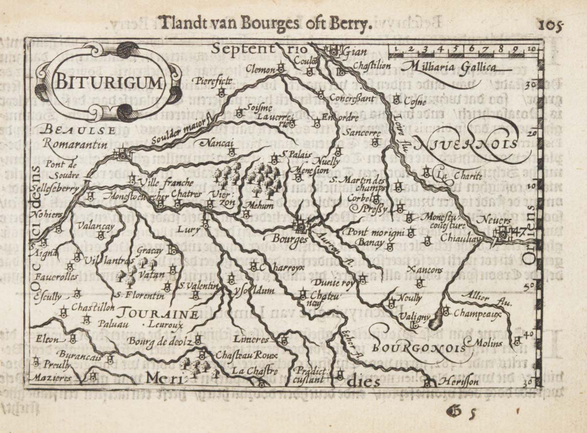


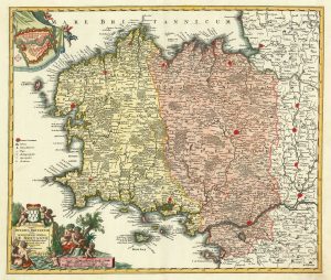
A 16th century miniature map of Berry
Biturigum.
Amsterdam, Cornelis Claez, 1599, Dutch text edition. 85 x 125, with letterpress surtitle and pagination.
£55.00
Description
A scarce map of Berry, engraved by either Pieter van den Keere or Jodocus Hondius for the 1598 'Caert-Thresoor', with a text by an unknown author. Despite being published a year after the first edition, this is a second state: the right border has been re-engraved with latitude graduations.
By 1600 this map was being published in the 'Tabularum Geographicarum Contractarum' with a text by Petrus Bertius, and in 1616 a new plate was engraved by Jodocus Hondius II, slightly larger and with wider borders with scales of longitude and latitude.
Condition:
Faint damp stains.Related products
-
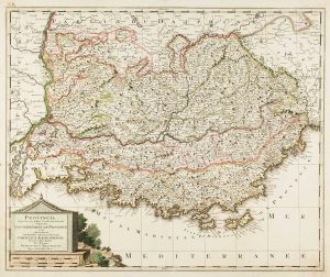
Map of Provence in fine original colour
VALK, Gerard. Date: 1710Stock #: 13446 £460.00 -
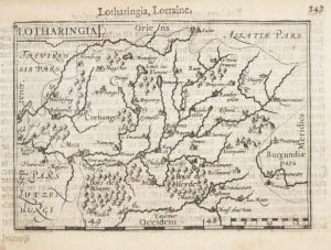
A 16th century miniature map of Lorraine
LANGENES, Barent. Date: 1599Stock #: 21149 £50.00 -
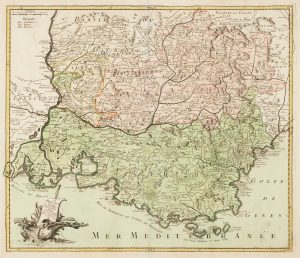
18th century map of Provence in fine colour
LE ROUGE, Georges-Louis. Date: 1747Stock #: 14772 £400.00 -
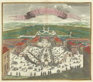
A bird’s-eye view of Louis XIV’s court at Versailles
SEUTTER, Matthaus. Date: 1735Stock #: 23735 £700.00 -
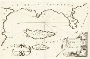
A map of Saint Marguerite with Cannes and Antibes
CORONELLI, Vincenzo Maria. Date: 1690Stock #: 20625 £280.00 -
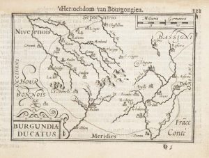
A 16th century miniature map of the Duchy of Burgundy
LANGENES, Barent. Date: 1599Stock #: 21140 £55.00 -
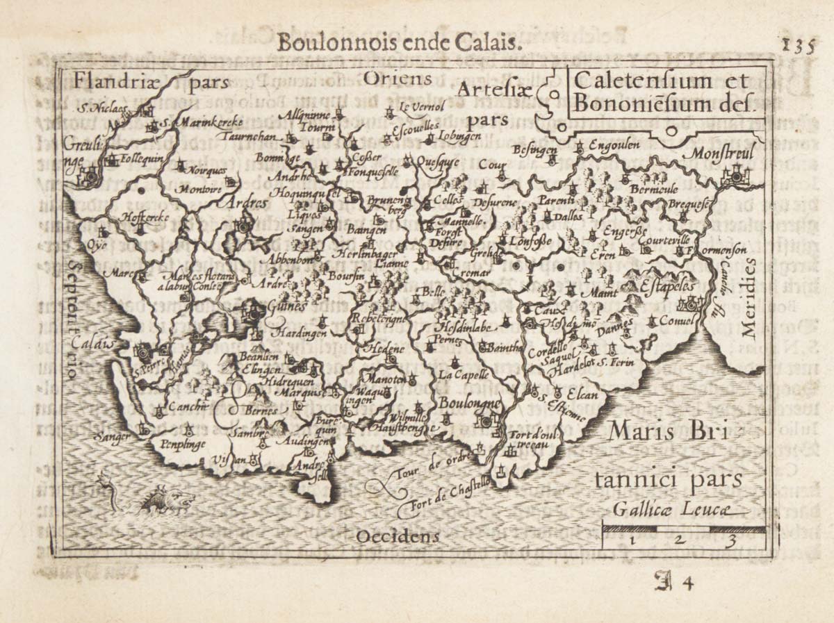
A detailed 18th century map of Brittany
HOMANN, Johann Baptist. Date: 1720Stock #: 21195 £420.00 -
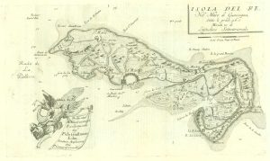
17th century map of the Ile de Ré
CORONELLI, Vincenzo Maria. Date: 1690Stock #: 19540 £260.00 -
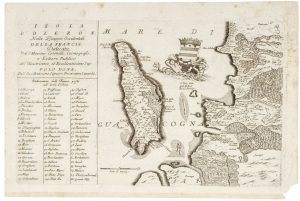
17th century map of Oleron
CORONELLI, Vincenzo Maria. Date: 1690Stock #: 21090 £240.00
Items by the same author
[ti_wishlists_addtowishlist]

[ti_wishlists_addtowishlist]

A 16th century miniature map of Saxony, Thuringia & Meissen
LANGENES, Barent. Date: 1599 Stock #: 21173 £50.00
[ti_wishlists_addtowishlist]

[ti_wishlists_addtowishlist]

[ti_wishlists_addtowishlist]
[ti_wishlists_addtowishlist]