


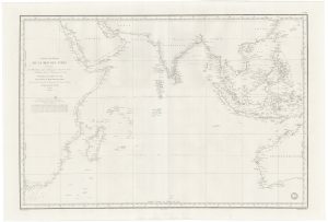
A Dutch chart of the Indian Ocean with Australia
Mar di India.
Amsterdam, 1680, German text edition. Original colour. 440 x 560mm.
£2,000.00
1 in stock
x
Question About This Item?
A Dutch chart of the Indian Ocean with Australia & JANSSON, Jan.Stock #: 23581
Add to Wishlist
Export as PDFEnquireSimilar to Sell?Add to Wishlist
Description
A fine 17th century chart of the Indian Ocean, depicting from the Cape of Good Hope to the 'Island' of Korea and Japan, as well as the coastline of Australia (with Tasmania far off shore).
The map was first published in the sea atlas that formed Volume 5 of his 'Atlas Novus', issued 1650. The original plate omitted Tasman's discoveries in Australia, due to the secrecy of the Dutch East India Company. Only in the 1680s was the north coast of Australia and Tasmania added to the plate. Even then the area between Cape York Peninsula and New Guinea were left vague, expressing the lake of certainty that was not corrected for another century.
Condition:
Minor restoration at centre fold and edges.Related products
-
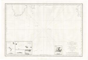
The Southern Indian Ocean with early Antarctic discoveries
DAUSSY, Pierre. Date: 1873Stock #: 21223 £400.00 -
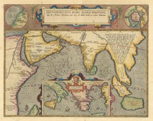
The Indian Ocean from Ortelius’s ”Parergon”
ORTELIUS, Abraham. Date: 1608Stock #: 23719 £950.00 -
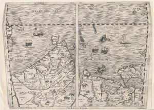
Important 16th century ‘upside-down’ map of the Indian Ocean
GASTALDI, Giacomo. Date: 1565Stock #: 22851 £9,500.00 -
A French 19th century sea chart of the Indian Ocean
DAUSSY, Pierre. Date: 1837Stock #: 21222 £550.00
Items by the same author
Add to Wishlist
Add to Wishlist

A magnificent example of the first folio sea atlas of the World
JANSSON, Jan. Date: 1650 Stock #: 23074 £47,500.00
Add to Wishlist
Add to Wishlist
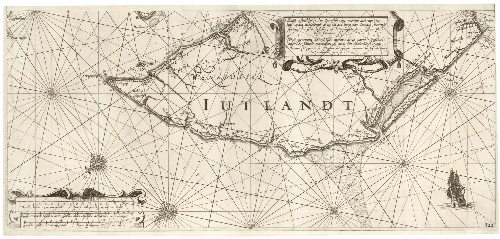
A rare 17th century sea chart of Jutland
JANSSON, Jan. Date: 1620 Stock #: 25262 £2,000.00
Add to Wishlist
Add to Wishlist

A 17th century map of Ireland from a pocket atlas
JANSSON, Jan. Date: 1631 Stock #: 25065 £325.00
Add to Wishlist
Add to Wishlist

An early issue of Jansson's map of Ireland
JANSSON, Jan. Date: 1638 Stock #: 23865 £950.00
Add to Wishlist
Add to Wishlist

Map of the River Elbe with a prospect of Hamburg
JANSSON, Jan. Date: 1630 Stock #: 24816 £500.00
Add to Wishlist
Add to Wishlist
