


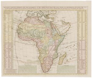
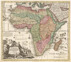
An 18th century wall map of Africa
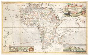
Africa, According to Mr. D'Anville with Several Additions, & Improvements, with a Particular Chart of the Gold Coast; wherein are distinguished all the European Forts and Factories, The whole Illustrated With a Summary Description Relative to the Trade & Natural-Produce, Manners & Customs of that Part of the World.
London: Robert Sayer, 1772. Original outline colour. Four sheets joined in pairs, total 1045 x 1250mm.
£1,800.00
1 in stock
x
Question About This Item?
An 18th century wall map of Africa & ANVILLE, Jean Baptiste B. D'.Stock #: 22567Similar to Sell?
Description
A very fine example of a large and detailed map of Africa (on the coasts at least), with a huge title cartouche of natives killing and eating their enemies. Extensive text boxes describe the trading opportunities of each region. The text in the inset of the Gold Coast is devoted to gold rather than the other main export of the area, slaves.
Condition:
A good example.References:
See NORWICH: 105 for a later state, erroneously described as two-sheet.Related products
-
18th century map of Africa
CHATELAIN, Henri Abraham. Date: 1721Stock #: 22177 £450.00 -
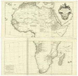
Two-sheet map of Africa
JAILLOT, Alexis-Hubert. Date: 1705Stock #: 24063 £1,200.00 -
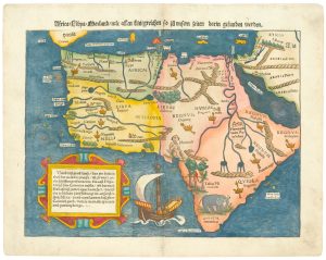
One of the earliest printed maps of Africa
MUNSTER, Sebastian. Date: 1565Stock #: 24891 £1,800.00 -
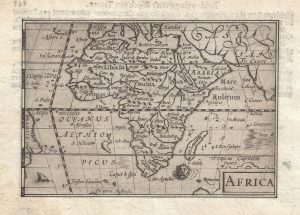
The first issue of this 16th century miniature map of Africa
LANGENES, Barent. Date: 1599Stock #: 21290 £300.00 -
Classic 18th century map of Africa
SEUTTER, Matthaus. Date: 1720Stock #: 20253 £780.00 -
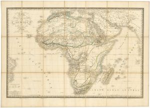
The European exploration of Africa in the first half of the 19th century
BRUÉ, Adrien Hubert. Date: 1840Stock #: 24103 £450.00 -
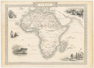
A mid-19th century map of Africa with vignettes
TALLIS, John. Date: 1851Stock #: 23542 £250.00 -
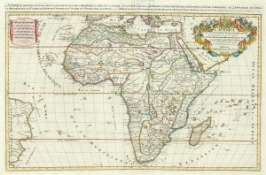
A Venetian edition of D’Anville’s wall map of Africa
ANVILLE, Jean Baptiste B. D'. Date: 1780Stock #: 21916 £1,400.00 -
An 18th century two-sheet map of Africa
MOLL, Herman. Date: 1730Stock #: 22283 £1,800.00
Items by the same author
[ti_wishlists_addtowishlist]

18th century chart of the Persian Gulf
ANVILLE, Jean Baptiste B. D'. Date: 1780 Stock #: 24587 £650.00
[ti_wishlists_addtowishlist]

18th century map of the Gold Coast of Africa
ANVILLE, Jean Baptiste B. D'. Date: 1772 Stock #: 22018 £150.00
[ti_wishlists_addtowishlist]

A Venetian edition of D'Anville's wall map of Africa
ANVILLE, Jean Baptiste B. D'. Date: 1780 Stock #: 21916 £1,400.00
[ti_wishlists_addtowishlist]

The French exploration of Louisiana at the beginning of the 18th century
ANVILLE, Jean Baptiste B. D'. Date: 1752 Stock #: 21854 £1,600.00
[ti_wishlists_addtowishlist]

18th century map of Beizhili, with Beijing
ANVILLE, Jean Baptiste B. D'. Date: 1735 Stock #: 18178 £750.00
[ti_wishlists_addtowishlist]
