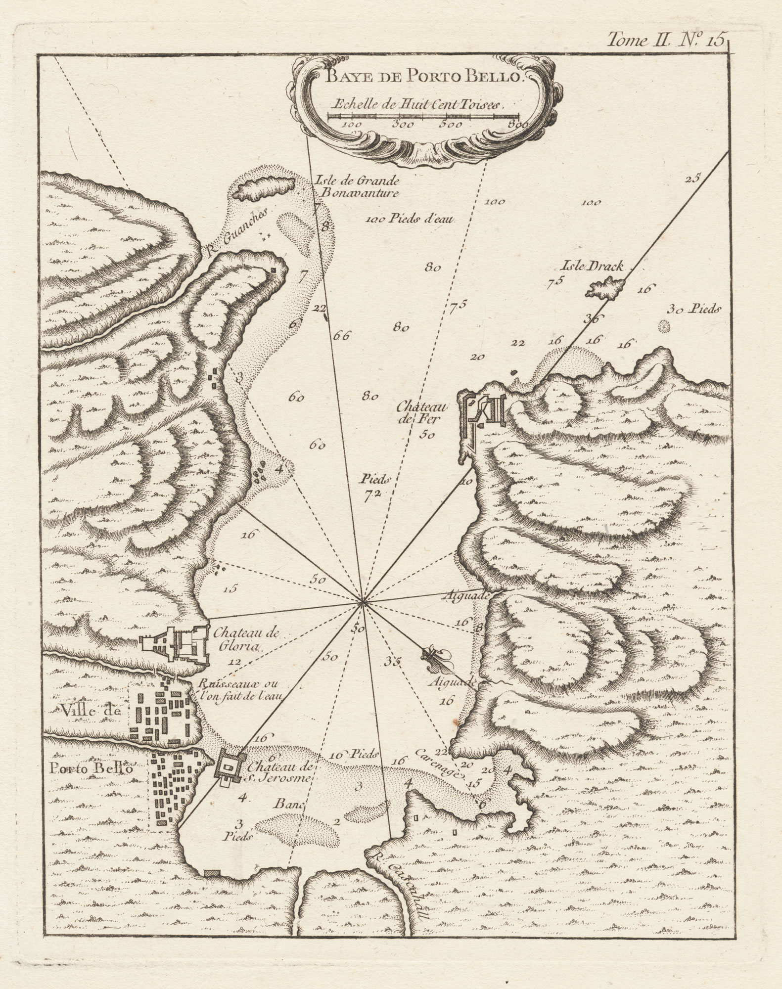


A scarce 18th century plan of Portobelo
Baye de Porto Bello.
Paris, 1764. 230 x 180mm, with good margins.
£120.00
1 in stock
x
Question About This Item?
A scarce 18th century plan of Portobelo & BELLIN, Jacques-Nicolas.Stock #: 20760Similar to Sell?
Description
A chart of Portobelo, showing the castle and street layout of the city.
Admiral Edward Vernon captured the port in 1739, during the 'War of Jenkin's Ear', leading to huge celebrations in England, commemorated by the use of 'Portobello' for places all over the British Isles.
A scarce map, from the only edition of Bellin's atlas, 'Le Petit Atlas Maritime'.
Condition:
A good example.Related products
Items by the same author
[ti_wishlists_addtowishlist]
[ti_wishlists_addtowishlist]
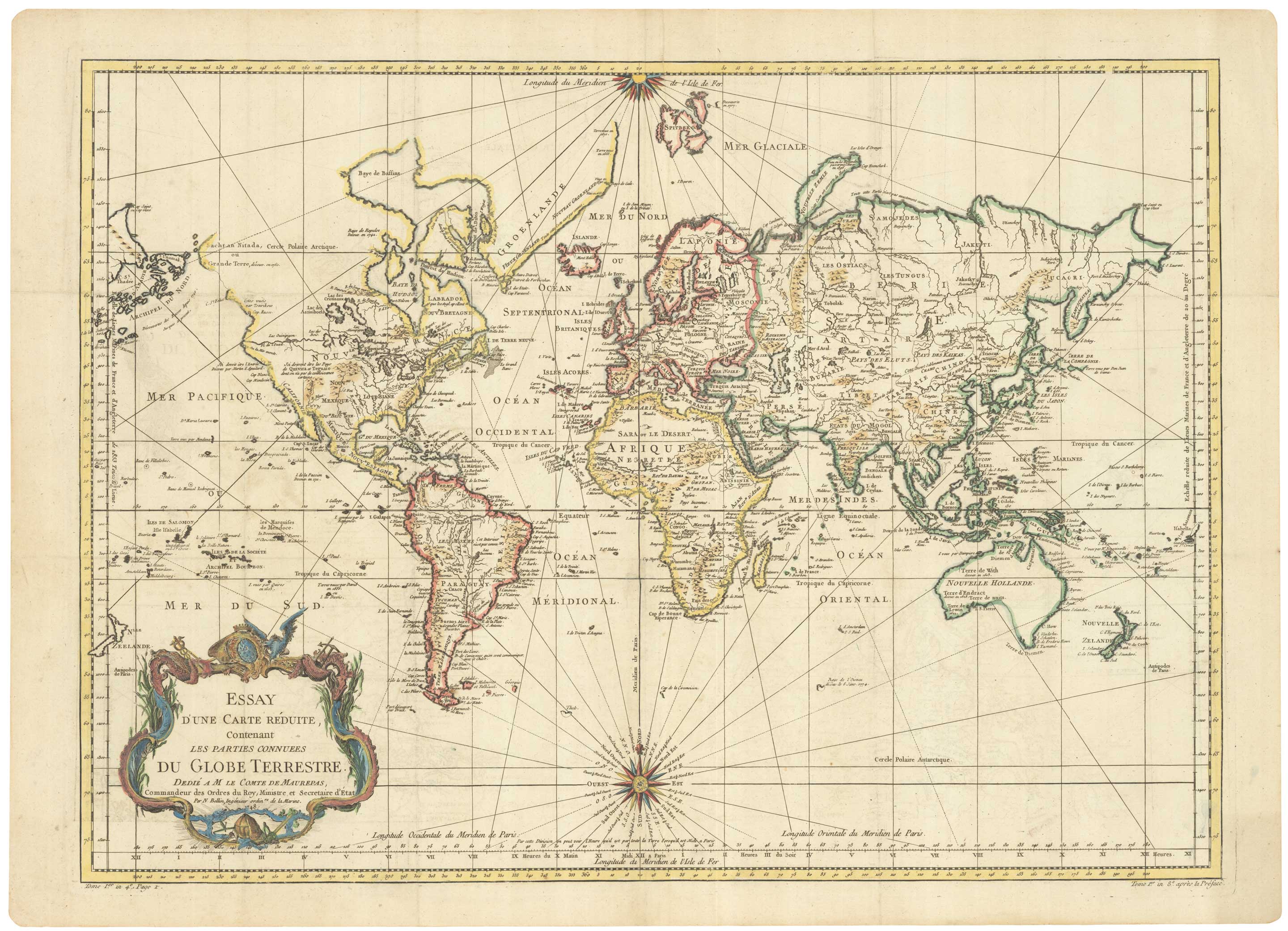
A large sea chart of the World on Mercator's Projection
BELLIN, Jacques-Nicolas. Date: 1775 Stock #: 25116 £1,600.00
[ti_wishlists_addtowishlist]
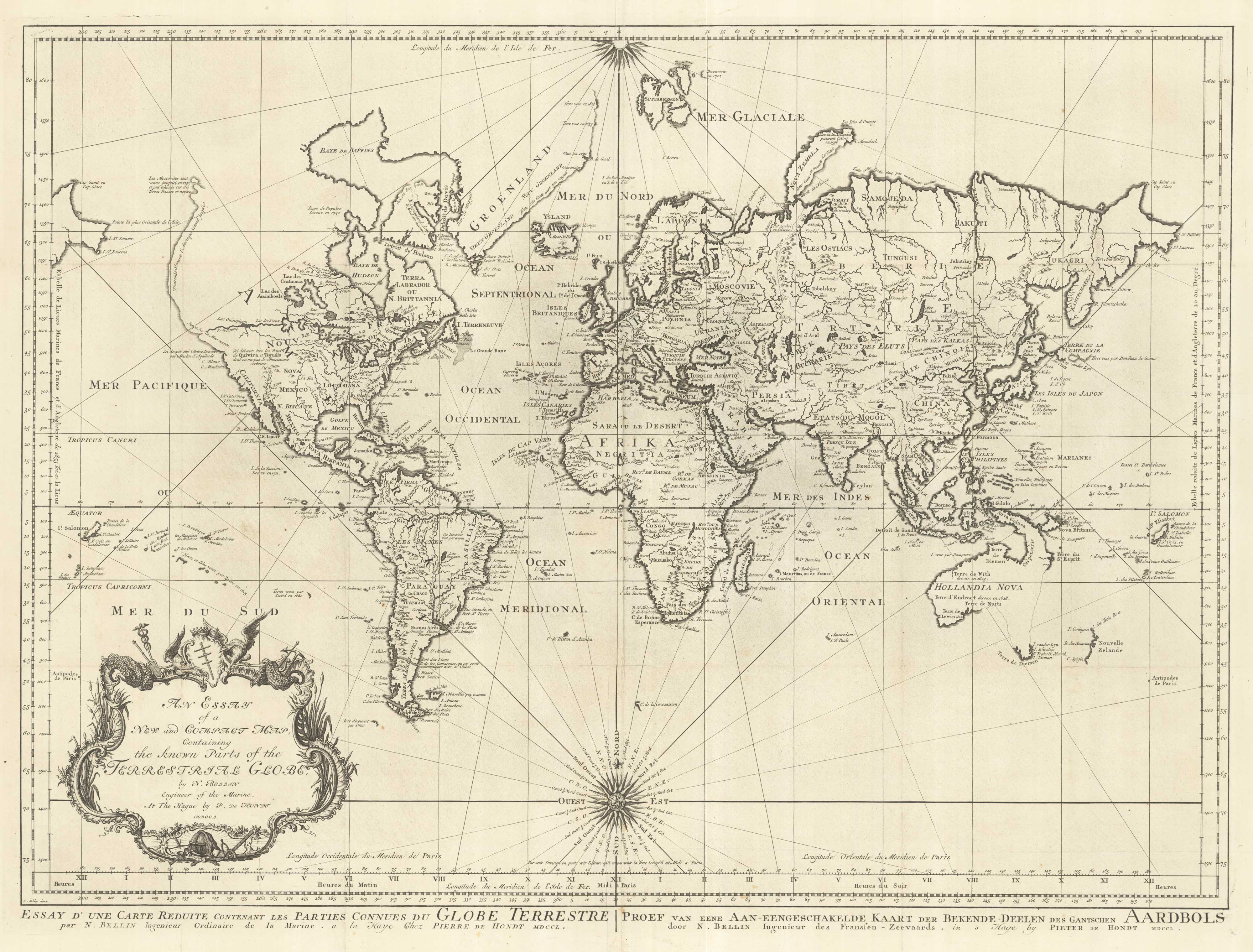
18th century nautical chart on Mercator's Projection
BELLIN, Jacques-Nicolas. Date: 1750 Stock #: 25151 £1,600.00
[ti_wishlists_addtowishlist]
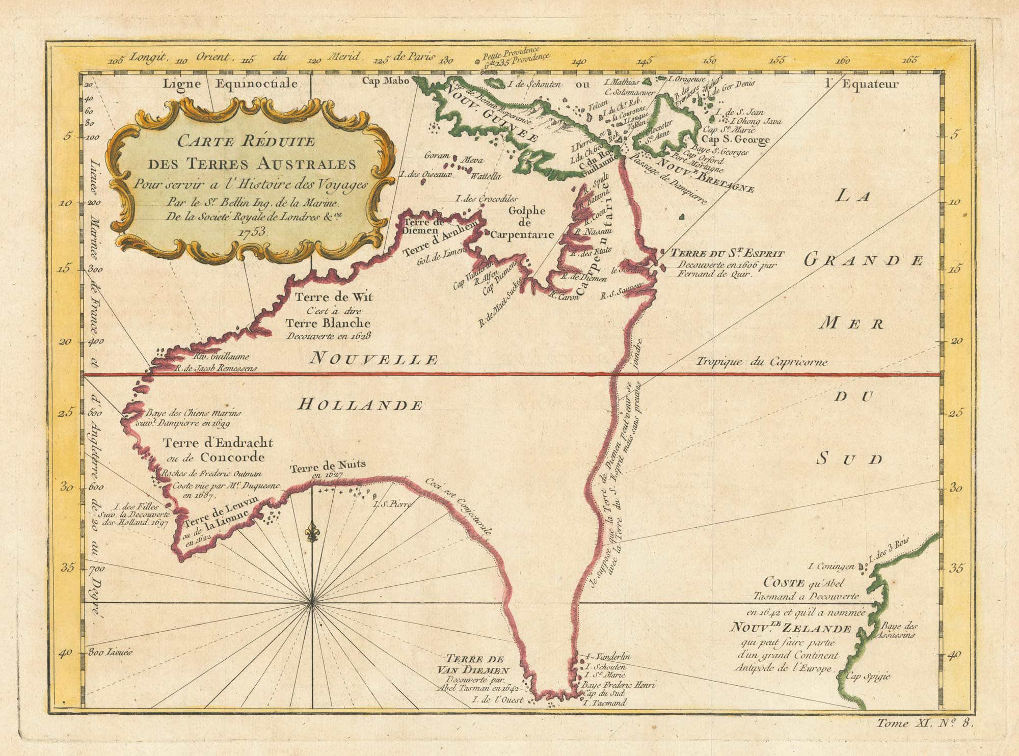
A pre-Cook discoveries map of Australia
BELLIN, Jacques-Nicolas. Date: 1753 Stock #: 25052 £1,000.00
[ti_wishlists_addtowishlist]
[ti_wishlists_addtowishlist]