Antique Maps of English Counties
Showing 91–120 of 120 products
Sort by:
Add to Wishlist
Add to Wishlist
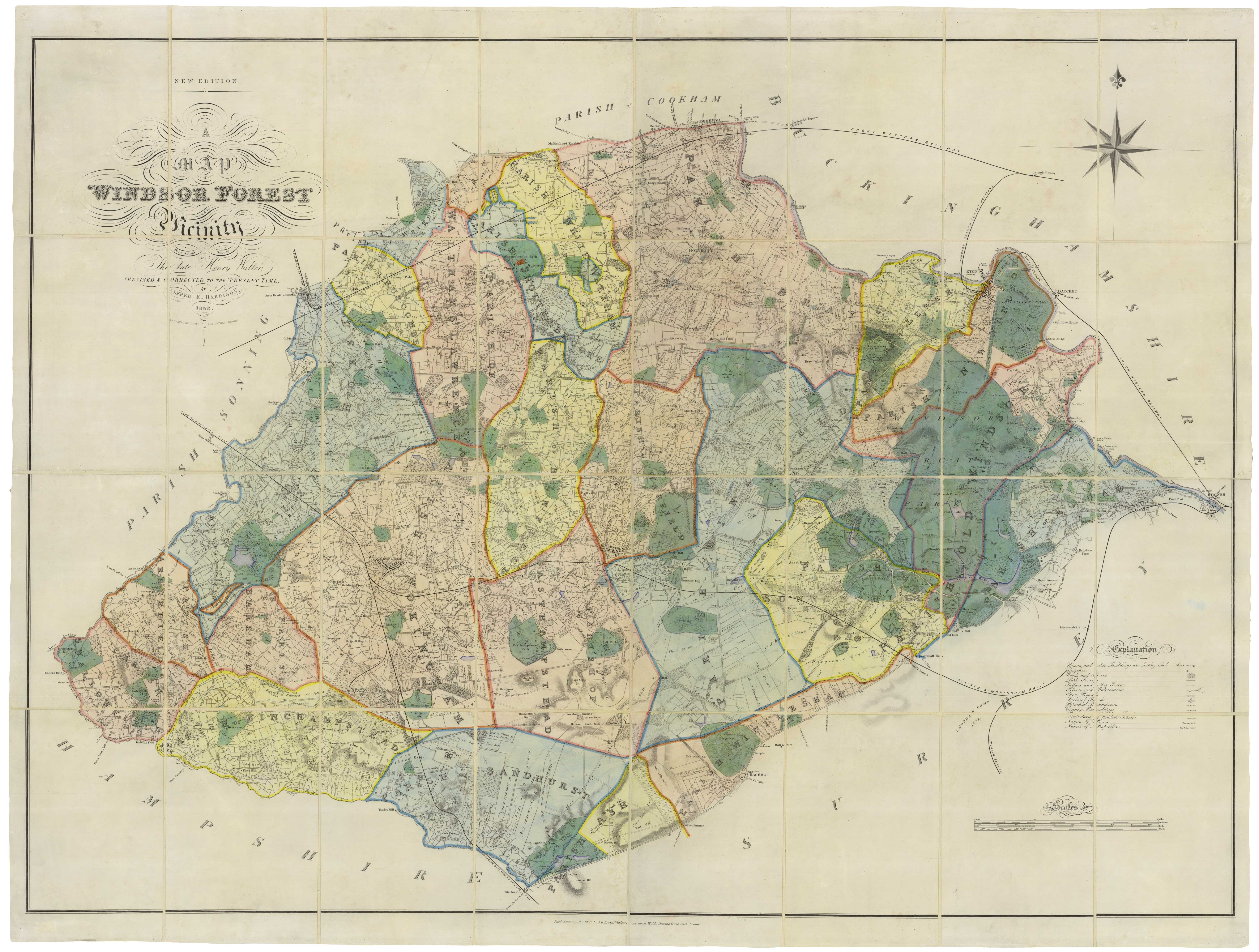
A scarce 19th century large-scale map of Windsor Forest
HARRISON, Alfred E. Date: 1856 Stock #: 18982 £3,250.00
Add to Wishlist
Add to Wishlist
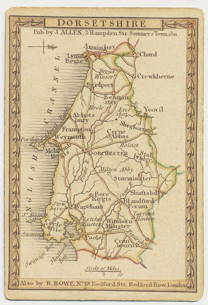
A scarce playing-card map of Dorset
ALLEN, Joseph. Date: 1811 Stock #: 18719 £500.00
Add to Wishlist
Add to Wishlist
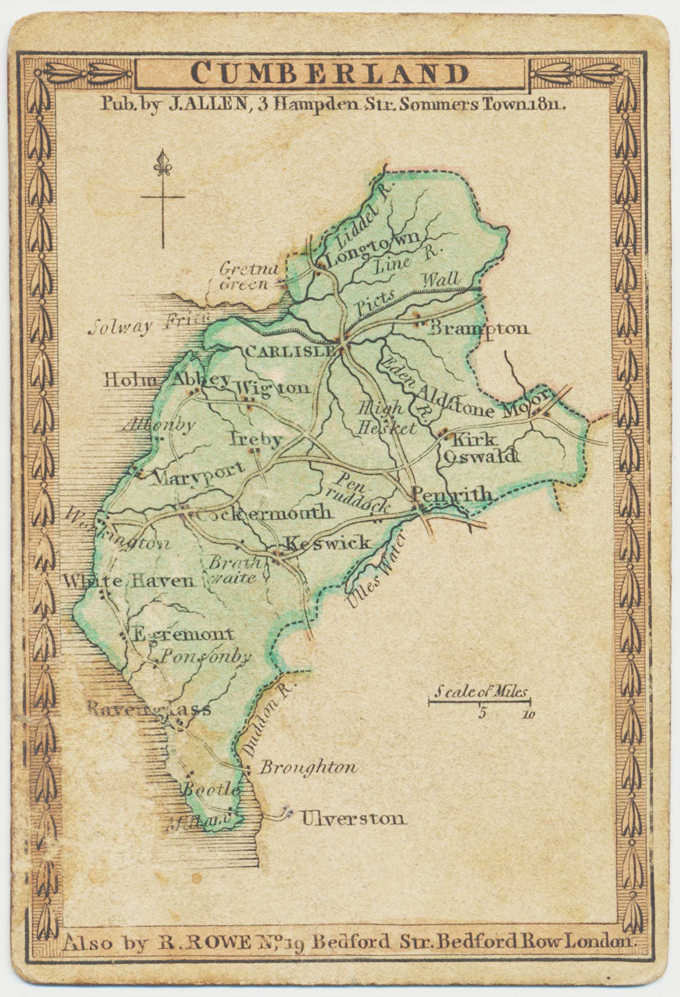
A scarce playing-card map of Cumberland
ALLEN, Joseph. Date: 1811 Stock #: 18720 £400.00
Add to Wishlist
Add to Wishlist
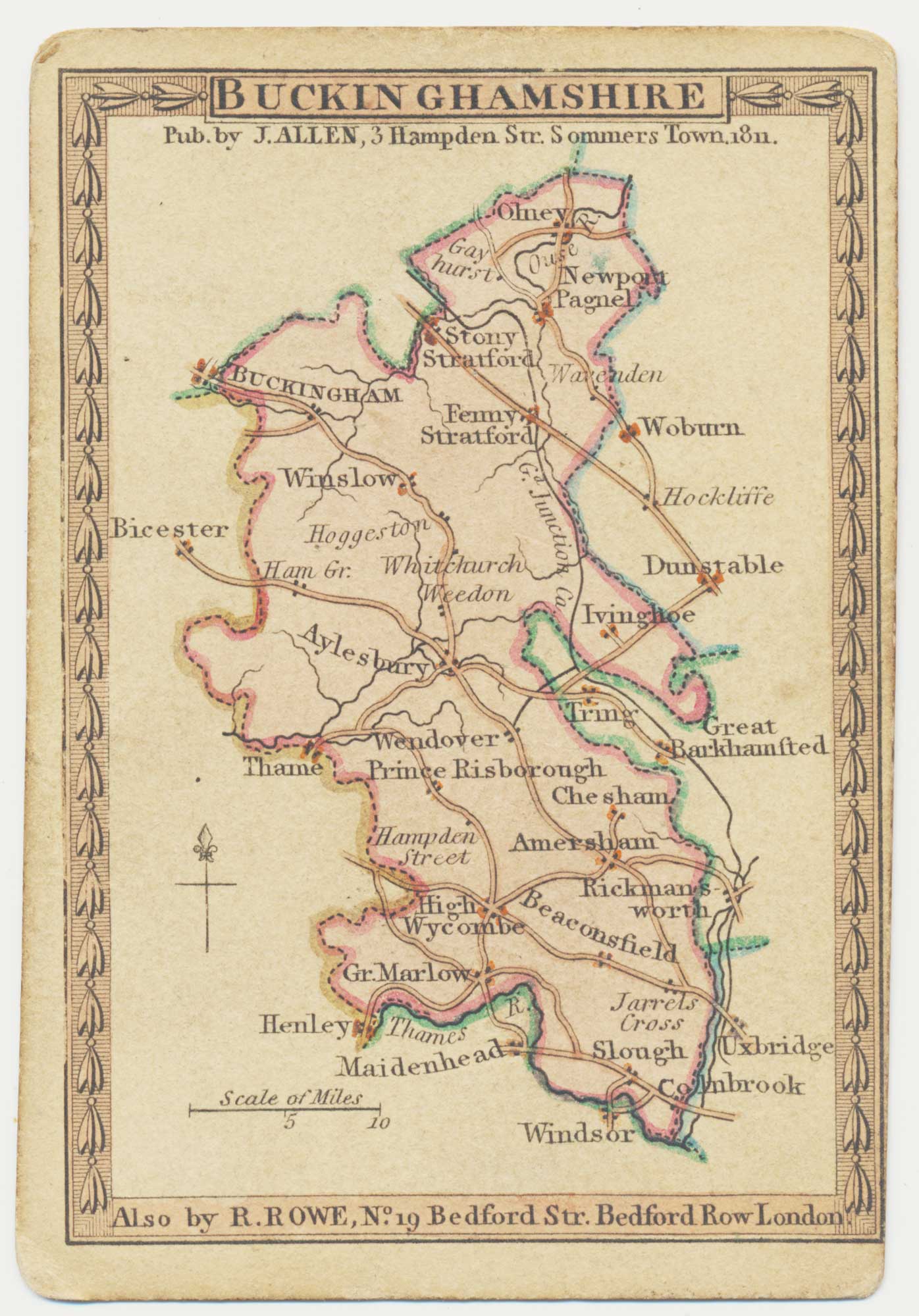
A scarce playing-card map of Buckinghamshire
ALLEN, Joseph. Date: 1811 Stock #: 18715 £450.00
Add to Wishlist
Add to Wishlist
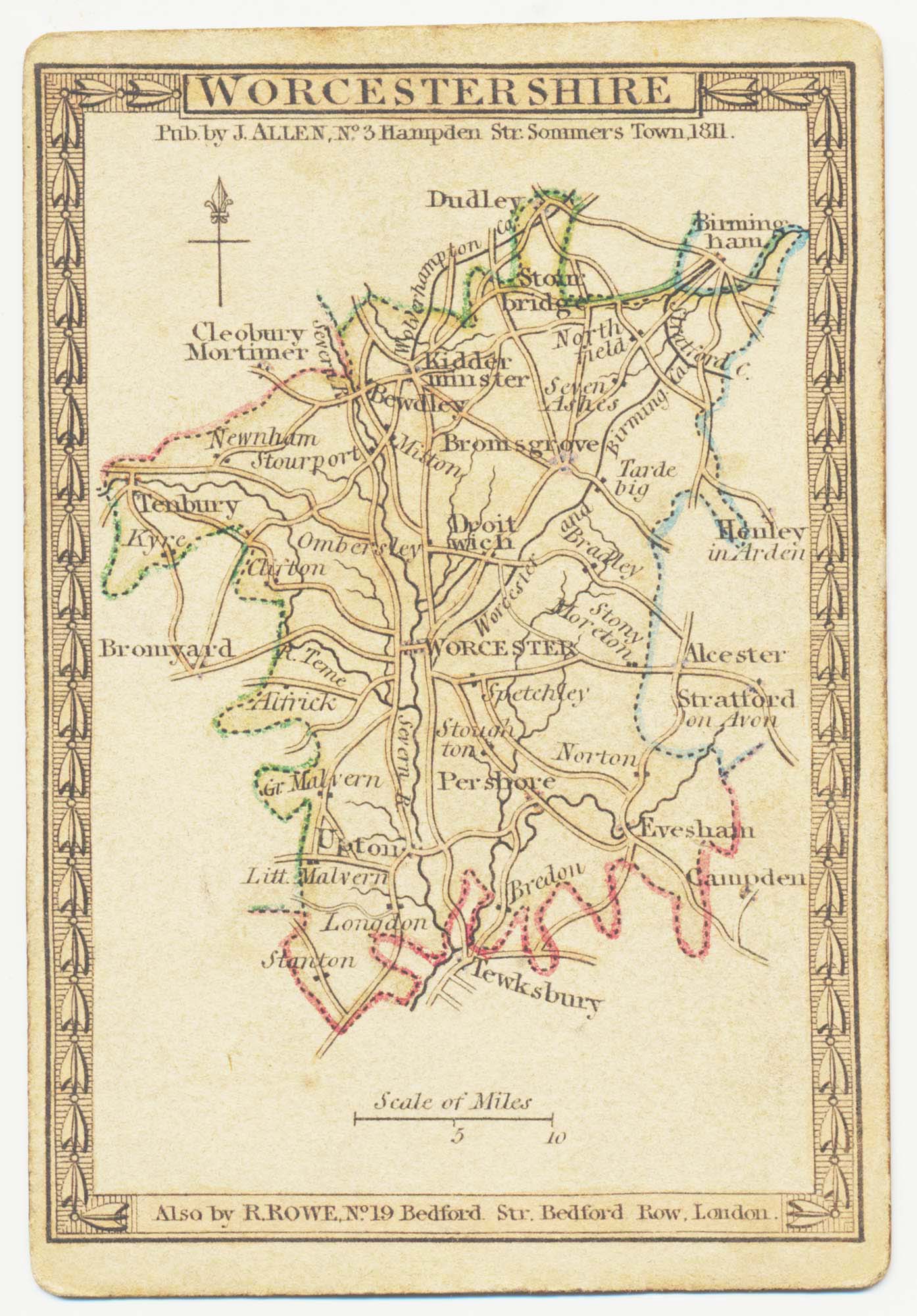
A scarce playing-card map of Worcestershire
ALLEN, Joseph. Date: 1811 Stock #: 18728 £400.00
Add to Wishlist
Add to Wishlist
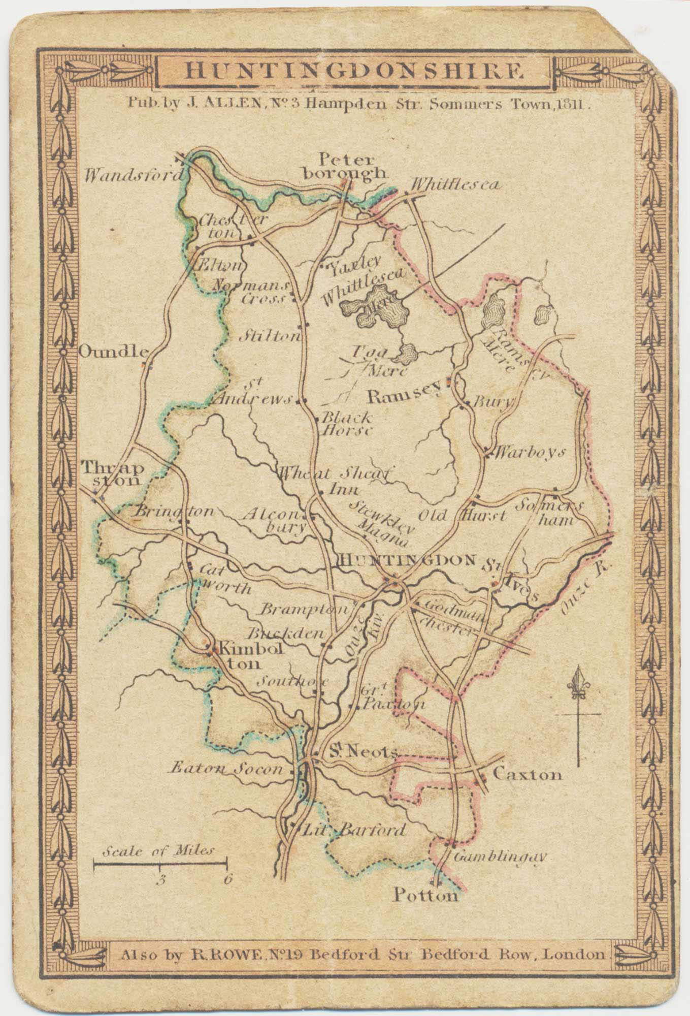
A scarce playing-card map of Huntingdonshire
ALLEN, Joseph. Date: 1811 Stock #: 18711 £300.00
Add to Wishlist
Add to Wishlist
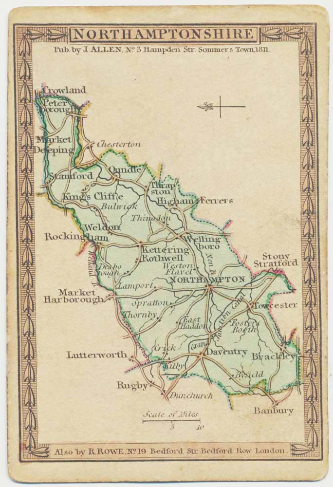
A scarce playing-card map of Northamptonshire
ALLEN, Joseph. Date: 1811 Stock #: 18730 £400.00
Add to Wishlist
Add to Wishlist
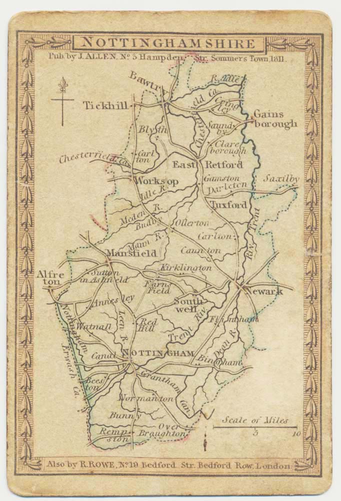
A scarce playing-card map of Nottinghamshire
ALLEN, Joseph. Date: 1811 Stock #: 18713 £400.00
Add to Wishlist
Add to Wishlist
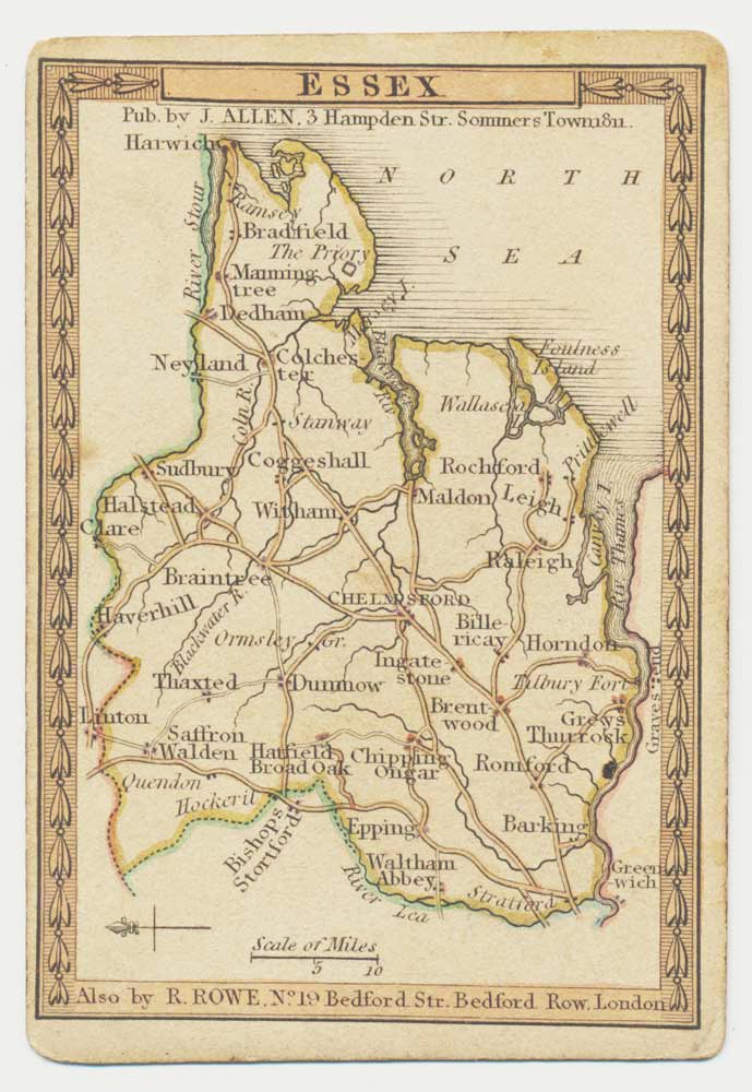
A scarce playing-card map of Essex
ALLEN, Joseph. Date: 1811 Stock #: 18724 £500.00
Add to Wishlist
Add to Wishlist
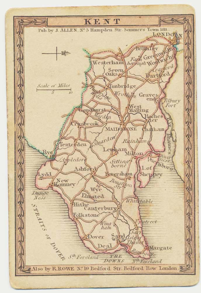
A scarce playing-card map of Kent
ALLEN, Joseph. Date: 1811 Stock #: 18725 £500.00
Add to Wishlist
Add to Wishlist
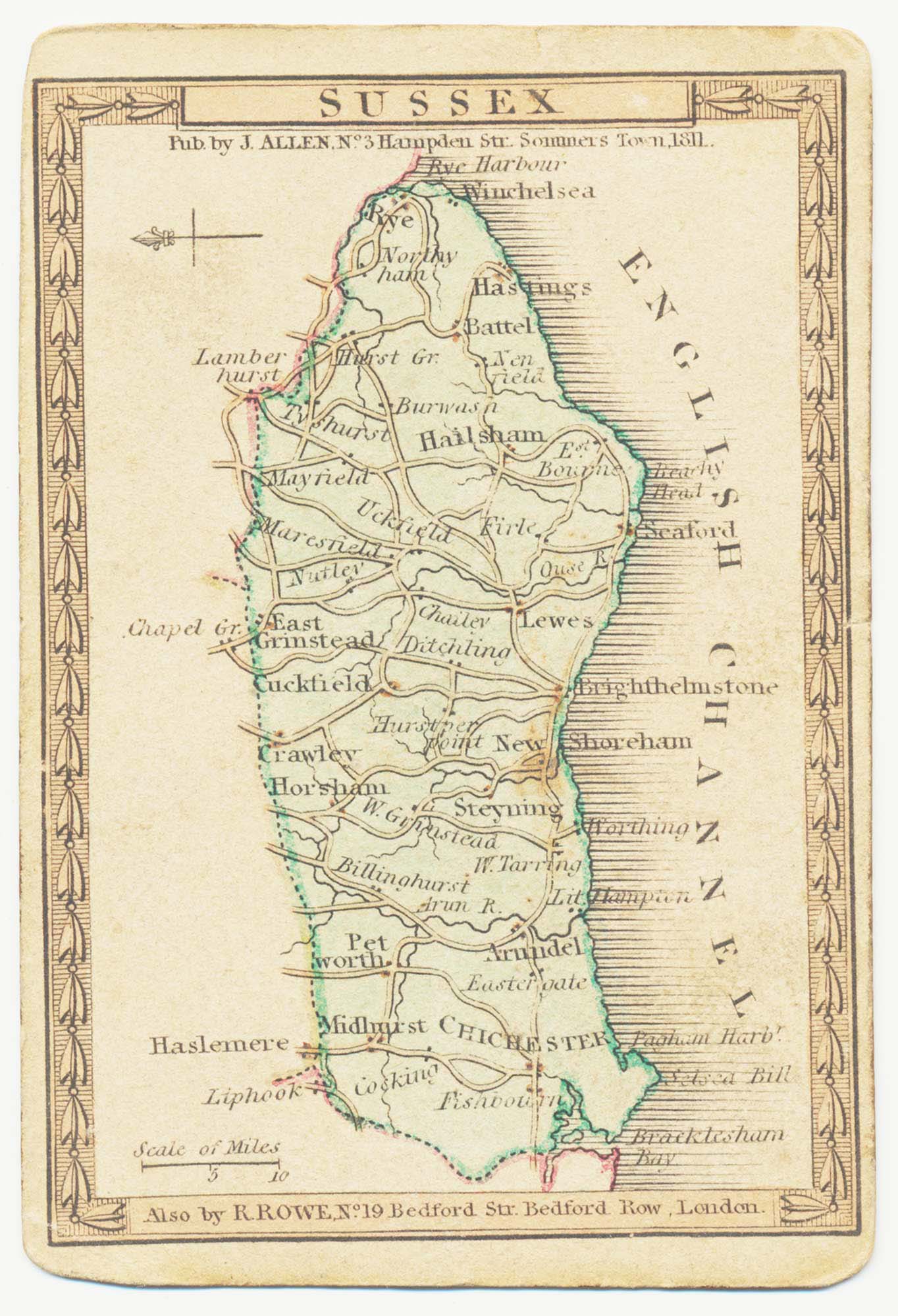
A scarce playing-card map of Sussex
ALLEN, Joseph. Date: 1811 Stock #: 18736 £500.00
Add to Wishlist
Add to Wishlist
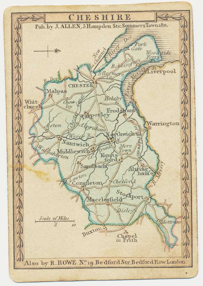
A scarce playing-card map of Cheshire
ALLEN, Joseph. Date: 1811 Stock #: 18727 £500.00
Add to Wishlist
Add to Wishlist
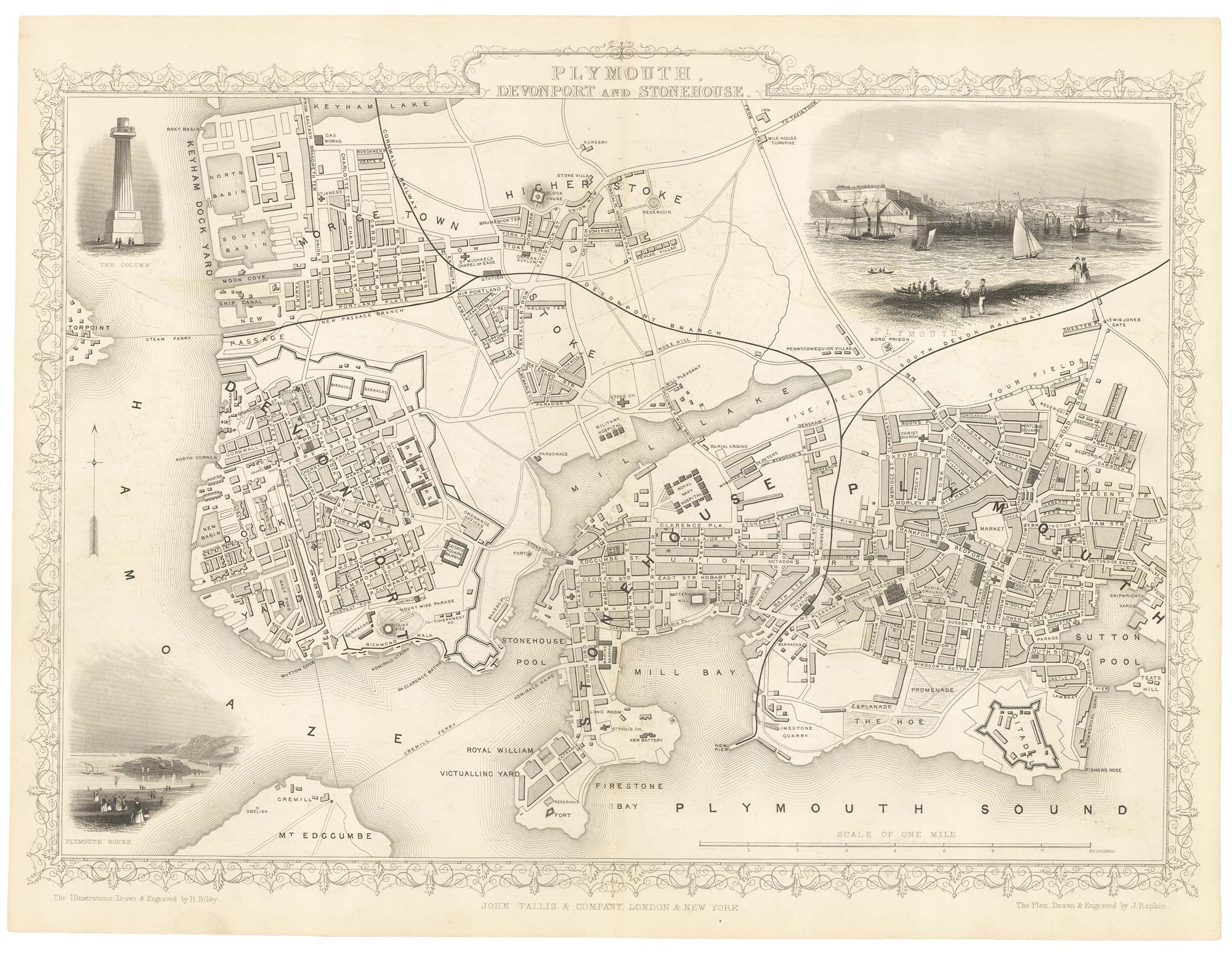
A detailed Victorian plan of Plymouth
TALLIS, John. Date: 1851 Stock #: 17732 £120.00
Add to Wishlist
Add to Wishlist
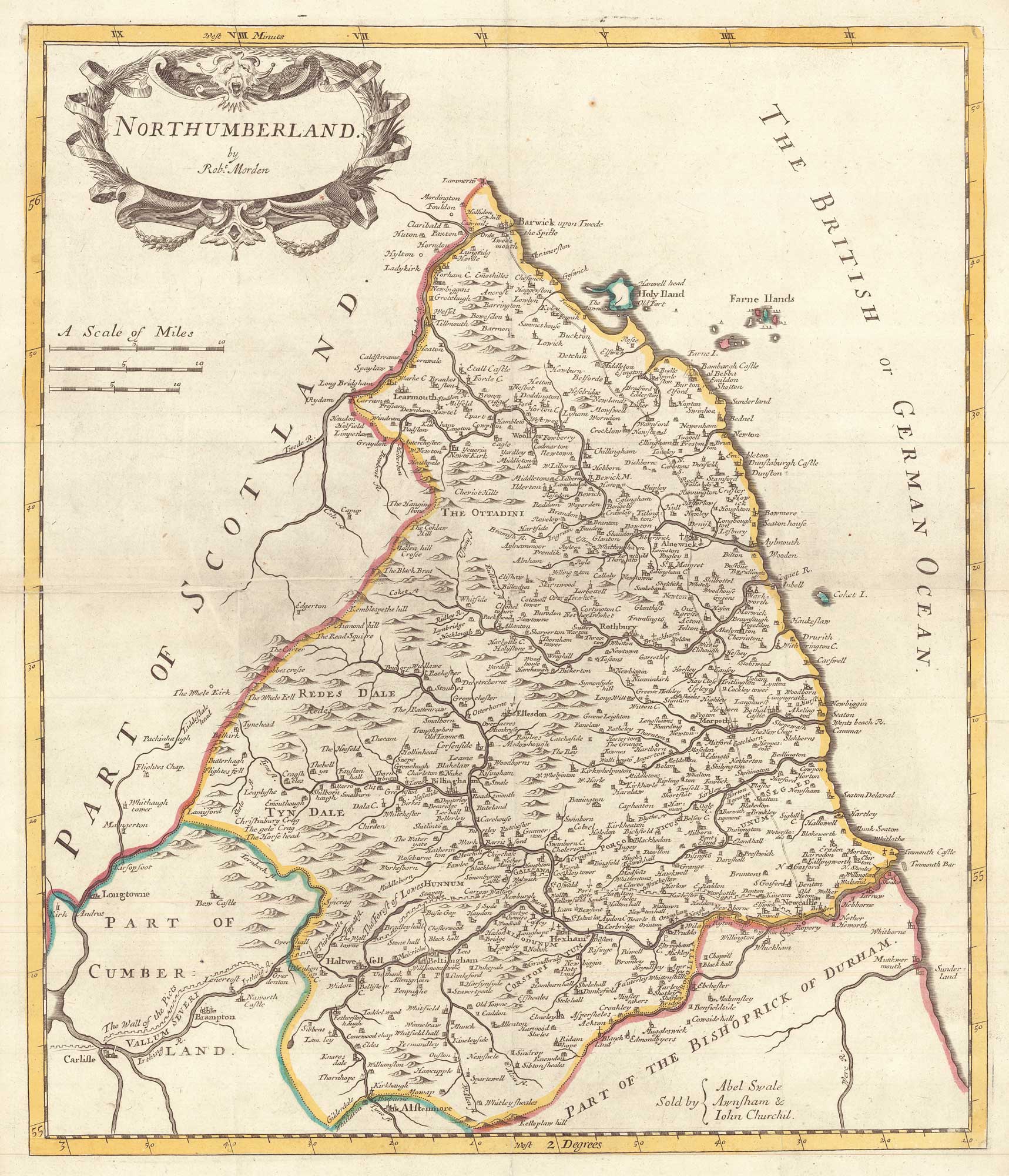
A 17th century map of Northumberland, marking Hadrian's Wall
MORDEN, Robert. Date: 1695 Stock #: 17722 £200.00
Add to Wishlist
Add to Wishlist
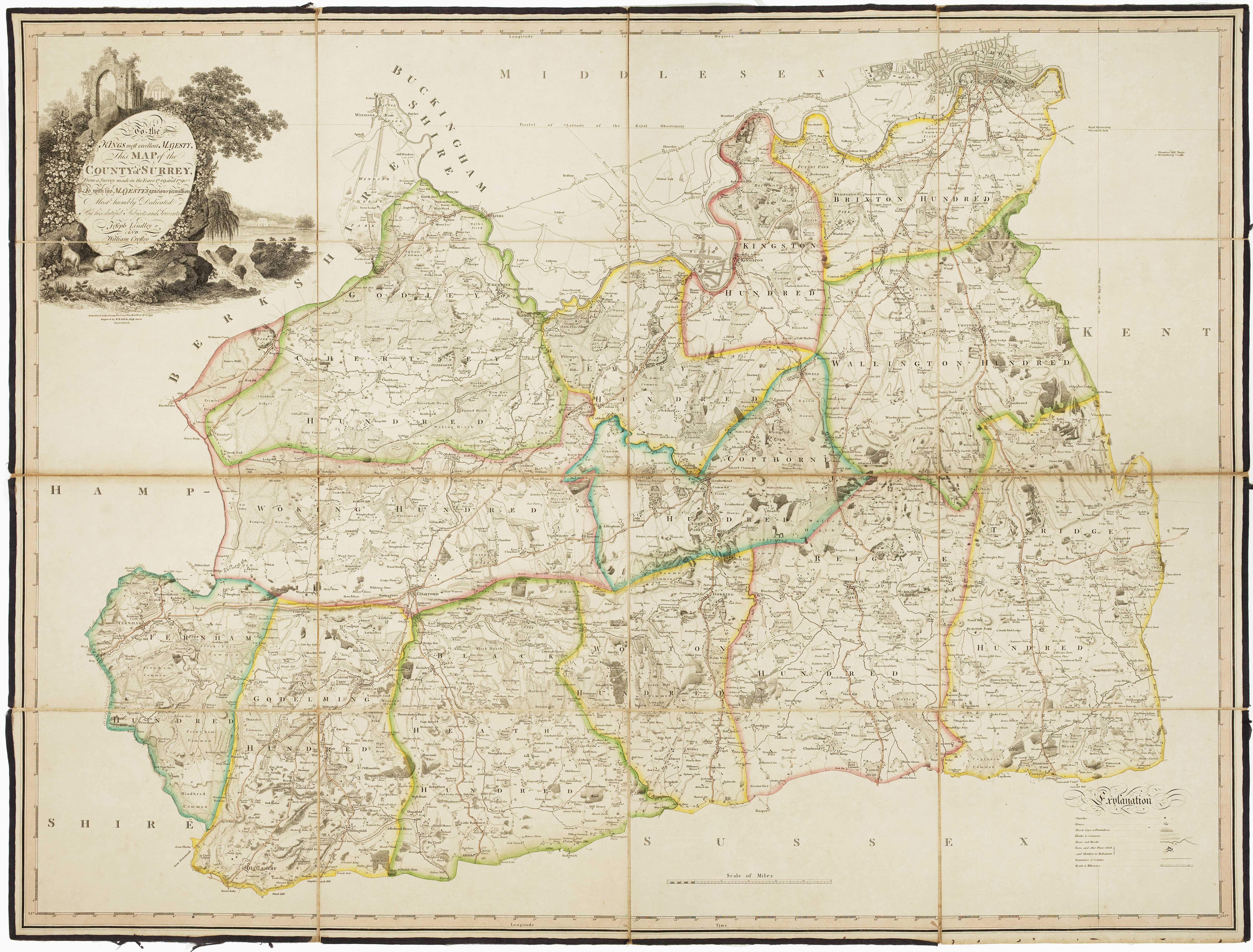
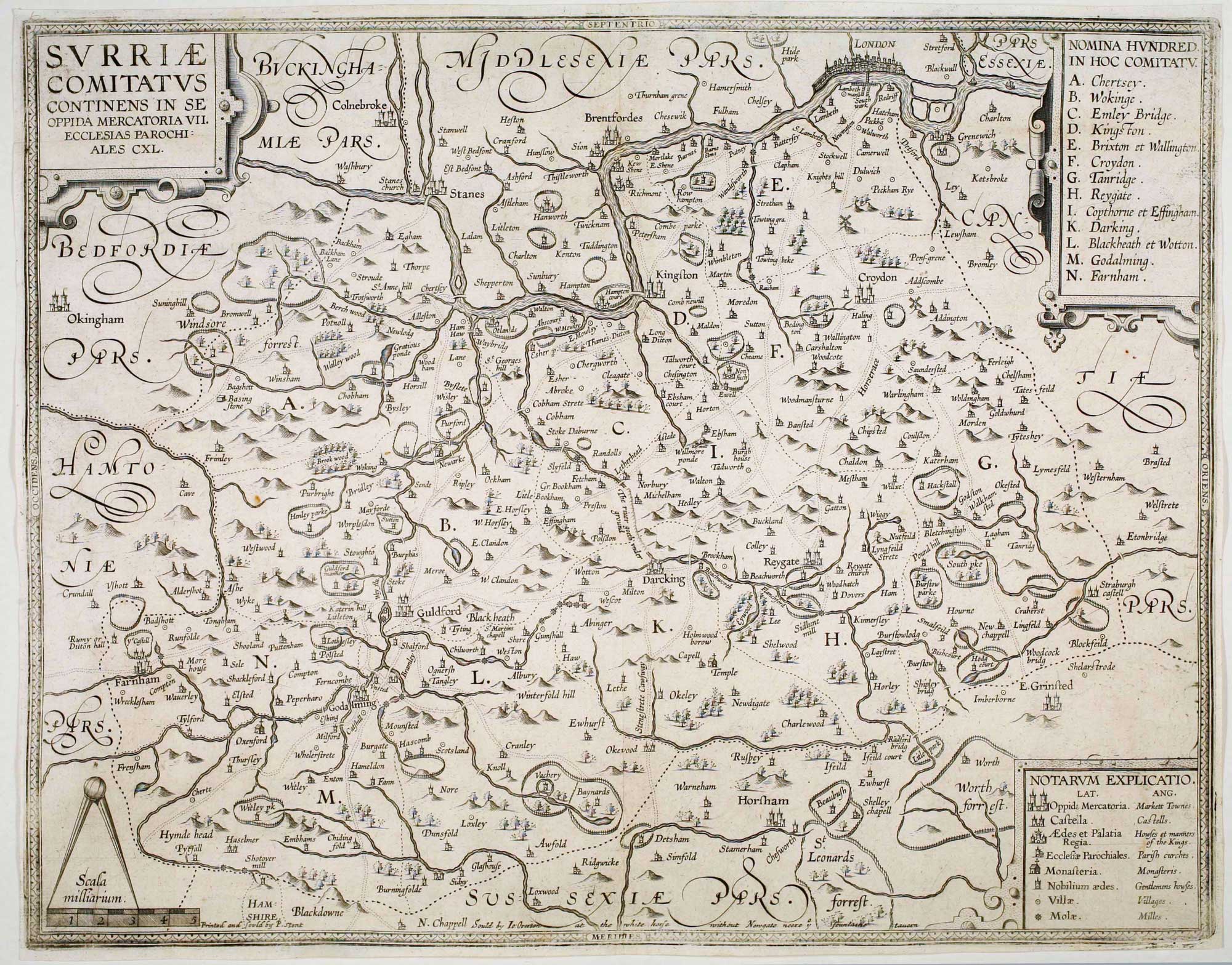
The first trigonometrical map of Surrey
LINDLEY, Joseph & CROSLEY, William. Date: 1793 Stock #: 16383 £2,200.00
Add to Wishlist
Add to Wishlist

16th century map of Cheshire from the Duke of York's Library
BLAEU, Johannes. Date: 1648 Stock #: 15535 £460.00
Add to Wishlist
Add to Wishlist

A map of Cheshire from the Duke of York's Library
JANSSON, Jan. Date: 1700 Stock #: 15537 £450.00
Add to Wishlist
Add to Wishlist
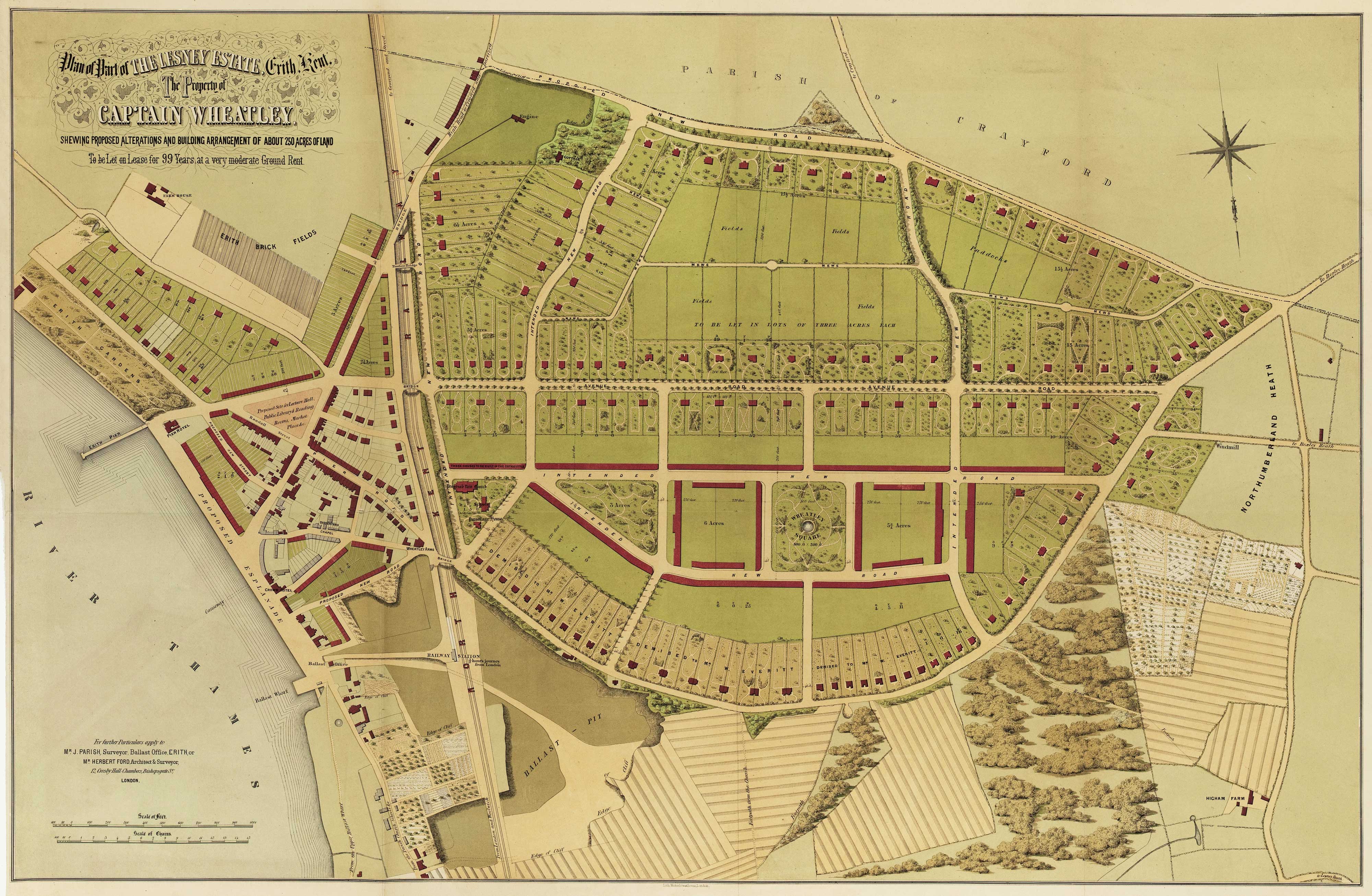
Urban planning in Erith during the Age of the Railway
Anonymous. Date: 1873 Stock #: 16089 £600.00
Add to Wishlist
Add to Wishlist
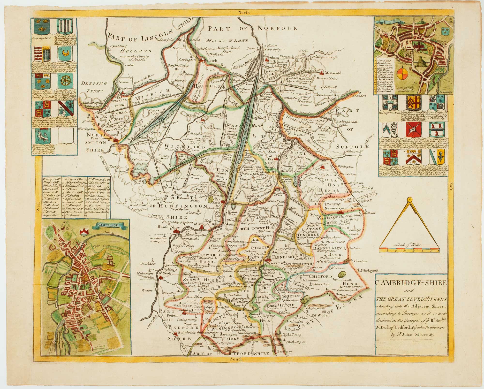
Uncommon map of Cambridgeshire from a Saxton county atlas
WILLDEY, George. Date: 1749 Stock #: 15847 £1,250.00
Add to Wishlist
Add to Wishlist
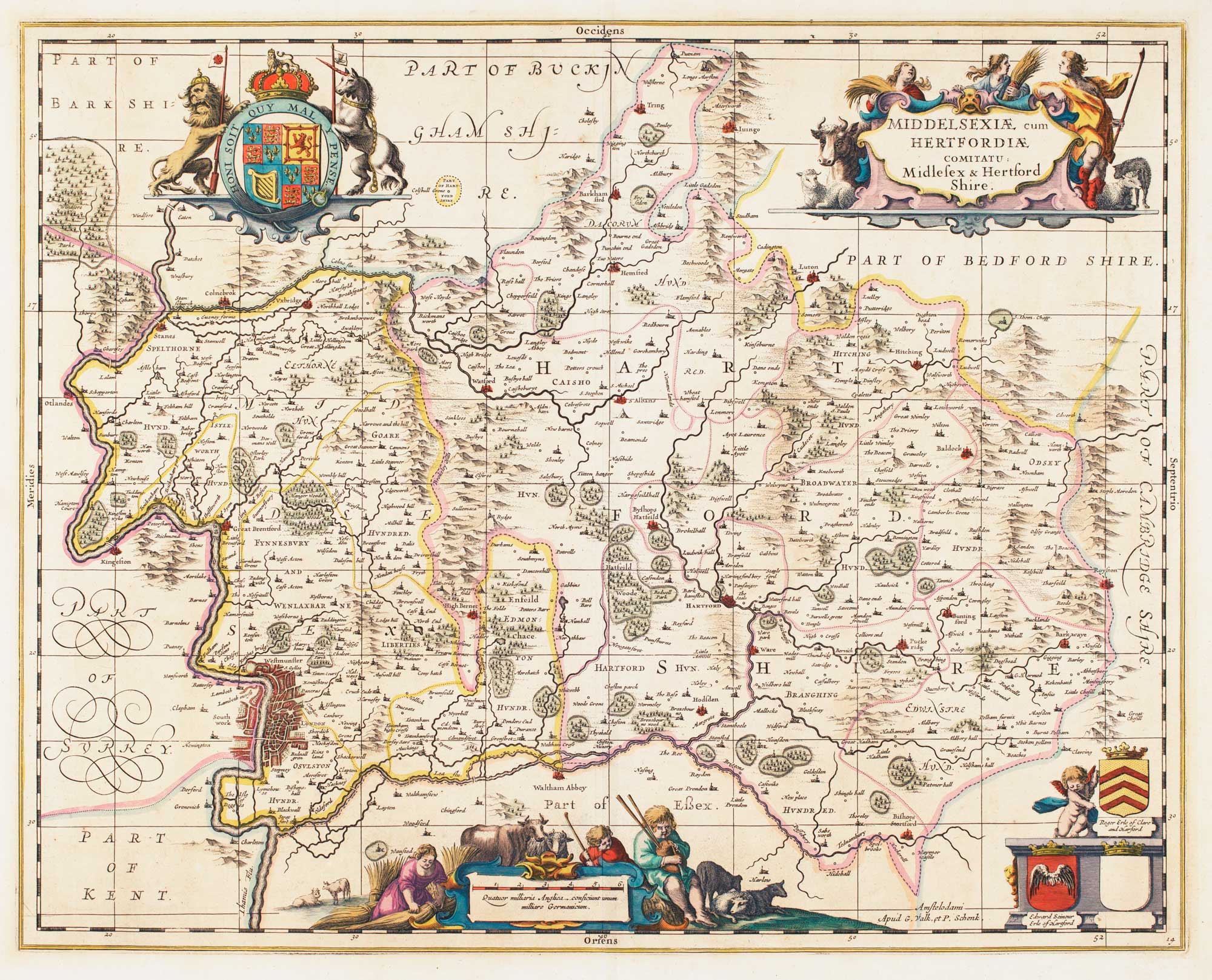
17th century map of Middlesex & Hertfordshire
JANSSON, Jan. Date: 1710 Stock #: 14617 £850.00
Add to Wishlist
Add to Wishlist

Plan of Manchester & Salford
Anonymous. Date: 1810 Stock #: 15436 £160.00
Add to Wishlist
Add to Wishlist

Map of Nottinghamshire published during the English Civil War
BLAEU, Johannes. Date: 1648 Stock #: 14532 £500.00
Add to Wishlist
Add to Wishlist
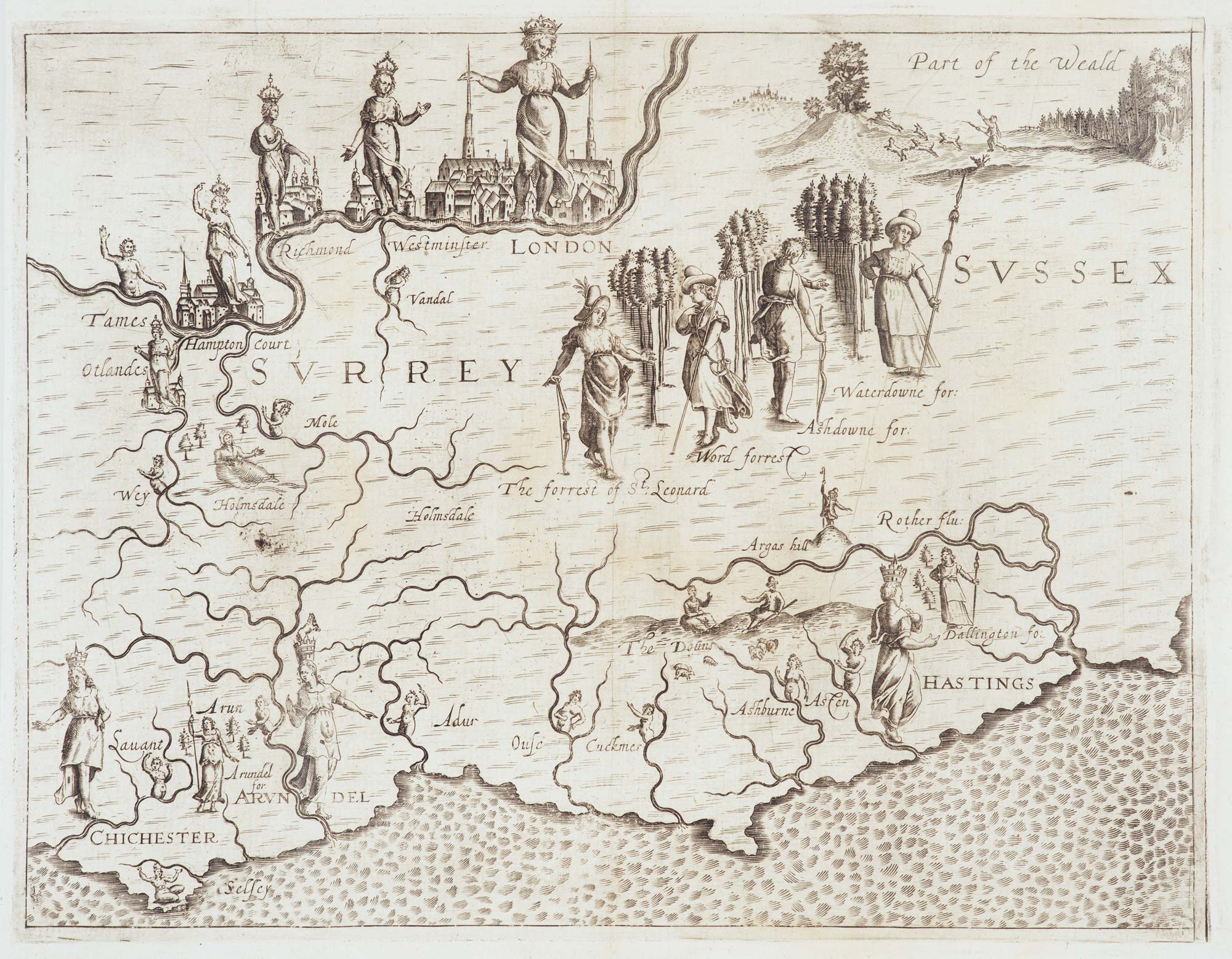
Map of Surrey and Sussex from Drayton's fantastical 'Poly-Olbion'
DRAYTON, Michael. Date: 1612 Stock #: 14044 £450.00
Add to Wishlist
Add to Wishlist
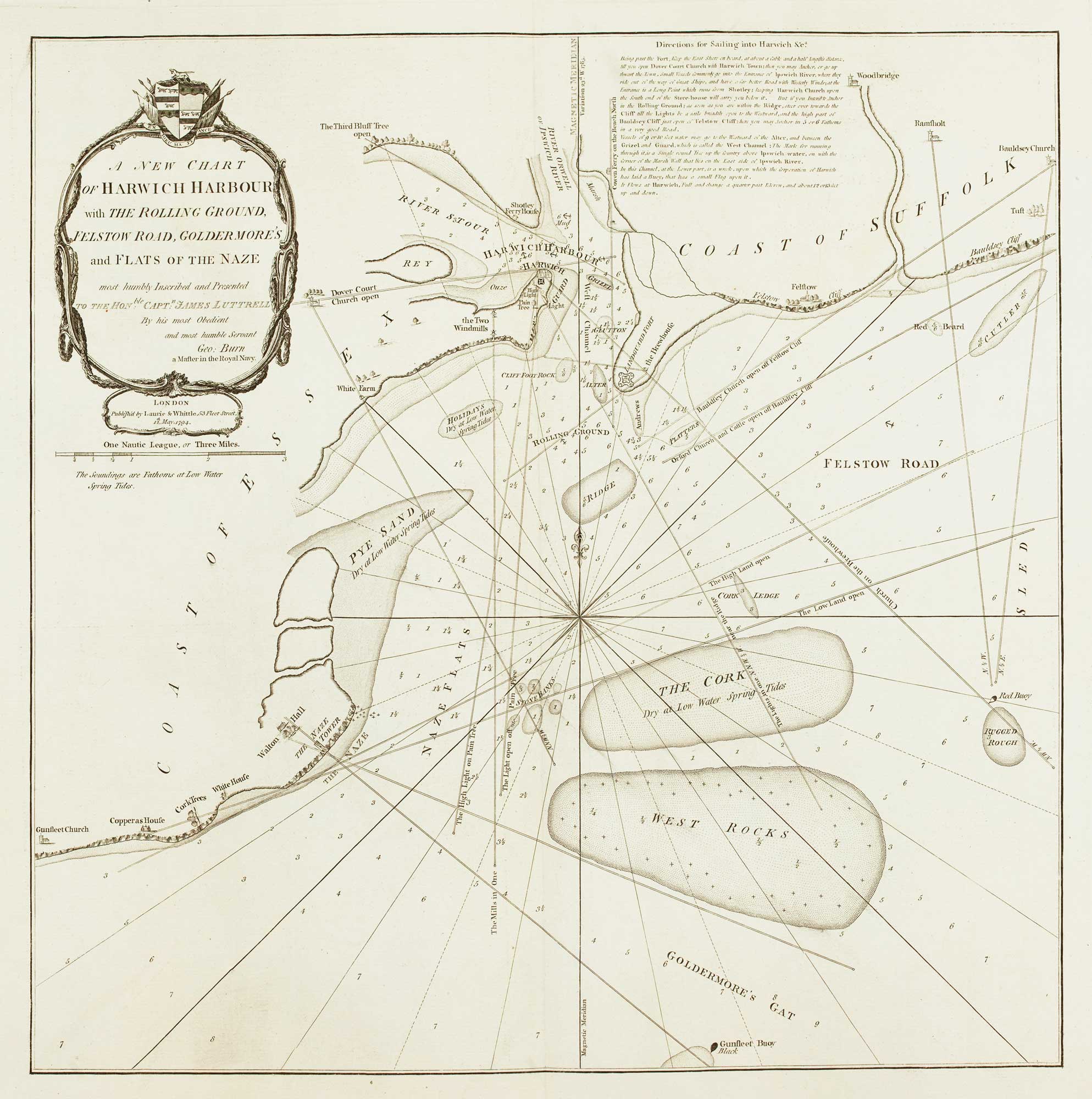
Detailed chart of the approaches to Harwich Harbour
BURN, George. Date: 1794 Stock #: 13254 £400.00
Add to Wishlist
Add to Wishlist
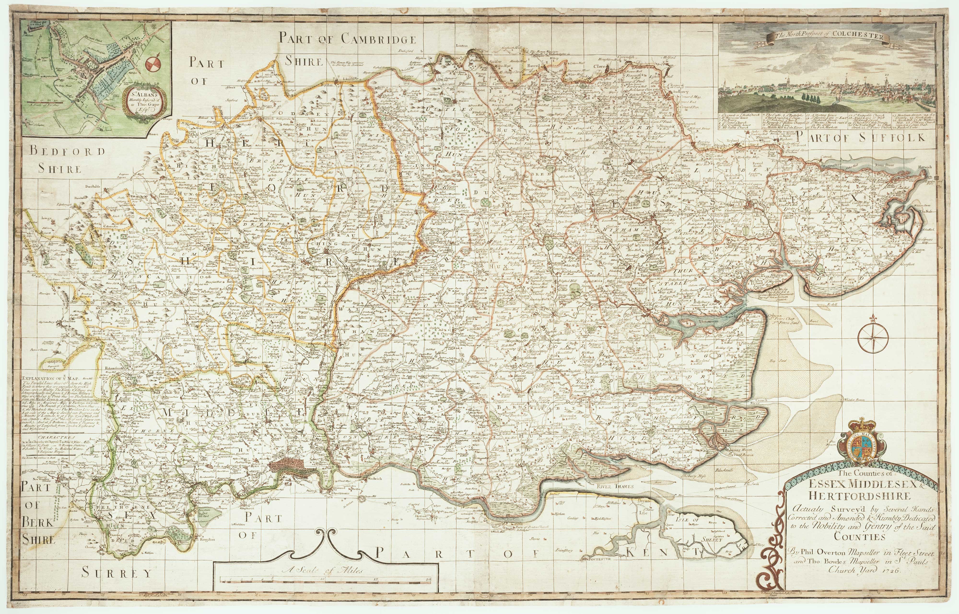
Rare map of Middlesex, Essex and Hertfordshire
WARBURTON, John. Date: 1726 Stock #: 12907 £1,100.00
Add to Wishlist
Add to Wishlist
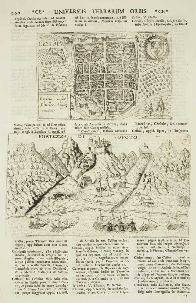
Chester
VALEGIO, Francesco & ROSACCIO, Guiseppe. Date: 1713 Stock #: 9797 £50.00
Add to Wishlist
Add to Wishlist
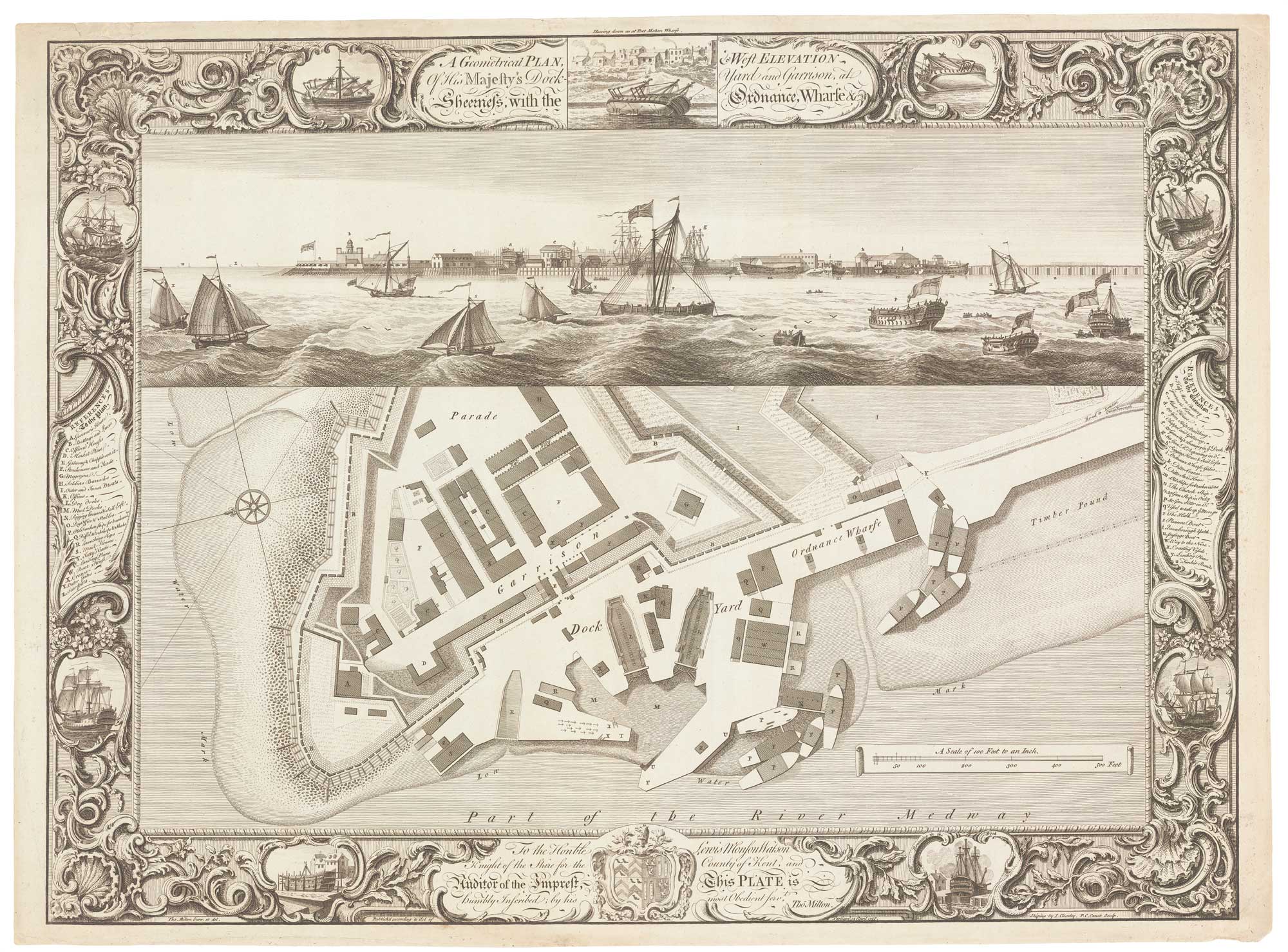
Fine plan of the naval dockyard at Sheerness, Kent
MILTON, Thomas. Date: 1755 Stock #: 8492 £600.00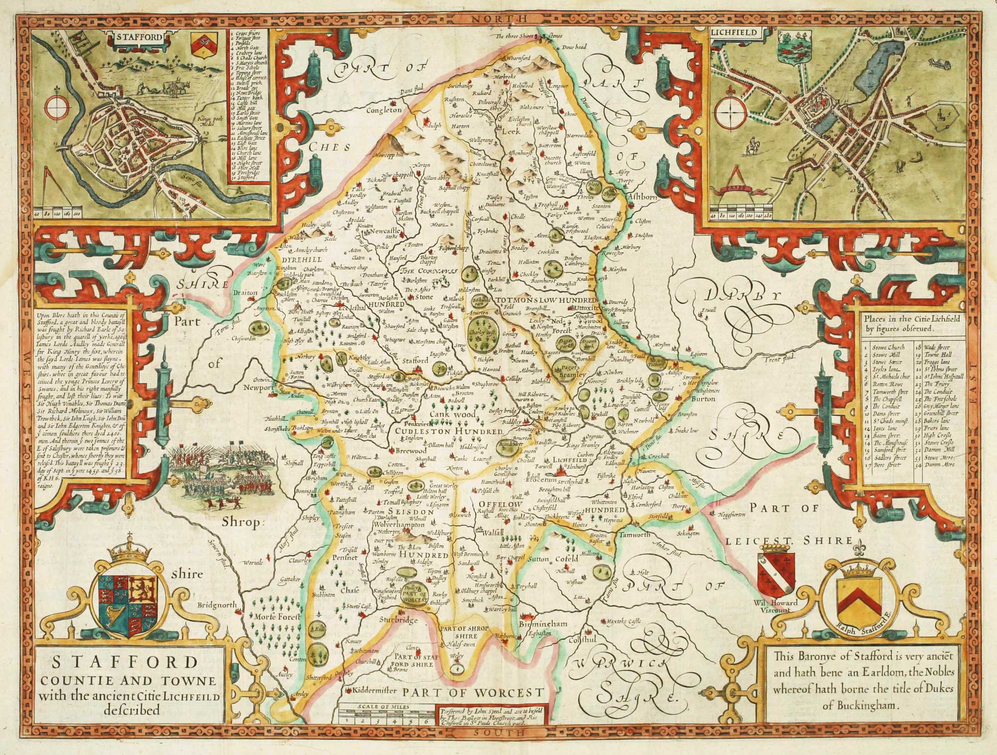
Add to Wishlist
Add to Wishlist
The so-called 'Anonymous' map of Surrey
SMITH, William. Date: 1665 Stock #: 9177 £2,000.00
Add to Wishlist
Add to Wishlist