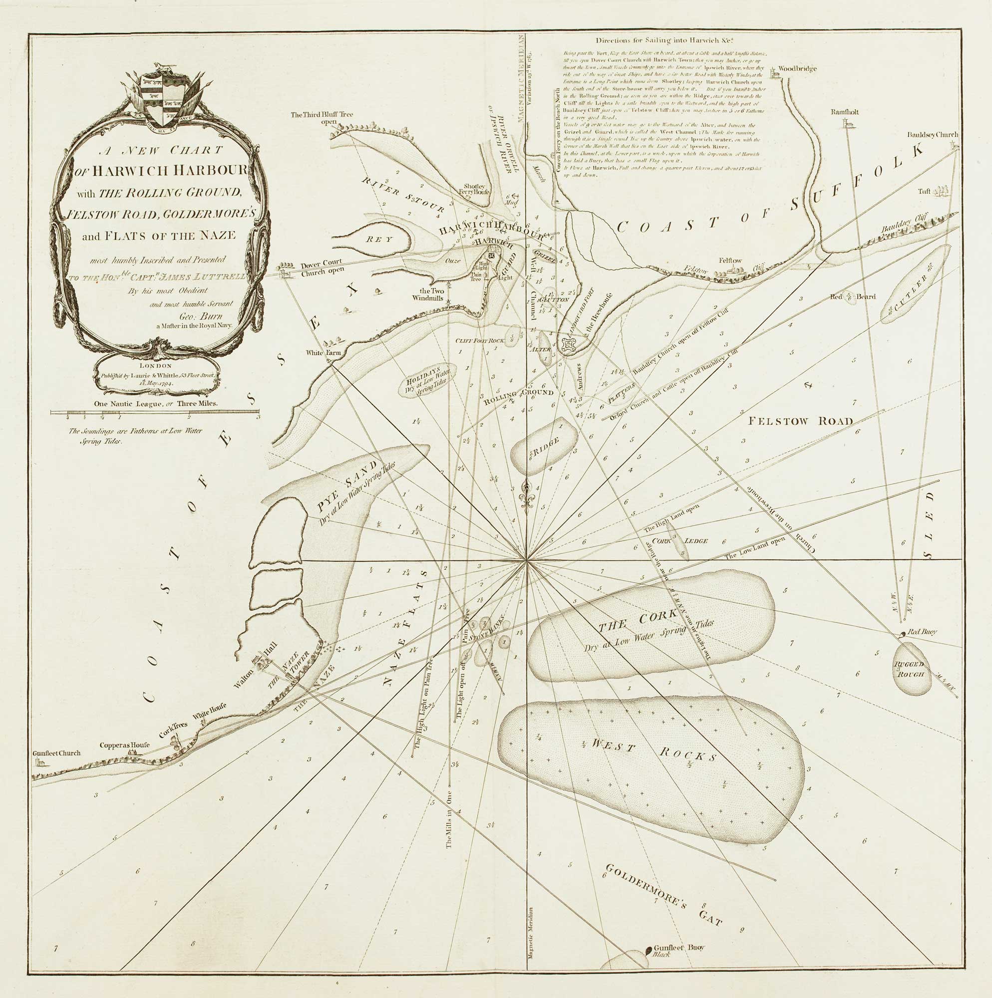


Detailed chart of the approaches to Harwich Harbour
A New Chart of Harwich Harbour with the Rolling Ground, Felstow Road, Goldermore's and Flats of the Naze most humbly Inscribed and Presented to the Hon.ble Capt.n James Lutterell...
London: Laurie & Whittle, 1794. 520 x 510mm.
£400.00
1 in stock
x
Question About This Item?
Detailed chart of the approaches to Harwich Harbour & BURN, George.Stock #: 13254Similar to Sell?
Description
Harwich was important as the only safe anchorage on the east coast of England between the Thames and Humber. As such it was important for the Royal Navy, especially at the time this chart was published, as invasion by Revolutionary France was feared.