Antique Maps of Oxfordshire
Showing 1–5 of 5 products
Sort by:
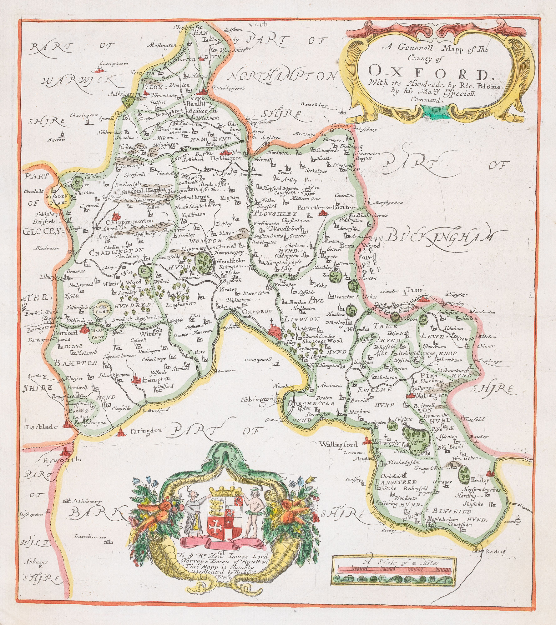
Add to Wishlist
Add to Wishlist
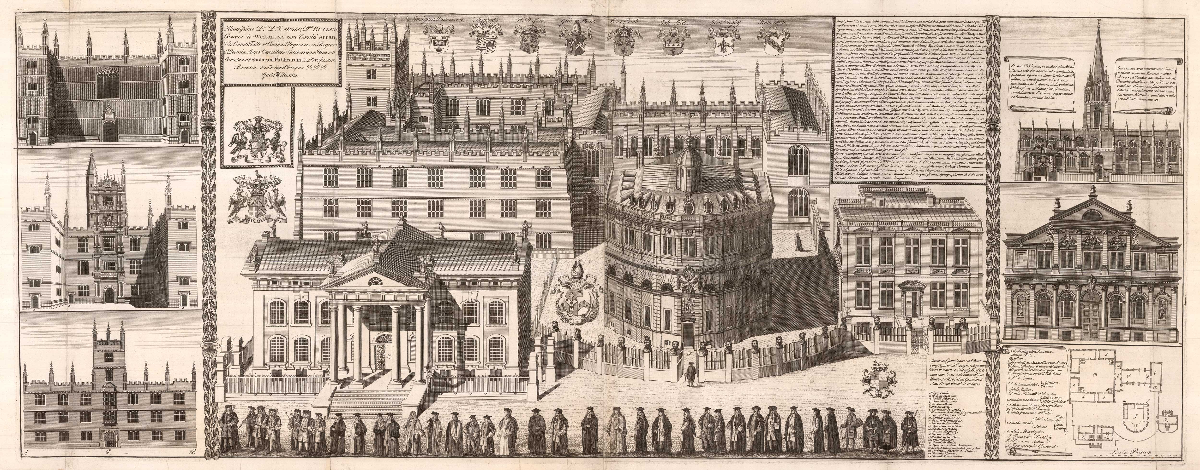
A majestic two-sheet view of the Bodleian buildings from Broad Street
WILLIAMS, William. Date: 1935 Stock #: 25684 £2,500.00
Add to Wishlist
Add to Wishlist

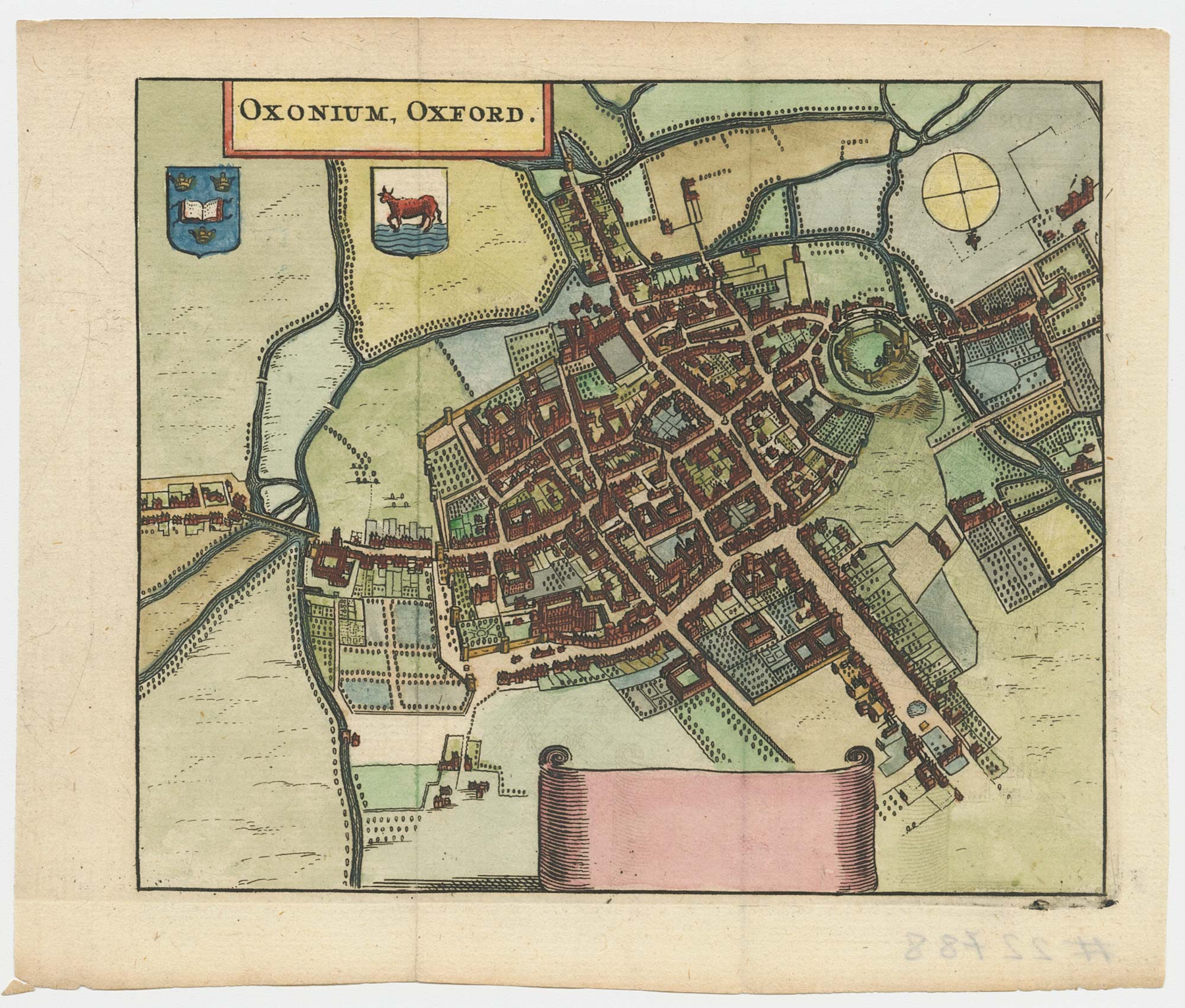
A map of Oxford in Elizabethan times
AGAS, Ralph. Date: 1935 Stock #: 23589 £1,250.00
Add to Wishlist
Add to Wishlist
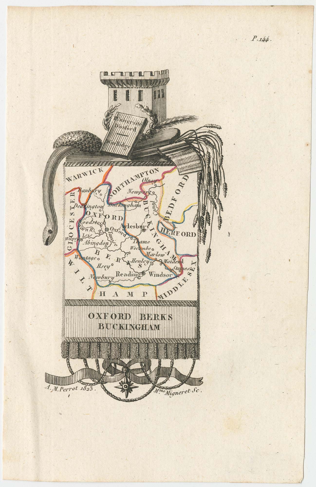
Miniature map of Oxfordshire and Buckinghamshire
PERROT, Aristide Michel. Date: 1828 Stock #: 23133 £100.00
Add to Wishlist
Add to Wishlist
A 17th century townplan of Oxford
HERMANNIDES, Rutger. Date: 1661 Stock #: 22788 £350.00
Add to Wishlist
Add to Wishlist