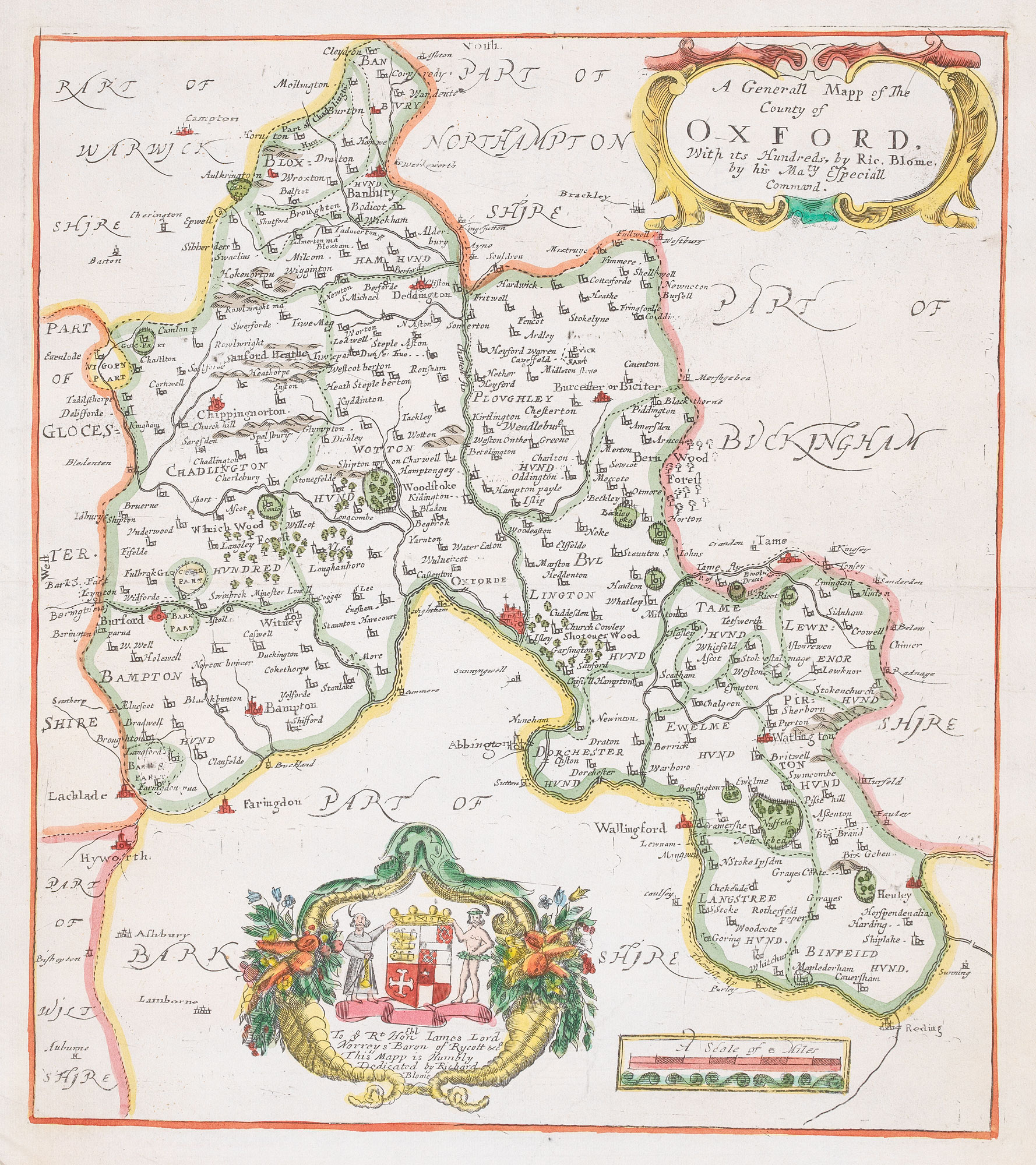


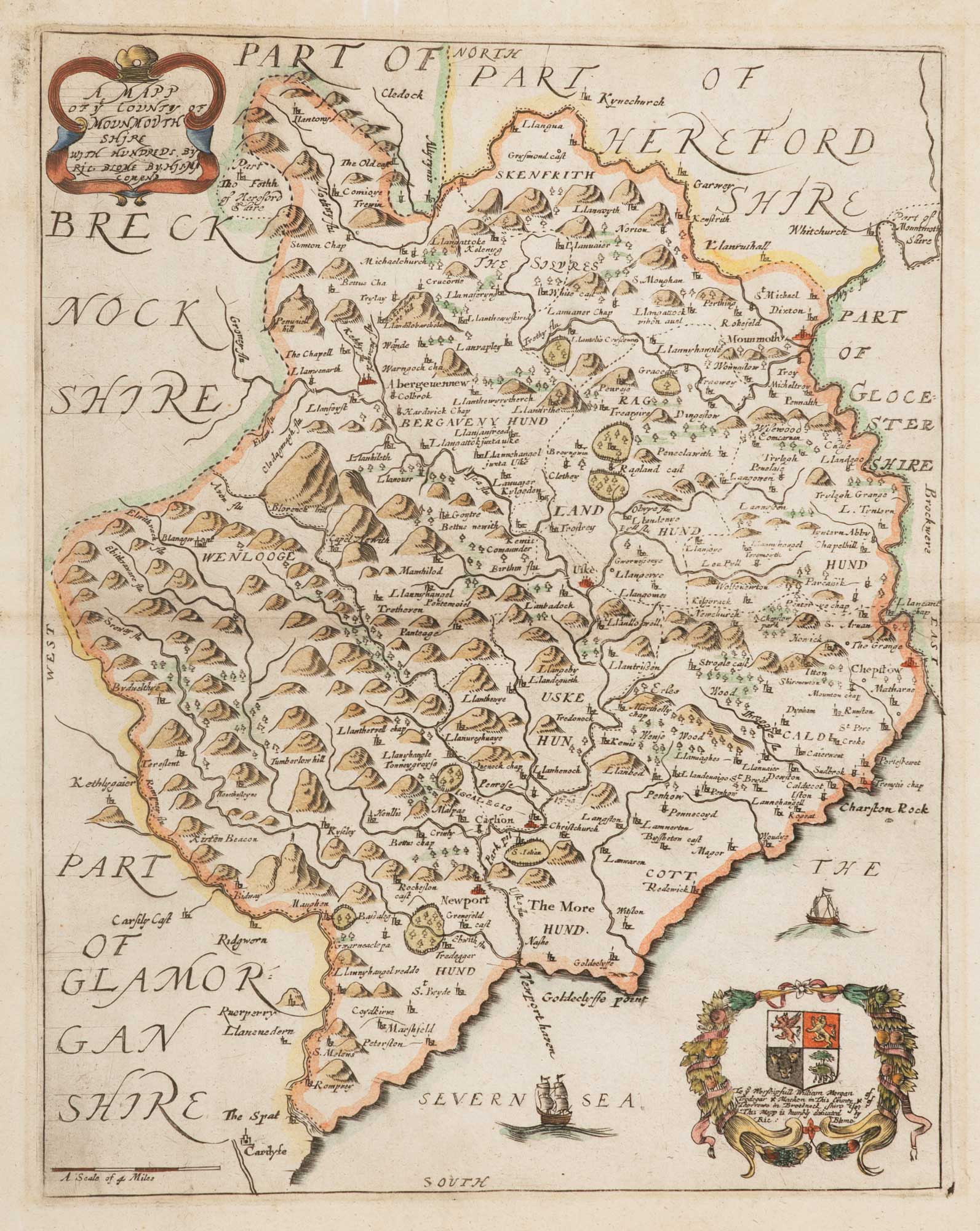
17th century map of Oxfordshire
A Generall Mapp of the County of Oxford, With its Hundreds, by Ric. Blome, by his Maty. Especiall Command.
London, c.1673. Coloured. 325 x 285mm.
£320.00
Description
Published in Blome's 'Britannia', with two decorative cartouches. The map depicts county and hundred boundaries, rivers, towns and villages, parks surrounded by palings, woodland, and relief.
Condition:
A good example.Related products
-
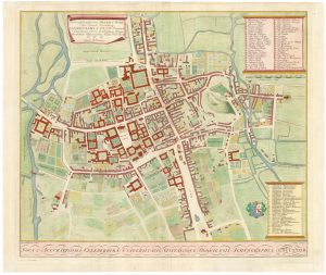
A 17th century townplan of Oxford
HERMANNIDES, Rutger. Date: 1661Stock #: 22788 £350.00 -
Miniature map of Oxfordshire and Buckinghamshire
PERROT, Aristide Michel. Date: 1828Stock #: 23133 £100.00 -
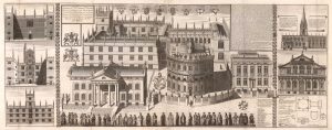
A majestic two-sheet view of the Bodleian buildings from Broad Street
WILLIAMS, William. Date: 1935Stock #: 25684 £2,500.00 -
A map of Oxford in Elizabethan times
AGAS, Ralph. Date: 1935Stock #: 23589 £1,250.00
Items by the same author
[ti_wishlists_addtowishlist]
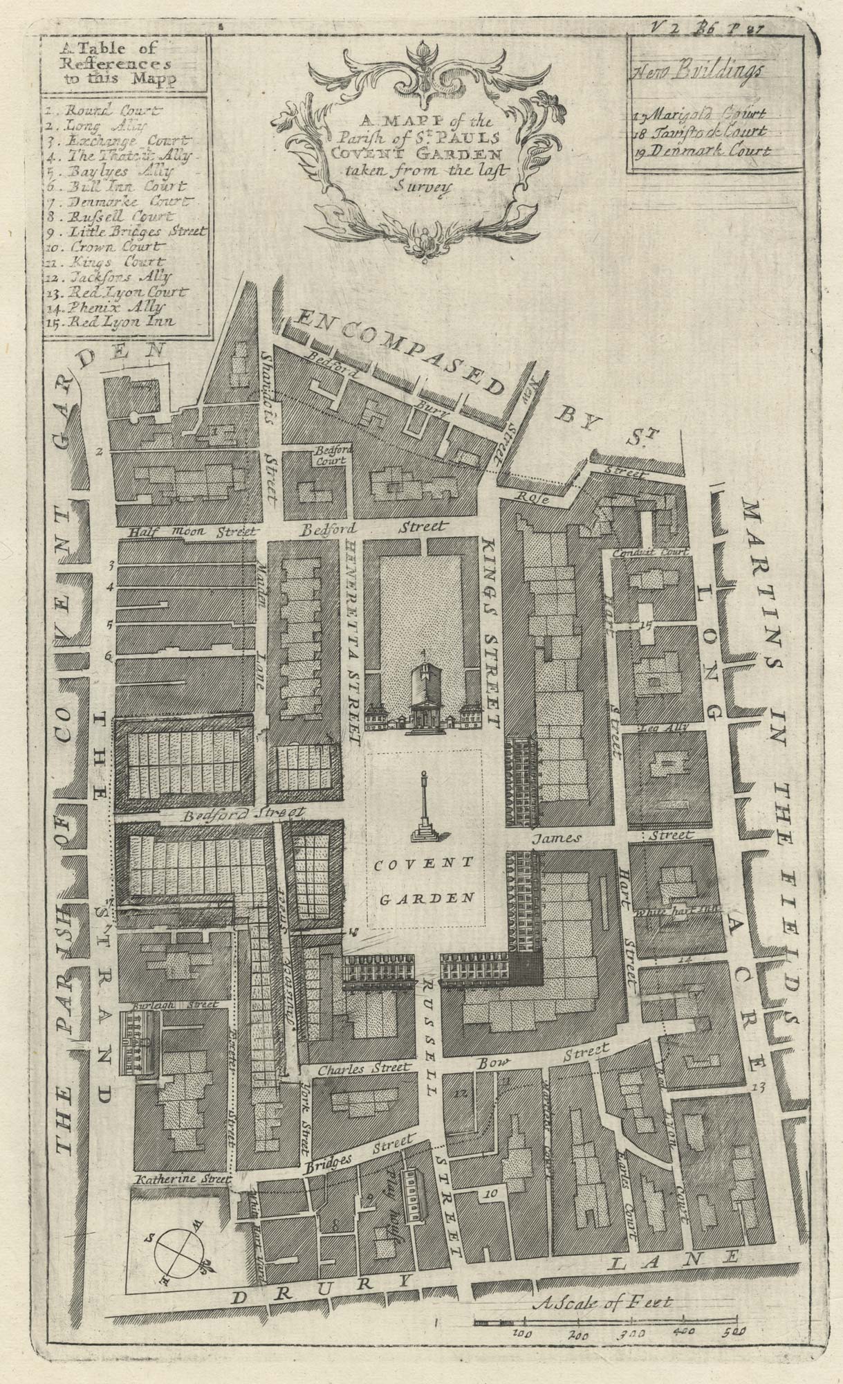
A plan of Covent Garden at the end of the 17th century
BLOME, Richard. Date: 1720 Stock #: 25170 £200.00
[ti_wishlists_addtowishlist]
A plan of Covent Garden at the end of the 17th century
BLOME, Richard. Date: 1720 Stock #: 25282 £400.00
[ti_wishlists_addtowishlist]
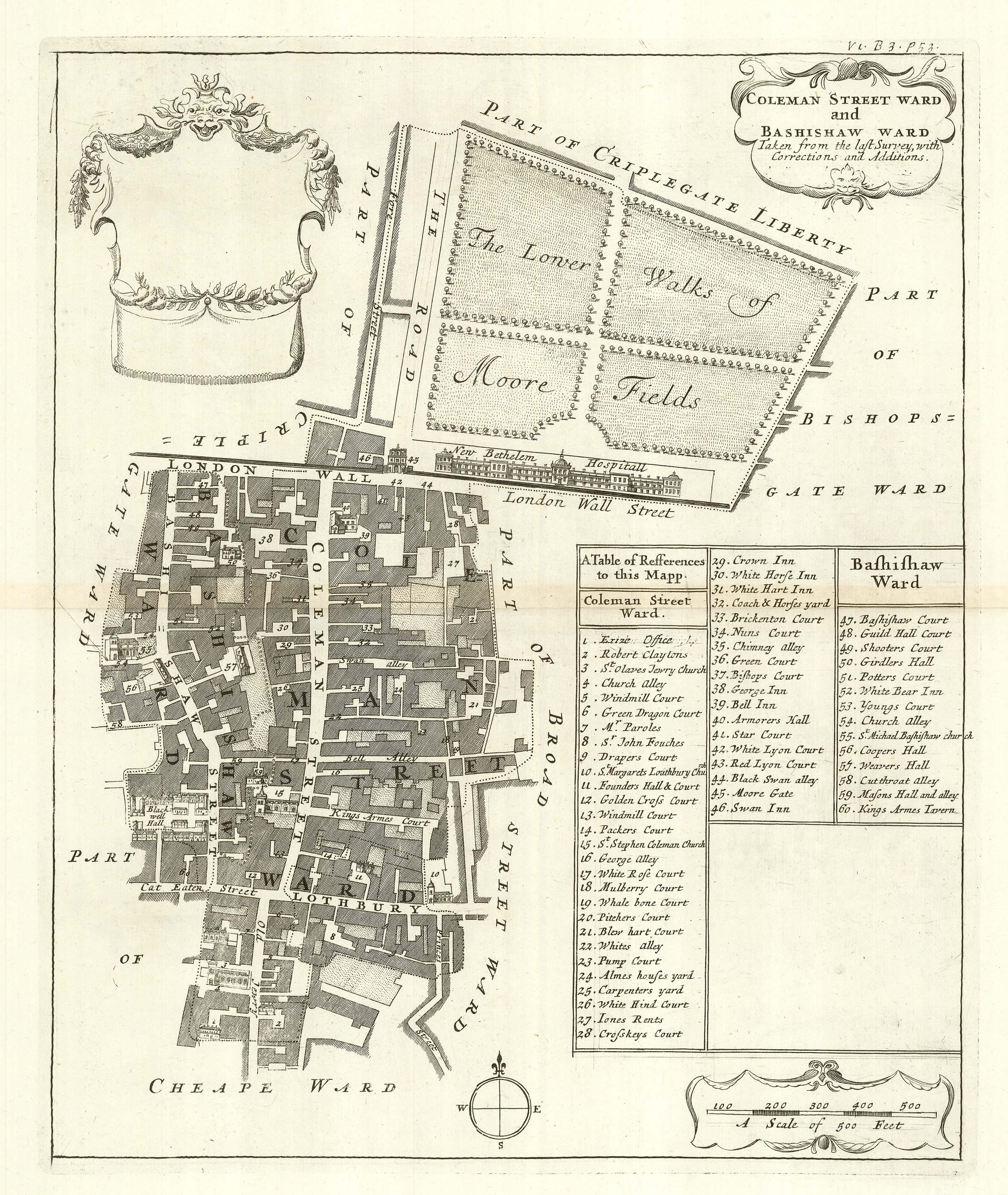
The wards of Coleman Street and Bassishaw at the end of the 17th century
BLOME, Richard. Date: 1720 Stock #: 25162 £200.00
[ti_wishlists_addtowishlist]
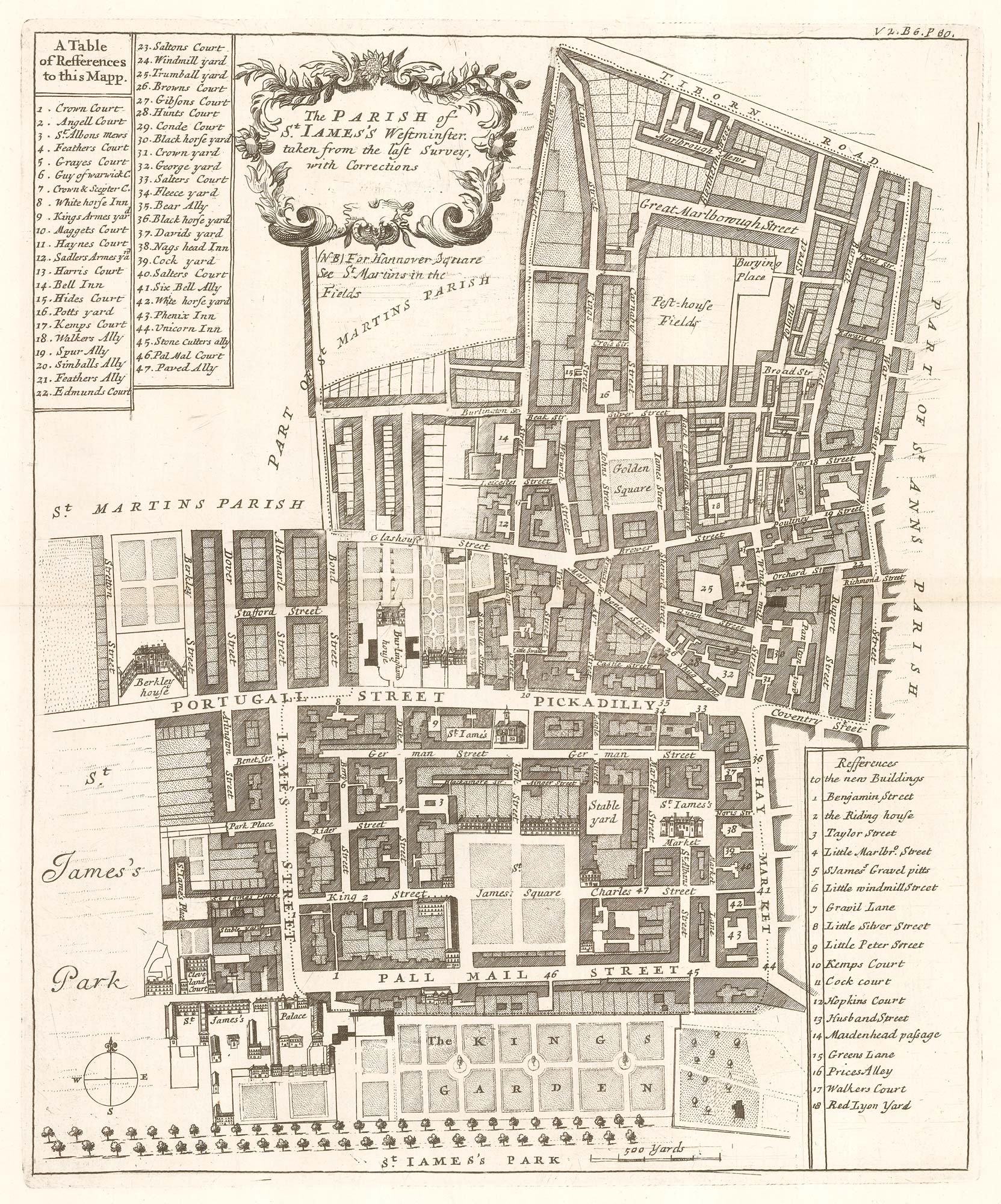
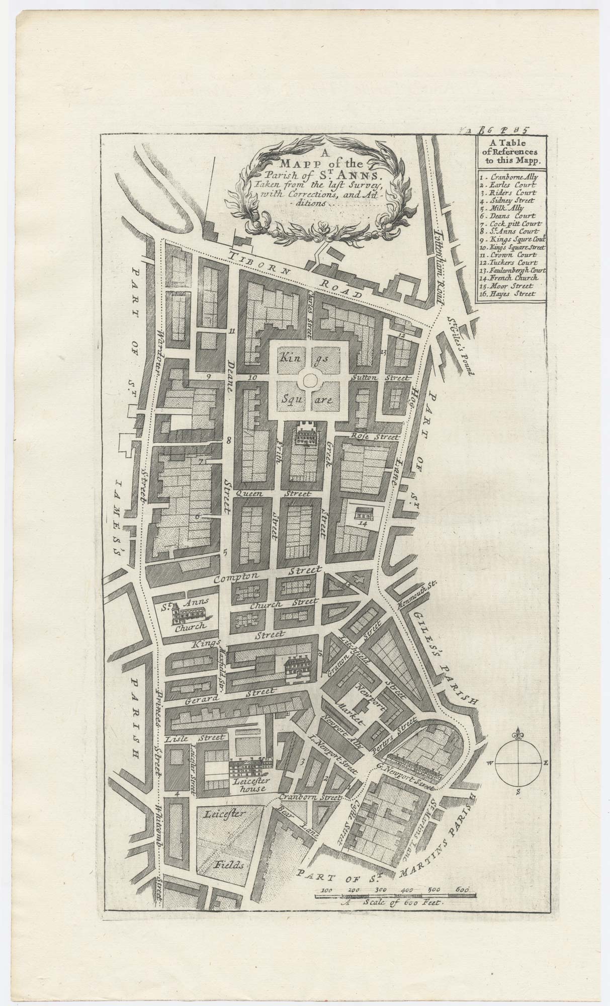
Plan of St James's Parish at the end of the 17th century
BLOME, Richard. Date: 1720 Stock #: 25160 £450.00
[ti_wishlists_addtowishlist]
[ti_wishlists_addtowishlist]