Antique Maps of the Eastern Seaboard
Showing 1–30 of 37 products
Sort by:
Add to Wishlist
Add to Wishlist
The earliest depiction of post roads in America
MOLL, Herman. Date: 1732 Stock #: 25480 £1,100.00
Add to Wishlist
Add to Wishlist
17th century miniature map of Virginia
DU VAL, Pierre. Date: 1672 Stock #: 25366 £500.00
Add to Wishlist
Add to Wishlist
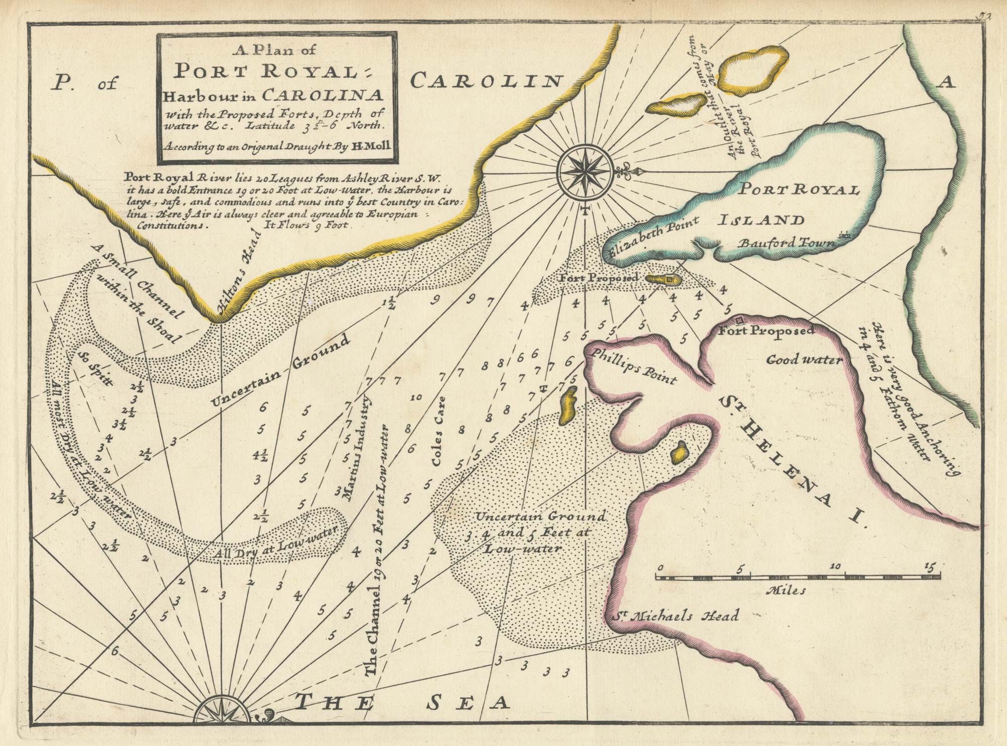
An 18th century English chart of Port Royal
MOLL, Herman. Date: 1732 Stock #: 25479 £300.00
Add to Wishlist
Add to Wishlist
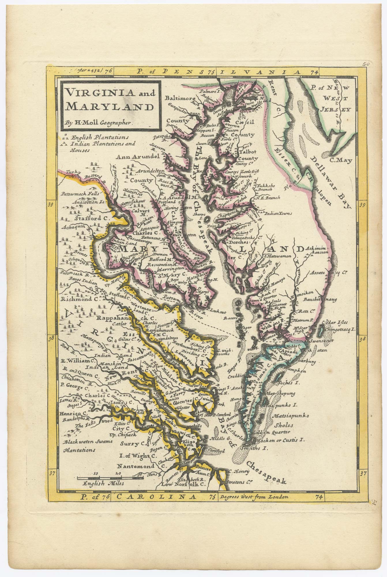
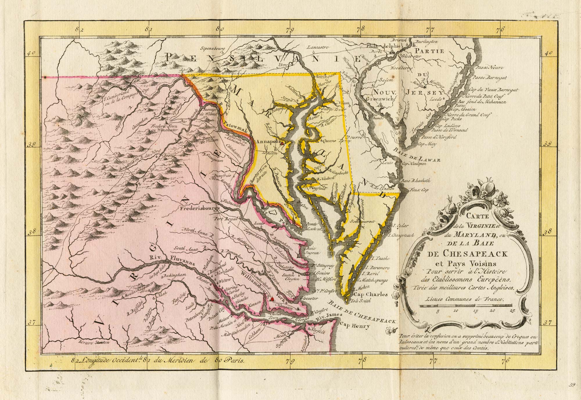
An 18th century English map of Virginia and Maryland
MOLL, Herman. Date: 1732 Stock #: 25473 £1,100.00
Add to Wishlist
Add to Wishlist
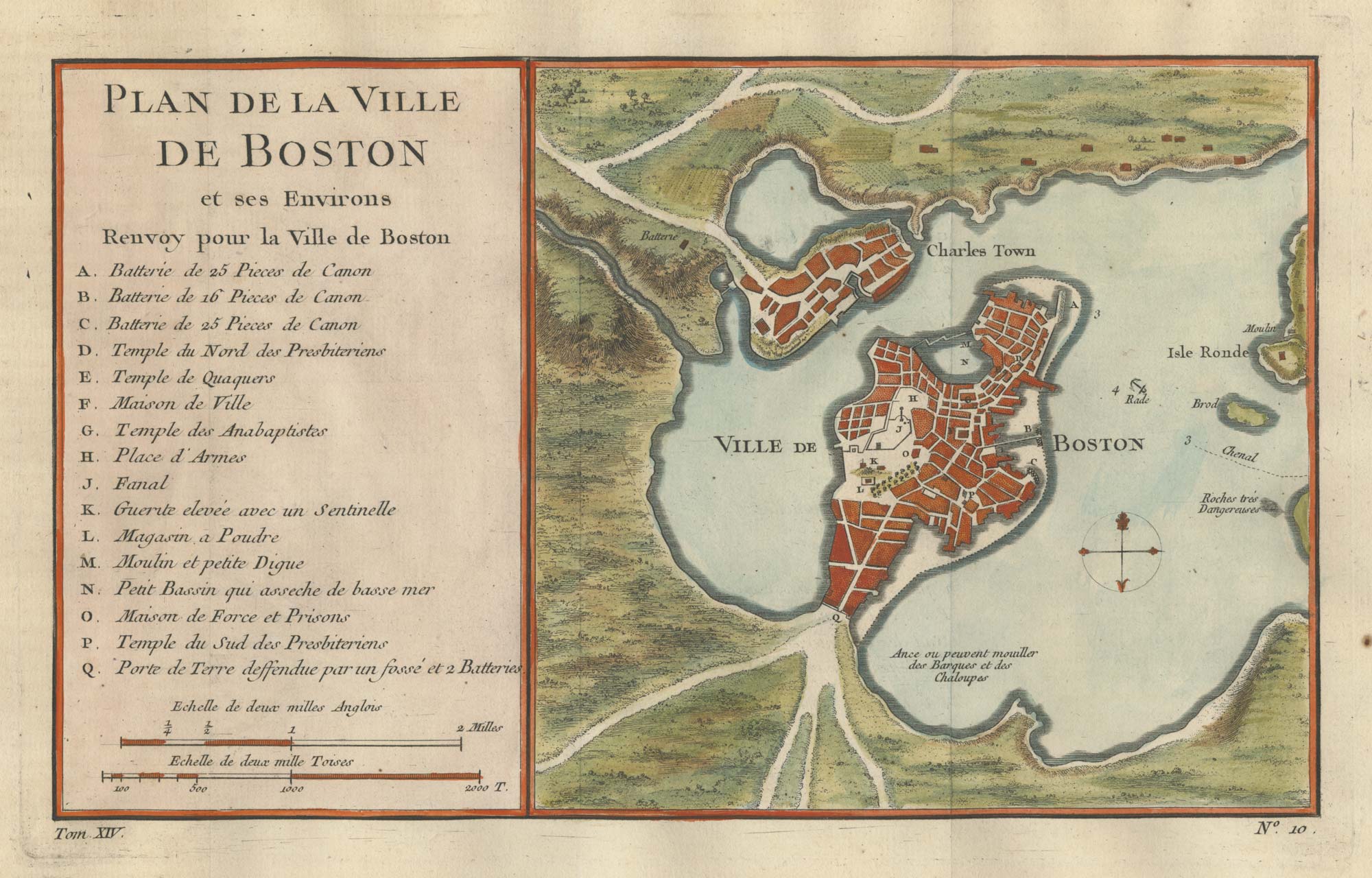
An 18th century town plan of Boston
BELLIN, Jacques-Nicolas. Date: 1760 Stock #: 25451 £380.00
Add to Wishlist
Add to Wishlist
A 17th century map of Virginia from a pocket atlas
JANSSON, Jan. Date: 1631 Stock #: 25066 £500.00
Add to Wishlist
Add to Wishlist
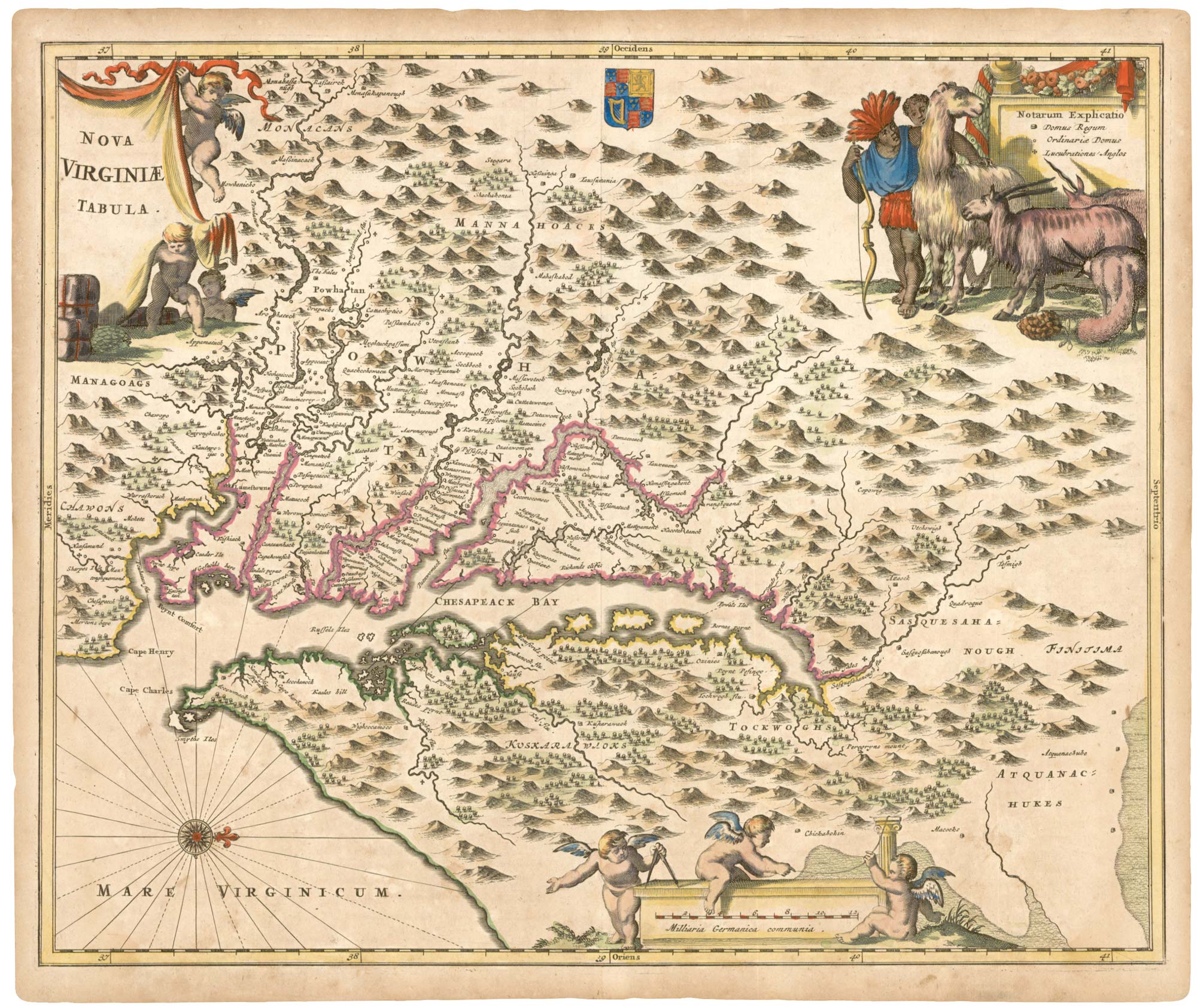
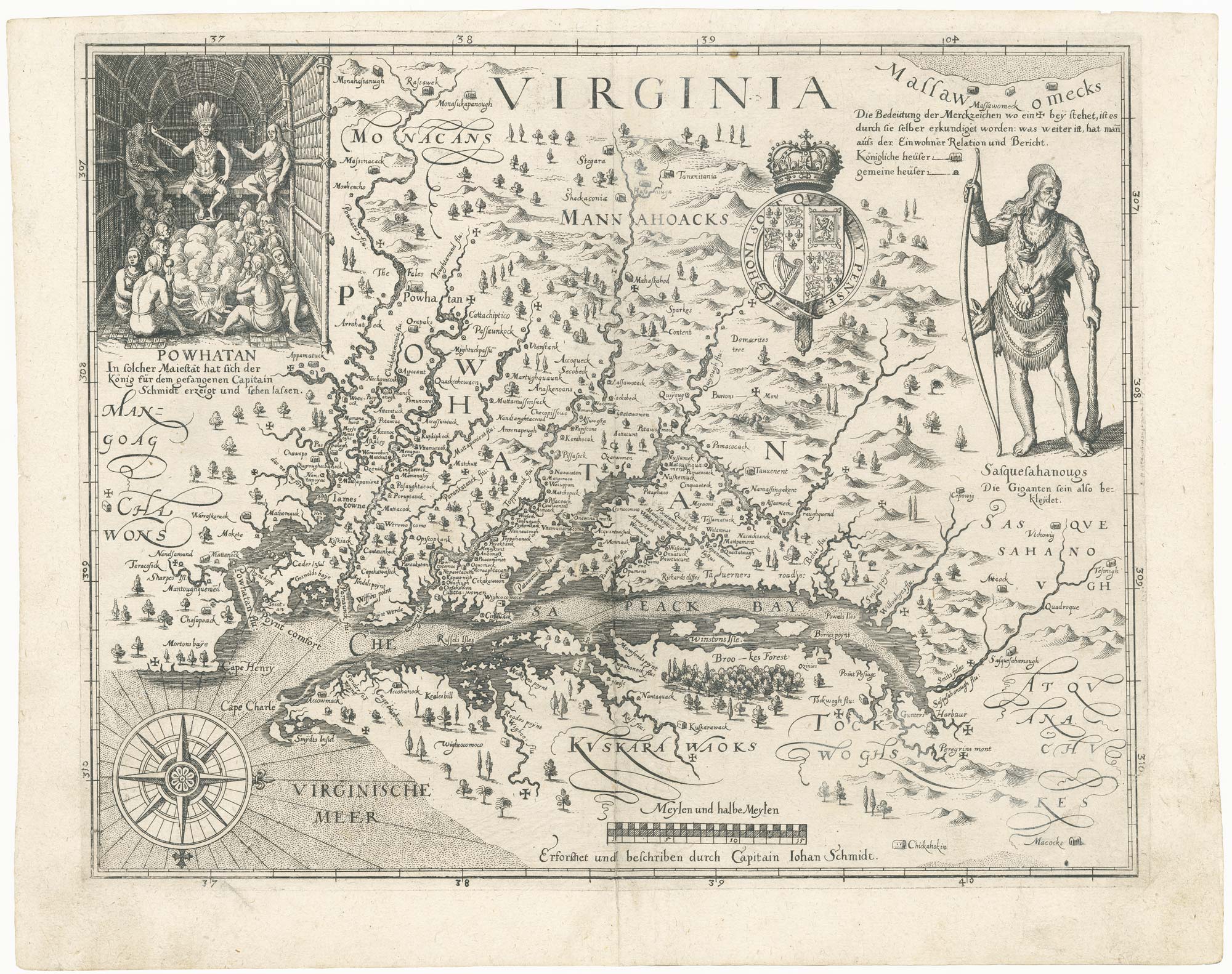
17th century map of Virginia
MONTANUS, Arnoldus. Date: 1671 Stock #: 24929 £980.00
Add to Wishlist
Add to Wishlist
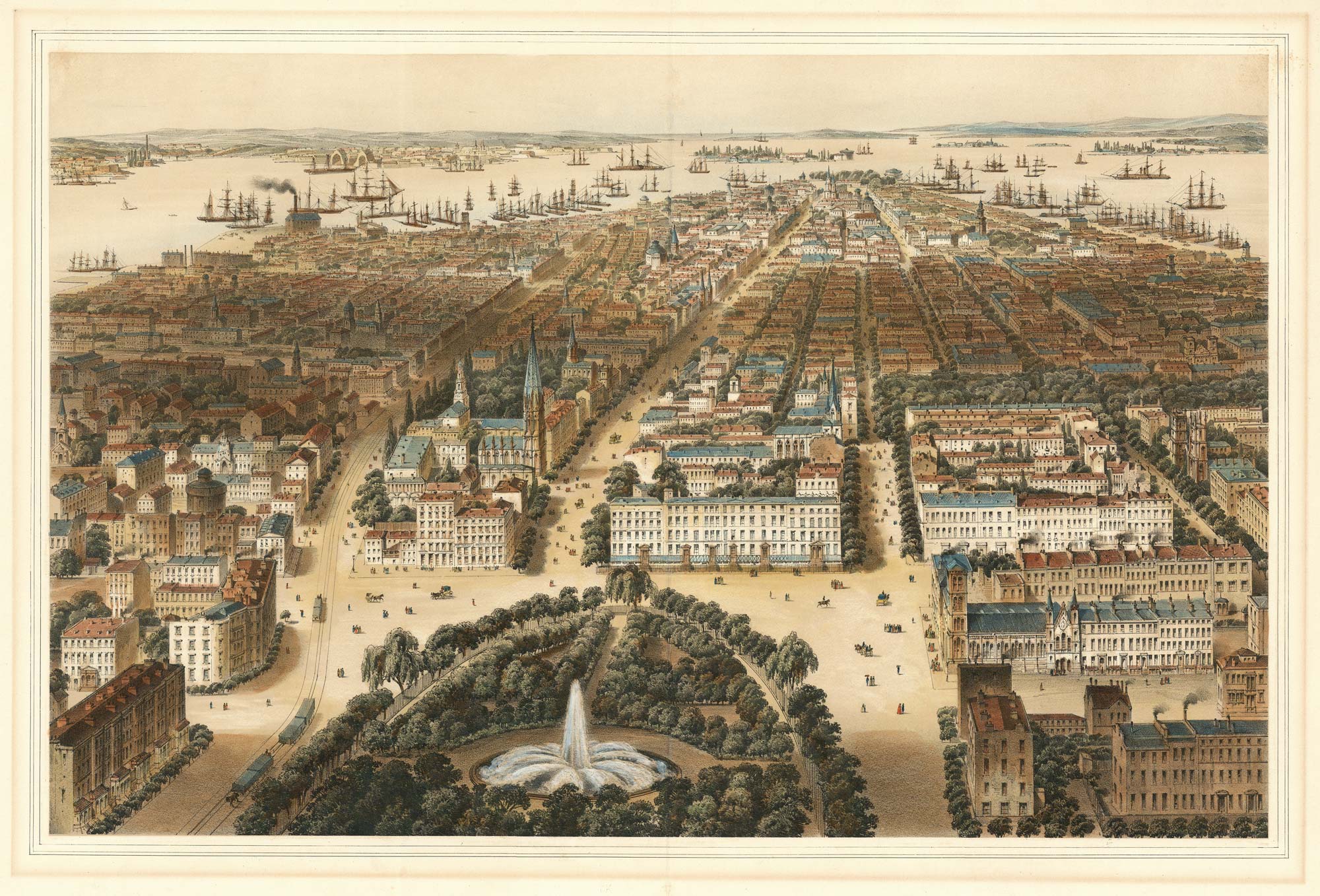
A prospect of New York from Union Square
BACHMANN, C. Date: 1849 Stock #: 24751 £4,000.00
Add to Wishlist
Add to Wishlist
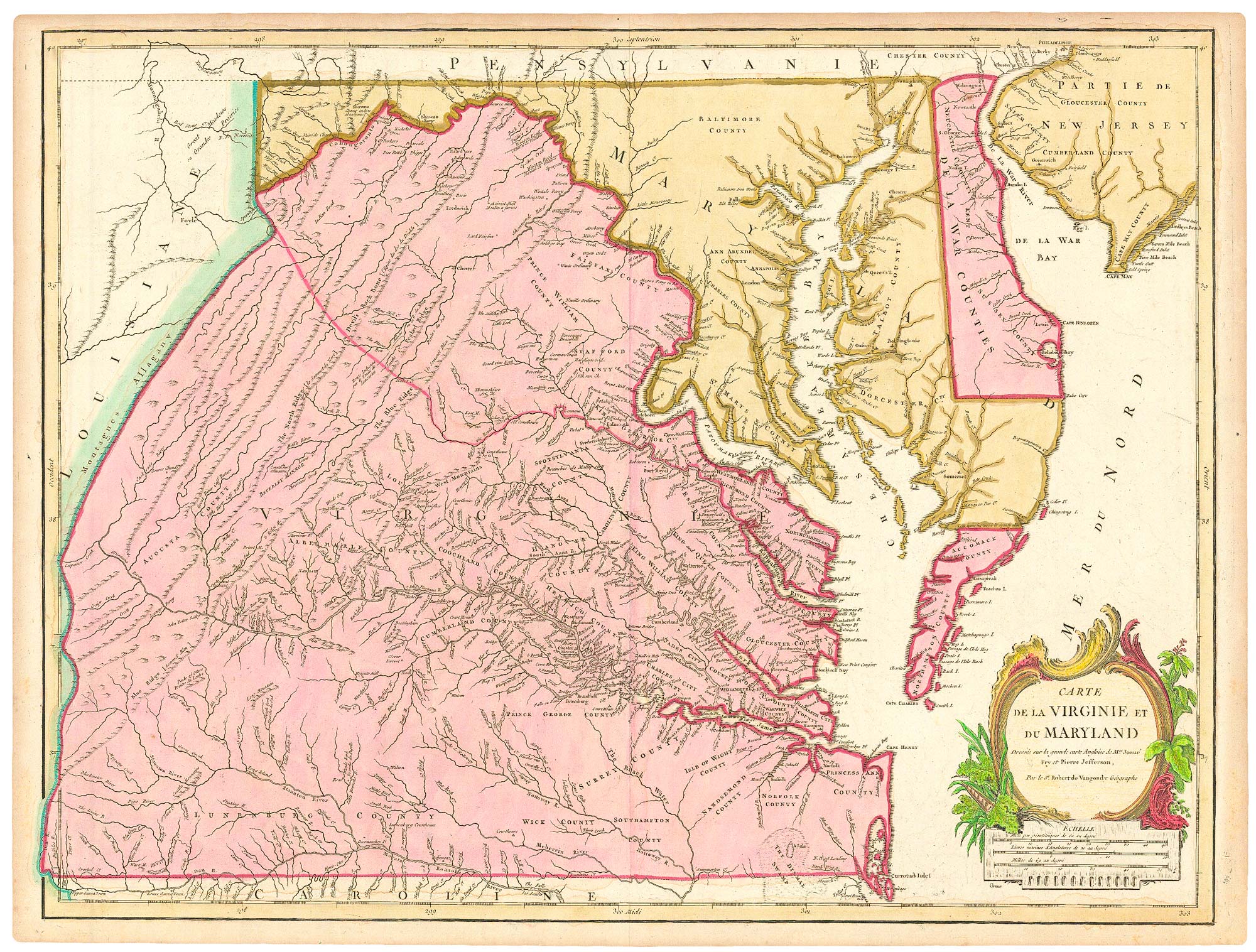
A French edition of an important map of Virginia
FRY, Joshua & JEFFERSON, Peter. Date: 1793 Stock #: 24838 £1,300.00
Add to Wishlist
Add to Wishlist
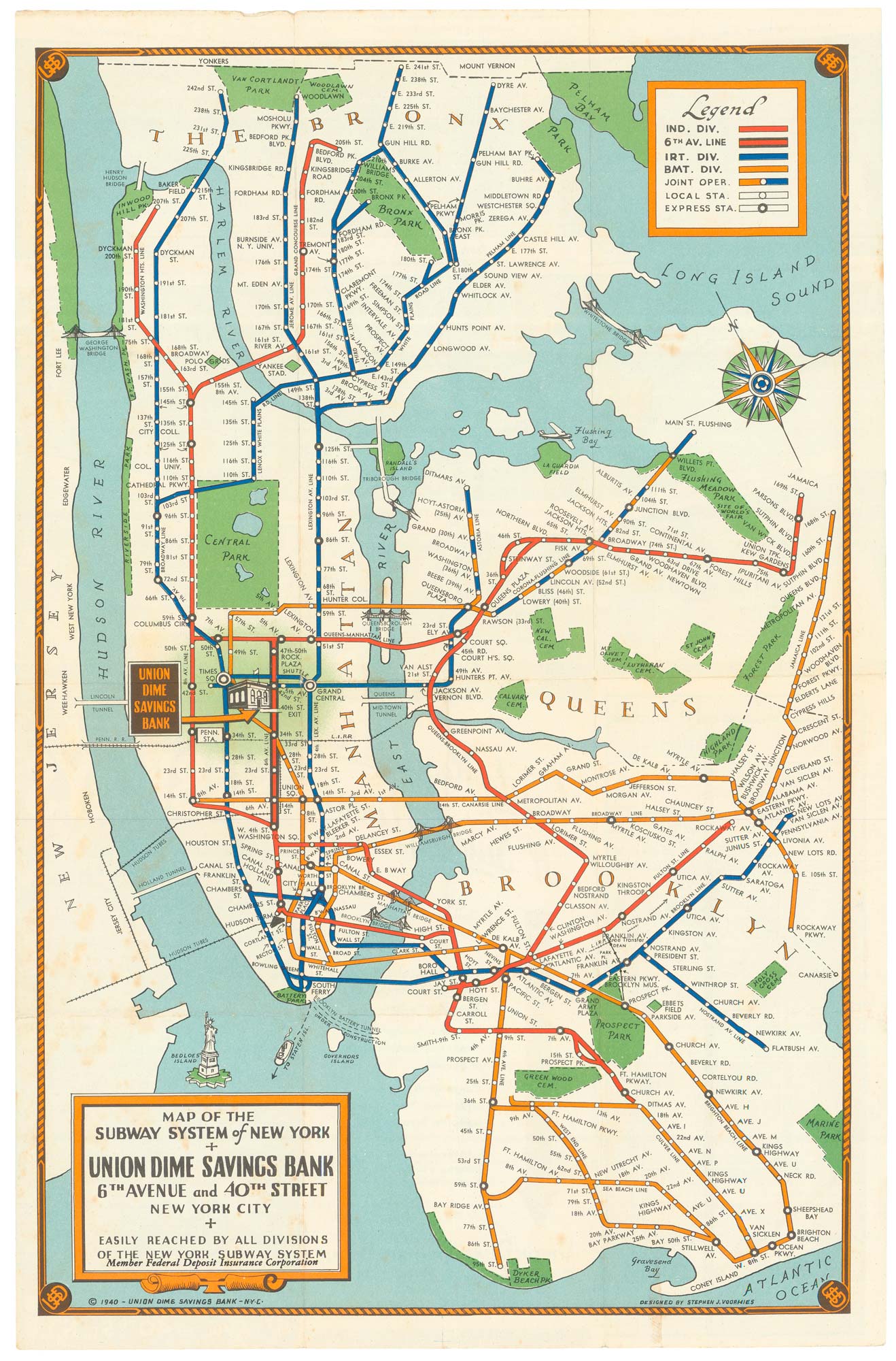
Map of the New York Subway System in 1940
VOORHIES, Stephen Jerome. Date: 194 Stock #: 24773 £480.00
Add to Wishlist
Add to Wishlist
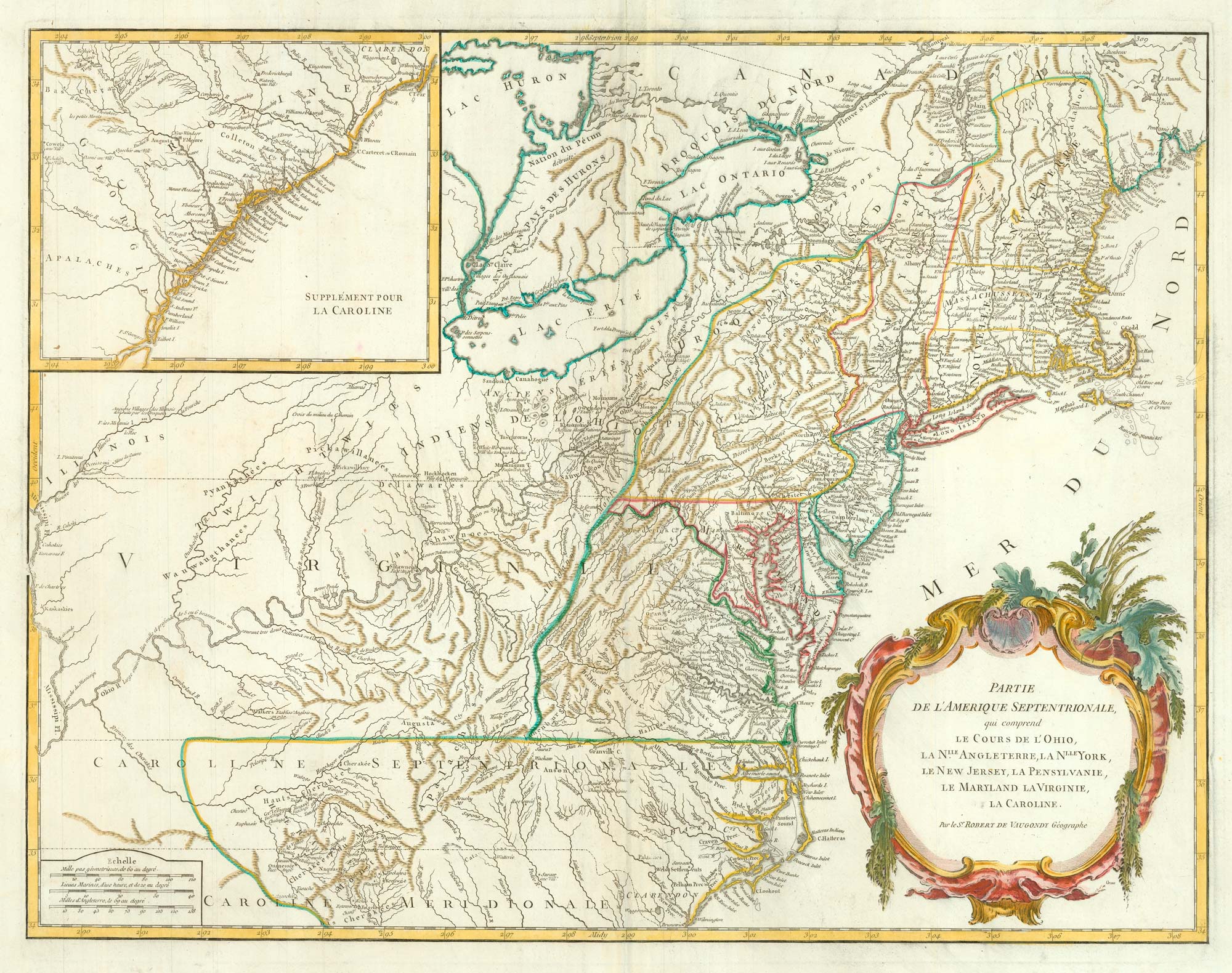
18th century map of the Eastern Seaboard
ROBERT DE VAUGONDY, Didier. Date: 1770 Stock #: 24555 £750.00
Add to Wishlist
Add to Wishlist
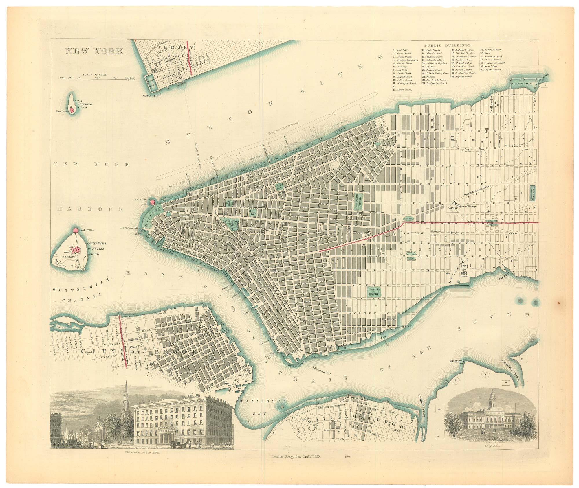
19th century town plan of New York
Society for the Diffusion of Useful Knowledge. Date: 1853 Stock #: 24871 £485.00
Add to Wishlist
Add to Wishlist
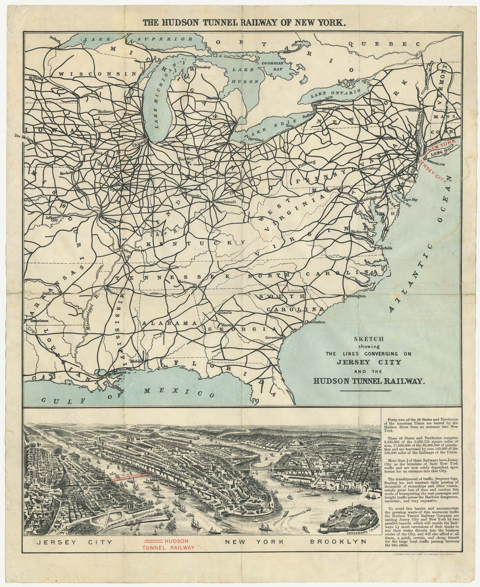
The building of the Uptown Hudson Tubes in New York
Anonymous. Date: 1890 Stock #: 24556 £450.00
Add to Wishlist
Add to Wishlist
A derivative of John Smith's map of Virginia
SMITH, John. Date: 1627 Stock #: 24496 £5,500.00
Add to Wishlist
Add to Wishlist

A view of Boston by the governor of the Province of Massachusetts Bay
POWNALL, Thomas. Date: 1757 Stock #: 24026 £250.00
Add to Wishlist
Add to Wishlist
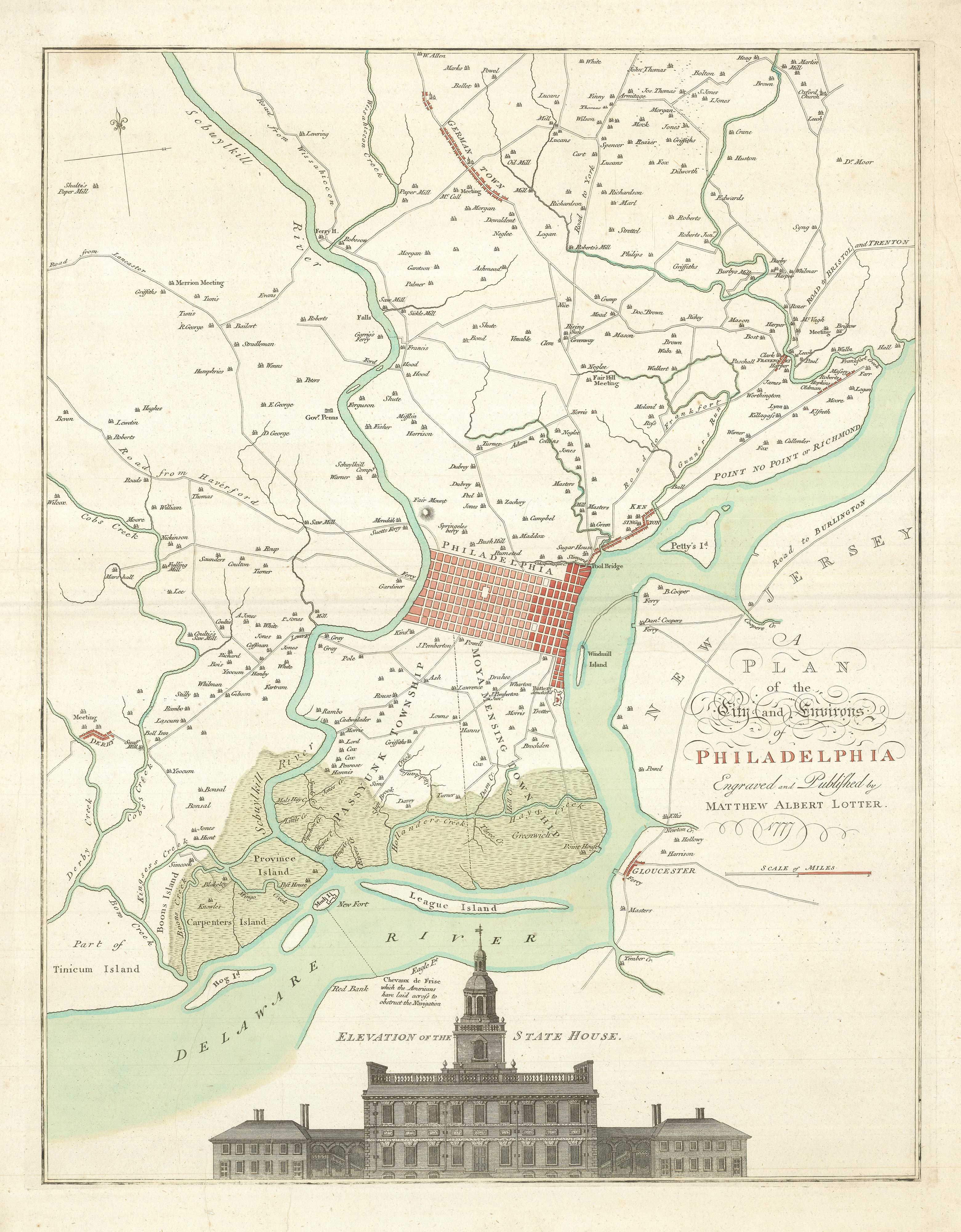
A map of Philadelphia as the capital of the Revolution
LOTTER, Matthaus Albrecht. Date: 1777 Stock #: 24398 £3,400.00
Add to Wishlist
Add to Wishlist
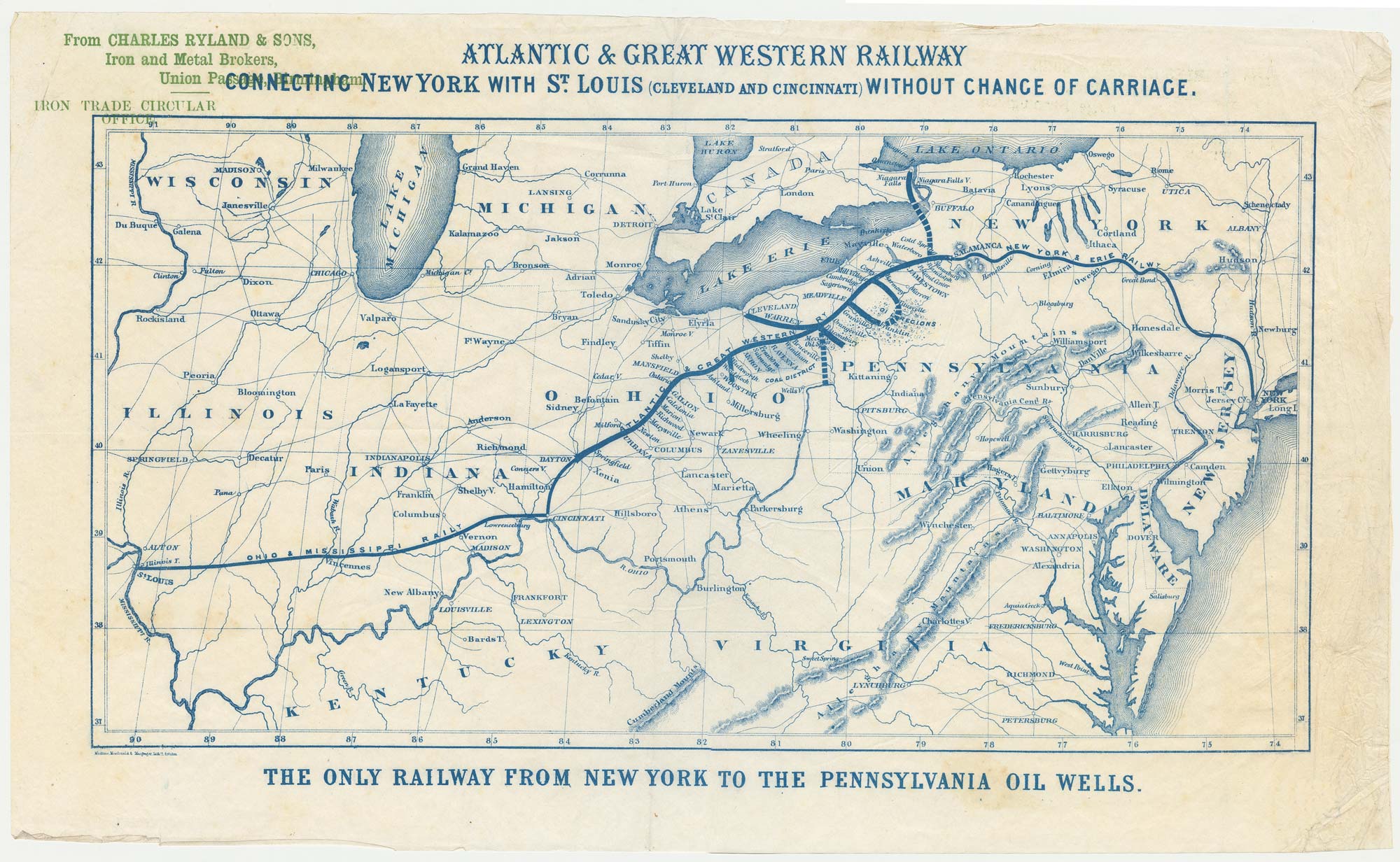
An advert for an American railway
Anonymous. Date: 1865 Stock #: 24455 £750.00
Add to Wishlist
Add to Wishlist
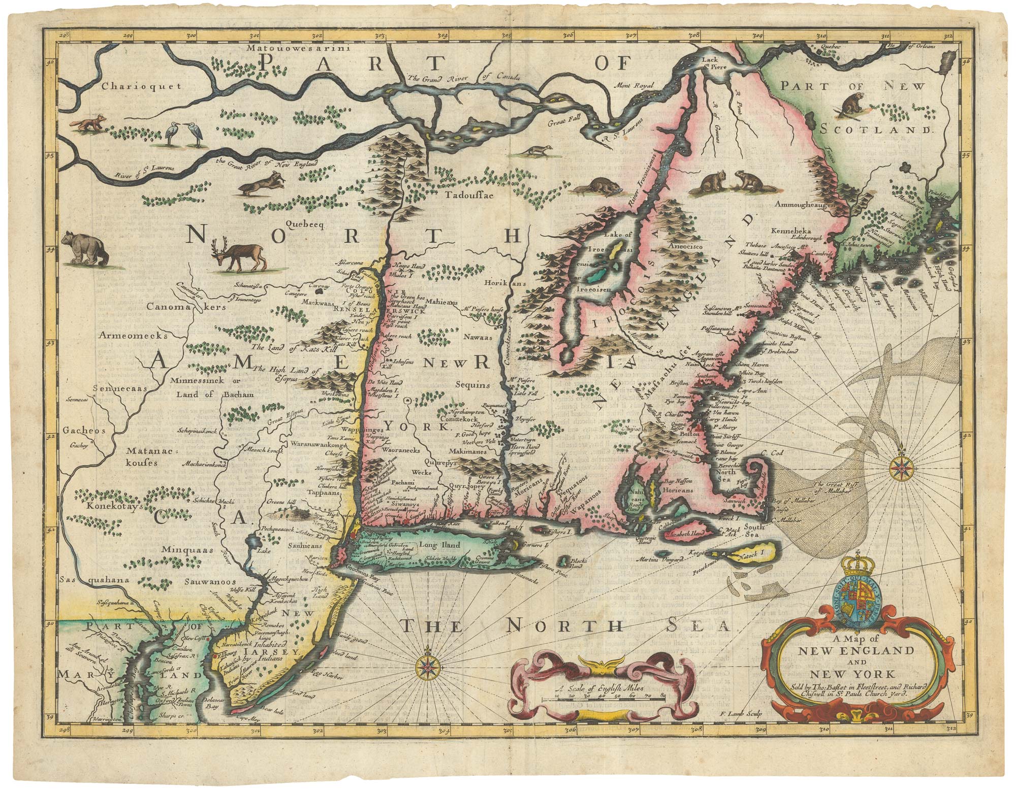
The Speed map of New England
SPEED, John. Date: 1676 Stock #: 23794 £6,500.00
Add to Wishlist
Add to Wishlist
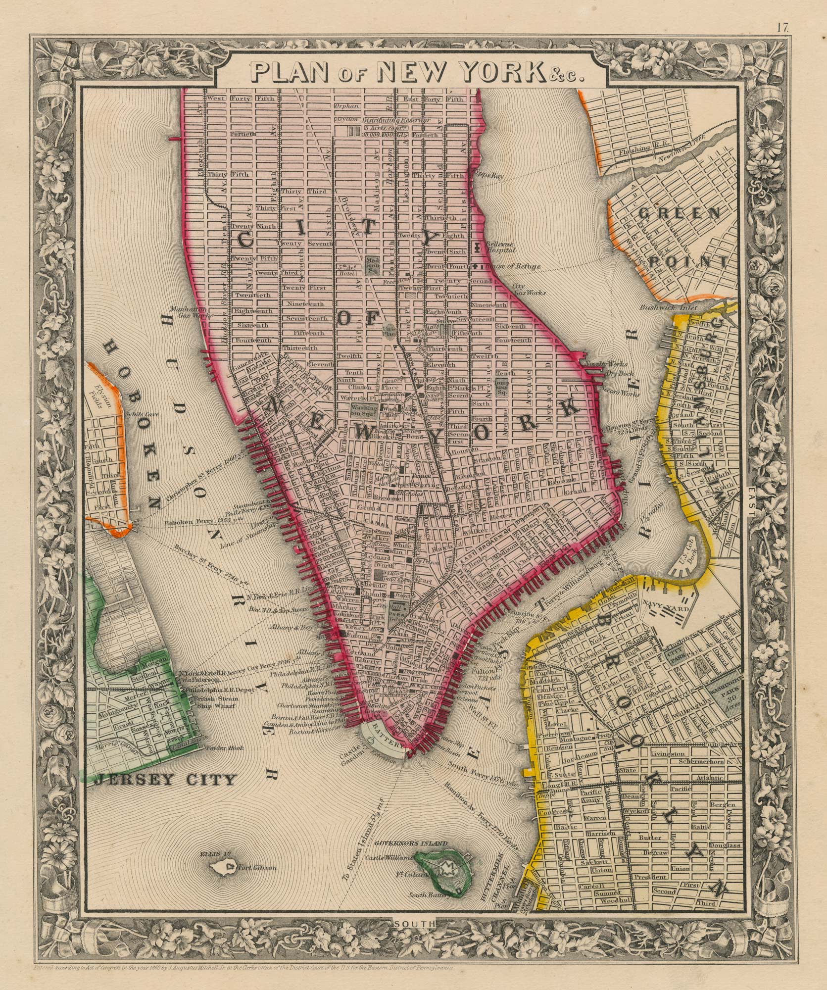
Detailed plan of New York City
MITCHELL, Samuel Augustus. Date: 1860 Stock #: 23834 £350.00
Add to Wishlist
Add to Wishlist
18th century map of Virginia & Maryland in original colours.
BELLIN, Jacques-Nicolas. Date: 1773 Stock #: 23224 £380.00
Add to Wishlist
Add to Wishlist
18th century map of New England and New York in original colours
BELLIN, Jacques-Nicolas. Date: 1773 Stock #: 23227 £380.00
Add to Wishlist
Add to Wishlist
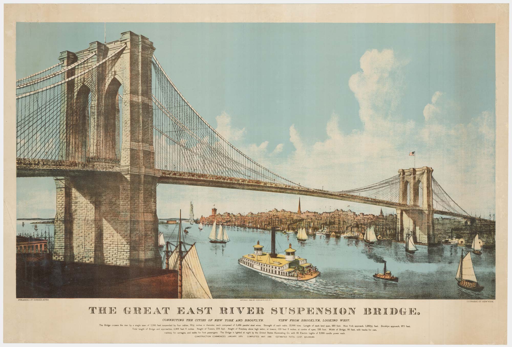
A large view of the newly-completed Brooklyn Bridge
CURRIER & IVES. Date: 1886 Stock #: 22791 £5,000.00
Add to Wishlist
Add to Wishlist
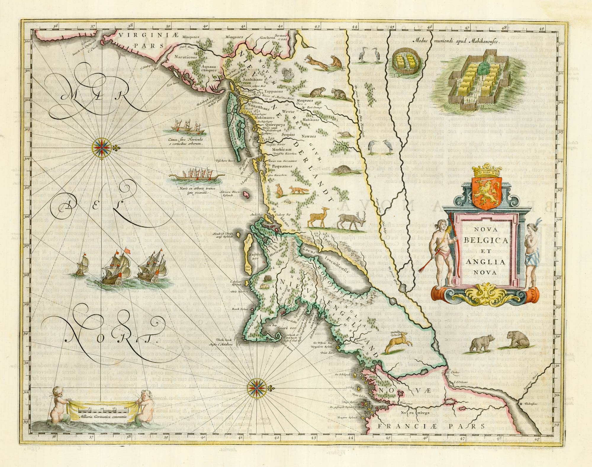
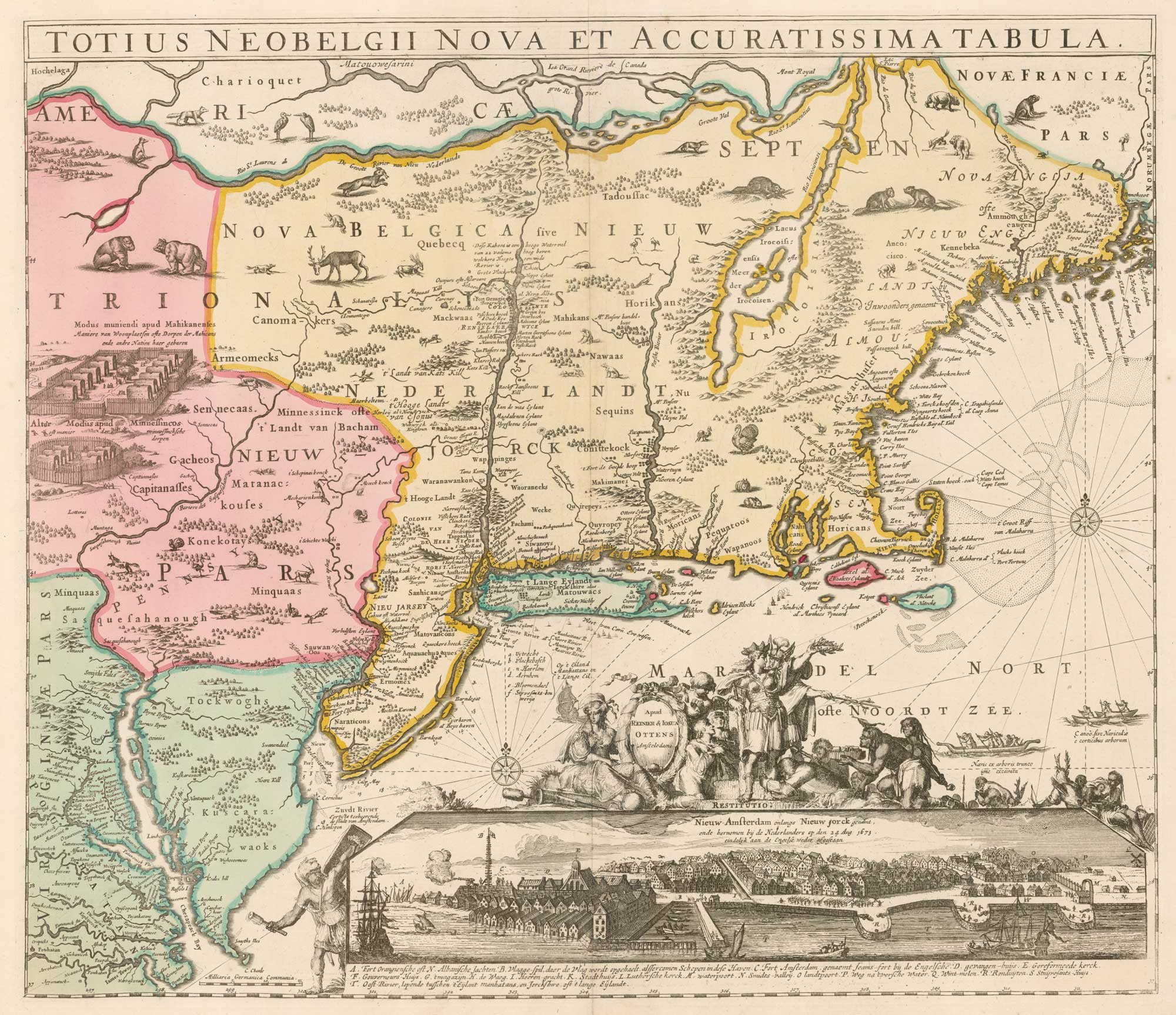
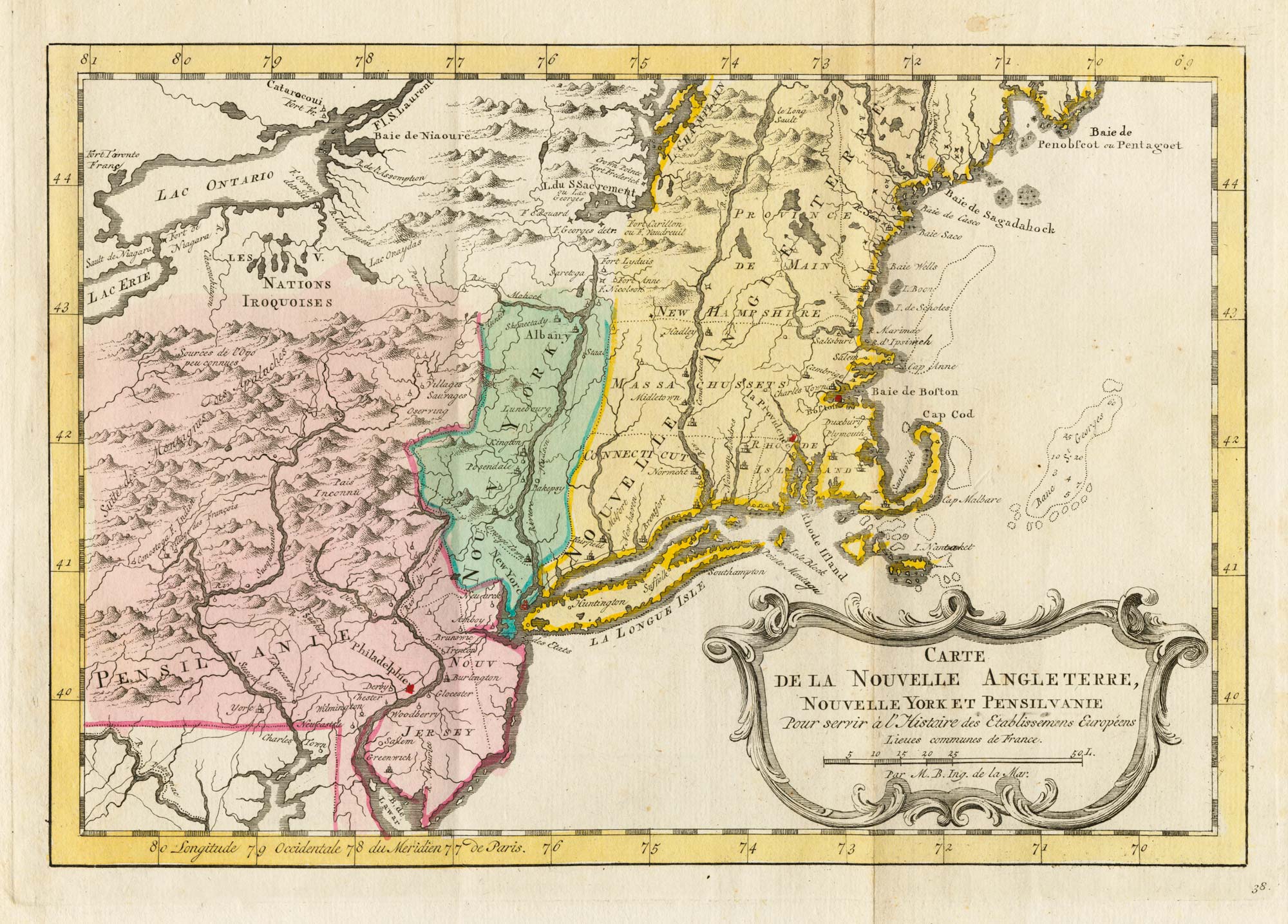
Classic C17th map of New England and New Netherlands
BLAEU, Willem Janszoon. Date: 1662 Stock #: 22719 £4,250.00
Add to Wishlist
Add to Wishlist
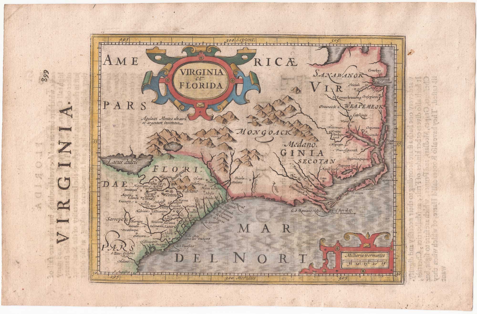
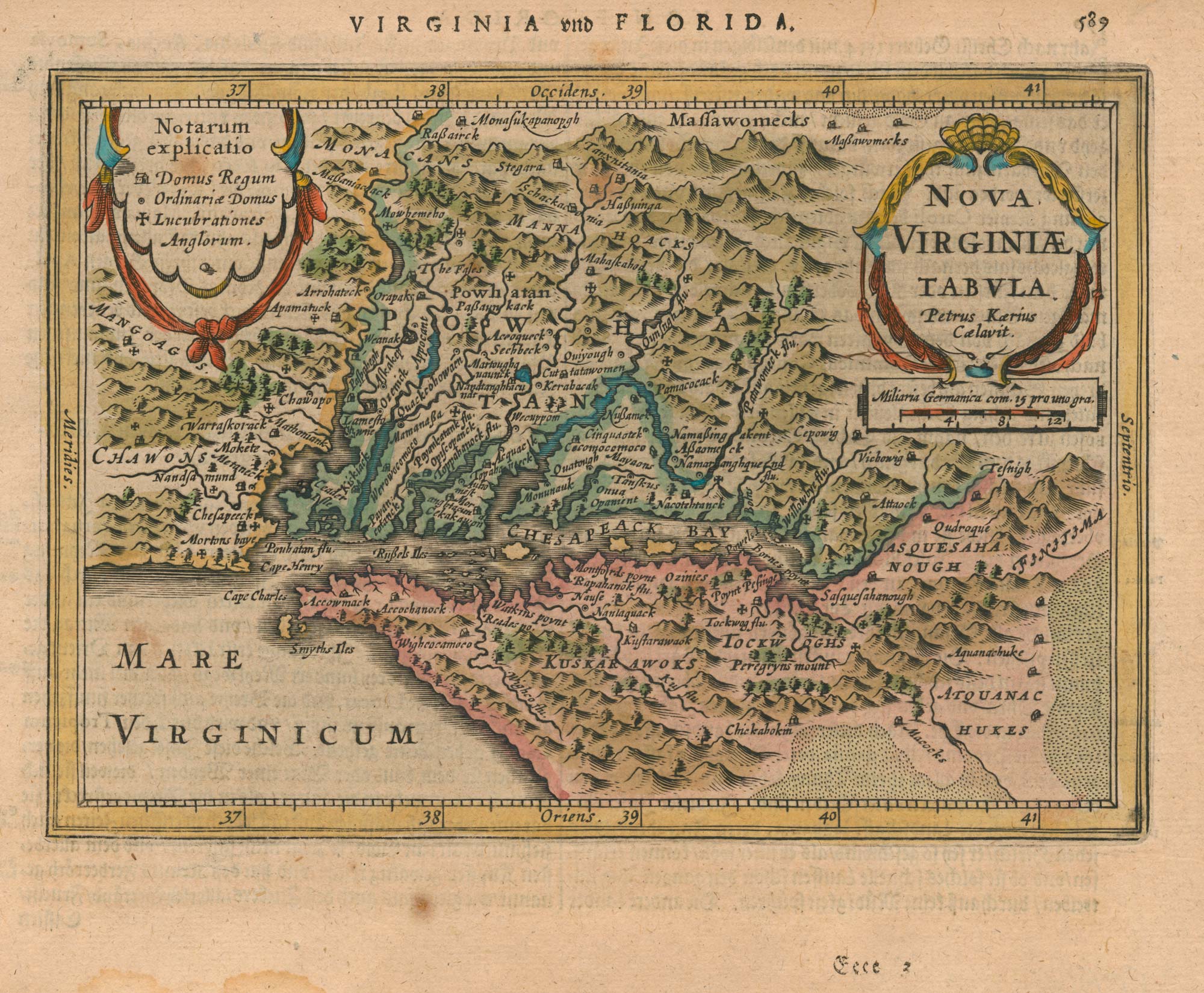
Virginia and Florida from the first English Edition of the 'Atlas Minor'
HONDIUS, Jodocus. Date: 1635 Stock #: 22380 £680.00
Add to Wishlist
Add to Wishlist
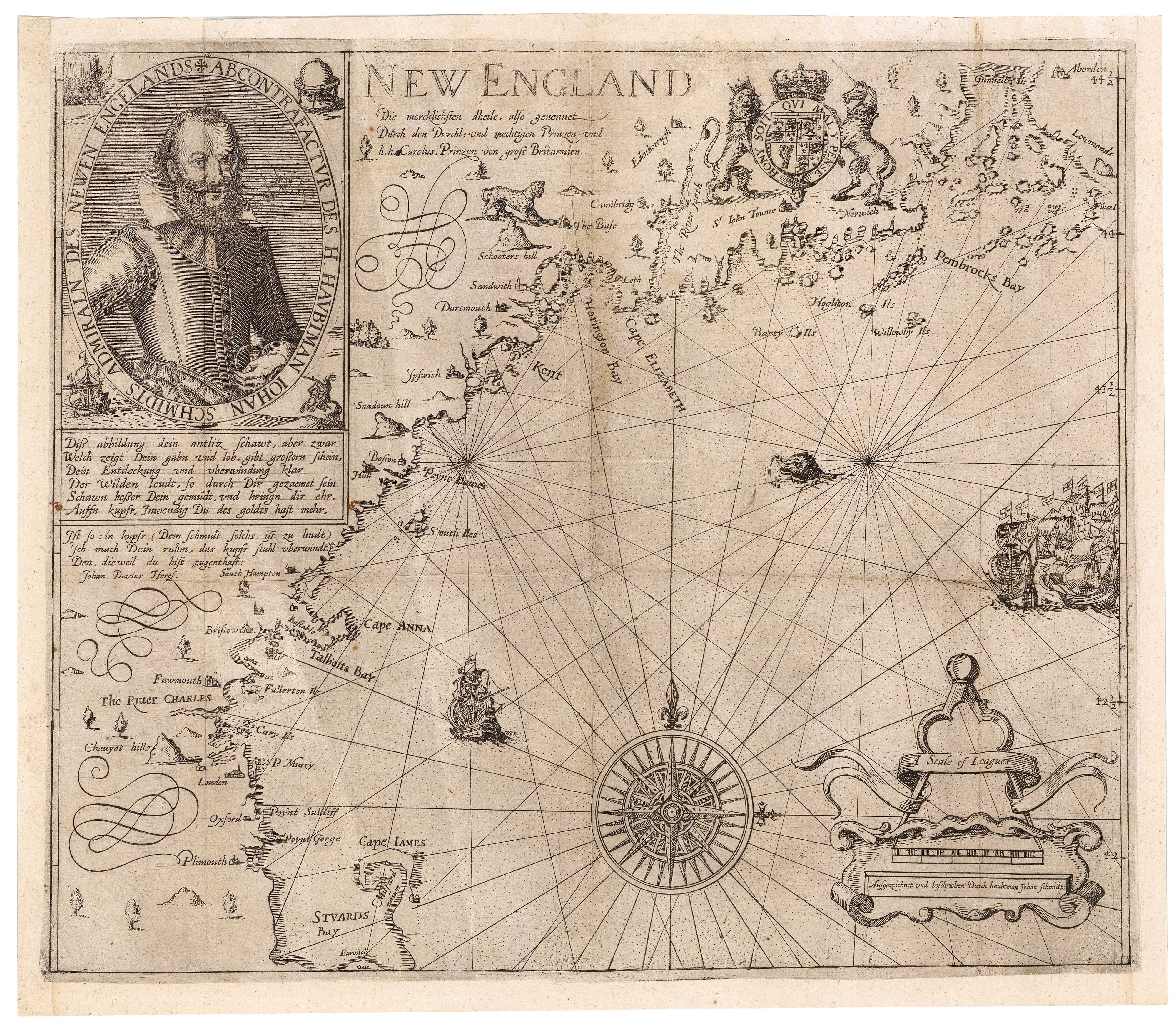
A rare German edition of John Smith's map of New England
SMITH, John. Date: 1617 Stock #: 21888 £8,000.00
Add to Wishlist
Add to Wishlist
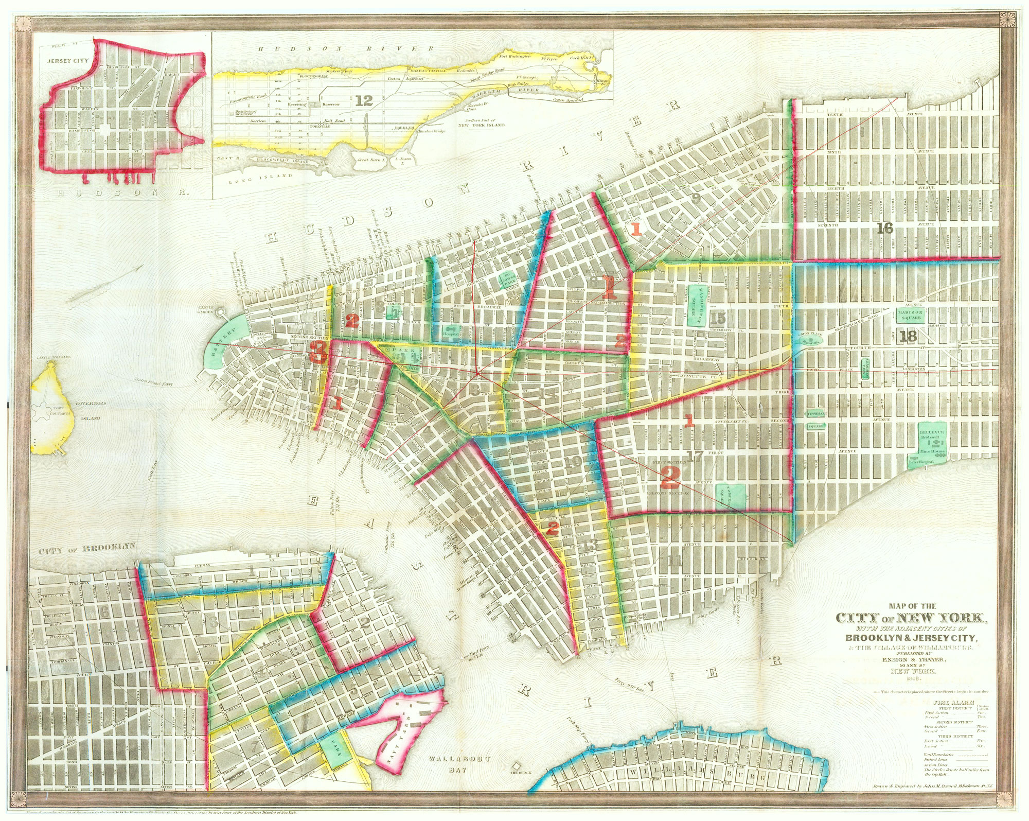
Mid-19th century town plan of New York City
ATWOOD, John M. Date: 1849 Stock #: 20672 £875.00
Add to Wishlist
Add to Wishlist
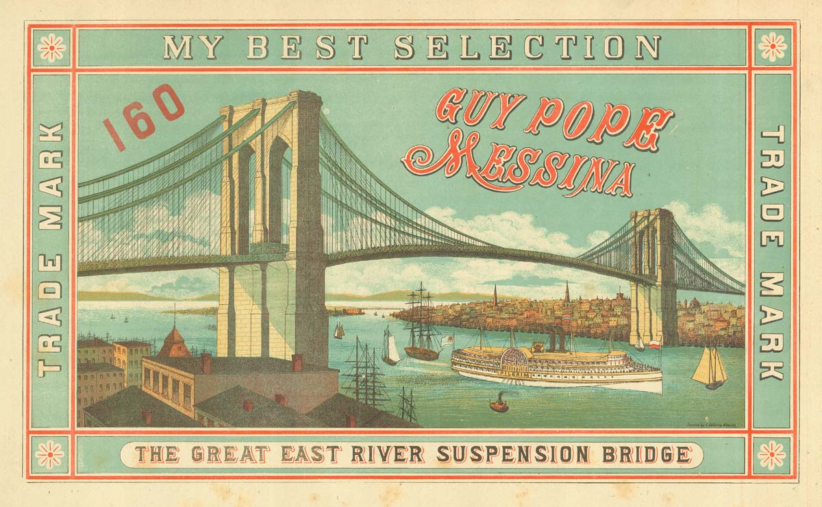
Scarce advertising orange crate label featuring Brooklyn Bridge
Anonymous. Date: 1885 Stock #: 20527 £750.00
Add to Wishlist
Add to Wishlist
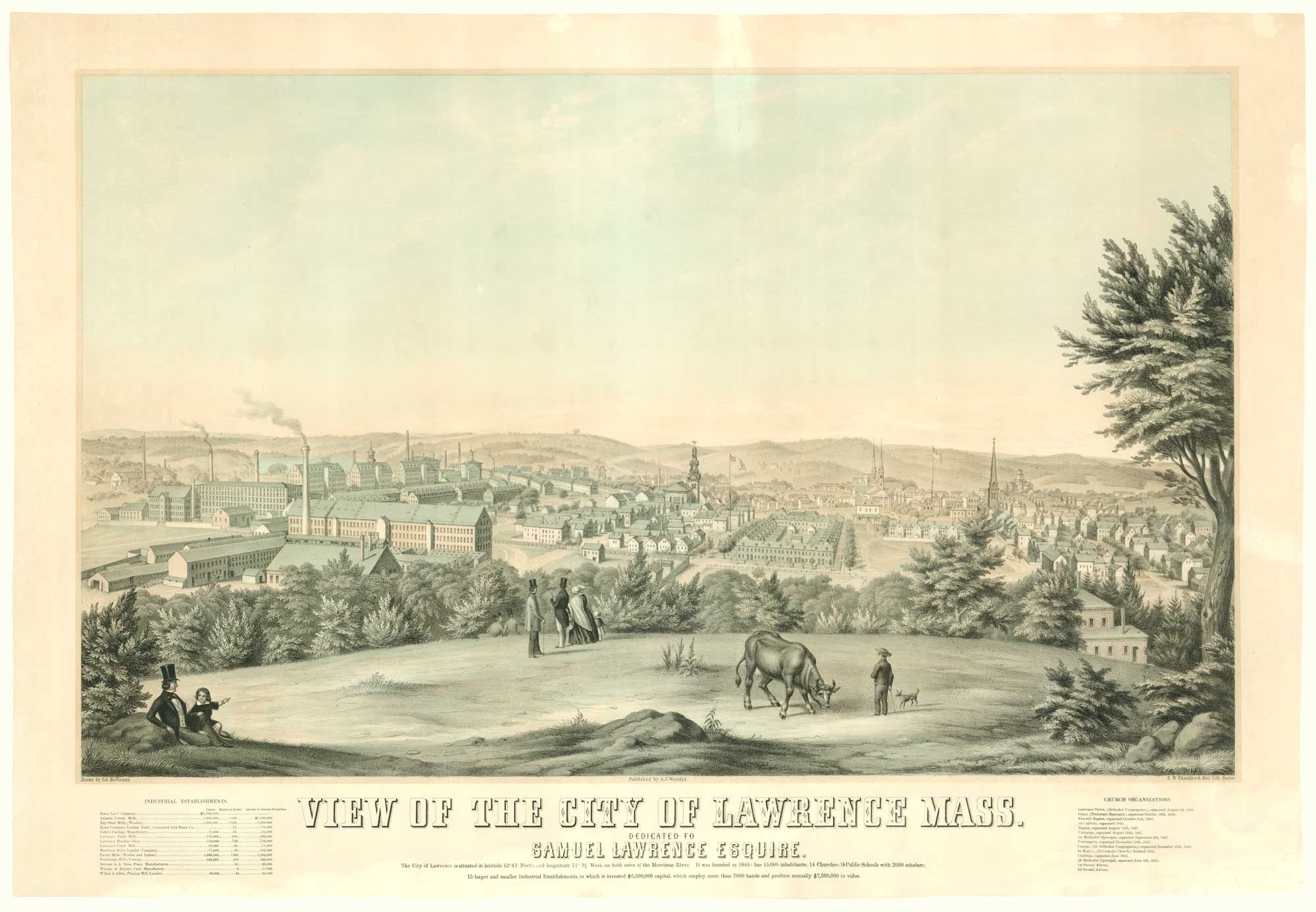
A rare prospect of Lawrence, Massachusetts
HOFFMAN, Edward. Date: 1854 Stock #: 19185 £1,600.00
Add to Wishlist
Add to Wishlist

A scarce bird's-eye view of Philadelphia
SERZ, John. Date: 1870 Stock #: 19184 £1,500.00
Add to Wishlist
Add to Wishlist