Antique Maps of Africa
Showing 31–60 of 120 products
Sort by:
[ti_wishlists_addtowishlist]
[ti_wishlists_addtowishlist]
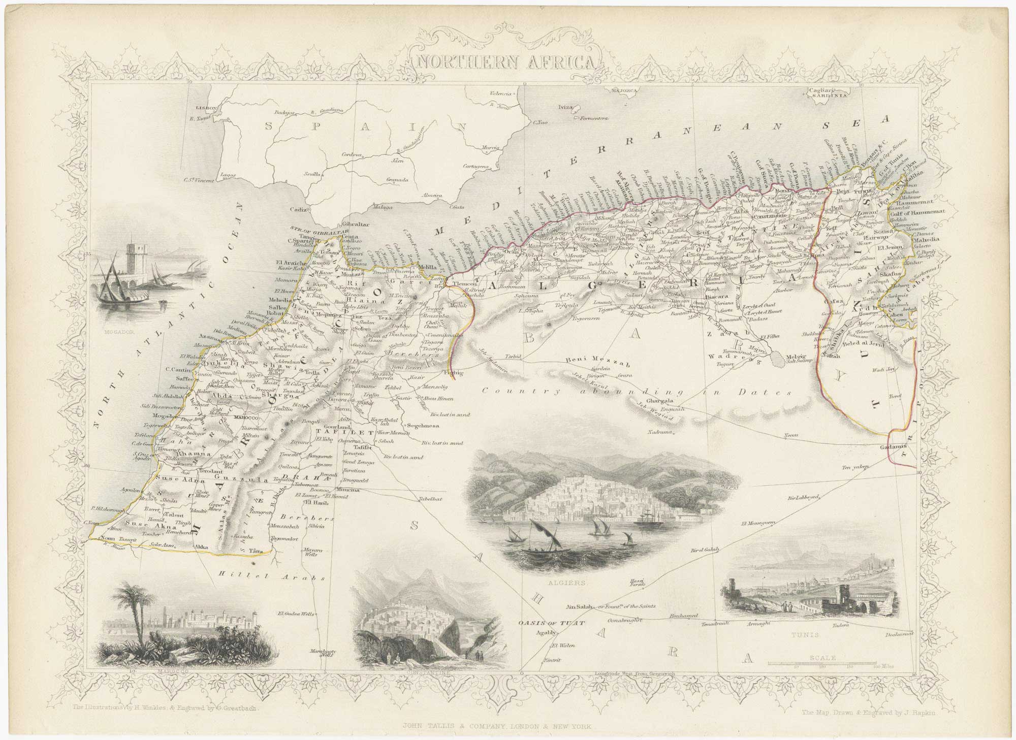
Mid 19th century map of north west Africa with vignettes
TALLIS, John. Date: 1851 Stock #: 23539 £100.00
[ti_wishlists_addtowishlist]
[ti_wishlists_addtowishlist]
[ti_wishlists_addtowishlist]
[ti_wishlists_addtowishlist]
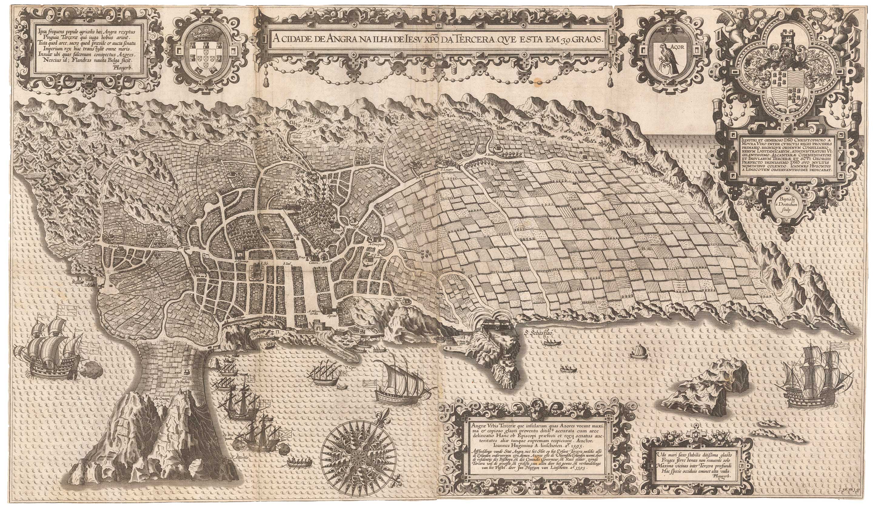
An important 16th century plan of Angra
LINSCHOTEN, Jan Huygen van. Date: 1595 Stock #: 23737 £2,800.00
[ti_wishlists_addtowishlist]
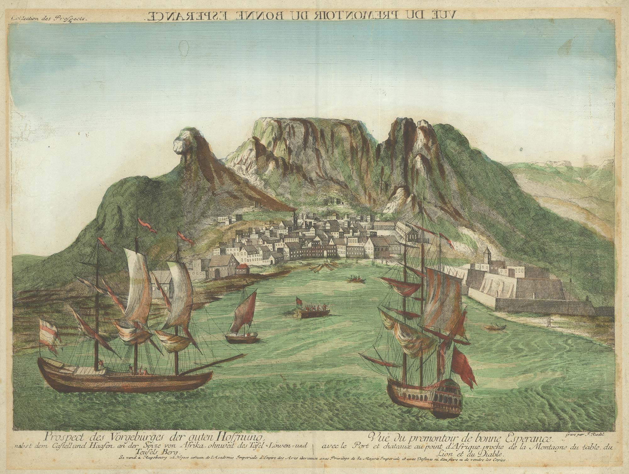
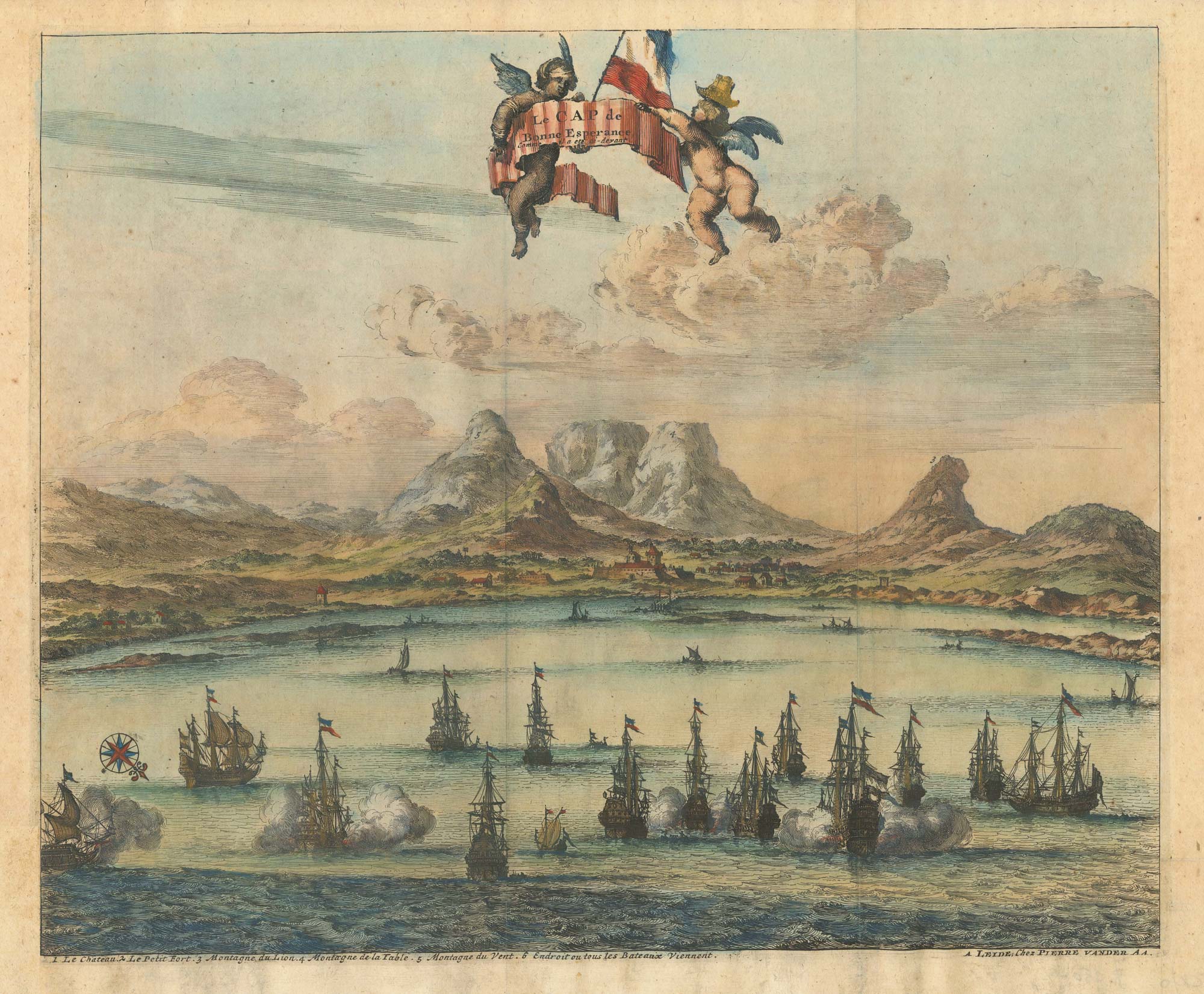
18th century vue d'optique of the Cape of Good Hope
RIEDEL, Gottlieb Friedrich. Date: 1780 Stock #: 23736 £600.00
[ti_wishlists_addtowishlist]
[ti_wishlists_addtowishlist]
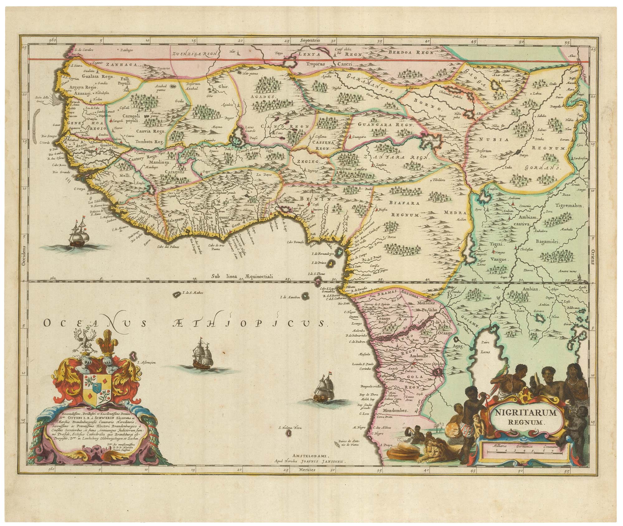
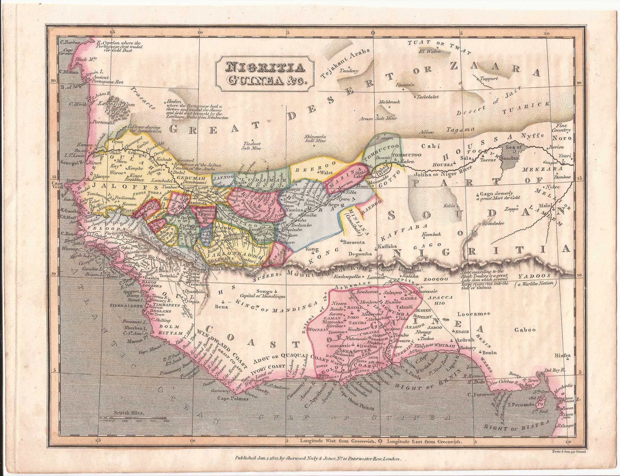
A 17th century old map of the Gulf of Guinea in West Africa
JANSSON, Jan. Date: 1680 Stock #: 23630 £500.00
[ti_wishlists_addtowishlist]
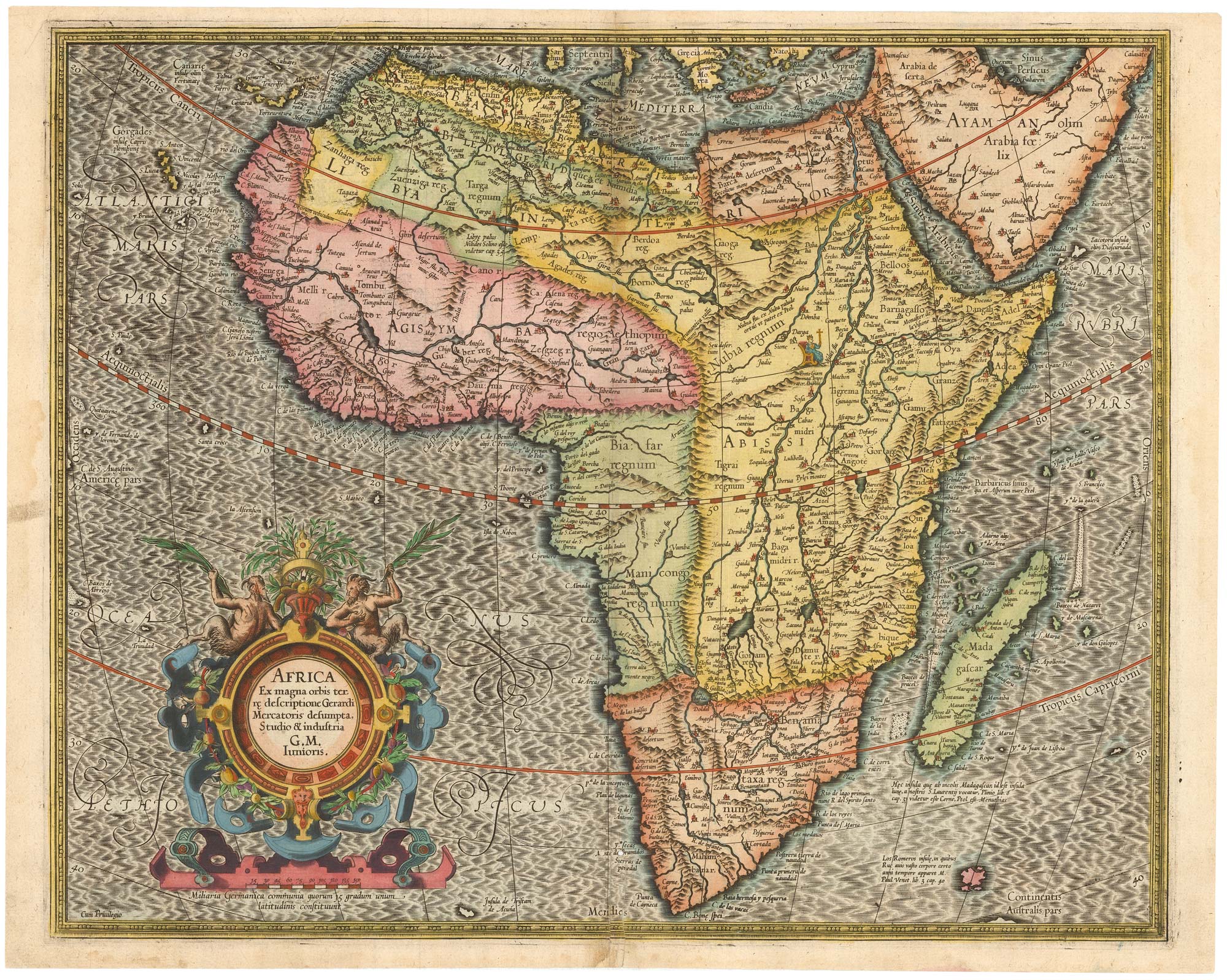
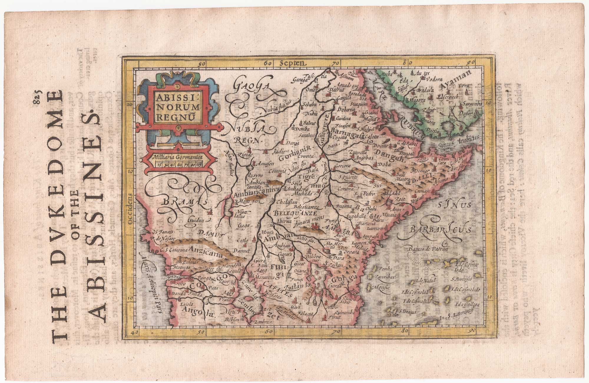
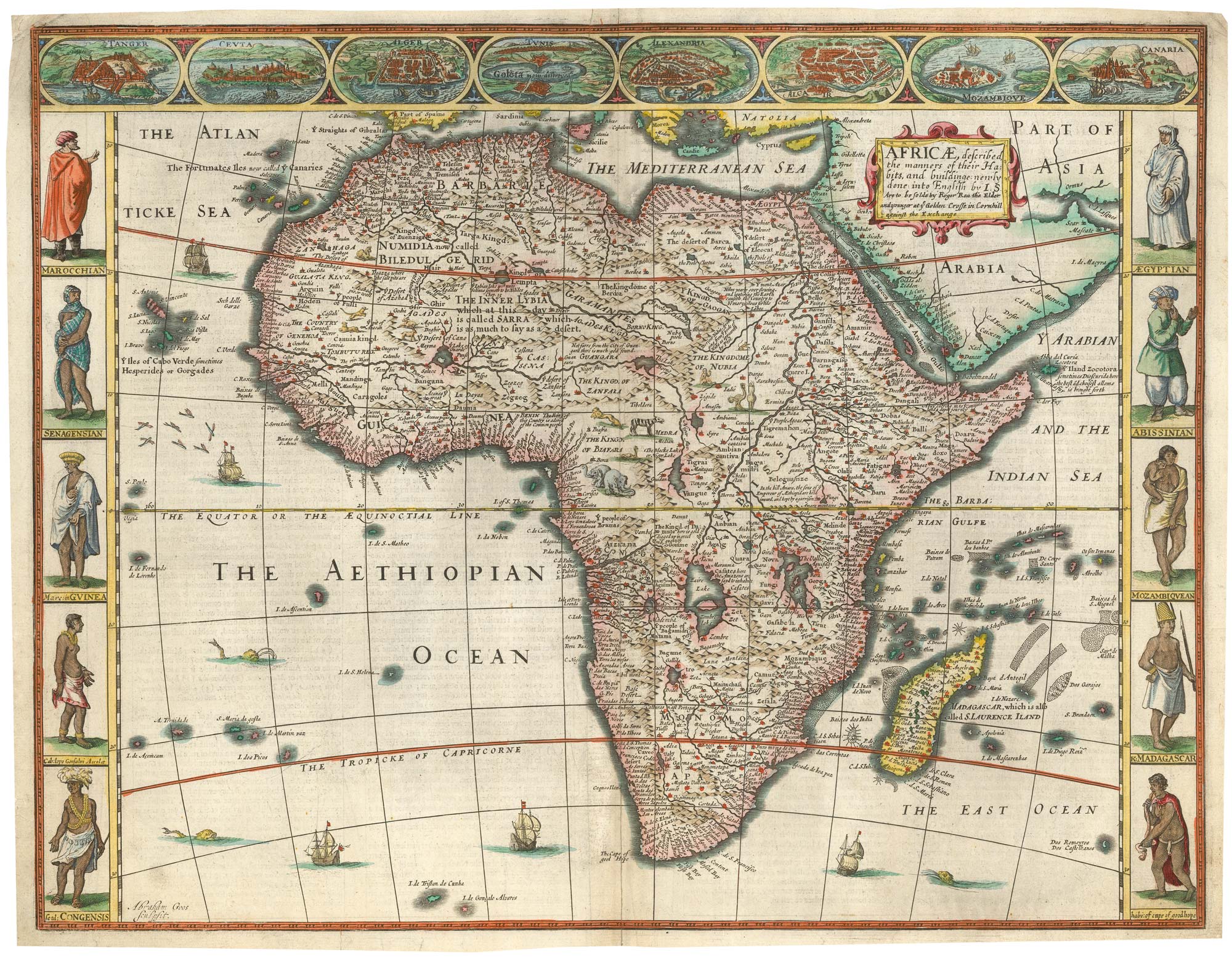
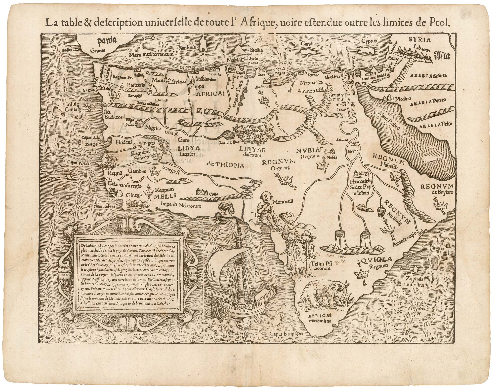
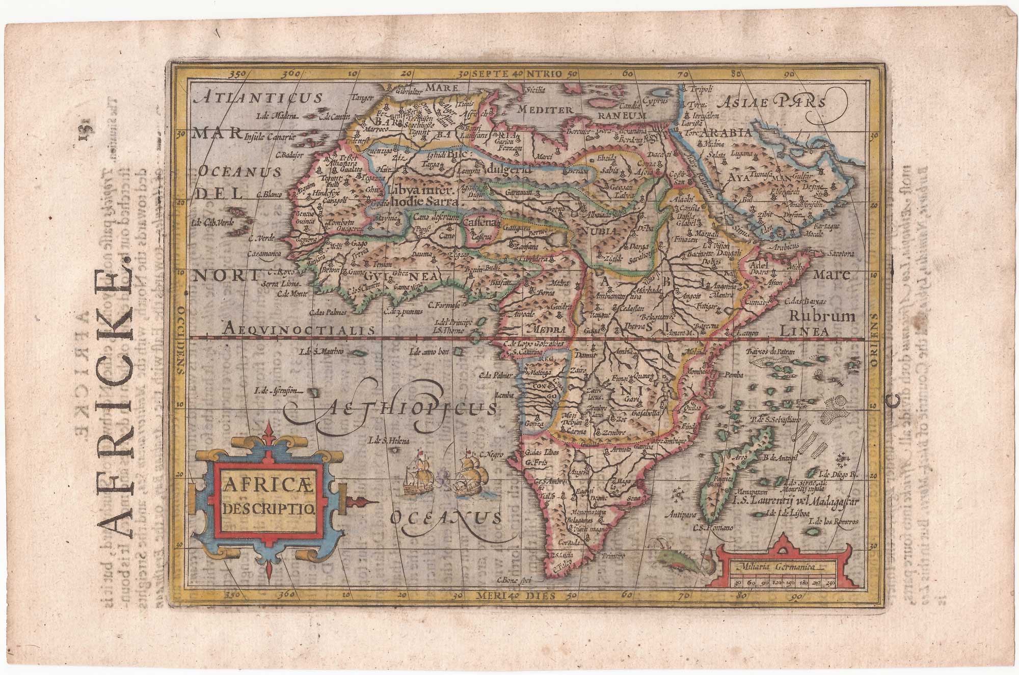
The first issue of this 16th century map of Africa
MERCATOR, Gerard II. Date: 1595 Stock #: 23299 £1,500.00
[ti_wishlists_addtowishlist]
[ti_wishlists_addtowishlist]
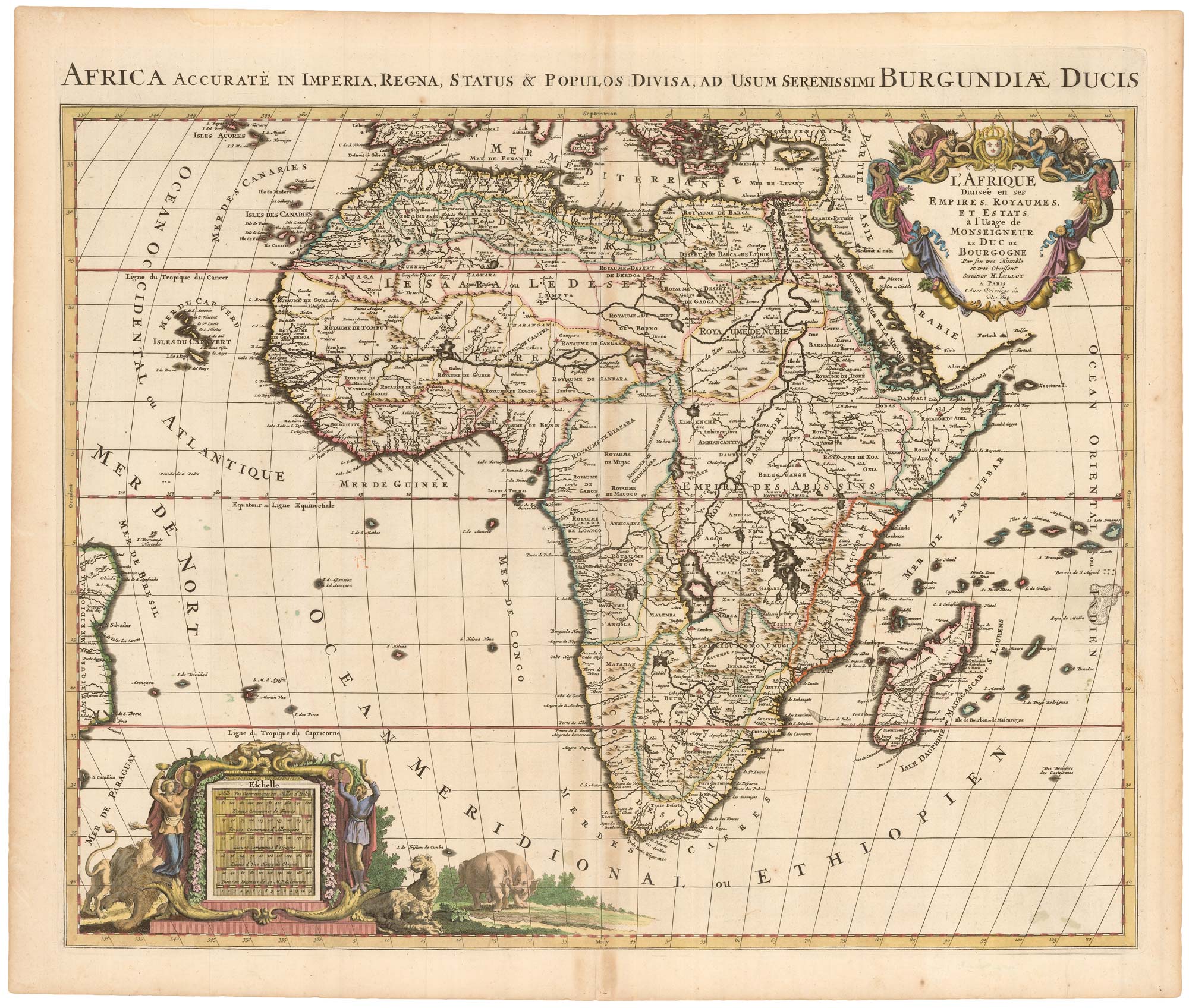
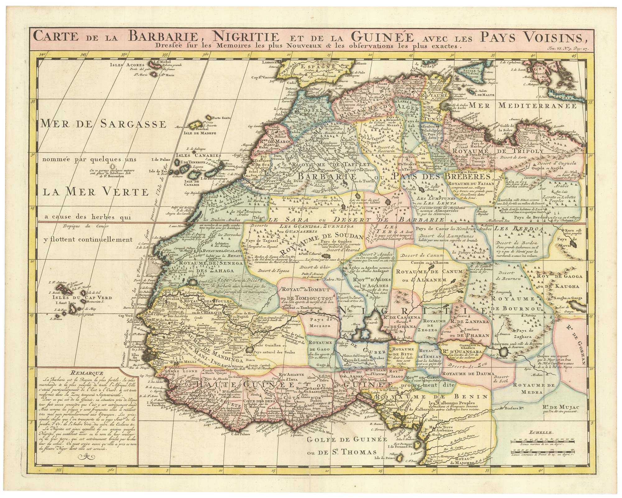
A Dutch pirated edition of a 17th century French map
MORTIER, Pierre. Date: 1694 Stock #: 23096 £780.00
[ti_wishlists_addtowishlist]
[ti_wishlists_addtowishlist]
[ti_wishlists_addtowishlist]
[ti_wishlists_addtowishlist]
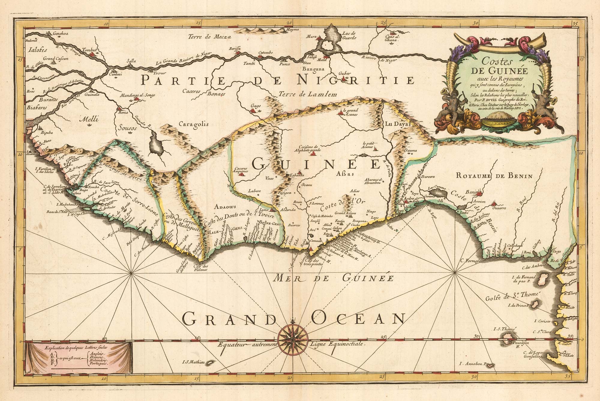
Du Val's folio map of the slave forts of the Gulf of Guinea
DU VAL, Pierre. Date: 1671 Stock #: 23256 £480.00
[ti_wishlists_addtowishlist]
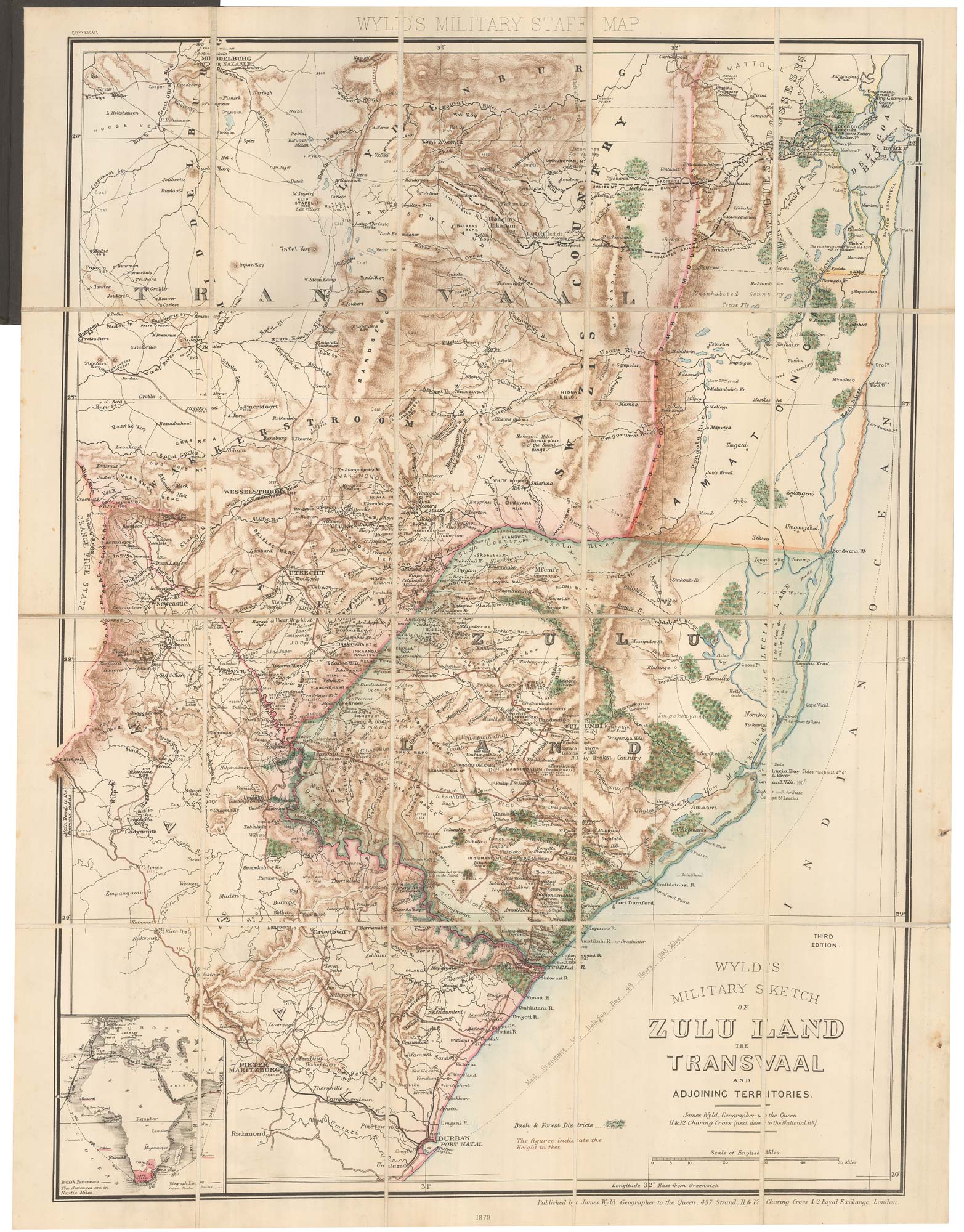
A contemporary military folding map for the Anglo-Zulu War of 1879.
WYLD, James. Date: 1879 Stock #: 22989 £650.00
[ti_wishlists_addtowishlist]
[ti_wishlists_addtowishlist]
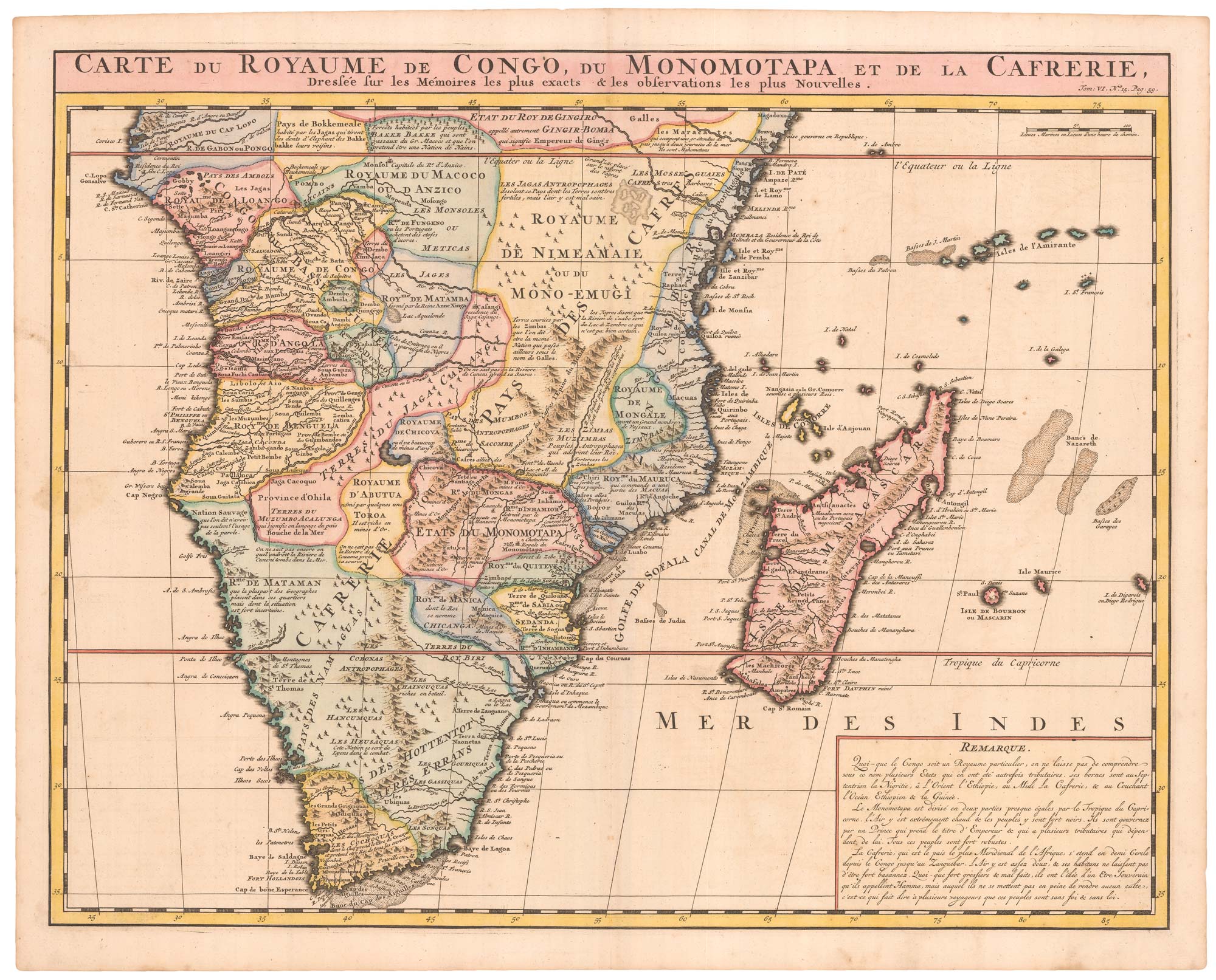
An 18th century map of Africa below the Equator
CHATELAIN, Henri Abraham. Date: 1720 Stock #: 22880 £380.00
[ti_wishlists_addtowishlist]

[ti_wishlists_addtowishlist]

Read's map of Napoleon's exile on St Helena, First State
READ, R.P. Date: 1815 Stock #: 22660 £1,200.00
[ti_wishlists_addtowishlist]

Read's map of Napoleon's exile on St Helena, Second State
READ, R.P. Date: 1817 Stock #: 22662 £1,200.00
[ti_wishlists_addtowishlist]

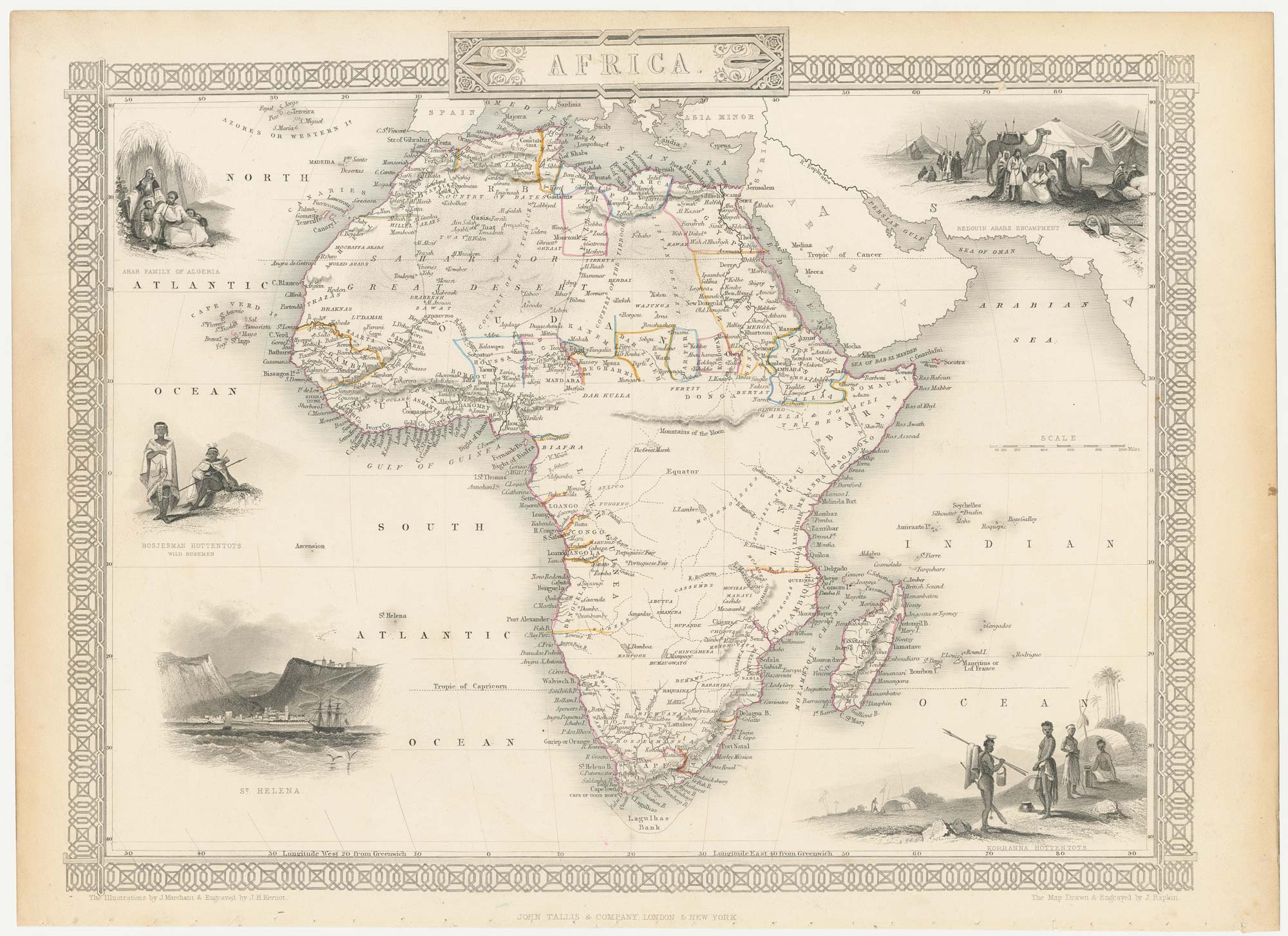
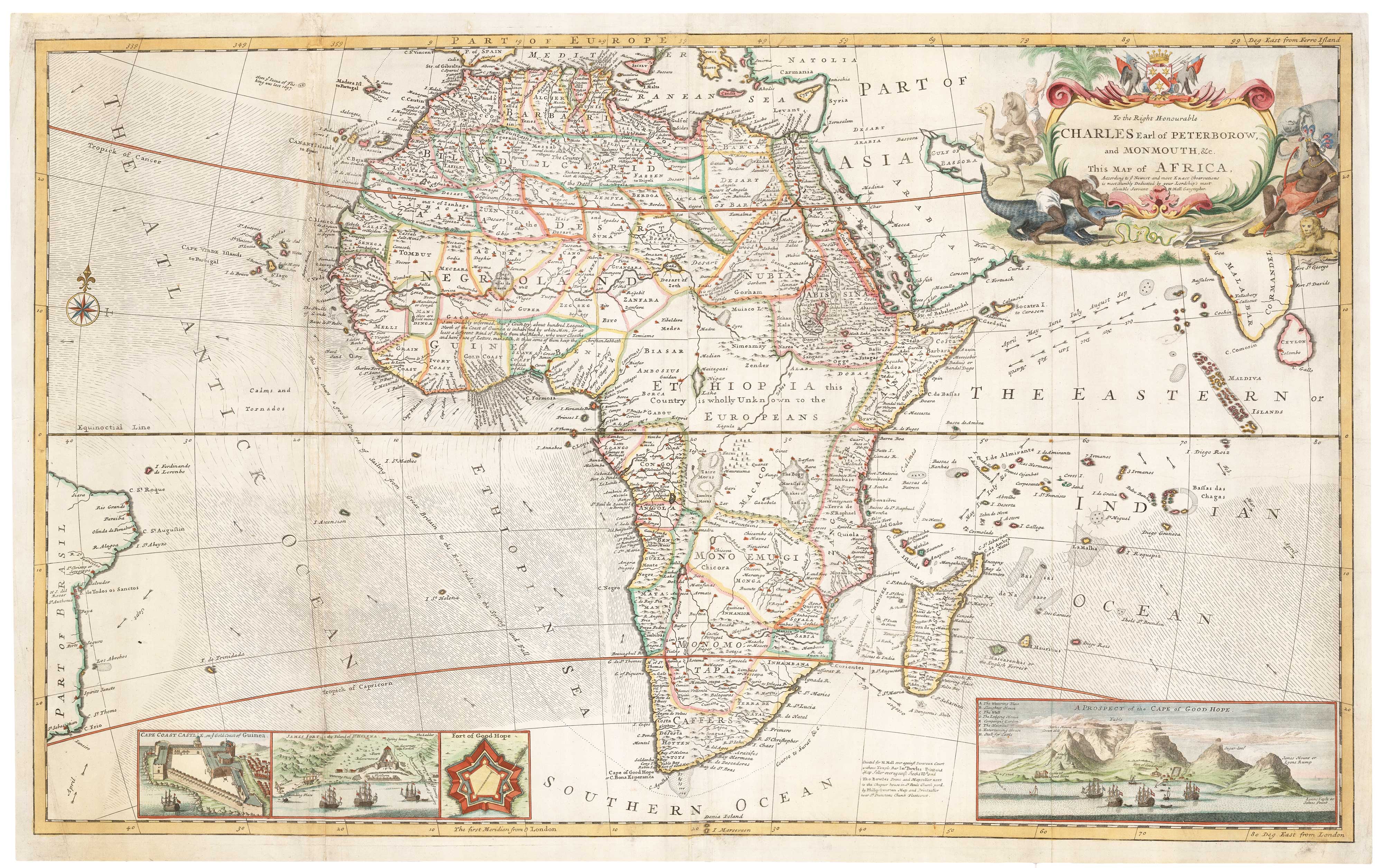
An 18th century wall map of Africa
ANVILLE, Jean Baptiste B. D'. Date: 1772 Stock #: 22567 £1,800.00
[ti_wishlists_addtowishlist]
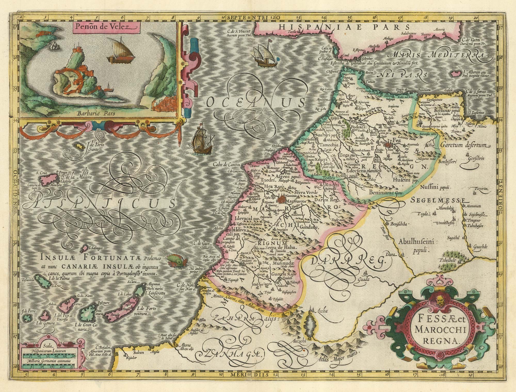
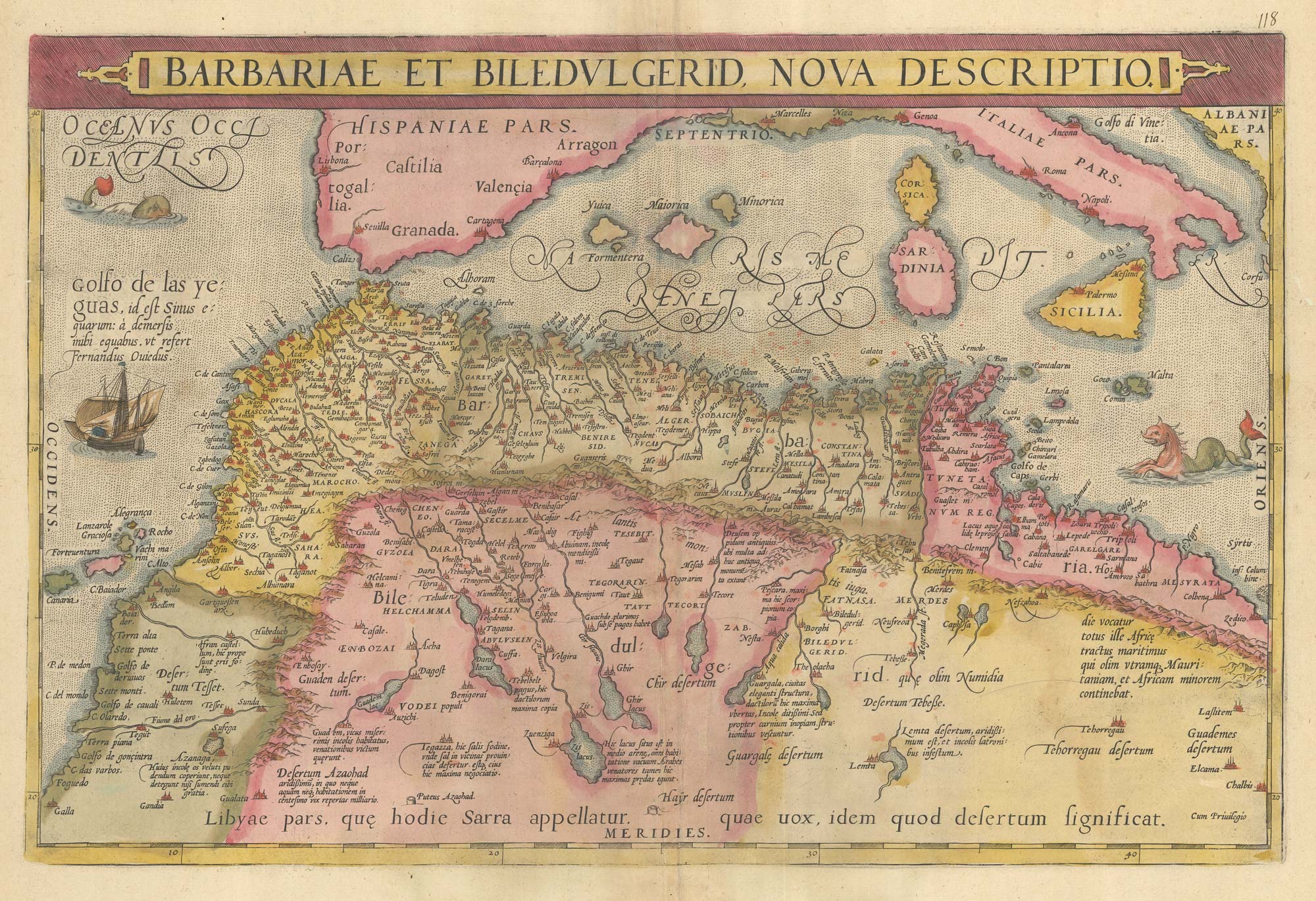
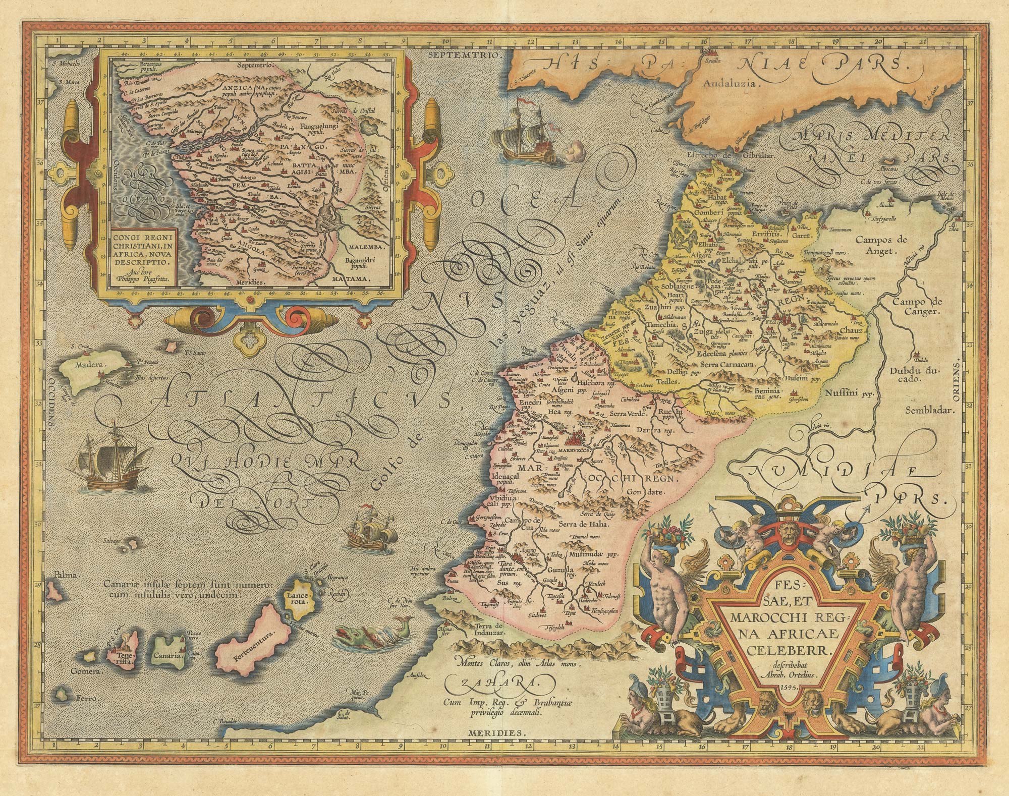
A 17th century map of Morocco in fine original colour
HONDIUS, Jodocus. Date: 1630 Stock #: 22653 £650.00
[ti_wishlists_addtowishlist]
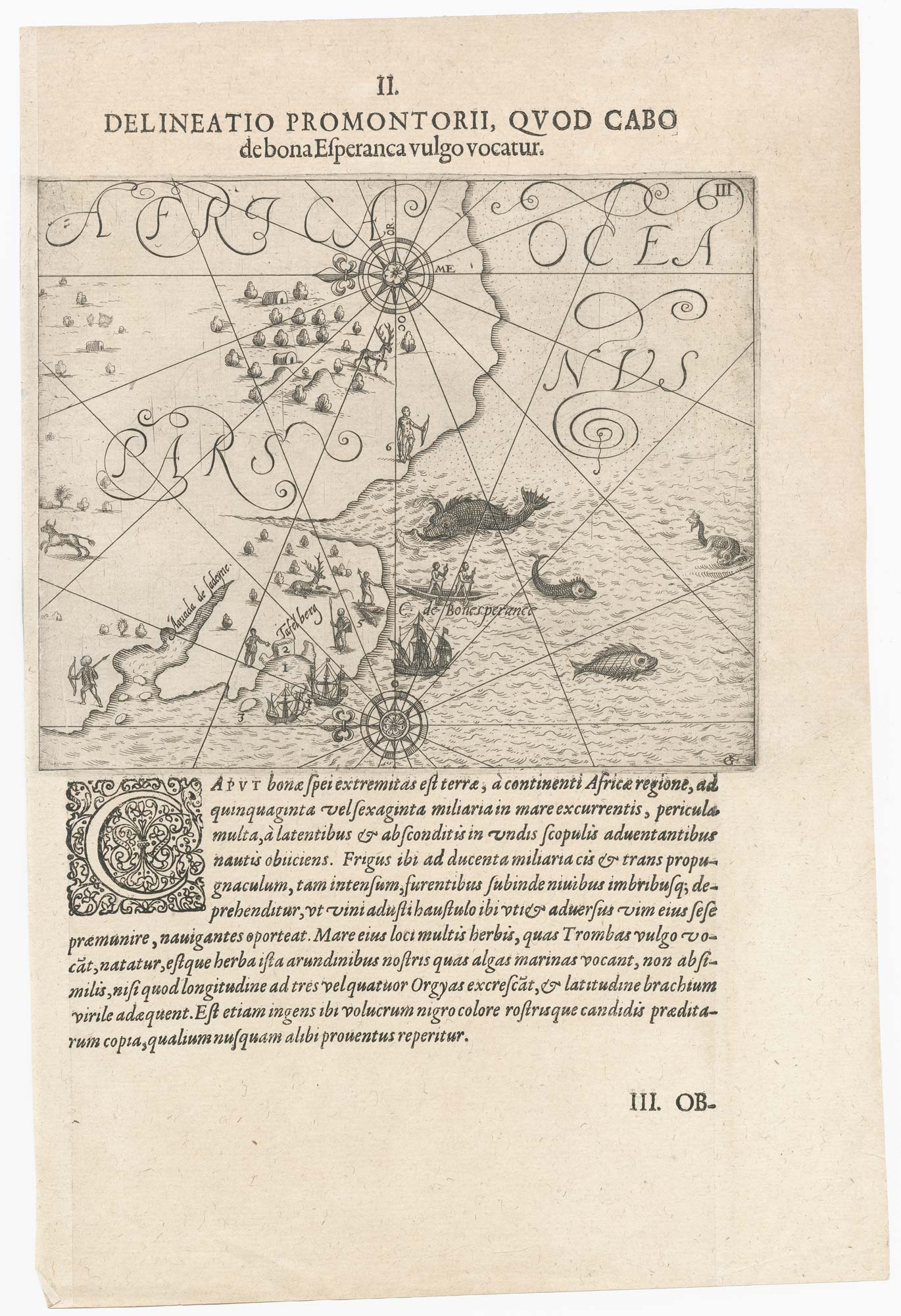
One of the earliest maps to depict the Cape of Good Hope
DE BRY, Theodore. Date: 1612 Stock #: 22976 £400.00
[ti_wishlists_addtowishlist]
[ti_wishlists_addtowishlist]
[ti_wishlists_addtowishlist]
[ti_wishlists_addtowishlist]
Africa from the first English Edition of the 'Atlas Minor'
HONDIUS, Jodocus. Date: 1635 Stock #: 22386 £300.00
[ti_wishlists_addtowishlist]