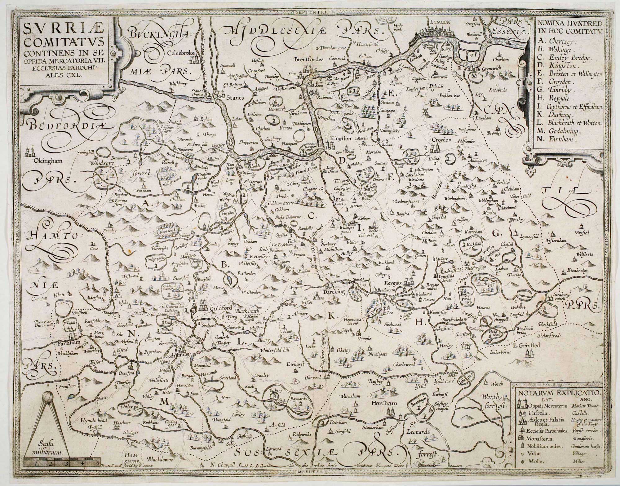


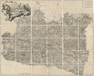
The so-called ‘Anonymous’ map of Surrey
Surriae Comitatus Continens in Se Oppida Mercatoria VII. Ecclesias Parochiales CXL.
London: John Overton, c.1665. 385 x 485mm.
£2,000.00
Description
A close copy of John Norden's map of Surrey, but on a larger scale. It is one of a collection of twelve county maps drawn by William Smith and believed to have been engraved by Jodocus Hondius in Amsterdam in 1602-3. On the map Smith has marked the major roads, something which did not become a feature on other county maps until after Ogilby's 'Britannia' in 1675.
The other counties were never engraved, possibly because Hondius dropped the project in favour of Speed's atlas. About 1650 the plates came into the possession of Peter Stent, who added 'Printed andd Sould by P.Stent' bottom left; this example comes from the third and final state, with 'Sould by Jo: Overton at the white horse without Newgate neere y fountaine tauern' centre bottom.
Condition:
Narrow margins as issued, otherwise a very good example, dark impression.Related products
-
The first trigonometrical map of Surrey
LINDLEY, Joseph & CROSLEY, William. Date: 1793Stock #: 16383 £2,200.00 -
Map of Surrey and Sussex from Drayton’s fantastical ‘Poly-Olbion’
DRAYTON, Michael. Date: 1612Stock #: 14044 £450.00 -
Speed’s famous map of Surrey
SPEED, John. Date: 1627Stock #: 18590 £1,250.00 -
The first large-scale map of Surrey
ROCQUE, John. Date: 1770Stock #: 25119 £4,500.00 -
A rare issue of Speed’s map of Surrey
SPEED, John. Date: 1665Stock #: 24010 £1,250.00 -
Miniature map of Surrey, Sussex and Kent
PERROT, Aristide Michel. Date: 1828Stock #: 23134 £140.00 -
A rare 17th century playing card map of Surrey
MORDEN, Robert. Date: 1676Stock #: 25014 £750.00