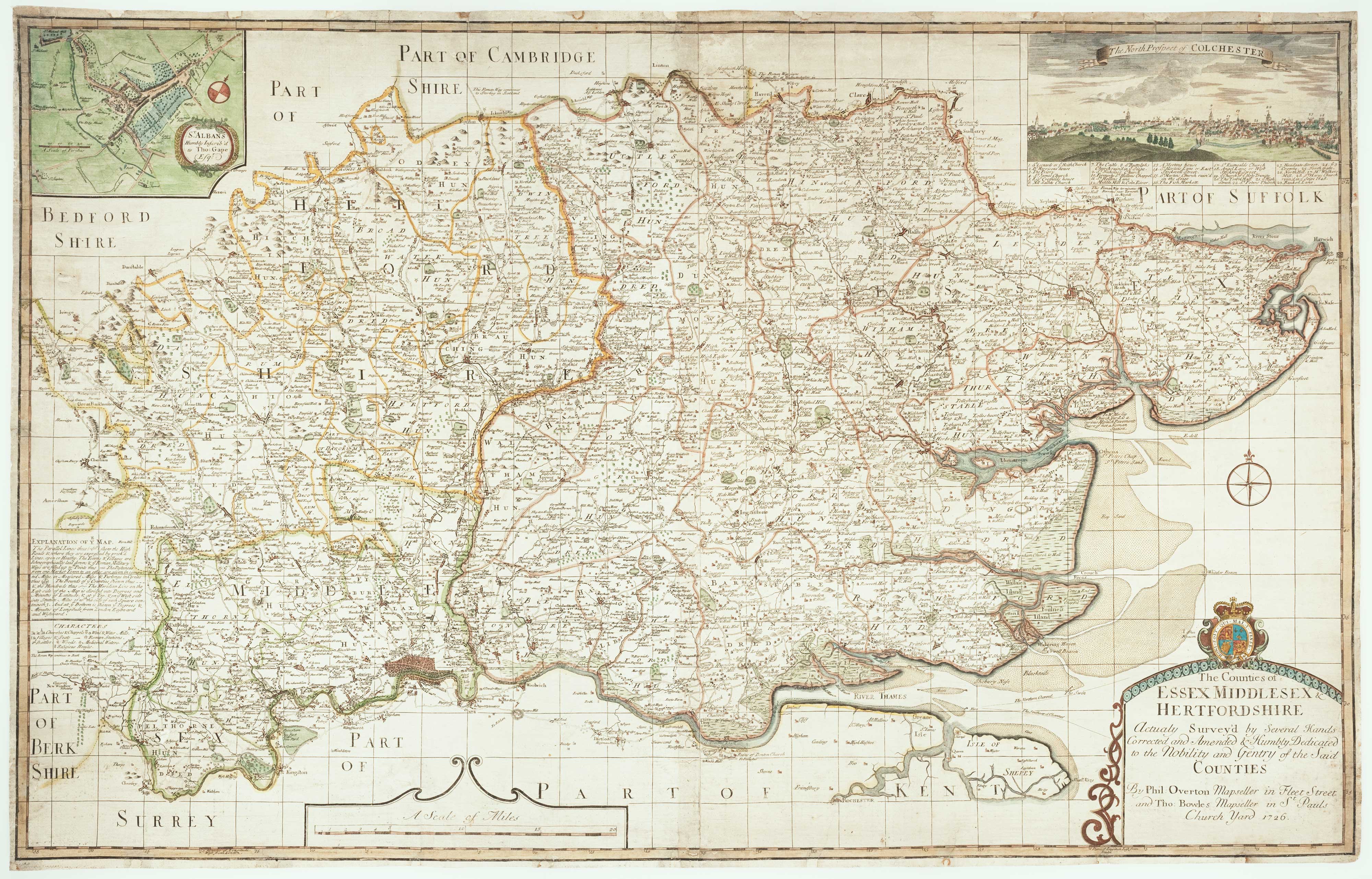


Rare map of Middlesex, Essex and Hertfordshire
The Counties of Essex Middlesex & Hertfordshire Actualy Survey'd by Several Hands, Corrected and Amended & Humbly Dedicated to the Nobility of the Said Counties...
London: Philip Overton and Thomas Bowles, 1726. Original colour. Two sheets conjoined, total 605 x 950mm.
£1,100.00
1 in stock
x
Question About This Item?
Rare map of Middlesex, Essex and Hertfordshire & WARBURTON, John.Stock #: 12907
Add to Wishlist
Export as PDFEnquireSimilar to Sell?Add to Wishlist
Description
A large and detailed map of the three counties, marking the roads, with an inset plan of St Albans and a prospect of Colchester.
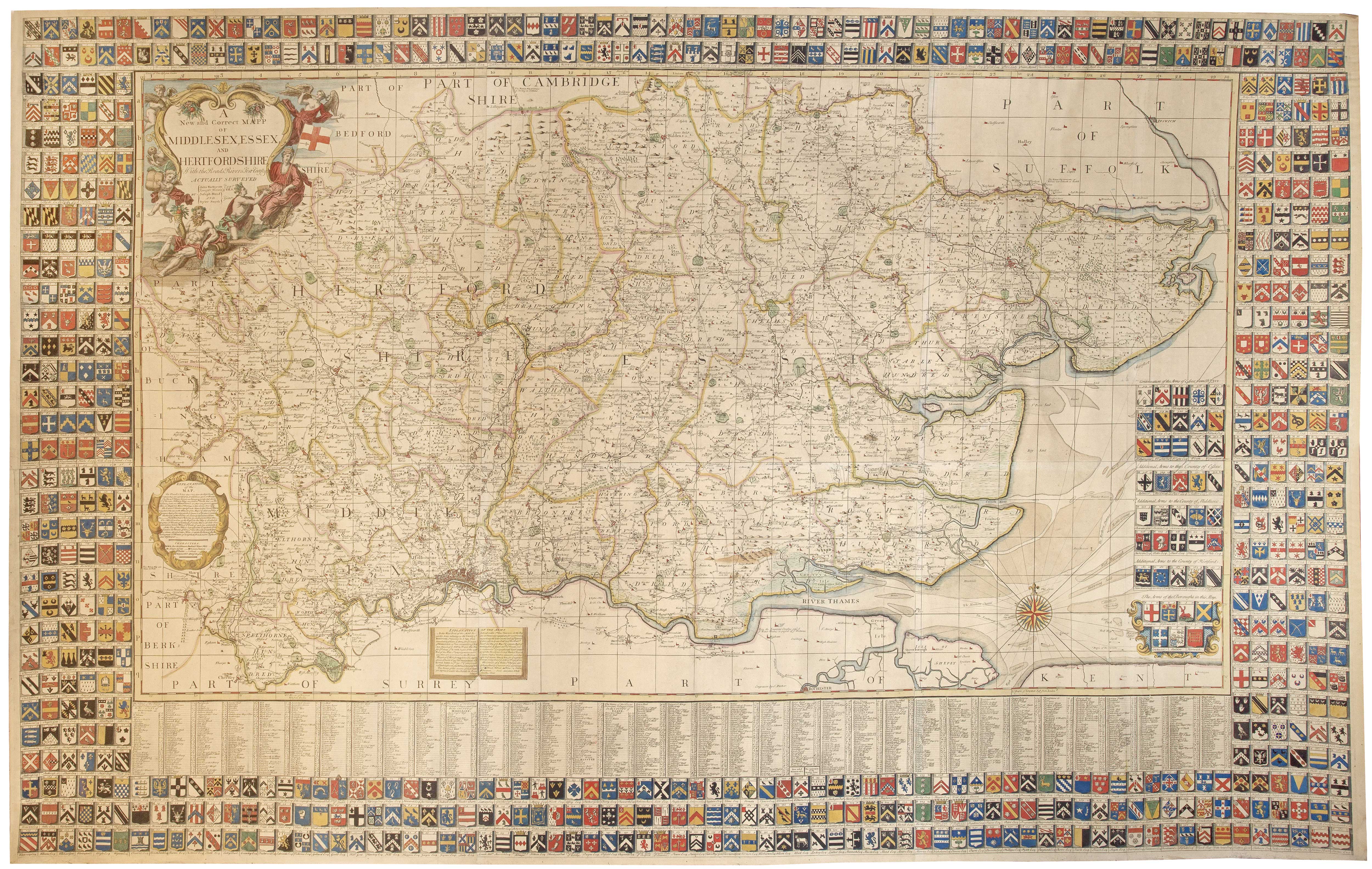
The map is reduced from a six-sheet map by John Warburton (1682-1759), Joseph Bland & Payler Smith, published in 1724, with the map surrounded with 736 armorials of local nobles whose subscriptions paid for the publication. As Overton and Bowles were not getting the subscriptions this pirate dispenses with the armorials but adds the plan and prospect.
Condition:
Some restoration.References:
RODGER: Large Scale Maps of the British Isles, 181.Related products
-
A monumental six-sheet map of Middlesex, Essex and Hertfordshire
WARBURTON, John. Date: 1726Stock #: 25159 £6,500.00 -
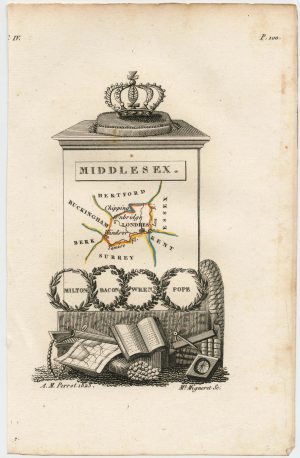
Miniature map of Middlesex
PERROT, Aristide Michel. Date: 1828Stock #: 23302 £45.00 -
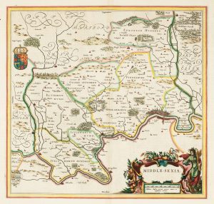
A classic 17th century Dutch map of Middlesex
BLAEU, Johannes. Date: 1658Stock #: 22701 £550.00 -
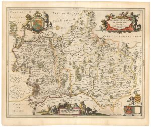
17th century map of Middlesex & Hertfordshire
JANSSON, Jan. Date: 1646Stock #: 23925 £750.00 -
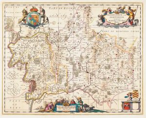
17th century map of Middlesex & Hertfordshire
JANSSON, Jan. Date: 1710Stock #: 14617 £850.00 -
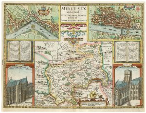
A First Edition example of Speed’s map of Middlesex
SPEED, John. Date: 1611Stock #: 25120 £2,500.00
Items by the same author
Add to Wishlist
Add to Wishlist