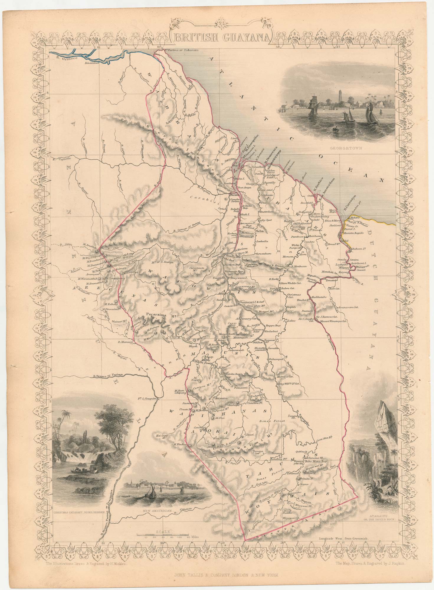


Map of Guyana with vignettes
British Guayana.
London, John Tallis & Co., c.1851. Original outline colour. Steel engraving, printed area 355 x 250mm.
£90.00
Description
A detailed map of Guyana, with decorative vignettes of Georgetown and New Amsterdam.
The map was drawn and engraved by John Rapkin for the 'The Illustrated Atlas, and Modern History of the World, Geographical Political, Commercial & Statistical', edited by Montgomery Martin, which was one of the last decorative atlases to be published.
Condition:
A good example.Related products
Items by the same author
[ti_wishlists_addtowishlist]

Mid 19th century map of Ireland with decorative vignettes
TALLIS, John. Date: 1851 Stock #: 21568 £240.00
[ti_wishlists_addtowishlist]

A mid-19th century map of Germany with decorative vignettes
TALLIS, John. Date: 1851 Stock #: 23486 £120.00
[ti_wishlists_addtowishlist]

[ti_wishlists_addtowishlist]

[ti_wishlists_addtowishlist]

Mid 19th century map of Greece with decorative vignettes
TALLIS, John. Date: 1851 Stock #: 23523 £140.00
[ti_wishlists_addtowishlist]
