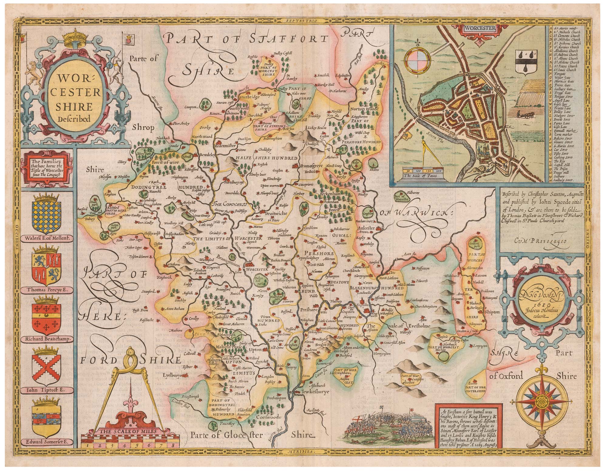


A fine 17th century map of Worcestershire
Worcestershire described...
London: Thomas Bassett & Richard Chiswell, 1676, Coloured. 380 x 510mm.
£500.00
Description
An important map of Worcestershire, engraved by Jodocus Hondius for John Speed's county atlas, 'The Theatre of the Empire of Great Britain', first published 1611-12. It is one of the most decorative maps of the county, with ornate cartouches for the title and scale, an inset plan of Worcester, the arms of local nobles and a vignette battle scene representing the Battle of Evesham in 1265. An English text on the reverse gives a history of the county and an extensive list of towns and villages.
Condition:
A good example.Related products

Items by the same author
Add to Wishlist
Add to Wishlist

A 17th century English panelled map of France
SPEED, John. Date: 1665 Stock #: 23995 £1,000.00
Add to Wishlist
Add to Wishlist

Germany from the first English atlas of the World
SPEED, John. Date: 1665 Stock #: 23993 £1,400.00
Add to Wishlist
Add to Wishlist
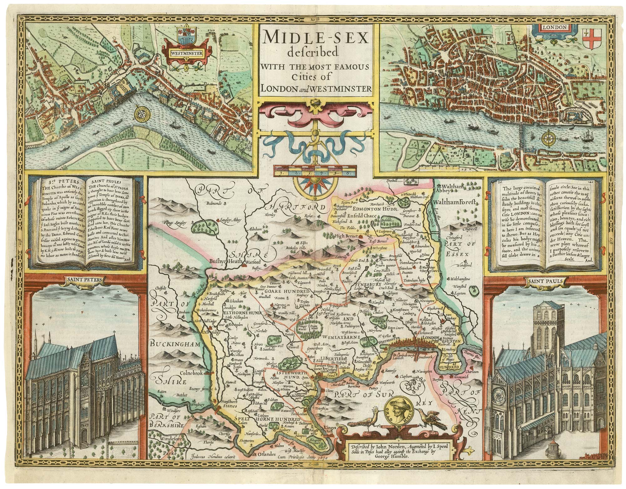
A First Edition example of Speed's map of Middlesex
SPEED, John. Date: 1611 Stock #: 25120 £2,500.00
Add to Wishlist
Add to Wishlist
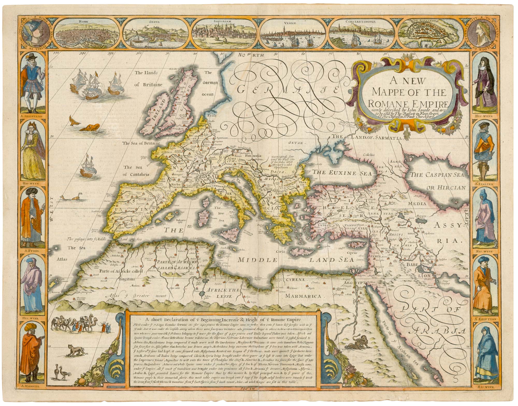
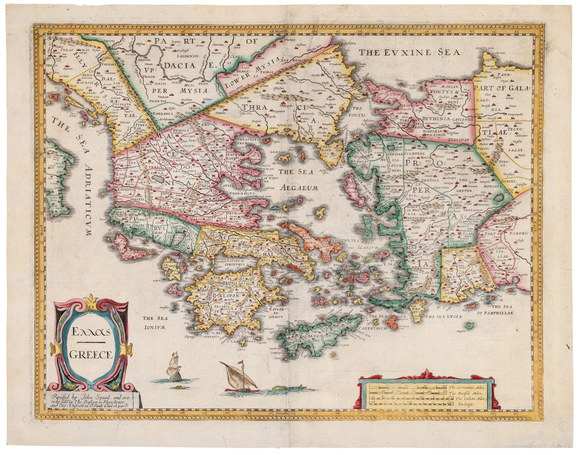
A 17th century map of the Roman Empire
SPEED, John. Date: 1676 Stock #: 25079 £1,500.00
Add to Wishlist
Add to Wishlist
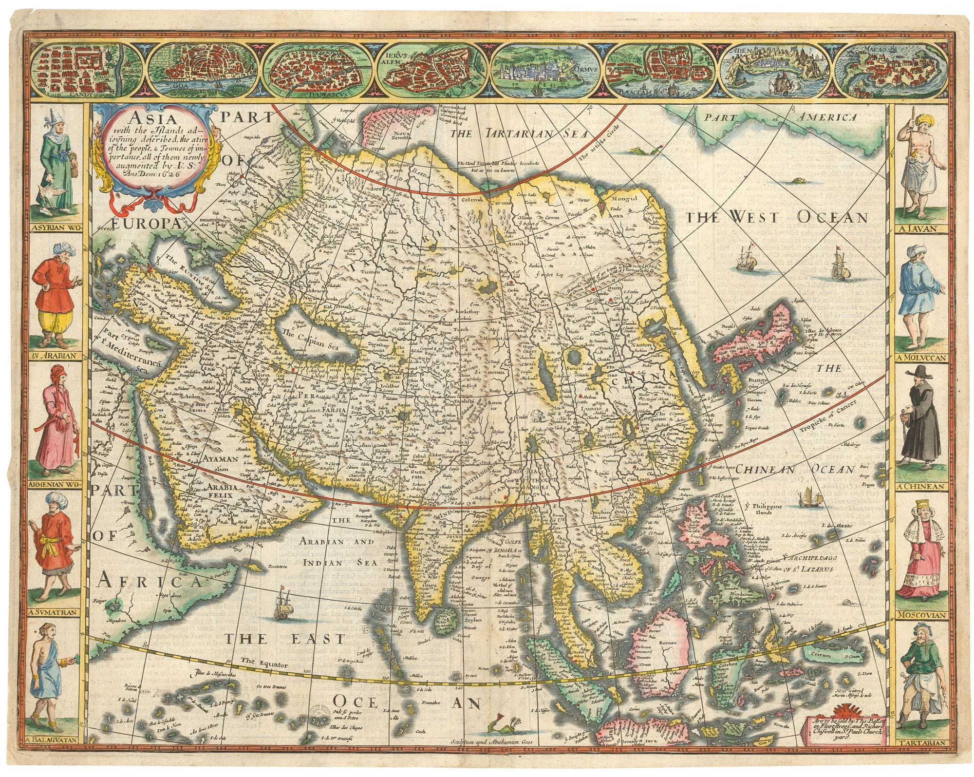
John Speed's famous map of Asia
SPEED, John. Date: 1676 Stock #: 23982 £2,750.00
Add to Wishlist
Add to Wishlist