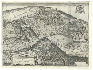
An 18th century map of the Papal States
Gli Stati del Sommo Pontefice chiamati, Il Patrimonio di S.to Pietro, con insieme Il Latio Vecchio et Campagna di Sabina.
Augsburg, c.1760. Original colour. 500 x 580mm.
£450.00
1 in stock
x
Question About This Item?
An 18th century map of the Papal States & SEUTTER, Matthaus.Stock #: 22733Similar to Sell?
Description
A detailed map of the environs of Rome, extending to Lago di Bolsena top left, L'Aquila top right, and Gaeta bottom right.
The large title cartouche features an homage to the Papacy.
Condition:
Loss in margin top left, well outside plate mark.Related products
-
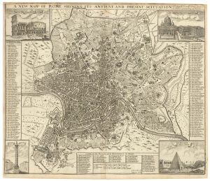
A scarce English plan of Rome
SENEX, John. Date: 1721Stock #: 23926 £1,100.00 -
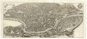
17th century bird’s-eye view of Rome
TEMPESTA, Antonio. Date: 1650Stock #: 23888 £1,800.00 -
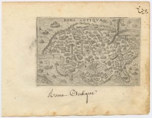
A 16th century town plan of classical Rome
VALEGIO, Francesco. Date: 1598Stock #: 24195 £140.00 -

An early engraving of Rome’s Pantheon
BEATRIZET, Nicolas. Date: 1602Stock #: 18798 £1,600.00 -
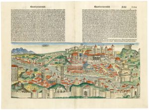
Incunable prospect of Rome
SCHEDEL, D. Hartmann. Date: 1493Stock #: 24452 £1,800.00 -
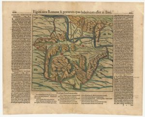
A 16th century woodcut map of Classical Rome
MUNSTER, Sebastian. Date: 1572Stock #: 24572 £220.00 -
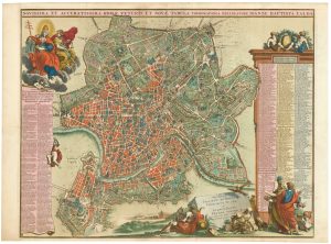
A fine plan of Rome after Falda with exceptional colouring
AA, Pieter van der. Date: 1695Stock #: 25236 £3,000.00 -
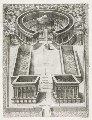
A reconstruction of the aviary of Marcus Terentius Varro
BRAMBILLA, Ambrogio. Date: 1607Stock #: 18876 £850.00 -
A 17th century view of the villas of Frascati
GREUTER, Matthaus. Date: 1620Stock #: 24825 £400.00
Items by the same author
[ti_wishlists_addtowishlist]

The Far East, with an elaborate title cartouche
SEUTTER, Matthaus. Date: 1741 Stock #: 18156 £1,400.00
[ti_wishlists_addtowishlist]

[ti_wishlists_addtowishlist]
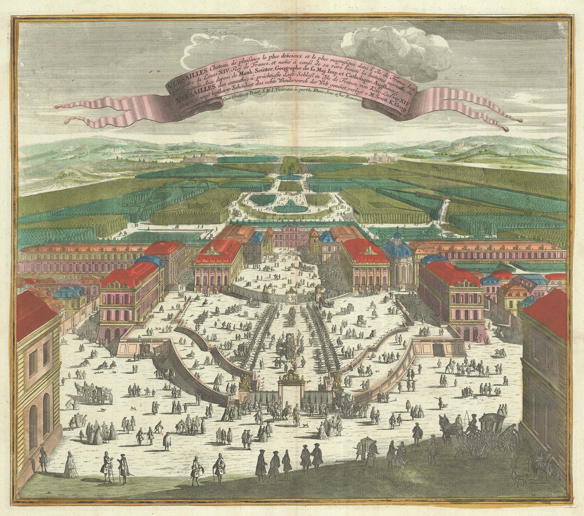
A bird's-eye view of Louis XIV's court at Versailles
SEUTTER, Matthaus. Date: 1735 Stock #: 23735 £700.00
[ti_wishlists_addtowishlist]
[ti_wishlists_addtowishlist]
[ti_wishlists_addtowishlist]