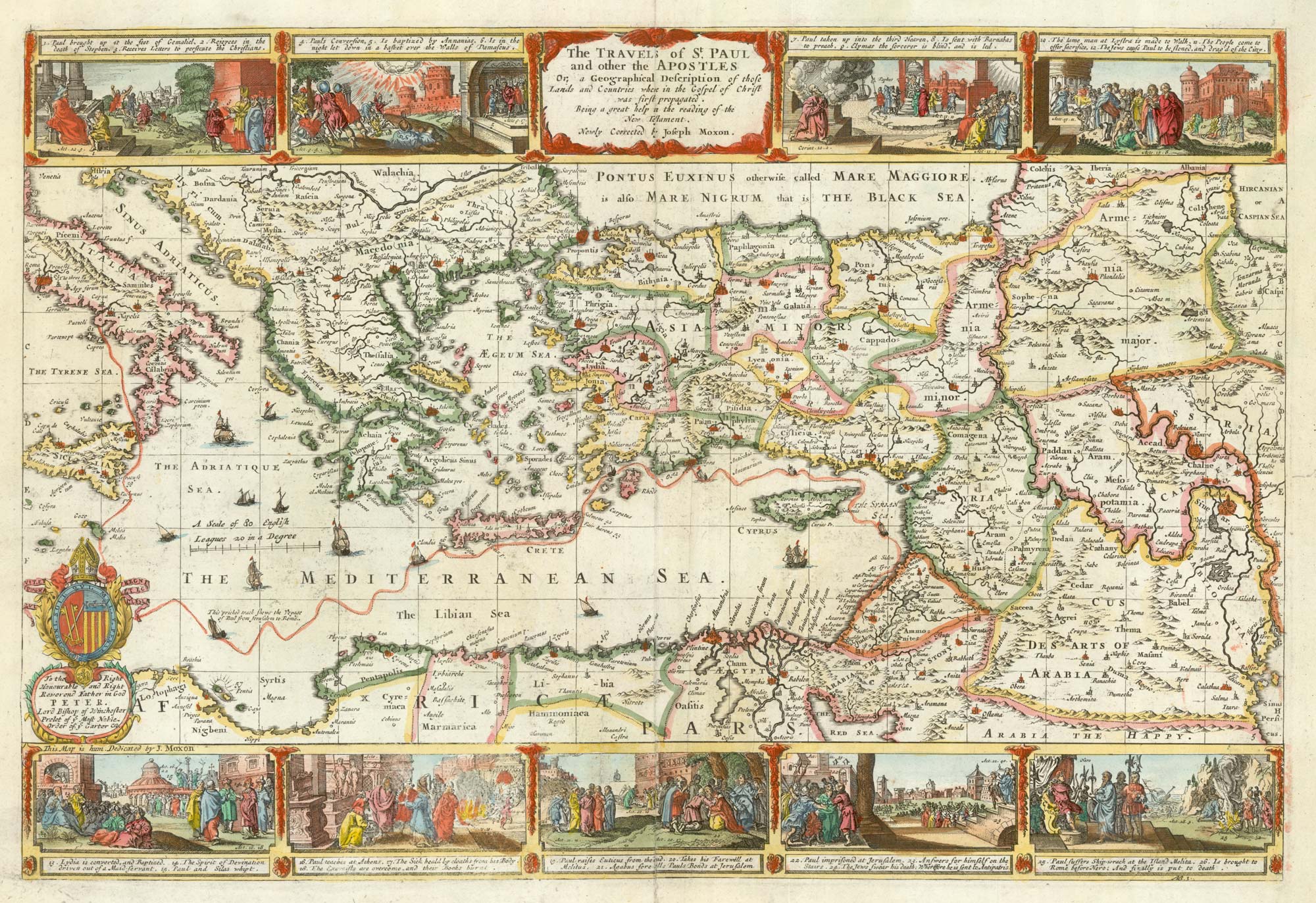
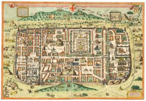
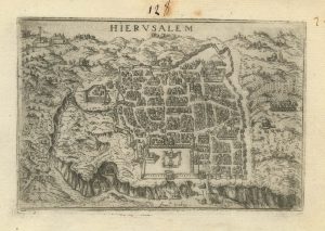
A 17th century English plan of Jerusalem
Jerusalem.
London: James Moxon, c.1695. Coloured. 320 x 475mm.
£700.00
Description
A plan of Jerusalem presented as a bird's-eye view, with buildings shown in pserpective, with an extensive key on a banner held aloft by an eagle. Underneath are scenes of the Crucifixion and Soloman being annointed king.
When first published in the 'Sacred Geographie, or Scriptual Mapps', in 1671, the map was dedicated to John Wilkins, Bishop of Chester; this example has the dedication changed to John Sharp, who was Archbishop of York between 1691 and 1714.
Condition:
Some restoration at centre fold.References:
LAOR 1084.Related products
-
A scarce early 17th C. plan of Jerusalem
BEAUVAU, Henri de. Date: 1615Stock #: 23467 £750.00 -
A prospect of Jerusalem in the 17th century by a professional artist
BRUYN, Cornelis de. Date: 1714Stock #: 24950 £2,200.00 -
A 16th century town plan of Jerusalem
VALEGIO, Francesco. Date: 1598Stock #: 24161 £450.00 -
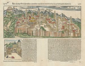
16th century prospect of Jerusalem
MUNSTER, Sebastian. Date: 1560Stock #: 21536 £470.00 -

A 17th century plan of Old Testament Jerusalem
STOOPENDAEL, Daniel. Date: 1680Stock #: 24805 £525.00 -
A classic map-view of Jerusalem at the time of Christ
ADRICHOM, Christiaan van. Date: 1682Stock #: 25207 £2,250.00 -
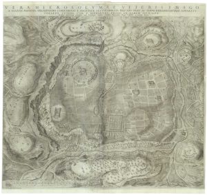
Villalpando’s important large-scale plan of Jerusalem
VILLALPANDO, Juan Bautista. Date: 1604Stock #: 22075 £2,000.00 -
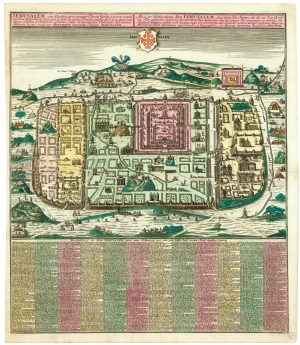
A plan of Jerusalem after Adrichom
SEUTTER, Matthaus. Date: 1730Stock #: 24600 £750.00 -
A 16th century town plan of Jerusalem
VALEGIO, Francesco. Date: 1598Stock #: 24160 £475.00
Items by the same author
[ti_wishlists_addtowishlist]

A rare 17th century English maps of the world and the heavens
MOXON, Joseph. Date: 1695 Stock #: 25274 £3,200.00
[ti_wishlists_addtowishlist]