


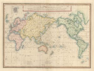
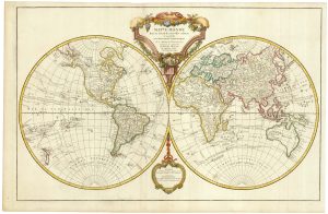
The world divided into maritime and terrestrial spheres
Nouvelle Mappemonde aves les dernieres Decouvertes et les Voyages des plus celebres Voyageurs.
Florence: Molini, Landi et Comp., 1806. Original colour. 340 x 650mm, with French letterpress underneath, total printed area 470 x 650mm.
£500.00
1 in stock
x
Question About This Item?
The world divided into maritime and terrestrial spheres & LAS CASAS, Emmanuel.Stock #: 25097Similar to Sell?
Description
A double hemisphere world map on a projection that uses Paris as the centre of the right sphere. Thus most land appears in that sphere, with the Pacific, Indonesia and Australasia in the left.
Emmanuel, comte de Las Casas, used the pseudonym Le Sage to write his 'Atlas historique, genealogique, chronologique et geographique'. A Bonapartiste, he helped Napoleon surrender to the British after the Battle of Waterloo, and followed him to St Helena, where he acted as Napoleon's secretary, later publishing a 'Mémorial de Sainte-Hélène'.
Condition:
A good example.Related products
-

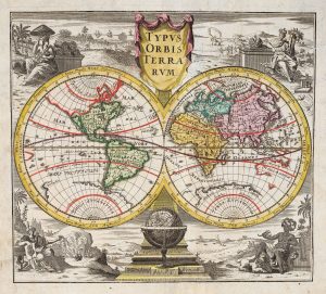
Miniature double-hemisphere world map
EXPILLY, Jean-Joseph. Date: 1765Stock #: 17435 £280.00 -
English world map showing Cook’s Voyages
FADEN, William. Date: 1838Stock #: 23199 £900.00 -
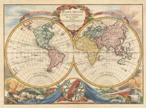
18th century double-hemisphere world map
MONATH, Peter Conrad. Date: 1749Stock #: 20464 £1,250.00 -
A scarce 18th century double-hemisphere world map
BOURGOIN, Pierre. Date: 1766Stock #: 22916 £1,200.00 -
De Jode’s rare cordiform world map in fine original colour
DE JODE, Gerard. Date: 1578Stock #: 25173 Price on Application -

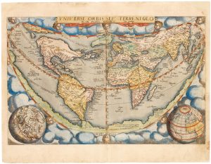
The second of Munster’s Ptolemaic world maps, in original colour
MUNSTER, Sebastian. Date: 1588Stock #: 24442 £3,500.00 -
An important world map, updated to include Cook’s three voyages
ROBERT DE VAUGONDY, Didier. Date: 1792Stock #: 23209 £1,600.00 -
The world as known to the Ancients
CASSINI, Giovanni Maria. Date: 1801Stock #: 13936 £1,200.00 -
An 18th century double-hemisphere world map
CHATELAIN, Henri Abraham. Date: 1747Stock #: 23390 £1,000.00
Items by the same author
[ti_wishlists_addtowishlist]
