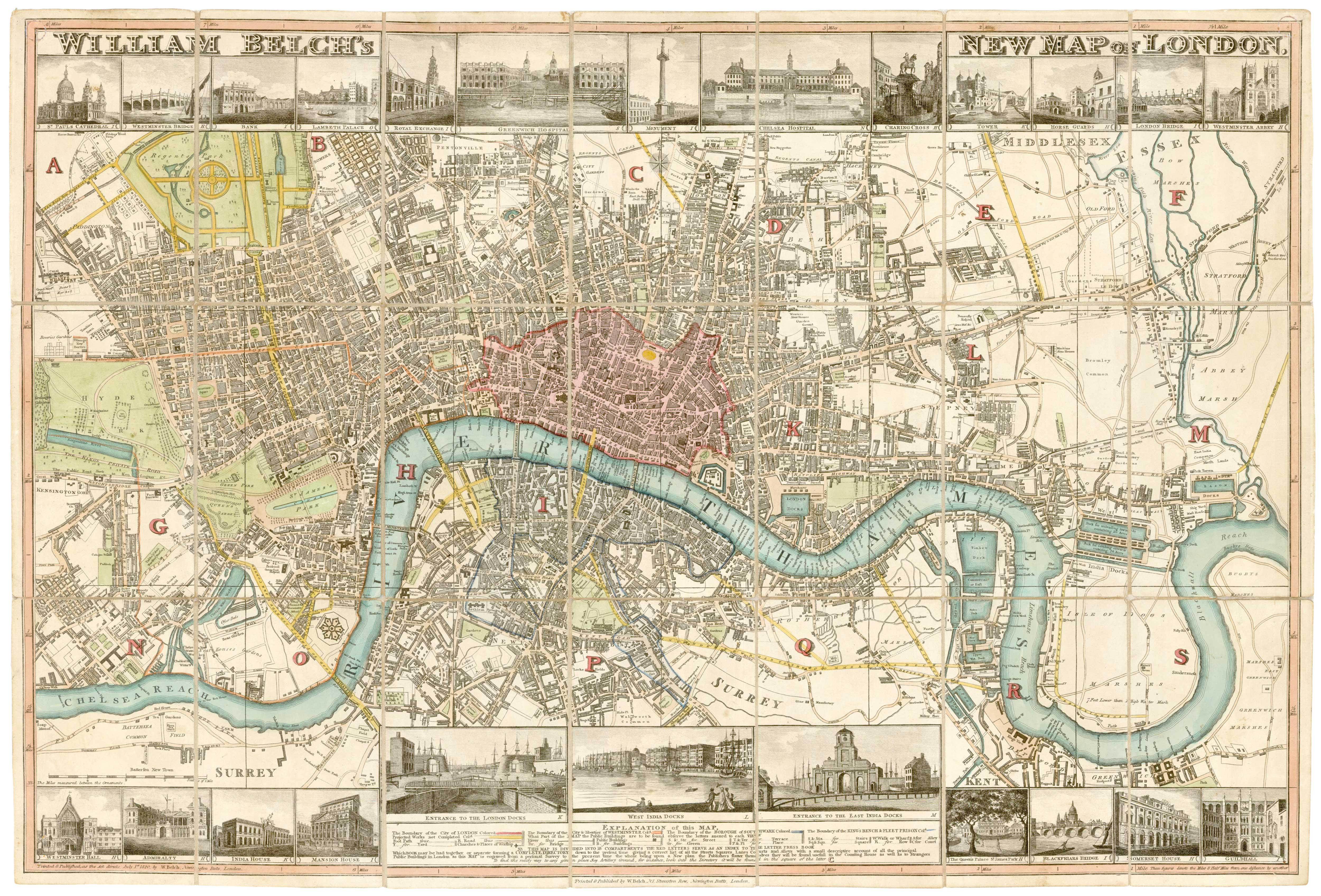


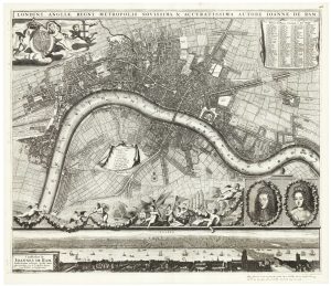
Town plan of Georgian London with illustrated borders
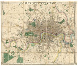
William Belch's New Map of London.
London: William Belch, 1820. Original colour. Dissected and laid on linen as issued; 530 x 800mm.
£2,800.00
1 in stock
x
Question About This Item?
Town plan of Georgian London with illustrated borders & LANGLEY & BELCH.Stock #: 23445Similar to Sell?
Description
An uncommon map of London, with 24 vignette views of buildings. Originally published in 1812, this example was published after the Langley & Belch partnership was declared bankrupt in 1819,
Of interest is the attention paid to 'Projected Works', coloured yellow. These include: Regent's Park and the 'Intended Road' (Regent Street) running south (although still showing Jew's Harp tea rooms and Willans Farm, both mentioned in William Blake's 'Jerusalem'); Waterloo Bridge and the southern approach roads; 'Regent Bridge', now Vauxhall Bridge, and the Vauxhall Bridge Road; and the Duke of Bedford's development around Tavistock Square in Bloomsbury.
Condition:
Linen replaced.References:
HOWGEGO: 256, plate 13. 4th state of 6.Related products
-
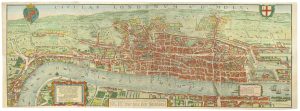
The elusive FIRST STATE of the earliest available printed map of London
BRAUN, Georg & HOGENBERG, Frans. Date: 1572Stock #: 25592 £12,500.00 -

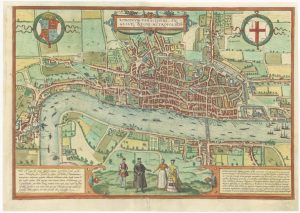
A map of London during the Interregum
NEWCOURT, Richard. Date: 1878Stock #: 25458 £6,850.00 -
The so-called ‘Agas’ plan of Elizabethan London on eight sheets
AGAS, Ralph. Date: 1737Stock #: 25408 £13,500.00 -
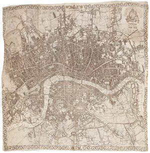
A very scarce handkerchief map of London
Anonymous. Date: 1832Stock #: 20799 £2,800.00 -
A fine 19th century wall map of London
WYLD, James. Date: 1875Stock #: 23579 £4,800.00 -
Facsimile of Rocque’s 16-Sheet Map of London
ROCQUE, John. Date: 1971Stock #: 15133 £400.00 -
The rare Jansson edition of the earliest available map of London
BRAUN, Georg & HOGENBERG, Frans. Date: 1657Stock #: 25199 £6,500.00 -
An Edwardian facsimile of a twelve-sheet map of London after the Fire
MORGAN, William. Date: 1904Stock #: 19441 £6,000.00 -
A scarce plan of London celebrating the Dutch Accession
DE RAM, Johannes. Date: 1690Stock #: 24617 £9,500.00